
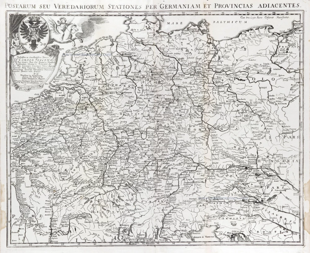
Postal map of Germania by Eugène Fricx. 1712
Fricx Eugène (1644-c.1740)
The bookseller and printer Eugène Henri Fricx was one of the most crucial map publishers of the Southern Netherlands in the 18th century. He lived in Brussels, where he had his shop on the Rue de la Madeleine. His activities in this field started in 1706 with the production of military plans of battles and sieges of the War of Succession. In the same year, he also started the publication of the map of the Southern Netherlands in 24 sheets; it was finished in 1712, apart from the sheet Luxembourg, which was engraved in 1727. He employed Jean Harrewijn of Brussels as an engraver and Cornelis Marke of Middelburg as a contractor for the 'enluminators'. Although he had children, his business was not continued after his death.
Postarum seu Veredariorum Stationes per Germaniam et Provincias Adiacentes.
Item Number: 29595 Authenticity Guarantee
Category: Antique maps > Europe > Central Europe
Old, antique map of Postal map of Germania by Eugène Fricx.
Title: Postarum seu Veredariorum Stationes per Germaniam et Provincias Adiacentes.
With dedication by J.P. Nell.
A Bruxelles Chez Eugene Henry Fricx Imprimer du Roy Rue de la Magdelaine. 1711.
Cum Privilegio Sacrae Caesare Maiestatis.
Cartographer: J.P. Nell von Nellenberg.
Date of the first edition: 1712.
Date of this map: 1712.
Copper engraving, printed on paper from two plates, joined.
Map size: 480 x 585mm (18.9 x 23.03 inches).
Sheet size: 510 x 610mm (20.08 x 24.02 inches).
Verso: Blank.
Condition: Folds as issued, excellent.
Condition Rating: A+.
From: Table des cartes des Pays Bas et des Frontières de France, Avec un recueil des plans des villes, sièges et battailles données entre les Hauts Alliés et la France. Bruxelles, H. Fricx, 1712. (Koeman II, p. 109 (Fri 1)
Fricx Eugène (1644-c.1740)
The bookseller and printer Eugène Henri Fricx was one of the most crucial map publishers of the Southern Netherlands in the 18th century. He lived in Brussels, where he had his shop on the Rue de la Madeleine. His activities in this field started in 1706 with the production of military plans of battles and sieges of the War of Succession. In the same year, he also started the publication of the map of the Southern Netherlands in 24 sheets; it was finished in 1712, apart from the sheet Luxembourg, which was engraved in 1727. He employed Jean Harrewijn of Brussels as an engraver and Cornelis Marke of Middelburg as a contractor for the 'enluminators'. Although he had children, his business was not continued after his death.
Related items
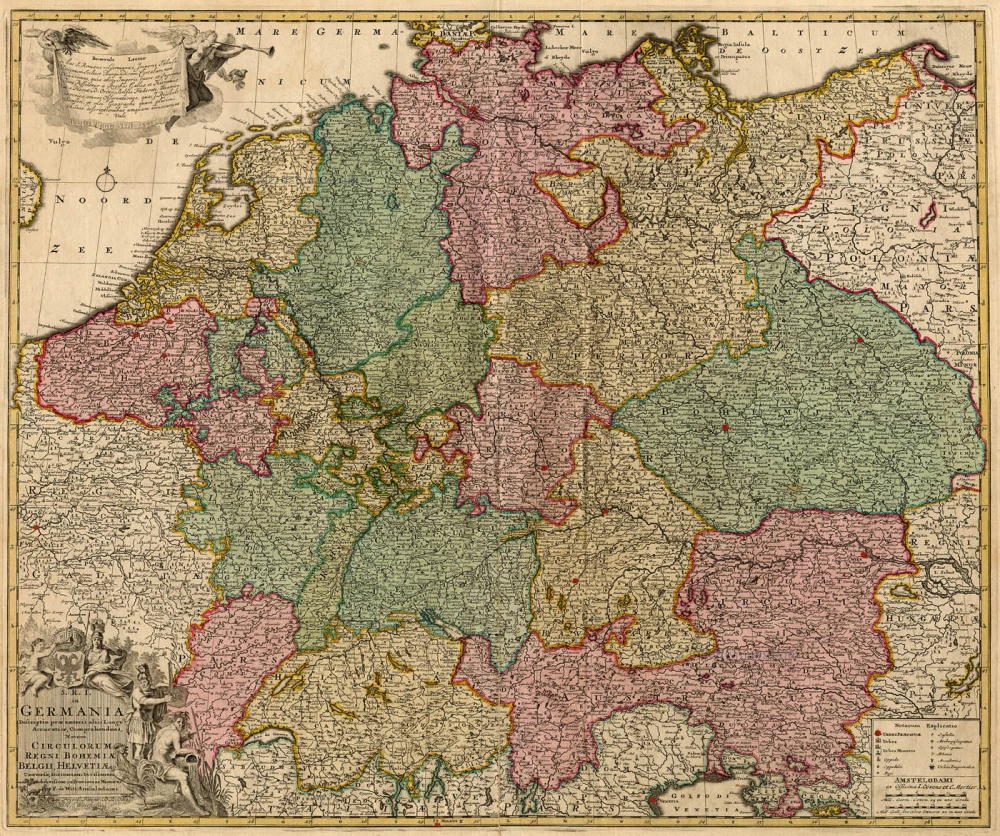
S.R.I. in Germania ... c. 1715
Germania, by F. de Wit - Covens & Mortier.
[Item number: 1262]

Deutschlanndt - Germaniae Typus 1612
Germania, by Frans Hogenberg, published by J.B. Vrients.
[Item number: 21682]
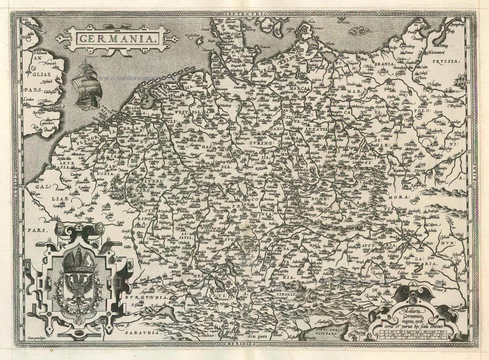
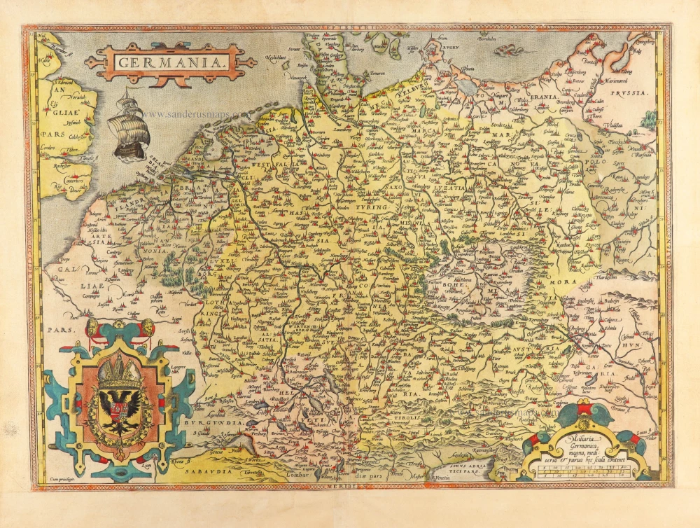
Germania 1598
Germania, by A. Ortelius.
[Item number: 22916]
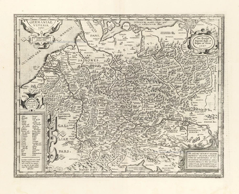
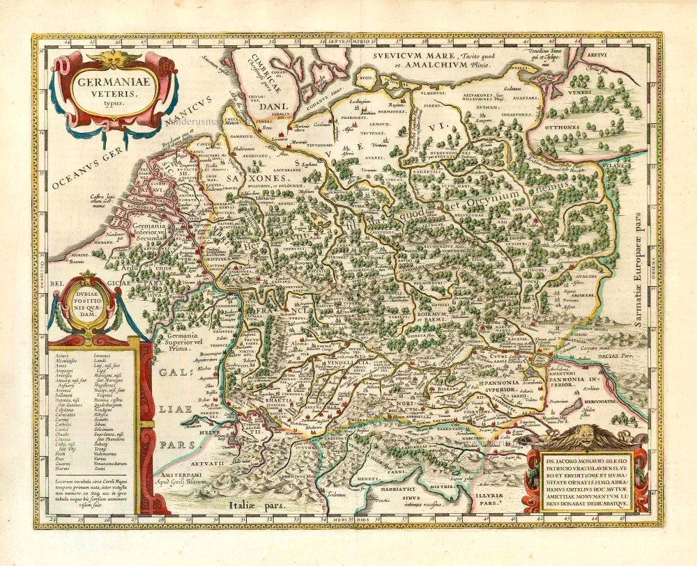
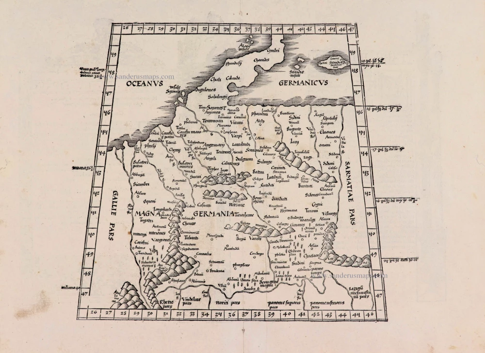
Germaniae Veteris Typus. 1612
Ancient Germania by Abraham Ortelius.
[Item number: 23115]
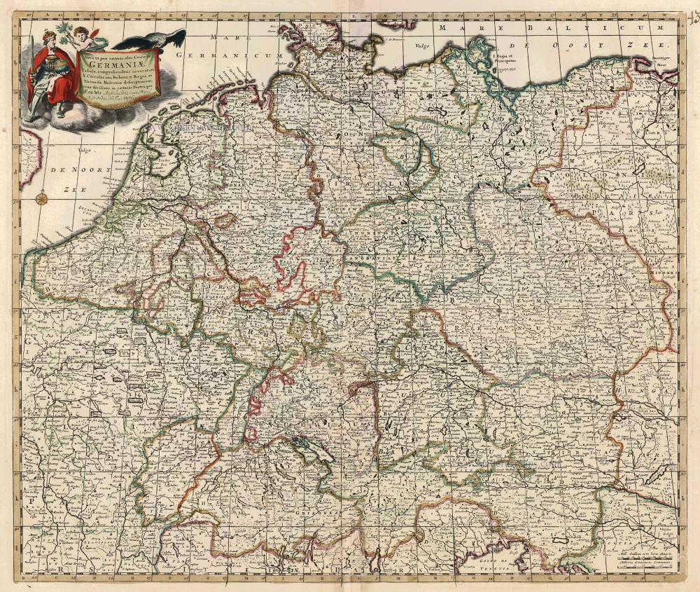
Nova et prae caeteris aliis Correcta Germaniae Tabula, comprehendens accuratam X. Circulorum, Bohemiae Regni, ac Universae Helvetiae descriptionem. c. 1680
GERMANIA by de Wit F.
[Item number: 24404]
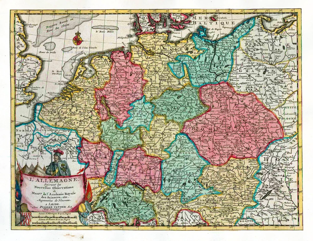
L'Allemagne. 1713
Germania, by P. Van der Aa.
[Item number: 26178]
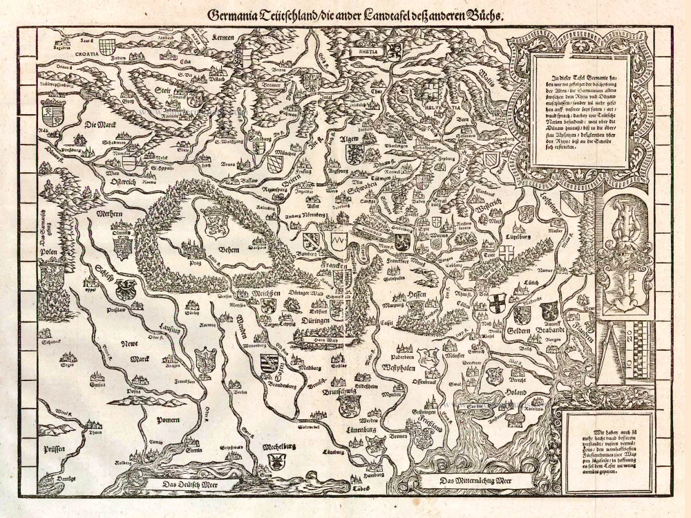
Germania Teütschland / die ander Landtafel desz anderen Büchs. 1548
Germania, by Johannes Stumpf.
[Item number: 26203]
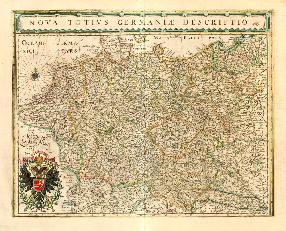
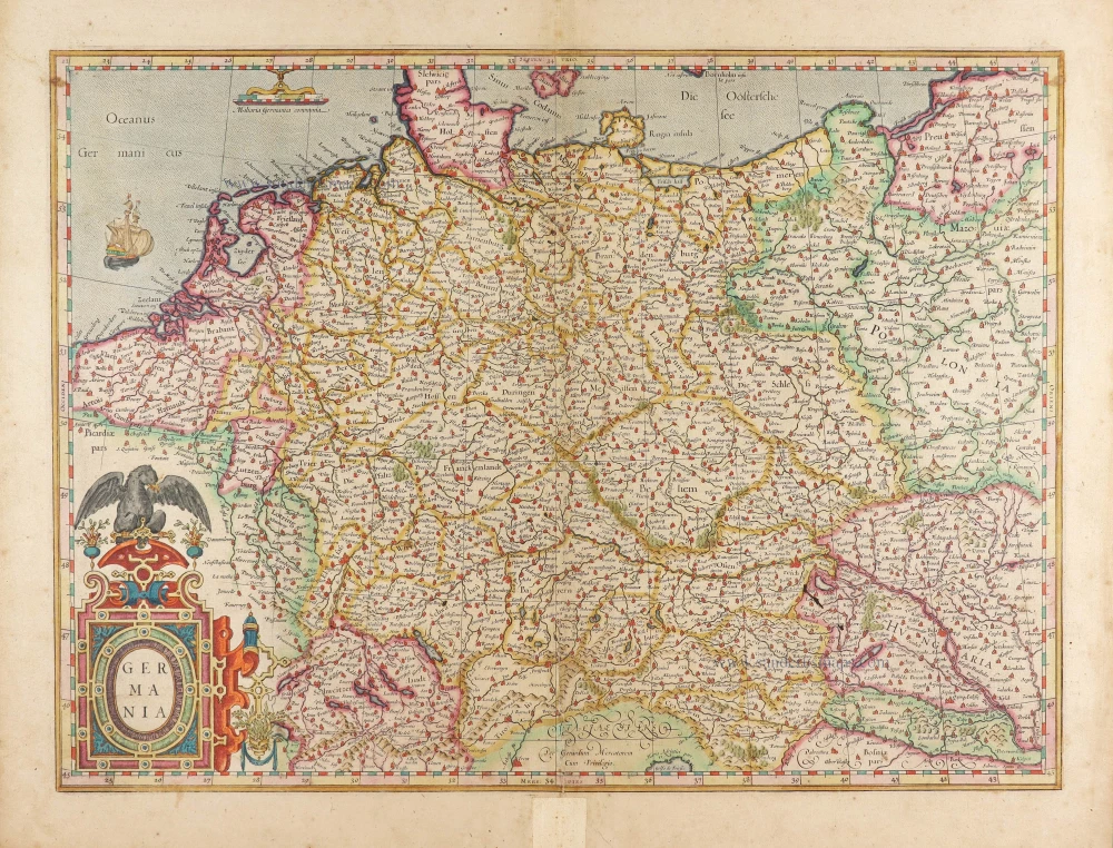
Nova Totius Germaniae Descriptio. 1643
Germania, by Willem Blaeu.
[Item number: 27104]
Germaniae Veteris Typus. 1643
Ancient Germania, by Willem Blaeu.
[Item number: 27122]
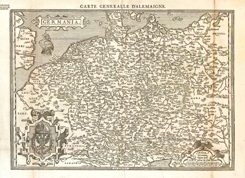
Germania. [Above the map :] Carte générale d'Alemaigne. 1575
Germania, by François de Belleforest.
[Item number: 27381]
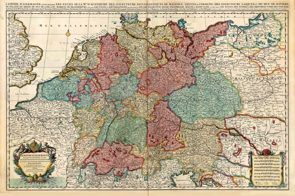
L'Empire d'Allemagne distingué suivant l'étendue de tous les Estats, Principautés et Souverainetés qui passent ou qui ont passé jusque a present sous le nom d'Allemagne. c. 1705
Germania, by Pieter Mortier.
[Item number: 27803]
Very rare. First state.
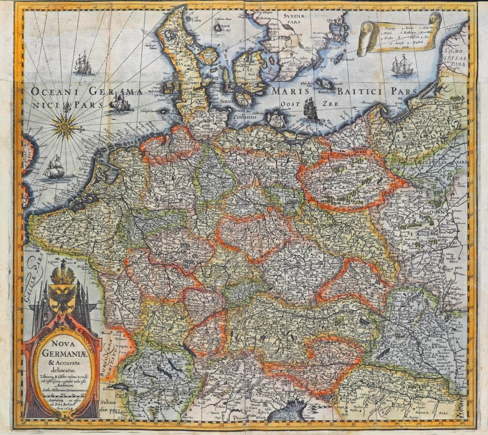
Nova Germaniae & Accurata delineatio. 1628
Germania, by Pieter Verbiest.
[Item number: 27933]
[No title] - [On verso:] Tabula .IIII. Europae. 1525
Ptolemaic Germania, by Lorenz Fries.
[Item number: 27958]
Germania. 1623
Germania by Gerard Mercator.
[Item number: 28939]

Hydrographica Germaniae c. 1741
Germania, by George Matthaus Seutter.
[Item number: 29057]
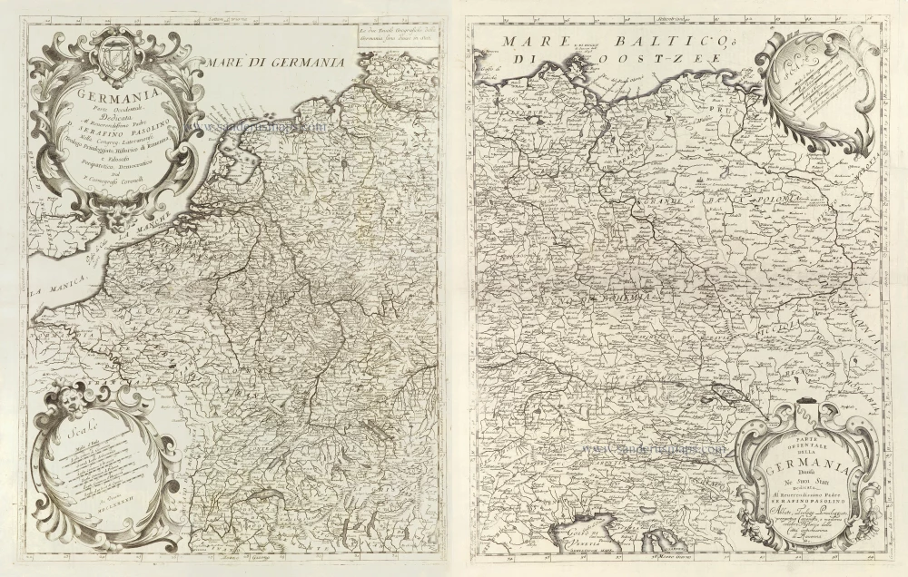
Germania, Parte Occidentale, [in set with:] Parte Orientale della Germania Divisa Ne Suoi Stati. 1696
Germania, by Vincenzo Coronelli.
[Item number: 29295]
Germania. 1595
Germania, by Abraham Ortelius.
[Item number: 30248]
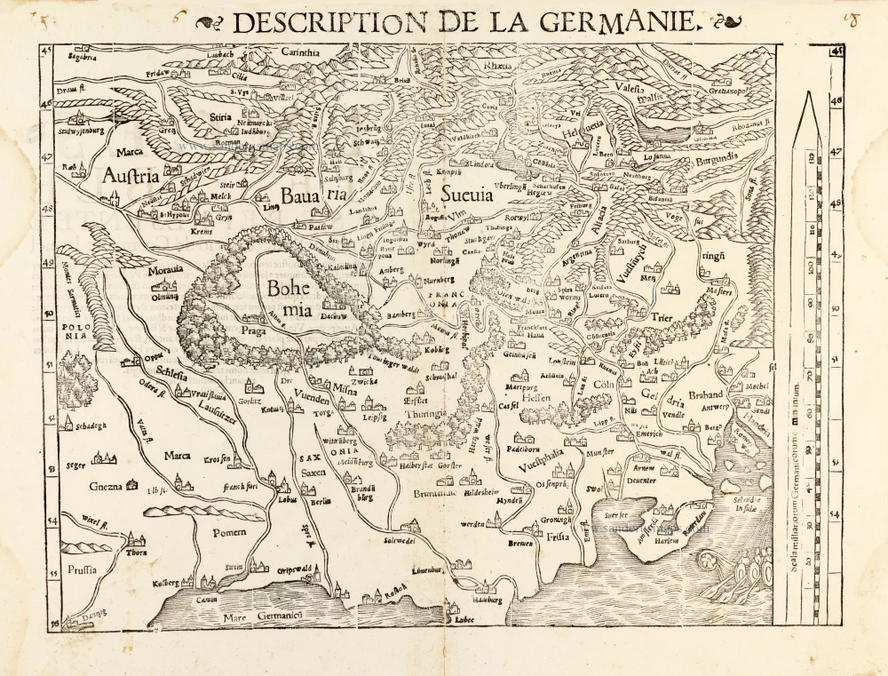
Description de la Germanie. 1568
Germania by Sebastian Münster.
[Item number: 30522]

Germania, Non ea tantum quae Rheno, Vistula, Danubio, mariqz Germanico Veteribus claudebatur; c. 1630-1650
Germania by an unknown mapmaker (Jean Leclerc?)
[Item number: 30842]