
Big spectacular map
Europe, by François Halma. Before 1713
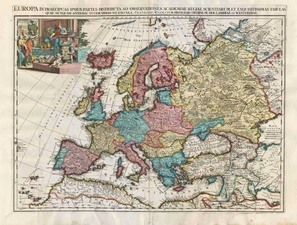
This map is probably an earlier state of Van der Aa's large-format Europe map: Goeree and Baptist's names are prominent on the bottom plinth of the cartouche. At Van der Aa, they were moved and replaced by Pieter Van der Aa's imprint, disturbing the background shading.
François Halma (Langerak, 1653 – Leeuwarden, 1722)
François Halma was a publisher who first established his business at Utrecht in 1674; later moved to Amsterdam where he worked as printer and publisher from 1699-1710 and finally settled at Leeuwarden, where he died in 1722.
Apart from many theological and historical works, he published a small number of geographical works and atlases. In 1695, during his period at Utrecht, he published Ptolemy’s Tabulae Geographicae orbis terrarium. His finest work appeared at Leeuwarden in 1718: the re-issue of Schotanus à Sterringa’s Friesche Atlas of 1698. He also published an edition of Sanson’s Description de l’Univers.
L'Europe selon les Nouvelles Observations de Messrs de l'Academie des Sciences, etc.
Item Number: 27850 Authenticity Guarantee
Category: Antique maps > Europe > Europe Continent
*** Unrecorded edition of Van der Aa's Europe map, by François Halma ***
Old, antique map of Europe, by François Halma.
Title: L'Europe selon les Nouvelles Observations de Messrs de l'Academie des Sciences, etc
[Above map:] Europa in Praecipuas ipsius Partes Distributa ad Observationes Academiae Regiae Scientiarum et Exquisitissimas Tabulas, quae nunquam Antehac Lucem Viderunt, Excusa A Francisco Halma, Cum privilegio Ordinum Hollandiae et Westfrisiae.
J. Goeree delin. J. Baptist Sculp.
Designer: J. Goeree.
Engraver: J. Baptist.
Date: before 1713
Copper engraving, printed on paper.
Size (not including margins): 505 x 665mm (19.88 x 26.18 inches).
Verso: Blank
Condition: Original coloured, excellent.
Condition Rating: A+.
References: van der Krogt A, See 01:07
Separate publication.
This map is probably an earlier state of Van der Aa's large-format Europe map: Goeree and Baptist's names are prominent on the bottom plinth of the cartouche. At Van der Aa, they were moved and replaced by Pieter Van der Aa's imprint, disturbing the background shading.
François Halma (Langerak, 1653 – Leeuwarden, 1722)
François Halma was a publisher who first established his business at Utrecht in 1674; later moved to Amsterdam where he worked as printer and publisher from 1699-1710 and finally settled at Leeuwarden, where he died in 1722.
Apart from many theological and historical works, he published a small number of geographical works and atlases. In 1695, during his period at Utrecht, he published Ptolemy’s Tabulae Geographicae orbis terrarium. His finest work appeared at Leeuwarden in 1718: the re-issue of Schotanus à Sterringa’s Friesche Atlas of 1698. He also published an edition of Sanson’s Description de l’Univers.
Related items
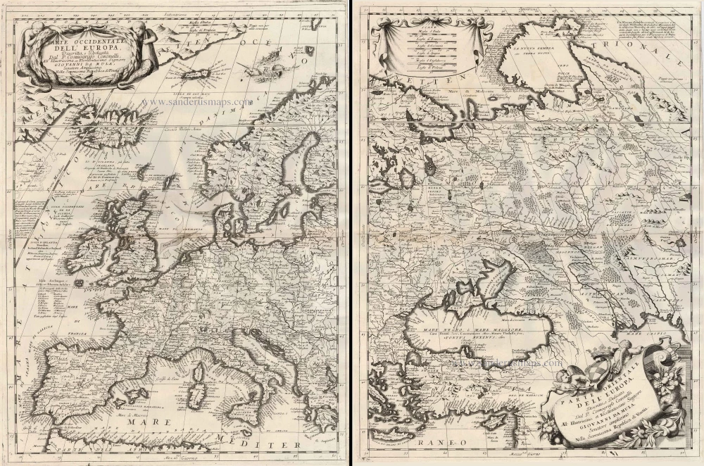
Parte Occidentale dell'Europa ... [in set with] Parte Orientale dell'Europa ... 1691
Europe, by V.M. Coronelli.
[Item number: 23186]

Europa Pars Tenet haec Mundi Reliquas Celeberrima Partes c. 1730.
Europe by G.& L. Valk.
[Item number: 24536]

Europa. 1600
Europe, by Matthias Quad.
[Item number: 26666]
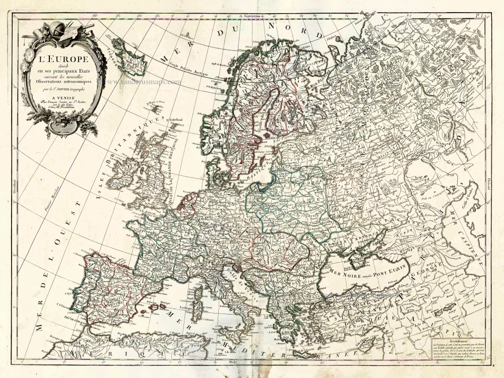
L'Europe Divisee en ses Principaux Etats. 1776-79
Europe, by Francesco Santini.
[Item number: 26947]

Scarce woodcut map
Europae. [Above the map :] La Carte d'Europe. 1575
Europe, by François de Belleforest.
[Item number: 27270]

Europa Vetus. 1667-69
Ancient Europe by Nicolas & Guillaume Sanson.
[Item number: 30000]
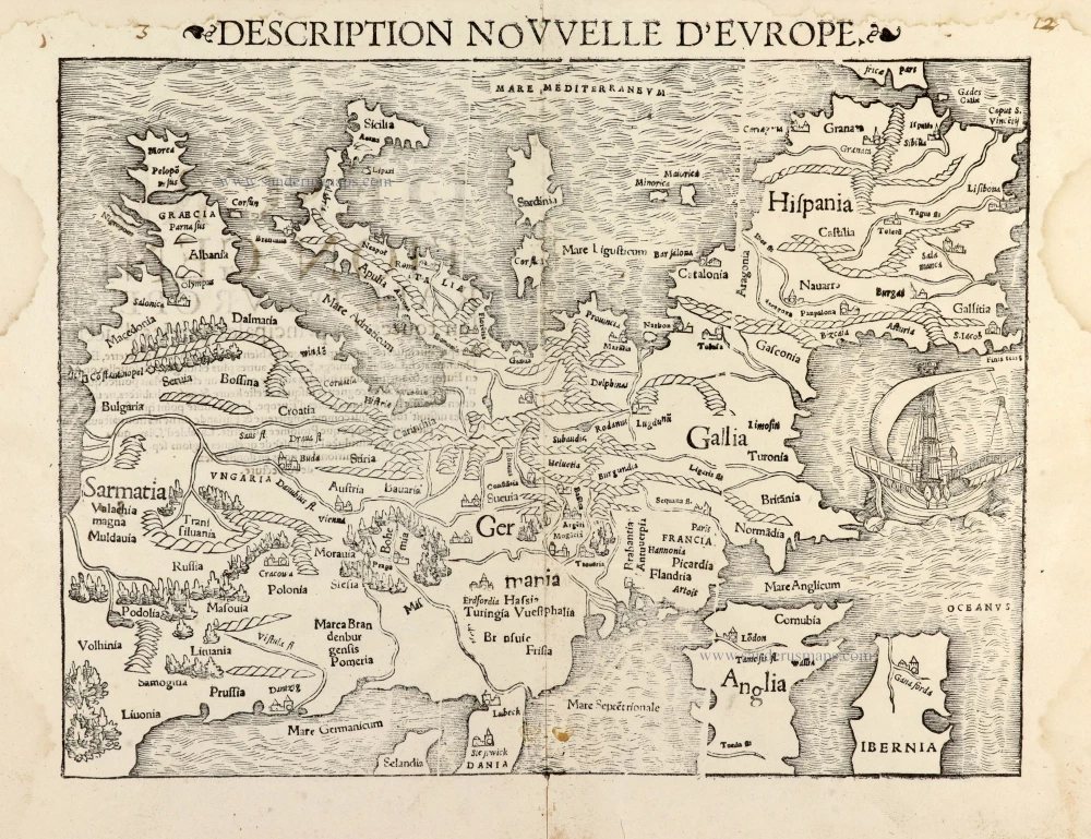
Description Nouvelle d'Europe. 1568
Europe by Sebastian Münster
[Item number: 30523]

Nobilis Hannoniae Com. Descriptio. 1634
Hainaut by Petrus Kaerius (Pieter Van den Keere), published by Claes Jansz. Visscher.
[Item number: 30736]

Europae. 1612
Europe, by Abraham Ortelius.
[Item number: 30944]

Rare
Nova Totius Europae Tabula ex magnis Gerardi de Iudaeis P. desumpta 1593
Europe by Cornelis de Jode
[Item number: 30946]