
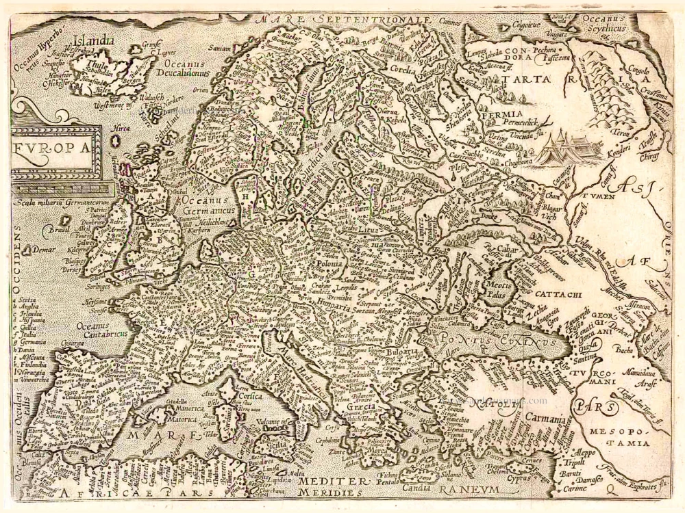
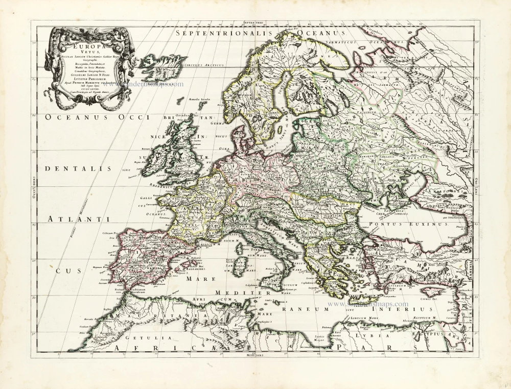
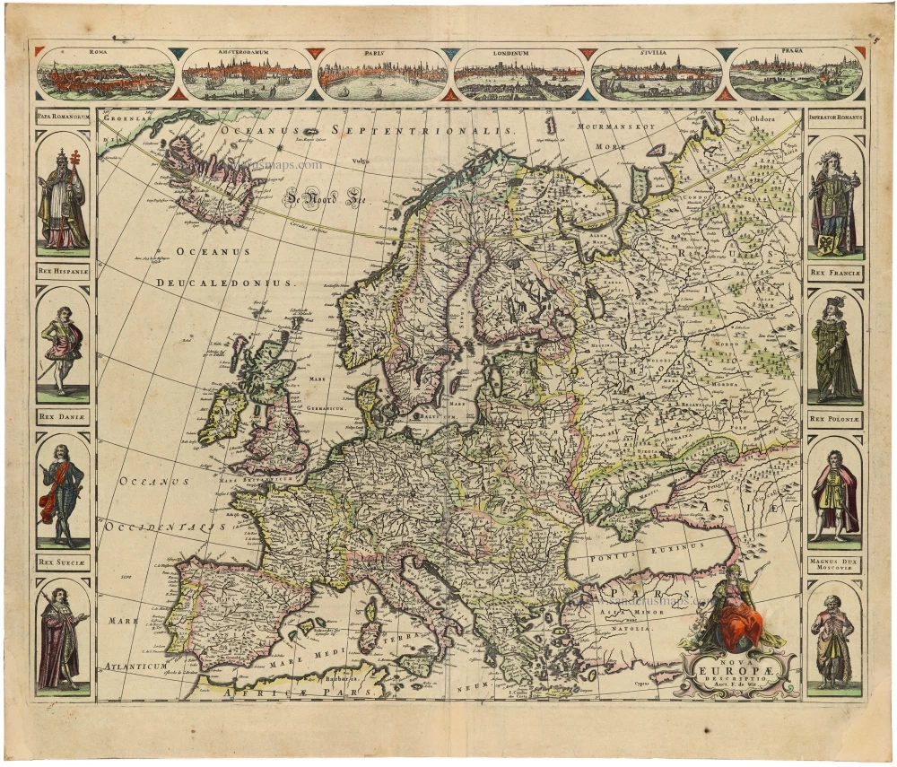
Europe by Blaeu Willem & Joan 1659

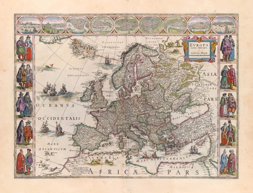
This map is a reduction of Blaeu's 1608 wall map.
The map is framed on both sides by five costumed figures. Left border: Angli; Galli; Belgi; Castiliani; Venetiani. Right border: Germani; Hungari; Bohemi; Poloni; Graeci. Along the upper edge runs a decorative border with nine European towns in oval frames: Amsterdam; Praga; Constantinopolis; Venetia; Roma; Paris; London; Toledo; and Lisboa.
The Blaeus: Willem Janszoon, Cornelis & Joan
Willem Jansz. Blaeu and his son Joan Blaeu are the seventeenth century's most widely known cartographic publishers.
Willem Jansz. (also written Guilielmus Janssonius) = Willem Janszoon Blaeu was born in Uitgeest (Netherlands), near Alkmaar, in 1571. He studied mathematics under Tycho Brahe and learned the theory and practice of astronomical observations and the art of instrument- and globe-making.
In 1596, he came to Amsterdam, where he settled down as a globe-, instrument- and mapmaker. He published his first cartographic work (a globe) in 1599 and probably published his first printed map (a map of the Netherlands) in 1604. He specialised in maritime cartography, published the first edition of the pilot guide Het Licht der Zeevaert in 1608, and was appointed Hydrographer of the V.O.C. (United East India Company) in 1633. After publishing books, wall maps, globes, charts and pilot guides for thirty years, he brought out his first atlas, Atlas Appendix (1630). This was the beginning of the great tradition of atlas-making by the Blaeus.
In 1618, another mapmaker, bookseller and publisher, Johannes Janssonius, established himself in Amsterdam next door to Blaeu's shop. No wonder these two neighbours began accusing each other of copying and stealing their information and became fierce competitors who did not have a good word to say about each other. In about 1621 Willem Jansz. decided to end the confusion between his name and his competitor's and assumed his grandfather's nickname, 'blauwe Willem' ('blue Willem'), as the family name; after that, he called himself Willem Jansz. Blaeu.
Willem Janszoon Blaeu died in 1638, leaving his prospering business to his sons, Cornelis and Joan. We only know that Cornelis's name occurs in the prefaces of books and atlases until c. 1645.
Joan Blaeu, born in Amsterdam in 1596, became a partner in his father's book trade and printing business. 1638, he was appointed his father's successor in the Hydrographic Office of the V.O.C. His efforts culminated in the magnificent Atlas Major and the town books of the Netherlands and Italy – works unsurpassed in history and modern times, giving eternal fame to the name of the Blaeu's.
A fire ruined the business on February 23, 1672, and one year later, Dr. Joan Blaeu died. The fire and the director's passing caused the complete sale of the Blaeu House's stock. Five public auctions dispersed the remaining books, atlases, copperplates, globes, etc., among many other map dealers and publishers in Amsterdam. The majority was acquired by several booksellers acting in partnership.
In the succeeding years, the remaining printing department remained in the hands of the Blaeu family until 1695, when the printing house's inventory was sold at a public auction. That meant the end of the Blaeu family as a printing house of world renown.
Europa Recens Descripta.
Item Number: 30206 Authenticity Guarantee
Category: Antique maps > Europe > Europe Continent
Europe by Willem & Joan Blaeu.
Title: Europa Recens Descripta.
à Guilielmo Blaeuw.
Date of the first edition: 1617.
Date of this map: 1659.
Copper engraving, printed on paper.
Image size: 410 x 557mm (16.14 x 21.93 inches).
Sheet size: 555 x 650mm (21.85 x 25.59 inches).
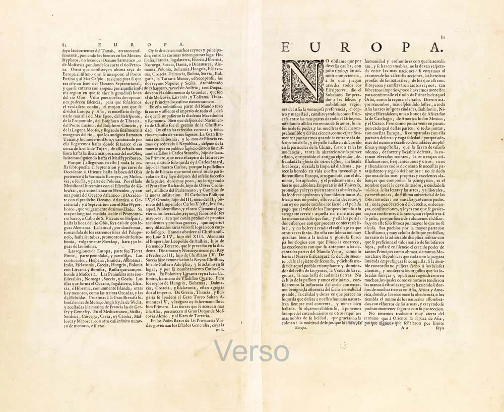
Verso: Spanish text.
Condition: Original coloured, excellent.
Condition Rating: A+.
From: Nuevo Atlas o Teatro del Mundo, En en qual, con gran cuydado, se proponen los Mapas y Descriptiones de todo el Universo, Por Juan Blaeu Tomo Primero. En Amsterdam, A costa en casa de Juan Blaeu, 1659-72. (Van der Krogt 2, 641.1)
This map is a reduction of Blaeu's 1608 wall map.
The map is framed on both sides by five costumed figures. Left border: Angli; Galli; Belgi; Castiliani; Venetiani. Right border: Germani; Hungari; Bohemi; Poloni; Graeci. Along the upper edge runs a decorative border with nine European towns in oval frames: Amsterdam; Praga; Constantinopolis; Venetia; Roma; Paris; London; Toledo; and Lisboa.
The Blaeus: Willem Janszoon, Cornelis & Joan
Willem Jansz. Blaeu and his son Joan Blaeu are the seventeenth century's most widely known cartographic publishers.
Willem Jansz. (also written Guilielmus Janssonius) = Willem Janszoon Blaeu was born in Uitgeest (Netherlands), near Alkmaar, in 1571. He studied mathematics under Tycho Brahe and learned the theory and practice of astronomical observations and the art of instrument- and globe-making.
In 1596, he came to Amsterdam, where he settled down as a globe-, instrument- and mapmaker. He published his first cartographic work (a globe) in 1599 and probably published his first printed map (a map of the Netherlands) in 1604. He specialised in maritime cartography, published the first edition of the pilot guide Het Licht der Zeevaert in 1608, and was appointed Hydrographer of the V.O.C. (United East India Company) in 1633. After publishing books, wall maps, globes, charts and pilot guides for thirty years, he brought out his first atlas, Atlas Appendix (1630). This was the beginning of the great tradition of atlas-making by the Blaeus.
In 1618, another mapmaker, bookseller and publisher, Johannes Janssonius, established himself in Amsterdam next door to Blaeu's shop. No wonder these two neighbours began accusing each other of copying and stealing their information and became fierce competitors who did not have a good word to say about each other. In about 1621 Willem Jansz. decided to end the confusion between his name and his competitor's and assumed his grandfather's nickname, 'blauwe Willem' ('blue Willem'), as the family name; after that, he called himself Willem Jansz. Blaeu.
Willem Janszoon Blaeu died in 1638, leaving his prospering business to his sons, Cornelis and Joan. We only know that Cornelis's name occurs in the prefaces of books and atlases until c. 1645.
Joan Blaeu, born in Amsterdam in 1596, became a partner in his father's book trade and printing business. 1638, he was appointed his father's successor in the Hydrographic Office of the V.O.C. His efforts culminated in the magnificent Atlas Major and the town books of the Netherlands and Italy – works unsurpassed in history and modern times, giving eternal fame to the name of the Blaeu's.
A fire ruined the business on February 23, 1672, and one year later, Dr. Joan Blaeu died. The fire and the director's passing caused the complete sale of the Blaeu House's stock. Five public auctions dispersed the remaining books, atlases, copperplates, globes, etc., among many other map dealers and publishers in Amsterdam. The majority was acquired by several booksellers acting in partnership.
In the succeeding years, the remaining printing department remained in the hands of the Blaeu family until 1695, when the printing house's inventory was sold at a public auction. That meant the end of the Blaeu family as a printing house of world renown.
Related items
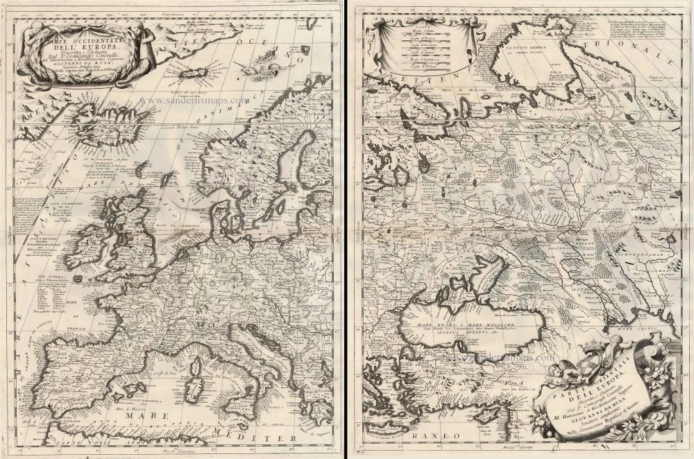
Parte Occidentale dell'Europa ... [in set with] Parte Orientale dell'Europa ... 1691
Europe, by V.M. Coronelli.
[Item number: 23186]

Europa Pars Tenet haec Mundi Reliquas Celeberrima Partes c. 1730.
Europe by G.& L. Valk.
[Item number: 24536]
Europa. 1600
Europe, by Matthias Quad.
[Item number: 26666]
L'Europe Divisee en ses Principaux Etats. 1776-79
Europe, by Francesco Santini.
[Item number: 26947]
Scarce woodcut map
Europae. [Above the map :] La Carte d'Europe. 1575
Europe, by François de Belleforest.
[Item number: 27270]
L'Europe Dreßée sur les Observations de Mrs. de l'Academie Royale des Sciences et quelques autres, & sur les memoires les plus recens. 1700-1708
Europe, by Guillaume Delisle, published by Pierre Mortier.
[Item number: 29519]
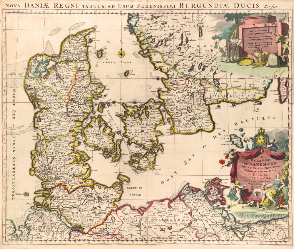
Le Royaume de Danemark, Divisé en ses Provinces. c. 1709
Denmark by Hubert Jaillot.
[Item number: 29589]
Europa Vetus. 1667-69
Ancient Europe by Nicolas & Guillaume Sanson.
[Item number: 30000]
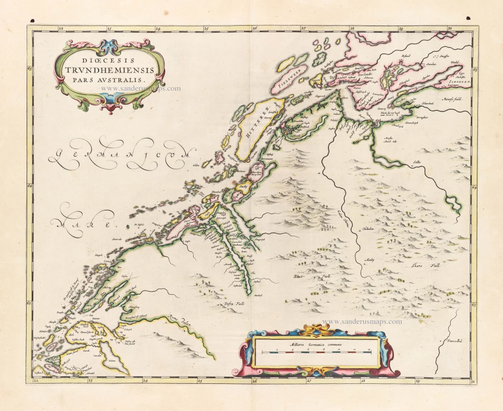
Dioecesis Trundhemiensis Pars Australis. 1659
Southern Trondheim by Joan Blaeu.
[Item number: 30212]
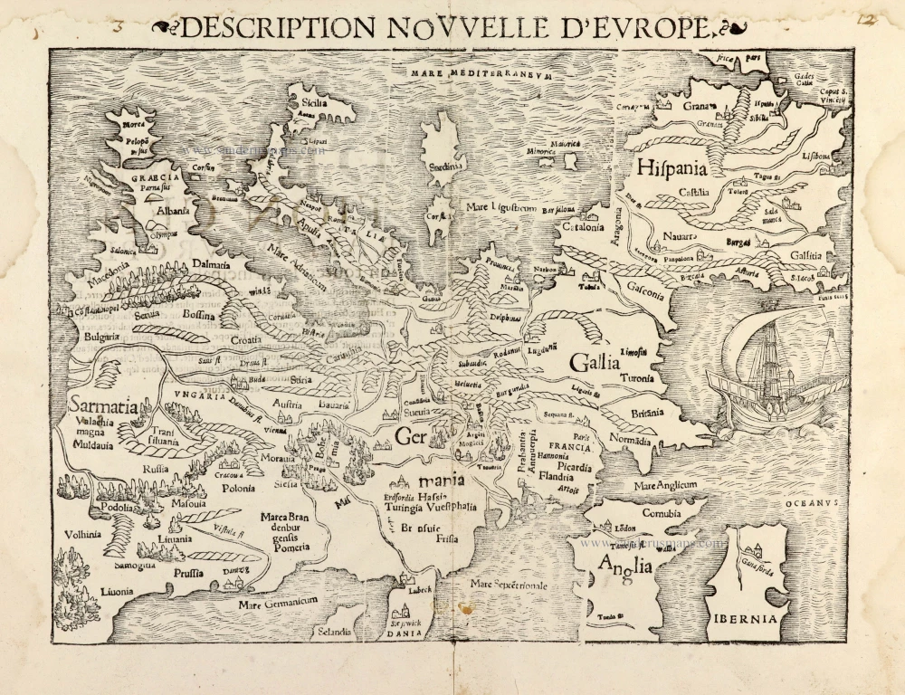
Description Nouvelle d'Europe. 1568
Europe by Sebastian Münster
[Item number: 30523]
Scarce map
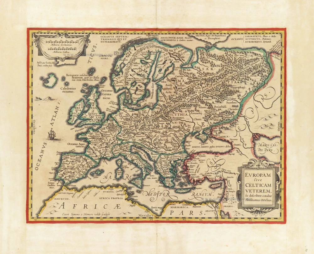
Europam sive Celticam Veterem c. 1630-1650
Europe by Evert van Hamersveldt, published by Johannes Janssonius.
[Item number: 30838]

L'Europe Divisée Suivant l'Estendue de ses Principaux Estats subdivisés en leurs principales Provinces. 1692
Europe, by N. Sanson, so-called published by Hubert Jaillot. (Pirated edition by Pierre Mortier).
[Item number: 31138]

Europa Christiani Orbis Domina in sua Imperia, Regna, et Styatus exacte divisa c. 1720
Europe by J.B. Homann
[Item number: 32098]

First state of one of the most beautiful and important portolan charts of Europe.
Universe Europae Maritime eiusque Navigationis Descriptio. | Generale Paschaerte van Europa, soe verre die Zeecusten ende Navigatien streckende zijn, 1585
Europe by L.J. Waghenaer
[Item number: 32269]
Accuratissima Europae Tabula. 1696-1713
Europe by J. Danckerts.
[Item number: 32457]

L' Europa. 1677
Europe by Giovanni De Rossi, after Nicolas Sanson.
[Item number: 32886]
new

Europa, ad Magnae Europae Gerardi Mercatoris P. Imitationem, Rumoldi Mercatoris F. Cura Edita, Seruato Tamen Initio Longitudinis ex Ratione Magnetis, quod Pater in Magna sua Universali Posuit. 1613
Europe by Gerard Mercator.
[Item number: 32928]
new
Scarce
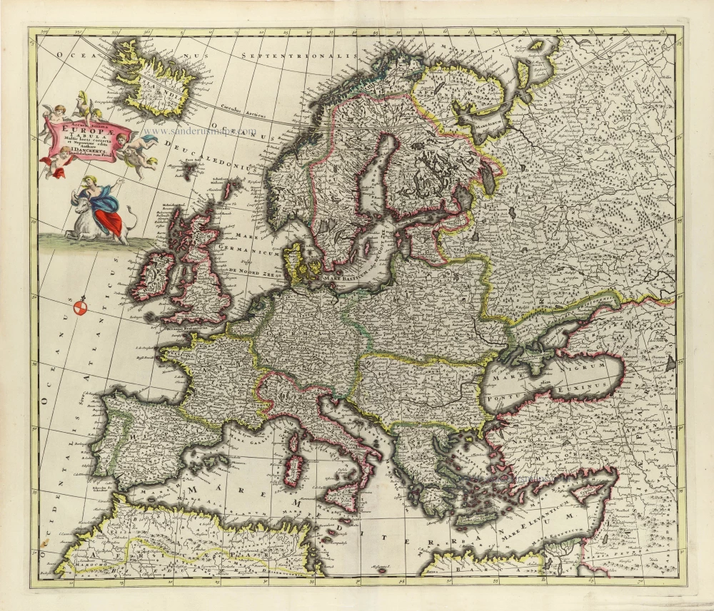
Nova Europa Descriptio. 1689-90
Europe by Frederick de Wit
[Item number: 32974]
new