
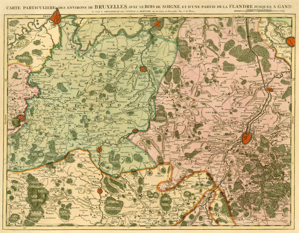
Old, antique map of Brussel - Geraardsbergen - Oudenaarde - Aalst by Frickx - Covens-Mortier 1745.
Covens & Mortier. A Map Publishing House in Amsterdam. 1721-1866.
For almost two centuries, the Amsterdam firm of Covens & Mortier was the most significant and crucial Dutch publishing house in commercial cartography. In terms of quantity, it was the biggest contemporary map-trading house worldwide, distributing innumerable maps, atlases, globes, and books.
Pieter (Pierre) Mortier (Leiden, 1661 – Amsterdam, 1711)
Nothing is known about the youth of Pieter Mortier. He studied in Paris from 1681 to approximately 1685. He must have come into contact with French 'libraires' and learned the bookselling trade there. In 1685, he returned to Amsterdam and opened a small bookshop. He joined the Book, Art Sellers' and Printers' Guild the same year.
Pieter sold books in Dutch and foreign languages but also published books himself, usually in French. His business flourished so much that in 1688, he was forced to rent another house on the Vijgendam.
Pieter Mortier's first privilege for maps was granted by the States of Holland and West Friesland on September 15, 1690. It refers to Sanson's maps, which he 'is printing and correcting with great pains and care'.
Pieter began publishing maps and atlases on a large scale. By the beginning of the 18th century, he had become so wealthy that he could purchase three houses in Amsterdam: the Beurssluis, on the Vijgendam, and the Heremietensteeg. He rebuilt the Vijgendam house into a large, prestigious structure that would serve for over a century as a shop, business, and residential structure for Covens & Mortier's publishing house.
He died on February 13, 1711, after a brief illness. The company continued under the management of Pieter's widow, Amelia' s-Gravesande.
After she died in 1719, her son, Cornelis, took over the management for a few years.
On November 20, 1721, a company was founded by Cornelis Mortier and Johannes Covens I. The latter was married the same year to Cornelis's sister. From that year on, the name of :
Covens & Mortier.
Their firm would see a massive expansion in the next 140 years. In 1732, the heirs sold the property to their brother Cornelis and his partner Covens. Their main competitors were Reinier & Josua Ottens and Gerard Valck & Petrus Schenck. After the death of Johannes Covens I (1774), his son Johannes Covens II (1722-1794) entered the business. In 1778, Johannes added a new company name :
J. Covens & Son.
Johannes Covens II was succeeded by his son Cornelis Covens (1764-1825), who, in turn, brought Peter Mortier IV, the great-grandson of Petrus Mortier I, into the business. The name was from 1794 to 1866:
Mortier, Covens & Son.
The last Covens in the series was Cornelis Johannes Covens (1806-1880).
Covens & Mortier had a large stock of atlases and maps, including Delisle, Jaillot, Johannes Janssonius, Sanson, and Claes Jansz. Visscher, Nicolaas Visscher, and Frederik de Wit. For decades, the press produced an impressive number of atlases.
Carte Paticulière des environs de Bruxelles avec lle Bois de Soigne et d'une partie de la Flandre jusques Gand.
Item Number: 21251 Authenticity Guarantee
Category: Antique maps > Europe > Belgium
Old, antique map of Brussel - Geraardsbergen - Oudenaarde - Aalst by Frickx - Covens-Mortier.
Date of the first edition: 1712
Date of this map: 1745.
Copper engraving
Size (not including margins): 41.5 x 55cm (16.2 x 21.5 inches)
Verso: Blank
Condition: Original coloured, excellent.
Condition Rating: A+
References: Koeman, Fri1 (10) van Egmont, p.121.
From: E. FRICKX. Atlas des Pays-Bas. Amsterdam, Covens & Mortier, 1745 (Koeman, FRI5)
Covens & Mortier. A Map Publishing House in Amsterdam. 1721-1866.
For almost two centuries, the Amsterdam firm of Covens & Mortier was the most significant and crucial Dutch publishing house in commercial cartography. In terms of quantity, it was the biggest contemporary map-trading house worldwide, distributing innumerable maps, atlases, globes, and books.
Pieter (Pierre) Mortier (Leiden, 1661 – Amsterdam, 1711)
Nothing is known about the youth of Pieter Mortier. He studied in Paris from 1681 to approximately 1685. He must have come into contact with French 'libraires' and learned the bookselling trade there. In 1685, he returned to Amsterdam and opened a small bookshop. He joined the Book, Art Sellers' and Printers' Guild the same year.
Pieter sold books in Dutch and foreign languages but also published books himself, usually in French. His business flourished so much that in 1688, he was forced to rent another house on the Vijgendam.
Pieter Mortier's first privilege for maps was granted by the States of Holland and West Friesland on September 15, 1690. It refers to Sanson's maps, which he 'is printing and correcting with great pains and care'.
Pieter began publishing maps and atlases on a large scale. By the beginning of the 18th century, he had become so wealthy that he could purchase three houses in Amsterdam: the Beurssluis, on the Vijgendam, and the Heremietensteeg. He rebuilt the Vijgendam house into a large, prestigious structure that would serve for over a century as a shop, business, and residential structure for Covens & Mortier's publishing house.
He died on February 13, 1711, after a brief illness. The company continued under the management of Pieter's widow, Amelia' s-Gravesande.
After she died in 1719, her son, Cornelis, took over the management for a few years.
On November 20, 1721, a company was founded by Cornelis Mortier and Johannes Covens I. The latter was married the same year to Cornelis's sister. From that year on, the name of :
Covens & Mortier.
Their firm would see a massive expansion in the next 140 years. In 1732, the heirs sold the property to their brother Cornelis and his partner Covens. Their main competitors were Reinier & Josua Ottens and Gerard Valck & Petrus Schenck. After the death of Johannes Covens I (1774), his son Johannes Covens II (1722-1794) entered the business. In 1778, Johannes added a new company name :
J. Covens & Son.
Johannes Covens II was succeeded by his son Cornelis Covens (1764-1825), who, in turn, brought Peter Mortier IV, the great-grandson of Petrus Mortier I, into the business. The name was from 1794 to 1866:
Mortier, Covens & Son.
The last Covens in the series was Cornelis Johannes Covens (1806-1880).
Covens & Mortier had a large stock of atlases and maps, including Delisle, Jaillot, Johannes Janssonius, Sanson, and Claes Jansz. Visscher, Nicolaas Visscher, and Frederik de Wit. For decades, the press produced an impressive number of atlases.
Related items
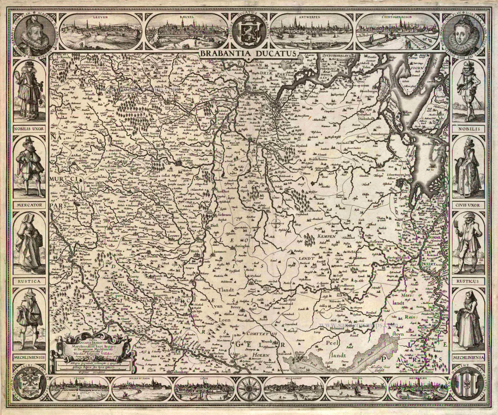
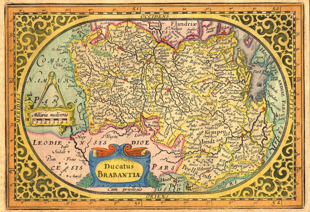
Brabantia Ducatus / Tabula Ducatus Brabantiae Continens Marchionatum Sacri Imperij et Dominium Mechliniense Magna cura edita à Nicolao Iohannis Visscher. Anno 1622. 1622
Brabant by C.J. Visscher.
[Item number: 2640]
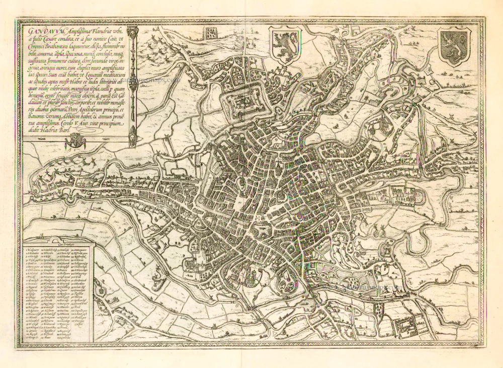
Gandavum, Amplißima Flandria Urbs ... 1657
Ghent (Gent) by Georg Braun & Frans Hogenberg, published by Johannes Janssonius.
[Item number: 2687]
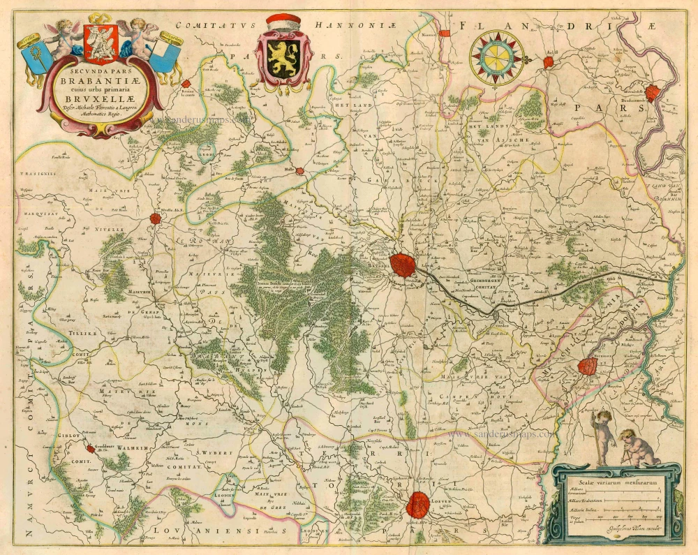
Secunda Pars Brabantiae cuius urbs primaria Bruxellae. 1659-72
Old antique map of Brussels by W. & J. Blaeu.
[Item number: 2966]
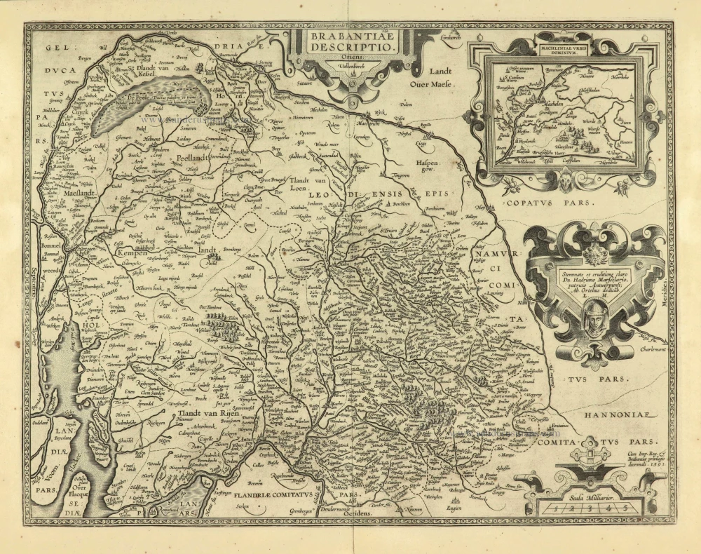
Brabantiae Descriptio 1601
Brabant, with an inset map of the district of Mechelen, by Abraham Ortelius.
[Item number: 12909]
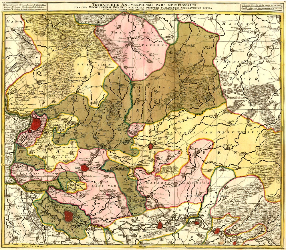
Tetrarchiae Antverpiensis Pars Meridionalis 1683-1696
Antwerpen - Mechelen by Visscher N. II.
[Item number: 14777]
Ducatus Brabantiae. 1631
Brabant by Abraham Goos,published by Joannes Janssonius.
[Item number: 17723]
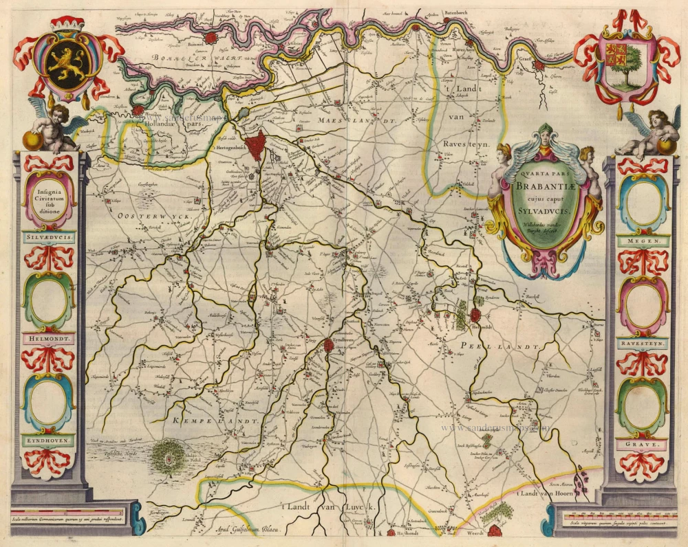
Quarta Pars Brabantiae cujus caput Sylvaducis. 1635
Northern Brabant, by Blaeu W. & J.
[Item number: 20384]
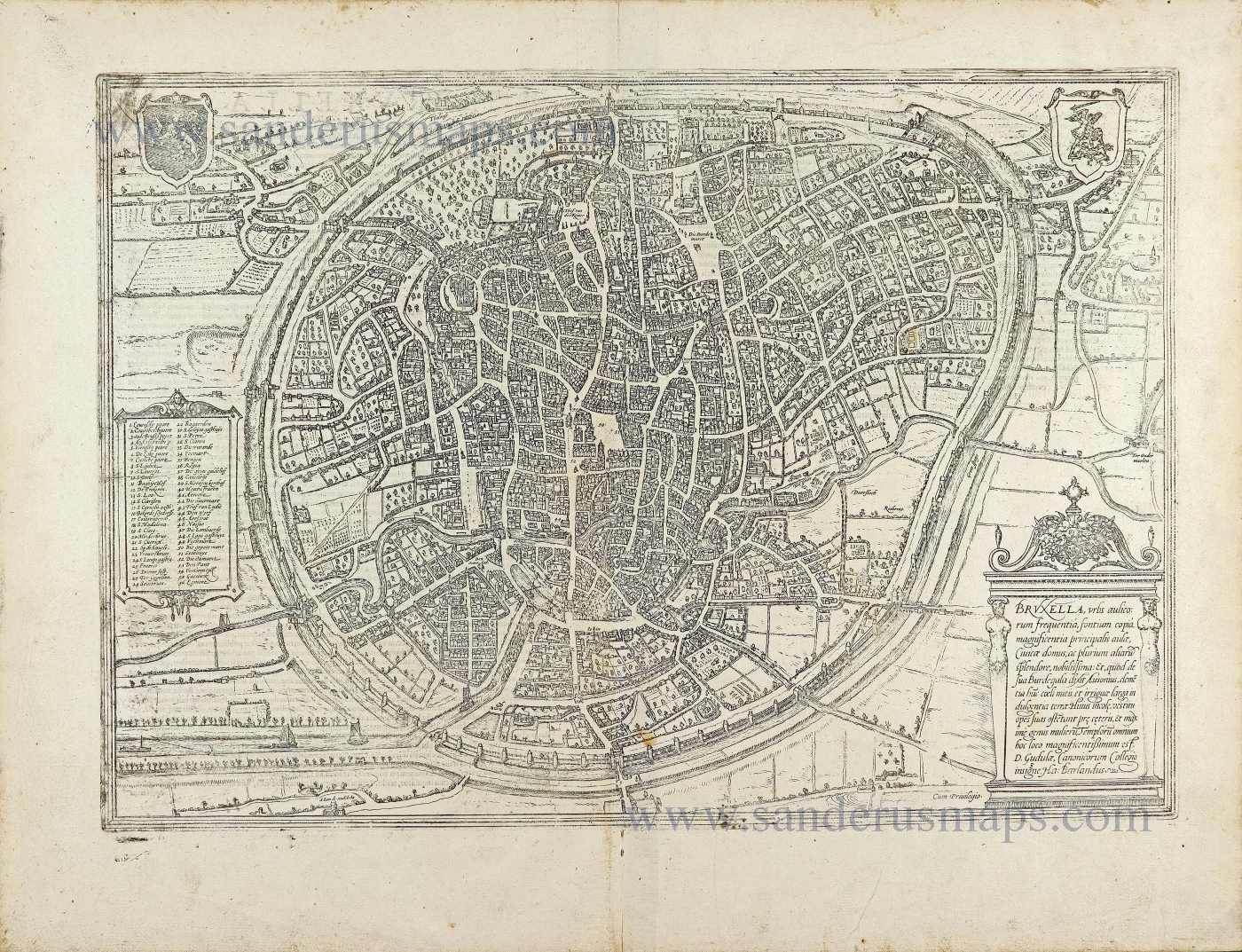
Bruxella, Urbs Aulicorum Frequentia, Fontium Copia, Magnificentia Principalis Aulae ... 1612
Brussels, by Braun and Hogenberg.
[Item number: 22311]
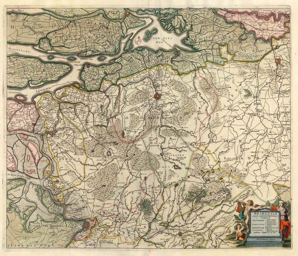
Brabantiae, pars Septentrionalis c. 1680
Northern Brabant, by Frederick de Wit.
[Item number: 24653]
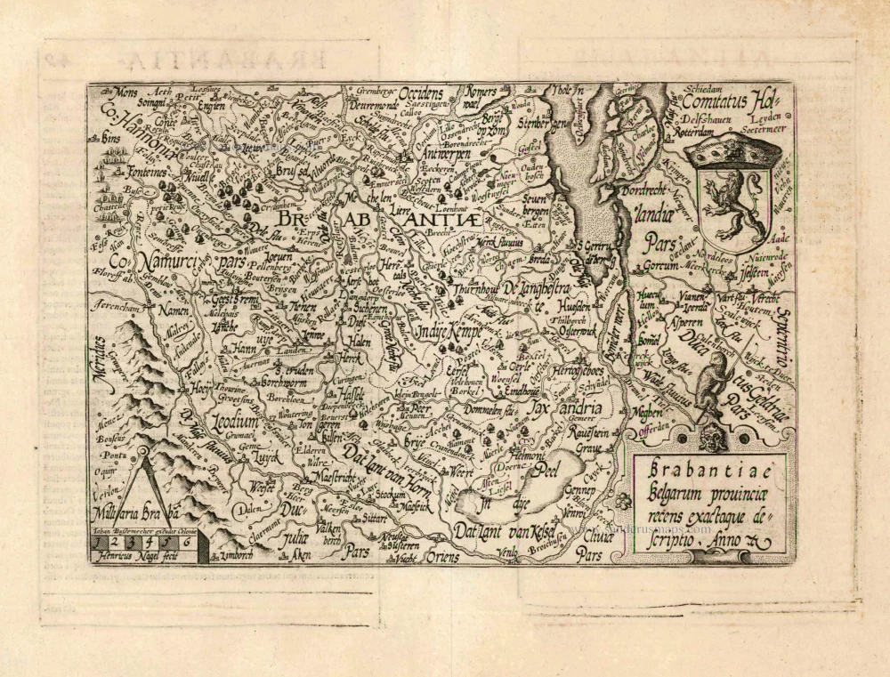
Brabantiae Belgarum provinciae recens exactaque descriptio. 1602
Brabant by M. Quad - J. Bussemacher.
[Item number: 25235]
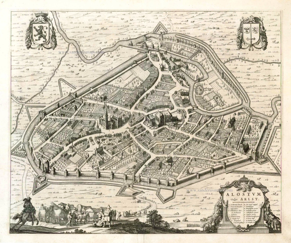
Alostum Vulgo Aalst. 1641-1644
Aalst, by A. Sanderus.
[Item number: 25271]
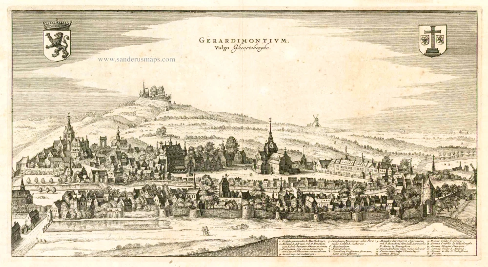
Gerardimontium Vulgo Gheertsberghe. 1641-1644
Geraardsbergen, by Antonius Sanderus.
[Item number: 25278]
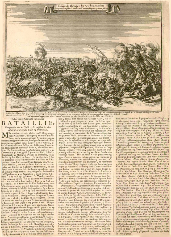
Glorieuse Batalye by Oudenaarden voorgevalletussen de Geallieerde en Franse Legers op den 11 Juli 1708. 1708
Military plan of Oudenaarde
[Item number: 25304]

Alostum, Urbs Flandriae Imperatoriae Firmissima. 1588
Aalst by Braun & Hogenberg.
[Item number: 25358]
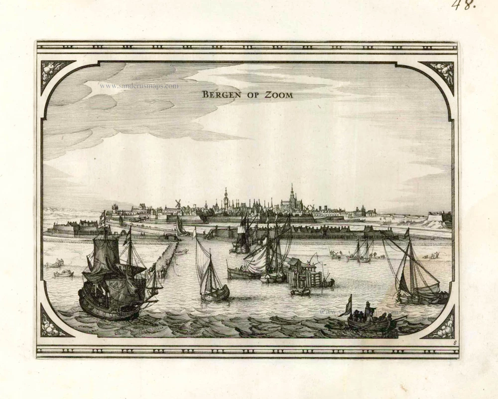
Bergen op Zoom. 1656
Bergen op Zoom, by Visscher N. - Schut P.H.
[Item number: 25374]