
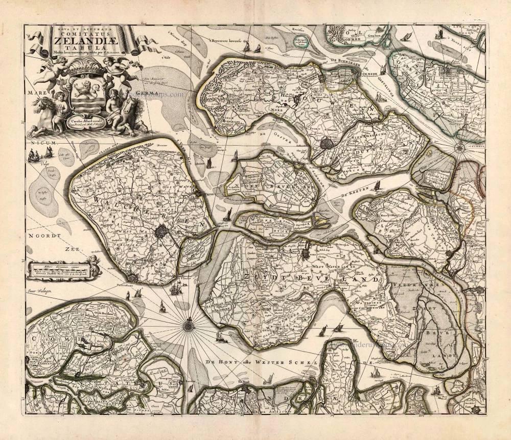
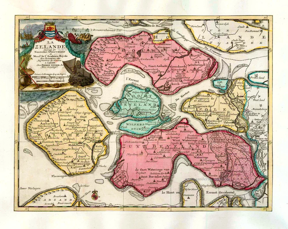
Zeeland by Carel Allard 1697
The Allard Family
The founder of this family of map-makers, publishers and print-sellers was Huych (Hugo) Allard (1625-1691). He worked in Amsterdam in 1684 and is supposed to have begun his business as early as 1645. He died in 1691, leaving his shop to his son, Carel Allard (1648-c. 1706). Carel brought out many maps and some atlases. His atlases are mainly composed of maps from the stock of other publishers like Janssonius and De Wit. However, some maps were his original creations. For these maps, the States of Holland granted him a privilege in 1683.
One of the sons of Carel, Abraham Allard (1676-c.1730), joined his father in the map trade and was accepted as a member of the ‘Constvercoopers gilde’ (Art dealer’s Guild) in 1708.
The original geographical maps by Allard, designed and cut between 1680 and 1700, are very decorative, well-composed and up-to-date.
Nova et Accurata Comitatus Zeelandiae Tabula.
Item Number: 26725 Authenticity Guarantee
Category: Antique maps > Europe > The Netherlands
Old, antique map of Zeeland, by Carel Allard.
Oude, antieke kaart van Zeeland, door Carel Allard.
Rare 3rd state.
Date of the first edition: 1674
Date of this map: 1697
Copper engraving, printed on paper.
Size (not including margins): 46 x 54.5cm (17.9 x 21.3 inches)
Verso: Blank
Condition: Excellent.
Condition Rating: A+
References: Blonk-van der Wijst (Zeeland), 48.3.
From: Atlas Minor sive Tabula Geographicae. Amsterdam, C. Allard, 1697. (Koeman, All2)
The Allard Family
The founder of this family of map-makers, publishers and print-sellers was Huych (Hugo) Allard (1625-1691). He worked in Amsterdam in 1684 and is supposed to have begun his business as early as 1645. He died in 1691, leaving his shop to his son, Carel Allard (1648-c. 1706). Carel brought out many maps and some atlases. His atlases are mainly composed of maps from the stock of other publishers like Janssonius and De Wit. However, some maps were his original creations. For these maps, the States of Holland granted him a privilege in 1683.
One of the sons of Carel, Abraham Allard (1676-c.1730), joined his father in the map trade and was accepted as a member of the ‘Constvercoopers gilde’ (Art dealer’s Guild) in 1708.
The original geographical maps by Allard, designed and cut between 1680 and 1700, are very decorative, well-composed and up-to-date.
Related items
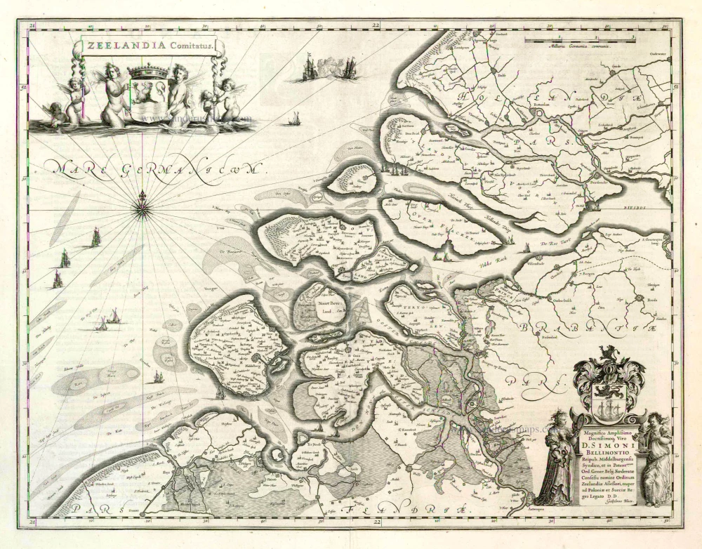
Zeelandia Comitatus 1635
Zeeland by Willem Blaeu.
[Item number: 3626]
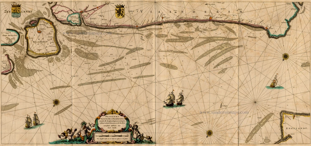
Paskaert van de Zeeusche en Vlaemsche Kusten, tonende Alle Drooghten, Diepten, en Ondiepten, tusschen t'Eylandt Schouwen en de Hoofden, Curieuselyck Beschreven door Dirck Davidsz 1667
Sea chart of Flanders (Vlaanderen) & Zeeland, by Pieter Goos.
[Item number: 19054]
Extremely rare sea chart.
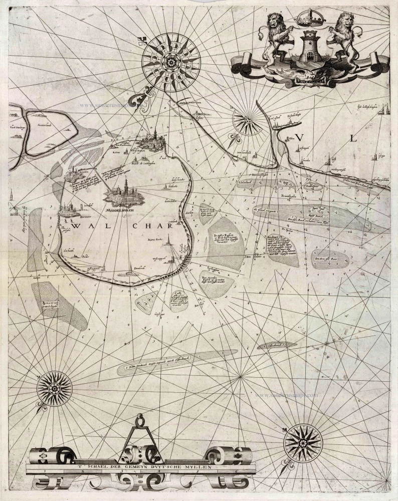
[No title] 1617
Zeeland - Flanders by Willem den Dooven.
[Item number: 25614]
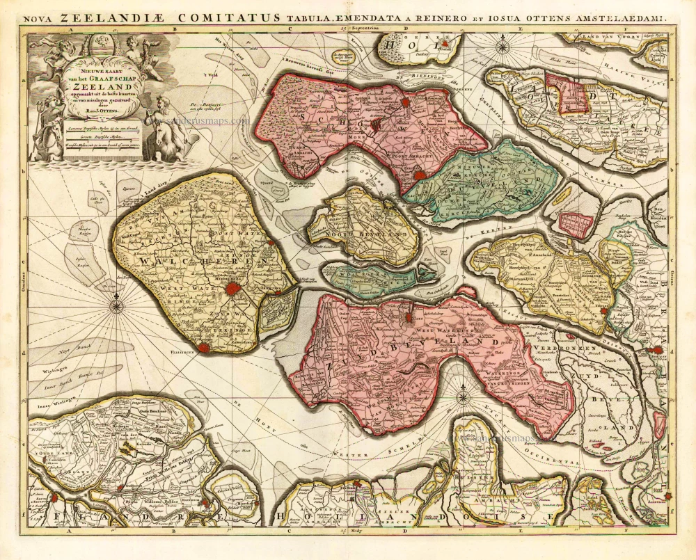
Nieuwe Kaart van het Graafschap Zeeland. 1730-45
Zeeland, by Ottens R. & I.
[Item number: 25736]
La Zelande. 1713
Zeeland, by Pieter Van der Aa.
[Item number: 26058]
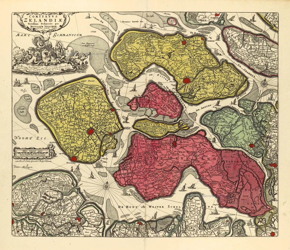
Comitatus Zelandiae. c. 1715
Zeeland by Nicolaas Visscher I, published by Petrus Schenk II.
[Item number: 28275]
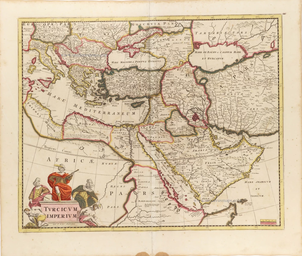
Turcicum Imperium. ca. 1691-96
Ottoman Empire, by De Wit F.
[Item number: 28988]