
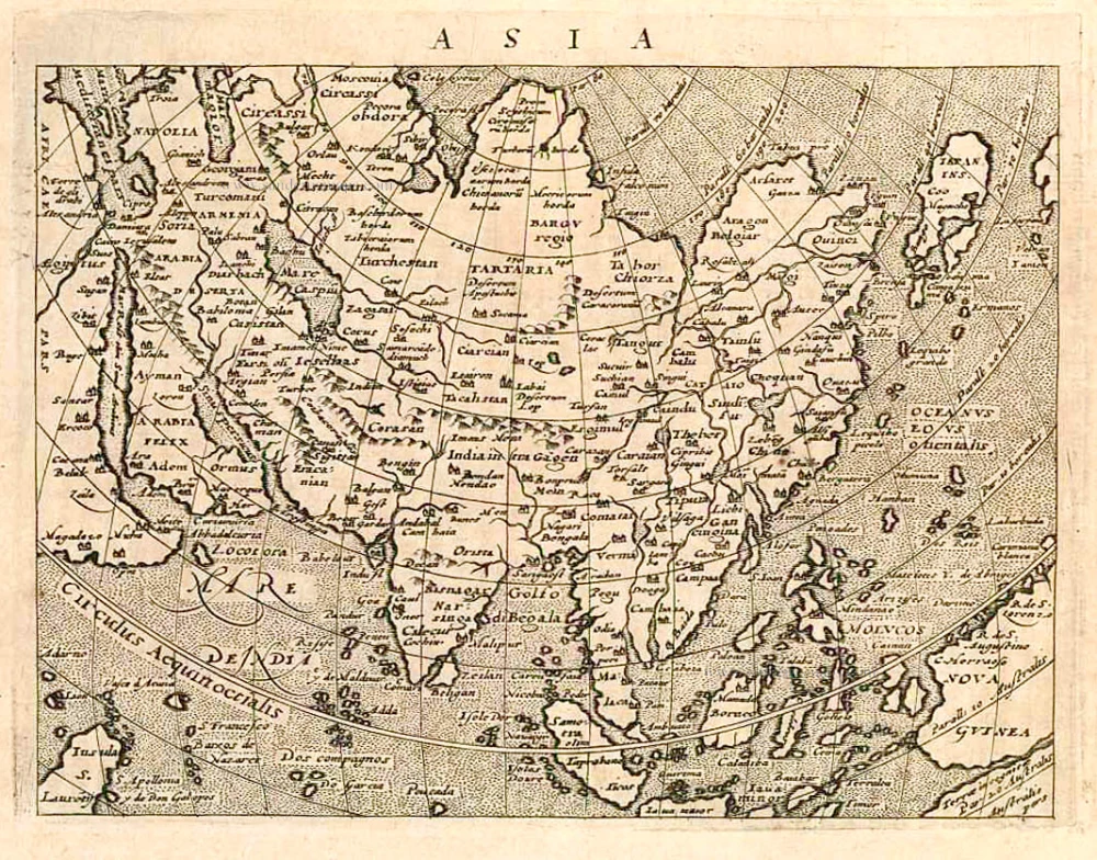
Rare first state of Solinus' Asia map with the earliest representation of the north-west coast of America.
Asia, by Sebastian Münster. 1538
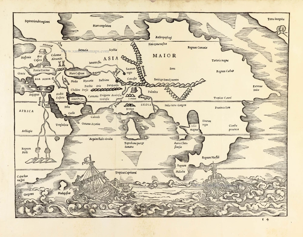
The top right corner of this Asia map depicts a northwest-orientated coastline labelled Terra incognita.
This is the earliest representation of the northwest coast of America on a printed map, showing only a few trees, hills and a small bay. Its existence has caused much debate; not even the cartographer is known for sure, although it is most often thought to be the work of Sebastian Münster, who compiled the book's text. The text opposite the map, on page 150, refers to this coast, 'In our days it has been explored by men'; however, no such voyage is known today. Wagner suggests that it might represent Japan; if so, this would be five years before the earliest recorded visit by a European. It also shows one of the first delineations of a strait between Asia and America some 200 years before Vitus Bering's voyage to this area. There was a debate about a possible land mass connection to the American continent. (Burden)
Gaius Julius Solinus was a Latin grammarian, geographer, and compiler who probably flourished in the early 3rd century AD.
Solinus was the author of De mirabilibus mundi ("The wonders of the world") which circulated both under the title Collectanea rerum memorabilium ("Collection of Curiosities"), and Polyhistor.
Asia Maior.
Item Number: 30050 Authenticity Guarantee
Category: Antique maps > America > North America
Old, antique map of Asia, by Sebastian Münster.
Title: Asia Maior.
Cartographer: Sebastian Münster.
Date of the first edition: 1538.
Date of this map: 1538.
First state / edition (of two), a second edition appeared in 1543.
Woodcut, printed on paper.
Image size: 245 x 330mm (9.65 x 12.99 inches).
Sheet size: 300 x 370mm (11.81 x 14.57 inches).
Verso: Blank.
Condition: Excellent.
Condition Rating: A+.
From: SOLINUS, Caius Julius. Polyhistor rerum toto orbe memorabilium thesaurus locupletissimus. Basel, Michael Isingrin & Henricum Petri, 1538.
The top right corner of this Asia map depicts a northwest-orientated coastline labelled Terra incognita.
This is the earliest representation of the northwest coast of America on a printed map, showing only a few trees, hills and a small bay. Its existence has caused much debate; not even the cartographer is known for sure, although it is most often thought to be the work of Sebastian Münster, who compiled the book's text. The text opposite the map, on page 150, refers to this coast, 'In our days it has been explored by men'; however, no such voyage is known today. Wagner suggests that it might represent Japan; if so, this would be five years before the earliest recorded visit by a European. It also shows one of the first delineations of a strait between Asia and America some 200 years before Vitus Bering's voyage to this area. There was a debate about a possible land mass connection to the American continent. (Burden)
Gaius Julius Solinus was a Latin grammarian, geographer, and compiler who probably flourished in the early 3rd century AD.
Solinus was the author of De mirabilibus mundi ("The wonders of the world") which circulated both under the title Collectanea rerum memorabilium ("Collection of Curiosities"), and Polyhistor.
Related items
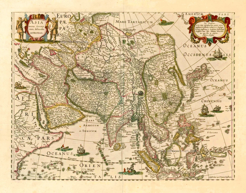
Asia Recens Summa Cura Delineata. 1644-58
Asia, by J. Janssonius
[Item number: 7508]

Accuratissima totius Asiae Tabula. c. 1691-96
Asia, by F. De Wit.
[Item number: 10960]
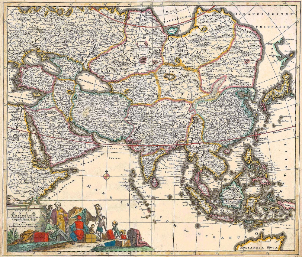
Exactissima Asiae Delineatio in praecipuas regiones Caeterasq Partes divisa. c. 1700
Asia by Th. Danckerts.
[Item number: 11298]
Asia 1602
Asia by Langenes, published by Bertius P.
[Item number: 12518]
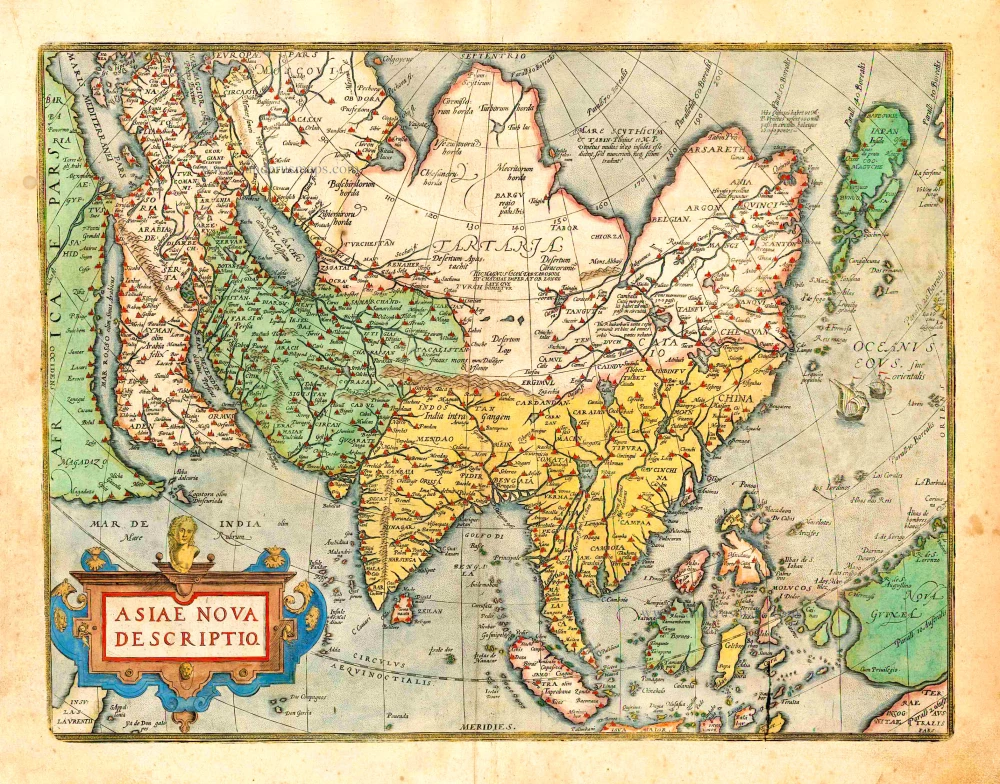
Asiae Nova Descriptio. 1612
Asia, by Abraham Ortelius.
[Item number: 22925]
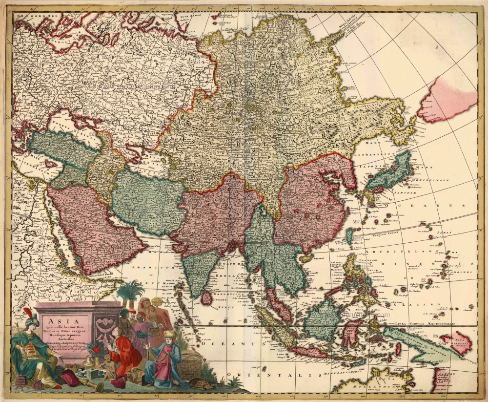
Asia qua Nulla Beatior Ora; Tractus in Eoos Vergens Mundique Teporem. c. 1730.
Asia, by G.& L. Valk.
[Item number: 24538]

Asiae in Tabula Geographica Delineatio. c. 1700
Asia by A.F. Zürner, published by Petrus Schenk.
[Item number: 25842]
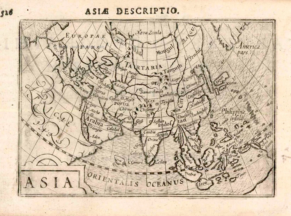
Asia. 1597
Asia, by Giovanni Magini.
[Item number: 26548]
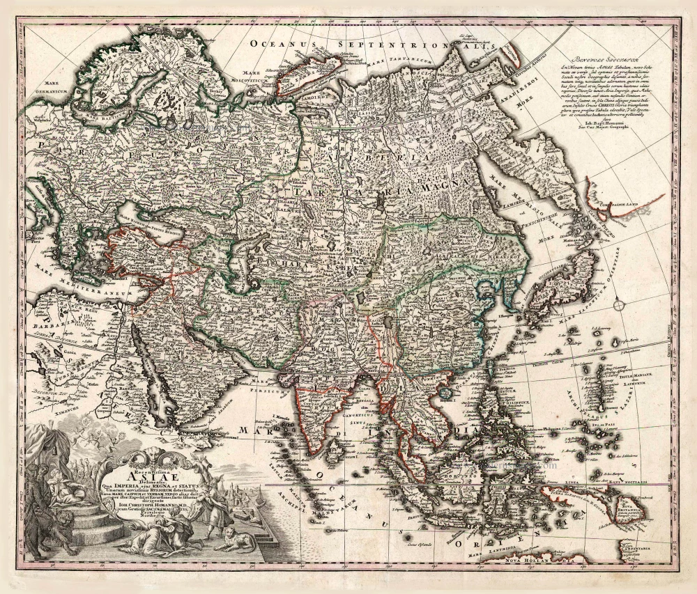
Recentissima Asiae Delineatio qua Imperia, ejus Regna et Status ... 1730-37
Asia, by Homann Johann Christoph.
[Item number: 26733]
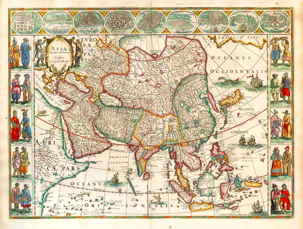
Asia Noviter Delineata. 1641-42
Asia, by Willem Blaeu.
[Item number: 27041]
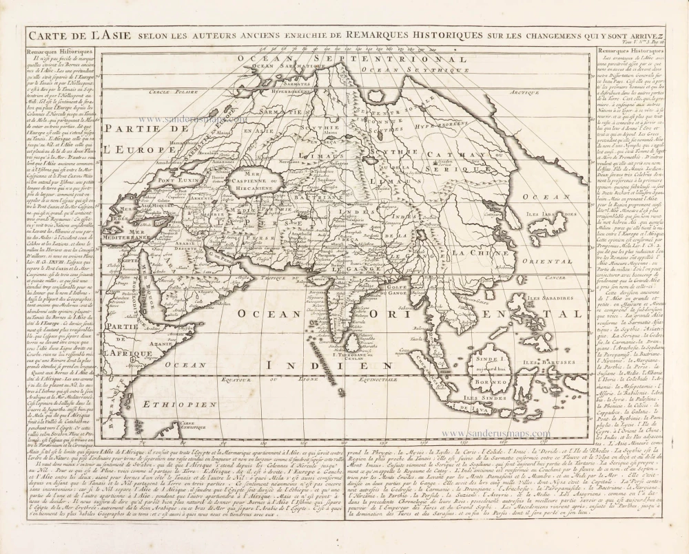
Carte de l'Asie selon les auteurs anciens enrichie de remarques historiques sur les changemens qui y sont arrivez. 1719
Asia, by Zacharias Châtelain.
[Item number: 29387]
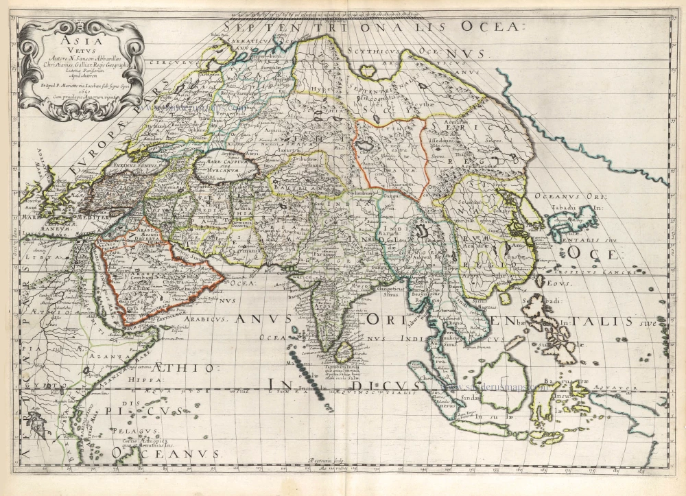
Asia Vetus. 1652
Ancient Asia by Nicolas Sanson.
[Item number: 29687]
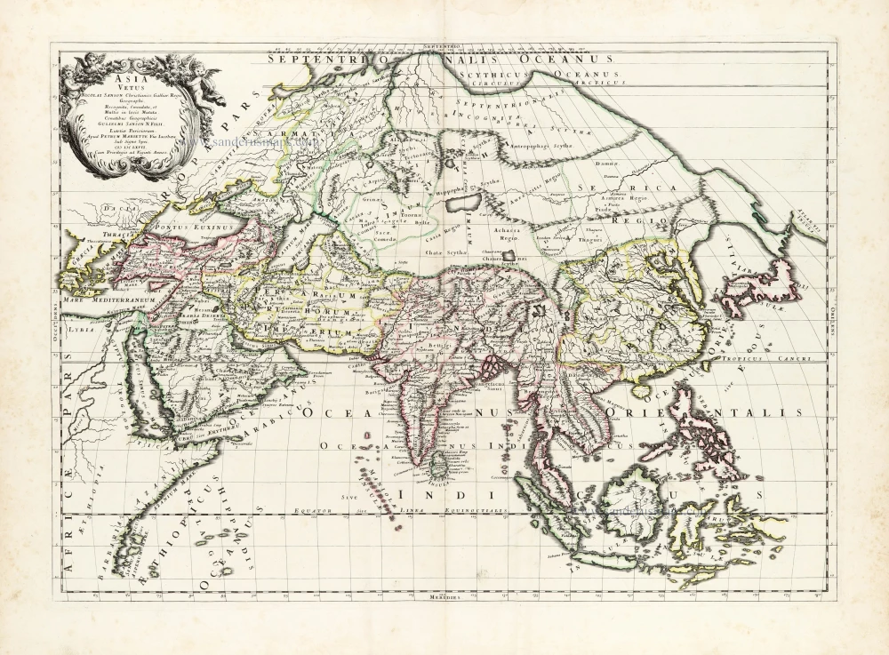
Asia Vetus. 1667-69
Ancient Asia by Nicolas & Guillaume Sanson.
[Item number: 30002]