
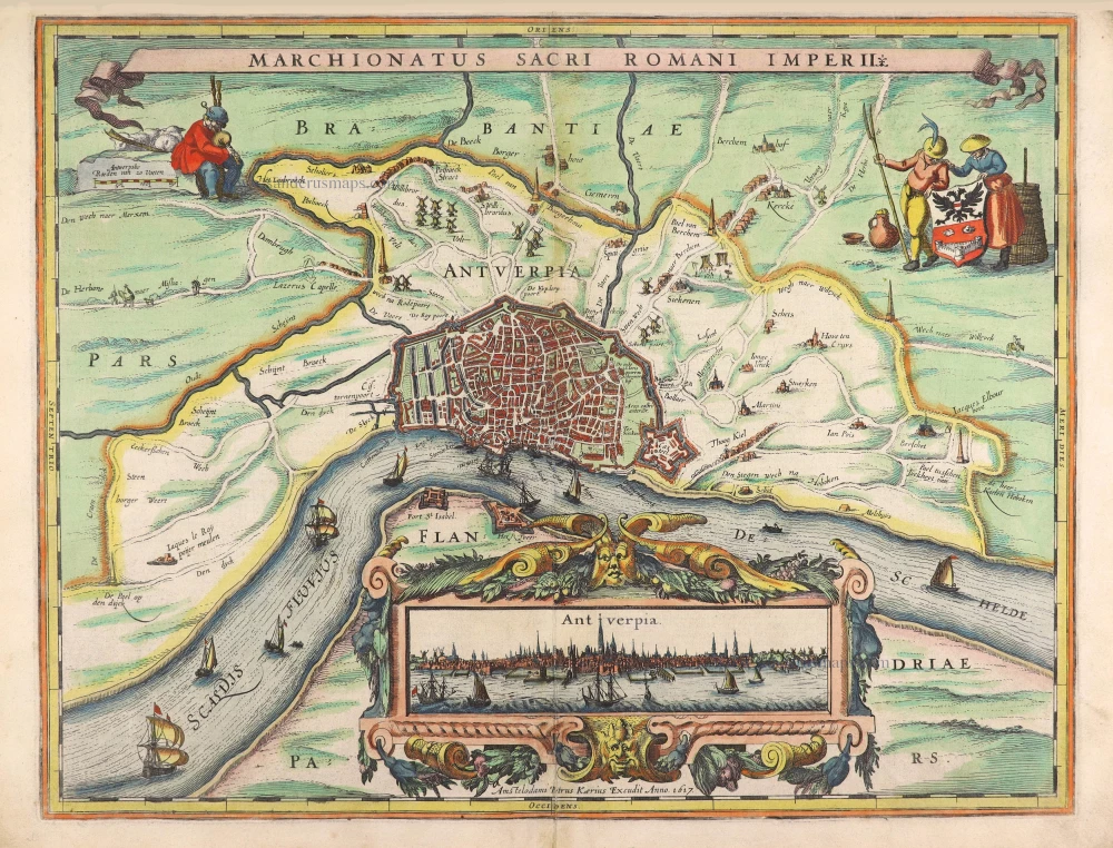
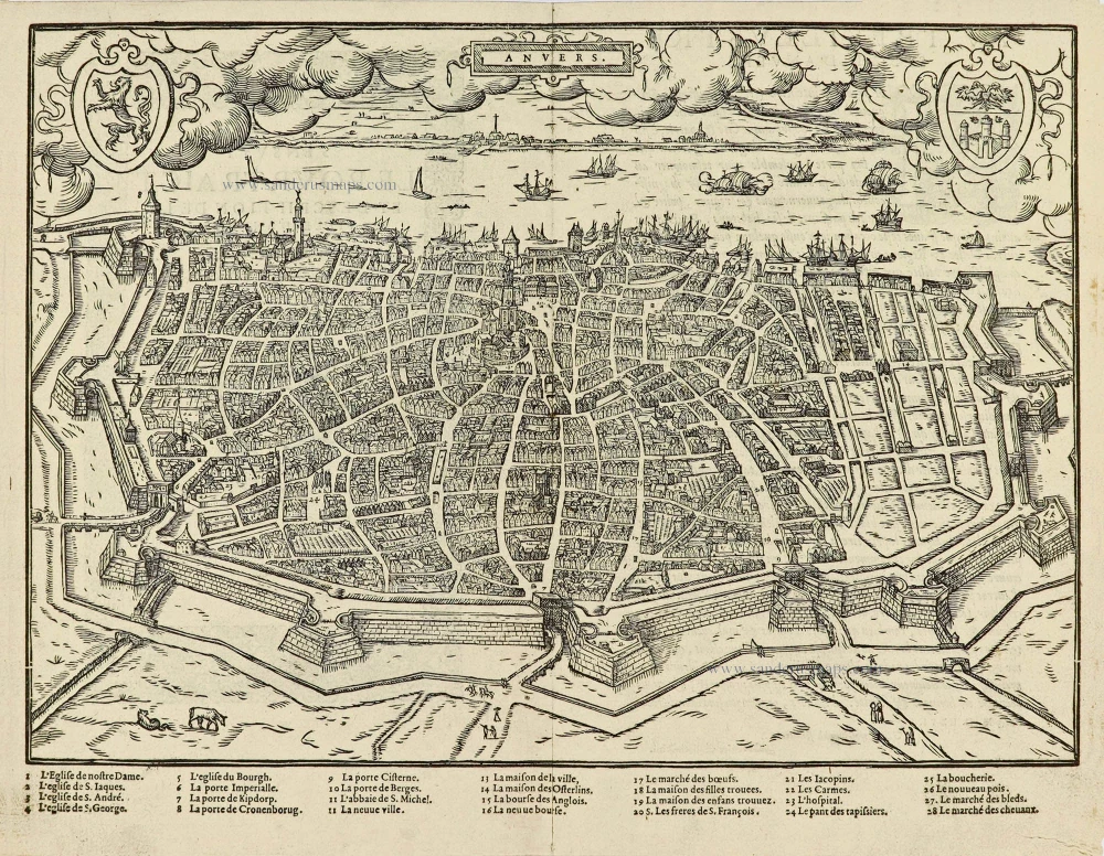
Antwerp (Antwerpen), by Petrus Kaerius. 1617
The item displayed on this page has been sold. However, we have a similar map in stock:
Antwerp (Antwerpen), by Petrus Kaerius. 1617
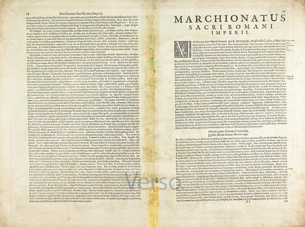
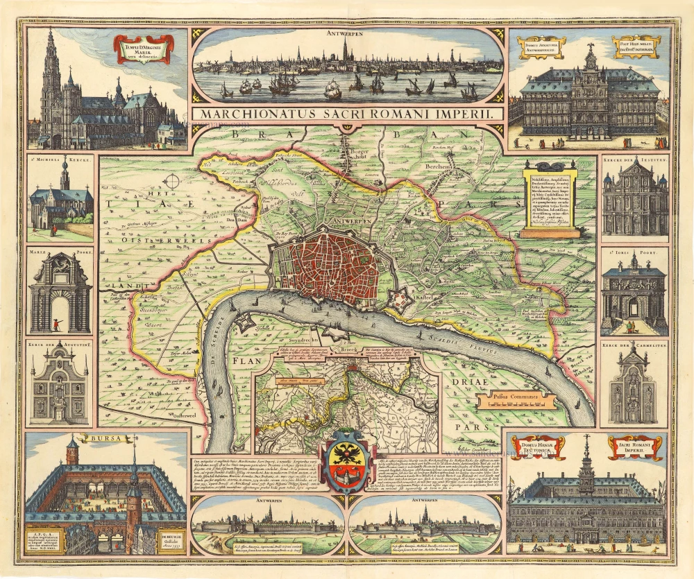
Marchionatus Sacri Romani Imperii.
[Item number: 30101]


Pieter Van den Keere (Petrus Kaerius) (1571-c.1650)
Pieter van den Keere was born in Ghent in 1571 as the son of the type-founder, Hendrik van den Keere. In 1584, he moved with his family to London for religious reasons. There, Van den Keere received training as an engraver from Jodocus Hondius, his brother-in-law. Not only the companionship with Jodocus Hondius but also the acquaintanceship with Pieter van den Berghe (Petrus Montanus), author of the text of the Germania Inferior, originates from the years of refuge in London.
Upon their settlement in Amsterdam in 1593, both Keere and Hondius embarked on a monumental project. Their collaboration resulted in the creation of a large wall map of Europe, a masterpiece that still stands as a testament to their skill and vision, dated 1595: Nova totius Europae descriptio.
In 1610, he set up a workshop in the Kalverstraat that he called ‘In den onseeckeren tijd’ (In the uncertain time). During this period, he made numerous copperplates, including maps for his Atlas of the Netherlands and the Atlas Minor published by Jodocus Hondius.
The Germania Inferior (1617) is the first original atlas of the Netherlands published in folio size. The text for the atlas, both in Dutch and in French, was written by Petrus Montanus. After 1623, Claes Jansz. Visscher bought the plates and substituted his name for Kaerius’s. In 1634, Visscher included many of these maps in his Germana Inferior.
Kaerius's fame is not only based on his atlas of the Netherlands. He is even better known as an engraver of many loose-leaf maps and as a collaborator of book publishers. His maps are found, i.e., in the Caert thresoor (Barent Langenes, 1598), Licht der Zeevaert (Blaeu, 1608), Atlas Minor (Hondius, 1628), and Caertboeck vande Midellandsche Zee (Barents, 1595).
Marchionatus Sacri Romani Imperii.
Item Number: 29407 Authenticity Guarantee
Category: Antique maps > Europe > Belgium
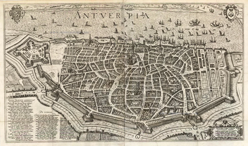
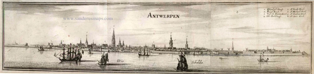
Old, antique map of Antwerp (Antwerpen), by Petrus Kaerius.
With inset: panoramic view of Antwerp.
Title: Marchionatus Sacri Romani Imperii.
Amstelodami Petrus Kaerius Excudit Anno 1617.
Oriented to the east.
Engraver: Petrus Kaerius.
Date of the first edition: 1617.
Date of this map: 1617.
Date on map: 1617.
Copper engraving, printed on paper.
Size (not including margins): 385 x 500mm (15.16 x 19.69 inches).
Verso: Latin text.
Condition: Original coloured, lower centrefold split closed.
Condition Rating: A.
From: Petri Kaerii Germania Inferior id est, XVII provinciarum ejus novae et exactae Tabulae Geographicae, cum Luculentis Singularum descriptionibus additis. À Petro Montano. Amsterdam, 1617. (Koeman, Kee1; Van der Krogt 3, 64:01)
Pieter Van den Keere (Petrus Kaerius) (1571-c.1650)
Pieter van den Keere was born in Ghent in 1571 as the son of the type-founder, Hendrik van den Keere. In 1584, he moved with his family to London for religious reasons. There, Van den Keere received training as an engraver from Jodocus Hondius, his brother-in-law. Not only the companionship with Jodocus Hondius but also the acquaintanceship with Pieter van den Berghe (Petrus Montanus), author of the text of the Germania Inferior, originates from the years of refuge in London.
Upon their settlement in Amsterdam in 1593, both Keere and Hondius embarked on a monumental project. Their collaboration resulted in the creation of a large wall map of Europe, a masterpiece that still stands as a testament to their skill and vision, dated 1595: Nova totius Europae descriptio.
In 1610, he set up a workshop in the Kalverstraat that he called ‘In den onseeckeren tijd’ (In the uncertain time). During this period, he made numerous copperplates, including maps for his Atlas of the Netherlands and the Atlas Minor published by Jodocus Hondius.
The Germania Inferior (1617) is the first original atlas of the Netherlands published in folio size. The text for the atlas, both in Dutch and in French, was written by Petrus Montanus. After 1623, Claes Jansz. Visscher bought the plates and substituted his name for Kaerius’s. In 1634, Visscher included many of these maps in his Germana Inferior.
Kaerius's fame is not only based on his atlas of the Netherlands. He is even better known as an engraver of many loose-leaf maps and as a collaborator of book publishers. His maps are found, i.e., in the Caert thresoor (Barent Langenes, 1598), Licht der Zeevaert (Blaeu, 1608), Atlas Minor (Hondius, 1628), and Caertboeck vande Midellandsche Zee (Barents, 1595).
Related items
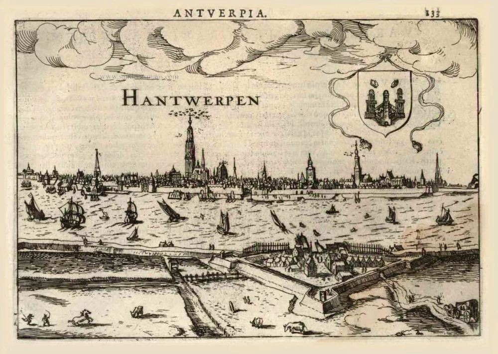
Hantwerpen. 1616
Antwerp (Antwerpen), by Lodovico Guicciardini.
[Item number: 224]
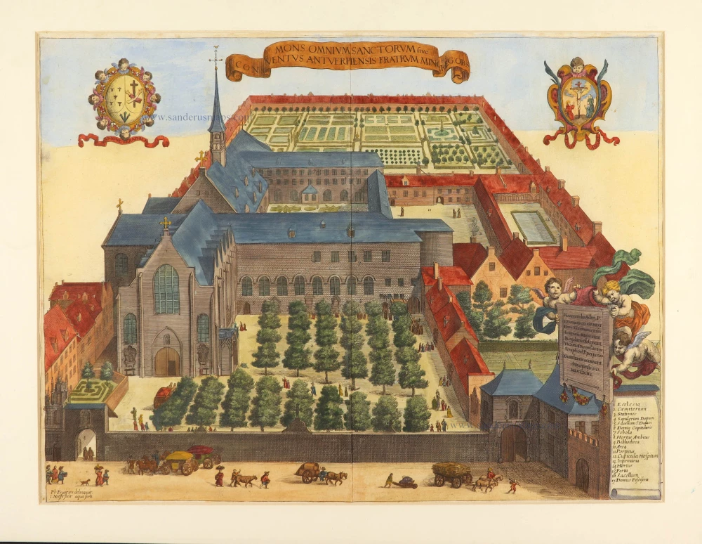
Mons Omnium Sanctorum sive Conventus Antverpiensis Fratrum Minor. 1726
Antwerpen - Minderbroeders, by Antonius Sanderus.
[Item number: 3560]
Antverpia 1596
Antwerp, by Georg Braun and Frans Hogenberg, after G. Hoefnagel.
[Item number: 5602]
Antwerpen. 1726
Antwerpen by D. Fassmann
[Item number: 5946]
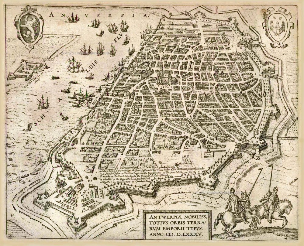
Antwerpiae Nobiliss. totius Orbis Terrarum Emporii Typus. Anno.M.D.LXXXV. (1585). c. 1586
Antwerp (Antwerpen), by Frans Hogenberg.
[Item number: 8017]
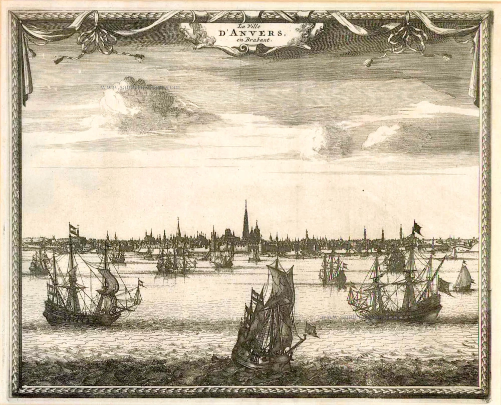
La Ville d'Anvers, en Brabant. c.1715
Antwerpen by Pieter van der Aa
[Item number: 11769]
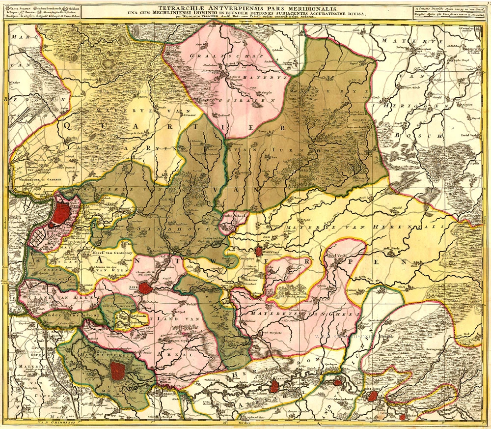
Tetrarchiae Antverpiensis Pars Meridionalis 1683-1696
Antwerpen - Mechelen by Visscher N. II.
[Item number: 14777]

Tertia Pars Brabantiae qua continetur Marchionat S.R.I. horum urbs primaria Antverpia. 1641-42
The Marquisate of Antwerp, by Willem Blaeu.
[Item number: 17537]
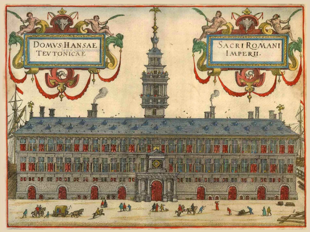
Domus Hansae Teutonicae - Sacri Romani Imperi. 1612
Hanse (Antwerp), by Lodovico Guicciardini.
[Item number: 18160]
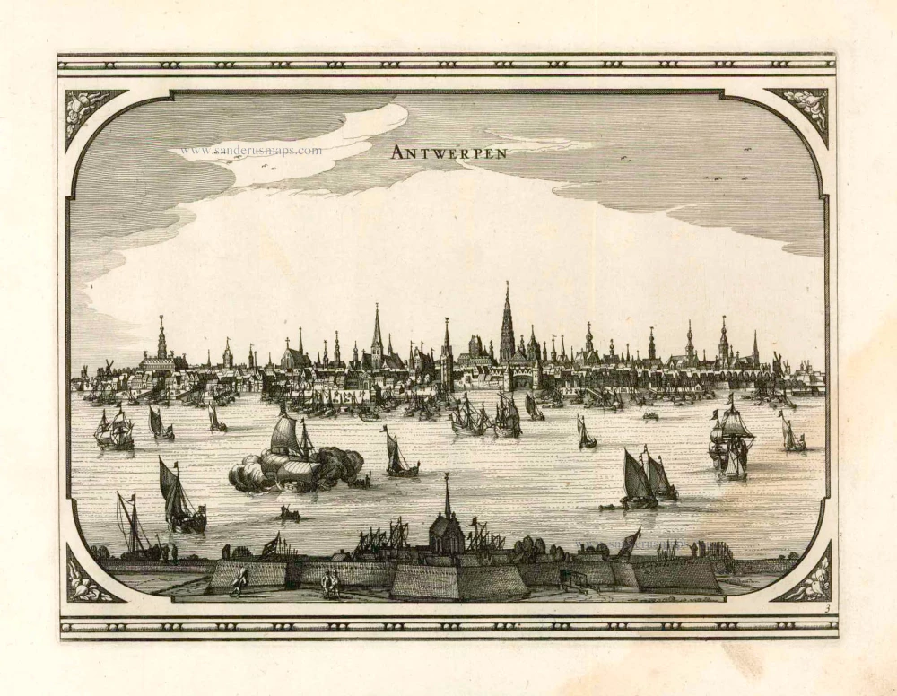
Printed from two plates, joint as published. 1659
Antwerp (Antwerpen) by C. Merian.
[Item number: 20256]
Antwerpen. 1656
Antwerpen by Visscher N. - Schut P.H.
[Item number: 25371]
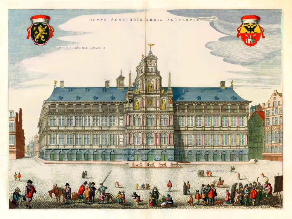
Domus Senatoria Urbis Antverpiae. 1652
City Hall of Antwerp, by J. Blaeu.
[Item number: 25508]
Rare.
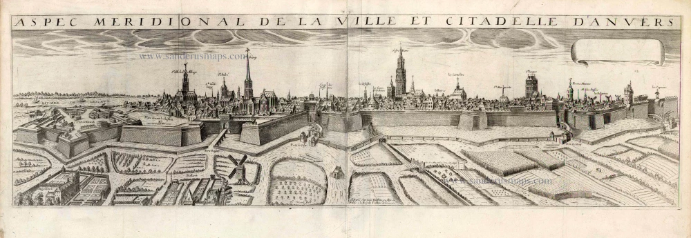
Aspec Meridionale de la ville et Citadelle d'Anvers. 1648
Antwerp by J. Boisseau.
[Item number: 25569]

Le Pourtraict de la tres noble ville d'Anvers, ainsi qu'elle se comporte a present. 1575
Antwerp (Antwerpen), by François de Belleforest.
[Item number: 27383]
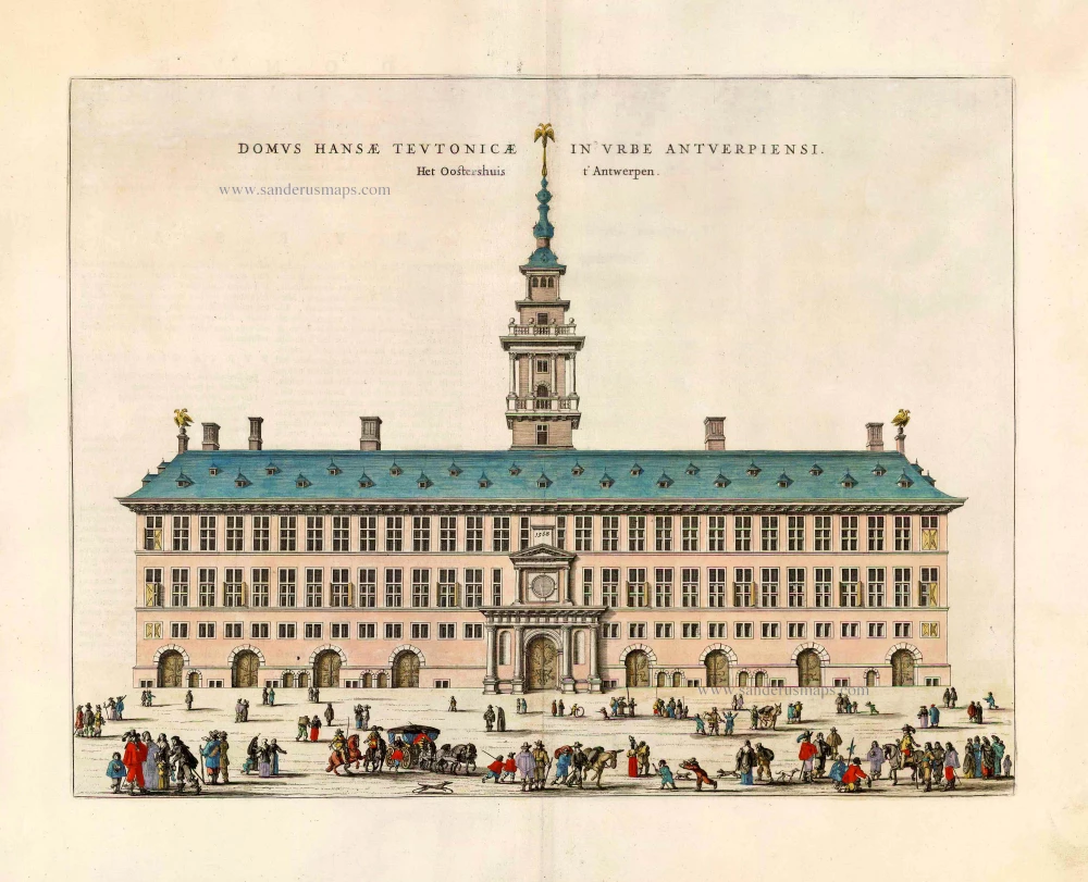
Domus Hansae Teutionicae in Urbe Antverpiensi. - Het Oostershuis t' Antwerpen. 1652
The Hanse in Antwerp (Antwerpen), by Joan Blaeu.
[Item number: 27507]
Very rare!
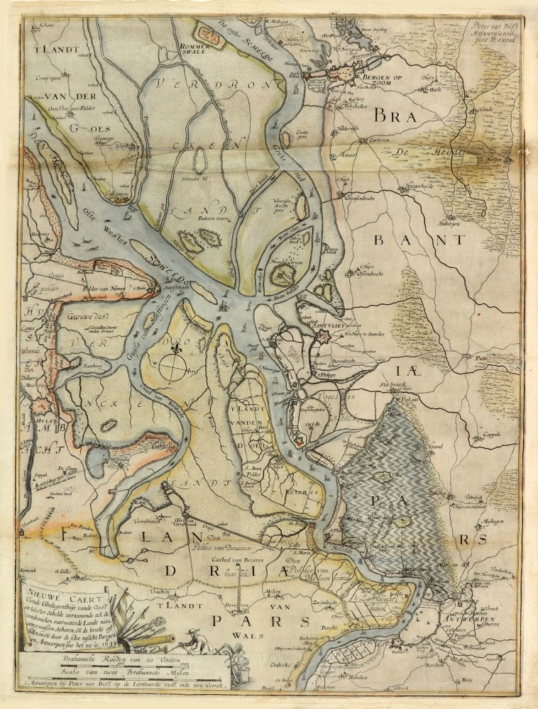
Nieuwe Caert Vande Ghelegentheijt vande Oost en Wester Schelde vertoonende ock de verdroncken overwaterde Lande nieu aengewaßen Schoren, eñ de kreeke oft killen in eñ door de selve tußche Bergen en Antwerpen soo het nu is. 1633. 1633
Schelde River (Antwerp), by Pieter Verbiest (Petrus Verbist).
[Item number: 28023]
Anvers. 1567
Antwerpen by Lodovico Guicciardini.
[Item number: 28175]

Arx Antverpensis. 1652
Antwerpen - Citadel, by Joan Blaeu.
[Item number: 28896]
Marchionatus Sacri Romani Imperii. 1656-80
Antwerp, by Nicolaes Visscher I.
[Item number: 28974]

Marchionatus Sacri Imperiit Dominii Mechelini Tabula. c. 1705
The marquisate of Antwerp and the manor of Mechelen, by Frederick de Wit.
[Item number: 28997]
Antverpia; Gallis Anvers. Vernacule Antwerpen. 1652
Antwerp (Antwerpen), by Joan Blaeu.
[Item number: 29420]
Plan de la ville et citadelle d'Anvers. 1712
Antwerpen by Eugène Fricx.
[Item number: 29541]
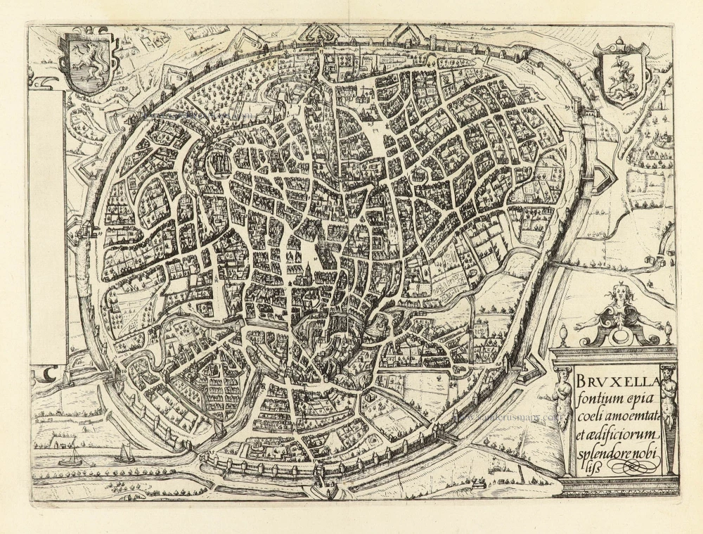
Bruxella fontium copia coelu amoemtate et aedificiorum, splendore nobiliss. 1609
Brussel - Bruxelles by Ludovico Guicciardini.
[Item number: 30814]
new