
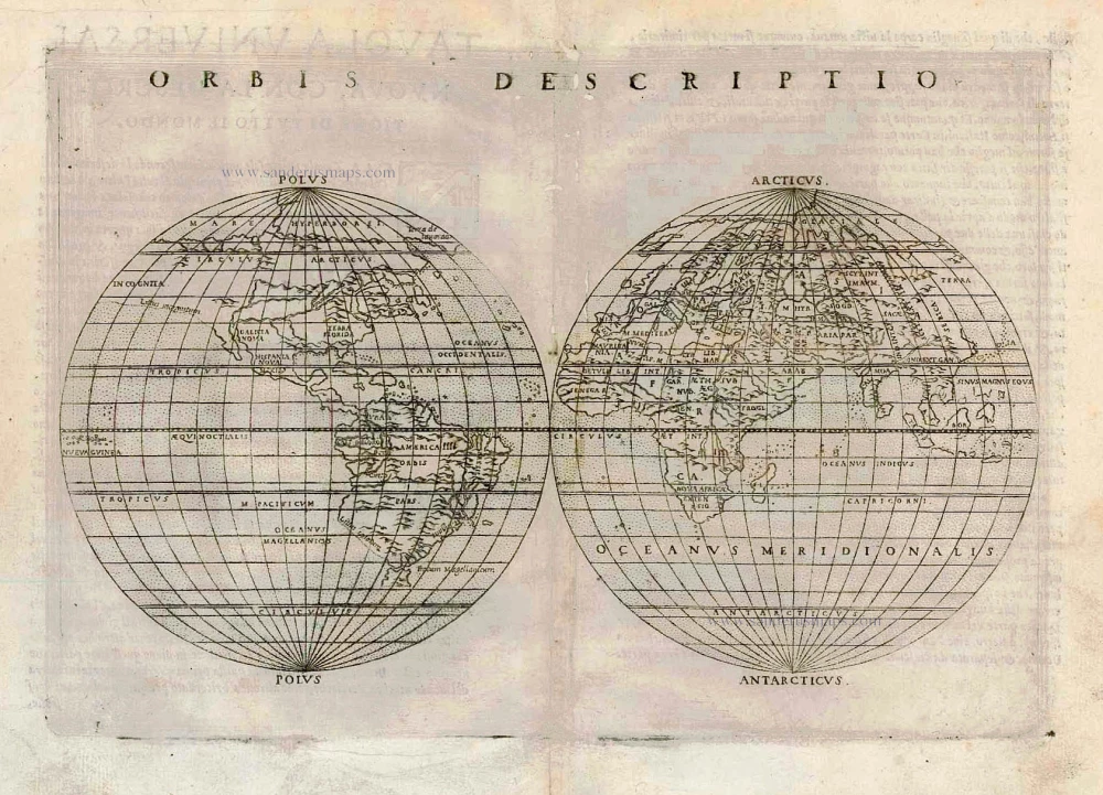
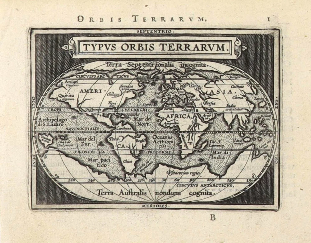
One of the first double hemisphere world maps.
World by Girolamo Ruscelli. 1564
Giacomo Gastaldi (c. 1500 – 1566)
Giacomo Gastaldi was born in Villafranca, in Piedmont, to a wealthy family. Although he is considered one of the greatest cartographers of the sixteenth century, the events of his life and his professional training in the field of cartography are unknown to us until he arrives in Venice, where, in 1539, he obtained a perpetual printing privilege from the Venetian Senate.
One of the first Venetian contacts took place with the geographer and humanist Giovanni Battista Ramusio, with whom he collaborated. At the beginning of the 1540s, Gastaldi was already an established cartographer and began to work on a series of maps first published separately and then included in the Italian edition of Ptolemy's Geography of 1548 and others made from scratch.
By the 1540s, he had developed his distinctive style of copper engraving for his increasingly prolific output of maps. His maps were used as a source by many mapmakers, including Camocio, Bertelli, Forlani, Ramusio, Cock, Luchini and Ortelius.
With the support of his influential friendships, Gastaldi also obtained public positions: in 1549, the Council of Ten commissioned him to make a large map of Africa, for a wall from the armoury in the Doge's Palace and, again for the same room, one map of Asia and one of North America.
It is difficult to quantify the number of maps he produced; more than a hundred have been attributed to him.
Paolo Forlani collaborated for a long time with Gastaldi and published numerous counterfeits and not authorized editions.
Gastaldi died in Venice on 14 October 1566.
Orbis Descriptio.
Item Number: 27838 Authenticity Guarantee
Category: Antique maps > World and Polar
Old, antique map of World, by Girolamo Ruscelli.
Title: Orbis Descriptio.
Cartographer: Giacomo Gastaldi.
Engraver: Giulo & Livio Sanuto.
Date of the first edition: 1561.
Date of this map: 1564.
Copper engraving, printed on paper.
Size (not including margins): 180 x 255mm (7.09 x 10.04 inches).
Verso: Italian text.
Condition: A few small worm tracks in the upper centre (backed).
Condition Rating: A.
References: Shirley (World), #110
From: La Geografia di Claudio Tolomeo Alessandrino. Venice, 1564.
Giacomo Gastaldi (c. 1500 – 1566)
Giacomo Gastaldi was born in Villafranca, in Piedmont, to a wealthy family. Although he is considered one of the greatest cartographers of the sixteenth century, the events of his life and his professional training in the field of cartography are unknown to us until he arrives in Venice, where, in 1539, he obtained a perpetual printing privilege from the Venetian Senate.
One of the first Venetian contacts took place with the geographer and humanist Giovanni Battista Ramusio, with whom he collaborated. At the beginning of the 1540s, Gastaldi was already an established cartographer and began to work on a series of maps first published separately and then included in the Italian edition of Ptolemy's Geography of 1548 and others made from scratch.
By the 1540s, he had developed his distinctive style of copper engraving for his increasingly prolific output of maps. His maps were used as a source by many mapmakers, including Camocio, Bertelli, Forlani, Ramusio, Cock, Luchini and Ortelius.
With the support of his influential friendships, Gastaldi also obtained public positions: in 1549, the Council of Ten commissioned him to make a large map of Africa, for a wall from the armoury in the Doge's Palace and, again for the same room, one map of Asia and one of North America.
It is difficult to quantify the number of maps he produced; more than a hundred have been attributed to him.
Paolo Forlani collaborated for a long time with Gastaldi and published numerous counterfeits and not authorized editions.
Gastaldi died in Venice on 14 October 1566.
Related items
Typus Orbis Terrarum. 1602
World by Barent Langenes
[Item number: 12009]
Rare first edition
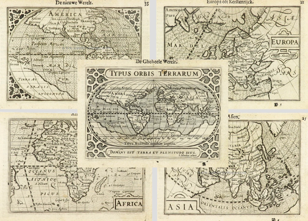
Typus Orbis Terrarum. [in set with:] America, [and] Europa, [and] Africa, [and] Asia. 1598
World and Continents by Barent Langenes & Cornelis Claesz. Five maps.
[Item number: 16457]

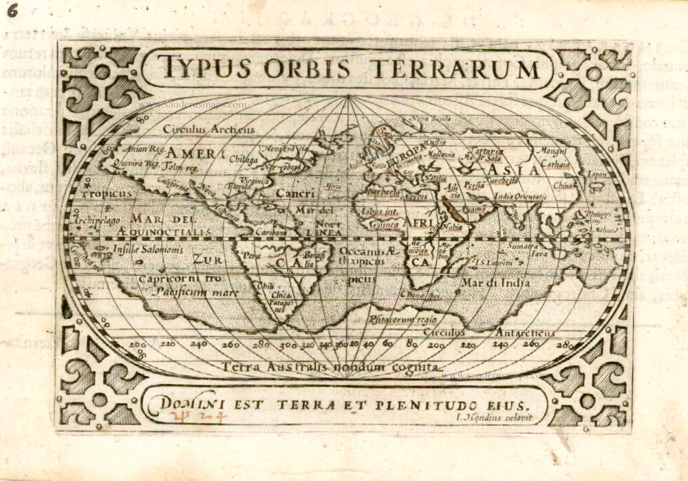
Universi Orbis Descriptio. 1597
World by Giovanni Magini
[Item number: 27837]

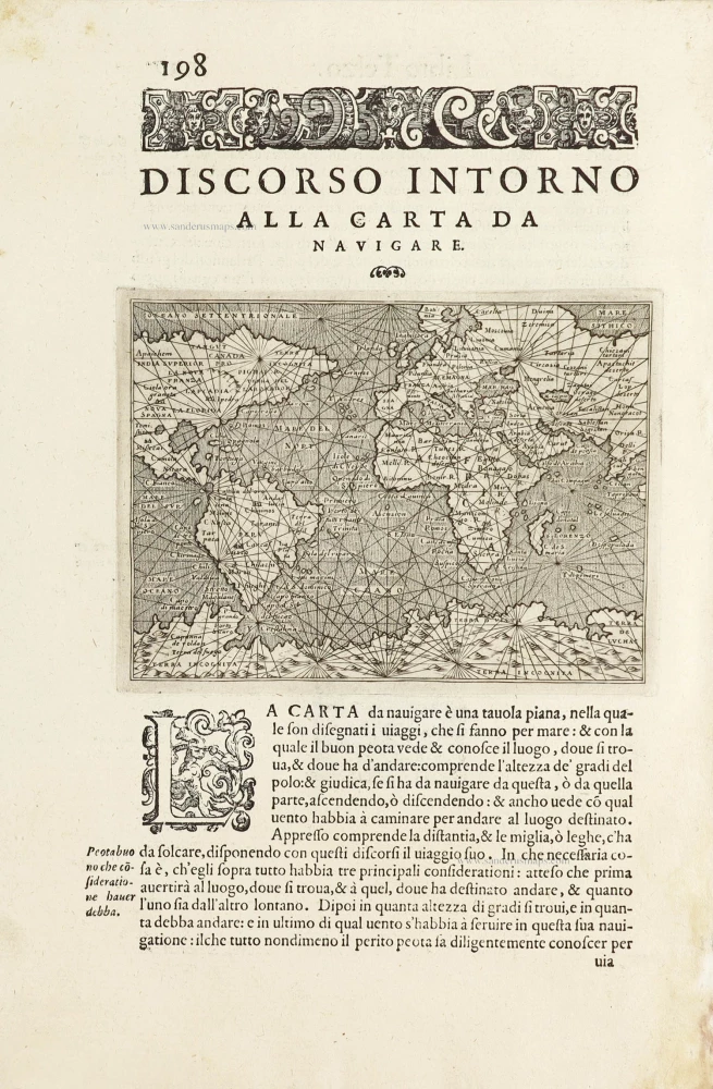
Discorso Intorno alla Carta da Navigare. 1572
World, by Thomaso Porcacchi.
[Item number: 28015]

A fine ornate example of the decorative cartography of the time.
Nova Totius Terrarum Orbis Geographica ac Hydrographica Tabula. Auct: Henr: Hondio. 1641
Double-hemisphere world map by Henricus Hondius.
[Item number: 28768]
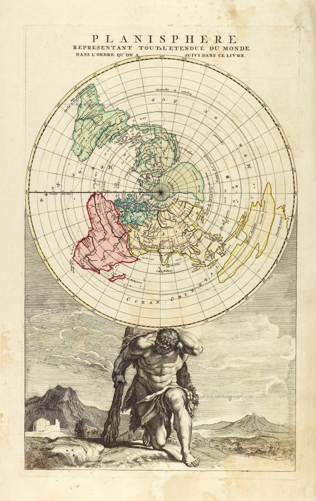
Planisphere representant toute l'Etendue du Monde, dans l'ordre qu'on a suivi dans ce livre. 1792
World in north polar azimuthal projection.
[Item number: 28810]
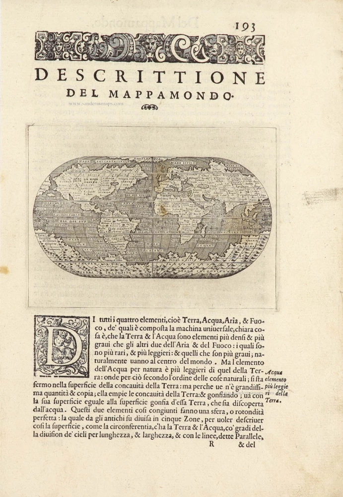
Descrittione Del Mappamondo. 1572
World by Porcacchi Tommaso.
[Item number: 28910]

Luxury colouring.
Orbis Terrarum Nova et Accuratissima Tabula. c. 1678
Double-hemisphere world map, by Nicolaas Visscher I.
[Item number: 28934]
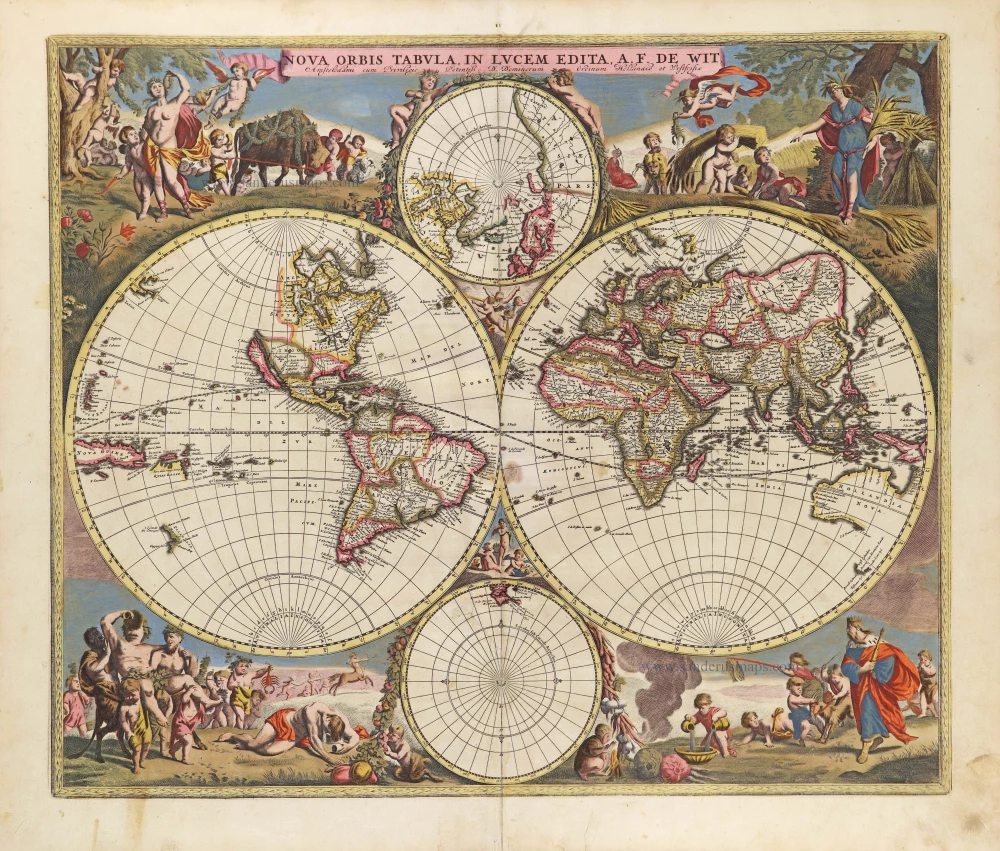
Nova Orbis Tabula in Lucem Edita, A. F. De Wit. c. 1690
World by Frederik De Wit, double hemisphere.
[Item number: 29231]

Mapmonde ou description generale du Globe Terrestre. 1713
World map by Zacharias Châtelain.
[Item number: 29555]
Typus Orbis Terrarum. 1589
The world by Abraham Ortelius / Philippe Galle.
[Item number: 29605]
Discorso Intorno alla Carta da Navigare. 1590
World by Thomaso Porcacchi.
[Item number: 29786]
Rare original colour.
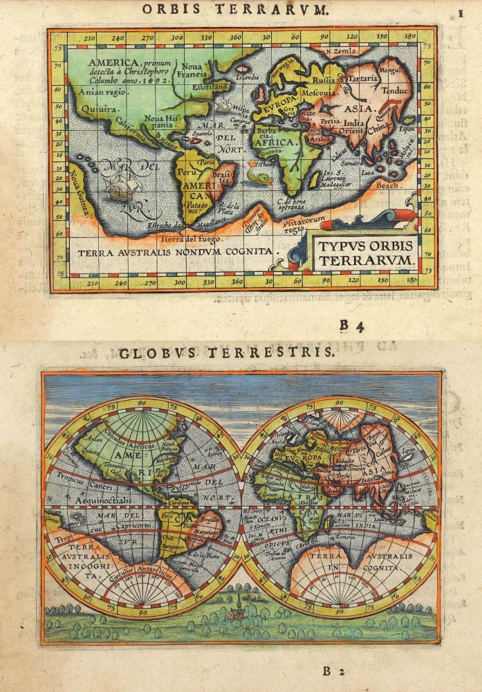
Typus Orbis Terrarum - Globus Terrestris. 1609
Two world maps by A. Ortelius, published by J.B. Vrients.
[Item number: 29861]
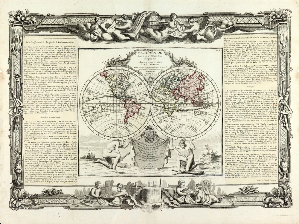
Mappe-Monde 1766-1780
World map by Louis Brion de la Tour, published by L.C Desnos.
[Item number: 30100]
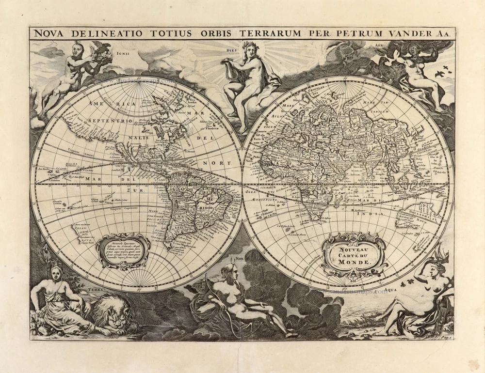
Nova Delineatio Totius Orbis Terrarum per Petrum Van der Aa. - Nouveau Carte du Monde. 1702
World by Pieter Van der Aa - double hemisphere.
[Item number: 30150]

'One of the supreme examples of map maker's art' (Shirley)
Nova Totius Terrarum Orbis Geographica ac Hydrographica. 1643
World by Willem Blaeu, in Mercator projection.
[Item number: 30271]
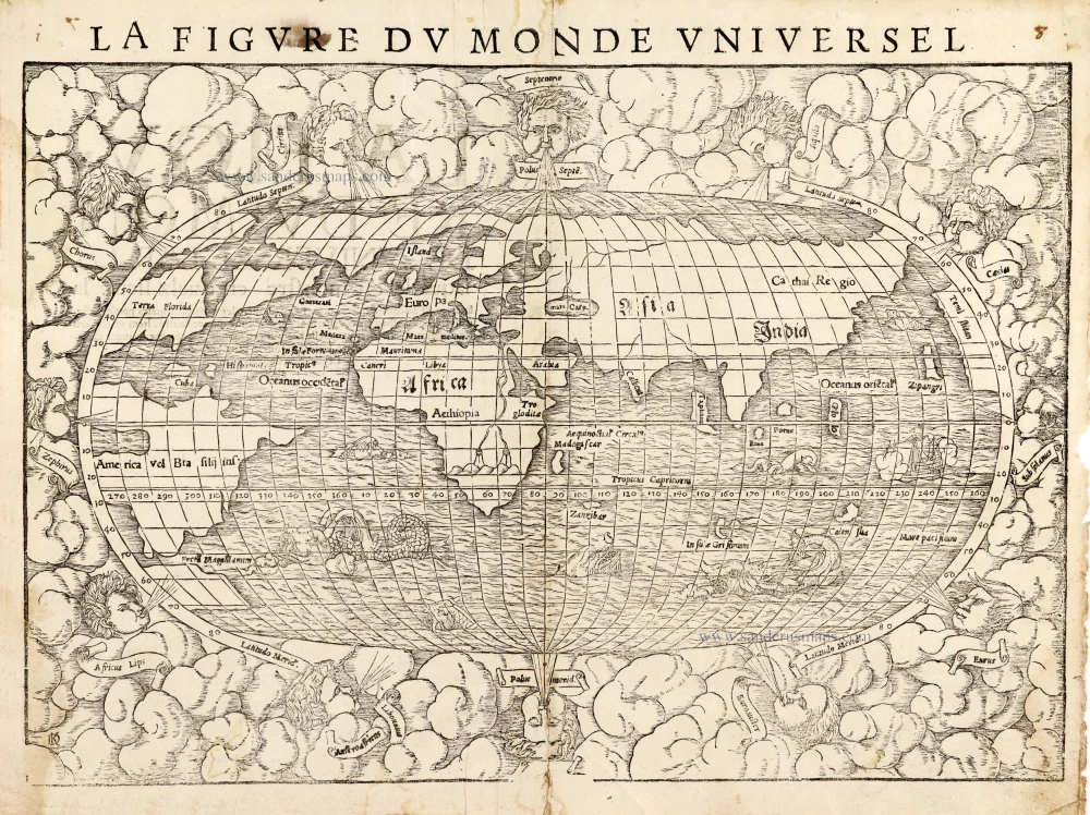
La Figure du Monde Universel 1568
Old antique map of the World by Sebastian Münster
[Item number: 30533]
VERY RARE FIRST STATE - only a few copies known
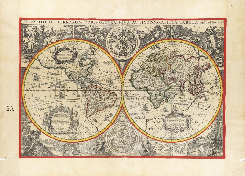
Nova Totius Terrarum Orbis Geographica ac Hydrographica auct: Iud: Hondio. c. 1630-1650
Double hemisphere world map by Jodocus Hondius, published by Melchior Tavernier.
[Item number: 30840]