
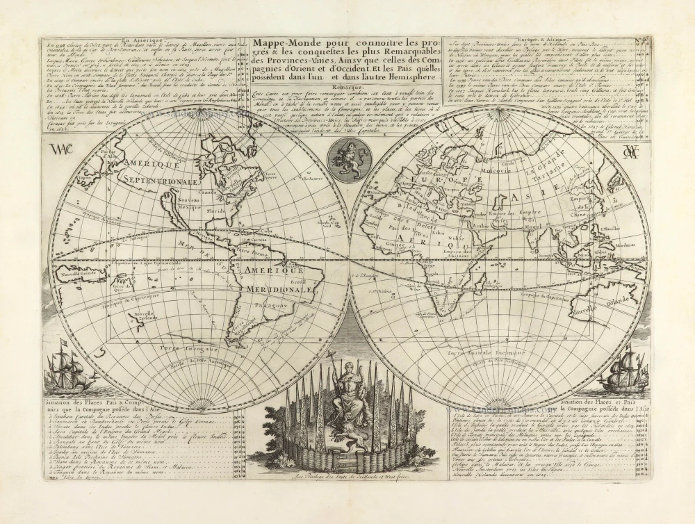
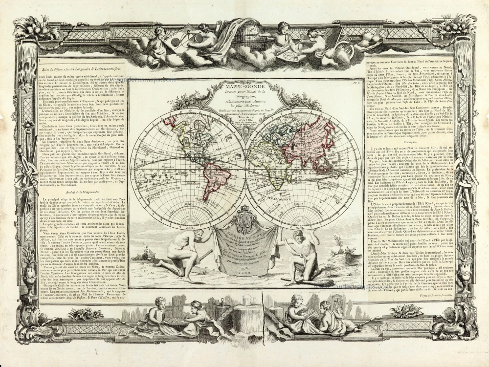
World map by Zacharias Châtelain. 1713
The Châtelain Family
Zacharias Châtelain (1684-1743) was a bookseller and publisher of Amsterdam. He was succeeded by his sons Zacharias jr and Henry Abraham. The Châtelain family was best known for the historical atlas Atlas Historique, ou nouvelle introduction à l’histoire…, a major work of its time. It was an encyclopaedia in seven volumes, including geography as one of its main subjects. The atlas was published in Amsterdam in seven volumes in various editions with different imprints from 1705 to 1739. An anonym person (Mr. C***) compiled the work with compositions of text, maps, plates and chronological and genealogical tables by Gueudeville, except volume 7, where H.P. Limiers took over this task. The maps were made mainly after the work of Guillaume de l'Isle.
The 1705 edition was published with the imprint “L’Honoré & Châtelain”. Later editions had the imprint: “les Frères Châtelain Libraires” or “L’Honoré & Châtelain Libraires”.
Mappe-Monde pour connoitre les Progres & les Conquestes les Plus Remarquables des Provinces-Unies, Ainsy que celles des Compagnies d'Orient et d'Occident, et les Païs qu'elles possèdent dans l'un et dans l'autre Hemisphere.
Item Number: 29698 Authenticity Guarantee
Category: Antique maps > World and Polar
Old, antique world map by Châtelain.
Title: Mappe-Monde pour connoitre les Progres & les Conquestes les Plus Remarquables des Provinces-Unies, Ainsy que celles des Compagnies d'Orient et d'Occident, et les Païs qu'elles possèdent dans l'un et dans l'autre Hemisphere.
Avec Privilege des Etats de Hollande et West frise.
Date of the first edition: 1713.
Date of this map: 1713.
Copper engraving, printed on paper.
Map size: 335 x 460mm (13.19 x 18.11 inches).
Sheet size: 440 x 540mm (17.32 x 21.26 inches).
Verso: Blank.
Condition: Excellent.
Condition Rating: A+.
From: Châtelain Z. Atlas Historique, ou Nouvelle Introduction A l'Histoire, à la Chronologie & à la Geographie Ancienne & Moderne; ... Tome Premier. Conténant la Gréce, l'Histoire Romaine, Rome Moderne, Naples, la France, l'Espagne, & les Provinces Unies.A Amsterdam, Chez L'Honoré & Châtelain, M.DCC.XIII. (1713). (Koeman II, p. 35, Cha2)
The Châtelain Family
Zacharias Châtelain (1684-1743) was a bookseller and publisher of Amsterdam. He was succeeded by his sons Zacharias jr and Henry Abraham. The Châtelain family was best known for the historical atlas Atlas Historique, ou nouvelle introduction à l’histoire…, a major work of its time. It was an encyclopaedia in seven volumes, including geography as one of its main subjects. The atlas was published in Amsterdam in seven volumes in various editions with different imprints from 1705 to 1739. An anonym person (Mr. C***) compiled the work with compositions of text, maps, plates and chronological and genealogical tables by Gueudeville, except volume 7, where H.P. Limiers took over this task. The maps were made mainly after the work of Guillaume de l'Isle.
The 1705 edition was published with the imprint “L’Honoré & Châtelain”. Later editions had the imprint: “les Frères Châtelain Libraires” or “L’Honoré & Châtelain Libraires”.
Related items

Orbis Vetus in utraque Continente juxta Mentem Sansonianam Distinctus, nec non Observationibus Astronomicis Redactus ... c. 1757
The world by Robert de Vaugondy.
[Item number: 5092]
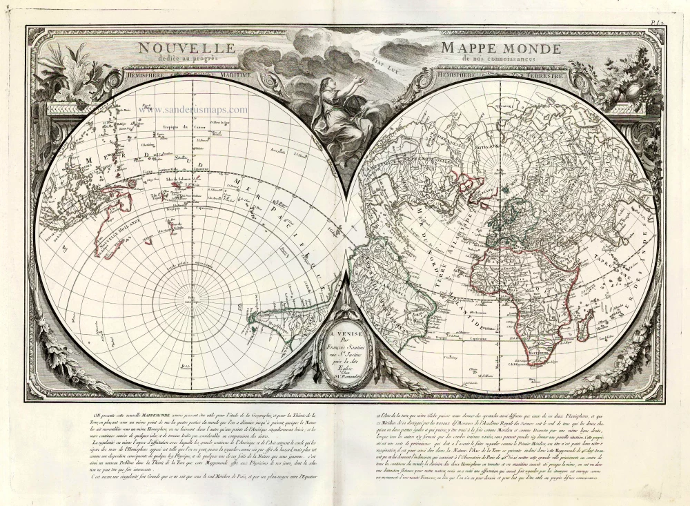
Nouvelle Mappe Monde Dediee au Progres de nos Connoissances. 1776-79
World by Francesco Santini.
[Item number: 26946]

Universi Orbis Descriptio. 1597
World by Giovanni Magini
[Item number: 27837]
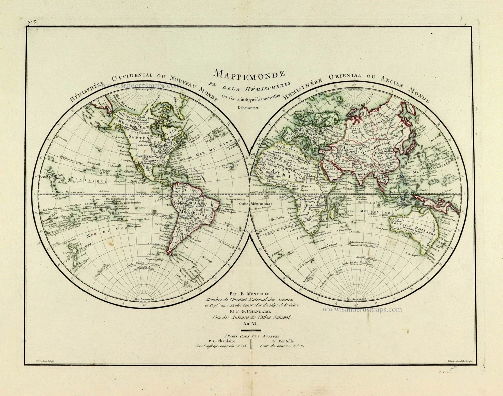
Mappemonde en deux Hémisphères. c. 1797
World map, double hemisphere by Pierre Grégoire Chanlaire.
[Item number: 28209]
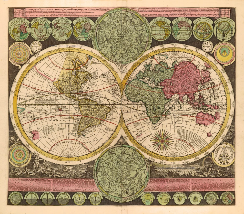
Planisphaerium Terrestre cum utroque Coelesti Hemisphaerio, sive Diversa Orbis Terraquei, c. 1700
World by Zürner A.F., double hemisphere.
[Item number: 28229]
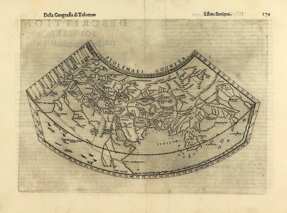
Ptolemaei Cognita. 1598
Ptolemaic world map by Giuseppe Rosaccio.
[Item number: 28290]
Mappe-Monde 1766-1780
World map by Louis Brion de la Tour, published by L.C Desnos.
[Item number: 30100]
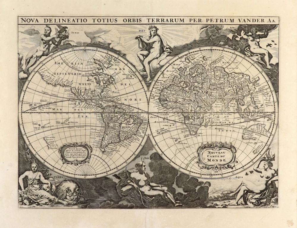
Nova Delineatio Totius Orbis Terrarum per Petrum Van der Aa. - Nouveau Carte du Monde. 1702
World by Pieter Van der Aa - double hemisphere.
[Item number: 30150]

'One of the supreme examples of map maker's art' (Shirley)
Nova Totius Terrarum Orbis Geographica ac Hydrographica. 1643
World in Mercator projection, by Willem Blaeu.
[Item number: 30271]
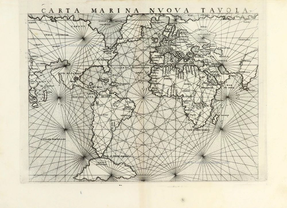
Carta Marina Nuova Tavola. 1561
World chart by Girolamo Ruscelli.
[Item number: 30380]