
the most comprehensive and up-to-date map published by the French before the fall of New France in 1760
North America, by J.N. Bellin. 1756-1770
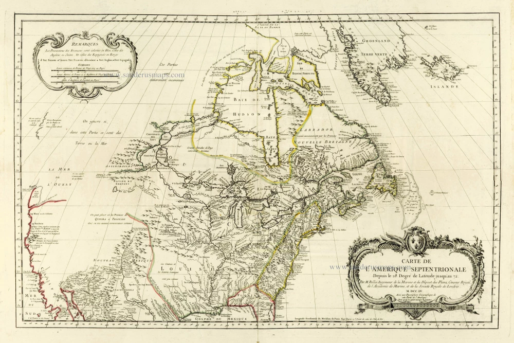
This is one of the most important maps Bellin made around the mid-18th century.
The earliest of Bellin's flood of maps appeared in 1744 in Charlevoix's Histoire, a widely circulated work in several languages.
Bellin used the surveys of the Chaussegros de Lérys, the La Verendrye-Ochagach map, and Father Laure's work. The Carte Des Lacs du Canada of 1744 was prepared almost wholly from Chaussegros de Léry material. This map put into print the imaginary islands Philippeaux and Pontchartrain in Lake Superior. The other significant maps of New France in the Histoire was Bellin's 1744 Carte de la Partie Orientale de la Nouvelle France. These maps by Bellin constituted the first new material on New France to appear since the maps of Guillaume De l'Isle three decades earlier.
In succeeding years, Bellin made many changes to these early maps. In 1745, he published a magnificent pair of large maps, Partie Orientale de la Nouvelle France and Partie Occidentale de la Nouvelle France. The latter, extensively revised in 1755, was the most accurate map of that area until well after the fall of New France and, therefore, clearly established French claims to the disputed territory. In the same year, Bellin published a new Carte de l'Amérique Septentrionale. He dropped the Ochagach version of the lands west of Lake Superior and adopted one by La Vérendrye, prepared in 1750 for Roland-Michel Barin de la Galissonière, then commandant general of New France. On this map, Bellin also changed the lower Great Lakes-Ohio area to correspond to the surveys of Father Bonnécamps. The map, accompanied by a book on the geography of North America, was the most comprehensive and up-to-date map published by the French before the fall of New France in 1760.
The widespread copying of the map by other mapmakers even after 1760 demonstrates the popularity of Bellin's outlines.
Jacques-Nicolas Bellin (1703-1772)
Jacques-Nicolas Bellin, a French geographer, was among the most important mapmakers of the eighteenth century. In 1721, at the age of 18, he was appointed hydrographer of the Ministry of the Navy following the French hydrographic office's creation and the Dépot of charts and plans of the Navy. Appointed hydrographic engineer in August 1741. Member of the Academy of the Navy and the Royal Society of London.
Over the course of a 50-year career, he drew the maps of several major works of his time such as Histoire et description générale de la Nouvelle-France de Charlevoix (1744); Histoire générale des voyages de l'Abbé Prévost (published between 1746 and 1759) ); Neptune François (1753), Hydrographie Françoise (1756-1765), and Petit Atlas Français (1763) - reissued as Petit Atlas Maritime (1765). He is the most copied cartographer of the 18th century.
His maps of Canada and the French territories of North America are of considerable value. This is all the more remarkable since, an archetype of the cabinet cartographer, Bellin never came to America. For his cartography of the St. Lawrence River, he entrusted handwritten maps to navigators to correct and enrich. With each return of these maps, he was updating his knowledge. Two basic needs drive its cartography of North America: to secure navigation on the St. Lawrence River and to claim for France the lands explored by the French in the Great Lakes region and along the Mississippi River.
Jacques-Nicolas Bellin died on March 21, 1772, in Versailles. In the burial certificate, he is described as "the first engineer of the navy and the deposit of plans, royal censor of the academy of navy and the royal society of London".
Carte de L'Amerique Septentrionale Depuis to 28. Degré de Latitude Jusqu'au 72.
Item Number: 28146 Authenticity Guarantee
Category: Antique maps > America > North America
Old, antique sea chart of North America, by J.N. Bellin.
Title: Carte de L'Amerique Septentrionale Depuis to 28. Degré de Latitude Jusqu'au 72.
Par M. Bellin Ingenieur de la Marine et du Dépost des Plans, Censeur Royal de l'Academie de Marine, et de la Société Royale de Londres.
M.DCC.LV.
Avec une Description Géographique de cette Partie de l'Amerique.
Nota qu'on na point marqué de Limites.
Date of the first edition: 1755.
Date of this map: 1756-1770.
Date on map: 1755.
Copper engraving, printed on paper.
Size (not including margins): 560 x 860mm (22.05 x 33.86 inches).
Verso: Blank.
Condition: Original coloured in outline, excellent.
Condition Rating: A+.
References: McCorkle, p. 113, 755-4; Wagner, #582; Heidenreich & Dahl, Map Collector vol.19, p. 5
From: L'Hydrographie Françoise ou Recueil des Cartes Dressées au Deposit des Plans de la Marine pour le Service des Vaisseaux du Roy. Paris, 1756-70. (Shirley (Brit.Lib.), M.Bell-2a)
This is one of the most important maps Bellin made around the mid-18th century.
The earliest of Bellin's flood of maps appeared in 1744 in Charlevoix's Histoire, a widely circulated work in several languages.
Bellin used the surveys of the Chaussegros de Lérys, the La Verendrye-Ochagach map, and Father Laure's work. The Carte Des Lacs du Canada of 1744 was prepared almost wholly from Chaussegros de Léry material. This map put into print the imaginary islands Philippeaux and Pontchartrain in Lake Superior. The other significant maps of New France in the Histoire was Bellin's 1744 Carte de la Partie Orientale de la Nouvelle France. These maps by Bellin constituted the first new material on New France to appear since the maps of Guillaume De l'Isle three decades earlier.
In succeeding years, Bellin made many changes to these early maps. In 1745, he published a magnificent pair of large maps, Partie Orientale de la Nouvelle France and Partie Occidentale de la Nouvelle France. The latter, extensively revised in 1755, was the most accurate map of that area until well after the fall of New France and, therefore, clearly established French claims to the disputed territory. In the same year, Bellin published a new Carte de l'Amérique Septentrionale. He dropped the Ochagach version of the lands west of Lake Superior and adopted one by La Vérendrye, prepared in 1750 for Roland-Michel Barin de la Galissonière, then commandant general of New France. On this map, Bellin also changed the lower Great Lakes-Ohio area to correspond to the surveys of Father Bonnécamps. The map, accompanied by a book on the geography of North America, was the most comprehensive and up-to-date map published by the French before the fall of New France in 1760.
The widespread copying of the map by other mapmakers even after 1760 demonstrates the popularity of Bellin's outlines.
Jacques-Nicolas Bellin (1703-1772)
Jacques-Nicolas Bellin, a French geographer, was among the most important mapmakers of the eighteenth century. In 1721, at the age of 18, he was appointed hydrographer of the Ministry of the Navy following the French hydrographic office's creation and the Dépot of charts and plans of the Navy. Appointed hydrographic engineer in August 1741. Member of the Academy of the Navy and the Royal Society of London.
Over the course of a 50-year career, he drew the maps of several major works of his time such as Histoire et description générale de la Nouvelle-France de Charlevoix (1744); Histoire générale des voyages de l'Abbé Prévost (published between 1746 and 1759) ); Neptune François (1753), Hydrographie Françoise (1756-1765), and Petit Atlas Français (1763) - reissued as Petit Atlas Maritime (1765). He is the most copied cartographer of the 18th century.
His maps of Canada and the French territories of North America are of considerable value. This is all the more remarkable since, an archetype of the cabinet cartographer, Bellin never came to America. For his cartography of the St. Lawrence River, he entrusted handwritten maps to navigators to correct and enrich. With each return of these maps, he was updating his knowledge. Two basic needs drive its cartography of North America: to secure navigation on the St. Lawrence River and to claim for France the lands explored by the French in the Great Lakes region and along the Mississippi River.
Jacques-Nicolas Bellin died on March 21, 1772, in Versailles. In the burial certificate, he is described as "the first engineer of the navy and the deposit of plans, royal censor of the academy of navy and the royal society of London".
Related items
Important map
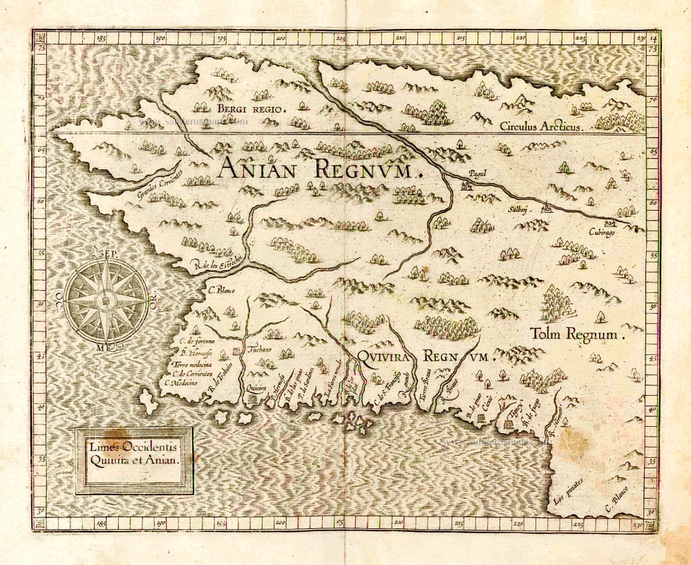
Limes Occidentis Quivira et Anian. 1607
West coast by Wytfliet, Cornelis van
[Item number: 26513]
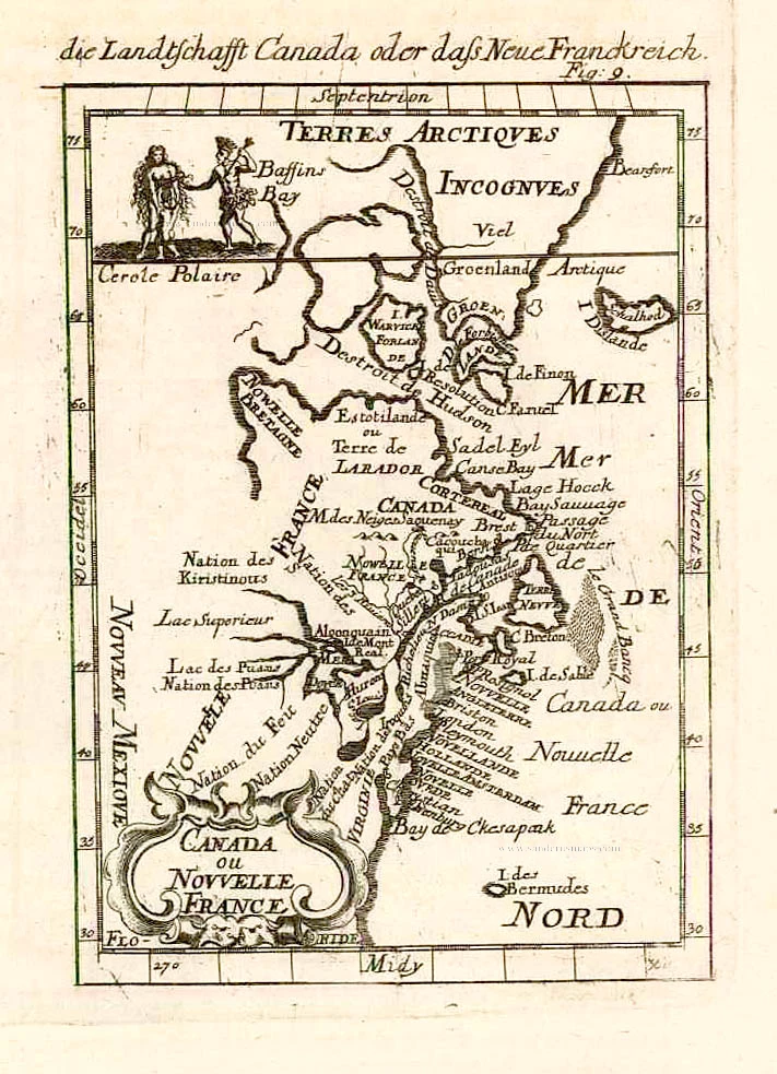
Canada ou Nouvelle France. 1685
North America (Northeast), by A.M. Mallet.
[Item number: 26601]
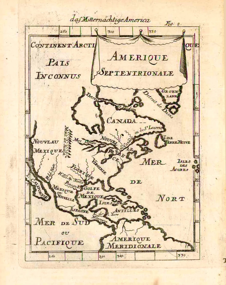
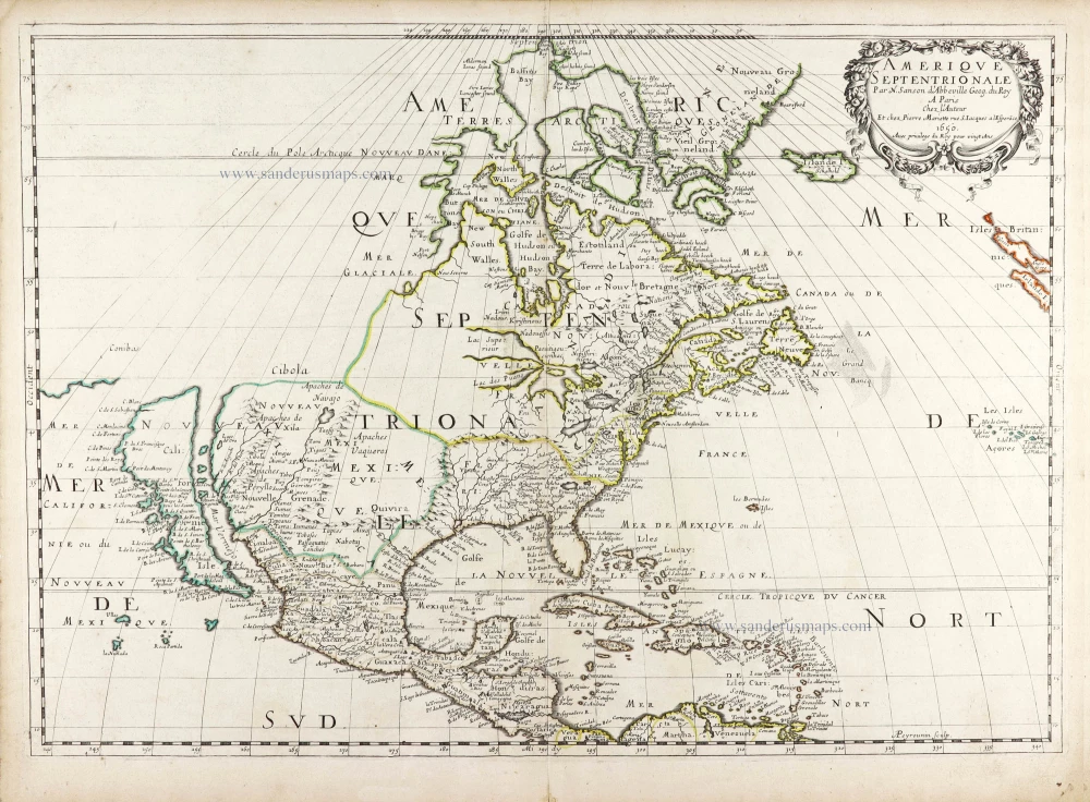
Amerique Septentrionale. 1685
North America, by A.M. Mallet.
[Item number: 26643]
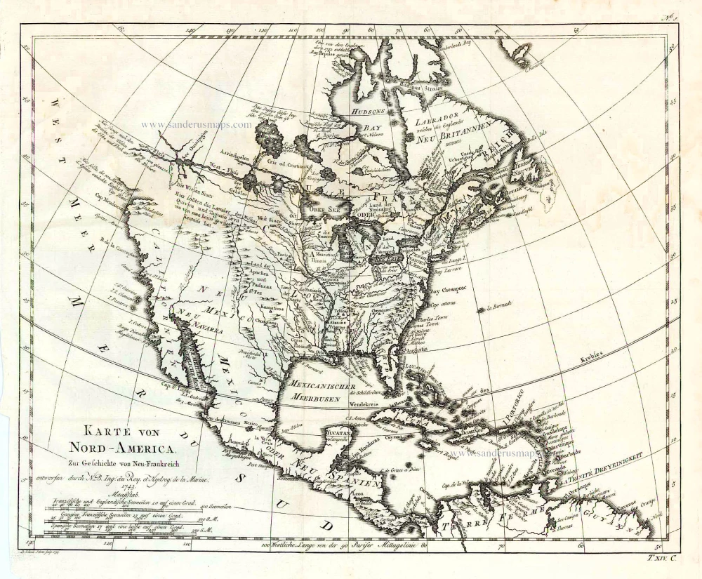
Karte von Nord-America, zur Geschichte von Neu-Frankreich. 1747-74
North America, by Jacques Nicolas Bellin.
[Item number: 26799]
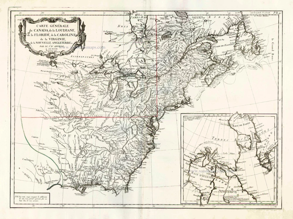
Carte Générale du Canada, de la Louisiane, de la Floride, de la Caroline, de la Virginie, de la Nouvelle Angleterre etc. 1776-79
North America (East), by Paolo Santini.
[Item number: 26980]
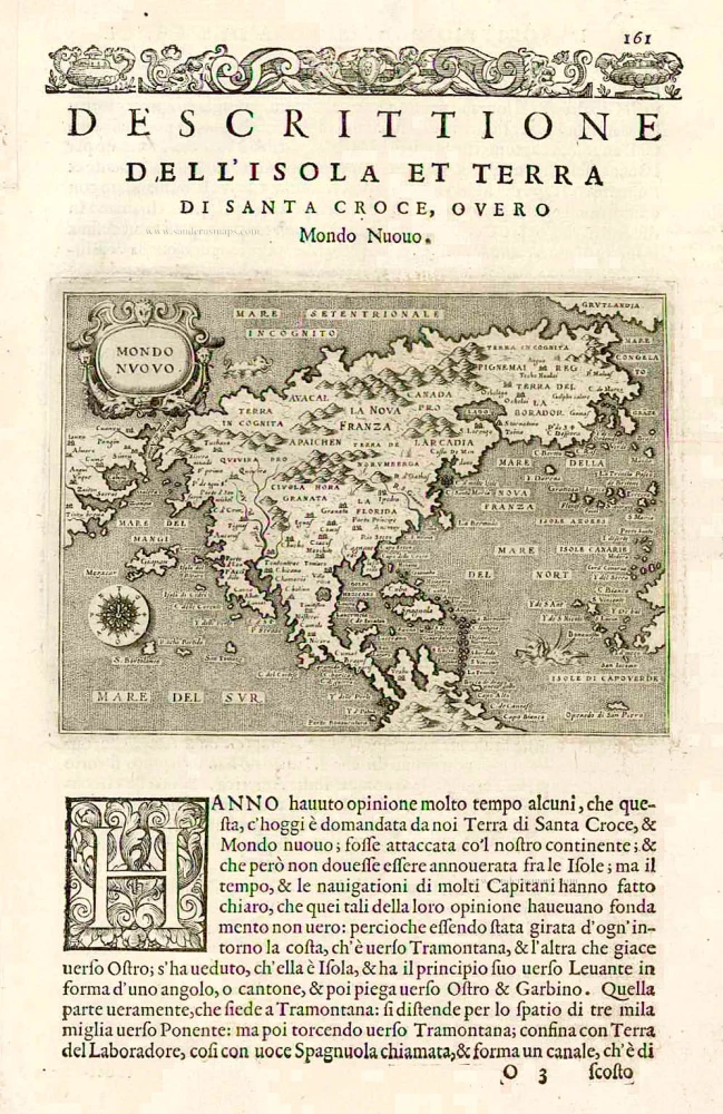
Earliest obtainable map of North America
Mondo Nuovo - Descrittione del l'Isola et Terra di Sancta Croce, overo Mondo Nuovo. 1576
North America, by Tomaso Porcacchi.
[Item number: 27651]

Early 'Texas' map
Nueva Hispania Tabula Nova. 1574
North America, by Girolamo Ruscelli.
[Item number: 27755]
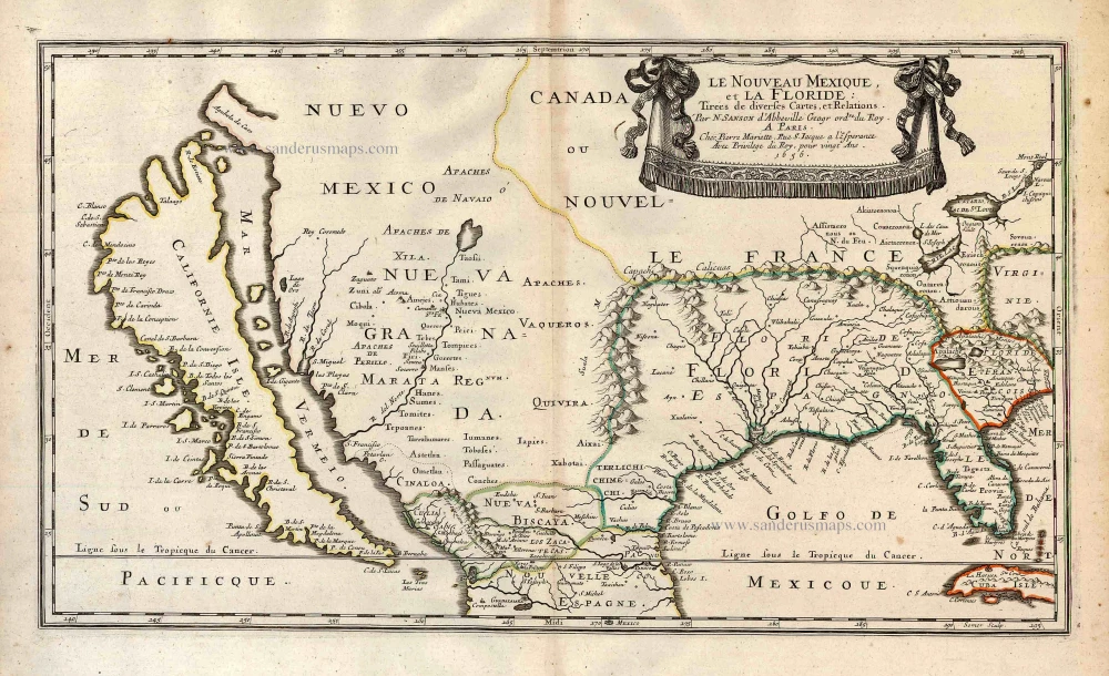
Important map.
Le Nouveau Mexique, et la Floride: 1658
Southern North America, by Nicolas Sanson.
[Item number: 27917]
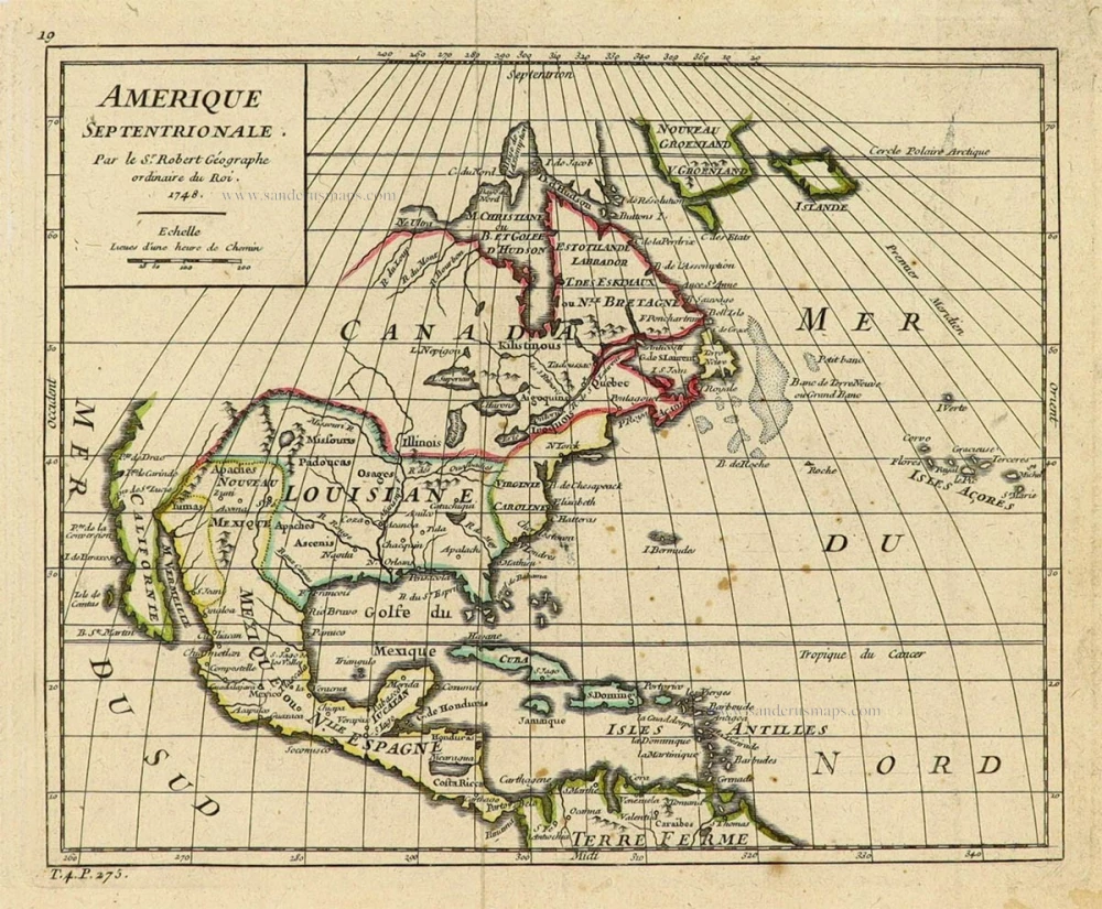
Amerique Septentrionale. 1748
North America by Robert de Vaugondy.
[Item number: 28157]

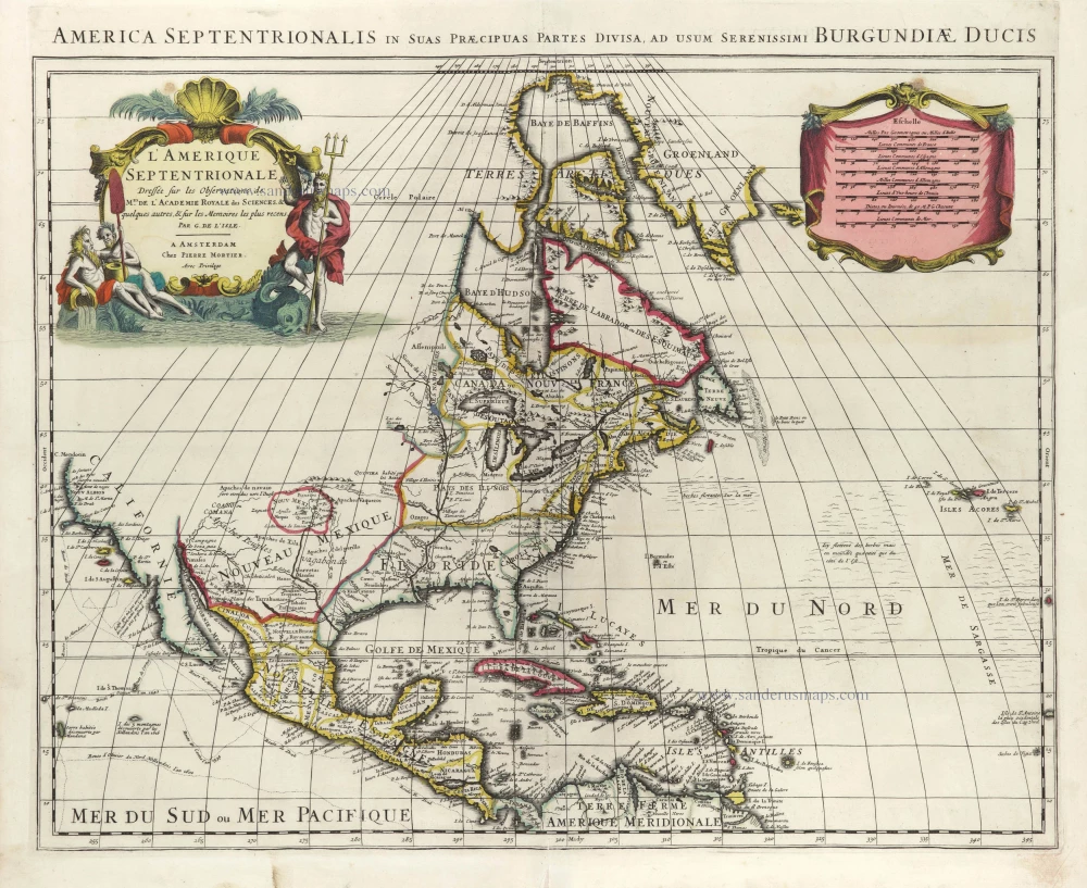
Amerique Septentrionale, Divisee en ses Principales Parties. 1694
North America, by Nicolas Sanson, published by Pierre Mortier after A.H. Jaillot.
[Item number: 29125]
L'Amerique Septentrionale. 1708
North America by G. de L'Isle, published by Pierre Mortier.
[Item number: 29510]
Landmark map of North Amerika
Amerique Septentrionale. 1652
Nicolas Sanson's landmark map of North America, scarce second state.
[Item number: 29597]
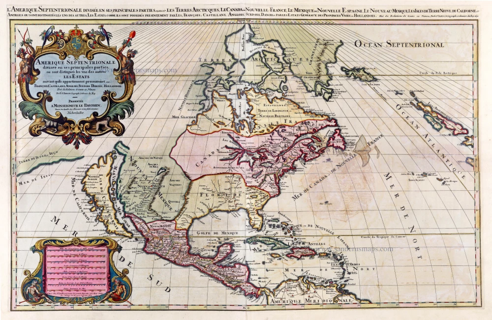
Big and spectacular map, heightened in gold.
Amerique Septentrionale, divisée en ses principales parties, ou sont distingués les uns des autres Les Estats suivant qu'ils appartiennet Presentemet aux Francois, Castillans, Anglois, Suedois, Danois, Hollandois. 1692
North America by A. H. Jaillot, published by Pierre Mortier.
[Item number: 29895]
California as an island.
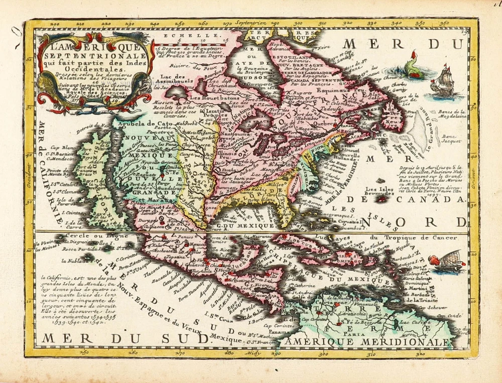
L'Amerique Septentrionale qui fait partie des Indes Occidentales. 1719
North America by Chiquet Jacques.
[Item number: 30085]
California as an island.
Americque Septentrionale. 1715
North America by Nicolas Sanson, published by Nicolas Chemereau.
[Item number: 30086]

California as an island.
L'America Settentrionale. 1677
North America by Giovanni Giacomo de Rossi.
[Item number: 30088]
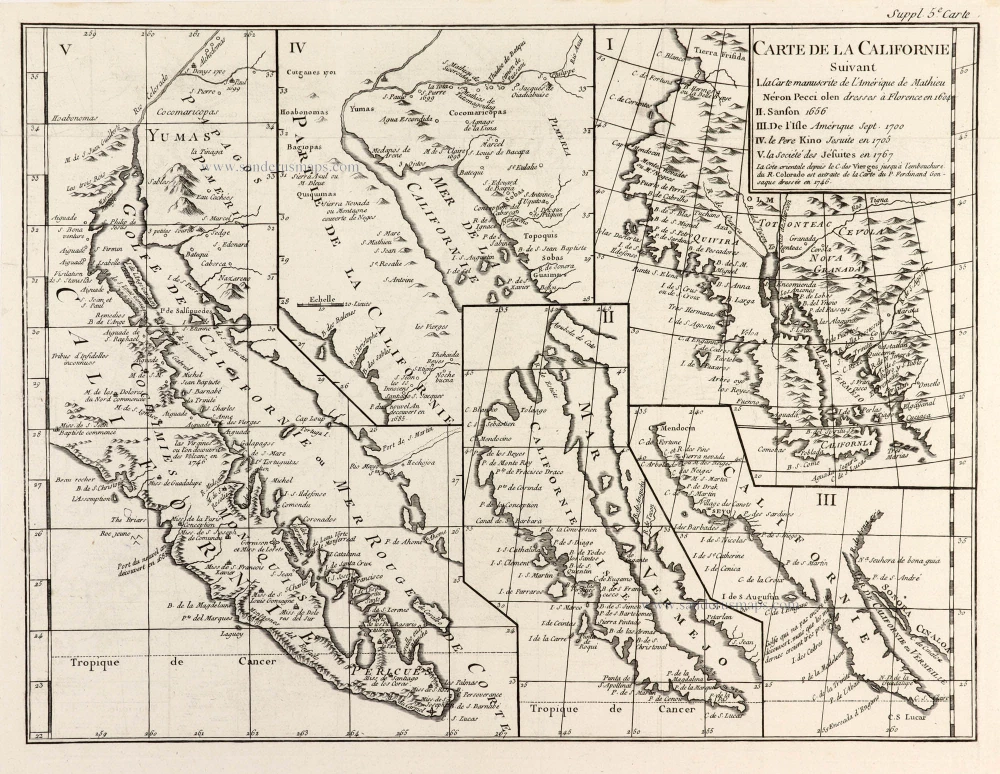
From 'Diderot & d'Alembert'
Carte de la Californie Suivant I. La Carte manuscrite de l'Amérique de Mathieu Néron Pecci olen dresses à Florence en 1604. II. Sanson 1656. III. De l'Isle Amérique Sept. 1700. IV. le Pere Kino Jesuite en 1705. V. la Société des Jésuites en 1767. 1777
California by Robert de Vaugondy.
[Item number: 30091]

Carte de la Partie de l'Amérique Septentrionale, comprenant les Possessions Espagnoles. 1788
North America by Louis Brion de la Tour.
[Item number: 30144]