
Very rare - unknown to Norwich
Africa by Pieter Van der Aa. 1706

Pieter van der Aa (Leiden, 1659-1733)
Pieter van der Aa was already in 1682 owner of a bookshop and auction house. During his life, he has published an enormous amount of printed material.
After 1700, van der Aa increasingly specialised in books on geography and travel.
He published composite atlases, a series of geographical descriptions of European countries, and some very spectacular works. Between 1706 and 1708 he published the Naauweurige versameling der gedenkwaardigste zee- en land-reysen, in 28 volumes.
Many of Van der Aa’s publications are richly illustrated with maps and plates. He took over many copperplates and prints from other publishers such as Carel Allard and Frederik De Wit. The composite atlases that appeared from his workshop contain a curious mixture of his own material, copies of maps from other publishers, and reprints made from old copper plates, now with his own imprint.
The Galérie agréable du monde, was completed in 1729, and comprised 66 parts, bound in 27 volumes. Van der Aa presented it as a good investment; after publication, the antiquarian value of the work would double, the more so since it was printed in a limited edition of only one hundred copies.
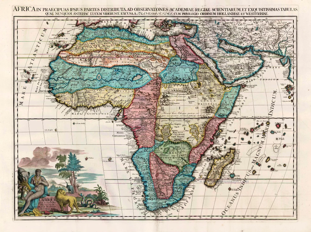
Africa, Volgens de alder-eerste Scheeps-Togten der Portugysen,
Item Number: 32320 new Authenticity Guarantee
Category: Antique maps > Africa
Africa by Pieter Van der Aa.
Title: Africa, Volgens de alder-eerste Scheeps-Togten der Portugysen,
Ter Ontdekking Uytgesonden A° 1419, enz.
Date of the first edition: 1706.
Date of this map: 1706.
Copper engraving, printed on paper.
Image size: 155 x 275mm (6 x 10¾ inches).
Sheet size: 215 x 300mm (8½ x 11¾ inches).
Verso: Blank.
Condition: Excellent.
Condition Rating: A+.
From: João de Barros, Scheeps-togt door Fernando Perez d'Andrade, als opperhoofd der vloor, uit last des konings don Manuel van Portugaal, van Malacca afgezonden na de Golf van Bengale en de kusten van China, in't jaar 1516. Leiden, P. van der Aa, 1706.
Very rare - unknown to Norwich
Pieter van der Aa (Leiden, 1659-1733)
Pieter van der Aa was already in 1682 owner of a bookshop and auction house. During his life, he has published an enormous amount of printed material.
After 1700, van der Aa increasingly specialised in books on geography and travel.
He published composite atlases, a series of geographical descriptions of European countries, and some very spectacular works. Between 1706 and 1708 he published the Naauweurige versameling der gedenkwaardigste zee- en land-reysen, in 28 volumes.
Many of Van der Aa’s publications are richly illustrated with maps and plates. He took over many copperplates and prints from other publishers such as Carel Allard and Frederik De Wit. The composite atlases that appeared from his workshop contain a curious mixture of his own material, copies of maps from other publishers, and reprints made from old copper plates, now with his own imprint.
The Galérie agréable du monde, was completed in 1729, and comprised 66 parts, bound in 27 volumes. Van der Aa presented it as a good investment; after publication, the antiquarian value of the work would double, the more so since it was printed in a limited edition of only one hundred copies.
Related items
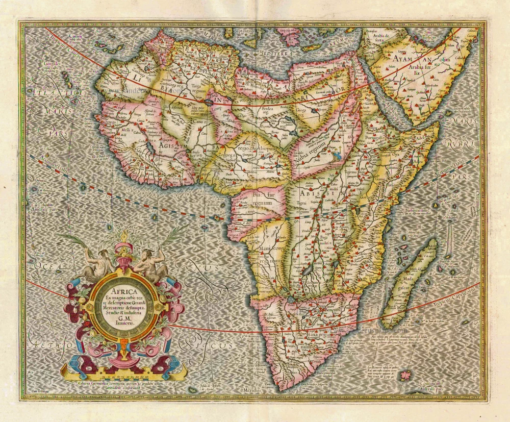
Africa Ex magna orbis terre 1633
Africa, by G. Mercator.
[Item number: 1452]
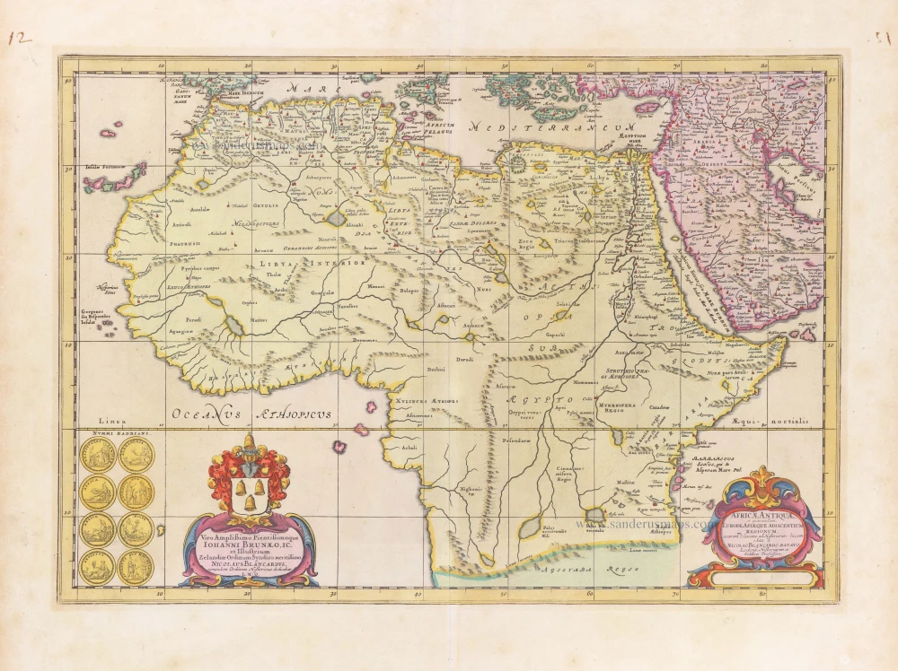
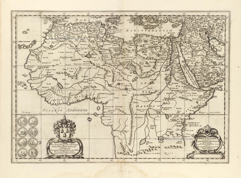
Africae Antiquae, et quarundam Europae, Asiaeque Adiacentium Regionum, 1684
Africa, by Janssonius à Waesberghe.
[Item number: 10916]
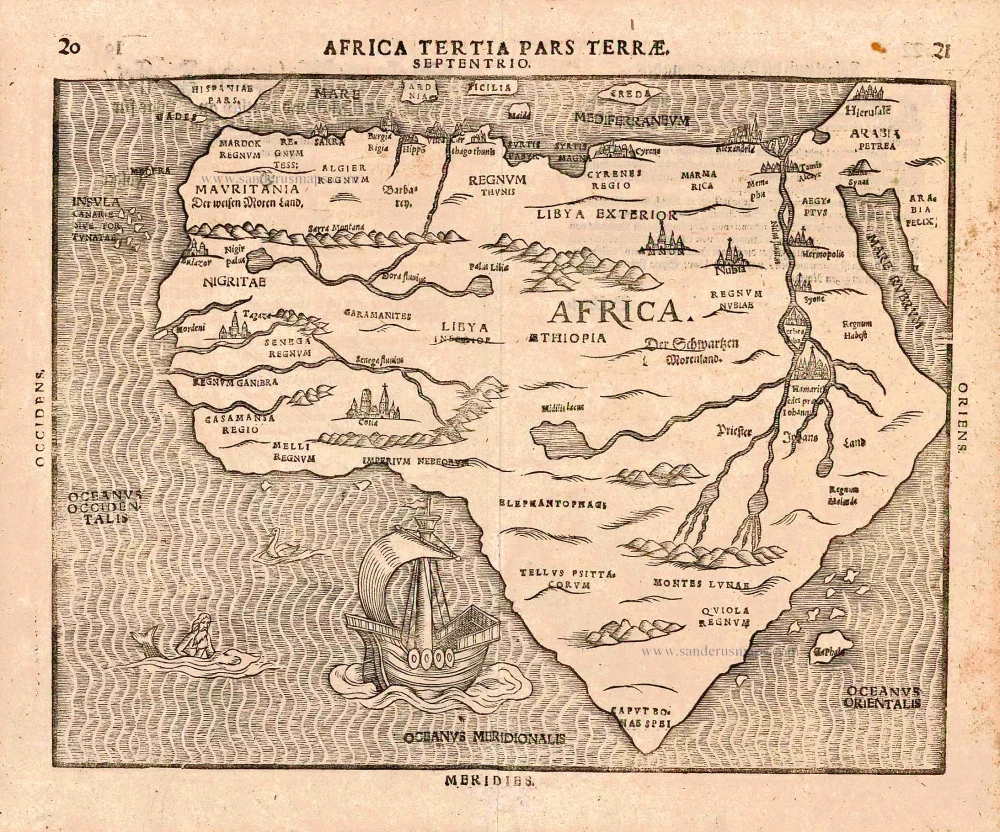
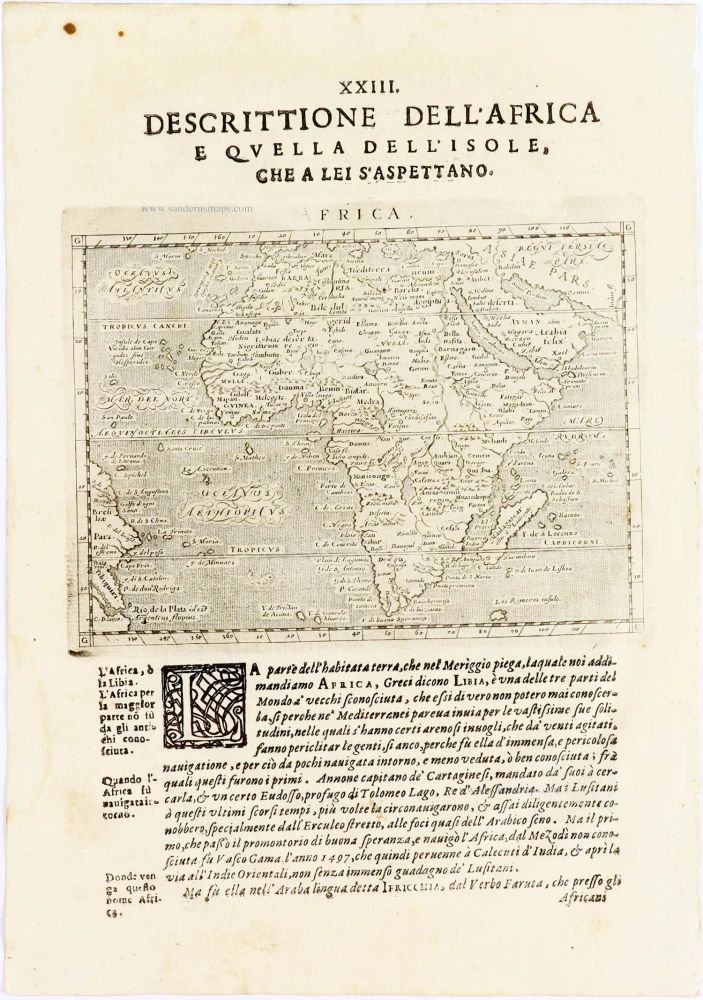
Africa Tertia Pars Terrae. 1581
Africa, by H. Bünting.
[Item number: 26228]
Affricae Tabula Nova. 1598
Africa, by Sebastian Münster.
[Item number: 27416]
Big and beautiful map.
L'Afrique Selon les Nouvelles Observations de Messrs. de l'Academie des Sciences, etc. Before 1713
Africa, by François Halma.
[Item number: 27853]
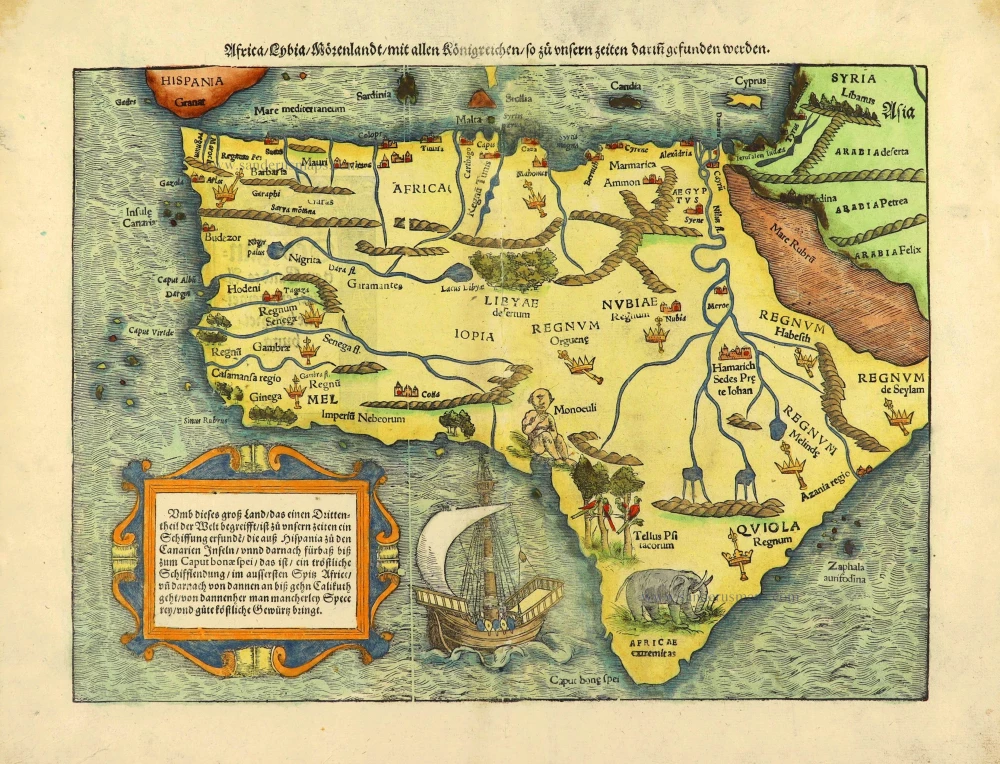
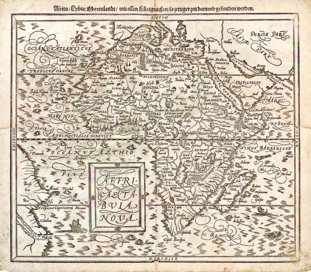
Africa / Lybia / Morenland / mit allen Künigreichen / so zu unsern zeiten darin gefunden werden. 1572
Africa by Sebastian Münster.
[Item number: 28142]
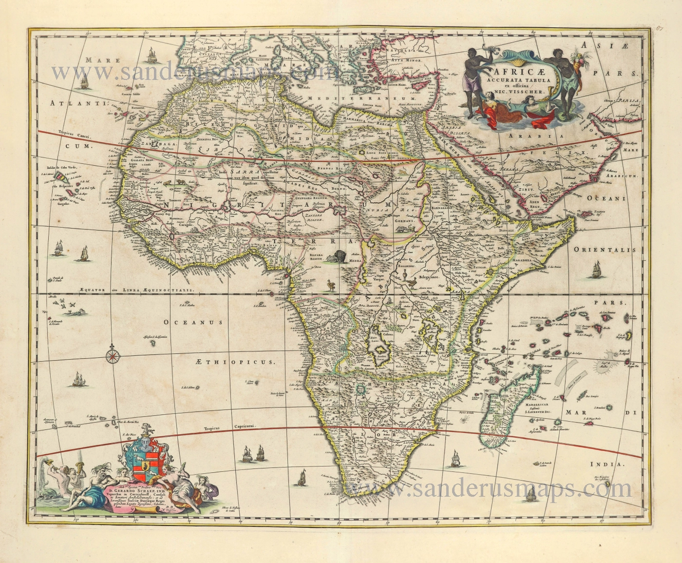
Africae Accurata Tabula. 1656-77
Africa by Nicolaes Visscher I.
[Item number: 28551]
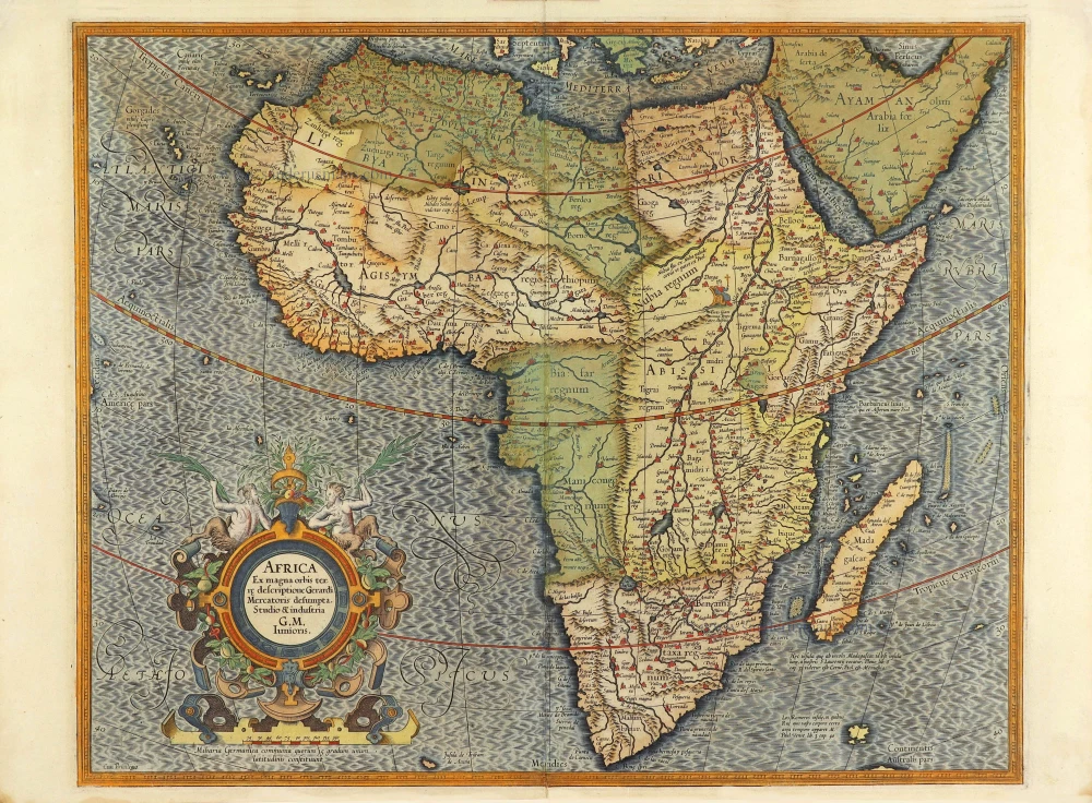
Africa Ex magna orbis terre. 1623
Africa by Gerard Mercator.
[Item number: 28678]
Africae Antiquae, et quarundam Europae, Asiaeque Adiacentium Regionum, 1684
Africa, by Janssonius à Waesberghe.
[Item number: 29053]
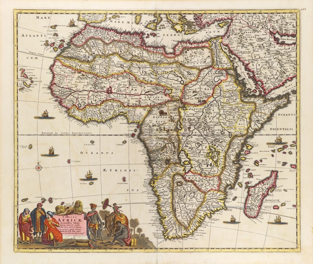
Totius Africae Accuratissima Tabula, c. 1697-1704
Africa, by Frederick De Wit.
[Item number: 29289]

Afrique. 1650
Africa by Nicolas Sanson.
[Item number: 29602]
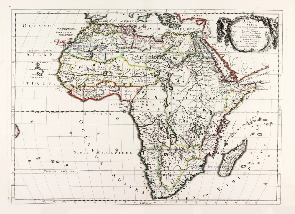
Africa Vetus. 1667-69
Ancient Africa by Nicolas & Guillaume Sanson.
[Item number: 30003]
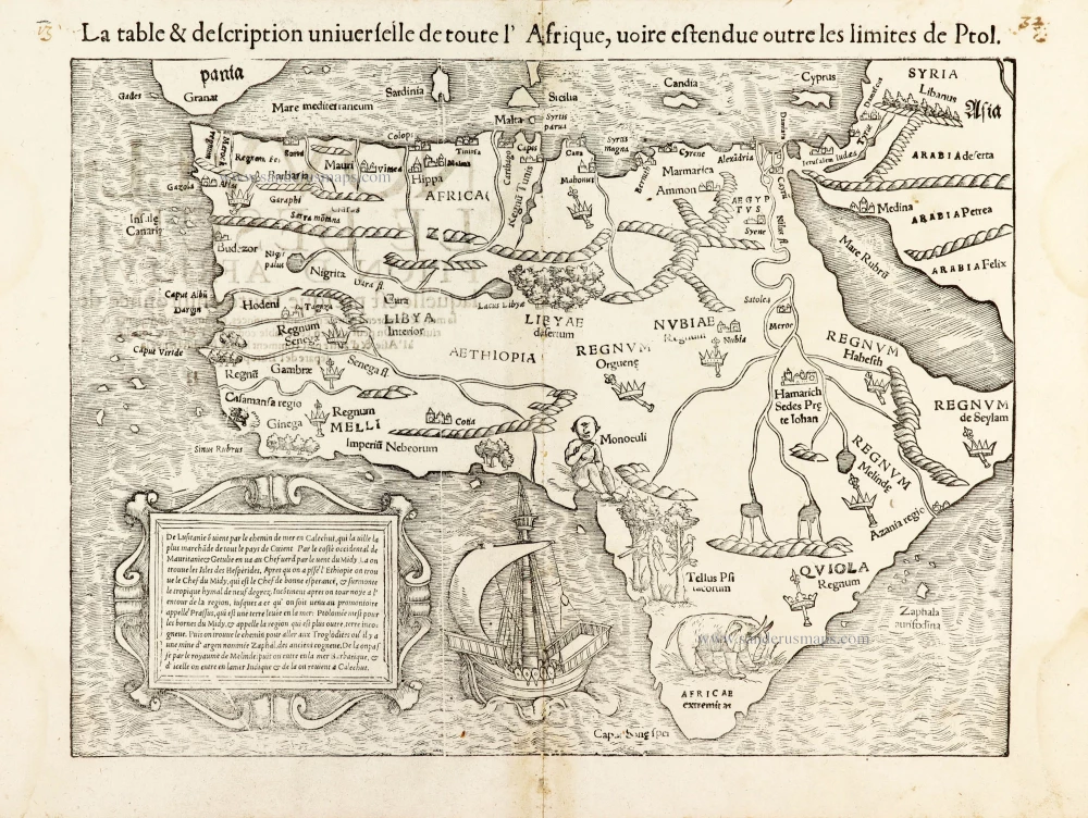
La table & description universelle de toute l' Afrique, voire estendue outre les limites de Ptol. 1568
AFRICA by Sebastian Münster
[Item number: 30519]
Africa 1621
Africa by Giovanni Magini.
[Item number: 30775]
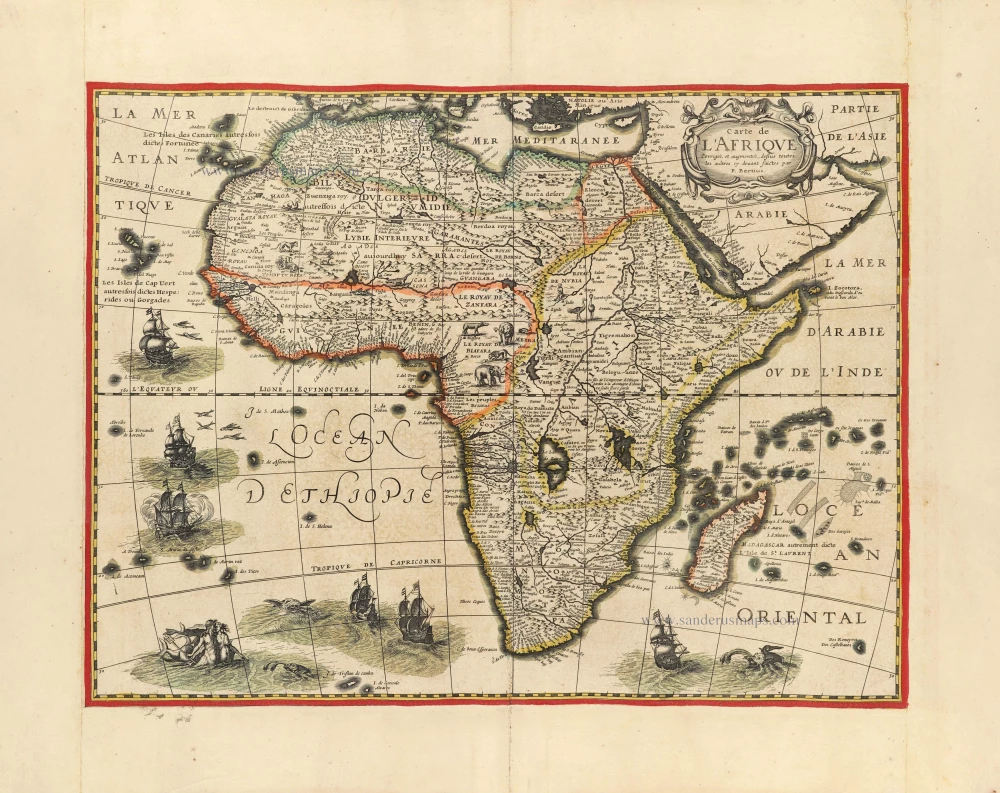
Carte de l'Afrique Corrigee et Augmentee, dessus Toutes les Aultres cy devant Faictes par P. Bertius. c. 1630-1650
Africa by Petrus Bertius, published by Melchior Tavernier.
[Item number: 30858]
Important map
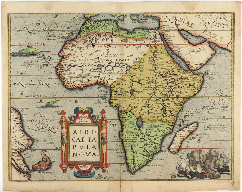
Africae Tabula Nova. 1575
Africa by Abraham Ortelius
[Item number: 30948]
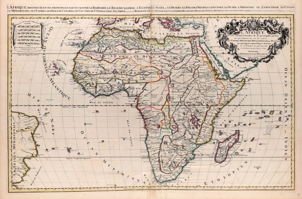
L'Afrique divisée suivant l'estendue de ses principales parties ou sont distingués les uns des autres, Les Empires, Monarchies, Royaumes, Estats et Peuples qui partagent aujourd'huy l'Afrique sur les Relations les plus Nouvelles. 1692
Africa, by N. Sanson, so-called published by Hubert Jaillot. (Pirated edition by Pierre Mortier).
[Item number: 31141]

Beautiful
Tabula Quarta Africae 1513
Ptolemy map of Africa by Martin Waldseemüller
[Item number: 31187]

Africae nova descriptio. 1640
Africa by Willem Blaeu.
[Item number: 31334]

Totius Africae Accuratissima Tabula Authore I. Danckerts Amstelodami 1683-1690
Africa by Justus Danckerts.
[Item number: 31787]

Africa. 1618
Africa by Petrus Bertius, published by Jodocus Hondius II.
[Item number: 32060]

Totius Africae Nova Repraesentatio qua Practer Diversos in ea Status et Regiones, etiam Origo Nili c. 1720
Africa by Homann J.B.
[Item number: 32097]