
China by Jodocus Hondius. 1634
The Hondius Family
Jodocus Hondius the Elder (1563-1612)
Joost d’Hondt was born at Wakken (Flanders) in 1563. Two years later, his family settled down in Ghent, where young Joost displayed a great gift for drawing and calligraphy. By study and lessons, he developed his talents and became an engraver with a good reputation.
Due to the circumstances of war, he moved in 1584 to London where he settled down as an engraver, instrument-maker and map-maker. In 1587, he married Coletta van den Keere, sister of the well-known engraver, Pieter van den Keere (Petrus Kaerius); some years earlier his sister, Jacomina, had married Pieter van den Berghe (Petrus Montanus). Joost, who had Latinized his name to Jodocus Hondius, closely co-operated with his two brothers-in-law.
The political situation in the Northern Netherlands in 1593 was such that Jodocus seemed to be justified in establishing himself in Amsterdam, where so many Antwerp printers, publishers, and engravers had gone. In this new centre of cartography, Jodocus Hondius set up his business “In de Wackere Hondt” (in the vigilant dog), this name being an allusion to his birthplace and name. Here he engraved many maps and published atlases and many other works such as his continuation of Gerard Mercator’s Atlas.
He suddenly passed away in February 1612. The publishing firm of Jodocus Hondius was continued by his widow; later on by his two sons Jodocus Jr., and Henricus, and by his son-in-law, J. Janssonius.
Jodocus Hondius II (1594-1629) & Henricus Hondius (1597-1651)
After the father’s death, the widow with her seven children continued publishing the atlases under the name of Jodocus Hondius till 1620. The firm was reinforced by the very welcome help of Joannes Janssonius (1588-1664), who married 24-year-old Elisabeth Hondius in 1612. After 1619 Mercator’s Atlas was published under the name of Henricus Hondius.
One of the most dramatic events in the early history of commercial cartography in Amsterdam was the sale of Jodocus Hondius Jr.’s copper-plates to Willem Jansz. Blaeu in 1629, the year of his death. At least 34 plates, from which Jodocus II had printed single-sheet maps for his own benefit, passed into the hands of his great competitor. Immediately after that, his brother, Henricus, and Joannes Janssonius ordered the engraving of identical plates.
During a long period, Henricus devoted all his energy to the publication of the Atlas. He saw its growth up to, and including, the fourth part in 1646; after that, his name does not figure any more on the title-pages. After 1638, the title of the Atlas was changed to Atlas Novus; it was mainly carried on by Joannes Janssonius.
The competition with the Blaeus dates from 1630. In 1630, Willem Janszoon (=Blaeu) made the first attack with his Atlantis Appendix. In 1635, Blaeu completed his Theatrum orbis terrarum in two volumes with texts in French, Latin, Dutch, and German, which prompted Henricus Hondius to speed up the enlargement of his Atlas.
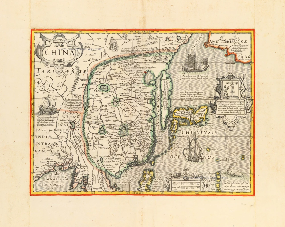
China.
Item Number: 30165 Authenticity Guarantee
Category: Antique maps > Asia > China
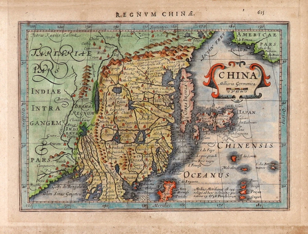
China by Jodocus Hondius.
Title: China.
Petrus Kaerius Caelavit.
Above map: Regnum Chinae. 615
Date of the first edition: 1628.
Date of this map: 1634.
Copper engraving, printed on paper.
Image size: 135 x 190mm (5.31 x 7.48 inches).
Sheet size: 175 x 220mm (6.89 x 8.66 inches).
Verso: Latin text.
Condition: Hand coloured, age-toned.
Condition Rating: A.
From: Atlas Minor Gerardi Mercatoris à I. Hondio plurimis aeneis Tabulis auctus et illustratus: denuo recognitus, additisque novis delineationibus emendatus. Amsterodami, Ex Officina Ioannis Ianssonii. MDCXXXIIII. [1634] (Van der Krogt IIIA, p. 519, 352:02)
The Hondius Family
Jodocus Hondius the Elder (1563-1612)
Joost d’Hondt was born at Wakken (Flanders) in 1563. Two years later, his family settled down in Ghent, where young Joost displayed a great gift for drawing and calligraphy. By study and lessons, he developed his talents and became an engraver with a good reputation.
Due to the circumstances of war, he moved in 1584 to London where he settled down as an engraver, instrument-maker and map-maker. In 1587, he married Coletta van den Keere, sister of the well-known engraver, Pieter van den Keere (Petrus Kaerius); some years earlier his sister, Jacomina, had married Pieter van den Berghe (Petrus Montanus). Joost, who had Latinized his name to Jodocus Hondius, closely co-operated with his two brothers-in-law.
The political situation in the Northern Netherlands in 1593 was such that Jodocus seemed to be justified in establishing himself in Amsterdam, where so many Antwerp printers, publishers, and engravers had gone. In this new centre of cartography, Jodocus Hondius set up his business “In de Wackere Hondt” (in the vigilant dog), this name being an allusion to his birthplace and name. Here he engraved many maps and published atlases and many other works such as his continuation of Gerard Mercator’s Atlas.
He suddenly passed away in February 1612. The publishing firm of Jodocus Hondius was continued by his widow; later on by his two sons Jodocus Jr., and Henricus, and by his son-in-law, J. Janssonius.
Jodocus Hondius II (1594-1629) & Henricus Hondius (1597-1651)
After the father’s death, the widow with her seven children continued publishing the atlases under the name of Jodocus Hondius till 1620. The firm was reinforced by the very welcome help of Joannes Janssonius (1588-1664), who married 24-year-old Elisabeth Hondius in 1612. After 1619 Mercator’s Atlas was published under the name of Henricus Hondius.
One of the most dramatic events in the early history of commercial cartography in Amsterdam was the sale of Jodocus Hondius Jr.’s copper-plates to Willem Jansz. Blaeu in 1629, the year of his death. At least 34 plates, from which Jodocus II had printed single-sheet maps for his own benefit, passed into the hands of his great competitor. Immediately after that, his brother, Henricus, and Joannes Janssonius ordered the engraving of identical plates.
During a long period, Henricus devoted all his energy to the publication of the Atlas. He saw its growth up to, and including, the fourth part in 1646; after that, his name does not figure any more on the title-pages. After 1638, the title of the Atlas was changed to Atlas Novus; it was mainly carried on by Joannes Janssonius.
The competition with the Blaeus dates from 1630. In 1630, Willem Janszoon (=Blaeu) made the first attack with his Atlantis Appendix. In 1635, Blaeu completed his Theatrum orbis terrarum in two volumes with texts in French, Latin, Dutch, and German, which prompted Henricus Hondius to speed up the enlargement of his Atlas.
Related items
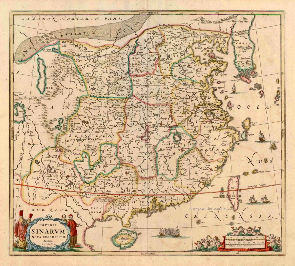
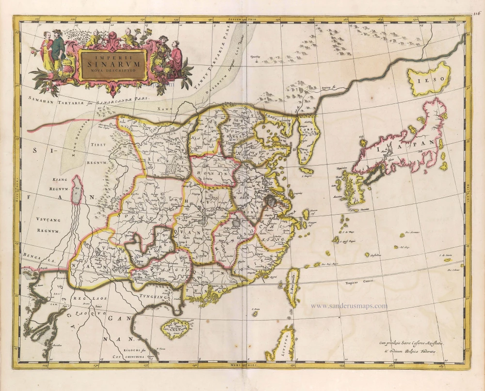
Imperii Sinarum Nova Descriptio. c. 1680.
China with Japan, Korea and Taiwan, by J. Janssonius.
[Item number: 2618]
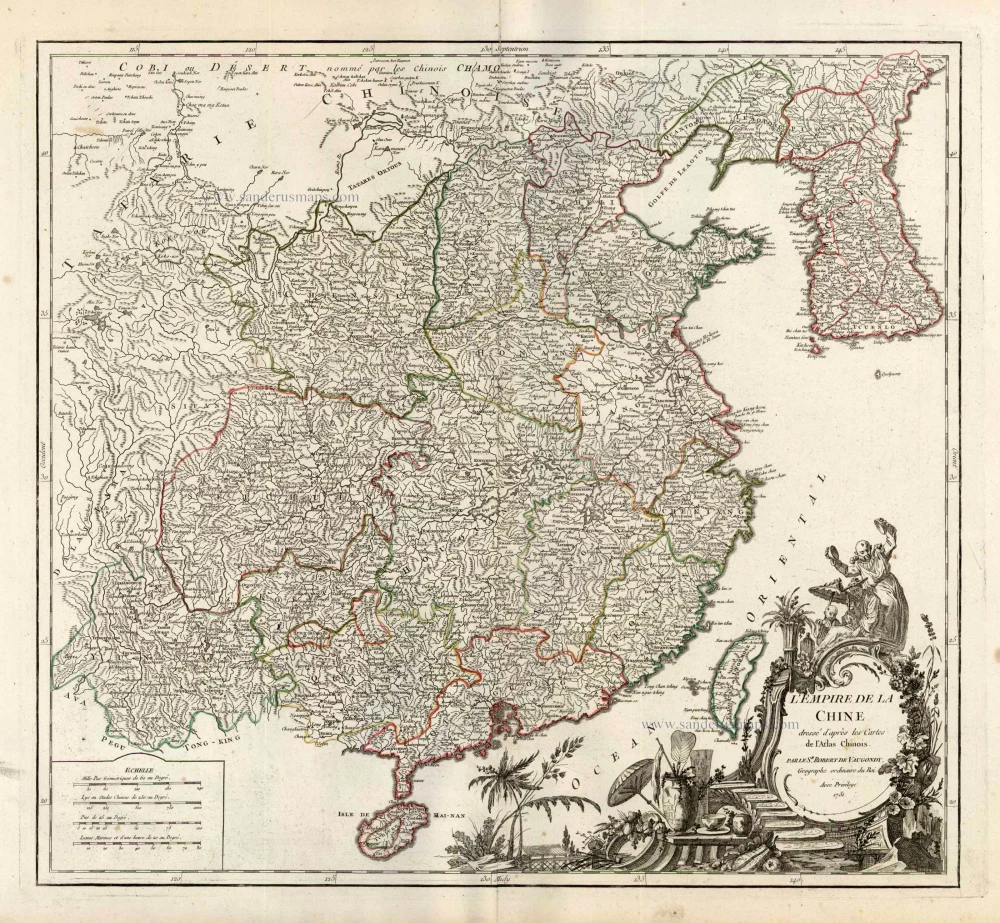
L'Empire de la Chine Dresse d'apres les Cartes de l'Atlas Chinois ... c. 1757
China, by Robert de Vaugondy.
[Item number: 5093]

With Korea as an island.
China 1619
China, Korea and Japan by J. Hondius.
[Item number: 6494]
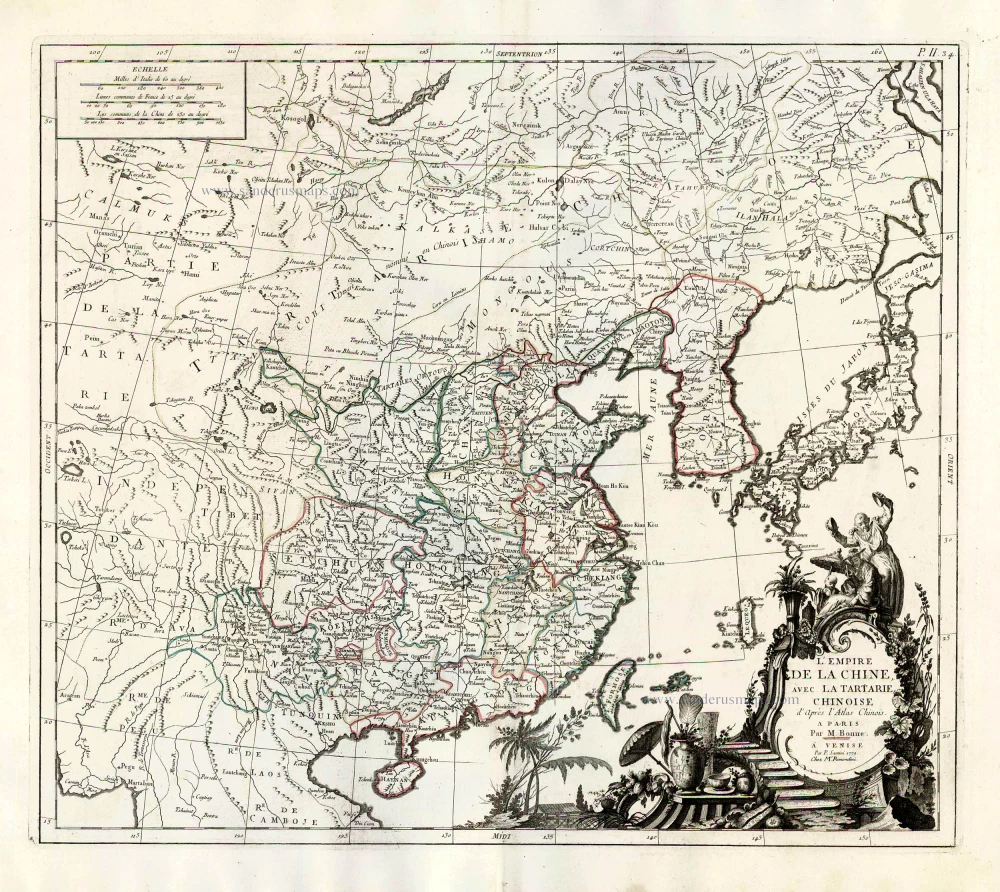
L'Empire de la Chine, avec la Tartarie Chinoise d'après l'Atlas Chinois. 1776-79
China with Korea and Japan, by Paolo Santini.
[Item number: 26974]
Important map.
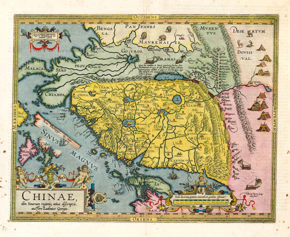
Chinae, Olim Sinarum regionis, nova descriptio. 1603
China by Abraham Ortelius
[Item number: 27040]
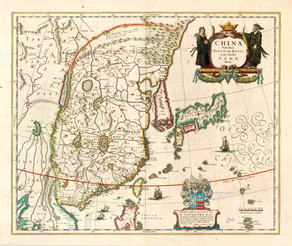
China Veteribus Sinarum Regio Nunc Incolis Tame Dicta. 1649-55
China - Japan - Korea, by Willem & Joan Blaeu.
[Item number: 27043]
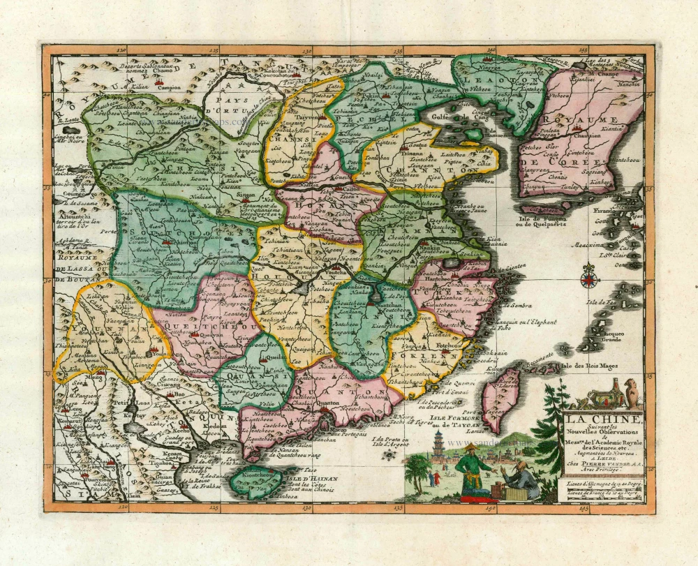
La Chine, Suivant les Nouvelles Observations. 1713
China, by Pieter van der Aa.
[Item number: 27095]
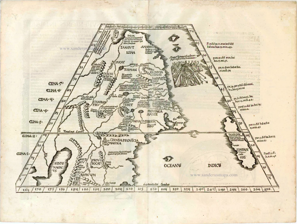
Early 1525 edition
Ta. Superioris Indiae et Tartariae Maioris. 1525
China - Japan, by Lorenz Fries after Martin Waldseemüller.
[Item number: 27928]
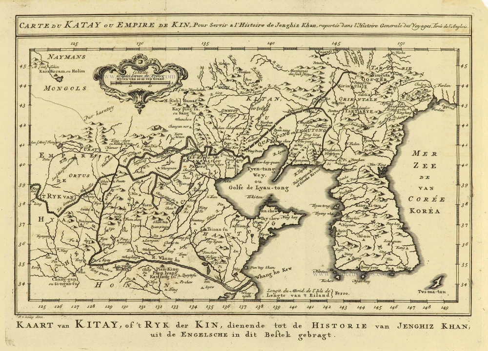
Carte du Katay, ou Empire de Kin. 1750
China - Korea by Jacques Nicolas Bellin.
[Item number: 28177]
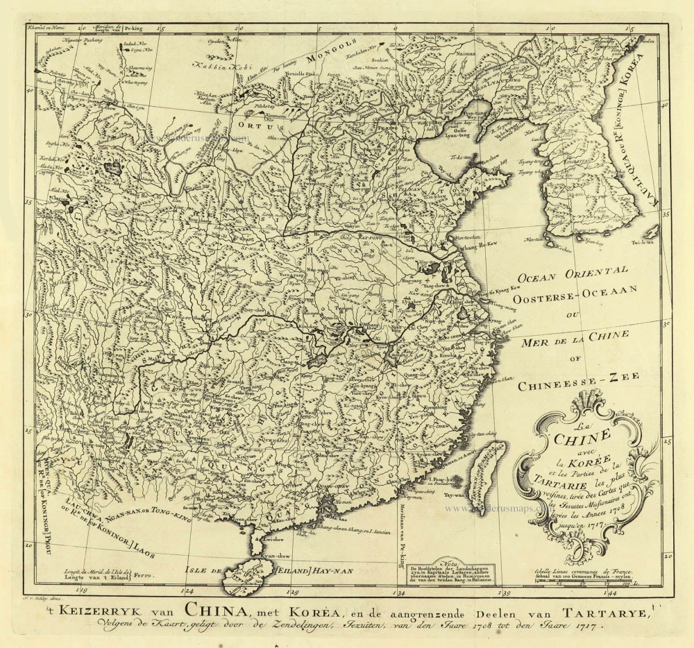
La Chine avec la Korée et les Parties de la Tartarie les plus voisines, 1749
China - Korea by Jacques Nicolas Bellin.
[Item number: 28195]
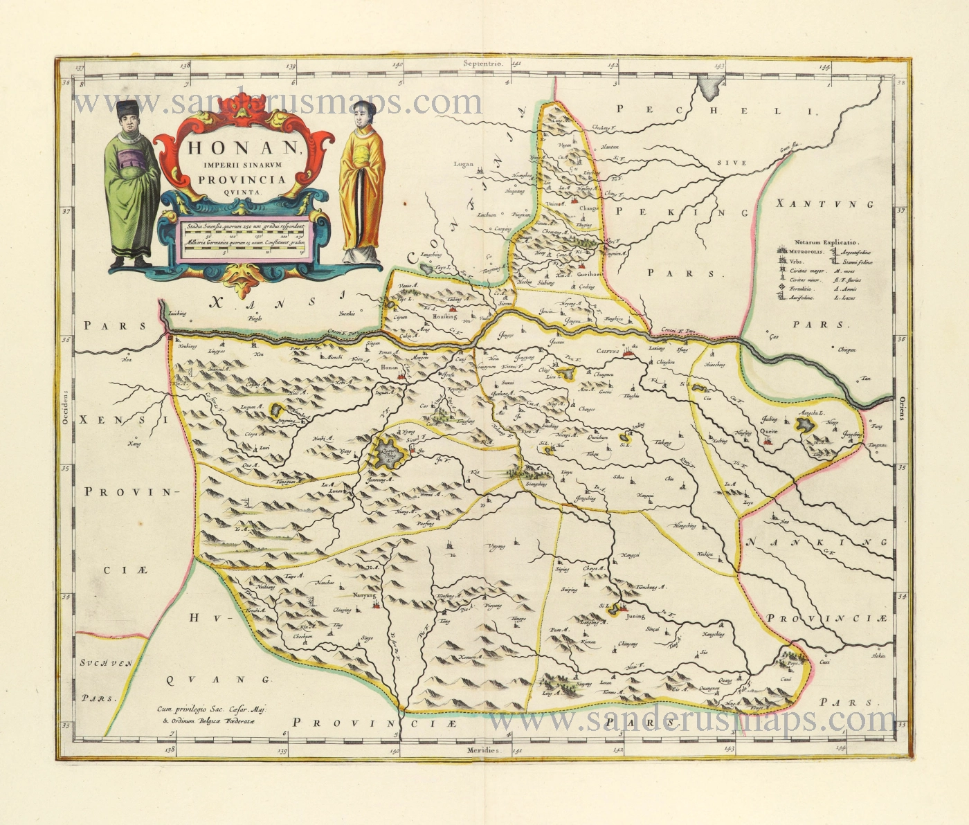
Honan, Imperii Sinarum Provincia Quinta. 1655-1659
Honan by Joan Blaeu
[Item number: 28593]
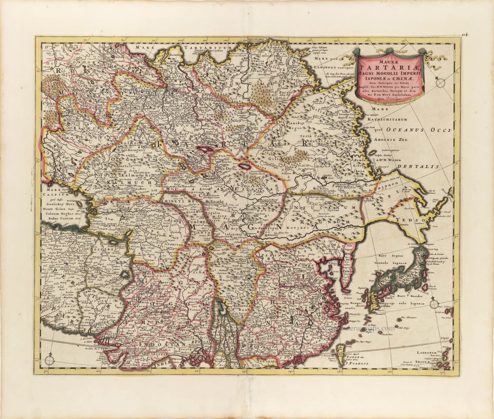
Magnae Tartariae, Magni Mogolis Imperii, Iaponiae et Chinae. ca. 1697-1707
Tartary, China, and Japan, by Frederick de Wit.
[Item number: 28996]
From the Martini atlas
Imperii Sinarum Nova Descriptio. c. 1691-97
China by Joan Blaeu, published by Frederick de Wit.
[Item number: 29431]
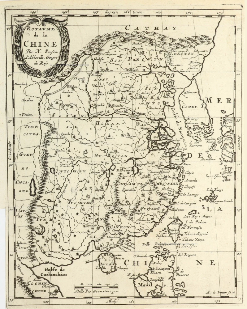
Royaume de la Chine. 1682
China by Nicolas Sanson, published by Simon de Vries.
[Item number: 30235]
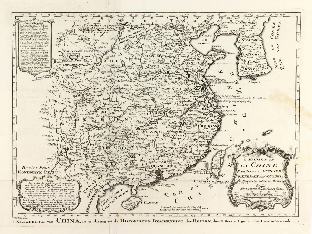
L'Empire de la Chine 1748
China by N. Bellin.
[Item number: 30260]
Important and rare China map.
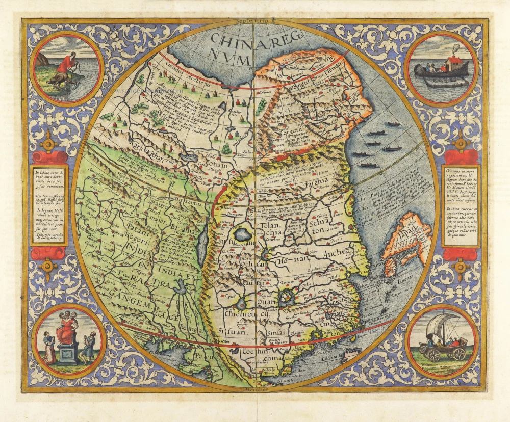
China Regnum. 1593
China by Cornelis de Jode
[Item number: 30312]
With Korea as an island.
China c. 1630-1650
China, Korea and Japan by J. Hondius.
[Item number: 30856]