
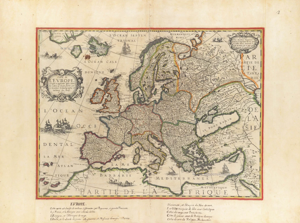
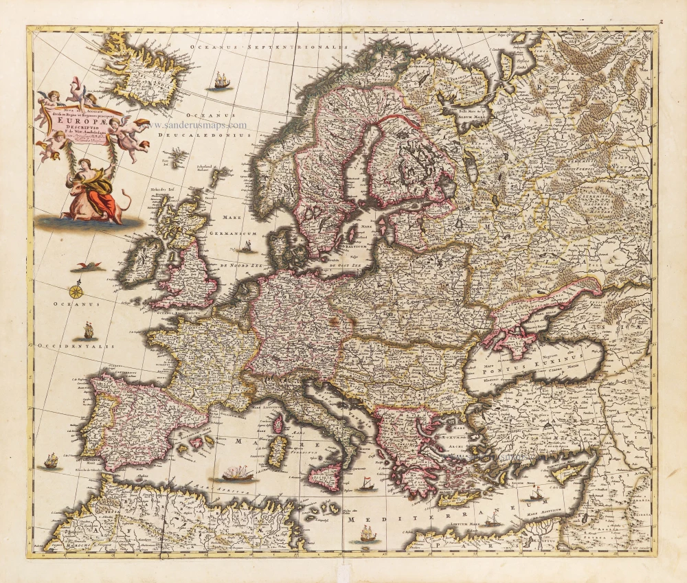
Europe by Petrus Bertius, published by Melchior Tavernier. c. 1630-1650
This rare map is one of four known continents that Melchior Tavernier engraved. The Asia map bears the imprint of Cornelis Danckerts (the elder), a highly skilled engraver. It is safe to assume that the others were also by his hand.
Petrus Bertius (1565-1629)
Petrus Bertius, born at Beveren, Flanders, in 1565, was related to Pieter van den Keere (Kaerius) and Jodocus Hondius. Both famous cartographers were brothers-in-law of Petrus Bertius. As a refugee, he settled in Amsterdam, and after finishing his studies, he became a professor of mathematics and librarian at the University of Leiden. In 1618, he became a cosmographer and historiographer for Louis XIII of France. He lived in Paris, where he died in 1629.
Petrus Bertius's remarkable work ethic is evident in the numerous geographical and theological works he produced. His contributions to the works of Clüver and Herrera further solidified his reputation in geography.
His fame among geographers was established by his text in the pocket atlas Tabularum Geographicarum and by his edition of Ptolemy’s Geographia.
The origin of the Tabularum Geographicum lies in the well-known miniature atlas Caert thresoor, published by Barent Langenes in 1598 in Middelburg. Bertius engraved 169 maps for this small but attractive atlas, sold for the first time in 1599 by Cornelis Claesz in Amsterdam. In 1600, Claesz published the pocket atlas with a Latin text composed by Petrus Bertius. From then on, new editions, often enlarged with new maps, regularly appeared, subsequently published by Cornelis Claesz, Jodocus Hondius, Johannes Janssonius and ultimately, in 1649, by Claes Jansz. Visscher.
Koeman divides this series of pocketbooks into two atlases: The Caert-thresoor, published by Langenes and Claesz., with five editions between 1598 and 1609, and the Tabularum Geographicarum Contractarum by Petrus Bertius with ten editions between 1600 and 1650.
The Tavernier Family.
Engravers, booksellers and publishers in Paris.
There were two Melchiors; they flourished concurrently, making their contribution impossible to distinguish.
Melchior Tavernier I, the elder (1564-1641)
Gabriel Tavernier (1566-1610)
Flemish engraver.
Melchior Tavernier II, the younger (1594-1665)
Son of Gabriel Tavernier. Engraver, mapseller and publisher 'dans l'Isle du Palais à la Sphère Royale', Paris.
He sold the works of Hondius, Janssonius and Willem Blaeu as some of the earliest published works of Nicolas Sanson. He sold most of his plates and equipment to Pierre Mariette in 1644.
Jean Bapitiste Tavernier (1605-1689)
He was the brother of Melchior and later became a merchant, diplomat, and traveller in Turkey, Persia, Central Asia, and the East Indies.
Carte de L'Europe, corrigée et augmentée dessus toutes les autres cy devant faictes
Item Number: 30839 Authenticity Guarantee
Category: Antique maps > Europe > Europe Continent
Rare map of Europe by Petrus Bertius, published by Melchior Tavernier.
Title: Carte de L'Europe, corrigée et augmentée dessus toutes les autres cy devant faictes
par P. Bertius Cosmographe et lecteur du Roy. A° 1627.
A Paris Chez Melchior Tavernier Graveur et Imprimeur du Roy pour les tailles douces demeurant en l'Isle du Palais sur le quay qui regarde la Megizerie.
Date of the first edition: 1627.
Date of this map: 1627.
Date on map: 1627.
Copper engraving, printed on paper.
Image size: 383 x 483mm (15.08 x 19.02 inches).
Sheet size: 505 x 695mm (19.88 x 27.36 inches).
Verso: Blank.
Condition: Original coloured and backed with paper, side margins extended; age-toned.
Condition Rating: A.
Separate publication - from a French Composite Atlas, c. 1630-1650.
An old French handwritten explanatory text about the colours used is in the bottom margin.
This rare map is one of four known continents that Melchior Tavernier engraved. The Asia map bears the imprint of Cornelis Danckerts (the elder), a highly skilled engraver. It is safe to assume that the others were also by his hand.
Petrus Bertius (1565-1629)
Petrus Bertius, born at Beveren, Flanders, in 1565, was related to Pieter van den Keere (Kaerius) and Jodocus Hondius. Both famous cartographers were brothers-in-law of Petrus Bertius. As a refugee, he settled in Amsterdam, and after finishing his studies, he became a professor of mathematics and librarian at the University of Leiden. In 1618, he became a cosmographer and historiographer for Louis XIII of France. He lived in Paris, where he died in 1629.
Petrus Bertius's remarkable work ethic is evident in the numerous geographical and theological works he produced. His contributions to the works of Clüver and Herrera further solidified his reputation in geography.
His fame among geographers was established by his text in the pocket atlas Tabularum Geographicarum and by his edition of Ptolemy’s Geographia.
The origin of the Tabularum Geographicum lies in the well-known miniature atlas Caert thresoor, published by Barent Langenes in 1598 in Middelburg. Bertius engraved 169 maps for this small but attractive atlas, sold for the first time in 1599 by Cornelis Claesz in Amsterdam. In 1600, Claesz published the pocket atlas with a Latin text composed by Petrus Bertius. From then on, new editions, often enlarged with new maps, regularly appeared, subsequently published by Cornelis Claesz, Jodocus Hondius, Johannes Janssonius and ultimately, in 1649, by Claes Jansz. Visscher.
Koeman divides this series of pocketbooks into two atlases: The Caert-thresoor, published by Langenes and Claesz., with five editions between 1598 and 1609, and the Tabularum Geographicarum Contractarum by Petrus Bertius with ten editions between 1600 and 1650.
The Tavernier Family.
Engravers, booksellers and publishers in Paris.
There were two Melchiors; they flourished concurrently, making their contribution impossible to distinguish.
Melchior Tavernier I, the elder (1564-1641)
Gabriel Tavernier (1566-1610)
Flemish engraver.
Melchior Tavernier II, the younger (1594-1665)
Son of Gabriel Tavernier. Engraver, mapseller and publisher 'dans l'Isle du Palais à la Sphère Royale', Paris.
He sold the works of Hondius, Janssonius and Willem Blaeu as some of the earliest published works of Nicolas Sanson. He sold most of his plates and equipment to Pierre Mariette in 1644.
Jean Bapitiste Tavernier (1605-1689)
He was the brother of Melchior and later became a merchant, diplomat, and traveller in Turkey, Persia, Central Asia, and the East Indies.
Related items
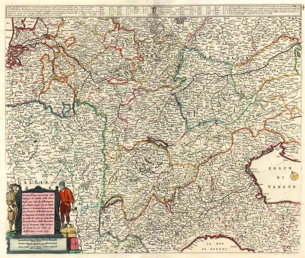
Carta Nova accurata del passagio et strada dalli Paesi Bassi per via de Allemagna per Italia ... c. 1680
Central Western Europe by Frederick de Wit.
[Item number: 13744]
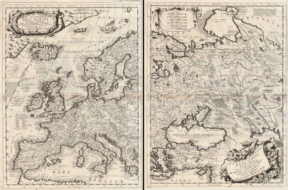
Parte Occidentale dell'Europa ... [in set with] Parte Orientale dell'Europa ... 1691
Europe, by V.M. Coronelli.
[Item number: 23186]

Europa Pars Tenet haec Mundi Reliquas Celeberrima Partes c. 1730.
Europe by G.& L. Valk.
[Item number: 24536]
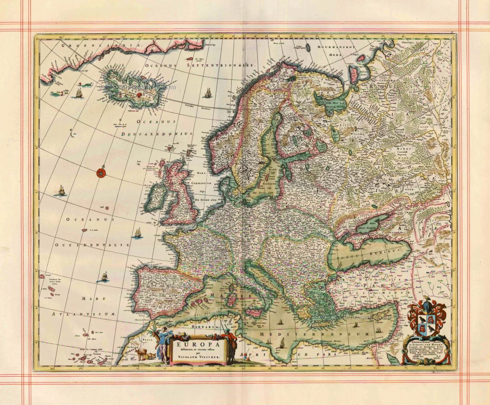
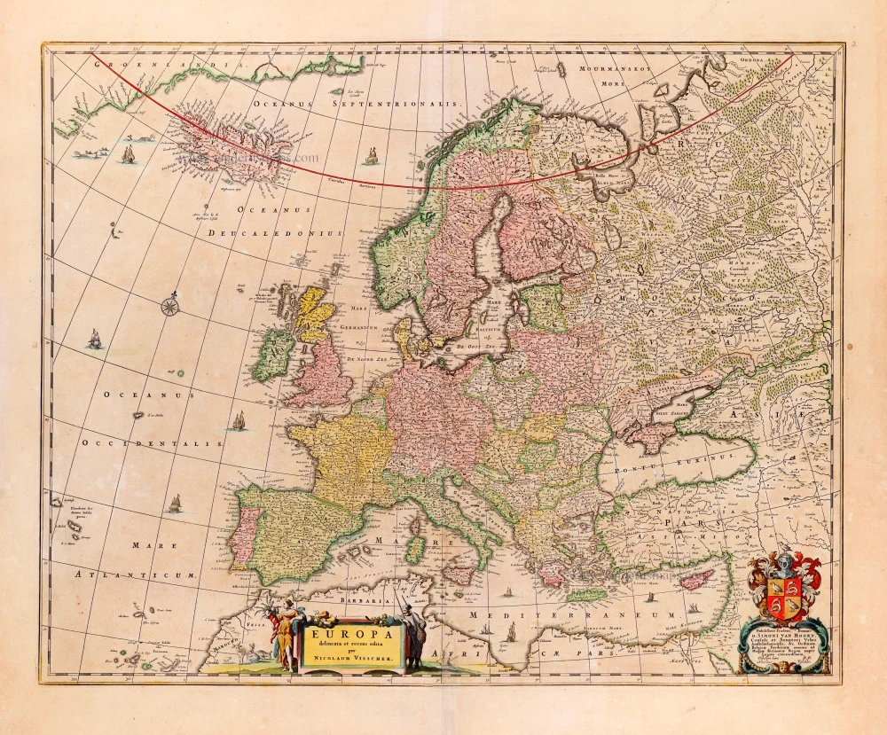
Europa delineata et recens edita. 1680
Europe by N. Visscher.
[Item number: 25056]
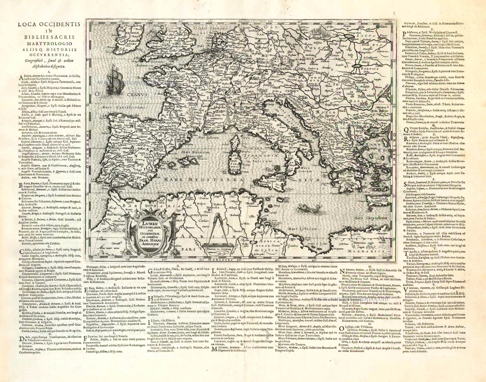
Lumen Historiarum per Occidentem. . . . 1624
Europe - Western Mediterranean Sea, by A. Ortelius.
[Item number: 26573]
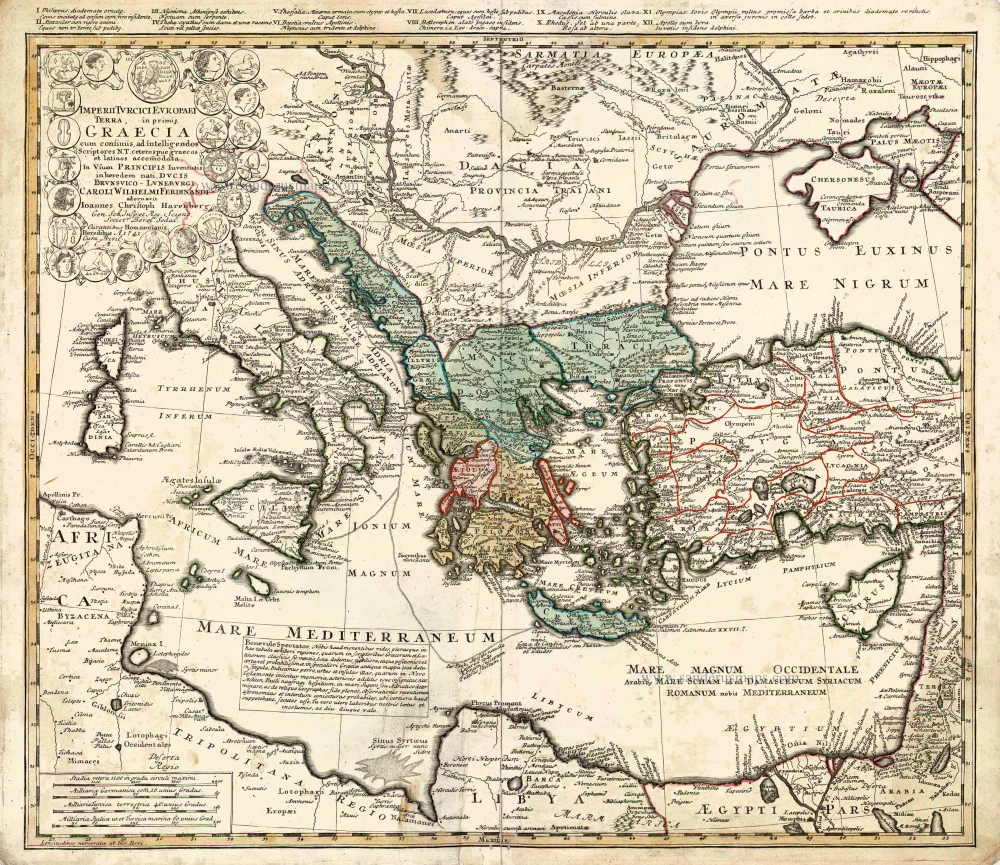
Imperii Turcici Europaei Terra in Primis Graecia. 1752-1775
Southeastern Europe - Turkey by Homann Heirs
[Item number: 26592]
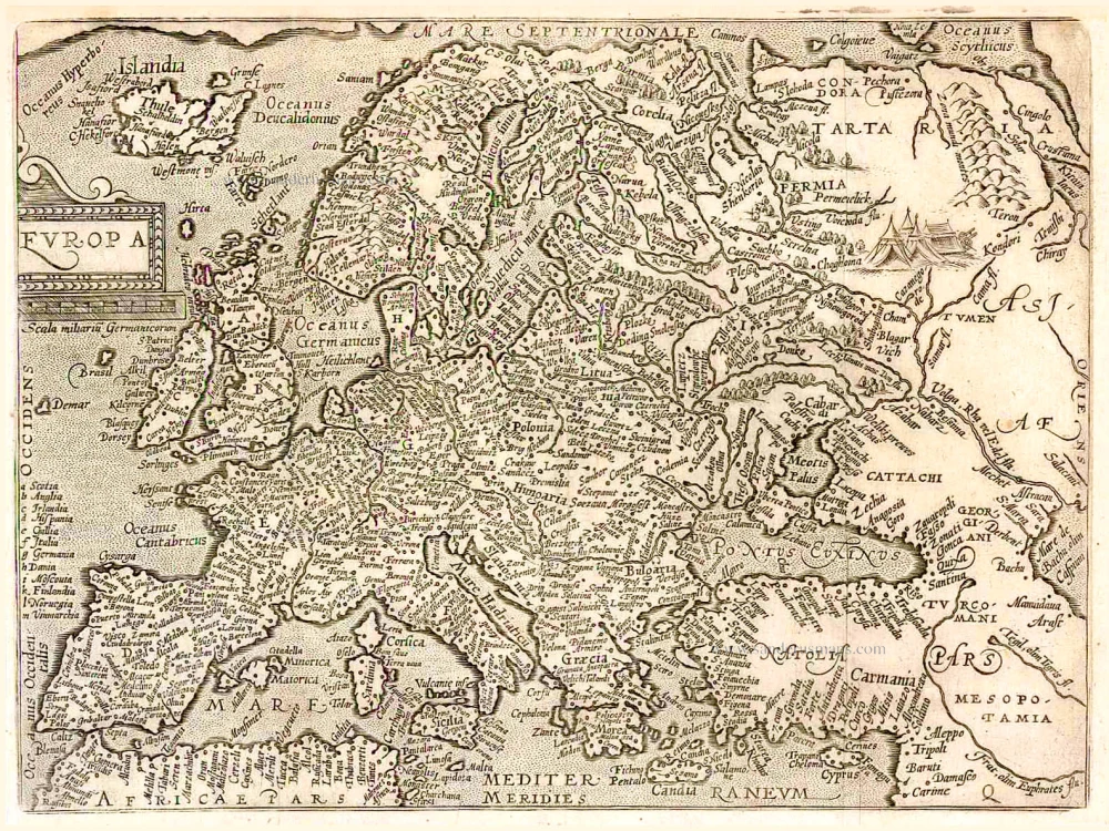
Europa. 1600
Europe, by Matthias Quad.
[Item number: 26666]
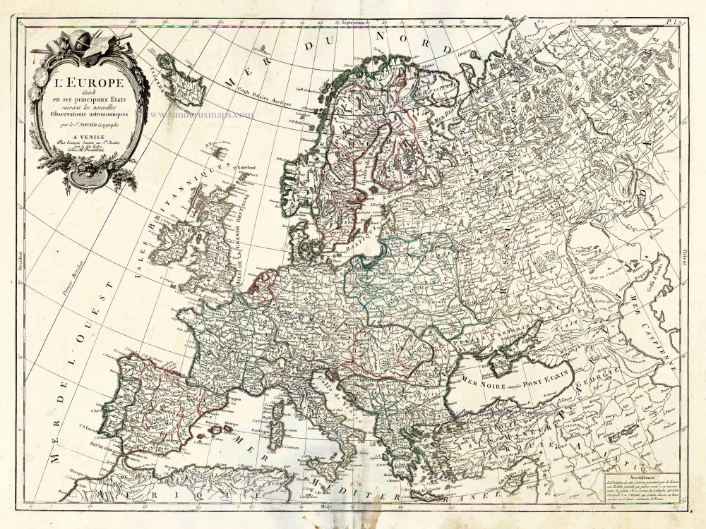
L'Europe Divisee en ses Principaux Etats. 1776-79
Europe, by Francesco Santini.
[Item number: 26947]
Europa delineata et recens edita. 1683-1696
Europe by Nicolaas Visscher II.
[Item number: 28712]
Nova et Accurate Divisa in Regna et Regiones Praecipuas Europae Descriptio. c. 1691-96
Europe, by Frederick de Wit;
[Item number: 29233]
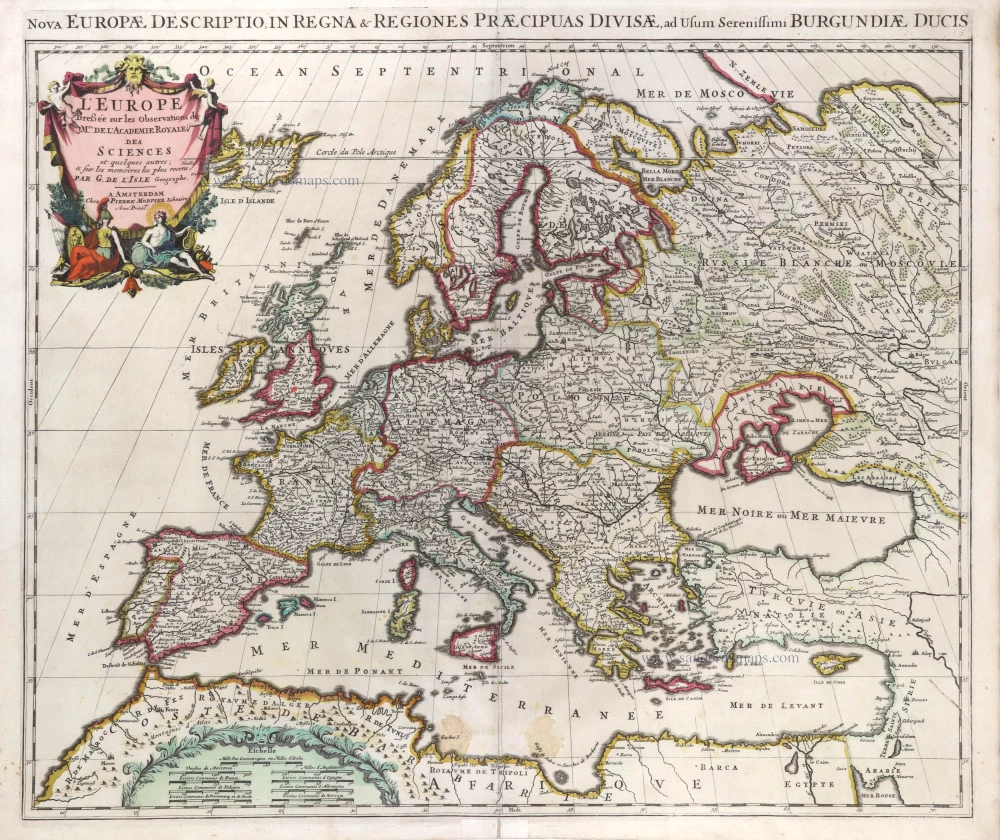
L'Europe Dreßée sur les Observations de Mrs. de l'Academie Royale des Sciences et quelques autres, & sur les memoires les plus recens. 1700-1708
Europe, by Guillaume Delisle, published by Pierre Mortier.
[Item number: 29519]
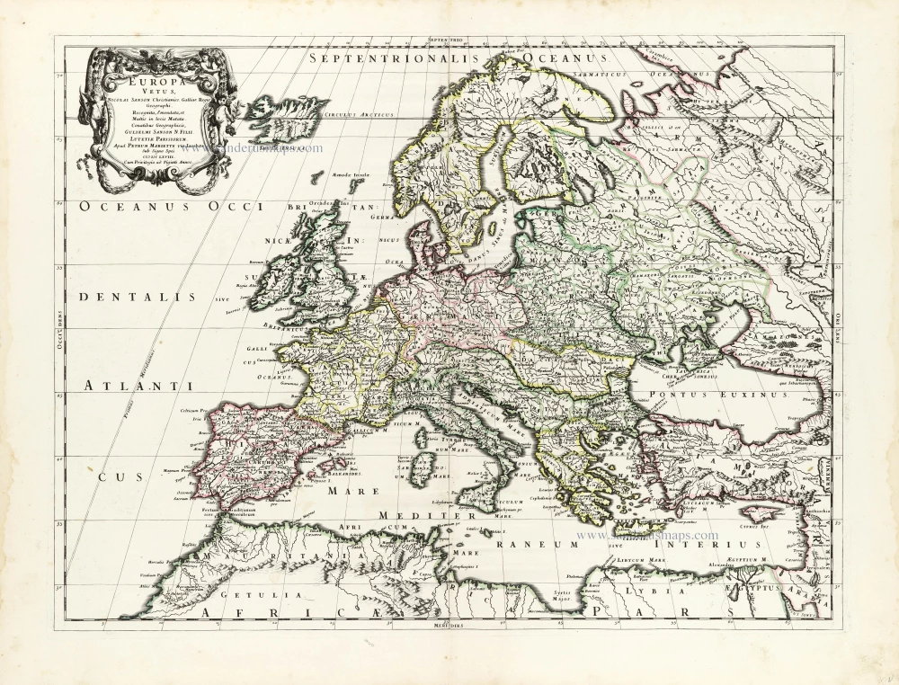
Europa Vetus. 1667-69
Ancient Europe by Nicolas & Guillaume Sanson.
[Item number: 30000]
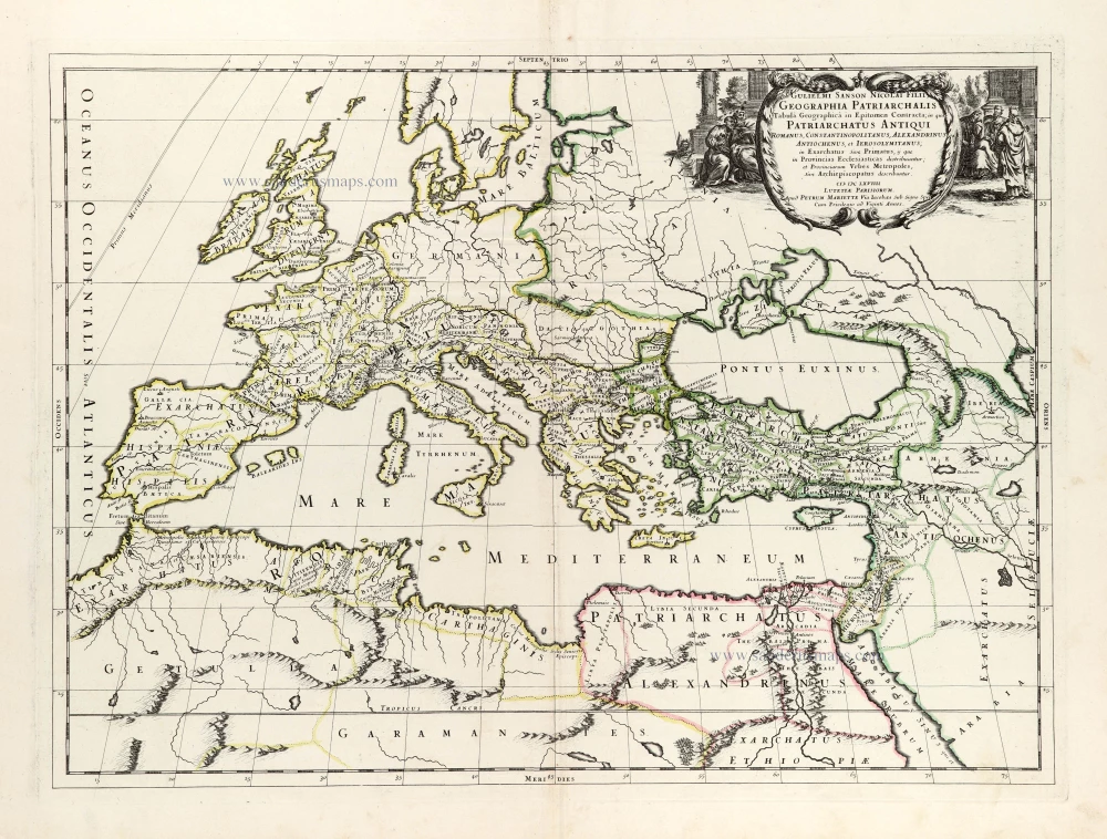
Geographia Patriarchalis Tabula Geographica in Epitomen Contracta; in quo Patriarchatus Antiqui Romanus, Constantinopolitanus, Alexandrinus Antiochenus, et Ierosolymitanus; ... 1669
Europe & Mediterranean Sea by Nicolas & Guillaume Sanson.
[Item number: 30049]
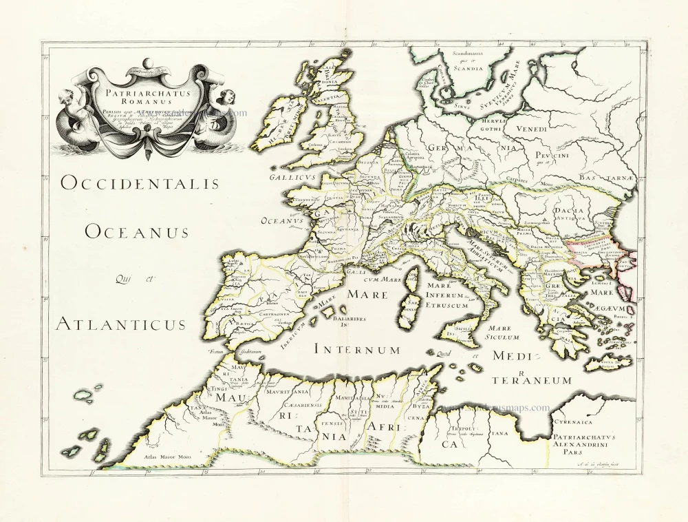
Patriarchatus Romanus c. 1632
Roman Empire in Europe, published by Melchior Tavernier.
[Item number: 30118]
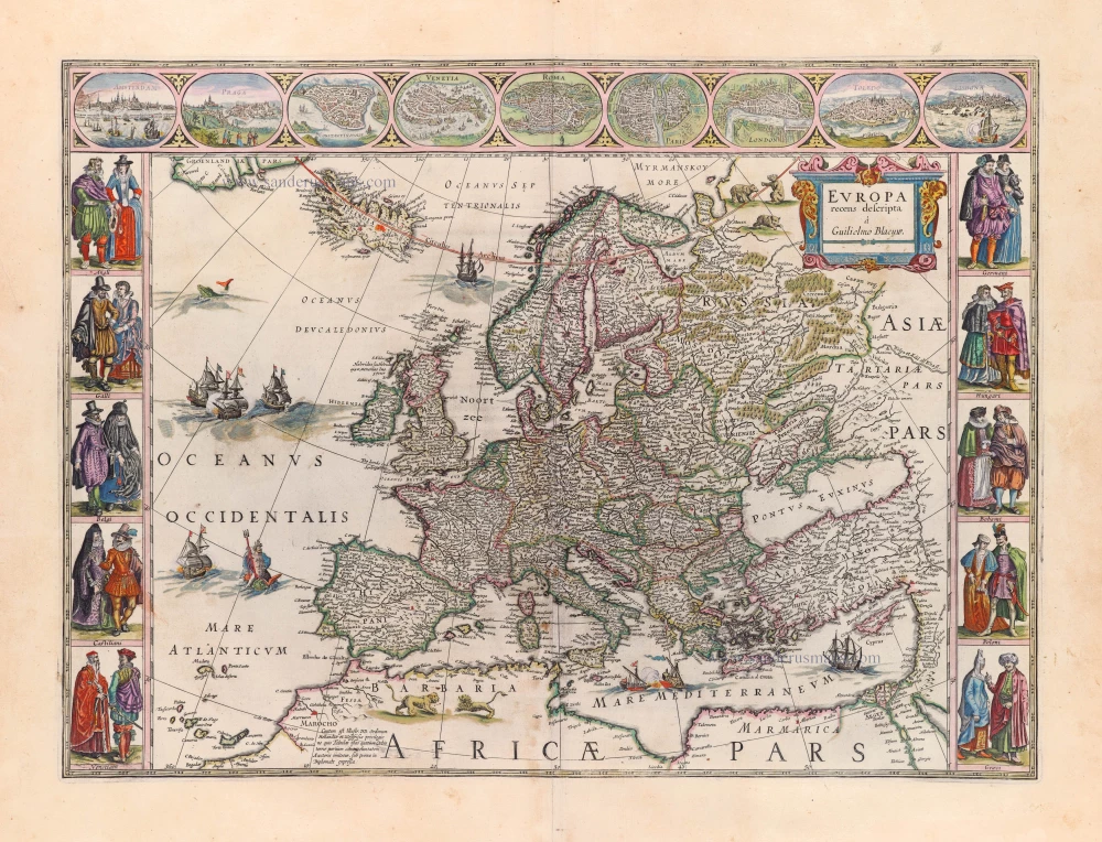
Europa Recens Descripta. 1659
Europe by Blaeu Willem & Joan
[Item number: 30206]
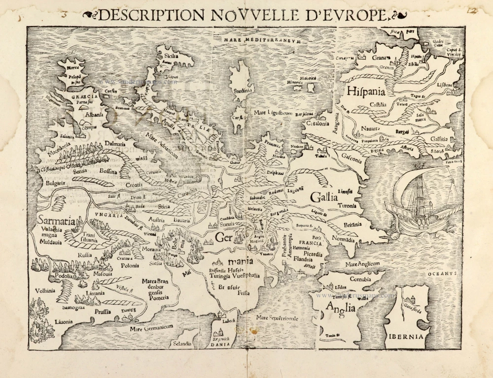
Description Nouvelle d'Europe. 1568
Europe by Sebastian Münster
[Item number: 30523]
Scarce map
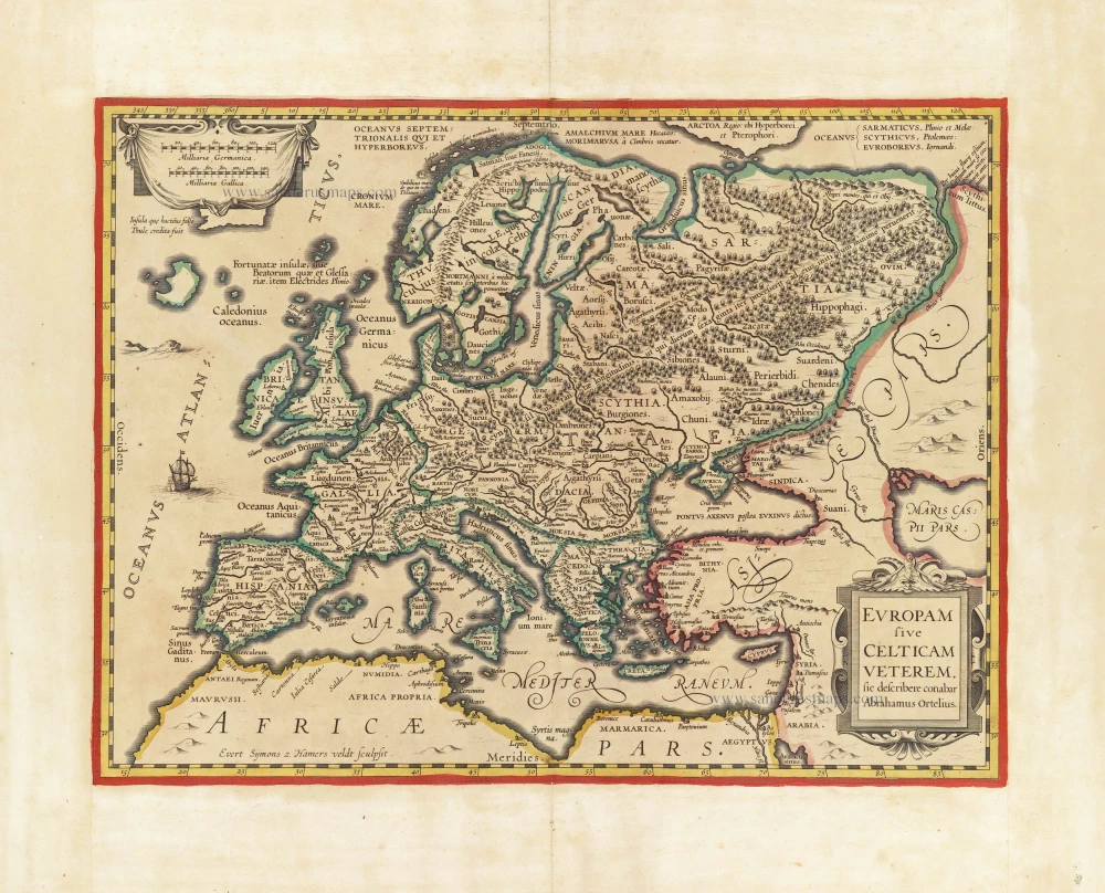
Europam sive Celticam Veterem c. 1630-1650
Europe by Evert van Hamersveldt, published by Johannes Janssonius.
[Item number: 30838]
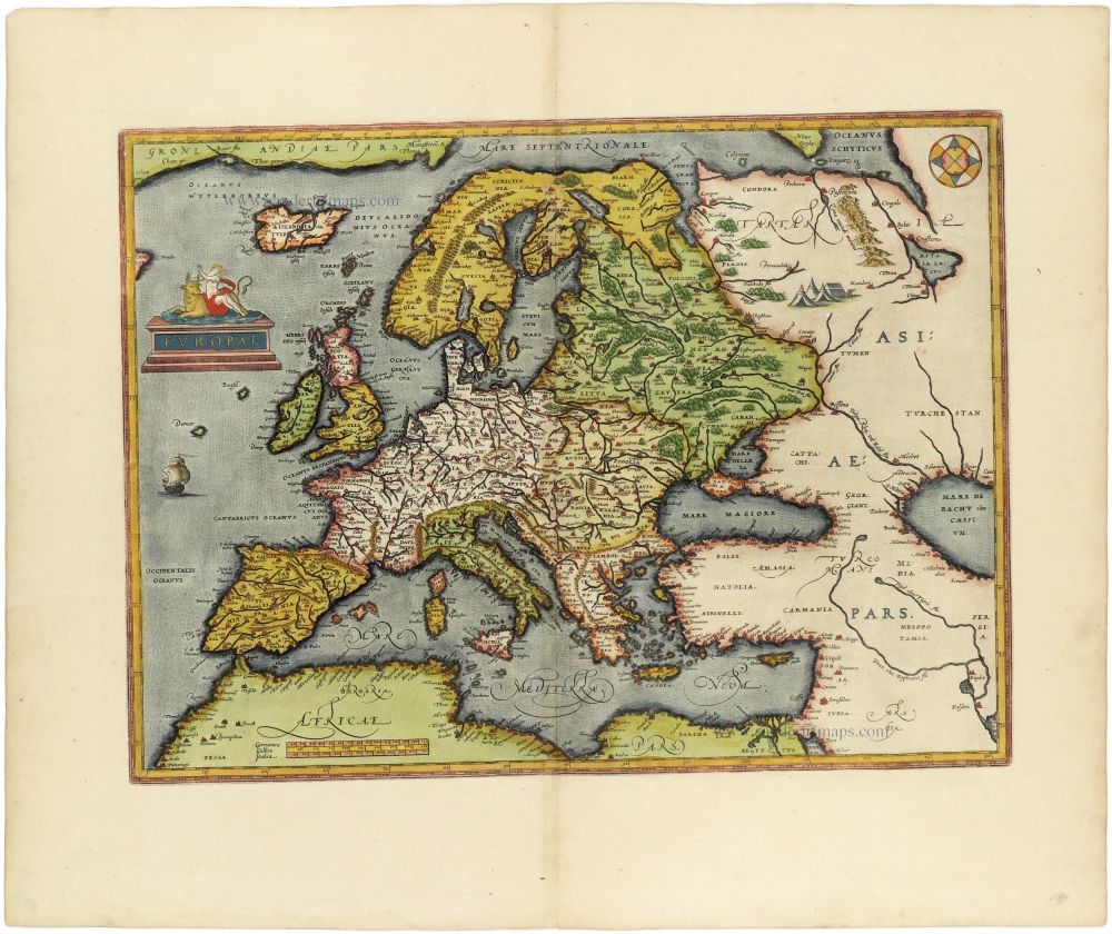
Europae. 1612
Europe, by Abraham Ortelius.
[Item number: 30944]
Rare
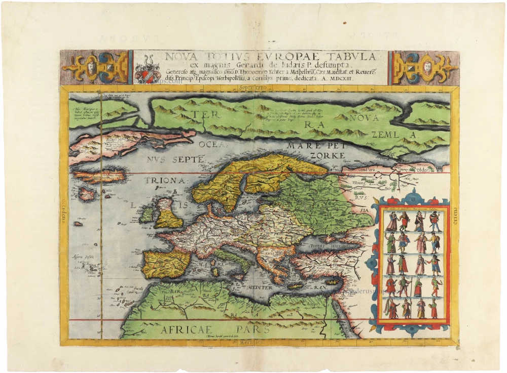
Nova Totius Europae Tabula ex magnis Gerardi de Iudaeis P. desumpta 1593
Europe by Cornelis de Jode
[Item number: 30946]

L'Europe Divisée Suivant l'Estendue de ses Principaux Estats subdivisés en leurs principales Provinces. 1692
Europe, by N. Sanson, so-called published by Hubert Jaillot. (Pirated edition by Pierre Mortier).
[Item number: 31138]