
Rare and important sea chart.
Lucas Janszoon Waghenaer, Zeeland and Flanders. 1586


The Speculum nauticum super navigatione is unique among the printed rutters of the sea in the 16th century because it is the first printed rutter with charts. Further, it outranks any other rutter of its period with its splendid presentation of charts and text; as such, it stood as a model for the folio-size pilot guides with charts in the 17th century. Thanks to the unparalleled skill of the engravers, Baptist and Johannes van Deutecom, the original ms. charts by Waghenaer were transformed into the most beautiful maps of the period. The composition and the adornment have contributed significantly to the splendour of what initially were simple sketch charts; the typography of the Plantijn printing house at Leiden further added to the book's quality. In its concept, the text follows the traditional composition of the 16th-century pilot guides, but the charts form a new element. One remarkable feature is the coastal profiles projected onto the land along the coasts, further elucidated by profiles drawn in the open areas of the charts. There is no evidence that Waghenaer copied his charts from existing sources. Some of them must have been based on his observations, and for the whole of the work, he must have relied on his own rich experience in practical navigation.
Lucas Janszoon Waghenaer (c. 1533 – 1606)
Lucas Janszoon Waghenaer grew up in Enkhuizen, a fishing port in the Netherlands on the Zuiderzee. It is known that around 1570, Waghenaer was already involved in drawing sea charts. The first indication of his cartographic activity was the plan of the town, engraved by Harmen Hansz. Müller of Amsterdam, dated 2 February. 1577.
In 1579, he gave up his career as a maritime pilot and obtained a post in the town. At the same time, he prepared his chartbook. Cutting the plates cost Waghenaer a large sum. He constantly sought loans and had to accept small jobs to help him earn a living. In the wealthy town of Enkhuizen, he was a poor man, seeking support in every direction and trusting in the success of his significant undertaking: the edition of the Spieghel der Zeevaerdt.
In 1583, the first part of the 'Spieghel' went to press in Plantijn's then-recently established printing house in Leiden. He dedicated the work to Prince William of Orange.
On 25 January 1584, he had a formal certificate drawn up before a notary: they attested the charts' reliability and originality in the Spieghel der Zeevaerdt.
Waghenaer continued to work on completing the second volume of the Spieghel. In the meantime, the first volume met with considerable success and was reprinted several times during the first two years. The work was reprinted regularly and was also very popular in England. Waghenaer had already become a famous man.
Soon after his Spieghel appeared, he formulated a plan to publish an improved "Rutter of the Sea'. This was to become the Thresoor der Zeevaerdt of 1592.
In addition to the revenue from his books, he received additional income from the sale of loose portolan charts. In 1580, he was granted a patent for two large charts of the European coasts. One of these portolan charts is the general map from the Spieghel der Zeevaerdt of 1584 and later editions.
In 1592, Jan Huygen van Linschoten settled in the town and wrote the journal of his voyages in Asia, which he published in 1596. In addition, Van Linschoten assisted Waghenaer in compiling another new seaman's guide, the Enchuyser Zeecaertboeck, which contained important information about the coasts of Northern Europe.
In 1598, Waghenaer was appointed as a commission member to develop a method for determining longitude at sea. Unfortunately, he must have been in financial difficulties for the last years of his life. He died in 1606, leaving his widow in dire circumstances.
............................................................................................
The Spieghel der Zeevaerdt or Speculum nauticum super navigatione holds a unique place among the printed rutters of the sea in the 16th century because it is the first printed rutter with charts. Further, it outranks any other rutter of its period with its splendid presentation of charts and text; as such, it stood as a model for the folio-size pilot guides with charts in the 17th century.
However, format and typography needed to be more balanced according to the taste of the practical navigators of that time and Lucas Jansz. Waghenaer returned to the traditional, more modest rutter in the oblong format, The Thresoor der Zeevaert, in 1592.
Thanks to the unparalleled skill of the engravers, Baptist and Johannes van Deutecom, the original ms. charts by Waghenaer were transformed into the most beautiful maps of the period.
The composition and the adornment have contributed significantly to the splendour of what initially were simple sketch charts; the typography of the Plantijn printing house at Leiden further added to the book's quality. In its concept, the text follows the traditional composition of the 16th-century pilot guides, but the charts form a new element. One remarkable feature is the coastal profiles projected onto the land along the coasts, further elucidated by profiles drawn in the charts' open areas. There is no evidence that Waghenaer copied his charts from existing sources. Some of them must have been based on his observations, and for the whole work, he must have relied on his rich experience in practical navigation.
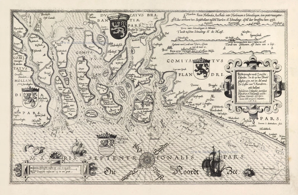
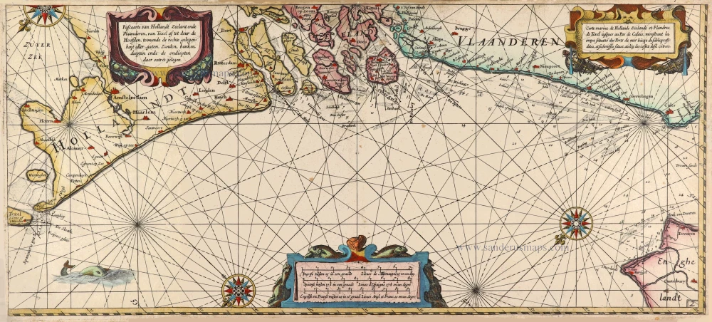
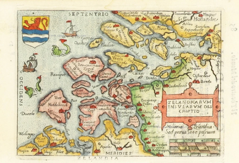
Beschrijvinghe vande Zeeusche Eijlanden Soe die op hare Strome geleghen zijn, met een deel vande Zee Custen van Vlaenderen enn Hollant. - Insularum Zelandiae, partisque Flandriae et Hollandiae accuratißima littoralis descriptio.
Item Number: 28469 Authenticity Guarantee
Category: Antique maps > Europe > Belgium
Old, antique chart of the coasts of Zeeland and Flanders, by Lucas Janszoon Waghenaer.
Title: Beschrijvinghe vande Zeeusche Eijlanden Soe die op hare Strome geleghen zijn, met een deel vande Zee Custen van Vlaenderen enn Hollant. - Insularum Zelandiae, partisque Flandriae et Hollandiae accuratißima littoralis descriptio.
Lucas Ioes aurigarius Inventor.
1583.
Oriented to the southeast.
Engraver: Joannes van Doetecum.
Date of the first edition: 1584.
Date of this map: 1586.
Copper engraving, printed on paper.
Map size: 325 x 515mm (12.8 x 20.28 inches).
Sheet size: 415 x 555mm (16.34 x 21.85 inches).
Verso: Latin text.
Condition: Nice strong impression, excellent.
Condition Rating: A+.
References: Koeman, IV p. 472 3b; TNH Doet3, p. 235 #796 State 2
From: Speculum nauticum super navigatione maris Occidentalis confectum, continens omnes oras maritimas Galliae, Hispaniae et praecipuarum partiu Angliae, ... - Spieghel der Zeevaerdt, vande navigatie der Westersche zee Innehoudende alle de Custen van Franckrijck, Spaignen, en t' principaelste deel van Engelandt, ... Lugduni Batavorum (Leiden), Excudebat typis Plantiniannis Franciscus Raphelengius, pro Luca Ioannis Aurigario. MDLXXXVI (1586). (Koeman IV, Wag5A)
The Speculum nauticum super navigatione is unique among the printed rutters of the sea in the 16th century because it is the first printed rutter with charts. Further, it outranks any other rutter of its period with its splendid presentation of charts and text; as such, it stood as a model for the folio-size pilot guides with charts in the 17th century. Thanks to the unparalleled skill of the engravers, Baptist and Johannes van Deutecom, the original ms. charts by Waghenaer were transformed into the most beautiful maps of the period. The composition and the adornment have contributed significantly to the splendour of what initially were simple sketch charts; the typography of the Plantijn printing house at Leiden further added to the book's quality. In its concept, the text follows the traditional composition of the 16th-century pilot guides, but the charts form a new element. One remarkable feature is the coastal profiles projected onto the land along the coasts, further elucidated by profiles drawn in the open areas of the charts. There is no evidence that Waghenaer copied his charts from existing sources. Some of them must have been based on his observations, and for the whole of the work, he must have relied on his own rich experience in practical navigation.
Lucas Janszoon Waghenaer (c. 1533 – 1606)
Lucas Janszoon Waghenaer grew up in Enkhuizen, a fishing port in the Netherlands on the Zuiderzee. It is known that around 1570, Waghenaer was already involved in drawing sea charts. The first indication of his cartographic activity was the plan of the town, engraved by Harmen Hansz. Müller of Amsterdam, dated 2 February. 1577.
In 1579, he gave up his career as a maritime pilot and obtained a post in the town. At the same time, he prepared his chartbook. Cutting the plates cost Waghenaer a large sum. He constantly sought loans and had to accept small jobs to help him earn a living. In the wealthy town of Enkhuizen, he was a poor man, seeking support in every direction and trusting in the success of his significant undertaking: the edition of the Spieghel der Zeevaerdt.
In 1583, the first part of the 'Spieghel' went to press in Plantijn's then-recently established printing house in Leiden. He dedicated the work to Prince William of Orange.
On 25 January 1584, he had a formal certificate drawn up before a notary: they attested the charts' reliability and originality in the Spieghel der Zeevaerdt.
Waghenaer continued to work on completing the second volume of the Spieghel. In the meantime, the first volume met with considerable success and was reprinted several times during the first two years. The work was reprinted regularly and was also very popular in England. Waghenaer had already become a famous man.
Soon after his Spieghel appeared, he formulated a plan to publish an improved "Rutter of the Sea'. This was to become the Thresoor der Zeevaerdt of 1592.
In addition to the revenue from his books, he received additional income from the sale of loose portolan charts. In 1580, he was granted a patent for two large charts of the European coasts. One of these portolan charts is the general map from the Spieghel der Zeevaerdt of 1584 and later editions.
In 1592, Jan Huygen van Linschoten settled in the town and wrote the journal of his voyages in Asia, which he published in 1596. In addition, Van Linschoten assisted Waghenaer in compiling another new seaman's guide, the Enchuyser Zeecaertboeck, which contained important information about the coasts of Northern Europe.
In 1598, Waghenaer was appointed as a commission member to develop a method for determining longitude at sea. Unfortunately, he must have been in financial difficulties for the last years of his life. He died in 1606, leaving his widow in dire circumstances.
............................................................................................
The Spieghel der Zeevaerdt or Speculum nauticum super navigatione holds a unique place among the printed rutters of the sea in the 16th century because it is the first printed rutter with charts. Further, it outranks any other rutter of its period with its splendid presentation of charts and text; as such, it stood as a model for the folio-size pilot guides with charts in the 17th century.
However, format and typography needed to be more balanced according to the taste of the practical navigators of that time and Lucas Jansz. Waghenaer returned to the traditional, more modest rutter in the oblong format, The Thresoor der Zeevaert, in 1592.
Thanks to the unparalleled skill of the engravers, Baptist and Johannes van Deutecom, the original ms. charts by Waghenaer were transformed into the most beautiful maps of the period.
The composition and the adornment have contributed significantly to the splendour of what initially were simple sketch charts; the typography of the Plantijn printing house at Leiden further added to the book's quality. In its concept, the text follows the traditional composition of the 16th-century pilot guides, but the charts form a new element. One remarkable feature is the coastal profiles projected onto the land along the coasts, further elucidated by profiles drawn in the charts' open areas. There is no evidence that Waghenaer copied his charts from existing sources. Some of them must have been based on his observations, and for the whole work, he must have relied on his rich experience in practical navigation.
Related items
Paskaert van de Zeeusche en Vlaemsche Kusten, tonende Alle Drooghten, Diepten, en Ondiepten, tusschen t'Eylandt Schouwen en de Hoofden, Curieuselyck Beschreven door Dirck Davidsz 1667
Sea chart of Flanders (Vlaanderen) & Zeeland, by Pieter Goos.
[Item number: 19054]
Spectacular 'Romain de Hooghe' map
Carte Nouvelle des Costes de Hollande, Zeelande, Flandre, Picardie, & Normandie ... Chez Pierre Mortier, 1693. 1700
Sea chart of the Channel - Flanders (Vlaanderen) - Zeeland, by Pieter Mortier.
[Item number: 27176]

Flandria et Zeelandia Comitatus. 1640-43
Flanders (Vlaanderen) and Zeeland, by Willem Blaeu.
[Item number: 27409]
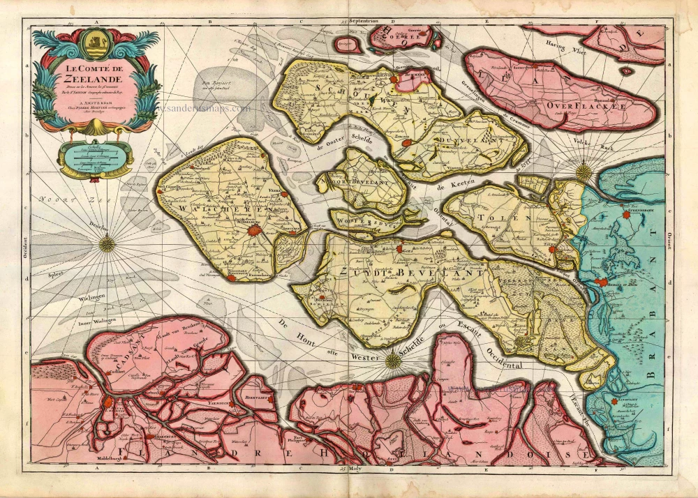
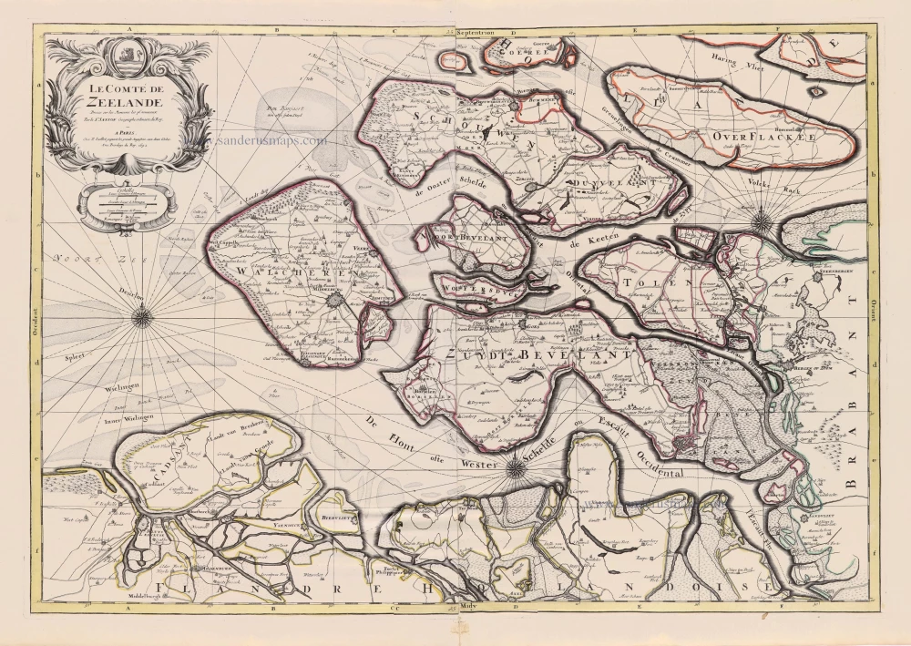
Le Comté de Zeelande. c. 1705
Zeeland, by Pieter Mortier.
[Item number: 27806]
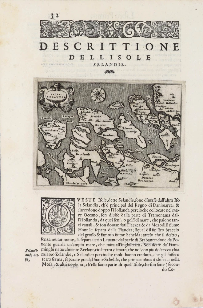
Isole Selandia - [Above map :] Descrittione dell'Isole Selandie. 1590
Zeeland, by Thomaso Porcacchi.
[Item number: 29759]
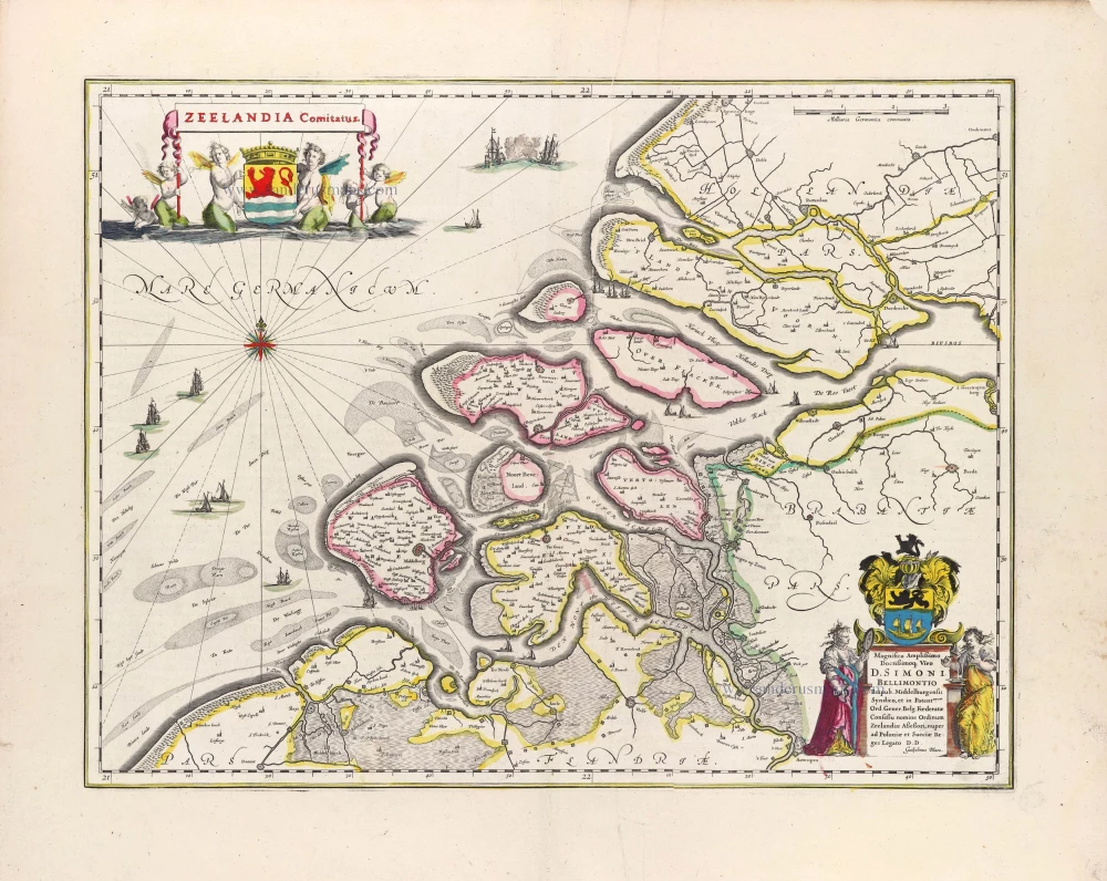
Zeelandia Comitatus. 1643
Zeeland, by W. Blaeu.
[Item number: 29937]
Rare sea chart of the Netherlands.
Pascaarte van Hollandt Zeelandt ende Vlaanderen, van Texel af tot deur de Hoofden, toonende de rechte gelegenheijt aller gaten, Zanden, banken, diepten ende de ondiepten daer ontret gelegen. - Carte Marine de Hollande Zeelande et Flandres, ... 1620-1634
Willem Blaeu, pirate edition by Joannes Janssonius.
[Item number: 30058]
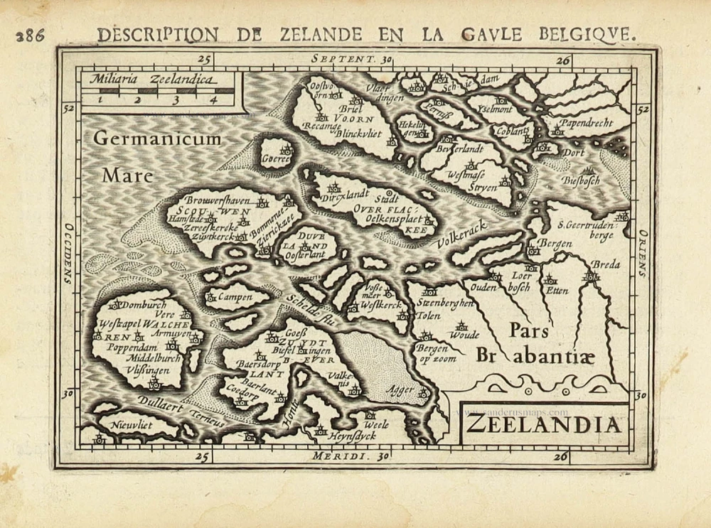
Zelandicarum Insularum Descriptio. 1598
Zeeland by Abraham Ortelius.
[Item number: 30236]
[No title - With inset view of the town of Middelburg:] Middelburgum. [Costumed figures:] Seelandi c. 1630-1650
Zeeland by Petrus Kaerius, published by C.J. Visscher.
[Item number: 30935]
Early edition
Zelandicarum Insularum exactissima et nova descriptio, 1573
Zeeland by Abraham Ortelius.
[Item number: 30967]
Very rare!
[No title] c. 1630-1635
Four atlas maps by Henricus Hondius, adapted to form a wall map of Flanders.
[Item number: 31002]

Early map of the Low Countries, 1561-1574
Fiandra, Brabantia, et Holanda Nuova. 1574
Low Countries by Girolamo Ruscelli.
[Item number: 31083]
Le Comté de Zeelande. 1692
Zeeland by N. Sanson, so-called published by Hubert Jaillot. (Pirated edition by Pierre Mortier).
[Item number: 31343]
Zeelandia. 1618
Zeeland by Petrus Bertius, published by Jodocus Hondius II.
[Item number: 31590]

Carte de Zeland. 1633
Zeeland by Christophe Tassin.
[Item number: 31929]

Comté de Flandres. 1633
Flanders (Vlaanderen) by Christophe Tassin.
[Item number: 31933]

Beautiful copy of this important map
Flandria. 1584
Flanders (Vlaanderen), by Abraham Ortelius.
[Item number: 32394]
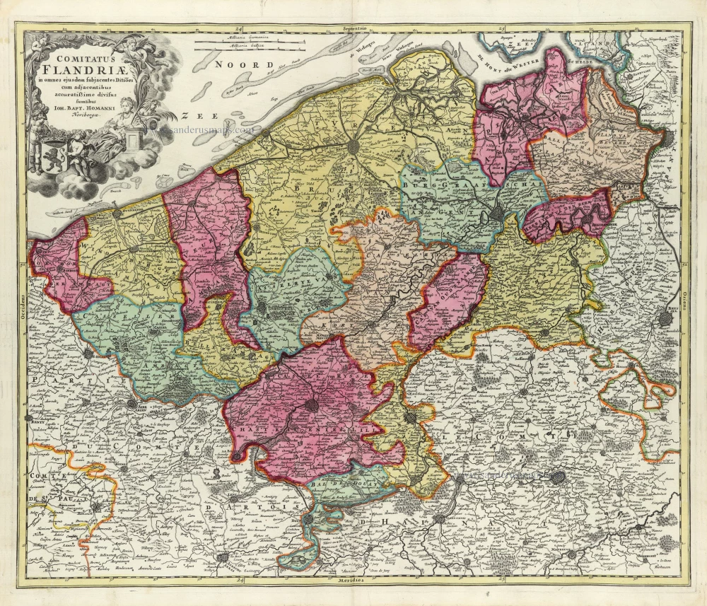
Comitatus Flandriae in omnes ejusdem subjacentes Ditioescum adjacentibus accuratissime divisus. c. 1720
Flanders (Vlaanderen), by J.B. Homann.
[Item number: 32398]
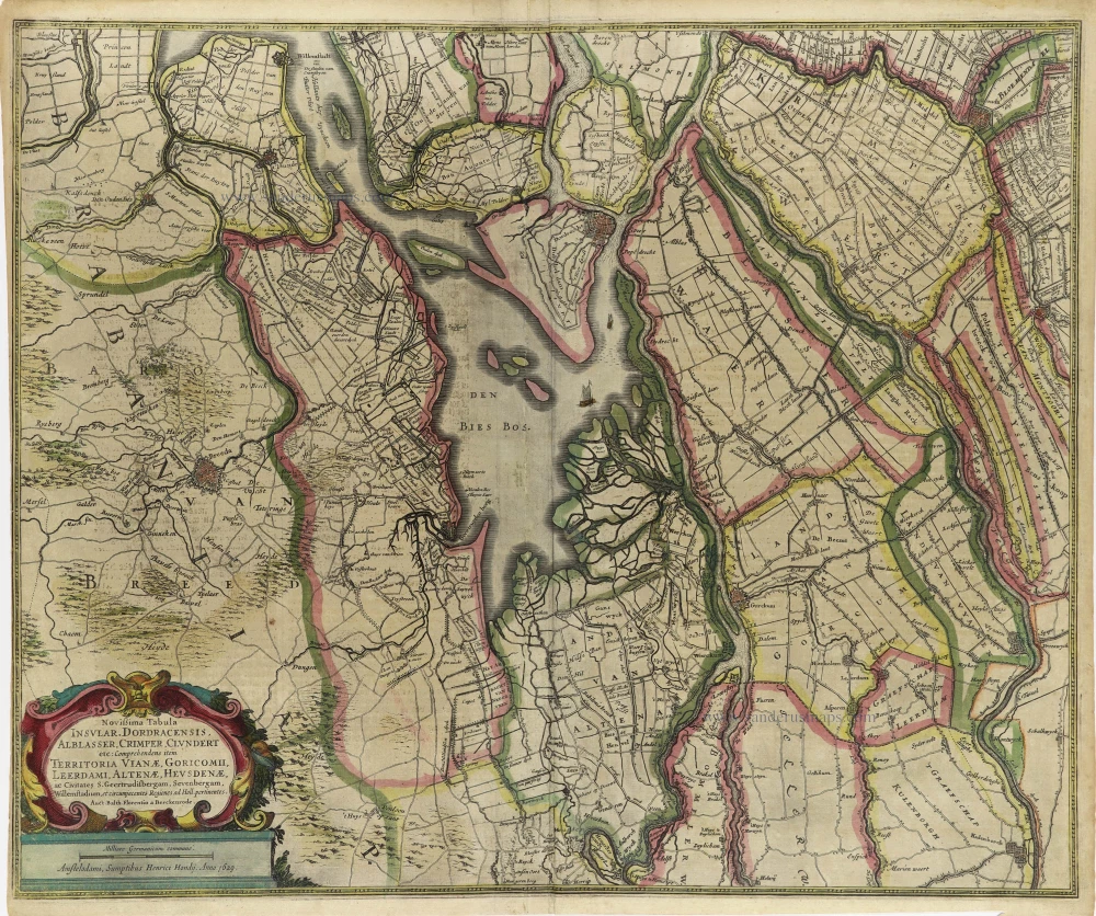
Novißima Tabula Insular. Dordracensis, Alblasser, Crimper, Clundert etc: Comprehens item Territoria Vianae, Goricomii, Leerdami, Altenae, Heusdenae, ac Civitates ... 1638
Holland (Southeast), by Henricus Hondius.
[Item number: 32446]

RARE
De Cust van Vlaenderen Beginnende vande Wielingen tot aen de Hoofden met alle haer sanden en droogten. 1644
Chart by Anthonie Jacobsz, the Flemish coast.
[Item number: 32608]
new

Pas Caerte van Texel, tot aende Hoofden; Begrypende in sich de Zee-custen van Vries-land, Holland, Zeeland, Flaenderen; ende Oost-cust van Engeland. 1680-1694
Chart of the Southern North Sea, by Joannes Van Keulen
[Item number: 32628]
new