
Very rare!
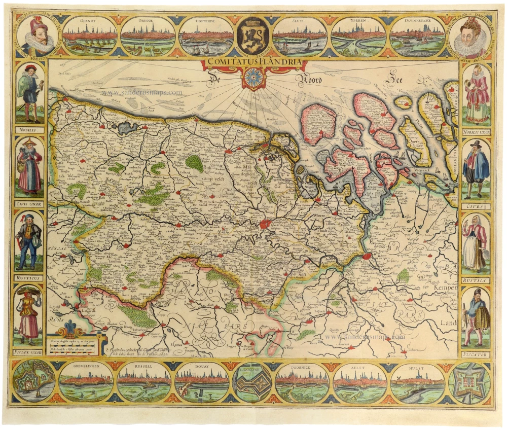
Four atlas maps by Henricus Hondius, adapted to form a wall map of Flanders. c. 1630-1635

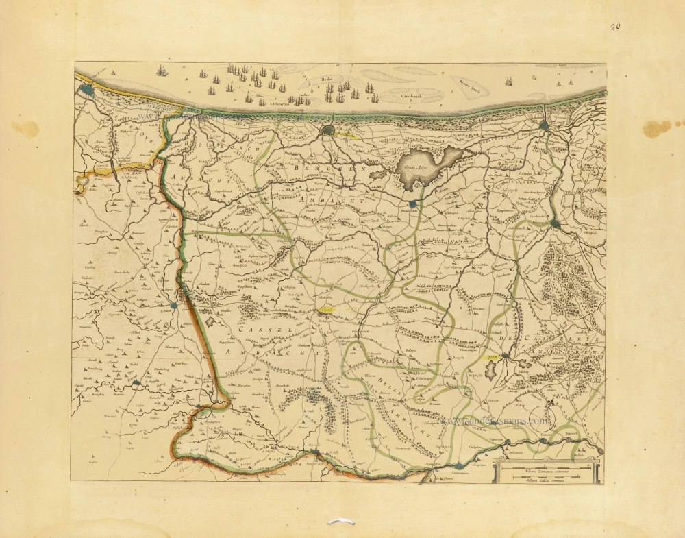


Schilder: There is no copy of the wall map published in Amsterdam, but it can be reconstructed. ... Hondius made convenient use of copperplates, which had also been used for the atlas edition. He took an efficient and cost-conscious approach to the publication of his wall map, as closer study shows that the core area of the wall map of Flanders use was made of copperplates, which had also been used for four sheets in Henricus Hondius's French-language atlas of 1633. Fine hairlines were drawn on the atlas sheets to indicate where the maps were to be cut or overlapped for the wall map. To obtain a rectangular format for the wall map as a whole, the unequally sized core sheets had to be filled out with freshly engraved sections. The following atlas sheets were used:
(1) Flandriae Pars Occidentalis. The area from Calais to the north of Nieuwpoort. 11.3 cm had to be cut off the lower margin as far as the latitude of Ieper.
(2) Pars Flandriae orientalis. The area from Nieuwpoort to Middelburg on Walcheren. Cutting 6.4 cm from the left margin and 5 cm from the lower margin enables this sheet to be fitted to the map sheet above.
(3) Flandria Gallica. The area between Ieper and Douai. 8 cm had to be cut off the left margin, so the cartouche disappeared.
(4) [untitled] Area bounded by Gent, Antwerp, Leuven and Oudenaarde towns.
This sheet adjoins the previous map sheet in the west.
These four map sheets were assembled to produce a map covering the whole core area of the county of Flanders. Only three small fragments were missing for the completion of the wall map: a large title or dedication cartouche in the lower left corner with a portion of Artois in the background (5); the area around the Western and Eastern Scheldt had to be added in the upper right corner to obtain the rectangular format of the wall map (6); and a narrow strip of the North Sea had to be added along the margin of the upper left sheet (7) so that it could match up with the second map sheet. Lastly, a little strip could be mounted along the upper margin of the map to round off the entire picture.
With the aid of this assemblage, we may conclude that Henricus Hondius had a wall map of Flanders on sale in 1633 (or earlier).
The Hondius Family
Jodocus Hondius the Elder (1563-1612)
Joost d’Hondt was born at Wakken (Flanders) in 1563. Two years later, his family settled in Ghent, where young Joost displayed an excellent gift for drawing and calligraphy. Through study and lessons, he developed his talents and became an engraver with a good reputation.
Due to the circumstances of the war, he moved to London in 1584, where he settled down as an engraver, instrument-maker, and map-maker. In 1587, he married Coletta van den Keere, sister of the well-known engraver Pieter van den Keere (Petrus Kaerius); some years earlier, his sister, Jacomina, had married Pieter van den Berghe (Petrus Montanus). Joost, who had Latinized his name to Jodocus Hondius, closely co-operated with his two brothers-in-law.
The political situation in the Northern Netherlands in 1593 was such that Jodocus seemed justified in establishing himself in Amsterdam, where many Antwerp printers, publishers, and engravers had gone. In this new centre of cartography, Jodocus Hondius set up his business “In de Wackere Hondt” (in the vigilant dog), this name being an allusion to his birthplace and name. He engraved many maps and published atlases and many other works, such as his continuation of Gerard Mercator’s Atlas.
He suddenly passed away in February 1612. The publishing firm of Jodocus Hondius was continued by his widow, later on, by his two sons, Jodocus Jr. and Henricus, and by his son-in-law, J. Janssonius.
Jodocus Hondius II (1594-1629) & Henricus Hondius (1597-1651)
After the father’s death, the widow and her seven children continued publishing the atlases under the name of Jodocus Hondius till 1620. The firm was reinforced by the very welcome help of Joannes Janssonius (1588-1664), who married 24-year-old Elisabeth Hondius in 1612. After 1619, Mercator’s Atlas was published under the name of Henricus Hondius.
One of the most dramatic events in the early history of commercial cartography in Amsterdam was the sale of Jodocus Hondius Jr.’s copper plates to Willem Jansz. Blaeu in 1629, the year of his death. At least 34 plates, from which Jodocus II had printed single-sheet maps for his benefit, passed into the hands of his great competitor. Immediately after that, his brother, Henricus, and Joannes Janssonius ordered the engraving of identical plates.
Henricus devoted all his energy to publishing the Atlas for an extended period. He saw its growth up to and including the fourth part in 1646; after that, his name no longer figures on the title pages. After 1638, the title of the Atlas was changed to Atlas Novus; Joannes Janssonius mainly carried it on.
The competition with the Blaeu's dates from 1630. In 1630, Willem Janszoon (=Blaeu) first attacked with his Atlantis Appendix. In 1635, Blaeu completed his Theatrum Orbis Terrarum in two volumes with French, Latin, Dutch, and German texts, prompting Henricus Hondius to speed up the enlargement of his Atlas.
[No title]
Item Number: 31002 Authenticity Guarantee
Category: Antique maps > Europe > Belgium
Four atlas maps by Henricus Hondius, adapted to form a wall map of Flanders.
[No title] - Cartouches erased.
Date: c. 1630-1635.
Copper engravings, printed on paper.
Image size each: 380-400 x 490-500mm (15 x 19.5 inches).
Sheet size each: 510 x 690mm (20 x 27 inches).
Verso: Blank.
Condition: Original coloured in outline, printed on thick paper, excellent.
Condition Rating: A+.
Separate publication - from a French Composite Atlas, c. 1630-1650.
Schilder: There is no copy of the wall map published in Amsterdam, but it can be reconstructed. ... Hondius made convenient use of copperplates, which had also been used for the atlas edition. He took an efficient and cost-conscious approach to the publication of his wall map, as closer study shows that the core area of the wall map of Flanders use was made of copperplates, which had also been used for four sheets in Henricus Hondius's French-language atlas of 1633. Fine hairlines were drawn on the atlas sheets to indicate where the maps were to be cut or overlapped for the wall map. To obtain a rectangular format for the wall map as a whole, the unequally sized core sheets had to be filled out with freshly engraved sections. The following atlas sheets were used:
(1) Flandriae Pars Occidentalis. The area from Calais to the north of Nieuwpoort. 11.3 cm had to be cut off the lower margin as far as the latitude of Ieper.
(2) Pars Flandriae orientalis. The area from Nieuwpoort to Middelburg on Walcheren. Cutting 6.4 cm from the left margin and 5 cm from the lower margin enables this sheet to be fitted to the map sheet above.
(3) Flandria Gallica. The area between Ieper and Douai. 8 cm had to be cut off the left margin, so the cartouche disappeared.
(4) [untitled] Area bounded by Gent, Antwerp, Leuven and Oudenaarde towns.
This sheet adjoins the previous map sheet in the west.
These four map sheets were assembled to produce a map covering the whole core area of the county of Flanders. Only three small fragments were missing for the completion of the wall map: a large title or dedication cartouche in the lower left corner with a portion of Artois in the background (5); the area around the Western and Eastern Scheldt had to be added in the upper right corner to obtain the rectangular format of the wall map (6); and a narrow strip of the North Sea had to be added along the margin of the upper left sheet (7) so that it could match up with the second map sheet. Lastly, a little strip could be mounted along the upper margin of the map to round off the entire picture.
With the aid of this assemblage, we may conclude that Henricus Hondius had a wall map of Flanders on sale in 1633 (or earlier).
The Hondius Family
Jodocus Hondius the Elder (1563-1612)
Joost d’Hondt was born at Wakken (Flanders) in 1563. Two years later, his family settled in Ghent, where young Joost displayed an excellent gift for drawing and calligraphy. Through study and lessons, he developed his talents and became an engraver with a good reputation.
Due to the circumstances of the war, he moved to London in 1584, where he settled down as an engraver, instrument-maker, and map-maker. In 1587, he married Coletta van den Keere, sister of the well-known engraver Pieter van den Keere (Petrus Kaerius); some years earlier, his sister, Jacomina, had married Pieter van den Berghe (Petrus Montanus). Joost, who had Latinized his name to Jodocus Hondius, closely co-operated with his two brothers-in-law.
The political situation in the Northern Netherlands in 1593 was such that Jodocus seemed justified in establishing himself in Amsterdam, where many Antwerp printers, publishers, and engravers had gone. In this new centre of cartography, Jodocus Hondius set up his business “In de Wackere Hondt” (in the vigilant dog), this name being an allusion to his birthplace and name. He engraved many maps and published atlases and many other works, such as his continuation of Gerard Mercator’s Atlas.
He suddenly passed away in February 1612. The publishing firm of Jodocus Hondius was continued by his widow, later on, by his two sons, Jodocus Jr. and Henricus, and by his son-in-law, J. Janssonius.
Jodocus Hondius II (1594-1629) & Henricus Hondius (1597-1651)
After the father’s death, the widow and her seven children continued publishing the atlases under the name of Jodocus Hondius till 1620. The firm was reinforced by the very welcome help of Joannes Janssonius (1588-1664), who married 24-year-old Elisabeth Hondius in 1612. After 1619, Mercator’s Atlas was published under the name of Henricus Hondius.
One of the most dramatic events in the early history of commercial cartography in Amsterdam was the sale of Jodocus Hondius Jr.’s copper plates to Willem Jansz. Blaeu in 1629, the year of his death. At least 34 plates, from which Jodocus II had printed single-sheet maps for his benefit, passed into the hands of his great competitor. Immediately after that, his brother, Henricus, and Joannes Janssonius ordered the engraving of identical plates.
Henricus devoted all his energy to publishing the Atlas for an extended period. He saw its growth up to and including the fourth part in 1646; after that, his name no longer figures on the title pages. After 1638, the title of the Atlas was changed to Atlas Novus; Joannes Janssonius mainly carried it on.
The competition with the Blaeu's dates from 1630. In 1630, Willem Janszoon (=Blaeu) first attacked with his Atlantis Appendix. In 1635, Blaeu completed his Theatrum Orbis Terrarum in two volumes with French, Latin, Dutch, and German texts, prompting Henricus Hondius to speed up the enlargement of his Atlas.
Related items
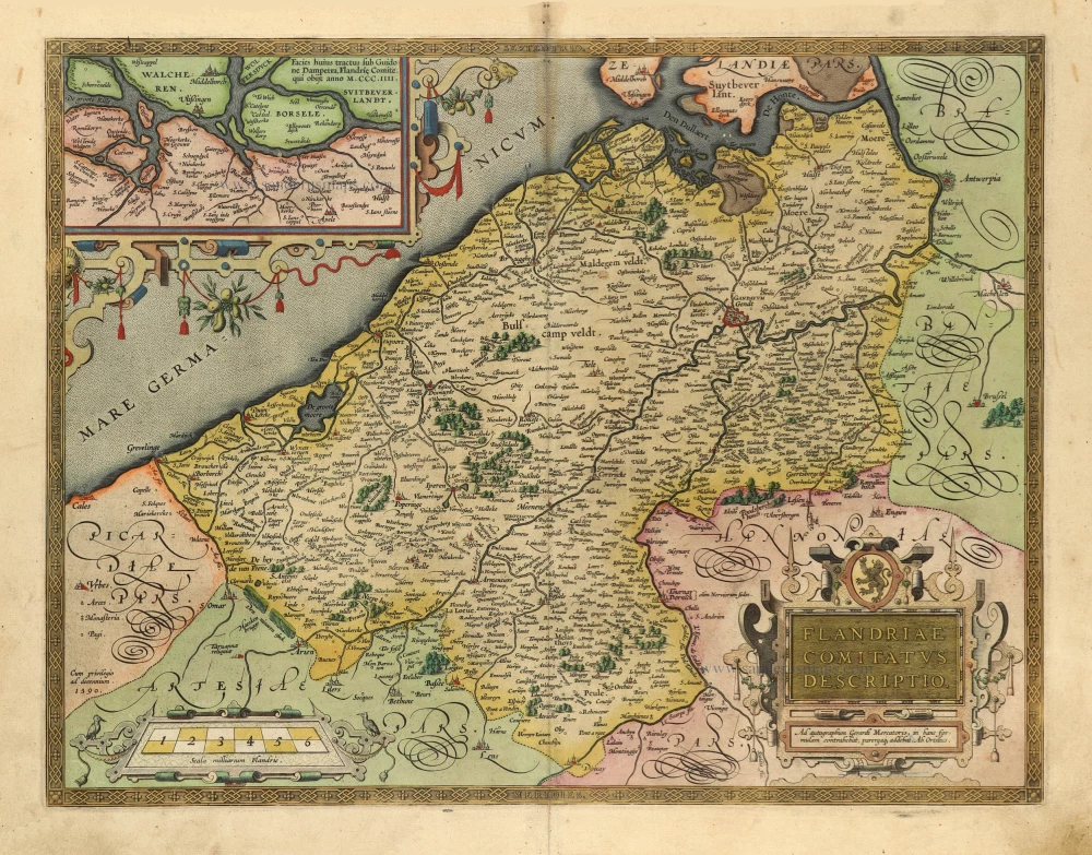
Flandriae Comitatus Descriptio. 1601
Vlaanderen by Abraham Ortelius
[Item number: 5767]

Flandriae Comitatus Pars Septentrionalis, comprehendens Franconatum Brugensem et ejusdem subjacentia Territoria. 1683-1696
Western Flanders (West Vlaanderen) by N. Visscher II.
[Item number: 13092]

[No title] 1633 (or earlier)
French Flanders (Frans Vlaanderen) by Henricus Hondius.
[Item number: 22635]

Flandriae Comitatus Descriptio. 1612
Flanders (Vlaanderen) by Abraham Ortelius.
[Item number: 22978]

Exactissima Flandriae descriptio. Flandria, Caroli V. Aug. Imp. max. natione illustrissima, Belgice provinciae est . . . . Ad signum Bibliothecae Diui Marci. Dominicus Zenoi Venetus excidebat. Venetijs M.D.M.VIIII. 1559
Flanders (Vlaanderen) by Domenico Zenoi.
[Item number: 25774]

Carte du Comté de Flandre. 1713
Flanders, by Pieter Van der Aa.
[Item number: 26053]

Flandriae Pars Occidentalis continens ... 1641
Western Flanders (West Vlaanderen), by Henricus Hondius.
[Item number: 26319]

Comitatus Flandria. 1637
Flanders (Vlaanderen), by Pieter Verbiest.
[Item number: 27128]

Spectacular 'Romain de Hooghe' map
Carte Nouvelle des Costes de Hollande, Zeelande, Flandre, Picardie, & Normandie ... Chez Pierre Mortier, 1693. 1700
Sea chart of the Channel - Flanders (Vlaanderen) - Zeeland, by Pieter Mortier.
[Item number: 27176]

Flandria et Zeelandia Comitatus. 1640-43
Flanders (Vlaanderen) and Zeeland, by Willem Blaeu.
[Item number: 27409]

EXTREMELY RARE FLANDERS MAP BY PIETER VERBIEST
Comitatus Flandria. 1630
Vlaanderen (Flanders), by Pieter Verbiest.
[Item number: 28002]

Le Comté de Flandre divisé en ses Chastellenies, et Balliages, &c. Le Franc de Bruges et Le Pays de Waes. c. 1705
Flanders (Vlaanderen), by Pieter Mortier.
[Item number: 28129]

Celeberrimi Flandriae Comitatus Typus. 1617
Flanders (Vlaanderen) by Petrus Kaerius (Pieter Van den Keere).
[Item number: 28453]

Flandriae Partes duae, quarum altera Proprietaria, altera Imperialis vulgo dicitur. 1656-80
Imperial Flanders (Oost-Vlaanderen) by Johannes Janssonius.
[Item number: 28618]

Morini, Gorduni, et Pleumosij in Morinis. - Les Eveschés de St Omer, Ipres, et Tournay. - Partie Occidentale du Comté de Flandre ou sont la Flandre Walone, et les Quartiers du Plat Pays du Franc(nat), et d'Ipres; dans la Flandre Teutone. 1679-1710
Historical map of French Flanders, by Guillaume Sanson.
[Item number: 29170]

Fiandra Parte Occidentale, 1696
West Flanders, by Vincenzo Coronelli.
[Item number: 29223]
Rare.
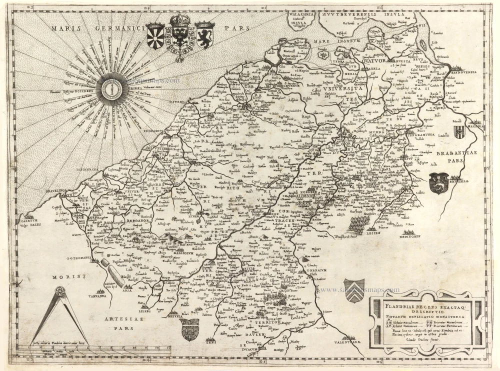
Flandriae recens exactaq descriptio. c. 1570
Flanders, by Claudio Duchetti, after Gerard Mercator.
[Item number: 29729]
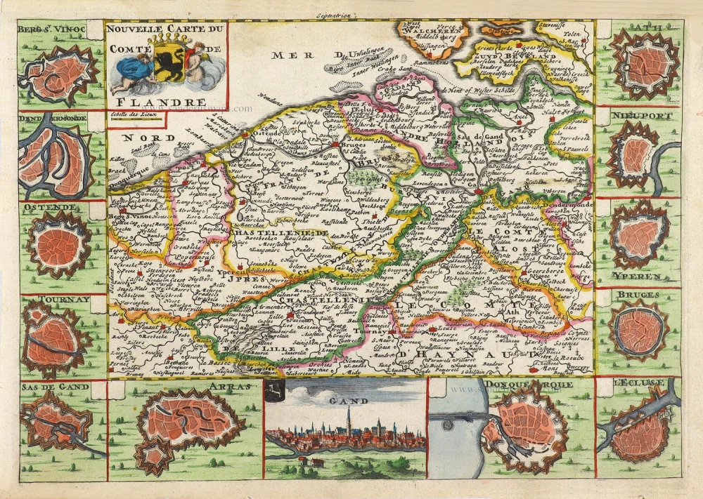
Nouvelle Carte du Comté de Flandre. 1706
Flanders (Vlaanderen) by Daniel De la Feuille.
[Item number: 29889]

Pars Flandriae Teutonicae Occidentalior. 1643
Western Flanders (West Vlaanderen), by Willem & Joan Blaeu.
[Item number: 29934]

Flandriae Partes duae, quarum altera Proprietata altera Imperialis vulgo dicitur. 1643
Keizerlijk Vlaanderen of Oost Vlaanderen (Imperial Flanders or Eastern Flanders), by Willem Blaeu.
[Item number: 29935]

Flandriae Comitatus Accuratissima Descriptio. c. 1658
Flanders (Vlaanderen) by Nicolaas Visscher I.
[Item number: 29980]

Rare
Exactissima Flandriae Descriptio. 1593
Flanders (Vlaanderen), by Gerard de Jode.
[Item number: 30309]
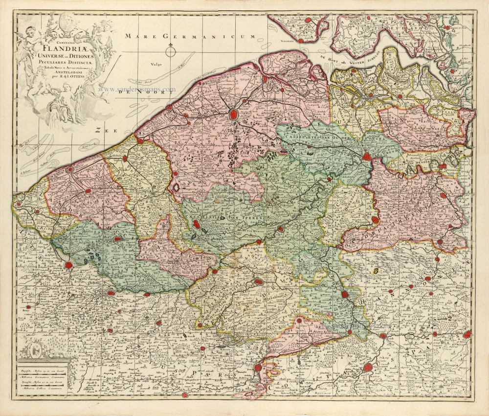
Comitatus Flandriae Universe in Ditiones Peculiares Distinctae. 1730-45
Flanders (Vlaanderen) by Ottens R. & J.
[Item number: 30524]

Comté de Flandres. 1633
Flanders (Vlaanderen) by Christophe Tassin.
[Item number: 31933]

Beautiful copy of this important map
Flandria. 1584
Flanders (Vlaanderen), by Abraham Ortelius.
[Item number: 32394]

Comitatus Flandriae in omnes ejusdem subjacentes Ditioescum adjacentibus accuratissime divisus. c. 1720
Flanders (Vlaanderen), by J.B. Homann.
[Item number: 32398]
The most beautiful 17th-century map of Flanders, with four decorative borders.
Comitatus Flandriae. 1652
Vlaanderen by C.J. Visscher.
[Item number: 33151]
new