
Flanders (Vlaanderen) by Lodovico Guicciardini. 1612
Lodovico Guicciardini (1521-1589)
Lodovico Guicciardini, an Italian writer and merchant from Florence, arrived in Antwerp in 1541 and lived there until he died in 1589.
His best-known work, the Descrittione di tutti I Paesi Bassi, was published in 1567 by the Antwerp publisher Willem Silvius. It was an influential account of the history and arts of the Low Countries, accompanied by city maps by various leading engravers. It was a great success right from the start, and many editions, translations, extracts, and adaptations have been released to this day. Although he experienced relative prosperity during certain periods, he ended his life in poverty.
In the first edition of the three original Italian publications of the Descrittione, Guicciardini describes the happy and prosperous Netherlands before the uprising against Spain. Only in the third Italian edition of 1588, published by Plantijn in Antwerp, does he show how the state of the country has gradually changed as a result of the war. This was the last edition published in Antwerp. In 1589 both Plantin and Guicciardini died. It would take until 1609 before a new edition was published in the northern Netherlands.
As new editions appeared, the number of illustrations increased, and several prints were replaced by new ones. The first four editions were mainly provided with woodcuts, the majority of which concerned the Southern Netherlands. In the later editions, only copper plates were used for an increasing number of engravings of cities and regions of the entire Netherlands. The work appeared in folio, oblong and duodecimo editions.
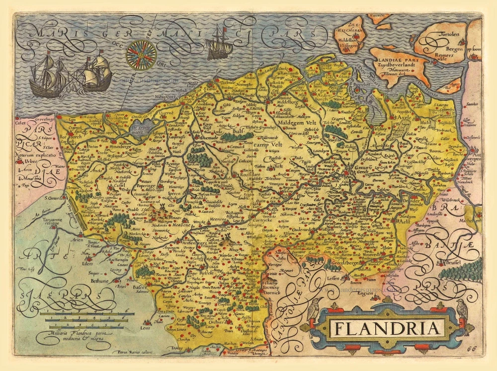
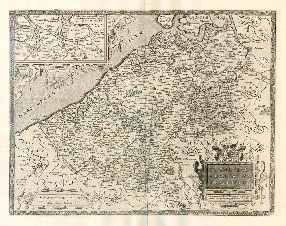
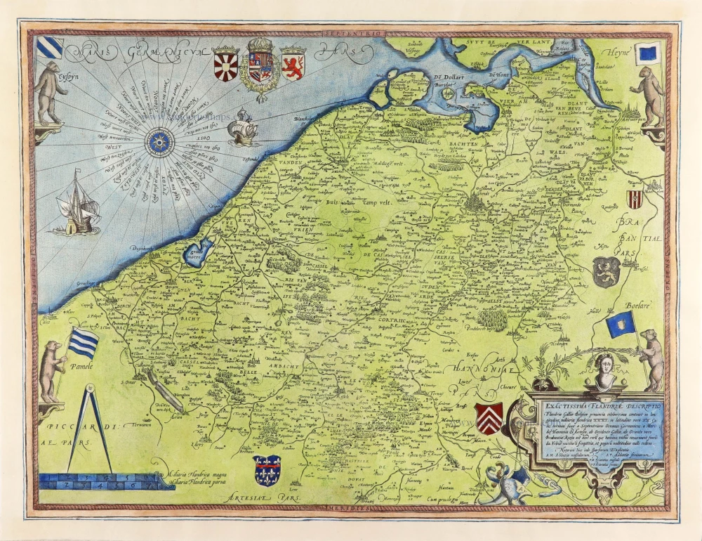
Flandria.
Item Number: 18166 Authenticity Guarantee
Category: Antique maps > Europe > Belgium
Old, antique map of Flanders (Vlaanderen), by Lodovico Guicciardini.
Title: Flandria.
Petrus Kaerius caelavit.
Oriented to the northwest.
Date of the first edition: 1609.
Date of this map: 1612.
Copper engraving, printed on paper.
Size (not including margins): 230 x 310mm (9.06 x 12.2 inches).
Verso: Blank.
Condition: Hand coloured, excellent.
Condition Rating: A+.
References: Guic. Ill., Vlaanderen-4.1
From: Guiciardini L. Beschryvinghe van alle de Nederlanden; anderssins ghenoemt Neder-Duytslandt. Amsterdam, Willem Jansz. [= Willem Blaeu], 1612.
Lodovico Guicciardini (1521-1589)
Lodovico Guicciardini, an Italian writer and merchant from Florence, arrived in Antwerp in 1541 and lived there until he died in 1589.
His best-known work, the Descrittione di tutti I Paesi Bassi, was published in 1567 by the Antwerp publisher Willem Silvius. It was an influential account of the history and arts of the Low Countries, accompanied by city maps by various leading engravers. It was a great success right from the start, and many editions, translations, extracts, and adaptations have been released to this day. Although he experienced relative prosperity during certain periods, he ended his life in poverty.
In the first edition of the three original Italian publications of the Descrittione, Guicciardini describes the happy and prosperous Netherlands before the uprising against Spain. Only in the third Italian edition of 1588, published by Plantijn in Antwerp, does he show how the state of the country has gradually changed as a result of the war. This was the last edition published in Antwerp. In 1589 both Plantin and Guicciardini died. It would take until 1609 before a new edition was published in the northern Netherlands.
As new editions appeared, the number of illustrations increased, and several prints were replaced by new ones. The first four editions were mainly provided with woodcuts, the majority of which concerned the Southern Netherlands. In the later editions, only copper plates were used for an increasing number of engravings of cities and regions of the entire Netherlands. The work appeared in folio, oblong and duodecimo editions.
Related items
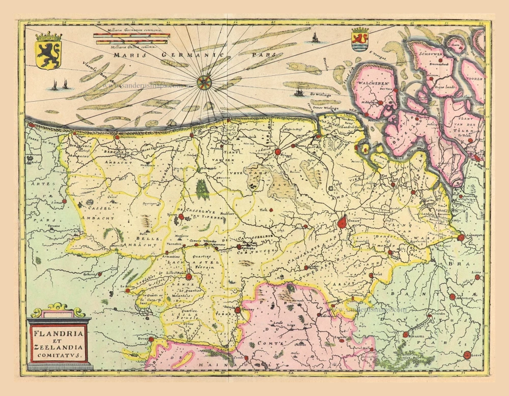
Flandria et Zeelandia Comitatus. 1659
Flanders (Vlaanderen) - Zeeland by Matthäus Merian & Martin Zeiller
[Item number: 12253]
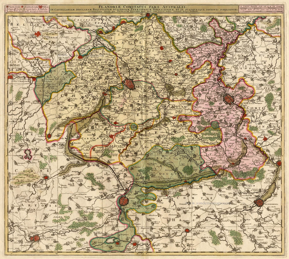
Flandriae Comitatus Pars Australis. 1683-1696
Vlaanderen - Flandres, by Visscher N.
[Item number: 18686]
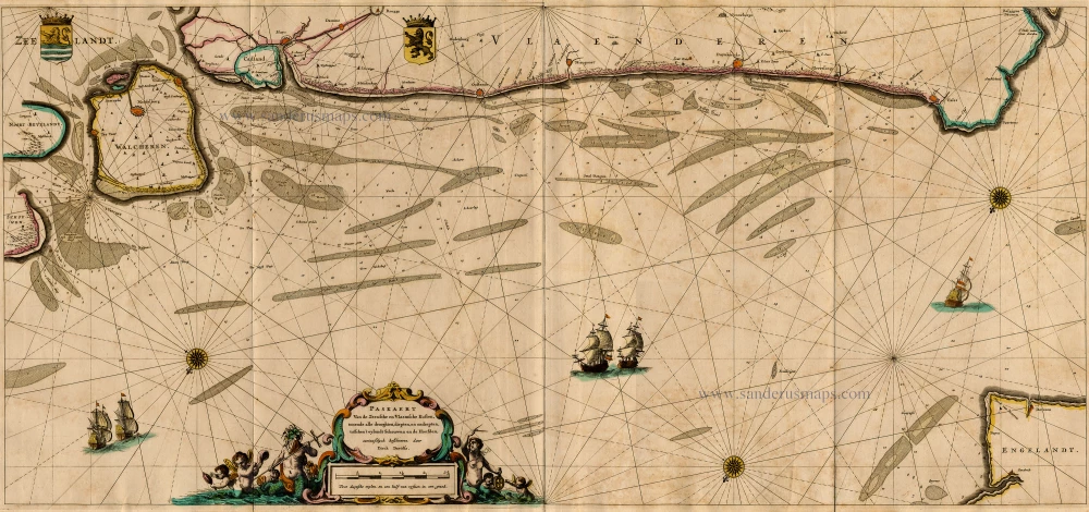
Paskaert van de Zeeusche en Vlaemsche Kusten, tonende Alle Drooghten, Diepten, en Ondiepten, tusschen t'Eylandt Schouwen en de Hoofden, Curieuselyck Beschreven door Dirck Davidsz 1667
Sea chart of Flanders (Vlaanderen) & Zeeland, by Pieter Goos.
[Item number: 19054]
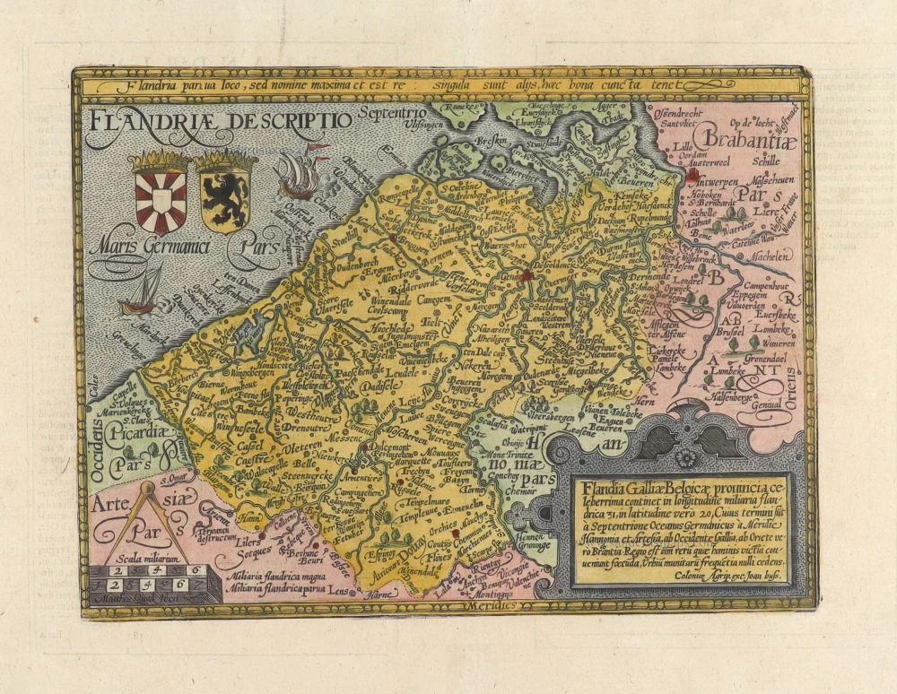
Flandriae Comitatus Descriptio. 1612
Flanders (Vlaanderen) by Abraham Ortelius.
[Item number: 22978]
Exactissima Flandriae descriptio. Flandria, Caroli V. Aug. Imp. max. natione illustrissima, Belgice provinciae est . . . . Ad signum Bibliothecae Diui Marci. Dominicus Zenoi Venetus excidebat. Venetijs M.D.M.VIIII. 1559
Flanders (Vlaanderen) by Domenico Zenoi.
[Item number: 25774]
Comitatus Flandria. 1637
Flanders (Vlaanderen), by Pieter Verbiest.
[Item number: 27128]

Flandria et Zeelandia Comitatus. 1640-43
Flanders (Vlaanderen) and Zeeland, by Willem Blaeu.
[Item number: 27409]
Flandriae Descriptio. 1600
Flanders (Vlaanderen) by Quad M.-Bussemacher J.
[Item number: 27470]
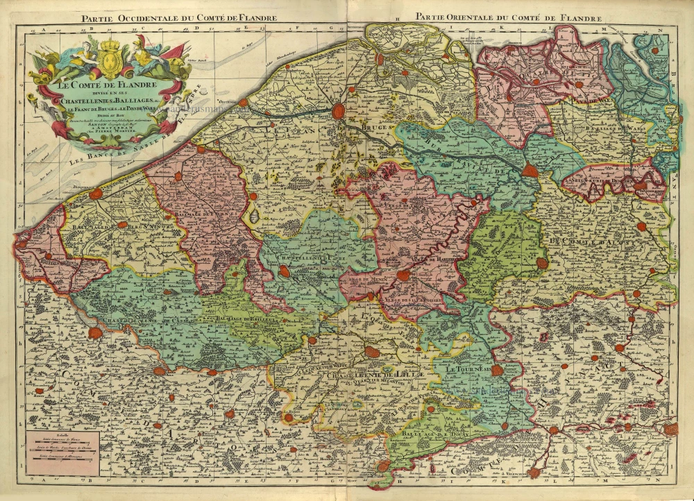
Le Comté de Flandre divisé en ses Chastellenies, et Balliages, &c. Le Franc de Bruges et Le Pays de Waes. c. 1705
Flanders (Vlaanderen), by Pieter Mortier.
[Item number: 28129]
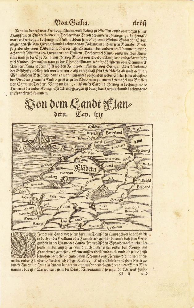
Flàdern. [Above map:] Von dem Landt Flandern. 1550
Flanders (Vlaanderen) by Sebastian Münster.
[Item number: 28922]
Rare.
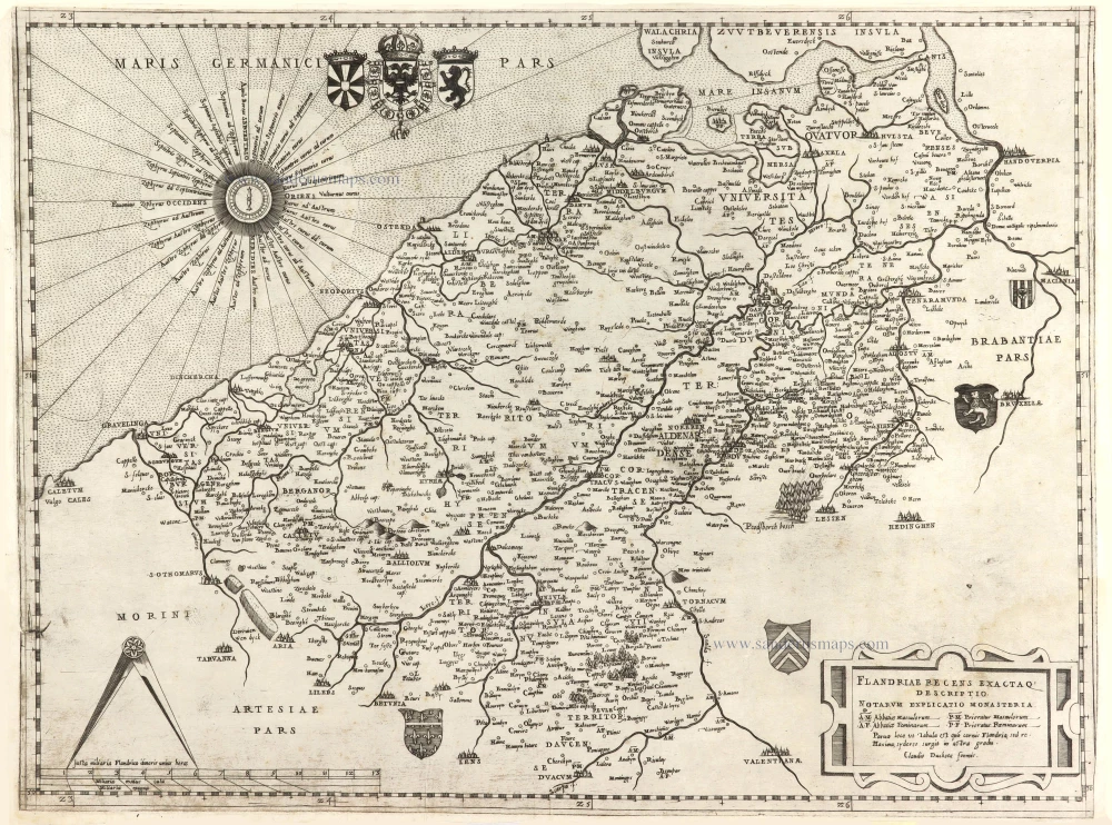
Flandriae recens exactaq descriptio. c. 1570
Flanders, by Claudio Duchetti, after Gerard Mercator.
[Item number: 29729]
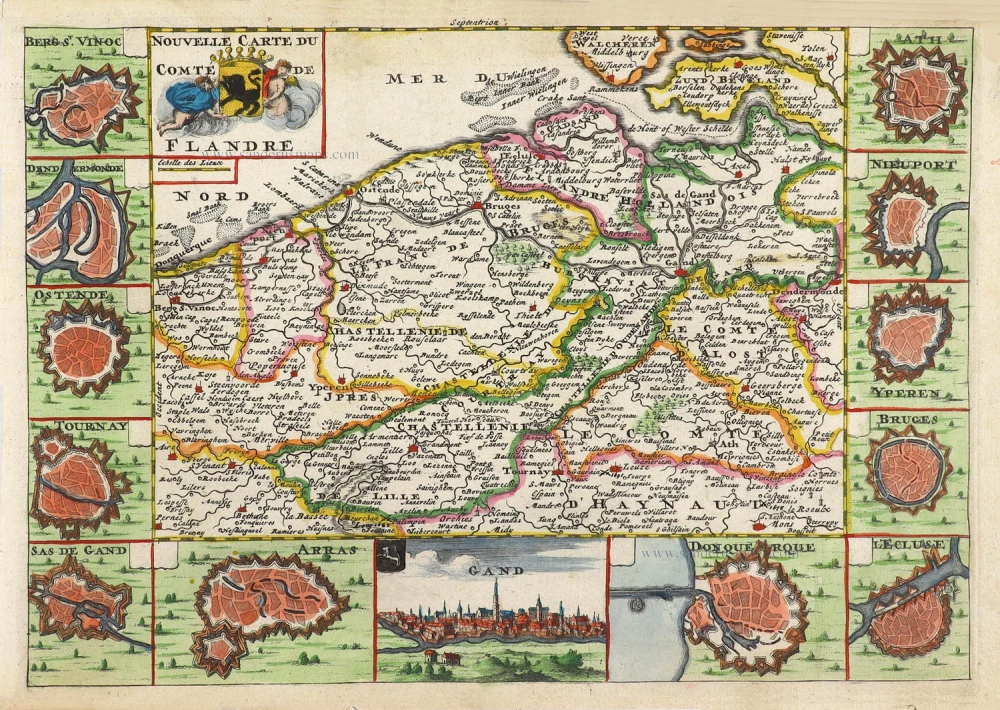
Nouvelle Carte du Comté de Flandre. 1706
Flanders (Vlaanderen) by Daniel De la Feuille.
[Item number: 29889]
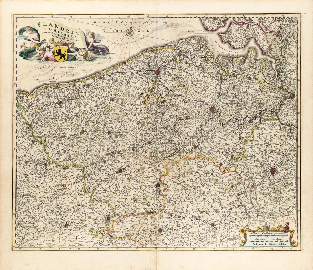
Flandriae Comitatus Accuratissima Descriptio. c. 1658
Flanders (Vlaanderen) by Nicolaas Visscher I.
[Item number: 29980]
Rare
Exactissima Flandriae Descriptio. 1593
Flanders (Vlaanderen), by Gerard de Jode.
[Item number: 30309]
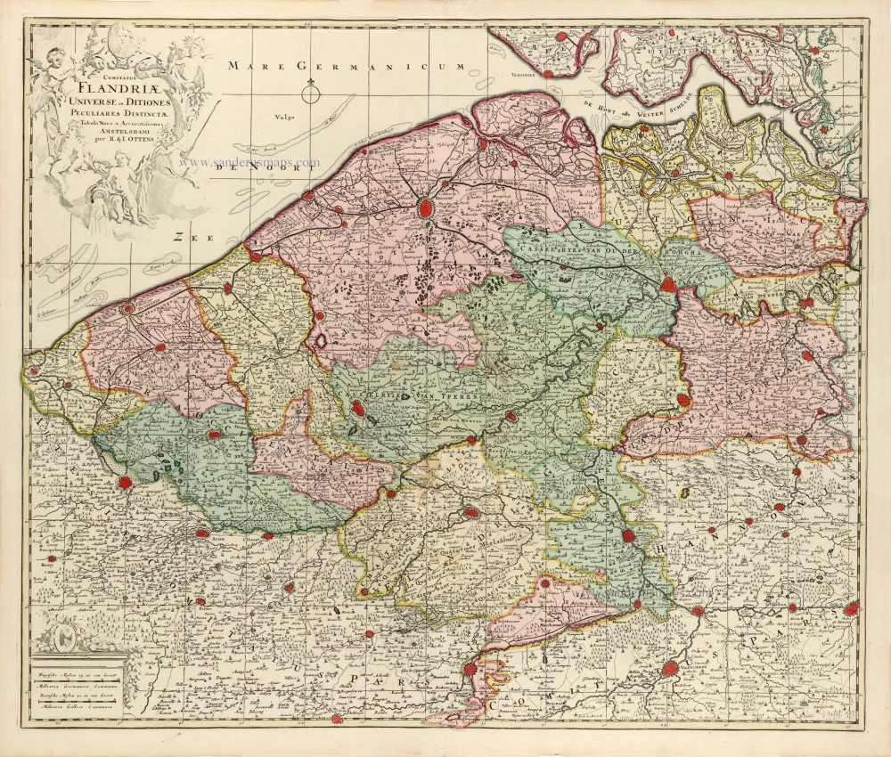
Comitatus Flandriae Universe in Ditiones Peculiares Distinctae. 1730-45
Flanders (Vlaanderen) by Ottens R. & J.
[Item number: 30524]
Very rare!
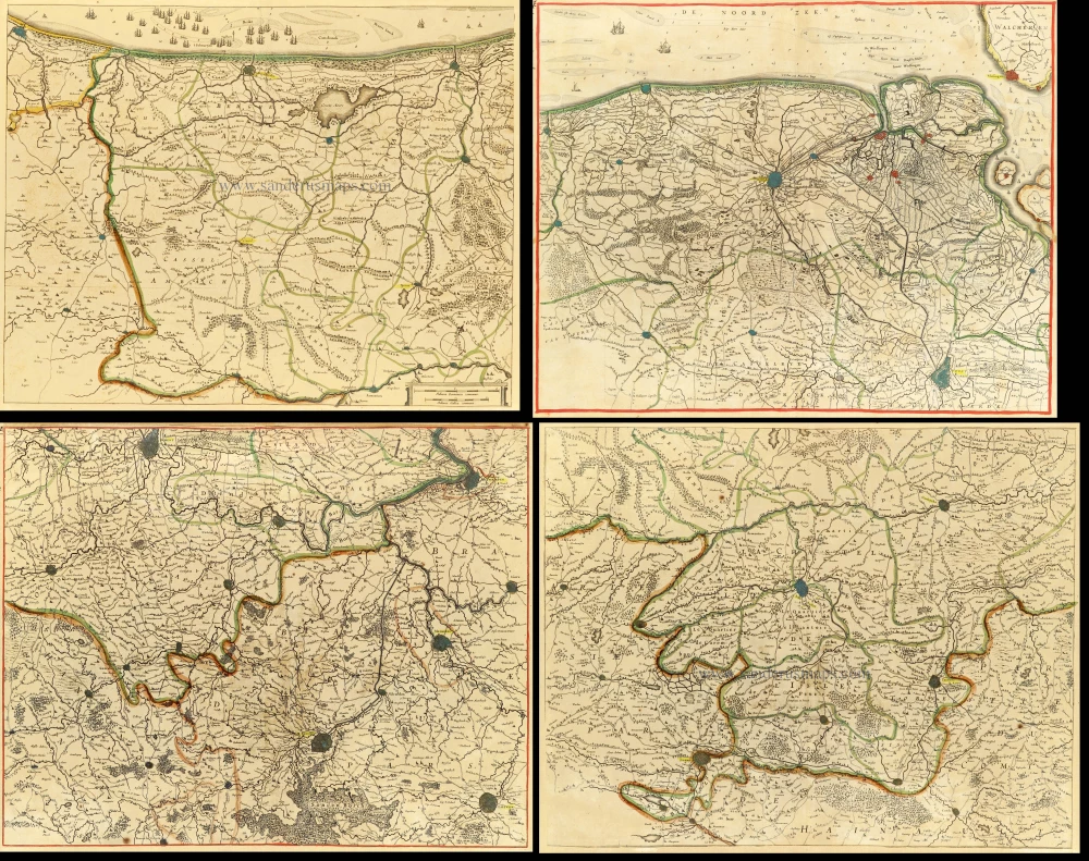
[No title] c. 1630-1635
Four atlas maps by Henricus Hondius, adapted to form a wall map of Flanders.
[Item number: 31002]

Fiandra, Brabantia, et Holanda Nuova. 1574
Low Countries by Girolamo Ruscelli.
[Item number: 31083]
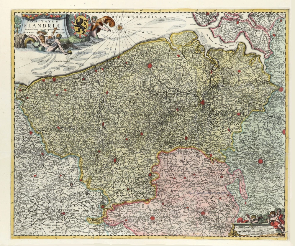
Comitatus Flandriae. 1728
Flanders (Vlaanderen) by G. van Schagen, published by Pieter van der Aa.
[Item number: 31254]
Flandriae Descriptio. 1594
Flanders (Vlaanderen) by Matthias Quad, published by J. Bussemacher.
[Item number: 31256]
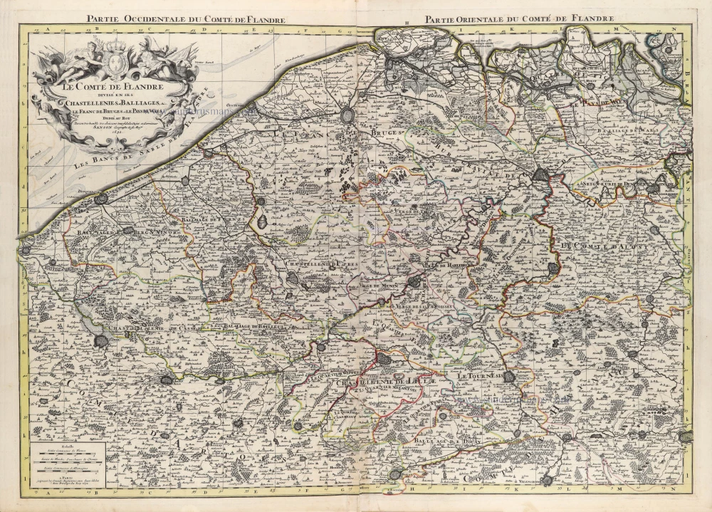
Le Comté de Flandre divisé en ses Chastellenies, et Balliages, &c. Le Franc de Bruges et Le Pays de Waes. 1692
Flanders (Vlaanderen) by N. Sanson, so-called published by Hubert Jaillot. (Pirated edition by Pierre Mortier).
[Item number: 31465]

Descrittione Particulare di Fiandra. 1567
Flanders (Vlaanderen) by L. Guicciardini.
[Item number: 31517]
Flandria. 1618
Vlaanderen (Flanders) by Petrus Bertius, published by Jodocus Hondius II.
[Item number: 31592]

Rare first edition.
Exactissima Flandriae Descriptio. 1578
Flanders (Vlaanderen), by Gerard de Jode.
[Item number: 31827]

Comté de Flandres. 1633
Flanders (Vlaanderen) by Christophe Tassin.
[Item number: 31933]