
Vlaanderen (Flanders) by Petrus Bertius, published by Jodocus Hondius II. 1618
Petrus Bertius (1565-1629)
Petrus Bertius, born at Beveren, Flanders, in 1565, was related to Pieter van den Keere (Kaerius) and Jodocus Hondius. Both famous cartographers were brothers-in-law of Petrus Bertius. As a refugee, he settled in Amsterdam, and after finishing his studies, he became a professor of mathematics and librarian at the University of Leiden. In 1618, he became a cosmographer and historiographer for Louis XIII of France. He lived in Paris, where he died in 1629.
Petrus Bertius's remarkable work ethic is evident in the numerous geographical and theological works he produced. His contributions to the works of Clüver and Herrera further solidified his reputation in geography.
His fame among geographers was established by his text in the pocket atlas Tabularum Geographicarum and by his edition of Ptolemy’s Geographia.
The origin of the Tabularum Geographicum lies in the well-known miniature atlas Caert thresoor, published by Barent Langenes in 1598 in Middelburg. Bertius engraved 169 maps for this small but attractive atlas, sold for the first time in 1599 by Cornelis Claesz in Amsterdam. In 1600, Claesz published the pocket atlas with a Latin text composed by Petrus Bertius. From then on, new editions, often enlarged with new maps, regularly appeared, subsequently published by Cornelis Claesz, Jodocus Hondius, Johannes Janssonius and ultimately, in 1649, by Claes Jansz. Visscher.
Koeman divides this series of pocketbooks into two atlases: The Caert-thresoor, published by Langenes and Claesz., with five editions between 1598 and 1609, and the Tabularum Geographicarum Contractarum by Petrus Bertius with ten editions between 1600 and 1650.
The Hondius Family
Jodocus Hondius the Elder (1563-1612)
Joost d’Hondt was born at Wakken (Flanders) in 1563. Two years later, his family settled in Ghent, where young Joost displayed an excellent gift for drawing and calligraphy. Through study and lessons, he developed his talents and became an engraver with a good reputation.
Due to the circumstances of the war, he moved to London in 1584, where he settled down as an engraver, instrument-maker, and map-maker. In 1587, he married Coletta van den Keere, sister of the well-known engraver Pieter van den Keere (Petrus Kaerius); some years earlier, his sister, Jacomina, had married Pieter van den Berghe (Petrus Montanus). Joost, who had Latinized his name to Jodocus Hondius, closely co-operated with his two brothers-in-law.
The political situation in the Northern Netherlands in 1593 was such that Jodocus seemed justified in establishing himself in Amsterdam, where many Antwerp printers, publishers, and engravers had gone. In this new centre of cartography, Jodocus Hondius set up his business “In de Wackere Hondt” (in the vigilant dog), this name being an allusion to his birthplace and name. He engraved many maps and published atlases and many other works, such as his continuation of Gerard Mercator’s Atlas.
He suddenly passed away in February 1612. The publishing firm of Jodocus Hondius was continued by his widow, later on, by his two sons, Jodocus Jr. and Henricus, and by his son-in-law, J. Janssonius.
Jodocus Hondius II (1594-1629) & Henricus Hondius (1597-1651)
After the father’s death, the widow and her seven children continued publishing the atlases under the name of Jodocus Hondius till 1620. The firm was reinforced by the very welcome help of Joannes Janssonius (1588-1664), who married 24-year-old Elisabeth Hondius in 1612. After 1619, Mercator’s Atlas was published under the name of Henricus Hondius.
One of the most dramatic events in the early history of commercial cartography in Amsterdam was the sale of Jodocus Hondius Jr.’s copper plates to Willem Jansz. Blaeu in 1629, the year of his death. At least 34 plates, from which Jodocus II had printed single-sheet maps for his benefit, passed into the hands of his great competitor. Immediately after that, his brother, Henricus, and Joannes Janssonius ordered the engraving of identical plates.
Henricus devoted all his energy to publishing the Atlas for an extended period. He saw its growth up to and including the fourth part in 1646; after that, his name no longer figures on the title pages. After 1638, the title of the Atlas was changed to Atlas Novus; Joannes Janssonius mainly carried it on.
The competition with the Blaeu's dates from 1630. In 1630, Willem Janszoon (=Blaeu) first attacked with his Atlantis Appendix. In 1635, Blaeu completed his Theatrum Orbis Terrarum in two volumes with French, Latin, Dutch, and German texts, prompting Henricus Hondius to speed up the enlargement of his Atlas.
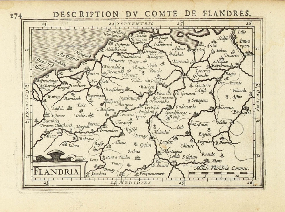
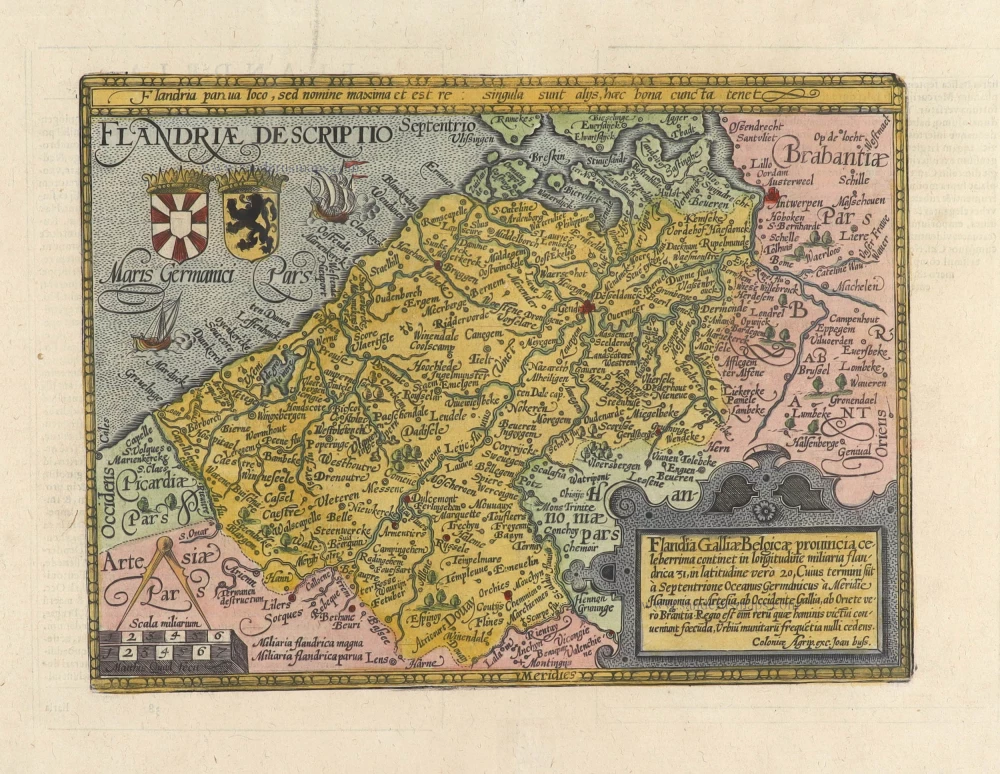
Flandria.
Item Number: 31592 Authenticity Guarantee
Category: Antique maps > Europe > Belgium
Vlaanderen (Flanders) by Petrus Bertius, published by Jodocus Hondius II.
Title: Flandria.
Date of the first edition: 1616.
Date of this map: 1618.
Copper engraving, printed on paper.
Image size: 95 x 135mm (3¾ x 5¼ inches).
Sheet size: 120 x 185mm (4¾ x 7¼ inches).
Verso: French text.
Condition: Excellent.
Condition Rating: A+.
From: Bertius P. La Geographie Racourcie de Pierre Bertius. Amsterdam, Jodocus Hondius jr. 1618. (Van der Krogt 3, 342:11)
Petrus Bertius (1565-1629)
Petrus Bertius, born at Beveren, Flanders, in 1565, was related to Pieter van den Keere (Kaerius) and Jodocus Hondius. Both famous cartographers were brothers-in-law of Petrus Bertius. As a refugee, he settled in Amsterdam, and after finishing his studies, he became a professor of mathematics and librarian at the University of Leiden. In 1618, he became a cosmographer and historiographer for Louis XIII of France. He lived in Paris, where he died in 1629.
Petrus Bertius's remarkable work ethic is evident in the numerous geographical and theological works he produced. His contributions to the works of Clüver and Herrera further solidified his reputation in geography.
His fame among geographers was established by his text in the pocket atlas Tabularum Geographicarum and by his edition of Ptolemy’s Geographia.
The origin of the Tabularum Geographicum lies in the well-known miniature atlas Caert thresoor, published by Barent Langenes in 1598 in Middelburg. Bertius engraved 169 maps for this small but attractive atlas, sold for the first time in 1599 by Cornelis Claesz in Amsterdam. In 1600, Claesz published the pocket atlas with a Latin text composed by Petrus Bertius. From then on, new editions, often enlarged with new maps, regularly appeared, subsequently published by Cornelis Claesz, Jodocus Hondius, Johannes Janssonius and ultimately, in 1649, by Claes Jansz. Visscher.
Koeman divides this series of pocketbooks into two atlases: The Caert-thresoor, published by Langenes and Claesz., with five editions between 1598 and 1609, and the Tabularum Geographicarum Contractarum by Petrus Bertius with ten editions between 1600 and 1650.
The Hondius Family
Jodocus Hondius the Elder (1563-1612)
Joost d’Hondt was born at Wakken (Flanders) in 1563. Two years later, his family settled in Ghent, where young Joost displayed an excellent gift for drawing and calligraphy. Through study and lessons, he developed his talents and became an engraver with a good reputation.
Due to the circumstances of the war, he moved to London in 1584, where he settled down as an engraver, instrument-maker, and map-maker. In 1587, he married Coletta van den Keere, sister of the well-known engraver Pieter van den Keere (Petrus Kaerius); some years earlier, his sister, Jacomina, had married Pieter van den Berghe (Petrus Montanus). Joost, who had Latinized his name to Jodocus Hondius, closely co-operated with his two brothers-in-law.
The political situation in the Northern Netherlands in 1593 was such that Jodocus seemed justified in establishing himself in Amsterdam, where many Antwerp printers, publishers, and engravers had gone. In this new centre of cartography, Jodocus Hondius set up his business “In de Wackere Hondt” (in the vigilant dog), this name being an allusion to his birthplace and name. He engraved many maps and published atlases and many other works, such as his continuation of Gerard Mercator’s Atlas.
He suddenly passed away in February 1612. The publishing firm of Jodocus Hondius was continued by his widow, later on, by his two sons, Jodocus Jr. and Henricus, and by his son-in-law, J. Janssonius.
Jodocus Hondius II (1594-1629) & Henricus Hondius (1597-1651)
After the father’s death, the widow and her seven children continued publishing the atlases under the name of Jodocus Hondius till 1620. The firm was reinforced by the very welcome help of Joannes Janssonius (1588-1664), who married 24-year-old Elisabeth Hondius in 1612. After 1619, Mercator’s Atlas was published under the name of Henricus Hondius.
One of the most dramatic events in the early history of commercial cartography in Amsterdam was the sale of Jodocus Hondius Jr.’s copper plates to Willem Jansz. Blaeu in 1629, the year of his death. At least 34 plates, from which Jodocus II had printed single-sheet maps for his benefit, passed into the hands of his great competitor. Immediately after that, his brother, Henricus, and Joannes Janssonius ordered the engraving of identical plates.
Henricus devoted all his energy to publishing the Atlas for an extended period. He saw its growth up to and including the fourth part in 1646; after that, his name no longer figures on the title pages. After 1638, the title of the Atlas was changed to Atlas Novus; Joannes Janssonius mainly carried it on.
The competition with the Blaeu's dates from 1630. In 1630, Willem Janszoon (=Blaeu) first attacked with his Atlantis Appendix. In 1635, Blaeu completed his Theatrum Orbis Terrarum in two volumes with French, Latin, Dutch, and German texts, prompting Henricus Hondius to speed up the enlargement of his Atlas.
Related items
Flandriae Comitatus Descriptio. 1601
Vlaanderen by Abraham Ortelius
[Item number: 5767]
Flandriae Comitatus Pars Australis. 1683-1696
Lille par Nicolas Visscher
[Item number: 18686]

Famous Mercator map of Flanders
Flandria. 1579
Vlaanderen by A. Ortelius.
[Item number: 22228]

Flandriae Comitatus Descriptio. 1612
Flanders (Vlaanderen) by Abraham Ortelius.
[Item number: 22978]

Exactissima Flandriae descriptio. Flandria, Caroli V. Aug. Imp. max. natione illustrissima, Belgice provinciae est . . . . Ad signum Bibliothecae Diui Marci. Dominicus Zenoi Venetus excidebat. Venetijs M.D.M.VIIII. 1559
Flanders (Vlaanderen) by Domenico Zenoi.
[Item number: 25774]

Comitatus Flandria. 1637
Flanders (Vlaanderen), by Pieter Verbiest.
[Item number: 27128]

Flandria et Zeelandia Comitatus. 1640-43
Flanders (Vlaanderen) and Zeeland, by Willem Blaeu.
[Item number: 27409]

EXTREMELY RARE FLANDERS MAP BY PIETER VERBIEST
Comitatus Flandria. 1630
Vlaanderen (Flanders), by Pieter Verbiest.
[Item number: 28002]

Le Comté de Flandre divisé en ses Chastellenies, et Balliages, &c. Le Franc de Bruges et Le Pays de Waes. c. 1705
Flanders (Vlaanderen), by Pieter Mortier.
[Item number: 28129]

Celeberrimi Flandriae Comitatus Typus. 1617
Flanders (Vlaanderen) by Petrus Kaerius (Pieter Van den Keere).
[Item number: 28453]
One of the oldest maps of Flanders
Flàdern. [Above map:] Von dem Landt Flandern. 1550
Flanders (Vlaanderen) by Sebastian Münster.
[Item number: 28922]
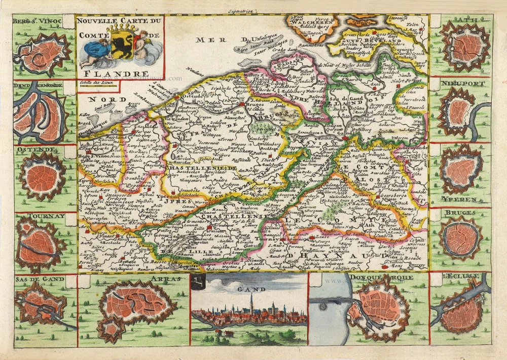
Nouvelle Carte du Comté de Flandre. 1706
Flanders (Vlaanderen) by Daniel De la Feuille.
[Item number: 29889]

Flandriae Comitatus Accuratissima Descriptio. c. 1658
Flanders (Vlaanderen) by Nicolaas Visscher I.
[Item number: 29980]

Rare
Exactissima Flandriae Descriptio. 1593
Flanders (Vlaanderen), by Gerard de Jode.
[Item number: 30309]
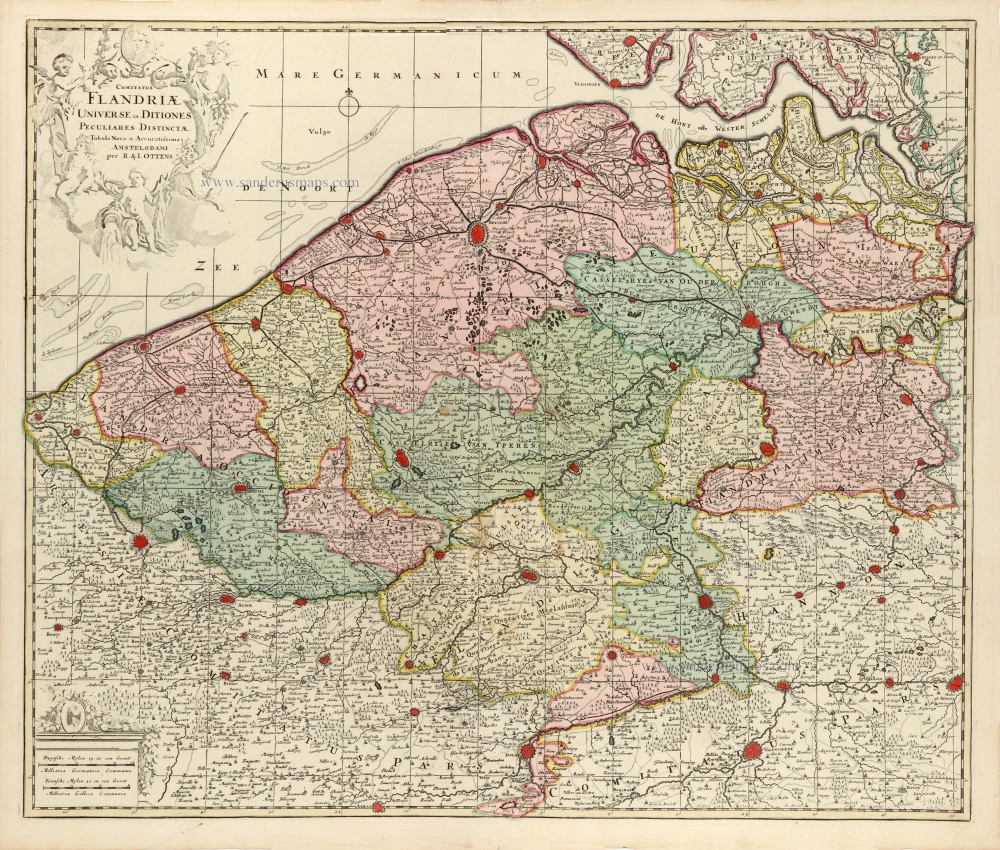
Comitatus Flandriae Universe in Ditiones Peculiares Distinctae. 1730-45
Flanders (Vlaanderen) by Ottens R. & J.
[Item number: 30524]

Comitatus Flandriae. 1728
Flanders (Vlaanderen) by G. van Schagen, published by Pieter van der Aa.
[Item number: 31254]
Flandriae Descriptio. 1594
Flanders (Vlaanderen) by Matthias Quad, published by J. Bussemacher.
[Item number: 31256]

Zelandia - Zelandicarum insularum exactissima et nova descriptio, 1592
Zeeland by Matthias Quad, published by J. Bussemacher.
[Item number: 31258]
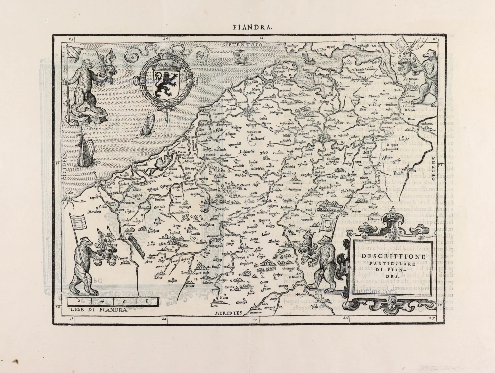
Descrittione Particulare di Fiandra. 1567
Flanders (Vlaanderen) by L. Guicciardini.
[Item number: 31517]

Comté de Flandres. 1633
Flanders (Vlaanderen) by Christophe Tassin.
[Item number: 31933]

Beautiful copy of this important map
Flandria. 1584
Flanders (Vlaanderen), by Abraham Ortelius.
[Item number: 32394]

Comitatus Flandriae in omnes ejusdem subjacentes Ditioescum adjacentibus accuratissime divisus. c. 1720
Flanders (Vlaanderen), by J.B. Homann.
[Item number: 32398]

Novissima Flandriae Comitatus Tabula cum omnibus praefecturis, etc. et Adjacentis Provinciis. 1696-1713
Flanders (Vlaanderen) by Theodore Danckerts.
[Item number: 32497]
The most beautiful 17th-century map of Flanders, with four decorative borders.
Comitatus Flandriae. 1652
Vlaanderen by C.J. Visscher.
[Item number: 33151]
new