
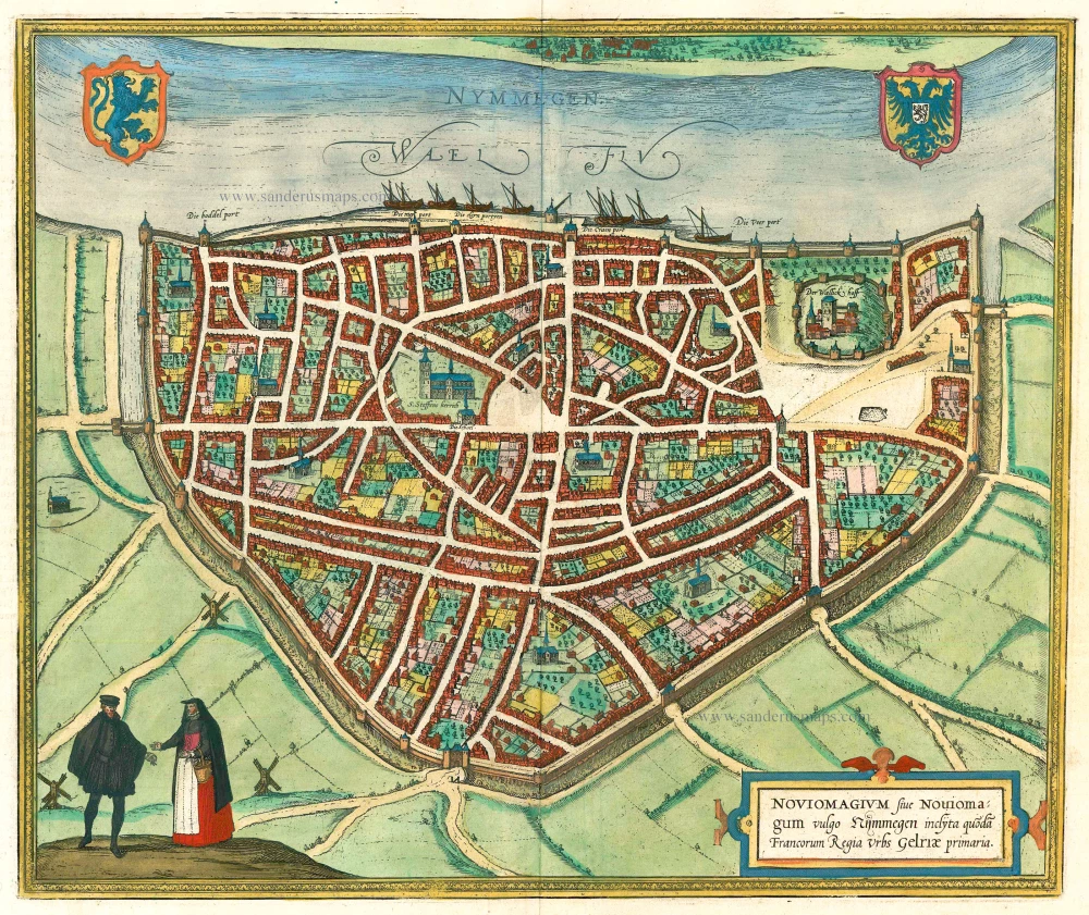
Nijmegen, by Braun & Hogenberg. 1582

TRANSLATION OF CARTOUCHE TEXT: Noviomagium or Noviomagum, commonally known as Nijmegen, was formerly, as a Frankish Palatinate, the capital of Guelders.
COMMENTARY BY BRAUN: "Of all the well-appointed churches, St Stephen's is the most important.. Other sights include the very old castle on top of the hill near the town: one might ask whether a better viewpoint is to be had anywhere in Belgium from where one can look out over the countryside, rivers, farmlands and fields. A great many ancient objects have been found in this area, left behind by the Romans, e.g. coins, stones, marble, fallen walls, tombs and monuments. As a result, the townsfolk enjoy digging over the ground and avidly searching for such finds."
A bird's-eye view of the city, where the royal castle of Valkhof can be seen on the right within the city walls. In the city centre is the tall Gothic Sint-Stevenskerk. This imperial and Hanseatic city was going through a troubled phase in Braun and Hogenberg's time. In 1543 Nijmegen, together with Guelders, became Spanish as a result of the Treaty of Venlo. In 1579 the city joined the United Provinces and was besieged and captured in 1585 by the Spanish in the course of the Dutch Revolt. The Orange party did not suceed in recapturing Nijmegen until 1591.(Taschen)
Braun G. & Hogenberg F. and the Civitates Orbis Terrarum.
The Civitates Orbis Terrarum, also known as the 'Braun & Hogenberg', is a six-volume town atlas and the most excellent book of town views and plans ever published: 363 engravings, sometimes beautifully coloured. It was one of the best-selling works in the last quarter of the 16th century. Georg Braun, a skilled writer, wrote the text accompanying the plans and views on the verso. Many plates were engraved after the original drawings of a professional artist, Joris Hoefnagel (1542-1600). The first volume was published in Latin in 1572 and the sixth in 1617. Frans Hogenberg, a talented engraver, created the tables for volumes I through IV, and Simon van den Neuwel made those for volumes V and VI. Other contributors were cartographers Daniel Freese and Heinrich Rantzau, who provided valuable geographical information. Works by Jacob van Deventer, Sebastian Münster, and Johannes Stumpf were also used as references. Translations appeared in German and French, making the atlas accessible to a broader audience.
Since its original publication of volume 1 in 1572, the Civitates Orbis Terrarum has left an indelible mark on the history of cartography. Seven more editions followed the first volume in 1575, 1577, 1582, 1588, 1593, 1599, and 1612. Vol.2, initially released in 1575, saw subsequent editions in 1597 and 1612. The subsequent volumes, each a treasure trove of historical insights, graced the world in 1581, 1588, 1593, 1599, and 1606. The German translation of the first volume, a testament to its widespread appeal, debuted in 1574, followed by the French edition in 1575.
Several printers were involved: Theodor Graminaeus, Heinrich von Aich, Gottfried von Kempen, Johannis Sinniger, Bertram Buchholtz, and Peter von Brachel, all of whom worked in Cologne.
Georg Braun (1541-1622)
Georg Braun, the author of the text accompanying the plans and views in the Civitates Orbis Terrarum, was born in Cologne in 1541. After his studies in Cologne, he entered the Jesuit Order as a novice, indicating his commitment to learning and intellectual pursuits. In 1561, he obtained his bachelor's degree; in 1562, he received his Magister Artium, further demonstrating his academic achievements. Although he left the Jesuit Order, he continued his studies in theology, gaining a licentiate in theology. His theological background likely influenced the content and tone of the text in the Civitates Orbis Terrarum, adding a unique perspective to the work.
Frans Hogenberg (1535-1590)
Frans Hogenberg was a Flemish and German painter, engraver, and mapmaker. He was born in Mechelen as the son of Nicolaas Hogenberg.
By the end of the 1560s, Frans Hogenberg was employed upon Abraham Ortelius's Theatrum Orbis Terrarum, published in 1570; he is named an engraver of numerous maps. In 1568, he was banned from Antwerp by the Duke of Alva and travelled to London, where he stayed a few years before emigrating to Cologne. He immediately embarked on his two most important works, the Civitates, published in 1572 and the Geschichtsblätter, which appeared in several series from 1569 until about 1587.
Thanks to large-scale projects like the Geschichtsblätter and the Civitates, Hogenberg's social circumstances improved with each passing year. He died as a wealthy man in Cologne in 1590.
Nymmegen - Noviomagium sive Nouiomagum vulgo Nijmmegen inclyta quoda Francorum Regia Urbs Gelriae primaria.
Item Number: 14229 Authenticity Guarantee
Category: Antique maps > Europe > The Netherlands - Cities
Old antique plan of Nijmegen by Braun & Hogenberg.
Title: Nymmegen - Noviomagium sive Nouiomagum vulgo Nijmmegen inclyta quoda Francorum Regia Urbs Gelriae primaria.
Cartographer: Jacob van Deventer.
Date of the first edition: 1581.
Date of this map: 1582.
Copper engraving, printed on paper.
Size (not including margins): 330 x 394mm (12.99 x 15.51 inches).
Verso: German text.
Condition: Uncoloured, excellent.
Condition Rating: A+.
From: Contrafactur und Beschreibung von den vornembsten Stetten der Welt. Liber Tertius. Köln, 1582. (Van der Krogt 4, 41:2.3)
TRANSLATION OF CARTOUCHE TEXT: Noviomagium or Noviomagum, commonally known as Nijmegen, was formerly, as a Frankish Palatinate, the capital of Guelders.
COMMENTARY BY BRAUN: "Of all the well-appointed churches, St Stephen's is the most important.. Other sights include the very old castle on top of the hill near the town: one might ask whether a better viewpoint is to be had anywhere in Belgium from where one can look out over the countryside, rivers, farmlands and fields. A great many ancient objects have been found in this area, left behind by the Romans, e.g. coins, stones, marble, fallen walls, tombs and monuments. As a result, the townsfolk enjoy digging over the ground and avidly searching for such finds."
A bird's-eye view of the city, where the royal castle of Valkhof can be seen on the right within the city walls. In the city centre is the tall Gothic Sint-Stevenskerk. This imperial and Hanseatic city was going through a troubled phase in Braun and Hogenberg's time. In 1543 Nijmegen, together with Guelders, became Spanish as a result of the Treaty of Venlo. In 1579 the city joined the United Provinces and was besieged and captured in 1585 by the Spanish in the course of the Dutch Revolt. The Orange party did not suceed in recapturing Nijmegen until 1591.(Taschen)
Braun G. & Hogenberg F. and the Civitates Orbis Terrarum.
The Civitates Orbis Terrarum, also known as the 'Braun & Hogenberg', is a six-volume town atlas and the most excellent book of town views and plans ever published: 363 engravings, sometimes beautifully coloured. It was one of the best-selling works in the last quarter of the 16th century. Georg Braun, a skilled writer, wrote the text accompanying the plans and views on the verso. Many plates were engraved after the original drawings of a professional artist, Joris Hoefnagel (1542-1600). The first volume was published in Latin in 1572 and the sixth in 1617. Frans Hogenberg, a talented engraver, created the tables for volumes I through IV, and Simon van den Neuwel made those for volumes V and VI. Other contributors were cartographers Daniel Freese and Heinrich Rantzau, who provided valuable geographical information. Works by Jacob van Deventer, Sebastian Münster, and Johannes Stumpf were also used as references. Translations appeared in German and French, making the atlas accessible to a broader audience.
Since its original publication of volume 1 in 1572, the Civitates Orbis Terrarum has left an indelible mark on the history of cartography. Seven more editions followed the first volume in 1575, 1577, 1582, 1588, 1593, 1599, and 1612. Vol.2, initially released in 1575, saw subsequent editions in 1597 and 1612. The subsequent volumes, each a treasure trove of historical insights, graced the world in 1581, 1588, 1593, 1599, and 1606. The German translation of the first volume, a testament to its widespread appeal, debuted in 1574, followed by the French edition in 1575.
Several printers were involved: Theodor Graminaeus, Heinrich von Aich, Gottfried von Kempen, Johannis Sinniger, Bertram Buchholtz, and Peter von Brachel, all of whom worked in Cologne.
Georg Braun (1541-1622)
Georg Braun, the author of the text accompanying the plans and views in the Civitates Orbis Terrarum, was born in Cologne in 1541. After his studies in Cologne, he entered the Jesuit Order as a novice, indicating his commitment to learning and intellectual pursuits. In 1561, he obtained his bachelor's degree; in 1562, he received his Magister Artium, further demonstrating his academic achievements. Although he left the Jesuit Order, he continued his studies in theology, gaining a licentiate in theology. His theological background likely influenced the content and tone of the text in the Civitates Orbis Terrarum, adding a unique perspective to the work.
Frans Hogenberg (1535-1590)
Frans Hogenberg was a Flemish and German painter, engraver, and mapmaker. He was born in Mechelen as the son of Nicolaas Hogenberg.
By the end of the 1560s, Frans Hogenberg was employed upon Abraham Ortelius's Theatrum Orbis Terrarum, published in 1570; he is named an engraver of numerous maps. In 1568, he was banned from Antwerp by the Duke of Alva and travelled to London, where he stayed a few years before emigrating to Cologne. He immediately embarked on his two most important works, the Civitates, published in 1572 and the Geschichtsblätter, which appeared in several series from 1569 until about 1587.
Thanks to large-scale projects like the Geschichtsblätter and the Civitates, Hogenberg's social circumstances improved with each passing year. He died as a wealthy man in Cologne in 1590.
Related items

Middelburgum, Selandiae Opp: Situ, Opere, et Mercimoniis, Florentiss: 1575
Middelburg by Braun & Hogenberg
[Item number: 4669]

Amorfortia Diocesis Ultraiectensis Oppidum amoenitate loci solique fertilitate admodum insigne. c. 1593
Amersfoort by Braun Georg & Hogenberg Frans
[Item number: 15424]

Arnhemium (on sheet with) Venlonum (and) Gelria (and) Ruremunda. 1623
Arnhem, Venlo, Gelre, Roermond, by Georg Braun & Frans Hogenberg.
[Item number: 22200]
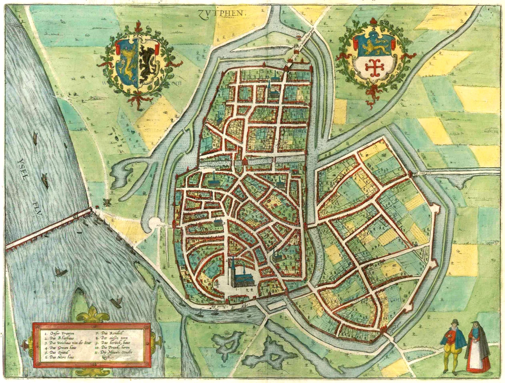
Zutphen. 1599
Zutphen by Braun & Hogenberg.
[Item number: 22260]

Bolzvardia vetus in Frisia Foederis Anzae teurinicae Op. [on sheet with] Stavria, vulgo Stavere ... [and] Harlinga [and] Hindelop. 1599
Bolsward, Stavoren, Harlingen, Hindelopen by Braun & Hogenberg.
[Item number: 22261]

Sneecha, vulgo Sneeck ... [on sheet with] Doccum [and] Sloten [and] Ylsta. 1599
Sneek, Doccum, Sloten, IJlst, by Braun & Hogenberg.
[Item number: 22263]

Bergen op Zoom - Berga, ad Somam, Brabantiae Opp: a fluvi olo sic dicto, ... 1581-88
Bergen-op-Zoom, by Georg Braun and Frans Hogenberg.
[Item number: 23306]
Noviomagium. 1599
Nijmegen, by Georg Braun and Frans Hogenberg.
[Item number: 24033]
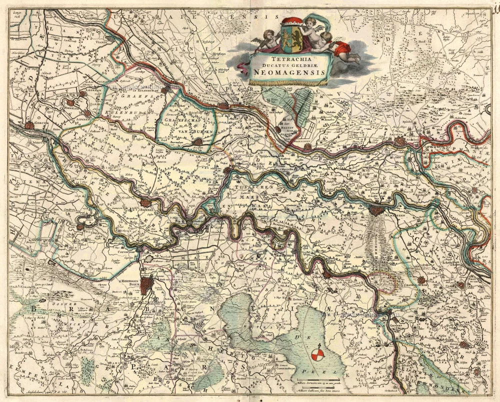
Tetrachia Ducatus Geldriae Neomagensis. c. 1689-90
Gelderland - Nijmegen by Frederick de Wit.
[Item number: 24431]
Noviomagium sive Noviomagu vulgo Nymmegen inclyta quondam Francorum Regia Urbs Gelriae primaria. 1576
Nijmegen, by Georg Braun & Frans Hogenberg.
[Item number: 28051]

Nimmegen - Novimagiu[m], sive Noviomagum vulgo Nijmmegen inclijta quon dam Francoru[m] Regia urbs Gelriae prima. 1612
Nijmegen by Ludovico Guicciardini.
[Item number: 32863]

Niemmegen. 1686
Nijmegen by Christoph Riegel.
[Item number: 33099]
new

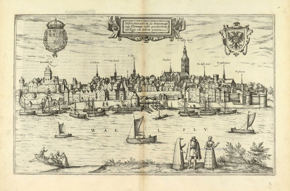
Noviomagium sive Noviomagu vulgo Nymmegen inclyta quondam Francorum Regia Urbs Gelriae primaria. 1582
Panoramic view of Nijmegen, by Georg Braun & Frans Hogenberg.
[Item number: 33198]
new