
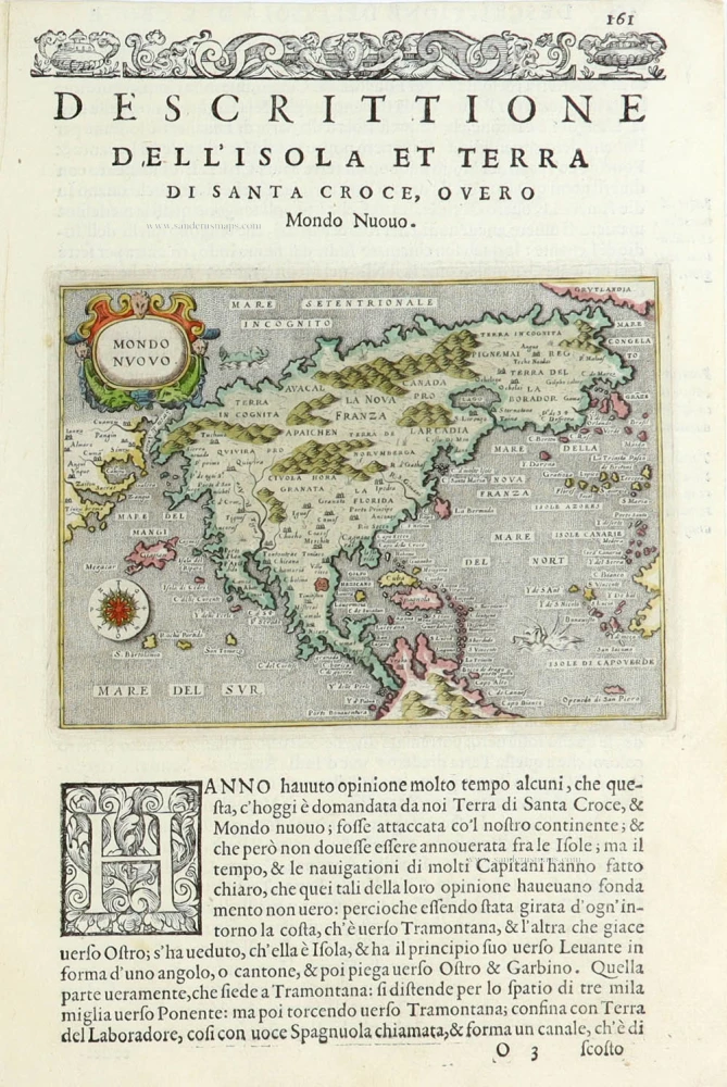
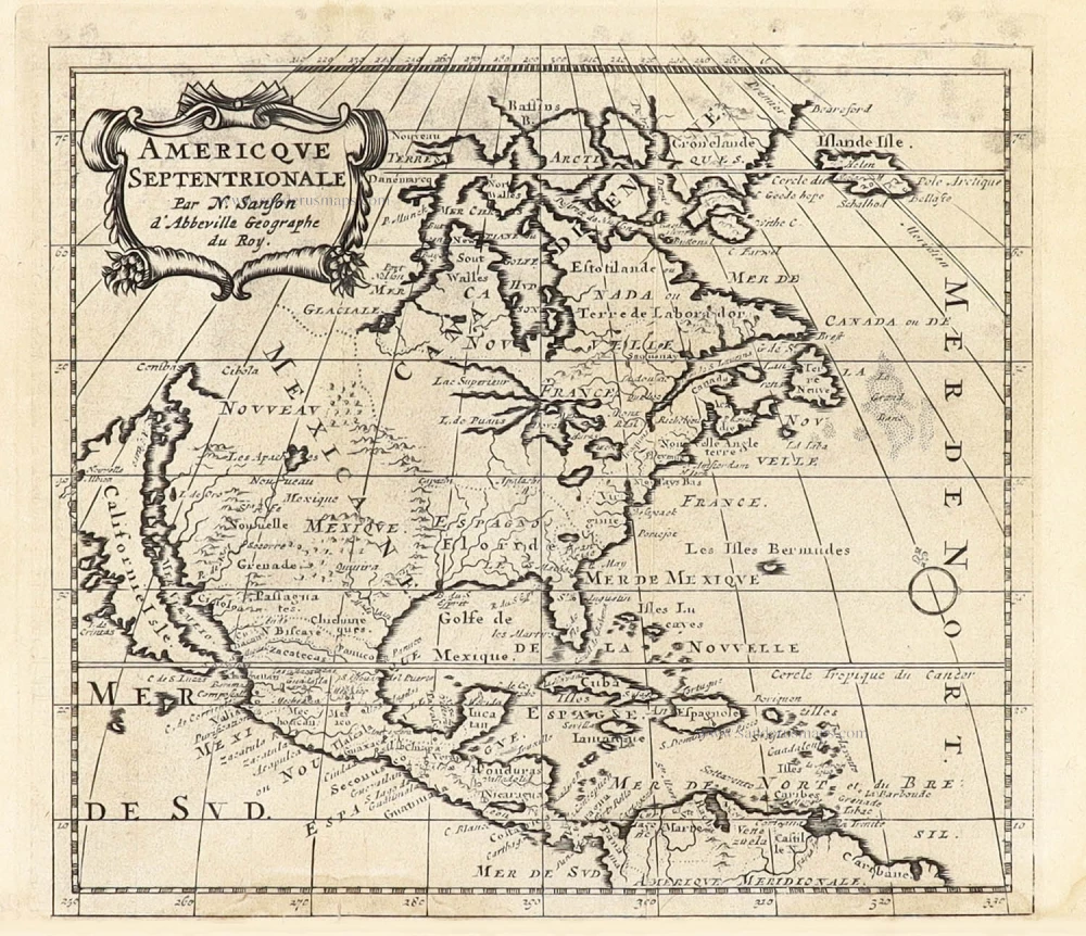
Earliest obtainable map of North America
North America, by Tomaso Porcacchi. 1576
Thomaso (Tommaso) Porcacchi (1530-1585)
Thomaso Porcacchi was born in Castiglion Fiorentino (Arentino), Tuscany, into a poor family. Through the patronage of Duke Cosimo I de' Medici, he was able to pursue his studies; afterwards, he embarked on a career as a translator, editor and author, initially in Florence, often working with the humanist scholar Lodovico Domenichi. His speciality was classical texts, particularly of a geographical and historical nature. Through this work, he came into contact with the prominent Venetian publisher Gabriel Giolito de' Ferrari and, in 1559, he moved to Venice to form a fruitful association with Giolito, who had produced several books containing maps.
Later in his career, Porcacchi composed an isolario, L'isole piu famose del mondo ..., published by Simone Galignani de Karera and Girolamo Porro in 1572. In 1574 Porro engraved the plates for another Porcachi volume, Funerali antichi di diversi popoli, et nationi ..., and he later contributed the maps to a new edition of Claudius Prolemy's Geographiae universae tum veteris tum novae ..., edited by Giovanni Antonio Magini and published by the Heirs of Simone Galignani de Karera.
The first edition of Porcacchi's L'isole piu famose contained 30 engraved maps, set in text. The coverage was worldwide, albeit concentrated on the Mediterranean. For the second edition, the text was rewritten, and 17 additional maps were inserted, to make a total of 47.
Mondo Nuovo - Descrittione del l'Isola et Terra di Sancta Croce, overo Mondo Nuovo.
Item Number: 30991 new Authenticity Guarantee
Category: Antique maps > America > North America
North America, by Tomaso Porcacchi.
Title: Mondo Nuovo - Descrittione del l'Isola et Terra di Sancta Croce, overo Mondo Nuovo.
Date of the first edition: 1572.
Date of this map: 1576.
Copper engraving, printed on paper.
Image size: 105 x 145mm (4.13 x 5.71 inches).
Sheet size: 255 x 175mm (10.04 x 6.89 inches).
Verso: Italian text.
Condition: Hand coloured, excellent.
Condition Rating: A+.
From: Porcacchi T. L'Isole Piu Famose Del Mondo. Venetia, 1576.
Thomaso (Tommaso) Porcacchi (1530-1585)
Thomaso Porcacchi was born in Castiglion Fiorentino (Arentino), Tuscany, into a poor family. Through the patronage of Duke Cosimo I de' Medici, he was able to pursue his studies; afterwards, he embarked on a career as a translator, editor and author, initially in Florence, often working with the humanist scholar Lodovico Domenichi. His speciality was classical texts, particularly of a geographical and historical nature. Through this work, he came into contact with the prominent Venetian publisher Gabriel Giolito de' Ferrari and, in 1559, he moved to Venice to form a fruitful association with Giolito, who had produced several books containing maps.
Later in his career, Porcacchi composed an isolario, L'isole piu famose del mondo ..., published by Simone Galignani de Karera and Girolamo Porro in 1572. In 1574 Porro engraved the plates for another Porcachi volume, Funerali antichi di diversi popoli, et nationi ..., and he later contributed the maps to a new edition of Claudius Prolemy's Geographiae universae tum veteris tum novae ..., edited by Giovanni Antonio Magini and published by the Heirs of Simone Galignani de Karera.
The first edition of Porcacchi's L'isole piu famose contained 30 engraved maps, set in text. The coverage was worldwide, albeit concentrated on the Mediterranean. For the second edition, the text was rewritten, and 17 additional maps were inserted, to make a total of 47.
Related items
Important map
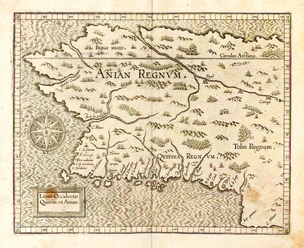
Limes Occidentis Quivira et Anian. 1607
West coast by Wytfliet, Cornelis van
[Item number: 26513]
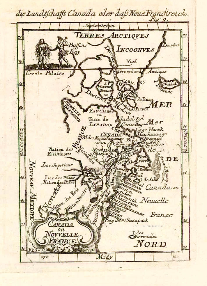
Canada ou Nouvelle France. 1685
North America (Northeast), by A.M. Mallet.
[Item number: 26601]
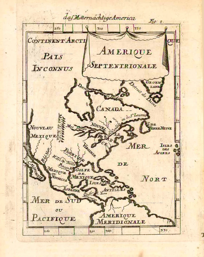
Amerique Septentrionale. 1685
North America, by A.M. Mallet.
[Item number: 26643]
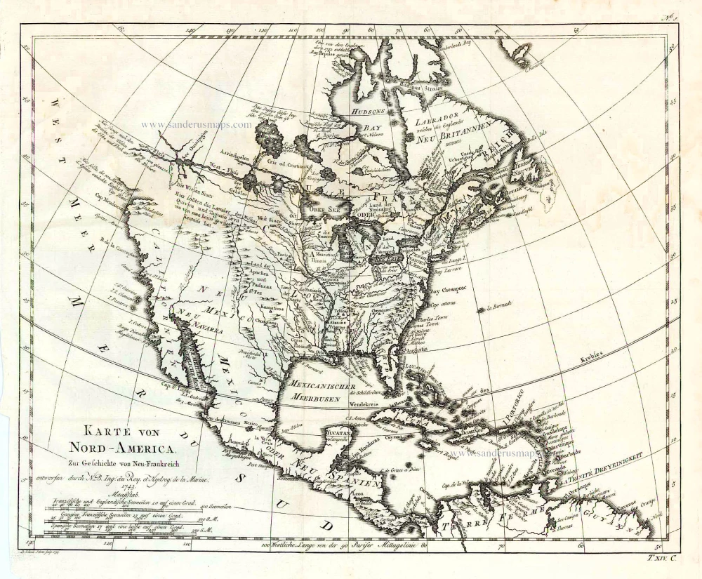
Karte von Nord-America, zur Geschichte von Neu-Frankreich. 1747-74
North America, by Jacques Nicolas Bellin.
[Item number: 26799]
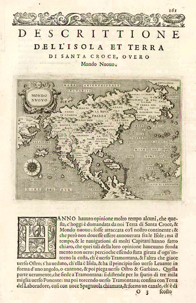
Earliest obtainable map of North America
Mondo Nuovo - Descrittione del l'Isola et Terra di Sancta Croce, overo Mondo Nuovo. 1576
Tomaso Porcacchi., North America
[Item number: 27651]

Early 'Texas' map
Nueva Hispania Tabula Nova. 1574
North America, by Girolamo Ruscelli.
[Item number: 27755]
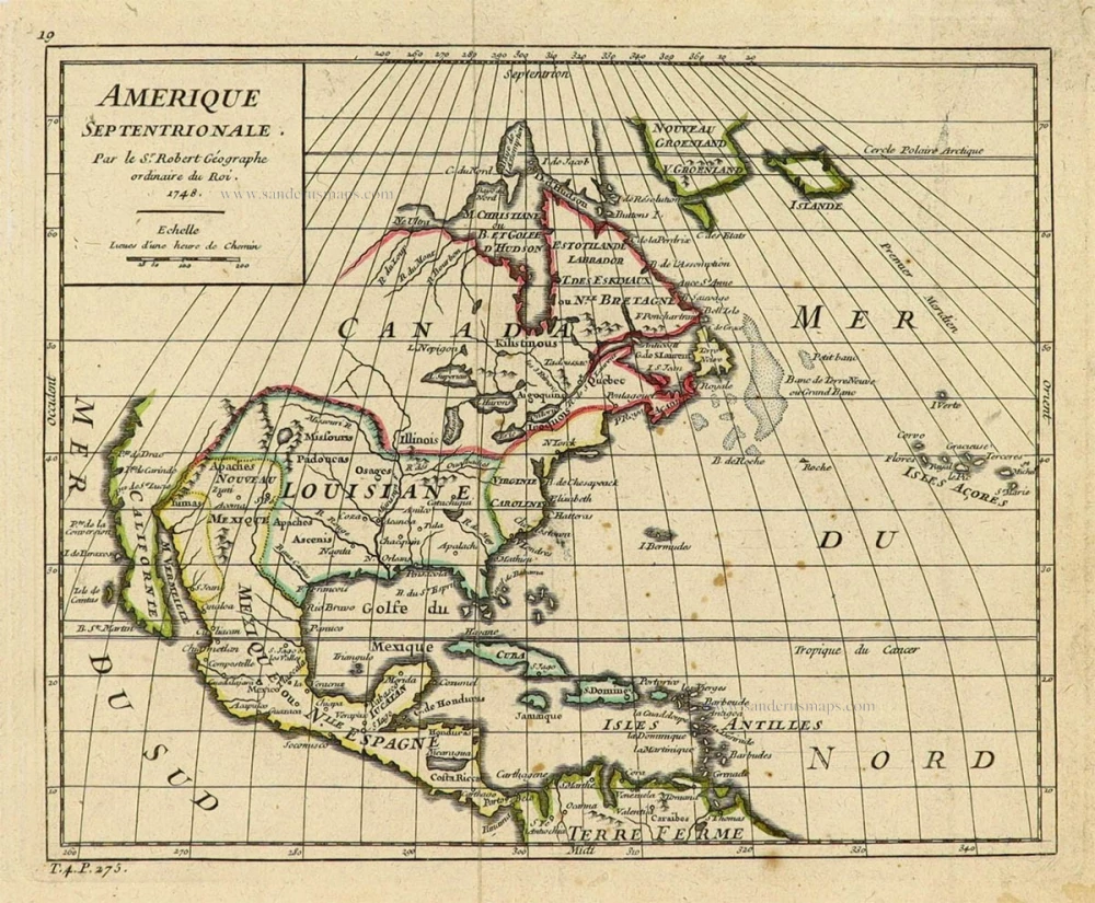
Amerique Septentrionale. 1748
North America by Robert de Vaugondy.
[Item number: 28157]

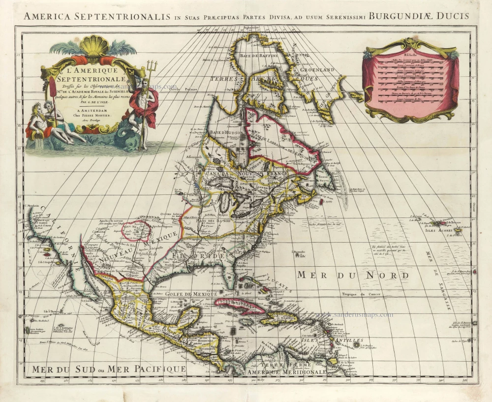
Amerique Septentrionale, Divisee en ses Principales Parties. 1694
North America, by Nicolas Sanson, published by Pierre Mortier after A.H. Jaillot.
[Item number: 29125]

Septemtrionaliora Americae à Groenlandia, per Freta Davidis et Hudson, ad Terram Novam = De Noordelyckste Zee kusten van America van Goenland door de Straet Davis ende Straet Hudson tot Terra Neuf. c. 1690
North-Eastern Coasts of North America (Canada), by Frederick de Wit.
[Item number: 29242]
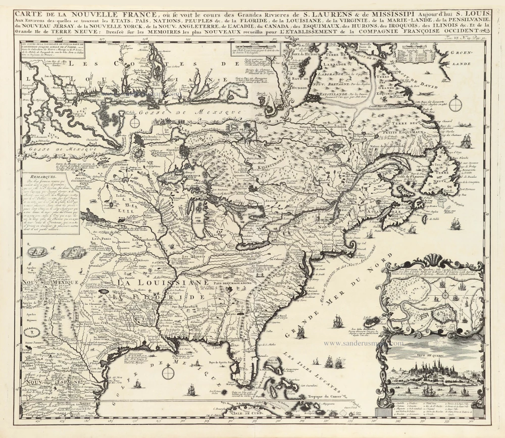
Carte de la Nouvelle France, ou se Voit le Cours des Grandes Rivieres de S. Laurens & de Mississipi Aujourd'hui S. Louis, Aux environs des quelles se trouvent les Etats, Païs, Nations, Peuples &c. de la Floride, de la Louisiane, de la Virginie, de la Marie-Lande, de la Pensilvanie, du Nouveau Jersay, de la Nouvelle Yorck, de la Nouv. Angleterre, de l'Acadie, du Canada, des Esquimaux, des Hurons, des Iroquois, des Ilinois &c. Et de la Grande Ile de Terre Neuve:. 1719
Eastern North America (U.S.), by Zacharias Châtelain.
[Item number: 29365]

Nouvelle carte de l'Amérique Septentrionale dressée sur les plus nouvelles observations de Messieurs de l'Académie des Sciences et des meilleurs Géographes avec des tables très Instructives et Curieuses de la Division de tous les Etats et les différents souverains qui en sont possesseur. 1713
North America, by Zacharias Châtelain.
[Item number: 29445]
Rare. Four gores.
Vincenzo Coronelli [No title] 1696
North America by Coronelli Vincenzo
[Item number: 29448]
L'Amerique Septentrionale. 1708
North America by G. de L'Isle, published by Pierre Mortier.
[Item number: 29510]
Landmark map of North Amerika
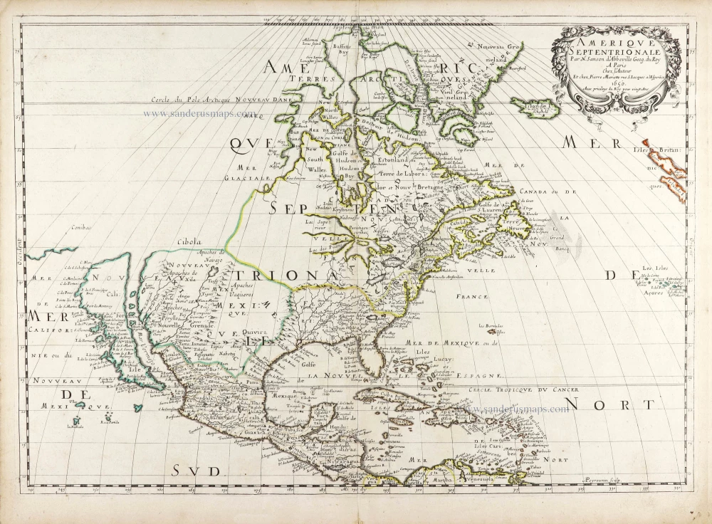
Amerique Septentrionale. 1652
Nicolas Sanson's landmark map of North America, scarce second state.
[Item number: 29597]
Big and spectacular map, heightened in gold.
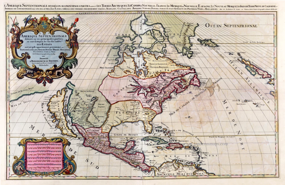
Amerique Septentrionale, divisée en ses principales parties, ou sont distingués les uns des autres Les Estats suivant qu'ils appartiennet Presentemet aux Francois, Castillans, Anglois, Suedois, Danois, Hollandois. 1692
North America by A. H. Jaillot, published by Pierre Mortier.
[Item number: 29895]
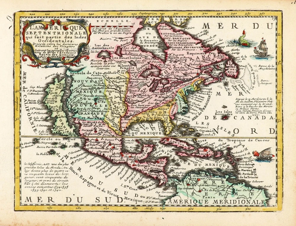
California as an island.
L'Amerique Septentrionale qui fait partie des Indes Occidentales. 1719
North America by Chiquet Jacques.
[Item number: 30085]
California as an island.
Americque Septentrionale. 1715
North America by Nicolas Sanson, published by Nicolas Chemereau.
[Item number: 30086]

California as an island.
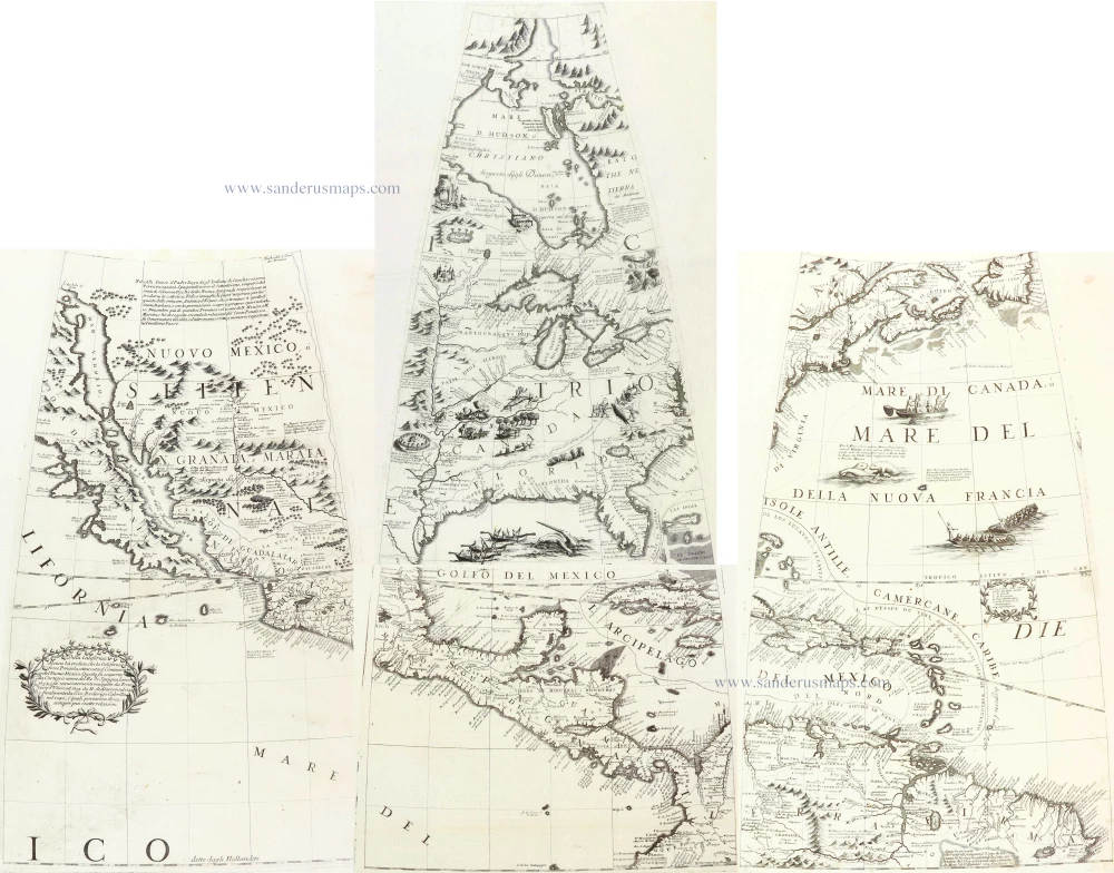
L'America Settentrionale. 1677
North America by Giovanni Giacomo de Rossi.
[Item number: 30088]

Carte de la Partie de l'Amérique Septentrionale, comprenant les Possessions Espagnoles. 1788
North America by Louis Brion de la Tour.
[Item number: 30144]