
Brabant by Frederick De Wit. 1670-71

Frederick de Wit (1630-1706)
The engraver and map-seller, Frederick de Wit, was born in Gouda (Netherlands) in 1630 as a son of Hendrick Fredericksz de Wit. Through his marriage with Maria van der Waag of Amsterdam in 1661, he obtained citizenship of the city where he had been working since 1648 and where he became one of the most famous engravers of maps of the second half of the 17th century. Although De Wit was a Catholic, which meant that he was not favoured at the time by the city council, he was awarded the honour of being listed as one of the "excellent citizens" on the roll of the city council in the years 1694-1704. However, his name was not written in the Guild of St. Luke book before 1664. At that time, he lived on the Kalverstraat "in de Witte Pascaert", where he stayed until his death in 1706. His earliest dates on maps engraved are 1659 (Regni Daniae) and 1660 (World map).
Frederick de Wit published several world atlases, a sea atlas, and an atlas of the Netherlands.
The dating of the maps is difficult. However, as a privilege was granted in 1689, the annotation 'cum privilegio' marks an edition after 1688.
Around 1700, Frederick de Wit entered the market with a town atlas. He produced two volumes with a total of 260 plans and views. Most were printed from plates used for Janssonius and Blaeu town atlases.
After he died in 1706, his widow continued the shop until 1709. The plates and stock of De Wit's atlas were sold to Covens & Mortier in 1710, who sold the atlas for an extended period.
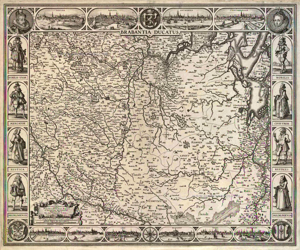
Tabula Ducatus Brabantiae continens Marchionatum Sacri Imperiii et Dominium Mechliniense
Item Number: 30526 Authenticity Guarantee
Category: Antique maps > Europe > Belgium
Brabant by Frederick De Wit.
Title: Tabula Ducatus Brabantiae continens Marchionatum Sacri Imperiii et Dominium Mechliniense
emendata à F. De Wit. 1666.
t'Amsterdam gedruckt by Frederick de Wit inde Kalverstraet by den Dam inde Witte Paskaert.
Oriented to the west.
Date of the first edition: 1666.
Date of this map: 1670-71.
Copper engraving, printed on paper.
Image size: 465 x 545mm (18.31 x 21.46 inches).
Sheet size: 510 x 605mm (20.08 x 23.82 inches).
Verso: Blank.
Condition: Original coloured, excellent..
Condition Rating: A+.
From: De Wit F., Atlas, Amsterdam, 1670-1671. (Carhart, p. 138, A-XI)
Frederick de Wit (1630-1706)
The engraver and map-seller, Frederick de Wit, was born in Gouda (Netherlands) in 1630 as a son of Hendrick Fredericksz de Wit. Through his marriage with Maria van der Waag of Amsterdam in 1661, he obtained citizenship of the city where he had been working since 1648 and where he became one of the most famous engravers of maps of the second half of the 17th century. Although De Wit was a Catholic, which meant that he was not favoured at the time by the city council, he was awarded the honour of being listed as one of the "excellent citizens" on the roll of the city council in the years 1694-1704. However, his name was not written in the Guild of St. Luke book before 1664. At that time, he lived on the Kalverstraat "in de Witte Pascaert", where he stayed until his death in 1706. His earliest dates on maps engraved are 1659 (Regni Daniae) and 1660 (World map).
Frederick de Wit published several world atlases, a sea atlas, and an atlas of the Netherlands.
The dating of the maps is difficult. However, as a privilege was granted in 1689, the annotation 'cum privilegio' marks an edition after 1688.
Around 1700, Frederick de Wit entered the market with a town atlas. He produced two volumes with a total of 260 plans and views. Most were printed from plates used for Janssonius and Blaeu town atlases.
After he died in 1706, his widow continued the shop until 1709. The plates and stock of De Wit's atlas were sold to Covens & Mortier in 1710, who sold the atlas for an extended period.
Related items
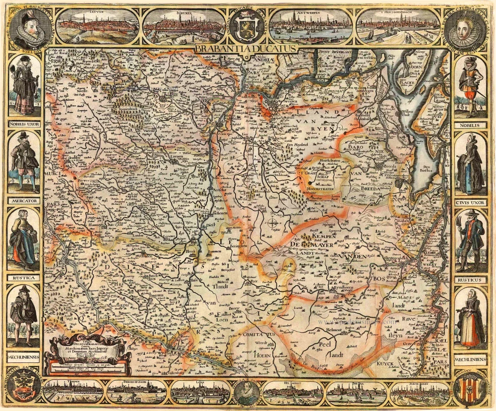
Brabantia Ducatus / Tabula Ducatus Brabantiae Continens Marchionatum Sacri Imperij et Dominium Mechliniense Magna cura edita à Nicolao Iohannis Visscher. Anno 1622. 1622
Brabant by C.J. Visscher.
[Item number: 2640]

Brabantiae Descriptio 1601
Brabant, with an inset map of the district of Mechelen, by Abraham Ortelius.
[Item number: 12909]
Ducatus Brabantiae. 1631
Brabant by Abraham Goos,published by Joannes Janssonius.
[Item number: 17723]

Novissima et Accuratissima Brabantiae Ducatus Tabula. 1638
Brabant by Henricus Hondius, published by J. Janssonius.
[Item number: 19012]

Brabantia Ducatus 1664-65
Brabant by Willem Blaeu
[Item number: 20955]

Brabantiae Belgarum provinciae recens exactaque descriptio. 1602
Brabant by M. Quad - J. Bussemacher.
[Item number: 25235]

Brabantiae Descriptio. 1595
Brabant, by A. Ortelius.
[Item number: 25573]
Pars Meridionalis Brabantiae continens Dominium Mechliniense Ducatum Arschotanum. 1641
Southern Brabant by Henricus Hondius.
[Item number: 26303]

Important and rare map.
Brabantiae Belgarum Provinciae Recens Exactaque Descriptio. 1558
Brabant, by Michele Tramezini.
[Item number: 26713]

Brabantiae Germaniae Inferioris Nobilissimmae Provinciae Descriptio. 1572
Brabant by Abraham Ortelius
[Item number: 26734]
Rare!
Brabantia Ducatus / Tabula Ducatus Brabantiae Continens Marchionatum Sacri Imperij et Dominium Mechliniense - Magna Cura edita à Petri Verbist Anno 1628. 1628
Brabant by Pieter Verbiest
[Item number: 27743]

Brabantia Ducatus Machliniae Urbis Dominium. 1617
The Duchy of Brabant by Pieter van den Keere (Petrus Kaerius).
[Item number: 28672]
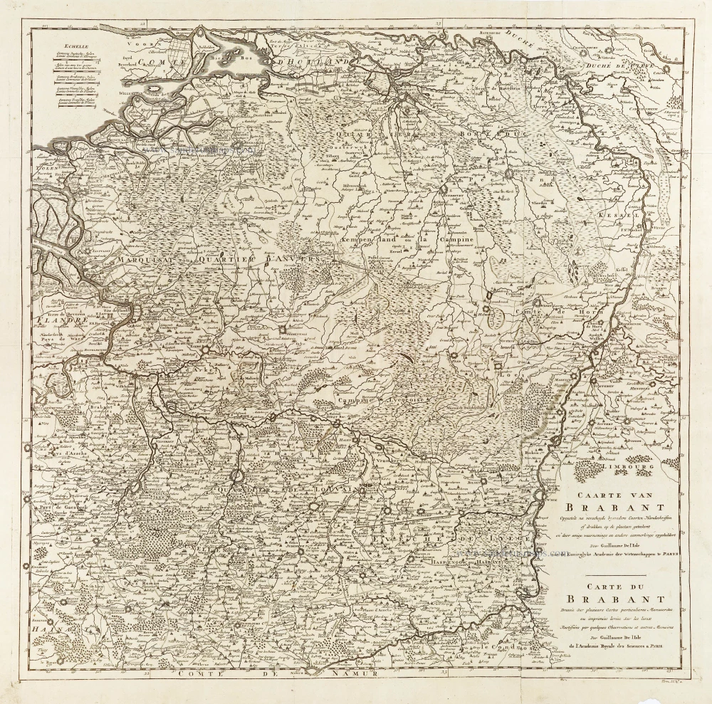
Caarte van Brabant - Carte du Brabant. 1729
Brabant, by Guillaume De L'Isle, published by J. Dumont.
[Item number: 29338]

First edition, woodcut
Descrittione particulare di Brabante. 1567
Brabant by Lodovico Guicciardini.
[Item number: 29504]

Forêt de Soignes - Zoniën Woud by Willem Blaeu.
Secunda Pars Brabantiae cuius urbs primaria Bruxellae. 1643
Southern Brabant (Brussels) by Willem Blaeu.
[Item number: 29930]
Very rare first state.
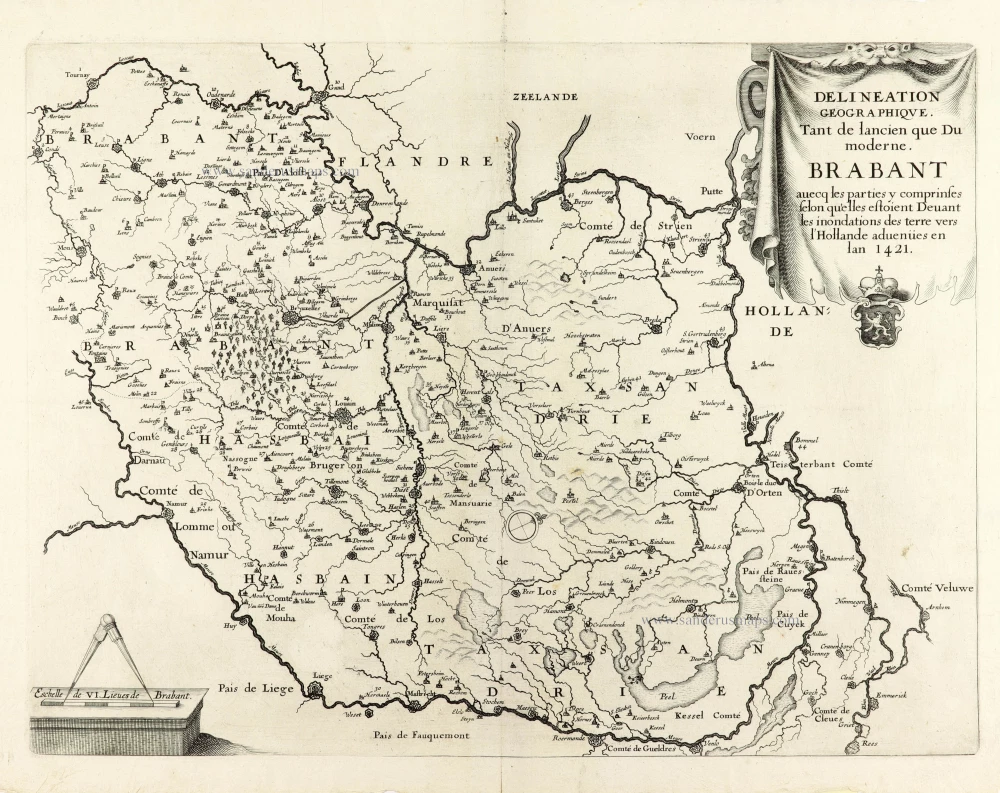
Delineation Geographique. Tant de lancien que Du moderne. Brabant avecq les parties y comprinses selon qu'elles estoient Devant les inondations des terre vers l'Hollande advenües en lan 1421. 1637
Historical map of Brabant by Christophe Butkens.
[Item number: 30291]

Partie Septentrionale du Duché de Brabant où se trouvent les Mairies de Bosleduc de Turnhout, de Santhoven, d'Herentals, les Marquisats de Berg-op-Zoom, et du St Empire, la Baronie de Bréda partie de la Seigneurie de Malines, et de l'Evêché de Lyége &c. 1757
Southern Brabant par Robert de Vaugondy.
[Item number: 30403]

Menapii. Dioecese de l'Archev[es]ché de Malines. Partie meridionale du Duché de Brabant, ou sont les quartiers de Louvain, et du Brusselles; et la seign[eu]rie de Malines. 1679-1710
Historical map of Southern Brabant, by Guillaume Sanson, published by P. Mariette.
[Item number: 30520]

[No Title] 1630
Brabant by Gerard Mercator.
[Item number: 30943]

Prima Pars Brabantiae cuius caput Lovanium. 1635
Leuven by Willem Blaeu.
[Item number: 31046]

Brabantia. 1618
Brabant by Petrus Bertius, published by Jodocus Hondius II.
[Item number: 31591]

Le Duché de Brabant qui comprend les quartiers de Louvan, Brusselles, Anvers et Bos le Duc 1692
Northern Brabant, by N. Sanson, so-called published by Hubert Jaillot. (Pirated edition by Pierre Mortier).
[Item number: 31721]

Carte de Brabant. 1633
Brabant by Chistophe Tassin.
[Item number: 31930]

Ducatus Brabantiae Nova Tabula in qua Lovanii Bruxxellarum March S. Imperii Sylvae Ducis et Mechliniae Dominia in sua suasq. minores Ditiones subdivisa ostenduntur. c. 1720
Brabant, by J.B. Homann.
[Item number: 32467]

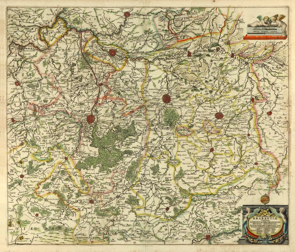
Ducatus Brabantiae Tabula continens Sacri Imperii Marchionatum et Dominium Mechliniense de novo accurate emendata. c. 1704-1706
Brabant by Johannes Danckerts.
[Item number: 32498]