Very rare first state.
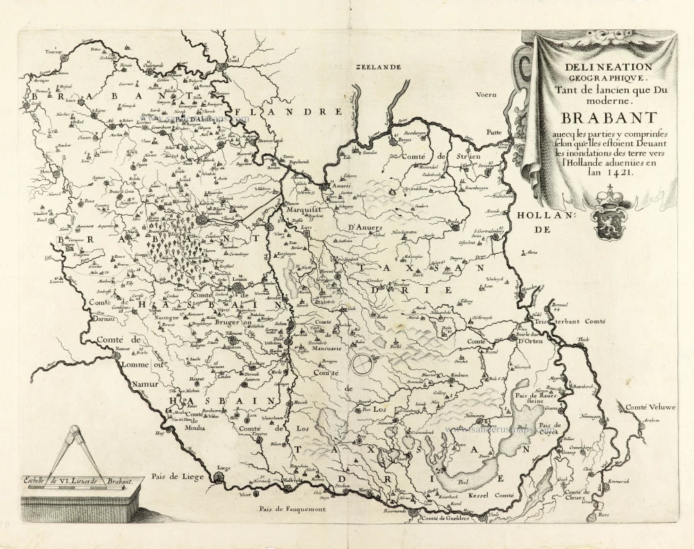
Historical map of Brabant by Christophe Butkens. 1637
Christophe Butkens (1590-1650)
Cistercian abbot from Antwerp, historian and genealogist. Author of the historical work Trophées tant sacres que prophane de la Duché de Brabant. (1637).
Delineation Geographique. Tant de lancien que Du moderne. Brabant avecq les parties y comprinses selon qu'elles estoient Devant les inondations des terre vers l'Hollande advenües en lan 1421.
Item Number: 30291 Authenticity Guarantee
Category: Antique maps > Europe > Belgium
Historical map of Brabant by Christophe Butkens.
It shows Brabant as it was before the St. Elisabeth Flood of 1421.
Title: Delineation Geographique. Tant de lancien que Du moderne. Brabant avecq les parties y comprinses selon qu'elles estoient Devant les inondations des terre vers l'Hollande advenües en lan 1421.
In the map image, 45 numbers refer to a corresponding explanation in the book.
Oriented to the west.
Engraver: Mathieu Borrekens.
Date of the first edition: 1637.
Date of this map: 1637.
First state (of two). The second edition appeared in 1721 and was printed from a new copperplate: the map has a frame, the Oosterschelde and the Westerschelde continue to the edge, etc.
Copper engraving, printed on paper.
Image size: 335 x 445mm (13.19 x 17.52 inches).
Sheet size: 370 x 460mm (14.57 x 18.11 inches).
Verso: Blank.
Condition: Excellent.
Condition Rating: A+.
From: F.C. Butkens. Trophées tant sacres que prophane de la Duché de Brabant. Antwerpen, Christophe Jeger, [1637].
Christophe Butkens (1590-1650)
Cistercian abbot from Antwerp, historian and genealogist. Author of the historical work Trophées tant sacres que prophane de la Duché de Brabant. (1637).

