
Brabant by Henricus Hondius, published by J. Janssonius. 1638


The Hondius Family
Jodocus Hondius the Elder (1563-1612)
Joost d’Hondt was born at Wakken (Flanders) in 1563. Two years later, his family settled down in Ghent, where young Joost displayed a great gift for drawing and calligraphy. By study and lessons, he developed his talents and became an engraver with a good reputation.
Due to the circumstances of war, he moved in 1584 to London where he settled down as an engraver, instrument-maker and map-maker. In 1587, he married Coletta van den Keere, sister of the well-known engraver, Pieter van den Keere (Petrus Kaerius); some years earlier his sister, Jacomina, had married Pieter van den Berghe (Petrus Montanus). Joost, who had latinized his name to Jodocus Hondius, closely co-operated with his two brothers-in-law.
The political situation in the Northern Netherlands in 1593 was such that Jodocus seemed to be justified in establishing himself in Amsterdam, where so many Antwerp printers, publishers, and engravers had gone. In this new centre of cartography, Jodocus Hondius set up his business “In de Wackere Hondt” (in the vigilant dog), this name being an allusion to his birthplace and name. Here he engraved many maps and published atlases and many other works such as his continuation of Gerard Mercator’s Atlas.
He suddenly passed away in February 1612. The publishing firm of Jodocus Hondius was continued by his widow; later on by his two sons Jodocus Jr., and Henricus, and by his son-in-law, J. Janssonius.
Jodocus Hondius II (1594-1629) & Henricus Hondius (1597-1651)
After the father’s death, the widow with her seven children continued publishing the atlases under the name of Jodocus Hondius till 1620. The firm was reinforced by the very welcome help of Joannes Janssonius (1588-1664), who married 24-year-old Elisabeth Hondius in 1612. After 1619 Mercator’s Atlas was published under the name of Henricus Hondius.
One of the most dramatic events in the early history of commercial cartography in Amsterdam was the sale of Jodocus Hondius Jr.’s copper-plates to Willem Jansz. Blaeu in 1629, the year of his death. At least 34 plates, from which Jodocus II had printed single-sheet maps for his own benefit, passed into the hands of his great competitor. Immediately after that, his brother, Henricus, and Joannes Janssonius ordered the engraving of identical plates.
During a long period, Henricus devoted all his energy to the publication of the Atlas. He saw its growth up to, and including, the fourth part in 1646; after that, his name does not figure any more on the title-pages. After 1638, the title of the Atlas was changed to Atlas Novus; it was mainly carried on by Joannes Janssonius.
The competition with the Blaeus dates from 1630. In 1630, Willem Janszoon (=Blaeu) made the first attack with his Atlantis Appendix. In 1635, Blaeu completed his Theatrum orbis terrarum in two volumes with texts in French, Latin, Dutch, and German, which prompted Henricus Hondius to speed up the enlargement of his Atlas.
The Janssonius Family
Joannes Janssonius (Arnhem, 1588-1664), son of the Arnhem publisher Jan Janssen, married Elisabeth Hondius, daughter of Jodocus Hondius, in Amsterdam in 1612. After his marriage, he settled down in this town as a bookseller and publisher of cartographic material. In 1618 he established himself in Amsterdam next door to Blaeu’s book shop. He entered into serious competition with Willem Jansz. Blaeu when copying Blaeu’s Licht der Zeevaert after the expiration of the privilege in 1620. His activities not only concerned the publication of atlases and books, but also of single maps and an extensive book trade with branches in Frankfurt, Danzig, Stockholm, Copenhagen, Berlin, Koningsbergen, Geneva, and Lyon. In 1631 he began publishing atlases together with Henricus Hondius.
In the early 1640s Henricus Hondius left the atlas publishing business completely to Janssonius. Competition with Joan Blaeu, Willem’s son and successor, in atlas production prompted Janssonius to enlarge his Atlas Novus finally into a work of six volumes, into which a sea atlas and an atlas of the Old World were inserted. Other atlases published by Janssonius are Mercator’s Atlas Minor, Hornius’s historical atlas (1652), the townbooks in eight volumes (1657), Cellarius’s Atlas Coelestis and several sea atlases and pilot guides.
After the death of Joannes Janssonius, the shop and publishing firm were continued by the heirs under the direction of Johannes van Waesbergen (c. 1616-1681), son-in-law of Joannes Janssonius. Van Waesbergen added the name of Janssonius to his own.
In 1676, Joannes Janssonius’s heirs sold by auction “all the remaining Atlases in Latin, French, High and Low German, as well as the Stedeboecken in Latin, in 8 volumes, bound and unbound, maps, plates belonging to the Atlas and Stedeboecken.” The copperplates from Janssonius’s atlases were afterwards sold to Schenk and Valck.
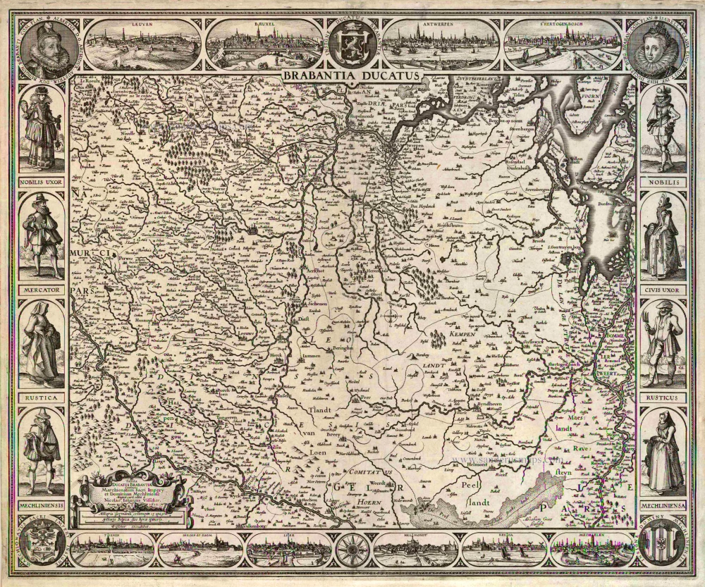
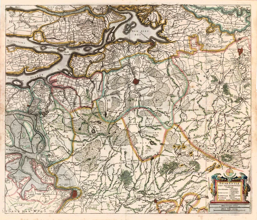
Novissima et Accuratissima Brabantiae Ducatus Tabula.
Item Number: 19012 Authenticity Guarantee
Category: Antique maps > Europe > Belgium
Old antique map of Brabant by Henricus Hondius, published by J. Janssonius.
Title: Novissima et Accuratissima Brabantiae Ducatus Tabula.
Amstelodami, Sumptibus Henrici Hondii, habitantis in Damo ad intersegne Atlantis. Anno 1629.
Oriented to the west.
Date of the first edition: 1629.
Date of this map: 1638.
Date on map: 1629.
Copper engraving, printed on paper.
Image size: 390 x 495mm (15.35 x 19.49 inches).
Sheet size: 490 x 570mm (19.29 x 22.44 inches).
Verso: German text.
Condition: Original coloured, excellent.
Condition Rating: A+.
From: Newer Atlas, Oder Weltbeschreibung, .... Amsterdam, J. Janssonius, 1638. (Van der Krogt 1, 421.1A)
The Hondius Family
Jodocus Hondius the Elder (1563-1612)
Joost d’Hondt was born at Wakken (Flanders) in 1563. Two years later, his family settled down in Ghent, where young Joost displayed a great gift for drawing and calligraphy. By study and lessons, he developed his talents and became an engraver with a good reputation.
Due to the circumstances of war, he moved in 1584 to London where he settled down as an engraver, instrument-maker and map-maker. In 1587, he married Coletta van den Keere, sister of the well-known engraver, Pieter van den Keere (Petrus Kaerius); some years earlier his sister, Jacomina, had married Pieter van den Berghe (Petrus Montanus). Joost, who had latinized his name to Jodocus Hondius, closely co-operated with his two brothers-in-law.
The political situation in the Northern Netherlands in 1593 was such that Jodocus seemed to be justified in establishing himself in Amsterdam, where so many Antwerp printers, publishers, and engravers had gone. In this new centre of cartography, Jodocus Hondius set up his business “In de Wackere Hondt” (in the vigilant dog), this name being an allusion to his birthplace and name. Here he engraved many maps and published atlases and many other works such as his continuation of Gerard Mercator’s Atlas.
He suddenly passed away in February 1612. The publishing firm of Jodocus Hondius was continued by his widow; later on by his two sons Jodocus Jr., and Henricus, and by his son-in-law, J. Janssonius.
Jodocus Hondius II (1594-1629) & Henricus Hondius (1597-1651)
After the father’s death, the widow with her seven children continued publishing the atlases under the name of Jodocus Hondius till 1620. The firm was reinforced by the very welcome help of Joannes Janssonius (1588-1664), who married 24-year-old Elisabeth Hondius in 1612. After 1619 Mercator’s Atlas was published under the name of Henricus Hondius.
One of the most dramatic events in the early history of commercial cartography in Amsterdam was the sale of Jodocus Hondius Jr.’s copper-plates to Willem Jansz. Blaeu in 1629, the year of his death. At least 34 plates, from which Jodocus II had printed single-sheet maps for his own benefit, passed into the hands of his great competitor. Immediately after that, his brother, Henricus, and Joannes Janssonius ordered the engraving of identical plates.
During a long period, Henricus devoted all his energy to the publication of the Atlas. He saw its growth up to, and including, the fourth part in 1646; after that, his name does not figure any more on the title-pages. After 1638, the title of the Atlas was changed to Atlas Novus; it was mainly carried on by Joannes Janssonius.
The competition with the Blaeus dates from 1630. In 1630, Willem Janszoon (=Blaeu) made the first attack with his Atlantis Appendix. In 1635, Blaeu completed his Theatrum orbis terrarum in two volumes with texts in French, Latin, Dutch, and German, which prompted Henricus Hondius to speed up the enlargement of his Atlas.
The Janssonius Family
Joannes Janssonius (Arnhem, 1588-1664), son of the Arnhem publisher Jan Janssen, married Elisabeth Hondius, daughter of Jodocus Hondius, in Amsterdam in 1612. After his marriage, he settled down in this town as a bookseller and publisher of cartographic material. In 1618 he established himself in Amsterdam next door to Blaeu’s book shop. He entered into serious competition with Willem Jansz. Blaeu when copying Blaeu’s Licht der Zeevaert after the expiration of the privilege in 1620. His activities not only concerned the publication of atlases and books, but also of single maps and an extensive book trade with branches in Frankfurt, Danzig, Stockholm, Copenhagen, Berlin, Koningsbergen, Geneva, and Lyon. In 1631 he began publishing atlases together with Henricus Hondius.
In the early 1640s Henricus Hondius left the atlas publishing business completely to Janssonius. Competition with Joan Blaeu, Willem’s son and successor, in atlas production prompted Janssonius to enlarge his Atlas Novus finally into a work of six volumes, into which a sea atlas and an atlas of the Old World were inserted. Other atlases published by Janssonius are Mercator’s Atlas Minor, Hornius’s historical atlas (1652), the townbooks in eight volumes (1657), Cellarius’s Atlas Coelestis and several sea atlases and pilot guides.
After the death of Joannes Janssonius, the shop and publishing firm were continued by the heirs under the direction of Johannes van Waesbergen (c. 1616-1681), son-in-law of Joannes Janssonius. Van Waesbergen added the name of Janssonius to his own.
In 1676, Joannes Janssonius’s heirs sold by auction “all the remaining Atlases in Latin, French, High and Low German, as well as the Stedeboecken in Latin, in 8 volumes, bound and unbound, maps, plates belonging to the Atlas and Stedeboecken.” The copperplates from Janssonius’s atlases were afterwards sold to Schenk and Valck.
Related items
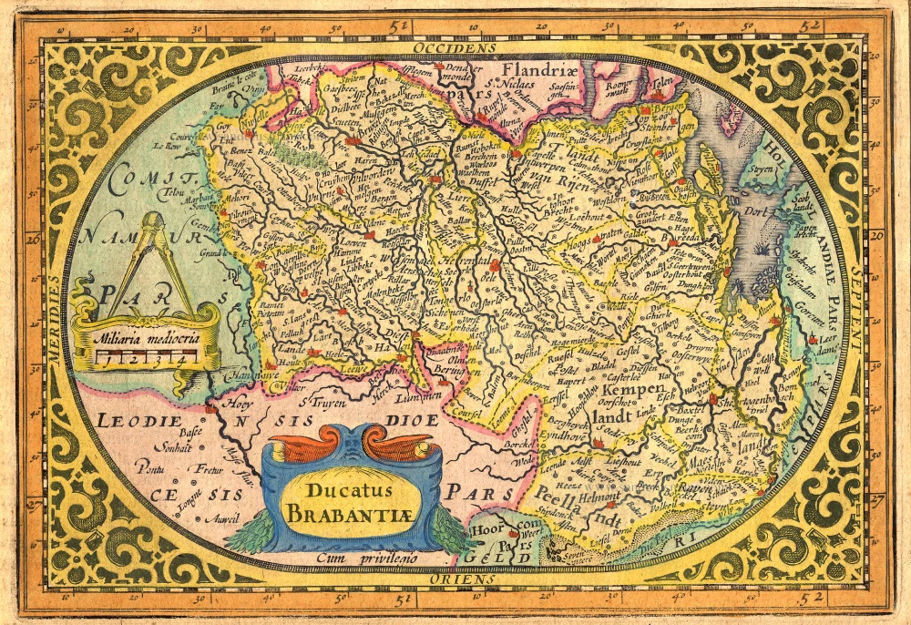
Brabantia Ducatus / Tabula Ducatus Brabantiae Continens Marchionatum Sacri Imperij et Dominium Mechliniense Magna cura edita à Nicolao Iohannis Visscher. Anno 1622. 1622
Brabant by C.J. Visscher.
[Item number: 2640]

Brabantiae Descriptio 1601
Brabant, with an inset map of the district of Mechelen, by Abraham Ortelius.
[Item number: 12909]
Ducatus Brabantiae. 1631
Brabant by Abraham Goos,published by Joannes Janssonius.
[Item number: 17723]

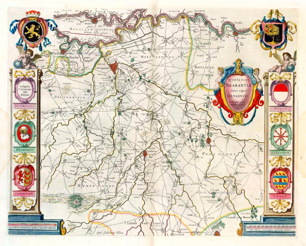
Quarta Pars Brabantiae cujus caput Sylvaducis. 1635
Northern Brabant, by Blaeu W. & J.
[Item number: 20384]

Brabantia Ducatus 1664-65
Brabant by Willem Blaeu
[Item number: 20955]

Brabantiae, pars Septentrionalis c. 1680
Northern Brabant, by Frederick de Wit.
[Item number: 24653]

Brabantiae Belgarum provinciae recens exactaque descriptio. 1602
Brabant by M. Quad - J. Bussemacher.
[Item number: 25235]

Brabantiae Descriptio. 1595
Brabant, by A. Ortelius.
[Item number: 25573]
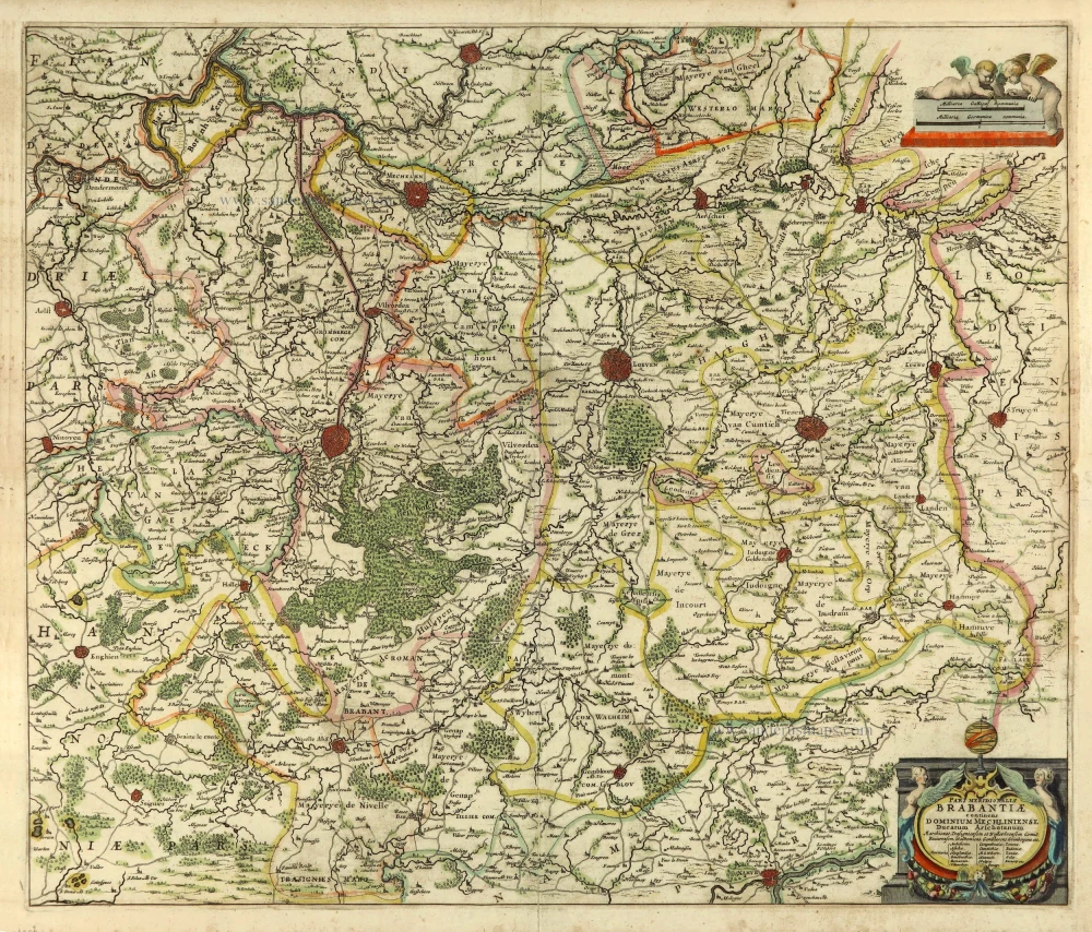
Pars Meridionalis Brabantiae continens Dominium Mechliniense Ducatum Arschotanum. 1641
Southern Brabant by Henricus Hondius.
[Item number: 26303]
Quarta Pars Brabantiae cujus caput Sylvaducis. 1643-50
Northern Brabant, by W. Blaeu.
[Item number: 26304]
Brabantiae Pars Septentrionalis Continens ... 1641
Northern Brabant, by Henricus Hondius.
[Item number: 26305]

[No title] 1633
Vlaanderen - Brabant, by J. Janssonius - J. Hondius.
[Item number: 26355]

Important and rare map.
Brabantiae Belgarum Provinciae Recens Exactaque Descriptio. 1558
Brabant, by Michele Tramezini.
[Item number: 26713]

Brabantiae Germaniae Inferioris Nobilissimmae Provinciae Descriptio. 1572
Brabant by Abraham Ortelius
[Item number: 26734]
Rare!
Brabantia Ducatus / Tabula Ducatus Brabantiae Continens Marchionatum Sacri Imperij et Dominium Mechliniense - Magna Cura edita à Petri Verbist Anno 1628. 1628
Brabant by Pieter Verbiest
[Item number: 27743]
Le Duché de Brabant qui comprend les Quartiers de Louvain, Brusselles, Anvers et Bosleduc diviséz en leurs Principales Jurisdictions, La Seigneurie de Malines et le Marquisat du Saint Empire. c. 1705
Southern Brabant, by Pieter Mortier.
[Item number: 27801]

Quarta Pars Brabantiae cujus caput Sylvaducis. c. 1680
Northern Brabant, by Joannes Janssonius.
[Item number: 28622]

Brabantia Ducatus Machliniae Urbis Dominium. 1617
The Duchy of Brabant by Pieter van den Keere (Petrus Kaerius).
[Item number: 28672]
Caarte van Brabant - Carte du Brabant. 1729
Brabant, by Guillaume De L'Isle, published by J. Dumont.
[Item number: 29338]

First edition, woodcut
Descrittione particulare di Brabante. 1567
Brabant by Lodovico Guicciardini.
[Item number: 29504]

Forêt de Soignes - Zoniën Woud by Willem Blaeu.
Secunda Pars Brabantiae cuius urbs primaria Bruxellae. 1643
Southern Brabant (Brussels) by Willem Blaeu.
[Item number: 29930]

Le Brabant Hollandois et Autrichien. 1747
Northwest Brabant by G.L. Le Rouge.
[Item number: 30255]
Very rare first state.
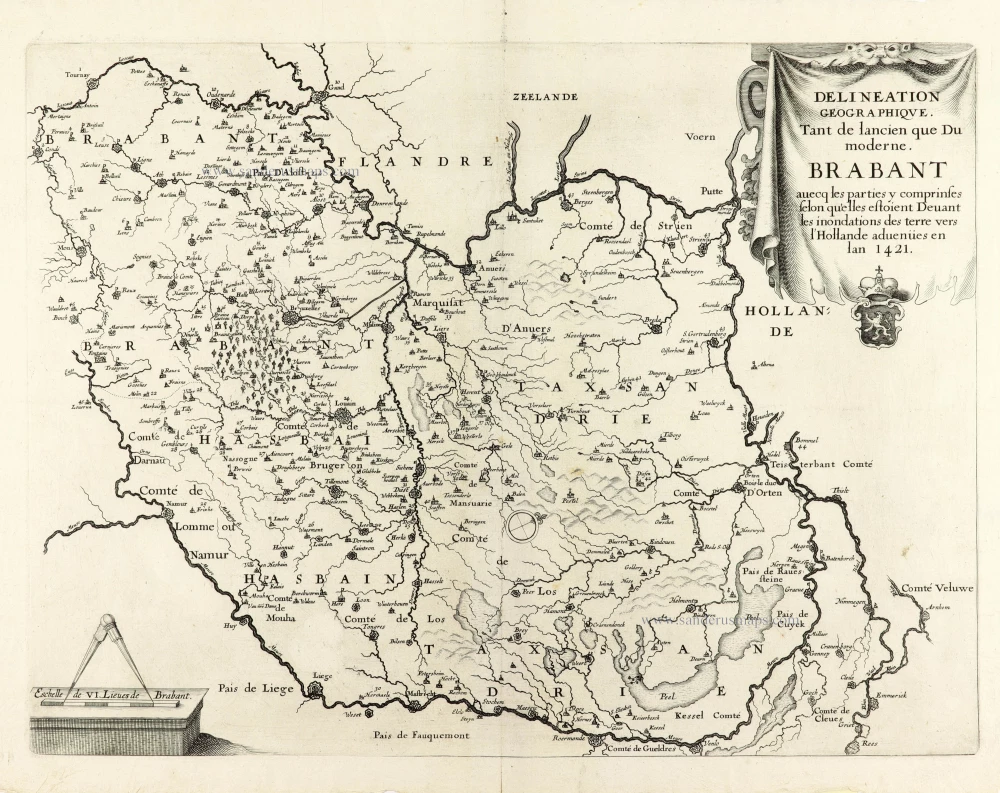
Delineation Geographique. Tant de lancien que Du moderne. Brabant avecq les parties y comprinses selon qu'elles estoient Devant les inondations des terre vers l'Hollande advenües en lan 1421. 1637
Historical map of Brabant by Christophe Butkens.
[Item number: 30291]

Partie Septentrionale du Duché de Brabant où se trouvent les Mairies de Bosleduc de Turnhout, de Santhoven, d'Herentals, les Marquisats de Berg-op-Zoom, et du St Empire, la Baronie de Bréda partie de la Seigneurie de Malines, et de l'Evêché de Lyége &c. 1757
Southern Brabant par Robert de Vaugondy.
[Item number: 30403]

Menapii. Dioecese de l'Archev[es]ché de Malines. Partie meridionale du Duché de Brabant, ou sont les quartiers de Louvain, et du Brusselles; et la seign[eu]rie de Malines. 1679-1710
Historical map of Southern Brabant, by Guillaume Sanson, published by P. Mariette.
[Item number: 30520]

Tabula Ducatus Brabantiae continens Marchionatum Sacri Imperiii et Dominium Mechliniense 1670-71
Brabant by Frederick De Wit.
[Item number: 30526]

[No Title] 1630
Brabant by Gerard Mercator.
[Item number: 30943]

Brabantia. 1618
Brabant by Petrus Bertius, published by Jodocus Hondius II.
[Item number: 31591]

Le Duché de Brabant qui comprend les quartiers de Louvan, Brusselles, Anvers et Bos le Duc 1692
Northern Brabant, by N. Sanson, so-called published by Hubert Jaillot. (Pirated edition by Pierre Mortier).
[Item number: 31721]

Carte de Brabant. 1633
Brabant by Chistophe Tassin.
[Item number: 31930]

Ducatus Brabantiae Nova Tabula in qua Lovanii Bruxxellarum March S. Imperii Sylvae Ducis et Mechliniae Dominia in sua suasq. minores Ditiones subdivisa ostenduntur. c. 1720
Brabant, by J.B. Homann.
[Item number: 32467]

Ducatus Brabantiae Tabula continens Sacri Imperii Marchionatum et Dominium Mechliniense de novo accurate emendata. c. 1704-1706
Brabant by Johannes Danckerts.
[Item number: 32498]