
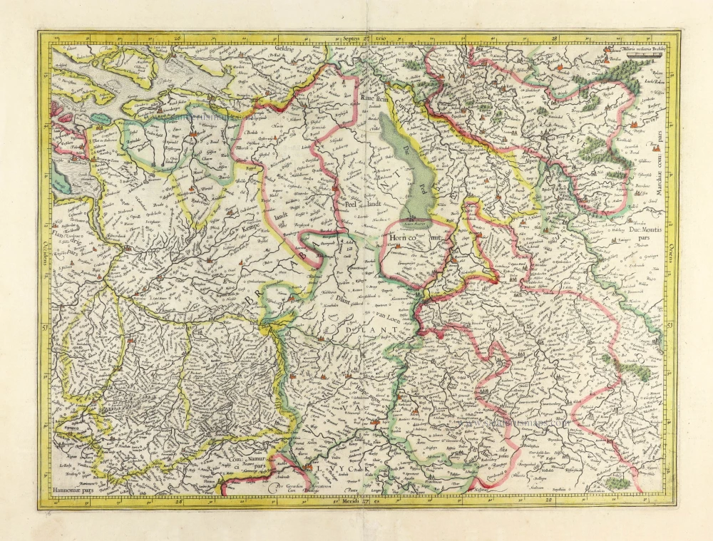
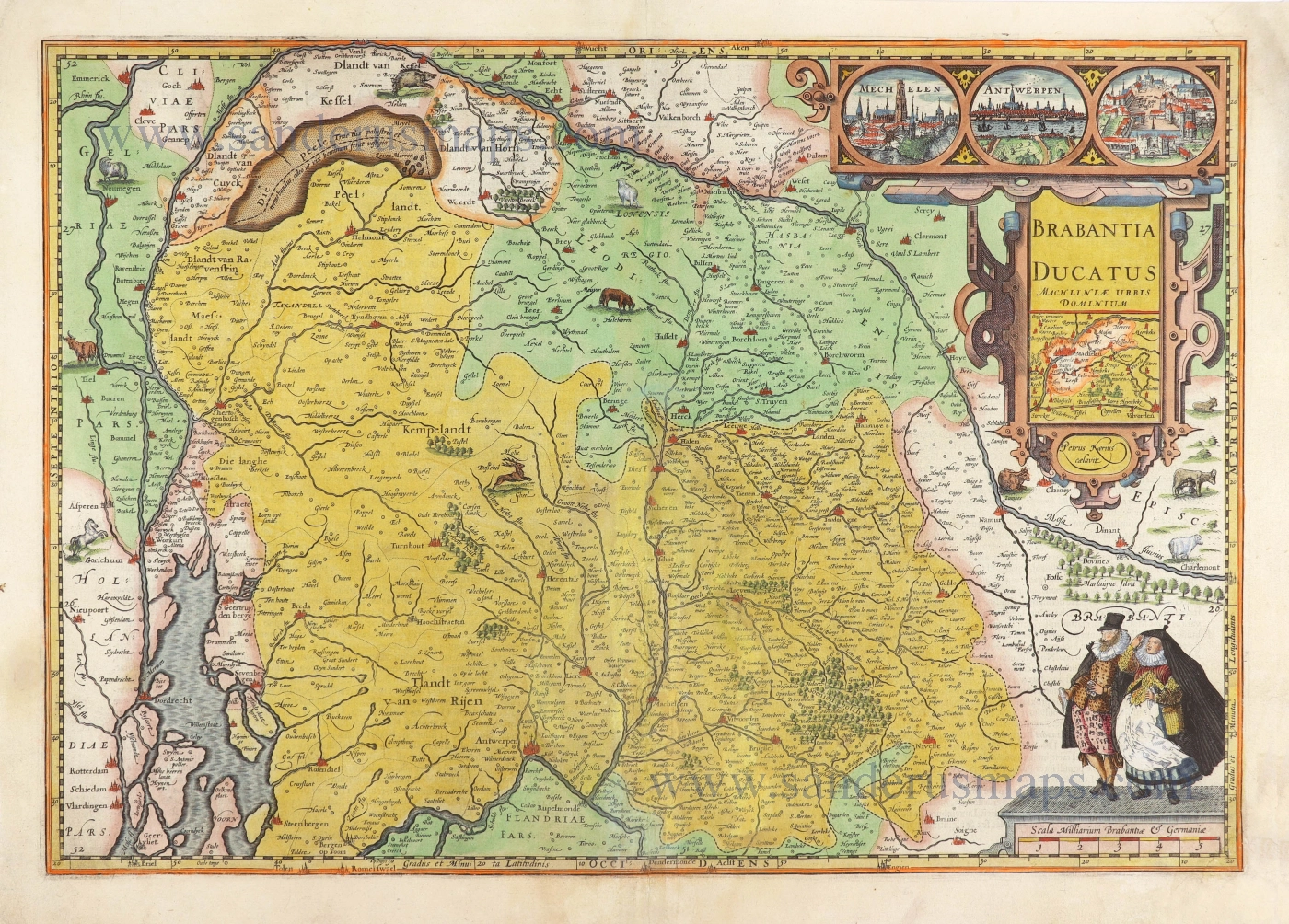
Brabant by Gerard Mercator. 1619


Gerard Mercator (1512 – 1594)
Gerard Mercator was born Gerard de Cremere in Rupelmonde (near Antwerp) on 5 March 1512.
Young Gerard learned what Latin he could in Rupelmonde, and when he was about fifteen, his uncle sent him to s'Hertogenbosch to study at a school run by the Brothers of the Common Life. One of Mercator’s teachers was the celebrated humanist Macropedius. After three and a half years with the brothers, Gerard went to Louvain, where he enrolled in the university in 1530 as one of the poor students at Castle College.
By this time, he had Latinized his name to Mercator. He studied philosophy and took his master’s degree in 1532. The problems of the creation of the Universe and the Earth interested him in particular, and this is reflected in his works written in later years.
After spending a few years in Antwerp, he returned to Louvain in c. 1535, where he took courses in mathematics under Gemma Frisius. Soon, he was recognised as an expert on the construction of mathematical instruments, as a land surveyor and, after 1537, as a cartographer. He drew his income from these activities after his marriage on August 3, 1536. He also qualified himself as a copper engraver, the first to introduce italic handwriting to this trade. The first maps, drawn and engraved by Gerard Mercator, are Palestine, 1537; the World in double heart-shaped projection, 1538; and Flanders, 1540.
In 1544, Mercator came into great danger: he was arrested on the accusation of heresy and put into jail. Thanks to the intervention of the University of Louvain, he was released after four months. In 1552, he moved with his family to Duisburg (Germany). In 1560, Mercator became a cosmographer in service of the Duke of Jülich-Cleve-Berge, and in 1563, he became a lecturer at the Grammar School of the new University in Duisburg. During this period, he made wall maps of Europe, 1554; of Loraine, 1564; the British Isles, 1564; and the famous world map with increasing latitudes, 1569. About this time, Mercator was also working on the project for a complete description of the creation, the Heavens, Earth, Sea and world history. This resulted in his Atlas, sive cosmographicae meditationes de fabrica mundi et fabricati figura. He also worked on an edition of Ptolemy’s Geographia in 1578. The first part of his book, which contains modern maps (France, Germany, and the Netherlands), appeared in 1585.
Shortly after the publication of the second part of his map book (not yet called Atlas) with the maps of Italy (1589), he had a stroke that ended his highly significant productivity. The great man passed away on 2 December 1594, leaving the responsibility of finishing the map book to his son Rumold. The final part of it appeared in 1595. Its title is Pars Altera, and it constitutes an essential part of what was then called Mercator’s Atlas.
The map of Europe and the world map in the Atlas are by Rumold Mercator. After Rumold died in 1599, the Atlas was reissued in 1602.
The plates of the maps, both of the Ptolemy edition and the Atlas, were sold in 1604 to Jodocus Hondius of Amsterdam. The following year, Hondius managed to bring out Ptolemy’s Geographia. In 1606, the first Amsterdam edition of the Mercator Atlas appeared in the next year. From then to 1638, the Atlas saw many enlarged editions in various languages.
[No Title]
Item Number: 30249 Authenticity Guarantee
Category: Antique maps > Europe > Belgium
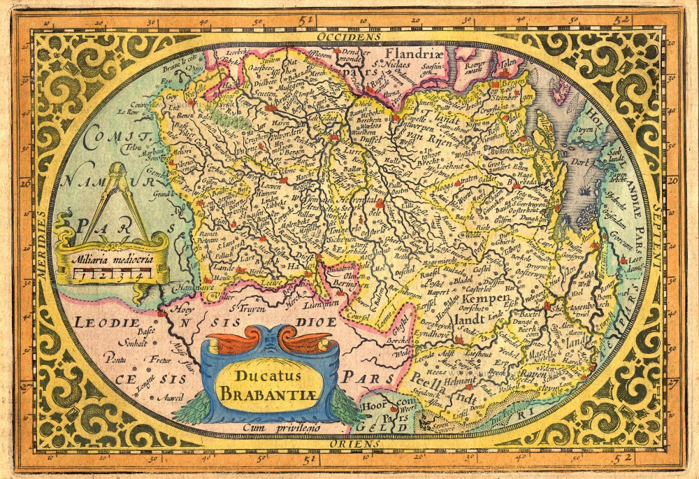
Brabant by Gerard Mercator.
[No Title]
Per Gerardum Mercatorem
Cum Privilegio.
Date of the first edition: 1585.
Date of this map: 1619.
Copper engraving, printed on paper.
Image size: 350 x 465mm (13.78 x 18.31 inches).
Sheet size: 390 x 535mm (15.35 x 21.06 inches).
Verso: French text.
Condition: Original coloured, centrefold split reinforced at the back.
Condition Rating: A.
From: Gerardi Mercatoris - Atlas sive Cosmographicae Meditationes de Fabrica Mundi et Fabricati Figura. Sumptibus & typis aeneis Iudoci Hondij, Amsterodami An. D. 1619. (Van der Krogt 1, 113)
Gerard Mercator (1512 – 1594)
Gerard Mercator was born Gerard de Cremere in Rupelmonde (near Antwerp) on 5 March 1512.
Young Gerard learned what Latin he could in Rupelmonde, and when he was about fifteen, his uncle sent him to s'Hertogenbosch to study at a school run by the Brothers of the Common Life. One of Mercator’s teachers was the celebrated humanist Macropedius. After three and a half years with the brothers, Gerard went to Louvain, where he enrolled in the university in 1530 as one of the poor students at Castle College.
By this time, he had Latinized his name to Mercator. He studied philosophy and took his master’s degree in 1532. The problems of the creation of the Universe and the Earth interested him in particular, and this is reflected in his works written in later years.
After spending a few years in Antwerp, he returned to Louvain in c. 1535, where he took courses in mathematics under Gemma Frisius. Soon, he was recognised as an expert on the construction of mathematical instruments, as a land surveyor and, after 1537, as a cartographer. He drew his income from these activities after his marriage on August 3, 1536. He also qualified himself as a copper engraver, the first to introduce italic handwriting to this trade. The first maps, drawn and engraved by Gerard Mercator, are Palestine, 1537; the World in double heart-shaped projection, 1538; and Flanders, 1540.
In 1544, Mercator came into great danger: he was arrested on the accusation of heresy and put into jail. Thanks to the intervention of the University of Louvain, he was released after four months. In 1552, he moved with his family to Duisburg (Germany). In 1560, Mercator became a cosmographer in service of the Duke of Jülich-Cleve-Berge, and in 1563, he became a lecturer at the Grammar School of the new University in Duisburg. During this period, he made wall maps of Europe, 1554; of Loraine, 1564; the British Isles, 1564; and the famous world map with increasing latitudes, 1569. About this time, Mercator was also working on the project for a complete description of the creation, the Heavens, Earth, Sea and world history. This resulted in his Atlas, sive cosmographicae meditationes de fabrica mundi et fabricati figura. He also worked on an edition of Ptolemy’s Geographia in 1578. The first part of his book, which contains modern maps (France, Germany, and the Netherlands), appeared in 1585.
Shortly after the publication of the second part of his map book (not yet called Atlas) with the maps of Italy (1589), he had a stroke that ended his highly significant productivity. The great man passed away on 2 December 1594, leaving the responsibility of finishing the map book to his son Rumold. The final part of it appeared in 1595. Its title is Pars Altera, and it constitutes an essential part of what was then called Mercator’s Atlas.
The map of Europe and the world map in the Atlas are by Rumold Mercator. After Rumold died in 1599, the Atlas was reissued in 1602.
The plates of the maps, both of the Ptolemy edition and the Atlas, were sold in 1604 to Jodocus Hondius of Amsterdam. The following year, Hondius managed to bring out Ptolemy’s Geographia. In 1606, the first Amsterdam edition of the Mercator Atlas appeared in the next year. From then to 1638, the Atlas saw many enlarged editions in various languages.
Related items
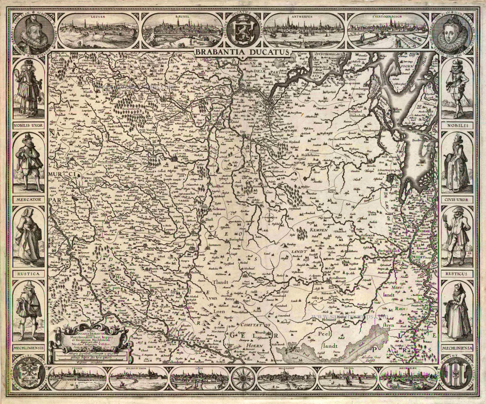
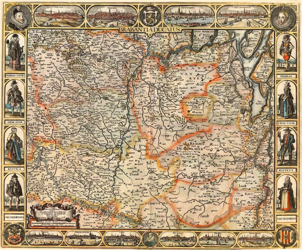
Brabantia Ducatus / Tabula Ducatus Brabantiae Continens Marchionatum Sacri Imperij et Dominium Mechliniense Magna cura edita à Nicolao Iohannis Visscher. Anno 1622. 1622
Brabant by C.J. Visscher.
[Item number: 2640]
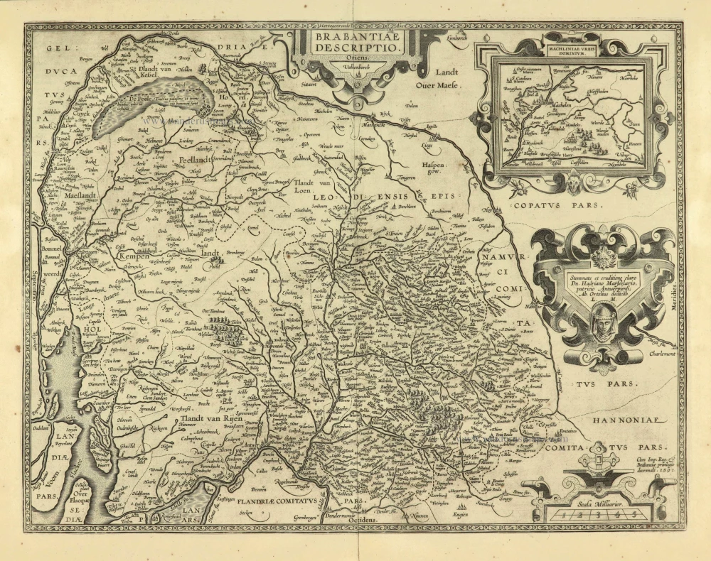
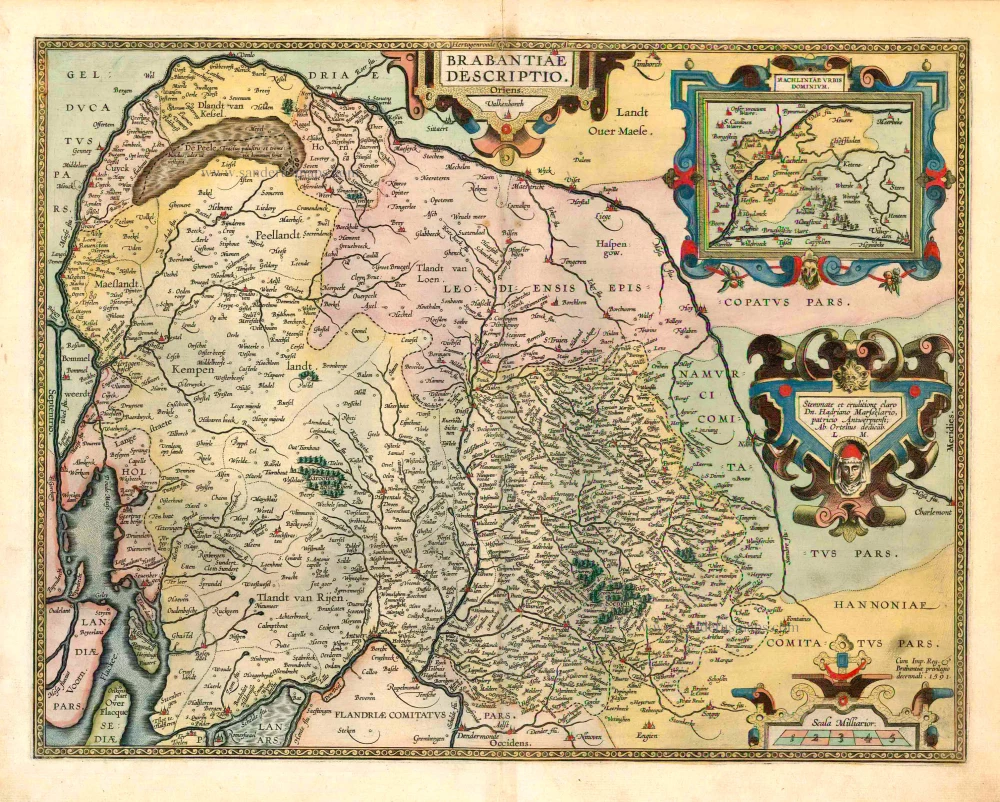
Brabantiae Descriptio 1601
Brabant, with an inset map of the district of Mechelen, by Abraham Ortelius.
[Item number: 12909]
Ducatus Brabantiae. 1631
Brabant by Abraham Goos,published by Joannes Janssonius.
[Item number: 17723]

Novissima et Accuratissima Brabantiae Ducatus Tabula. 1638
Brabant by Henricus Hondius, published by J. Janssonius.
[Item number: 19012]
Brabantiae Belgarum provinciae recens exactaque descriptio. 1602
Brabant by M. Quad - J. Bussemacher.
[Item number: 25235]
Brabantiae Descriptio. 1595
Brabant, by A. Ortelius.
[Item number: 25573]

Important and rare map.
Brabantiae Belgarum Provinciae Recens Exactaque Descriptio. 1558
Brabant, by Michele Tramezini.
[Item number: 26713]

Brabantiae Germaniae Inferioris Nobilissimmae Provinciae Descriptio. 1572
Brabant by Abraham Ortelius
[Item number: 26734]
Rare!
Brabantia Ducatus / Tabula Ducatus Brabantiae Continens Marchionatum Sacri Imperij et Dominium Mechliniense - Magna Cura edita à Petri Verbist Anno 1628. 1628
Brabant by Pieter Verbiest
[Item number: 27743]
Brabantia Ducatus Machliniae Urbis Dominium. 1617
The Duchy of Brabant by Pieter van den Keere (Petrus Kaerius).
[Item number: 28672]
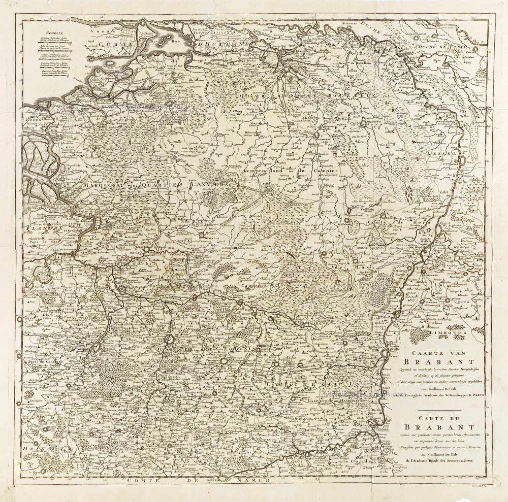
Caarte van Brabant - Carte du Brabant. 1729
Brabant, by Guillaume De L'Isle, published by J. Dumont.
[Item number: 29338]
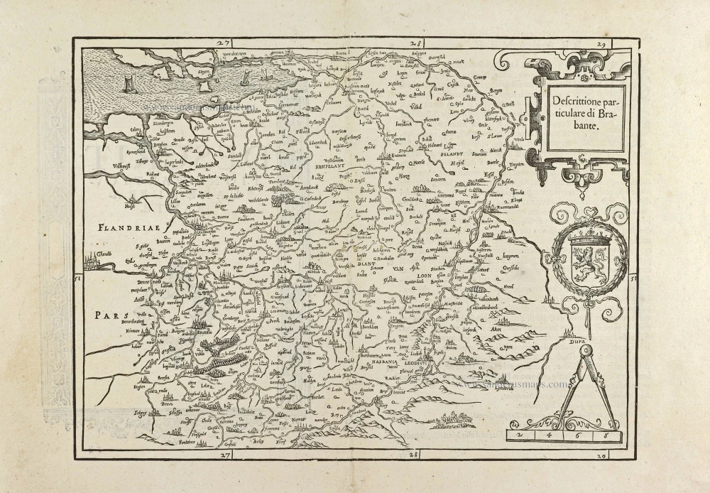
First edition, woodcut
Descrittione particulare di Brabante. 1567
Brabant by Lodovico Guicciardini.
[Item number: 29504]
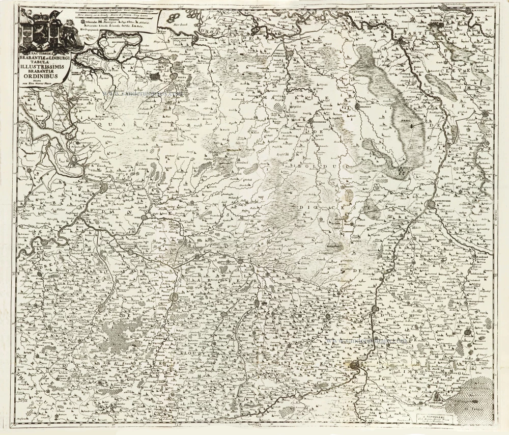
Exactissima Brabantiae et Limburgi Tabula Illustrissimis Brabantiae Ordinibus. 1712
Brabant & Zuid Limburg by Eugene Fricx.
[Item number: 29546]
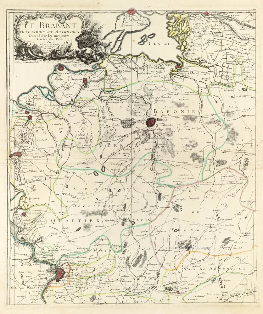
Le Brabant Hollandois et Autrichien. 1747
Northwest Brabant by G.L. Le Rouge.
[Item number: 30255]
Very rare first state.
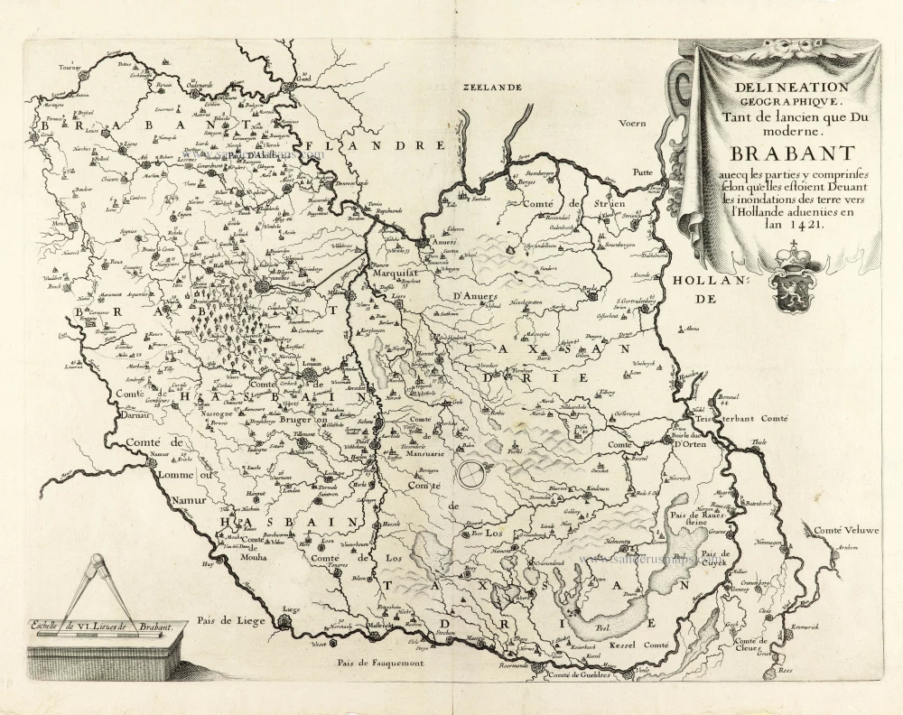
Delineation Geographique. Tant de lancien que Du moderne. Brabant avecq les parties y comprinses selon qu'elles estoient Devant les inondations des terre vers l'Hollande advenües en lan 1421. 1637
Historical map of Brabant by Christophe Butkens.
[Item number: 30291]
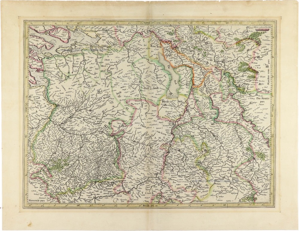
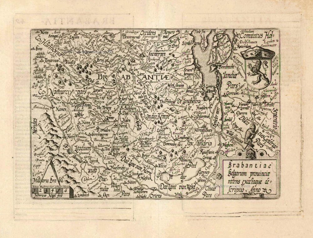
[No Title] 1630
Brabant by Gerard Mercator.
[Item number: 30943]