
Toledo, by Georg Braun and Frans Hogenberg. 1623
The item displayed on this page has been sold. However, we have a similar map in stock:
Toledo, by Georg Braun and Frans Hogenberg. 1617
Toletum
[Item number: 30115]


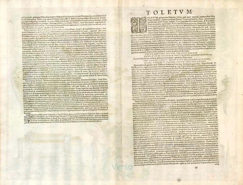


COMMENTARY BY BRAUN (on verso): " Toledo has already been described in the first volume of this atlas. In this plate, in addition to the plan of the city, the main or cathedral church and the royal palace are clearly illustrated [...]. I can say nothing firm about the founder of the city of Toledo, although some claim Hercules built it."
This detailed depiction of Toledo serves as a complement to the plate in Volume I. The two illustrations are very alike, something not usually the case with repeat views in the Civitates Orbis Terrarum and which may be explained by the fact that they both go back to the same original. The particular focus falls upon the city's two prominent buildings, the cathedral and the Alcazar. On the instructions of Archbishop Jiménez de Rada, the vast Gothic cathedral of Santa Maria was commenced around 1493. The Alcazar goes back to a Roman complex. It was renovated in the 16th century under Charles V, who used the palace as an official residence. Legend claims that Hercules founded the city. Still, Braun doubts this in his accompanying texts and offers alternative suggestions: in Volume I, he states Toledo was founded by the Roman consuls Telemon and Brutus, as recorded by L. Marinaeus Siculus and Tarapha. Strangely, in the present volume, he claims not to know where he read this. (Taschen)
Braun G. & Hogenberg F. and the Civitates Orbis Terrarum.
The Civitates Orbis Terrarum, also known as the 'Braun & Hogenberg', is a six-volume town atlas and the most excellent book of town views and plans ever published: 363 engravings, sometimes beautifully coloured. It was one of the best-selling works in the last quarter of the 16th century. Georg Braun, a skilled writer, wrote the text accompanying the plans and views on the verso. Many plates were engraved after the original drawings of a professional artist, Joris Hoefnagel (1542-1600). The first volume was published in Latin in 1572 and the sixth in 1617. Frans Hogenberg, a talented engraver, created the tables for volumes I through IV, and Simon van den Neuwel made those for volumes V and VI. Other contributors were cartographers Daniel Freese and Heinrich Rantzau, who provided valuable geographical information. Works by Jacob van Deventer, Sebastian Münster, and Johannes Stumpf were also used as references. Translations appeared in German and French, making the atlas accessible to a broader audience.
Since its original publication of volume 1 in 1572, the Civitates Orbis Terrarum has left an indelible mark on the history of cartography. Seven more editions followed the first volume in 1575, 1577, 1582, 1588, 1593, 1599, and 1612. Vol.2, initially released in 1575, saw subsequent editions in 1597 and 1612. The subsequent volumes, each a treasure trove of historical insights, graced the world in 1581, 1588, 1593, 1599, and 1606. The German translation of the first volume, a testament to its widespread appeal, debuted in 1574, followed by the French edition in 1575.
Several printers were involved: Theodor Graminaeus, Heinrich von Aich, Gottfried von Kempen, Johannis Sinniger, Bertram Buchholtz, and Peter von Brachel, all of whom worked in Cologne.
Georg Braun (1541-1622)
Georg Braun, the author of the text accompanying the plans and views in the Civitates Orbis Terrarum, was born in Cologne in 1541. After his studies in Cologne, he entered the Jesuit Order as a novice, indicating his commitment to learning and intellectual pursuits. In 1561, he obtained his bachelor's degree; in 1562, he received his Magister Artium, further demonstrating his academic achievements. Although he left the Jesuit Order, he continued his studies in theology, gaining a licentiate in theology. His theological background likely influenced the content and tone of the text in the Civitates Orbis Terrarum, adding a unique perspective to the work.
Frans Hogenberg (1535-1590)
Frans Hogenberg was a Flemish and German painter, engraver, and mapmaker. He was born in Mechelen as the son of Nicolaas Hogenberg.
By the end of the 1560s, Frans Hogenberg was employed upon Abraham Ortelius's Theatrum Orbis Terrarum, published in 1570; he is named an engraver of numerous maps. In 1568, he was banned from Antwerp by the Duke of Alva and travelled to London, where he stayed a few years before emigrating to Cologne. He immediately embarked on his two most important works, the Civitates, published in 1572 and the Geschichtsblätter, which appeared in several series from 1569 until about 1587.
Thanks to large-scale projects like the Geschichtsblätter and the Civitates, Hogenberg's social circumstances improved with each passing year. He died as a wealthy man in Cologne in 1590.
Toletum
Item Number: 2403 Authenticity Guarantee
Category: Antique maps > Europe > Spain and Portugal
Old, antique bird’s-eye view plan of Toledo, by Georg Braun & Frans Hogenberg, painted by Hoefnagel in 1566.
Ornate border with insets of the Alcazar and the cathedral.
Title: Toletum.
Date of the first edition: 1596.
Date of this map: 1623.
Copper engraving, printed on paper.
Size (not including margins): 375 x 505mm (14.76 x 19.88 inches).
Verso: Latin text.
Condition: Contemporary old coloured, excellent.
Condition Rating: A.
From: Urbium Praeipuarum Mundi Theatrum Quintum Auctore Georgio Braunio Agrippinate. Part 5. Köln, Petrus von Brachel, 1623. (Van der Krogt 4, 41:1.5)
COMMENTARY BY BRAUN (on verso): " Toledo has already been described in the first volume of this atlas. In this plate, in addition to the plan of the city, the main or cathedral church and the royal palace are clearly illustrated [...]. I can say nothing firm about the founder of the city of Toledo, although some claim Hercules built it."
This detailed depiction of Toledo serves as a complement to the plate in Volume I. The two illustrations are very alike, something not usually the case with repeat views in the Civitates Orbis Terrarum and which may be explained by the fact that they both go back to the same original. The particular focus falls upon the city's two prominent buildings, the cathedral and the Alcazar. On the instructions of Archbishop Jiménez de Rada, the vast Gothic cathedral of Santa Maria was commenced around 1493. The Alcazar goes back to a Roman complex. It was renovated in the 16th century under Charles V, who used the palace as an official residence. Legend claims that Hercules founded the city. Still, Braun doubts this in his accompanying texts and offers alternative suggestions: in Volume I, he states Toledo was founded by the Roman consuls Telemon and Brutus, as recorded by L. Marinaeus Siculus and Tarapha. Strangely, in the present volume, he claims not to know where he read this. (Taschen)
Braun G. & Hogenberg F. and the Civitates Orbis Terrarum.
The Civitates Orbis Terrarum, also known as the 'Braun & Hogenberg', is a six-volume town atlas and the most excellent book of town views and plans ever published: 363 engravings, sometimes beautifully coloured. It was one of the best-selling works in the last quarter of the 16th century. Georg Braun, a skilled writer, wrote the text accompanying the plans and views on the verso. Many plates were engraved after the original drawings of a professional artist, Joris Hoefnagel (1542-1600). The first volume was published in Latin in 1572 and the sixth in 1617. Frans Hogenberg, a talented engraver, created the tables for volumes I through IV, and Simon van den Neuwel made those for volumes V and VI. Other contributors were cartographers Daniel Freese and Heinrich Rantzau, who provided valuable geographical information. Works by Jacob van Deventer, Sebastian Münster, and Johannes Stumpf were also used as references. Translations appeared in German and French, making the atlas accessible to a broader audience.
Since its original publication of volume 1 in 1572, the Civitates Orbis Terrarum has left an indelible mark on the history of cartography. Seven more editions followed the first volume in 1575, 1577, 1582, 1588, 1593, 1599, and 1612. Vol.2, initially released in 1575, saw subsequent editions in 1597 and 1612. The subsequent volumes, each a treasure trove of historical insights, graced the world in 1581, 1588, 1593, 1599, and 1606. The German translation of the first volume, a testament to its widespread appeal, debuted in 1574, followed by the French edition in 1575.
Several printers were involved: Theodor Graminaeus, Heinrich von Aich, Gottfried von Kempen, Johannis Sinniger, Bertram Buchholtz, and Peter von Brachel, all of whom worked in Cologne.
Georg Braun (1541-1622)
Georg Braun, the author of the text accompanying the plans and views in the Civitates Orbis Terrarum, was born in Cologne in 1541. After his studies in Cologne, he entered the Jesuit Order as a novice, indicating his commitment to learning and intellectual pursuits. In 1561, he obtained his bachelor's degree; in 1562, he received his Magister Artium, further demonstrating his academic achievements. Although he left the Jesuit Order, he continued his studies in theology, gaining a licentiate in theology. His theological background likely influenced the content and tone of the text in the Civitates Orbis Terrarum, adding a unique perspective to the work.
Frans Hogenberg (1535-1590)
Frans Hogenberg was a Flemish and German painter, engraver, and mapmaker. He was born in Mechelen as the son of Nicolaas Hogenberg.
By the end of the 1560s, Frans Hogenberg was employed upon Abraham Ortelius's Theatrum Orbis Terrarum, published in 1570; he is named an engraver of numerous maps. In 1568, he was banned from Antwerp by the Duke of Alva and travelled to London, where he stayed a few years before emigrating to Cologne. He immediately embarked on his two most important works, the Civitates, published in 1572 and the Geschichtsblätter, which appeared in several series from 1569 until about 1587.
Thanks to large-scale projects like the Geschichtsblätter and the Civitates, Hogenberg's social circumstances improved with each passing year. He died as a wealthy man in Cologne in 1590.
Related items
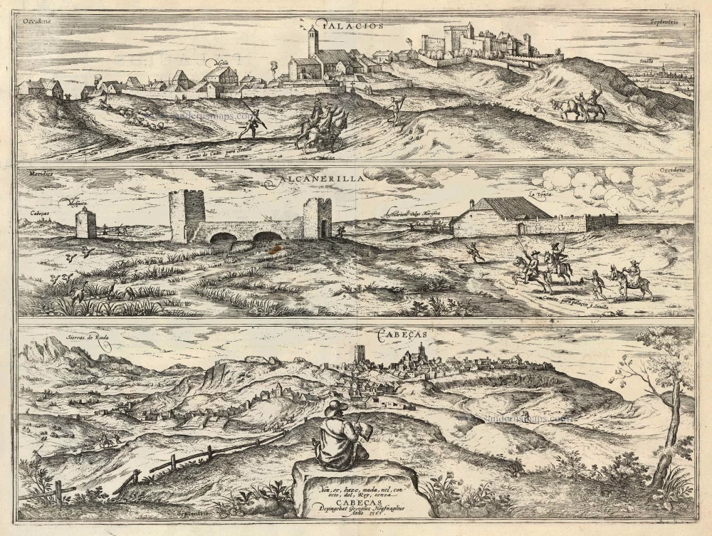
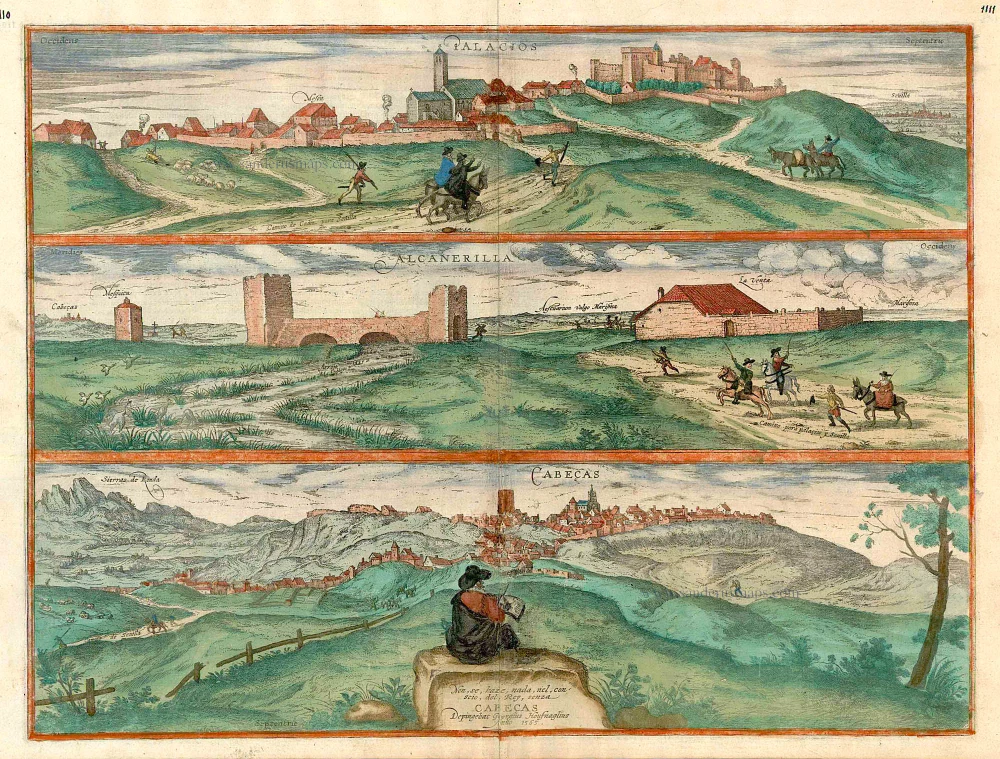
Palacios [on sheet with:] Alcanerilla [and] Cabecas. 1623
Palacios - Alcantarilla - Cabecas by Georg Braun & Frans Hogenberg.
[Item number: 103]
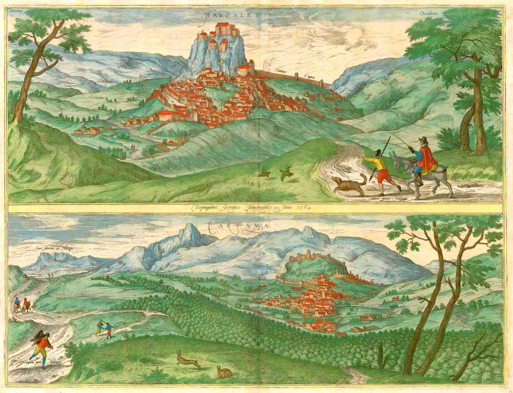
Hardales [on sheet with] Cartama. 1596
Ardales & Cartama by Georg Braun & Frans Hogenberg.
[Item number: 229]
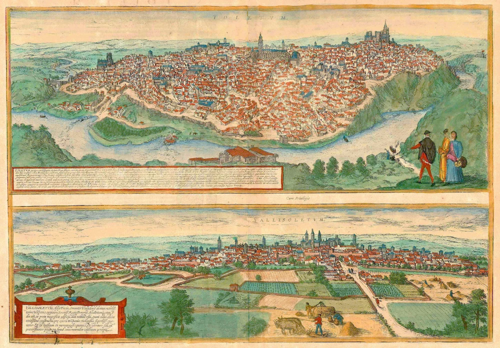
Toletum [on sheet with] Vallisoletum ... Nobilis. Totius Hispania Oppidum 1572-1624
Toledo & Valladolid by Georg Braun & Frans Hogenberg.
[Item number: 2067]
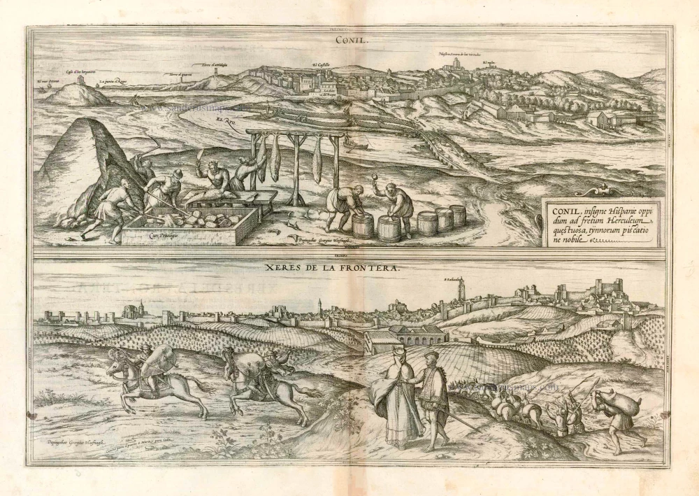
Conil [on sheet with] Xeres de la Frontera 1576
Conil de la Frontera and Jerez de la Frontera, by Georg Braun and Frans Hogenberg, after Georg Hoefnagel.
[Item number: 4133]
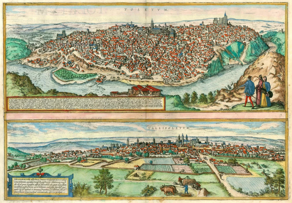
Toletum [on sheet with] Vallisoletum ... Nobilis. Totius Hispania Oppidum. 1572
Toledo and Valladolid by Georg Braun and Frans Hogenberg.
[Item number: 5913]
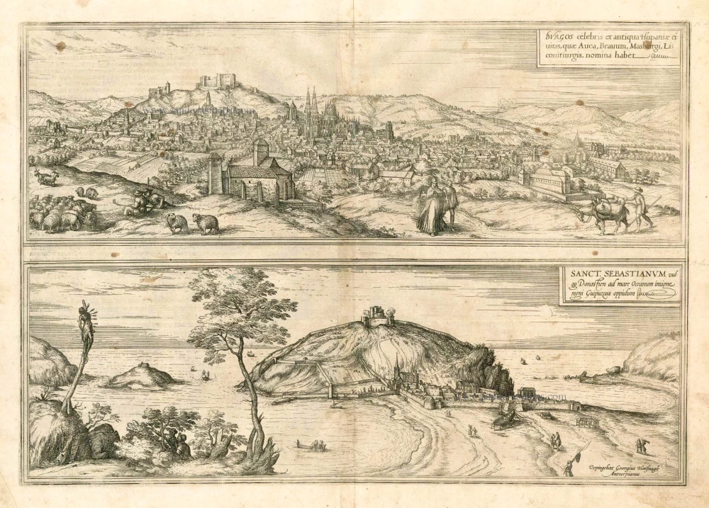
Burgos celebris et antiqua Hispaniae civitas, ... [on sheet with] Sanct. Sebastianum vulgo Donosien ad Occanum ... 1582
Burgos - San Sebastian by Braun & Hogenberg
[Item number: 14159]
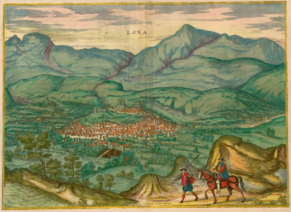
Loxa 1593
Loja, by Georg Braun and Frans Hogenberg.
[Item number: 14706]
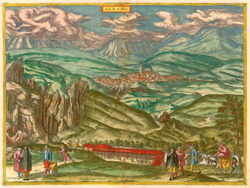
Alhama 1593
Alhama de Granada by Georg Braun & Frans Hogenberg
[Item number: 14714]
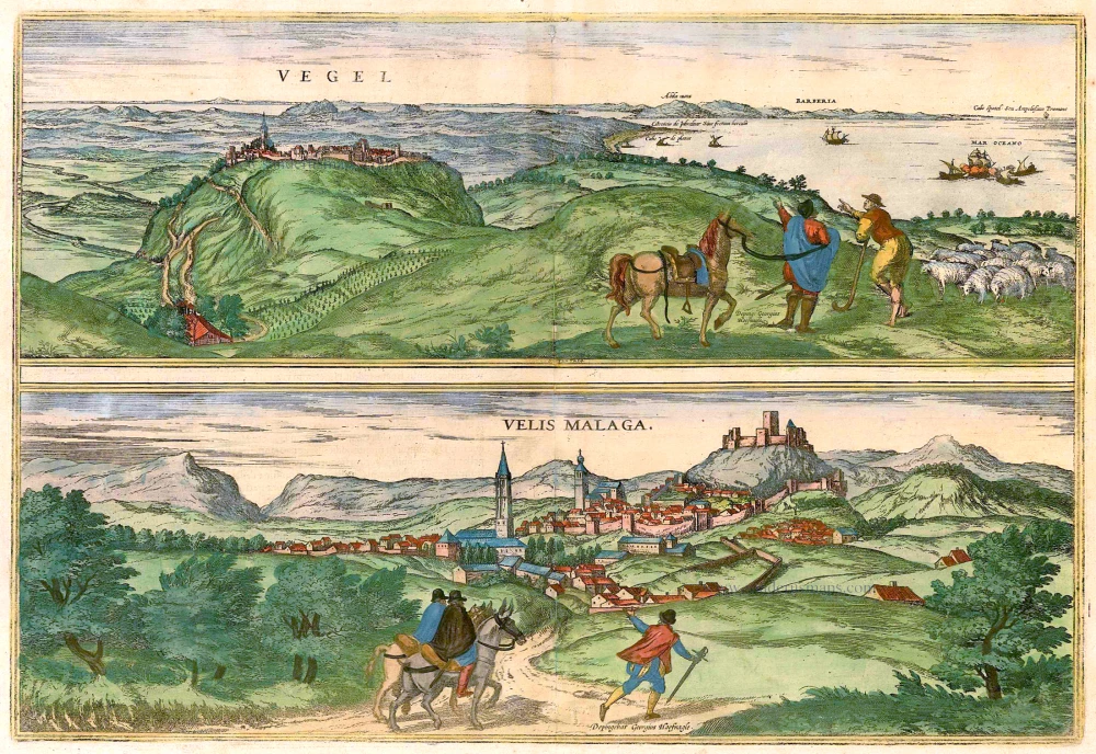
Vegel [on sheet with] Velis Malaga. 1575-1612
Vejer de la Frontera and Vélez-Málaga, by Georg Braun and Frans Hogenberg.
[Item number: 14895]

Corduba. c. 1625
Cordoba, by Georg Braun and Frans Hogenberg.
[Item number: 16385]
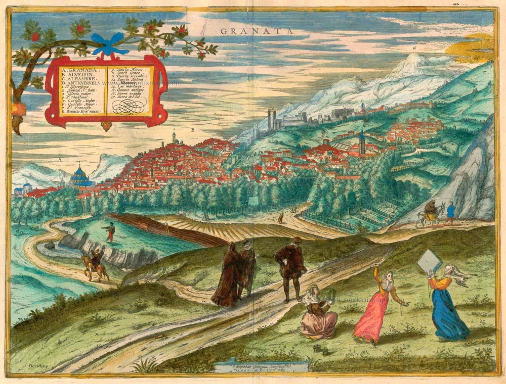
Granata. 1623
Granada by Georg Braun & Frans Hogenberg.
[Item number: 16665]
Palacios [on sheet with:] Alcanerilla [and] Cabecas. c. 1610
Los Palacios y Villafranca - Las Alcantarillas - Las Cabezas de San Juan, by Georg Braun and Frans Hogenberg.
[Item number: 16715]
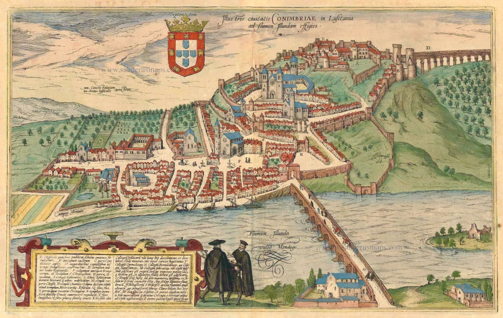
Illustris Civitati Conimbriae In Lusitania ad flumen Illundam effigies. 1596-1640
Coimbra by Braun & Hogenberg.
[Item number: 21345]
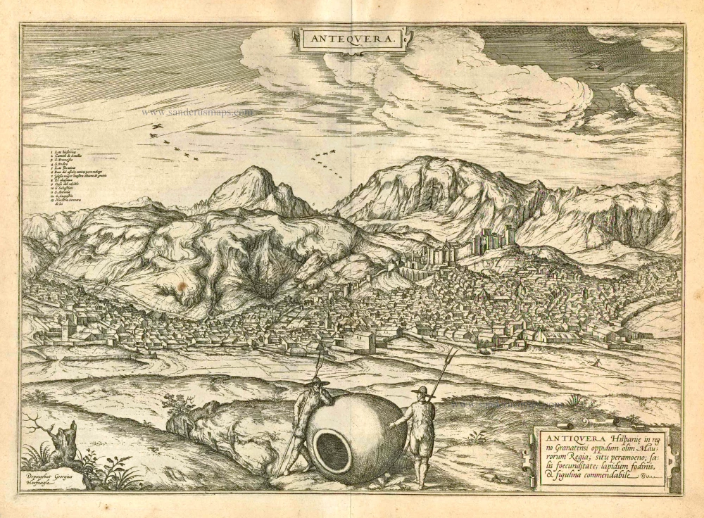
Antequera 1597
Antiquera, by Georg Braun and Frans Hogenberg.
[Item number: 23958]
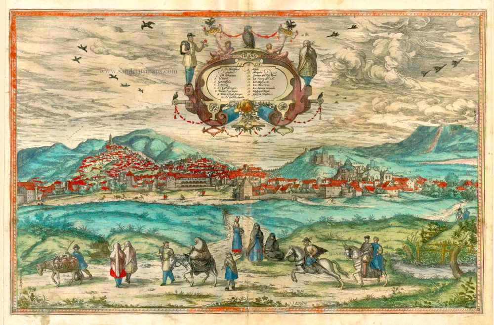
Granada 1563. 1582
Granada, by Georg Braun and Frans Hogenberg.
[Item number: 25487]
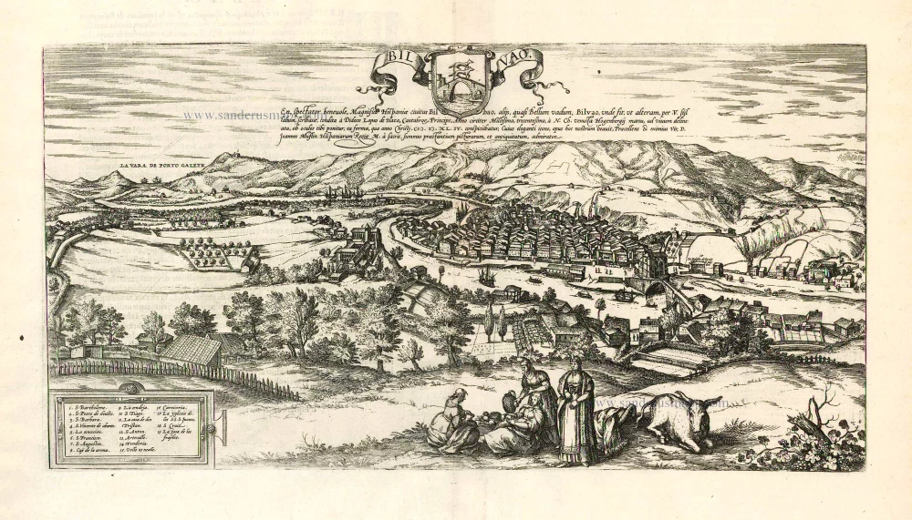
Bilvao. En, Spectator Benevole, Magnifica Hispaniae Civitas Bilbao ... 1593
Bilbao, by Georg Braun & Frans Hogenberg.
[Item number: 26930]