
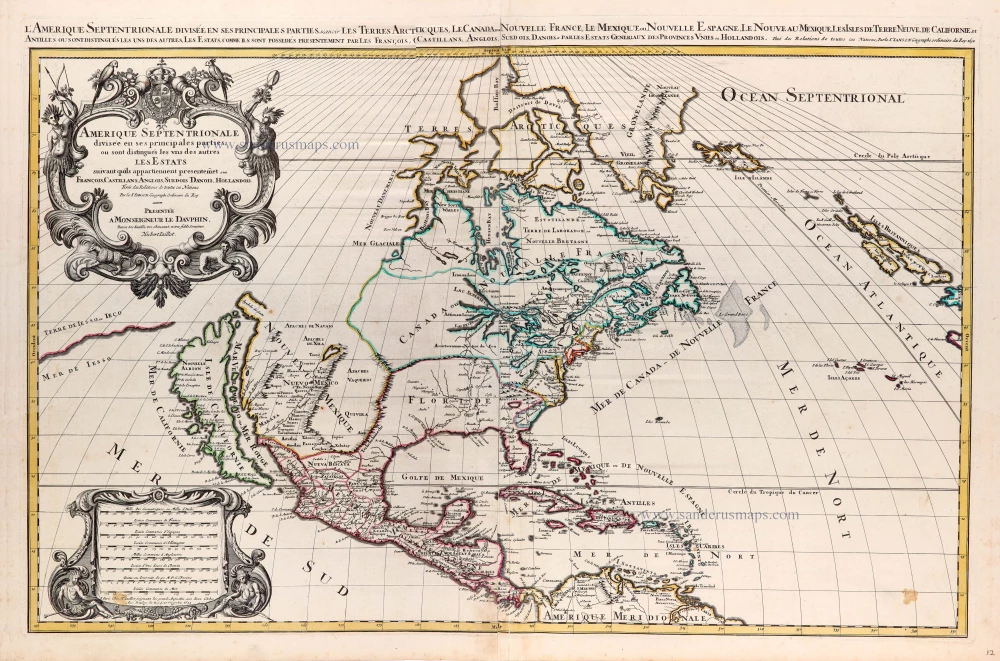
North America by Hubert Jaillot. (Pirated edition by Pierre Mortier). 1694


The Atlas Royal is one of those deceptive works published in Paris but produced in Amsterdam. Dedicated to the Duke of Burgundy, most maps are drawn from Alexis-Hubert Jaillot or the firm of Sanson in Paris. The work was done under the direction of the successful publisher Pierre Mortier in Amsterdam, but the imprint on the title page is of Nicolas de Fer in Paris! This clearly added importance to the atlas. It has been found with title pages dated 1695, 1697, and 1699. Despite the fact that no two examples are the same, all appear to carry this particular map.
The map is derived from earlier works by Jaillot, namely his large map of 1674, but most probably through Mortier's own large version, which was published in 1692. It bears the same ornate title cartouche along with another to frame the various national distance scales. A separate running Latin title appears above the neat line. No effort is placed on updating the cartography, which still reflects the original in 1674, which was already somewhat dated. (Burden)
Alexis-Hubert JAILLOT (1632-1712)
A.-H. Jaillot first started as a sculptor. In 1664 he married Jeanne Berey, daughter of the publisher and dealer of prints Nicolas I Berey. Jaillot soon rushed into the print business due to his father-in-law's deaths in 1665 and his brother-in-law in 1667. In 1668, A.-H. Jaillot and his wife acquire the Berey fund's geographical part, which consists of globes, maps, city views and atlases. He becomes the tenant of his father-in-law's shop, Aux Deux Globes, which he buys two years later.
Jaillot enters into an agreement with Guillaume Sanson to publish his maps that will form his Atlas Nouveau's embryo. Sanson undertakes to obtain the privilege for his maps for twenty years and to cede it to Jaillot, as is the custom. Jaillot, for its part, takes care of the engraving, printing and sale of the maps. He engages engravers, François Caumartin and Louis Cordier, to engrave his maps.
A conflict arises between Jaillot and Sanson, and in 1674 it comes to a lawsuit. In 1677 they came back to an agreement.
The Atlas Nouveau first appeared in 1681 and brought great prosperity to his publisher. Jaillot owes him his title of the geographer to the king, awarded on July 20, 1686. He continues to issue maps and signs more and more himself. In 1695, he published the Atlas Français, two-thirds of which are his maps and only one third by Sanson.
A.H. Jaillot dies in 1712 and leaves a vast trading fund.
Covens & Mortier. A Map Publishing House in Amsterdam. 1721-1866.
During almost two centuries, the largest and most important Dutch publishing house in commercial cartography was the Amsterdam firm of Covens & Mortier. Concerning quantity, it was possibly even the biggest contemporary map-trading house worldwide. They distributed innumerable maps, atlases, globes, and books.
Pieter (Pierre) Mortier (Leiden, 1661 – Amsterdam, 1711)
Nothing is known about the youth of Pieter Mortier. He studied in Paris from 1681 to approximately 1685. There he must have come into contact with French 'libraires' and learned the bookselling trade. Beginning 1685 he returned to Amsterdam where he opened a small bookshop. In the same year, he became a member of the Book, Art Sellers' and Printers' guild.
Pieter sold books in Dutch and foreign languages, but he also published books on his own, usually in the French language. His business flourished such that in 1688 he was already forced to rent another house on the Vijgendam.
Pieter Mortier's first privilege for maps was granted by the States of Holland and West Friesland on September 15 1690. It refers to the maps of Sanson that he 'is printing and correcting with great pains and care'.
Pieter began the large scale publication of maps and atlases. By the beginning of the 18th century, Pieter had become so wealthy that he could purchase three houses in Amsterdam: on the Beurssluis, on the Vijgendam, and the Heremietensteeg. He rebuilt the house on the Vijgendam into a large prestigious house that would serve for over a century as a shop, business, and residential structure for Covens & Mortier's publishing house.
He died on February 13, 1711, after a brief illness. The company continued to exist under Pieter's widow's management, Amelia' s-Gravesande.
After she died in 1719, her son Cornelis, took over the management for a few years.
On November 20, 1721, a company was founded by Cornelis Mortier and Johannes Covens I. The latter was married the same year with Cornelis's sister. From that year on, the name of :
Covens & Mortier.
Their firm would see a massive expansion in the next 140 years. In 1732 the heirs sold the property to their brother Cornelis and his partner Covens. Their main competitors were Reinier & Josua Ottens and Gerard Valck & Petrus Schenck. After the death of Johannes Covens I (1774), his son Johannes Covens II (1722-1794) entered the business. From 1778, Johannes added a new company name :
J. Covens & Son.
Johannes Covens II was succeeded by his son Cornelis Covens (1764-1825), who, in turn, brought Peter Mortier IV, the great-grandson of Petrus Mortier I, into the business. The name was from 1794 to 1866:
Mortier, Covens & Son.
The last Covens in the series was Cornelis Johannes Covens (1806-1880).
Covens & Mortier had a large stock of atlases and maps, including those of: Delisle, Jaillot, Johannes Janssonius, Sanson, Claes Jansz. Visscher, Nicolaas Visscher, and Frederik de Wit. For decades, an impressive number of atlases came from the press.
Amerique Septentrionale, Divisee en ses Principales Parties.
Item Number: 31419 Authenticity Guarantee
Category: Antique maps > America > North America
North America by Hubert Jaillot. (Pirated edition by Pierre Mortier).
Title: Amerique Septentrionale, Divisee en ses Principales Parties.
Presenté à Monseigneur le Duc de Bourgogne, Par Son tres-humble et tres obeissa Serviteur, H. Jaillot.
A Paris 1694.
With California as an island.
Date of the first edition: 1694.
Date of this map: 1694.
Date on map: 1694. (= 1st state of 5)
Copper engraving, printed on paper.
Image size: 480 x 580mm (19 x 22¾ inches).
Sheet size: 530 x 630mm (20¾ x 24¾ inches).
Verso: Blank.
Condition: Original coloured, excellent.
Condition Rating: A+.
From: Atlas Royal à l'usage de Monseigneur le duc de Bourgogne, contenant les cartes geographiques de toutes les parties du monde. ... A Paris, chez Nicolas de Fer. M.DC.XCV [1695]. (Pastoureau, p. 190, Fer III A)
The Atlas Royal is one of those deceptive works published in Paris but produced in Amsterdam. Dedicated to the Duke of Burgundy, most maps are drawn from Alexis-Hubert Jaillot or the firm of Sanson in Paris. The work was done under the direction of the successful publisher Pierre Mortier in Amsterdam, but the imprint on the title page is of Nicolas de Fer in Paris! This clearly added importance to the atlas. It has been found with title pages dated 1695, 1697, and 1699. Despite the fact that no two examples are the same, all appear to carry this particular map.
The map is derived from earlier works by Jaillot, namely his large map of 1674, but most probably through Mortier's own large version, which was published in 1692. It bears the same ornate title cartouche along with another to frame the various national distance scales. A separate running Latin title appears above the neat line. No effort is placed on updating the cartography, which still reflects the original in 1674, which was already somewhat dated. (Burden)
Alexis-Hubert JAILLOT (1632-1712)
A.-H. Jaillot first started as a sculptor. In 1664 he married Jeanne Berey, daughter of the publisher and dealer of prints Nicolas I Berey. Jaillot soon rushed into the print business due to his father-in-law's deaths in 1665 and his brother-in-law in 1667. In 1668, A.-H. Jaillot and his wife acquire the Berey fund's geographical part, which consists of globes, maps, city views and atlases. He becomes the tenant of his father-in-law's shop, Aux Deux Globes, which he buys two years later.
Jaillot enters into an agreement with Guillaume Sanson to publish his maps that will form his Atlas Nouveau's embryo. Sanson undertakes to obtain the privilege for his maps for twenty years and to cede it to Jaillot, as is the custom. Jaillot, for its part, takes care of the engraving, printing and sale of the maps. He engages engravers, François Caumartin and Louis Cordier, to engrave his maps.
A conflict arises between Jaillot and Sanson, and in 1674 it comes to a lawsuit. In 1677 they came back to an agreement.
The Atlas Nouveau first appeared in 1681 and brought great prosperity to his publisher. Jaillot owes him his title of the geographer to the king, awarded on July 20, 1686. He continues to issue maps and signs more and more himself. In 1695, he published the Atlas Français, two-thirds of which are his maps and only one third by Sanson.
A.H. Jaillot dies in 1712 and leaves a vast trading fund.
Covens & Mortier. A Map Publishing House in Amsterdam. 1721-1866.
During almost two centuries, the largest and most important Dutch publishing house in commercial cartography was the Amsterdam firm of Covens & Mortier. Concerning quantity, it was possibly even the biggest contemporary map-trading house worldwide. They distributed innumerable maps, atlases, globes, and books.
Pieter (Pierre) Mortier (Leiden, 1661 – Amsterdam, 1711)
Nothing is known about the youth of Pieter Mortier. He studied in Paris from 1681 to approximately 1685. There he must have come into contact with French 'libraires' and learned the bookselling trade. Beginning 1685 he returned to Amsterdam where he opened a small bookshop. In the same year, he became a member of the Book, Art Sellers' and Printers' guild.
Pieter sold books in Dutch and foreign languages, but he also published books on his own, usually in the French language. His business flourished such that in 1688 he was already forced to rent another house on the Vijgendam.
Pieter Mortier's first privilege for maps was granted by the States of Holland and West Friesland on September 15 1690. It refers to the maps of Sanson that he 'is printing and correcting with great pains and care'.
Pieter began the large scale publication of maps and atlases. By the beginning of the 18th century, Pieter had become so wealthy that he could purchase three houses in Amsterdam: on the Beurssluis, on the Vijgendam, and the Heremietensteeg. He rebuilt the house on the Vijgendam into a large prestigious house that would serve for over a century as a shop, business, and residential structure for Covens & Mortier's publishing house.
He died on February 13, 1711, after a brief illness. The company continued to exist under Pieter's widow's management, Amelia' s-Gravesande.
After she died in 1719, her son Cornelis, took over the management for a few years.
On November 20, 1721, a company was founded by Cornelis Mortier and Johannes Covens I. The latter was married the same year with Cornelis's sister. From that year on, the name of :
Covens & Mortier.
Their firm would see a massive expansion in the next 140 years. In 1732 the heirs sold the property to their brother Cornelis and his partner Covens. Their main competitors were Reinier & Josua Ottens and Gerard Valck & Petrus Schenck. After the death of Johannes Covens I (1774), his son Johannes Covens II (1722-1794) entered the business. From 1778, Johannes added a new company name :
J. Covens & Son.
Johannes Covens II was succeeded by his son Cornelis Covens (1764-1825), who, in turn, brought Peter Mortier IV, the great-grandson of Petrus Mortier I, into the business. The name was from 1794 to 1866:
Mortier, Covens & Son.
The last Covens in the series was Cornelis Johannes Covens (1806-1880).
Covens & Mortier had a large stock of atlases and maps, including those of: Delisle, Jaillot, Johannes Janssonius, Sanson, Claes Jansz. Visscher, Nicolaas Visscher, and Frederik de Wit. For decades, an impressive number of atlases came from the press.
Related items
Important map
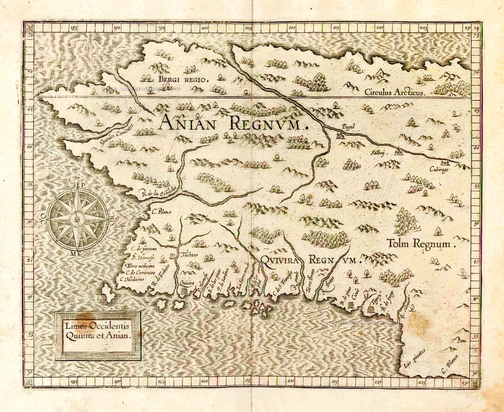
Limes Occidentis Quivira et Anian. 1607
West coast by Wytfliet, Cornelis van
[Item number: 26513]
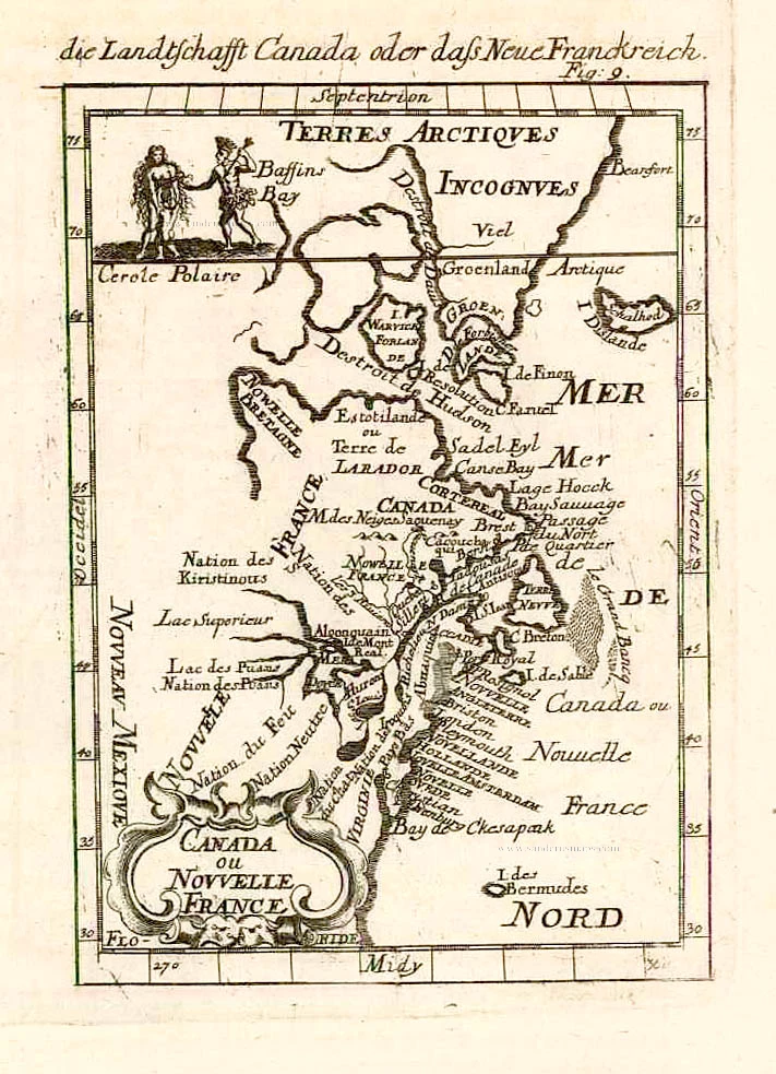
Canada ou Nouvelle France. 1685
North America (Northeast), by A.M. Mallet.
[Item number: 26601]
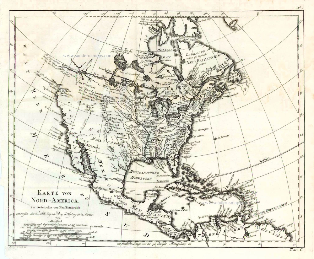
Karte von Nord-America, zur Geschichte von Neu-Frankreich. 1747-74
North America, by Jacques Nicolas Bellin.
[Item number: 26799]
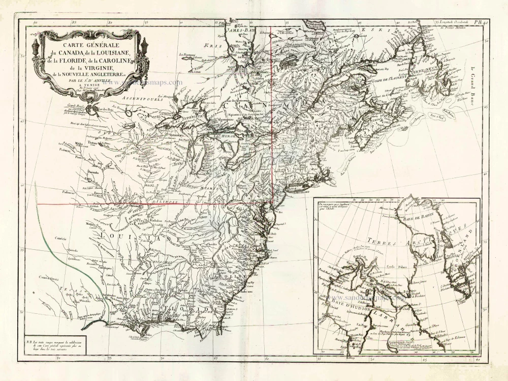
Carte Générale du Canada, de la Louisiane, de la Floride, de la Caroline, de la Virginie, de la Nouvelle Angleterre etc. 1776-79
North America (East), by Paolo Santini.
[Item number: 26980]
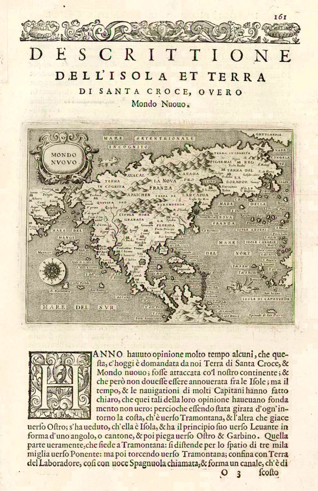
Earliest obtainable map of North America
Mondo Nuovo - Descrittione del l'Isola et Terra di Sancta Croce, overo Mondo Nuovo. 1576
Tomaso Porcacchi., North America
[Item number: 27651]

Early 'Texas' map
Nueva Hispania Tabula Nova. 1574
North America, by Girolamo Ruscelli.
[Item number: 27755]
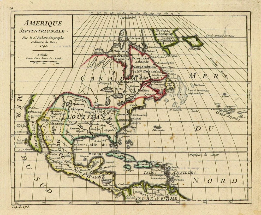
Amerique Septentrionale. 1748
North America by Robert de Vaugondy.
[Item number: 28157]

Amerique Septentrionale, Divisee en ses Principales Parties. 1694
North America, by Nicolas Sanson, published by Pierre Mortier after A.H. Jaillot.
[Item number: 29125]
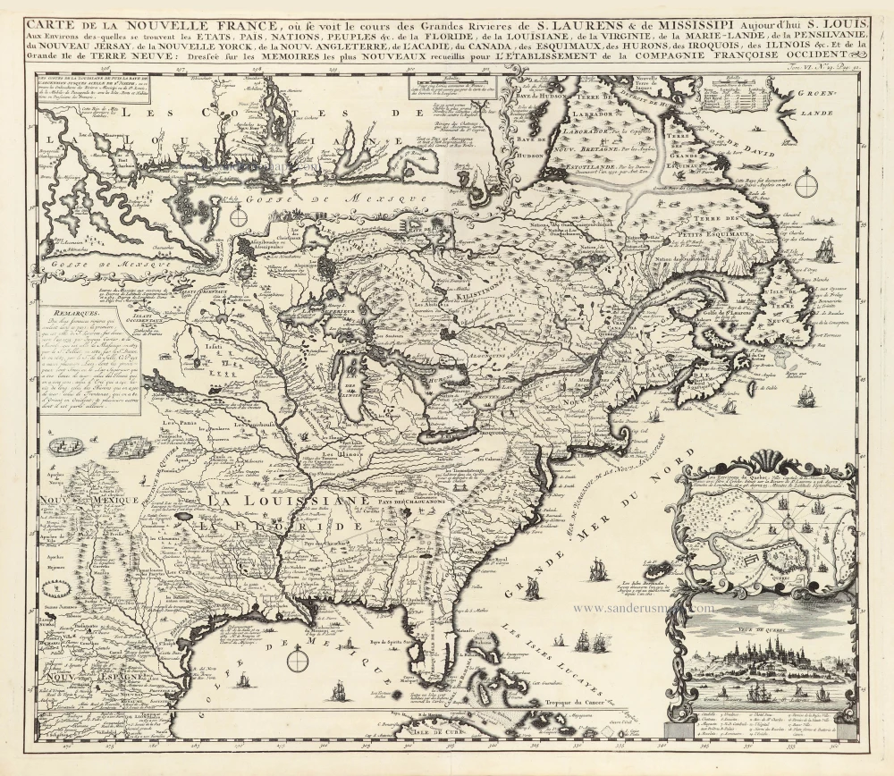
Carte de la Nouvelle France, ou se Voit le Cours des Grandes Rivieres de S. Laurens & de Mississipi Aujourd'hui S. Louis, Aux environs des quelles se trouvent les Etats, Païs, Nations, Peuples &c. de la Floride, de la Louisiane, de la Virginie, de la Marie-Lande, de la Pensilvanie, du Nouveau Jersay, de la Nouvelle Yorck, de la Nouv. Angleterre, de l'Acadie, du Canada, des Esquimaux, des Hurons, des Iroquois, des Ilinois &c. Et de la Grande Ile de Terre Neuve:. 1719
Eastern North America (U.S.), by Zacharias Châtelain.
[Item number: 29365]

Nouvelle carte de l'Amérique Septentrionale dressée sur les plus nouvelles observations de Messieurs de l'Académie des Sciences et des meilleurs Géographes avec des tables très Instructives et Curieuses de la Division de tous les Etats et les différents souverains qui en sont possesseur. 1713
North America, by Zacharias Châtelain.
[Item number: 29445]
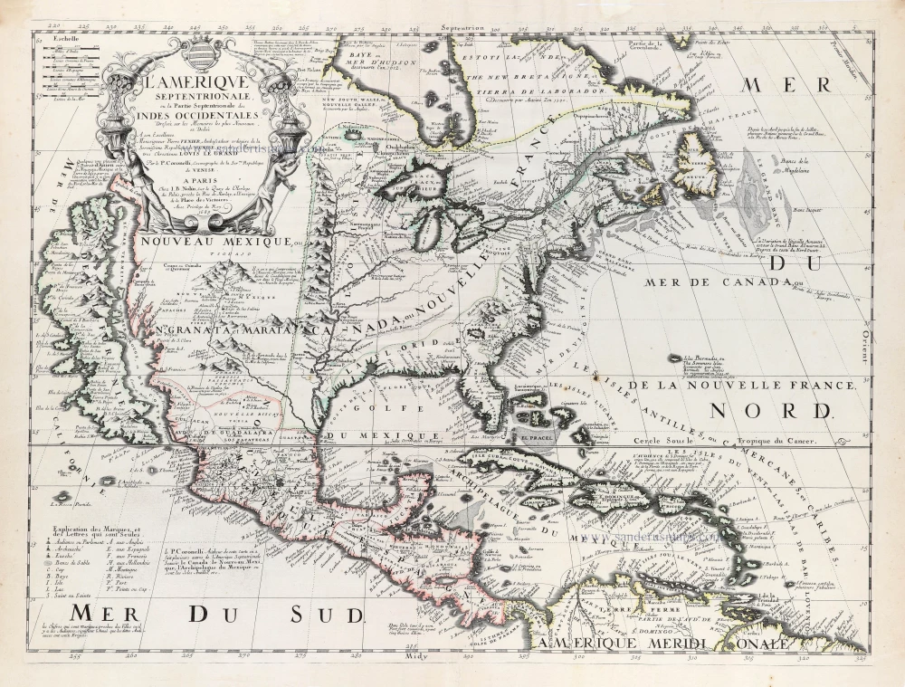
L'Amerique Septentrionale. 1708
North America by G. de L'Isle, published by Pierre Mortier.
[Item number: 29510]
California as an island.
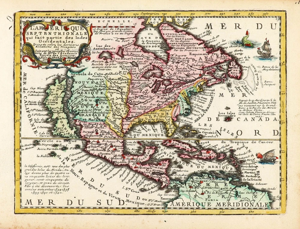
L'Amerique Septentrionale qui fait partie des Indes Occidentales. 1719
North America by Chiquet Jacques.
[Item number: 30085]
California as an island.
Americque Septentrionale. 1715
North America by Nicolas Sanson, published by Nicolas Chemereau.
[Item number: 30086]

Carte d'Assemblage de l'Amérique Septen-le 1827
North America by Philippe Vandermaelen.
[Item number: 31099]
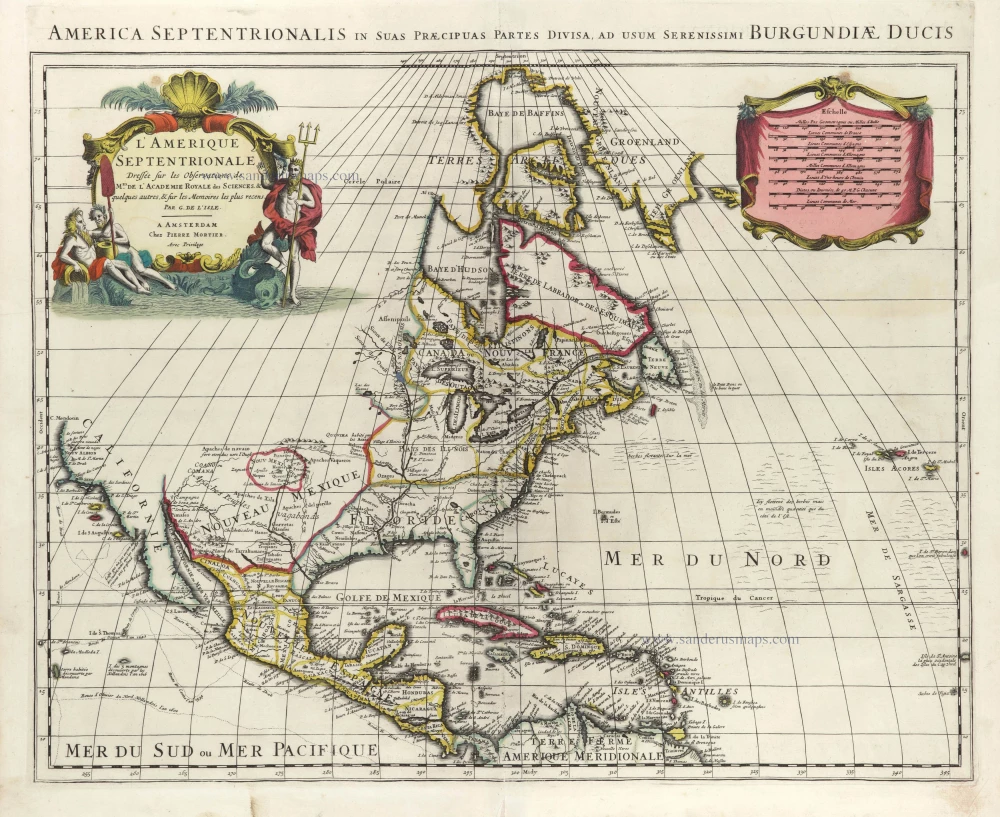
Amerique Septentrionale, Divisee en ses Principales Parties, ou sont Distingues les Uns des Autres les Estats Suivant qu'ils Appartiennent Presentemet aux Francois, Castillans, Anglois, Suedois, Danois, Hollandois. 1692
North America by N. Sanson, so-called published by Hubert Jaillot. (Pirated edition by Pierre Mortier).
[Item number: 31142]
Rare first edition of the important Coronelli-Nolin map of North America
L'Amerique Septentrionale, ou la Partie Septentrionale des Indes Occidentales. 1689
North and Central America by Vincenzo Coronelli, published by J.B. Nolin.
[Item number: 31338]

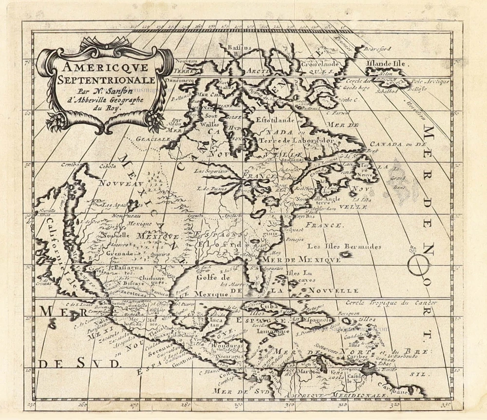
L' America Settentrionale. 1677
North America by Giovanni De Rossi, after Nicolas Sanson.
[Item number: 32889]
new