
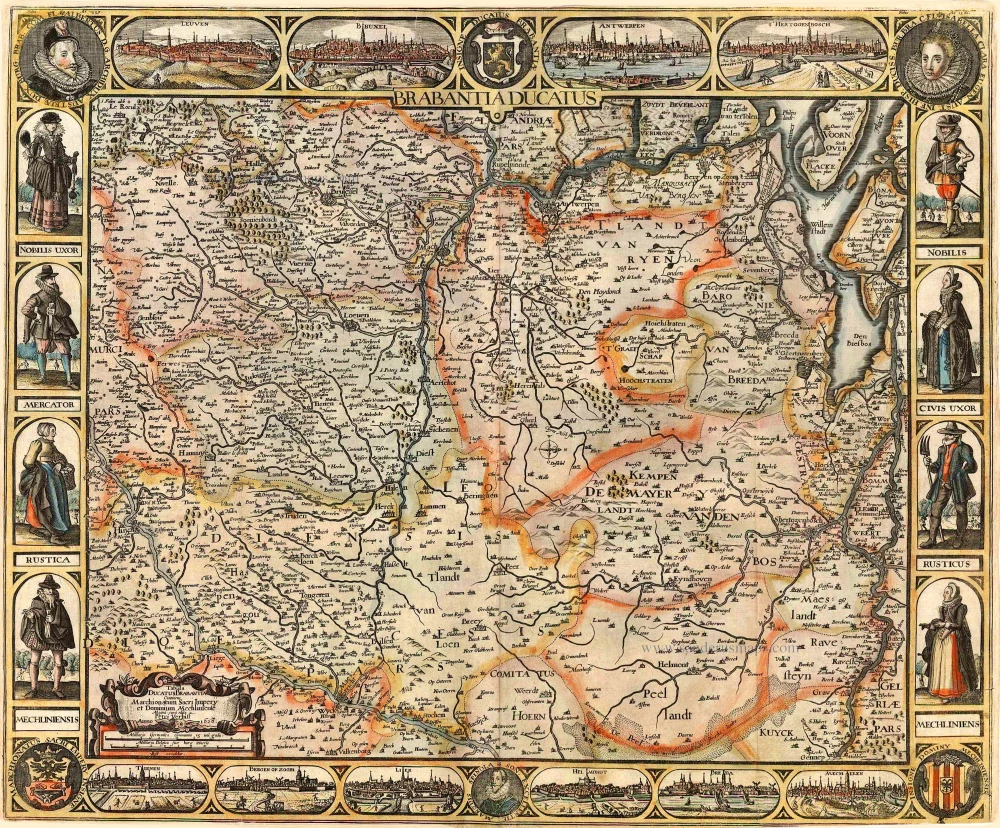
Brabant by Johann Baptist Homann. c. 1730-37

The Homann Family
Johann Baptist Homann (1664-1724) was born in Oberkammlach in Southern Germany. Around 1693 Homann moved to Vienna, where he lived and studied printing and copper plate engraving until 1695. In 1702 he founded a map publishing company in Nuremberg, which is recognized as one of the most important German map publishers of the eighteenth century. In the next five years, Homann produced hundreds of maps and developed a distinctive style characterized by heavy detailed engraving, elaborate allegorical cartouche work, and vivid hand colour. He published his first atlas in 1707. Homann's company successfully competed with leading European mapmakers. By 1715 Homann's rising star caught the attention of the Holy Roman Emperor Charles the VI, who appointed him Imperial Cartographer. In the same year, he was also appointed a member of the Royal Academy of Sciences in Berlin. Homann's prestigious title came with several significant advantages, including access to the most up to date cartographic information as well as the "Privilege". In 1716 Homann published his masterpiece Grosser Atlas über die ganze Welt (Grand Atlas of all the World).
After Johann Baptist Homann's death in 1724, Johan Christoph Homann (1703-1730) and other heirs continued the company under the name Homann's Erben (Homann's Heirs) until 1852.
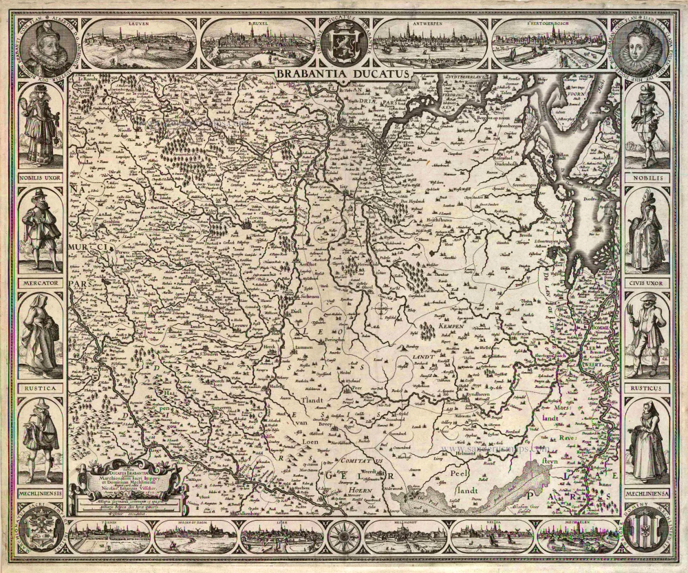
Ducatus Brabantiae Nova Tabula in qua Lovanii Bruxellarum March S. Imperii Sulvaeu Ducis et Mechliniae Dominia
Item Number: 30250 Authenticity Guarantee
Category: Antique maps > Europe > Belgium
Brabant by Johann Baptist Homann.
Title: Ducatus Brabantiae Nova Tabula in qua Lovanii Bruxellarum March S. Imperii Sulvaeu Ducis et Mechliniae Dominia
insuas quasq[ue] minores Ditiones subdivisa ostenduntur a Ioh Bapt Homanno Norimbergae
Cum Privilegio Sac.Caes. Majest.
Date of the first edition: c; 1712.
Date of this map: c. 1730-37.
Copper engraving, printed on paper.
Image size: 575 x 485mm (22.64 x 19.09 inches).
Sheet size: 620 x 540mm (24.41 x 21.26 inches).
Verso: Blank.
Condition: Original coloured, excellent.
Condition Rating: A+.
From: Grosser Atlas Uber die Gantze Welt ... Von Joann Baptist Homann ... Nürnberg, 1730 [- 1737]. [Shirley (Brit.Lib.), T.HOM-1c]
The Homann Family
Johann Baptist Homann (1664-1724) was born in Oberkammlach in Southern Germany. Around 1693 Homann moved to Vienna, where he lived and studied printing and copper plate engraving until 1695. In 1702 he founded a map publishing company in Nuremberg, which is recognized as one of the most important German map publishers of the eighteenth century. In the next five years, Homann produced hundreds of maps and developed a distinctive style characterized by heavy detailed engraving, elaborate allegorical cartouche work, and vivid hand colour. He published his first atlas in 1707. Homann's company successfully competed with leading European mapmakers. By 1715 Homann's rising star caught the attention of the Holy Roman Emperor Charles the VI, who appointed him Imperial Cartographer. In the same year, he was also appointed a member of the Royal Academy of Sciences in Berlin. Homann's prestigious title came with several significant advantages, including access to the most up to date cartographic information as well as the "Privilege". In 1716 Homann published his masterpiece Grosser Atlas über die ganze Welt (Grand Atlas of all the World).
After Johann Baptist Homann's death in 1724, Johan Christoph Homann (1703-1730) and other heirs continued the company under the name Homann's Erben (Homann's Heirs) until 1852.
Related items
Brabantia Ducatus / Tabula Ducatus Brabantiae Continens Marchionatum Sacri Imperij et Dominium Mechliniense Magna cura edita à Nicolao Iohannis Visscher. Anno 1622. 1622
Brabant by C.J. Visscher.
[Item number: 2640]
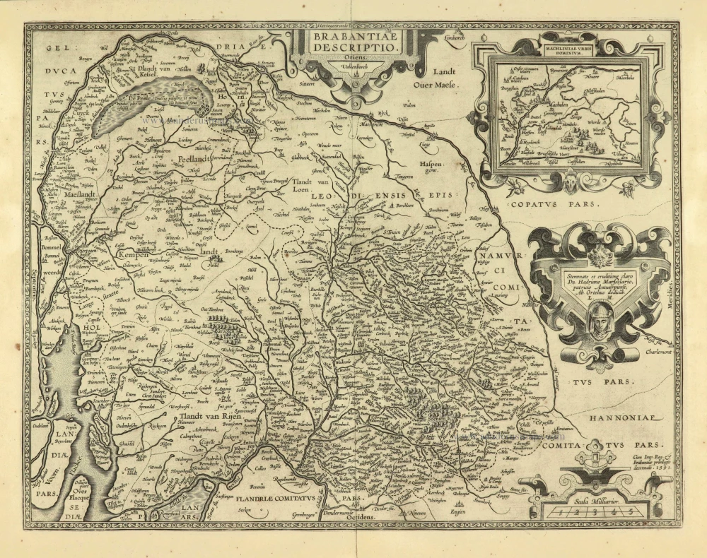
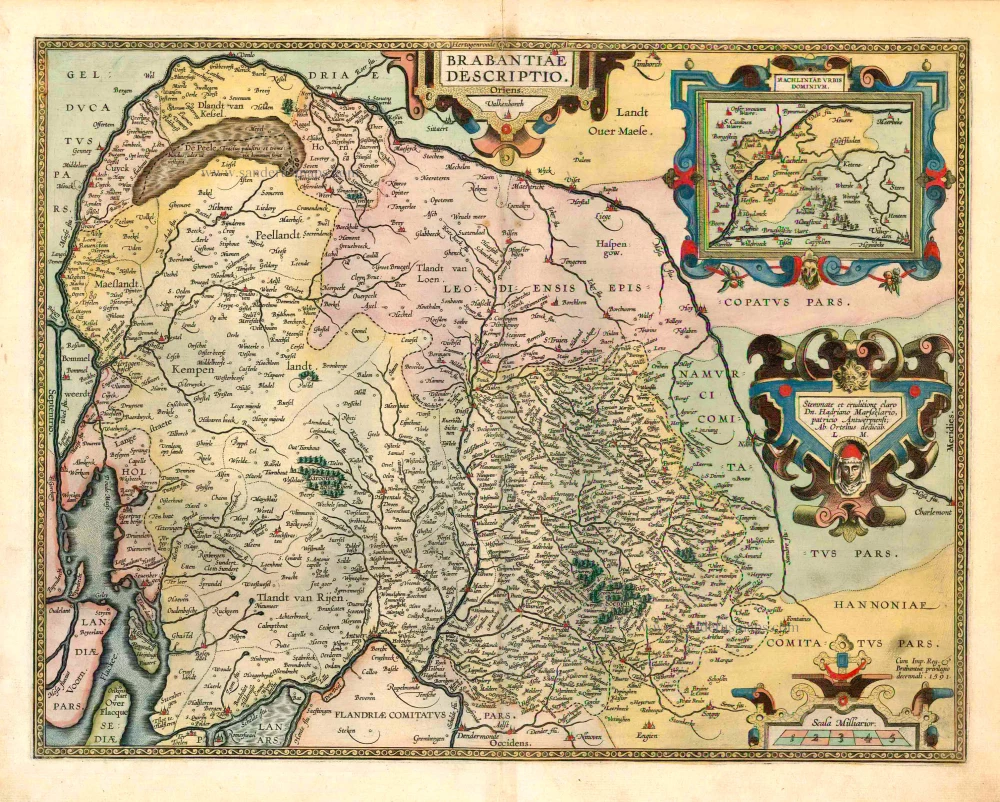
Brabantiae Descriptio 1601
Brabant, with an inset map of the district of Mechelen, by Abraham Ortelius.
[Item number: 12909]
Ducatus Brabantiae. 1631
Brabant by Abraham Goos,published by Joannes Janssonius.
[Item number: 17723]

Novissima et Accuratissima Brabantiae Ducatus Tabula. 1638
Brabant by Henricus Hondius, published by J. Janssonius.
[Item number: 19012]
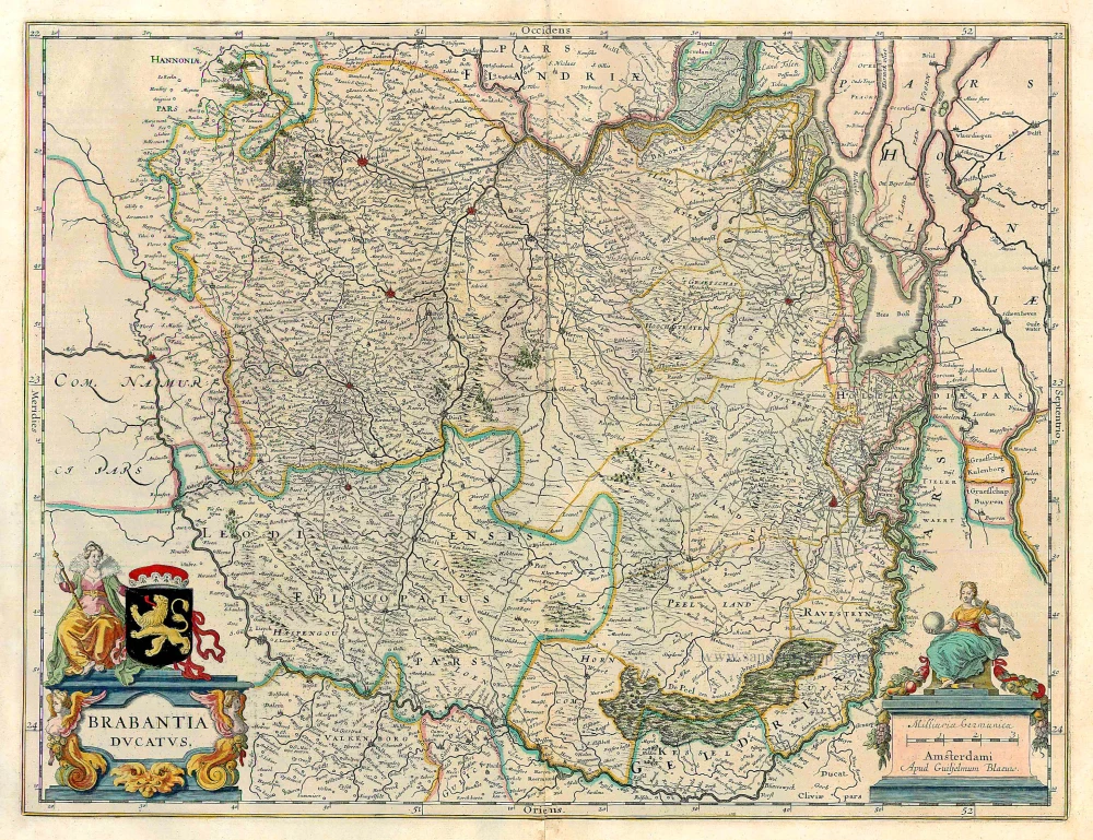
Brabantia Ducatus. 1647-50
Brabant, by W. Blaeu.
[Item number: 22657]
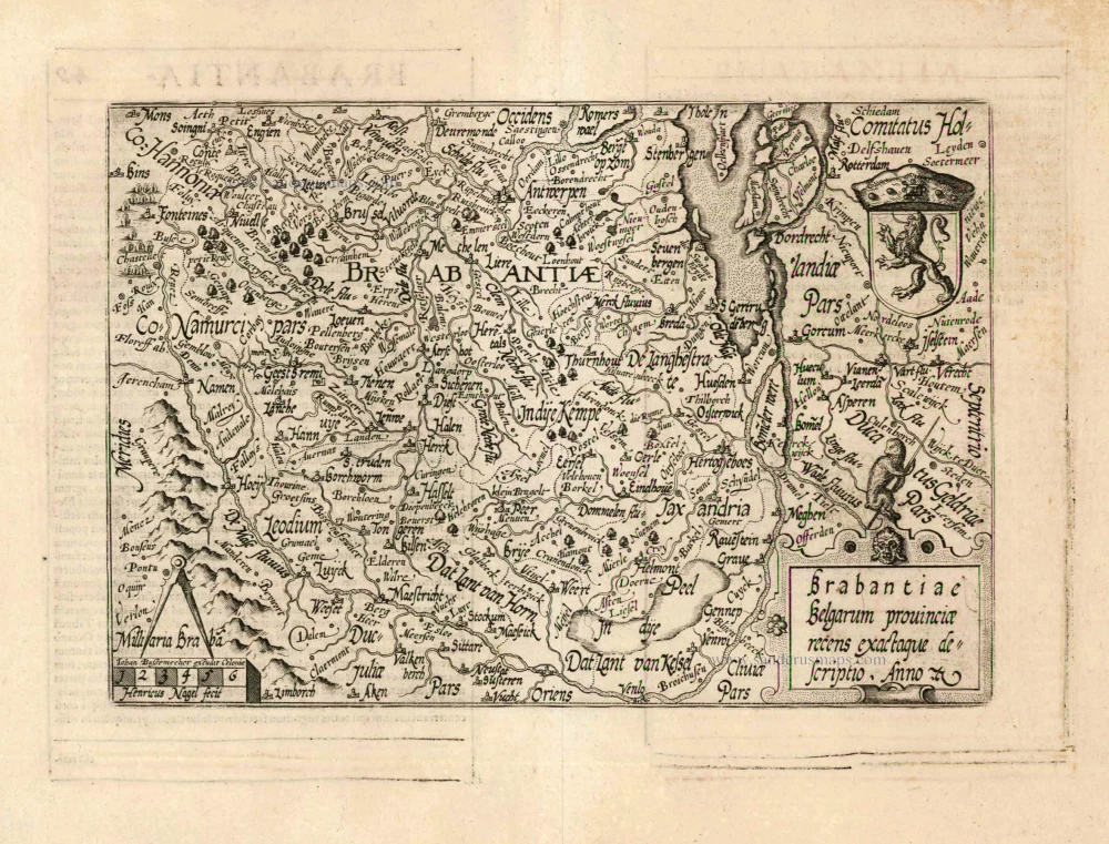
Brabantiae Belgarum provinciae recens exactaque descriptio. 1602
Brabant by M. Quad - J. Bussemacher.
[Item number: 25235]
Brabantiae Descriptio. 1595
Brabant, by A. Ortelius.
[Item number: 25573]

Important and rare map.
Brabantiae Belgarum Provinciae Recens Exactaque Descriptio. 1558
Brabant, by Michele Tramezini.
[Item number: 26713]

Brabantiae Germaniae Inferioris Nobilissimmae Provinciae Descriptio. 1572
Brabant by Abraham Ortelius
[Item number: 26734]
Rare!
Brabantia Ducatus / Tabula Ducatus Brabantiae Continens Marchionatum Sacri Imperij et Dominium Mechliniense - Magna Cura edita à Petri Verbist Anno 1628. 1628
Brabant by Pieter Verbiest
[Item number: 27743]
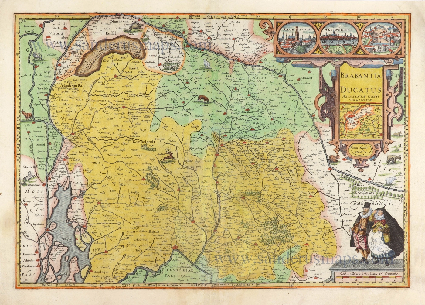
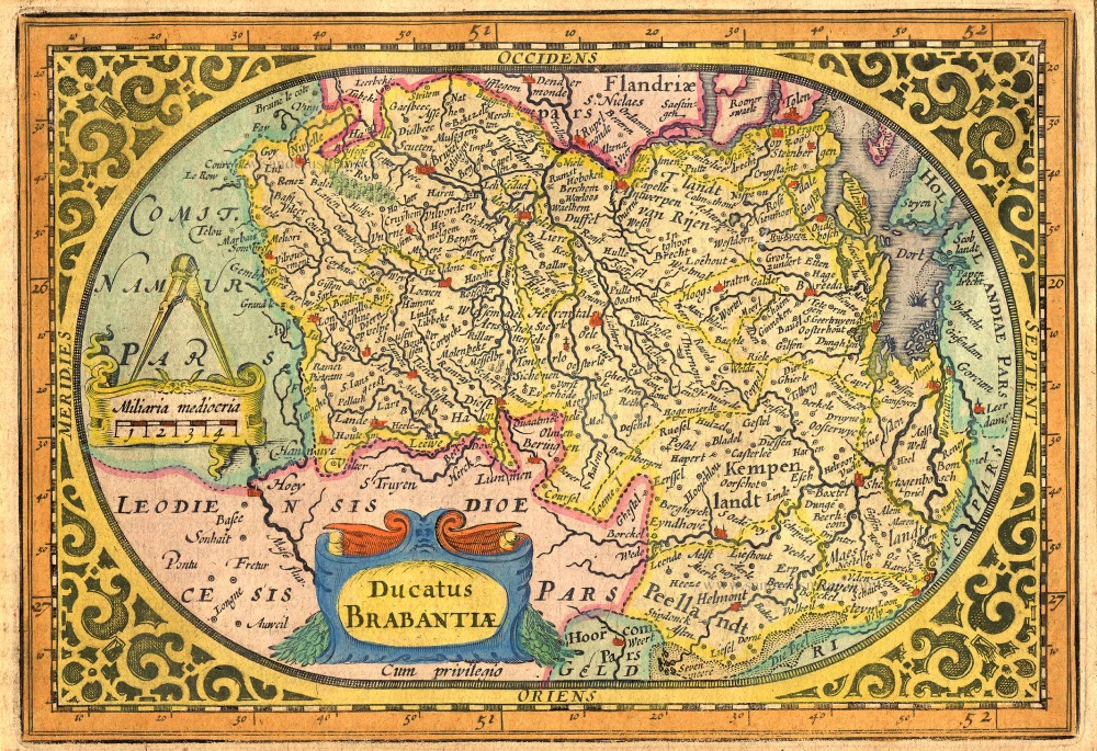
Brabantia Ducatus Machliniae Urbis Dominium. 1617
The Duchy of Brabant by Pieter van den Keere (Petrus Kaerius).
[Item number: 28672]
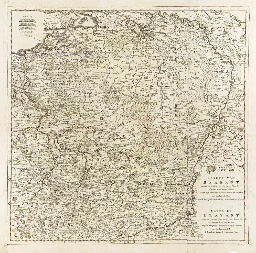
Caarte van Brabant - Carte du Brabant. 1729
Brabant, by Guillaume De L'Isle, published by J. Dumont.
[Item number: 29338]
First edition, woodcut
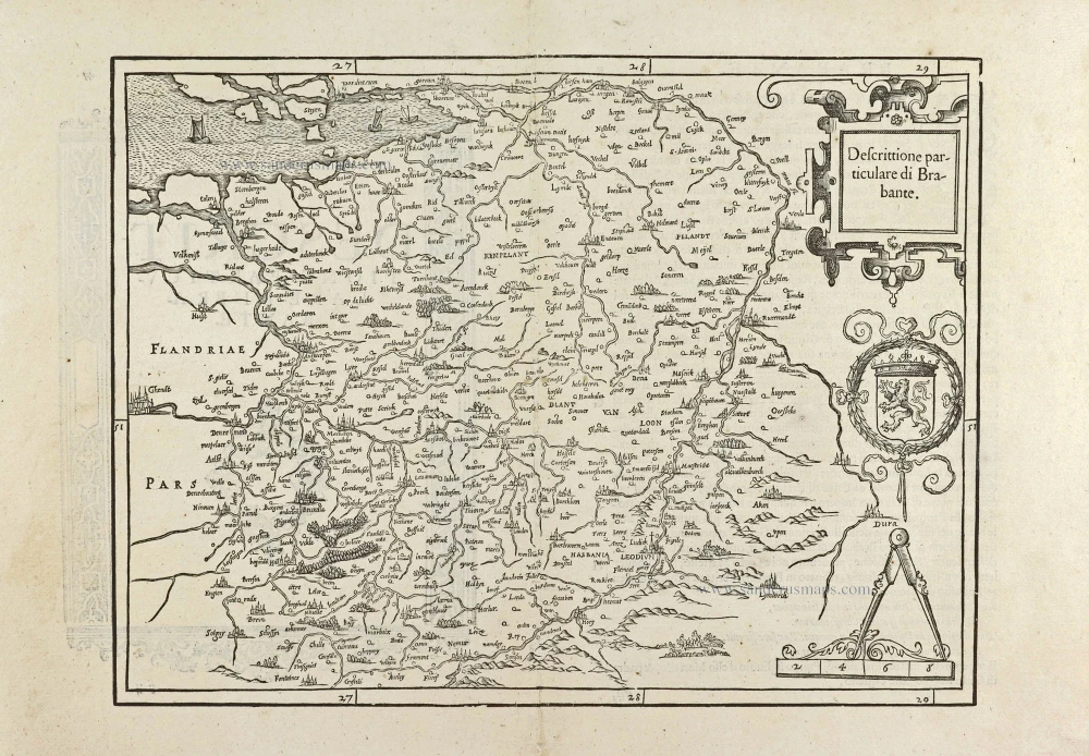
Descrittione particulare di Brabante. 1567
Brabant by Lodovico Guicciardini.
[Item number: 29504]
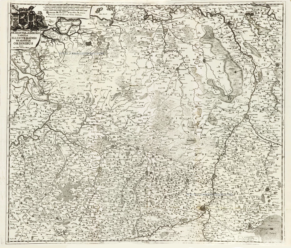
Exactissima Brabantiae et Limburgi Tabula Illustrissimis Brabantiae Ordinibus. 1712
Brabant & Zuid Limburg by Eugene Fricx.
[Item number: 29546]
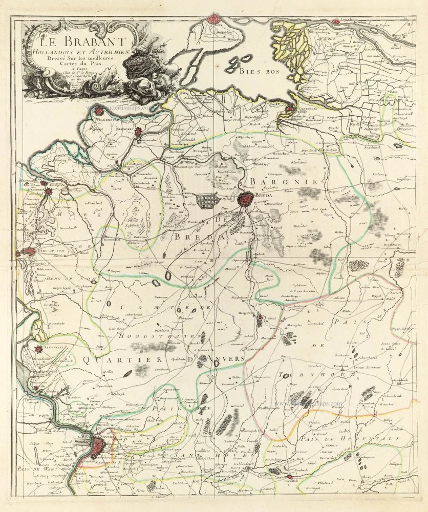
Le Brabant Hollandois et Autrichien. 1747
Northwest Brabant by G.L. Le Rouge.
[Item number: 30255]
Very rare first state.
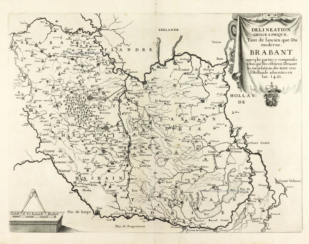
Delineation Geographique. Tant de lancien que Du moderne. Brabant avecq les parties y comprinses selon qu'elles estoient Devant les inondations des terre vers l'Hollande advenües en lan 1421. 1637
Historical map of Brabant by Christophe Butkens.
[Item number: 30291]
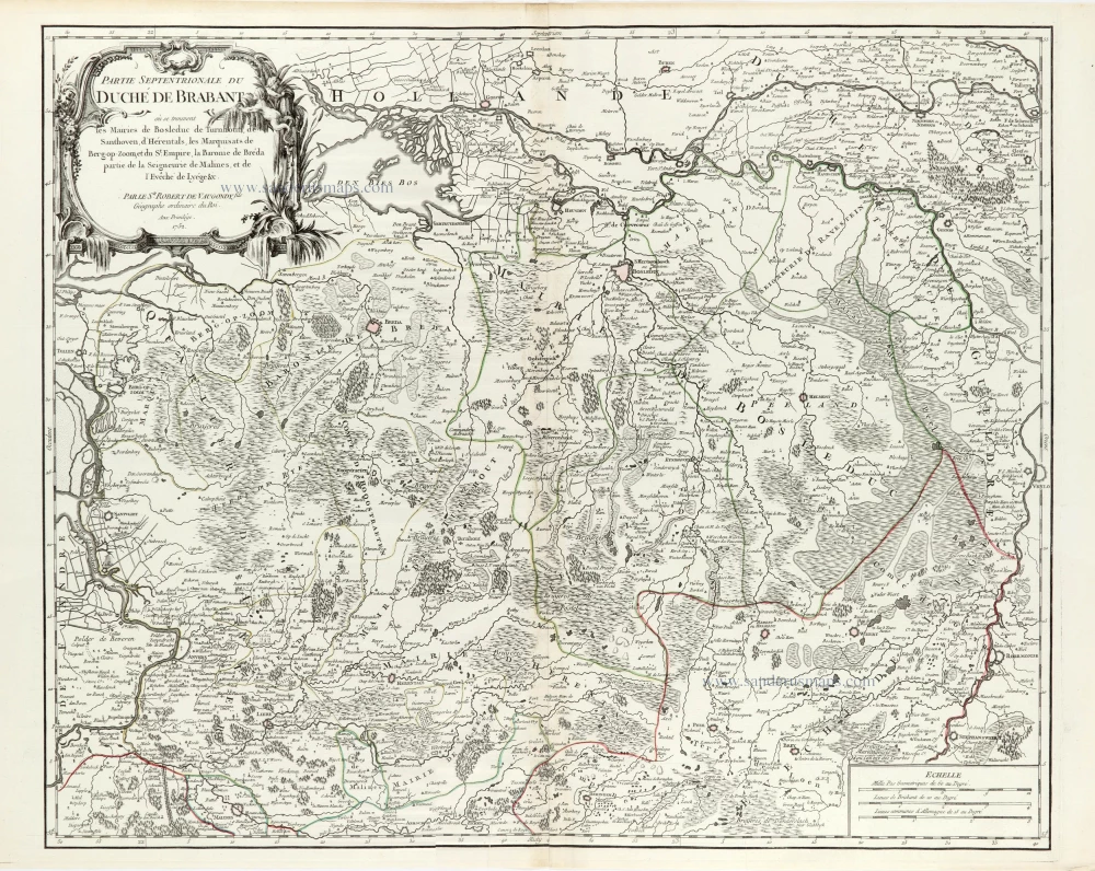
Partie Septentrionale du Duché de Brabant où se trouvent les Mairies de Bosleduc de Turnhout, de Santhoven, d'Herentals, les Marquisats de Berg-op-Zoom, et du St Empire, la Baronie de Bréda partie de la Seigneurie de Malines, et de l'Evêché de Lyége &c. 1757
Southern Brabant par Robert de Vaugondy.
[Item number: 30403]
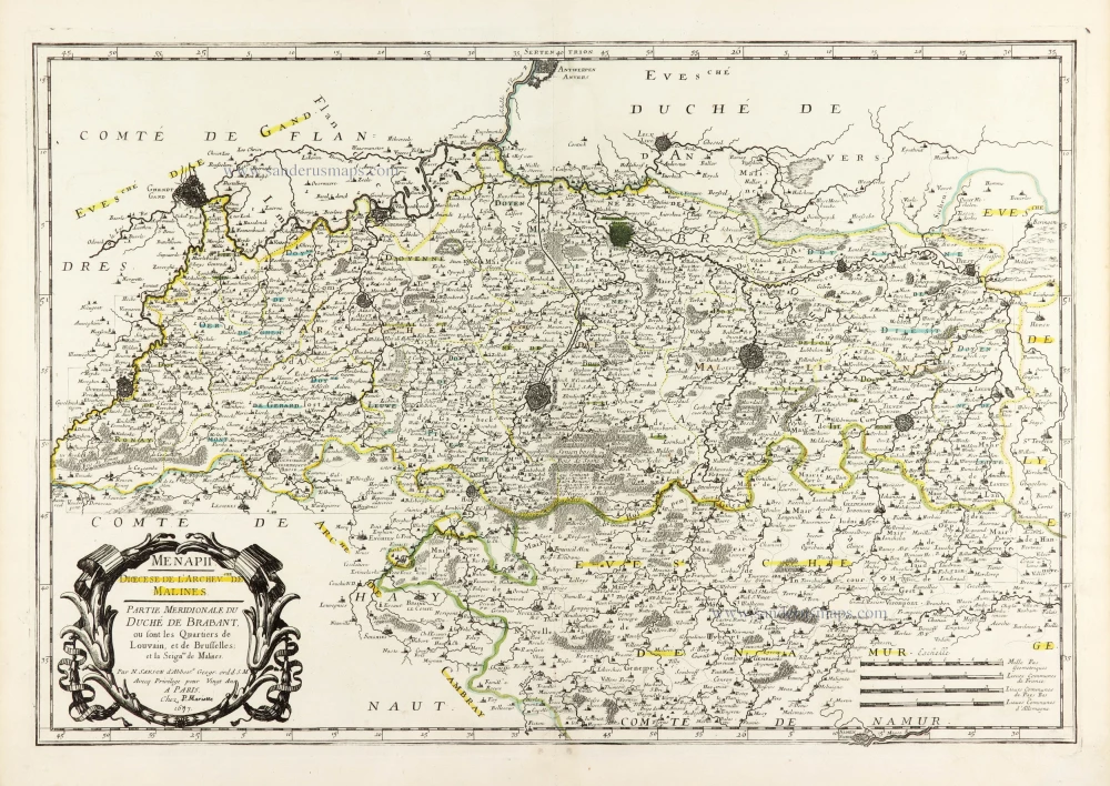
Menapii. Dioecese de l'Archev[es]ché de Malines. Partie meridionale du Duché de Brabant, ou sont les quartiers de Louvain, et du Brusselles; et la seign[eu]rie de Malines. 1679-1710
Historical map of Southern Brabant, by Guillaume Sanson, published by P. Mariette.
[Item number: 30520]

Tabula Ducatus Brabantiae continens Marchionatum Sacri Imperiii et Dominium Mechliniense 1670-71
Brabant by Frederick De Wit.
[Item number: 30526]