Antique maps catalogue
- All recent additions
-
Antique maps
- World and Polar
-
Europe
- Europe Continent
- Belgium
- Belgium - Cities
- The Low Countries
- The Netherlands
- The Netherlands - Cities
- Luxembourg
- France
- France - Cities
- Germany
- Germany - Cities
- Austria
- Italy
- Italy - Cities
- Spain and Portugal
- Greece & Greek Islands
- Switzerland
- British Isles
- British Isles - Cities
- Northern Europe
- Central Europe
- Eastern Europe
- Southeastern Europe
- America
- Asia
- Africa
- Mediterranean Sea
- Australia
- Oceans
- Celestial Maps
- Curiosities
- Books
- Medieval manuscripts
- Prints
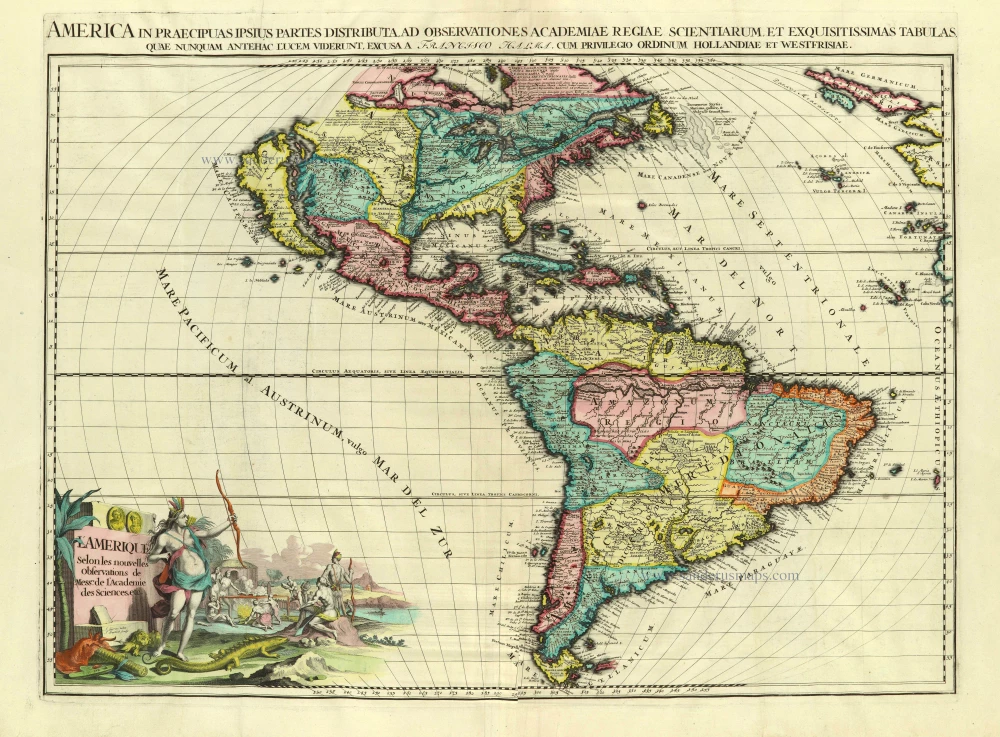
America, by François Halma. Before 1713
L'Amerique selon les Nouvelles Observations de Messrs. de ...
[Item number: 28017]
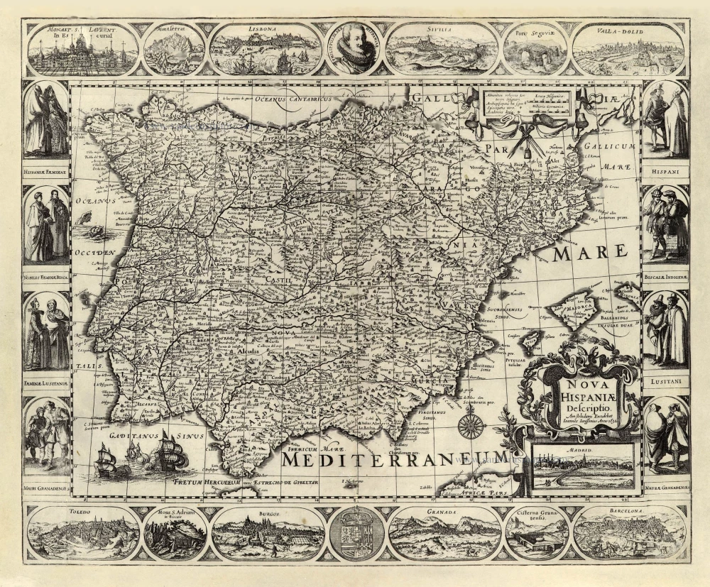
Spain by Joannes Janssonius. 1632
Nova Hispaniae Descriptio.
[Item number: 28205]
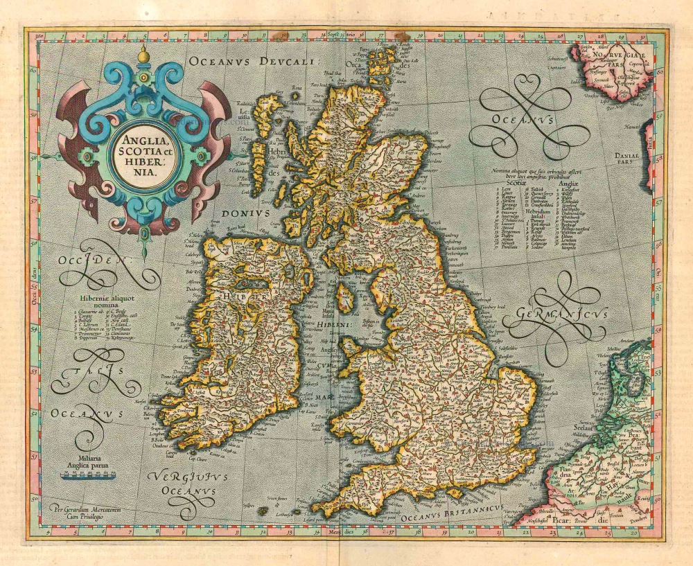
British Isles, by Gerard Mercator. 1623
Anglia, Scotia et Hibernia.
[Item number: 24894]
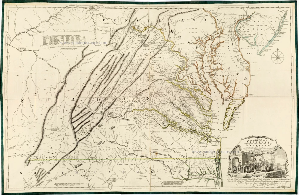
Joshua Fry & Peter Jefferson 1775
A Map of the Most Inhabited Part of Virginia Containing the ...
[Item number: 28119]
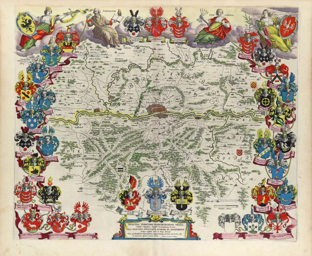
The Territory of Frankfurt am Main by J. Blaeu 1643
Novam Hanc Territorii Francofurtensis Tabulam ...
[Item number: 29904]
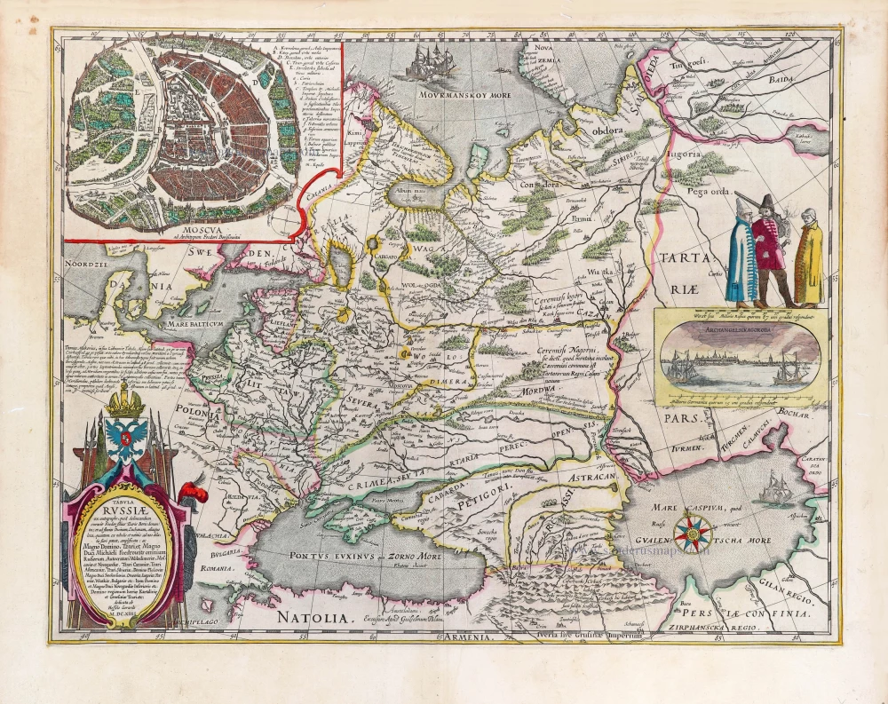
Russia by Willem & Joan Blaeu. 1643
Tabula Russiae ex autographo, quod delineandum curavit Foedor ...
[Item number: 29900]

Welcome to Sanderus Antiquariaat
Antiquariaat Sanderus, named after the famous Flemish historian, Antonius Sanderus, is specialised in antiquarian books, medieval manuscripts, antique maps and prints from the 15th to the 18th centuries.
The company is a member of the Antiquarian Booksellers’ Association (ABA), the “The Belgian Royal Chamber of Antiques and Art Dealers” and the International Association of Antique Map Dealers (IAMA).