Antique maps catalogue
- All recent additions
-
Antique maps
- World and Polar
-
Europe
- Europe Continent
- Belgium
- Belgium - Cities
- The Low Countries
- The Netherlands
- The Netherlands - Cities
- Luxembourg
- France
- France - Cities
- Germany
- Germany - Cities
- Austria
- Italy
- Italy - Cities
- Spain and Portugal
- Greece & Greek Islands
- Switzerland
- British Isles
- British Isles - Cities
- Northern Europe
- Central Europe
- Eastern Europe
- Southeastern Europe
- America
- Asia
- Africa
- Mediterranean Sea
- Australia
- Oceans
- Celestial Maps
- Curiosities
- Books
- Medieval manuscripts
- Prints

North America, by Nicolas Sanson, published by Pierre Mortier after A.H. Jaillot. 1694
Amerique Septentrionale, Divisee en ses Principales Parties.
[Item number: 29125]
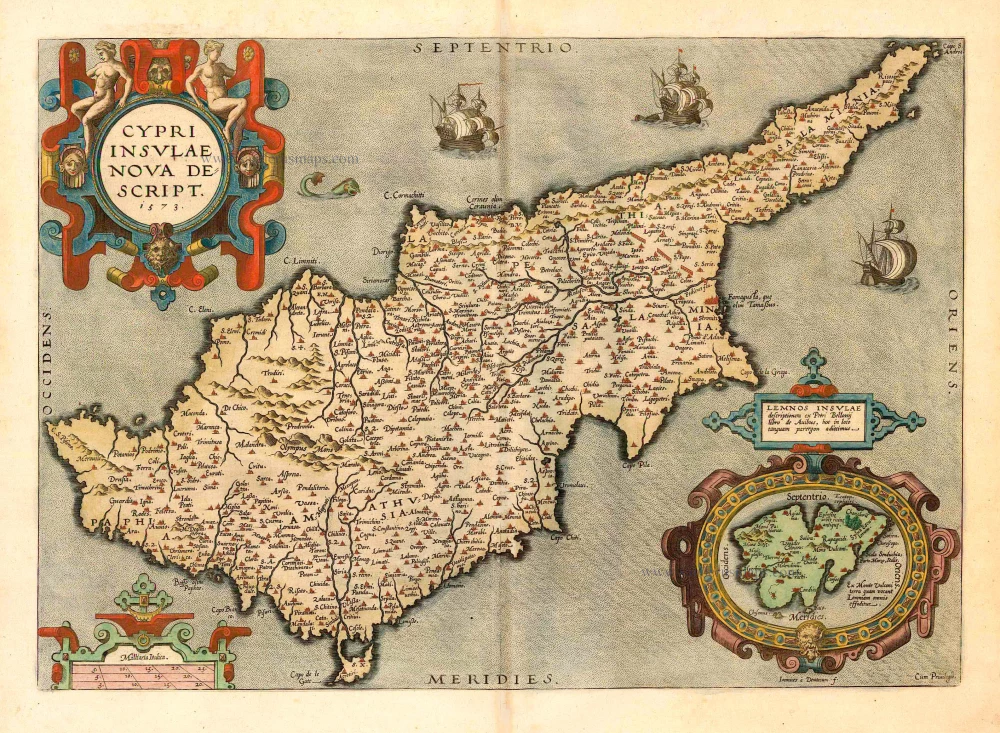
Cyprus, by Ortelius A. 1592
Cypri Insulae Nova Descript. 1573
[Item number: 22955]
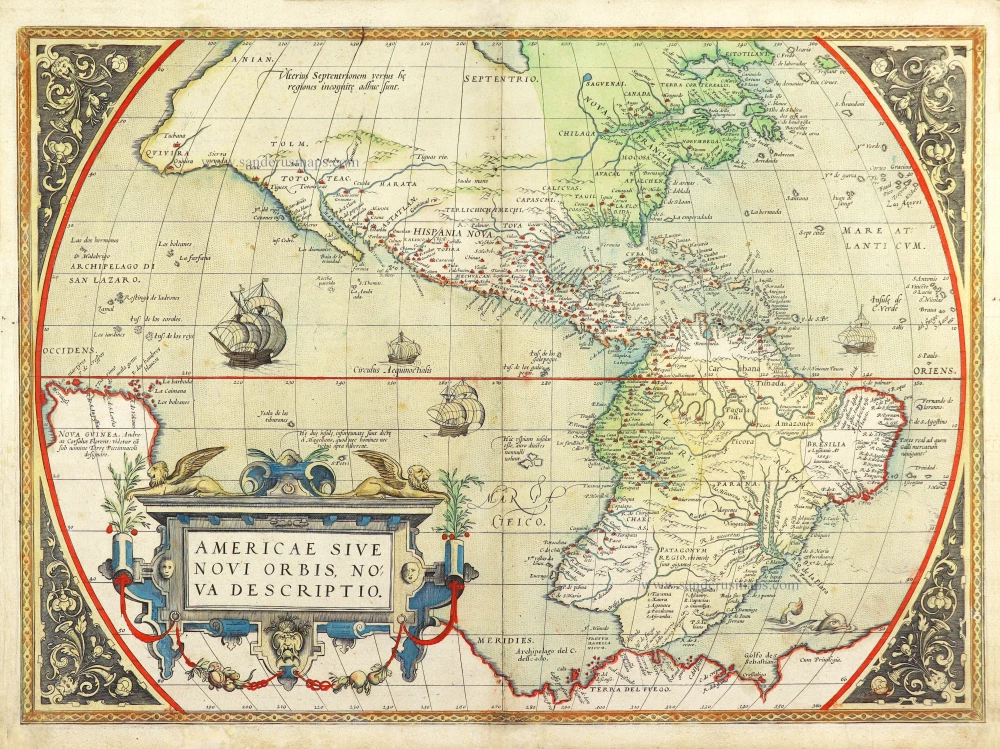
America by Abraham Ortelius. 1572
Americae Sive Novi Orbis, Nova Descriptio.
[Item number: 29237]
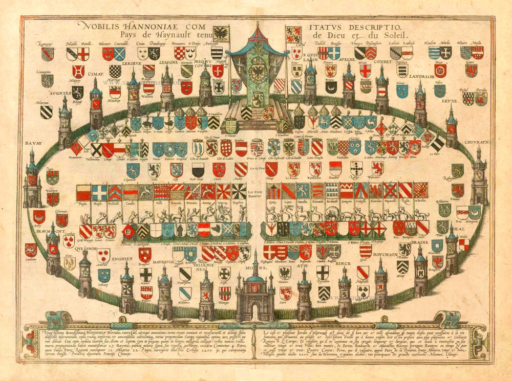
Heraldic Garden of the County of Hainaut, by Georg Braun and Frans Hogenberg. 1581
Nobilis Hannoniae Comitatus Descriptio. Pays de Haynault Tenu de ...
[Item number: 25340]
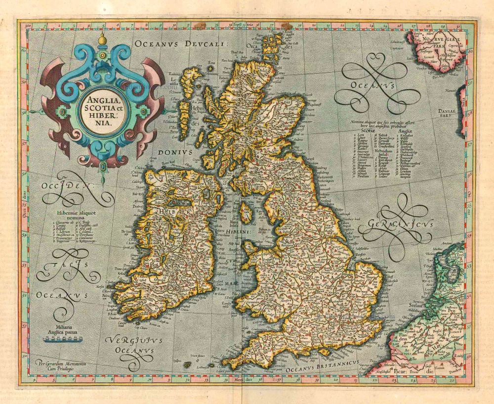
British Isles, by Gerard Mercator. 1623
Anglia, Scotia et Hibernia.
[Item number: 24894]

Battle of the War of Succession between the four Mughal princes, sons of Shah Jahan (1658–1659), by Z. Châtelain. 1719
Représentation et Description du Soulèvement des IV. Princes du M ...
[Item number: 31434]
new
Welcome to Sanderus Antiquariaat
Antiquariaat Sanderus, named after the famous Flemish historian, Antonius Sanderus, is specialised in antiquarian books, medieval manuscripts, antique maps and prints from the 15th to the 18th centuries.
The company is a member of the Antiquarian Booksellers’ Association (ABA), the “The Belgian Royal Chamber of Antiques and Art Dealers” and the International Association of Antique Map Dealers (IAMA).