Antique maps catalogue
- All recent additions
-
Antique maps
- World and Polar
-
Europe
- Europe Continent
- Belgium
- Belgium - Cities
- The Low Countries
- The Netherlands
- The Netherlands - Cities
- Luxembourg
- France
- France - Cities
- Germany
- Germany - Cities
- Austria
- Italy
- Italy - Cities
- Spain and Portugal
- Greece & Greek Islands
- Switzerland
- British Isles
- British Isles - Cities
- Northern Europe
- Central Europe
- Eastern Europe
- Southeastern Europe
- America
- Asia
- Africa
- Mediterranean Sea
- Australia
- Oceans
- Celestial Maps
- Curiosities
- Books
- Medieval manuscripts
- Prints
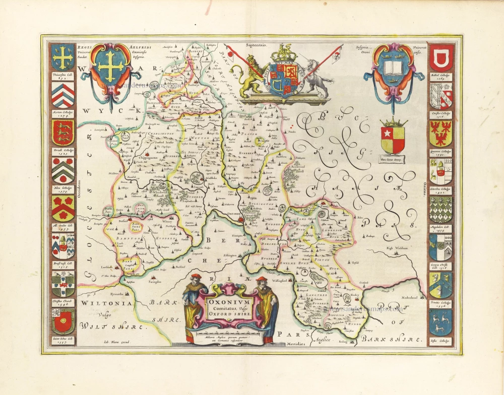
Oxfordshire by J. Blaeu 1645
Oxonium Comitatus, vulgo Oxford Shire.
[Item number: 29773]
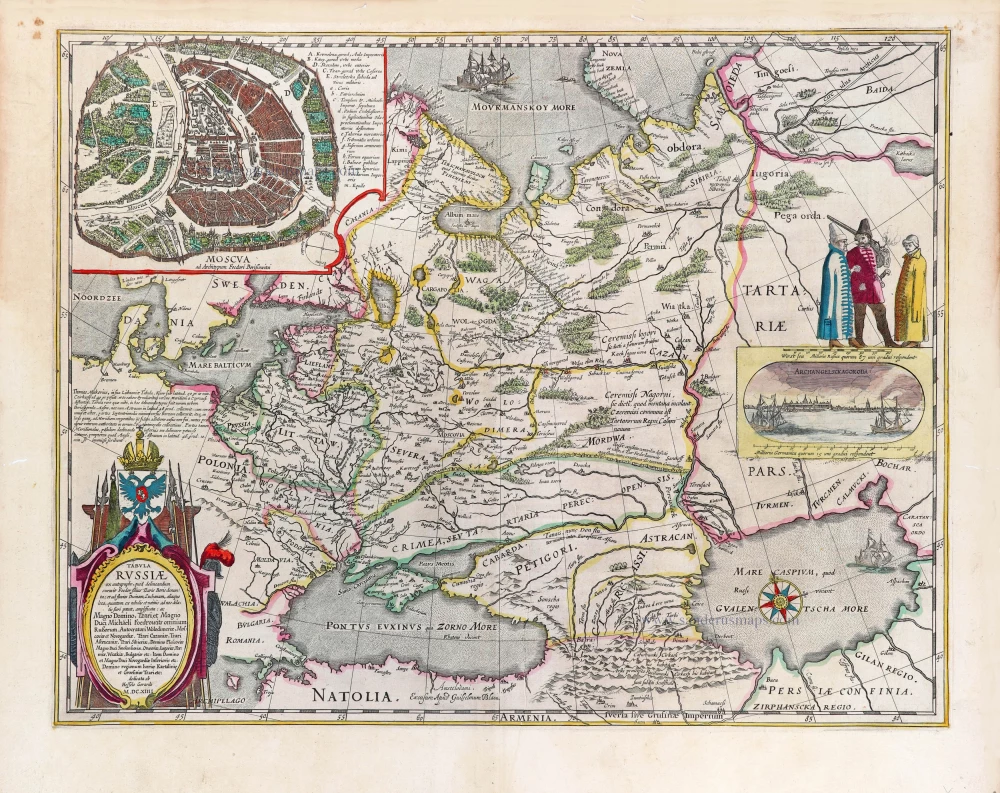
Russia by Willem & Joan Blaeu. 1643
Tabula Russiae ex autographo, quod delineandum curavit Foedor ...
[Item number: 29900]
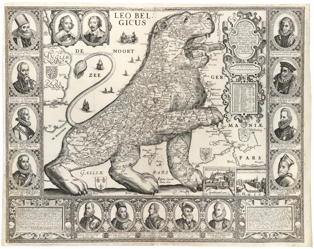
Leo Belgicus by Johan van Doetechum, published by C.J. Visscher. 1641
Leo Belgicus
[Item number: 31412]
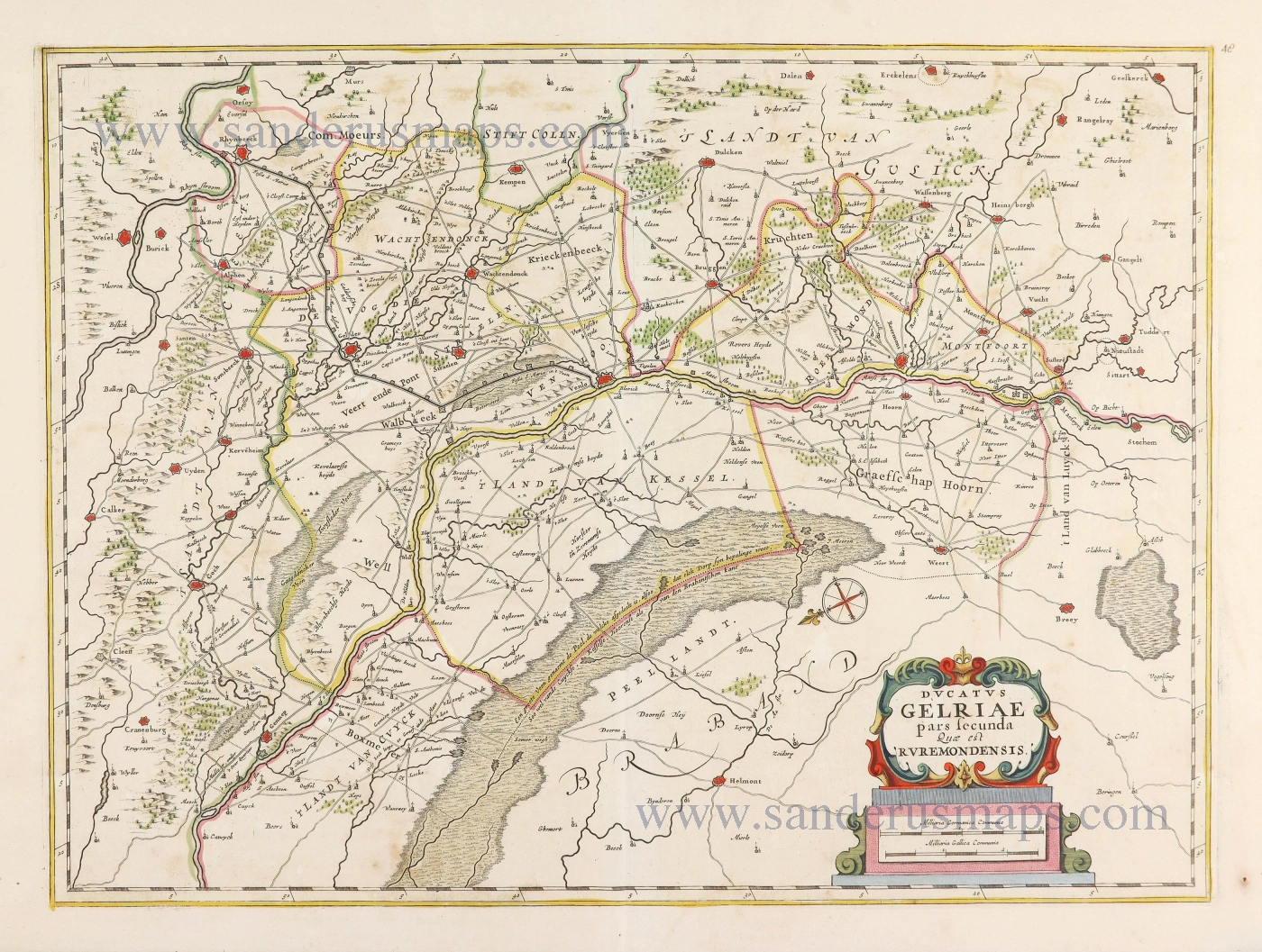
Gelderland - Roermond by Joannes Janssonius. 1677-80
Ducatus Gelriae pars secunda quae est Ruremondensis.
[Item number: 28585]
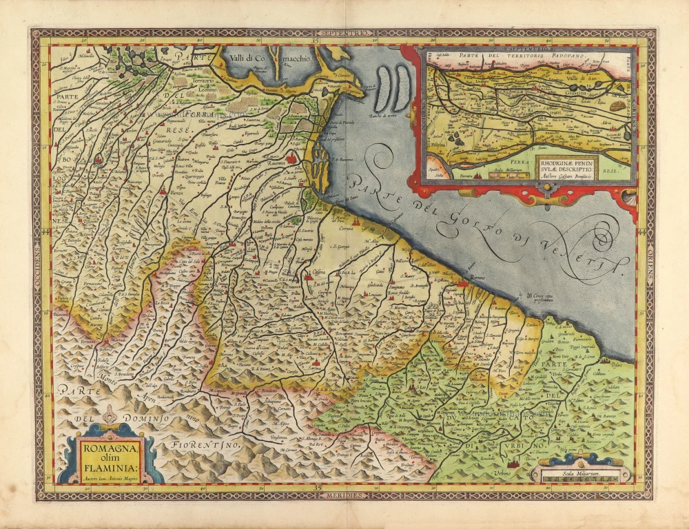
Romagna by J.B. Vrients 1612
Romagna, olim Flaminia.
[Item number: 30909]
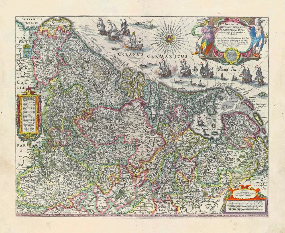
17 Provinces, by Willem Blaeu. 1631
Novus XVII Inferioris Germaniae Provinciarum Typus.
[Item number: 28019]

Welcome to Sanderus Antiquariaat
Antiquariaat Sanderus, named after the famous Flemish historian, Antonius Sanderus, is specialised in antiquarian books, medieval manuscripts, antique maps and prints from the 15th to the 18th centuries.
The company is a member of the Antiquarian Booksellers’ Association (ABA), the “The Belgian Royal Chamber of Antiques and Art Dealers” and the International Association of Antique Map Dealers (IAMA).