Antique maps catalogue
- All recent additions
-
Antique maps
- World and Polar
-
Europe
- Europe Continent
- Belgium
- Belgium - Cities
- The Low Countries
- The Netherlands
- The Netherlands - Cities
- Luxembourg
- France
- France - Cities
- Germany
- Germany - Cities
- Austria
- Italy
- Italy - Cities
- Spain and Portugal
- Greece & Greek Islands
- Switzerland
- British Isles
- British Isles - Cities
- Northern Europe
- Central Europe
- Eastern Europe
- Southeastern Europe
- America
- Asia
- Africa
- Mediterranean Sea
- Australia
- Oceans
- Celestial Maps
- Curiosities
- Books
- Medieval manuscripts
- Prints
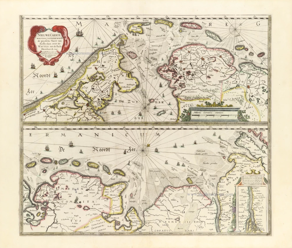
The Wadden Sea, by Henricus Hondius. 1653
Nieuwe Caerte waerinne vertoont wordt de gantsche Vaert van ...
[Item number: 30375]
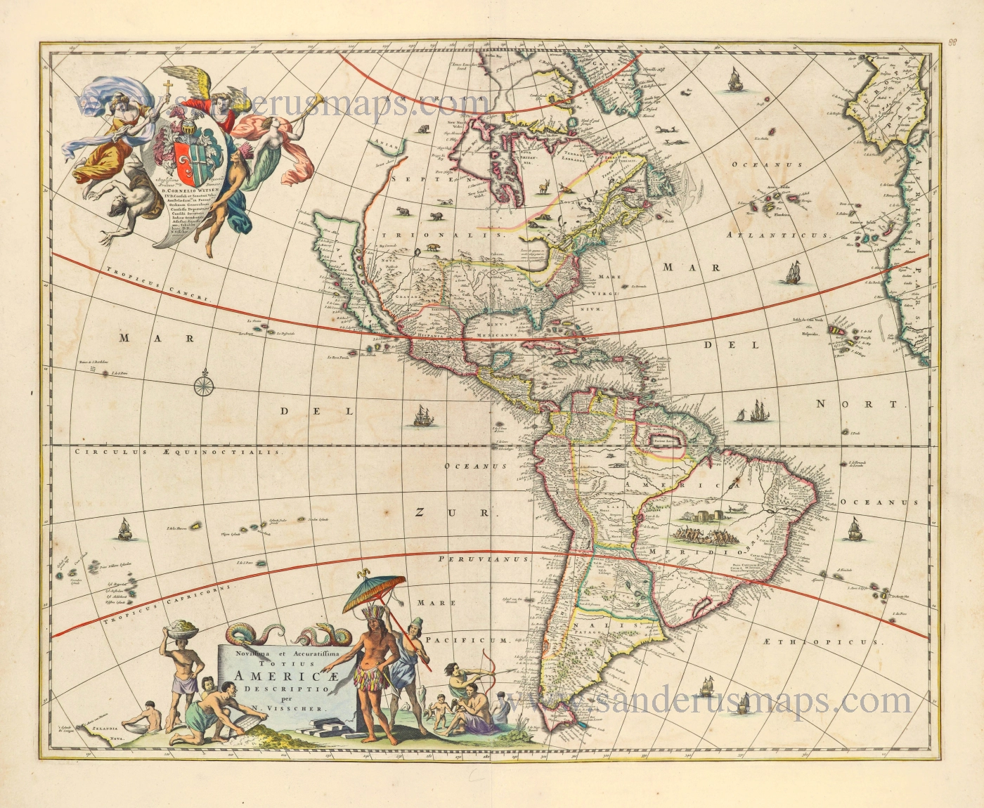
America by Nicolaes Visscher I. 1656-77
Novissima et Accuratissima Totius Americae Descriptio.
[Item number: 28554]
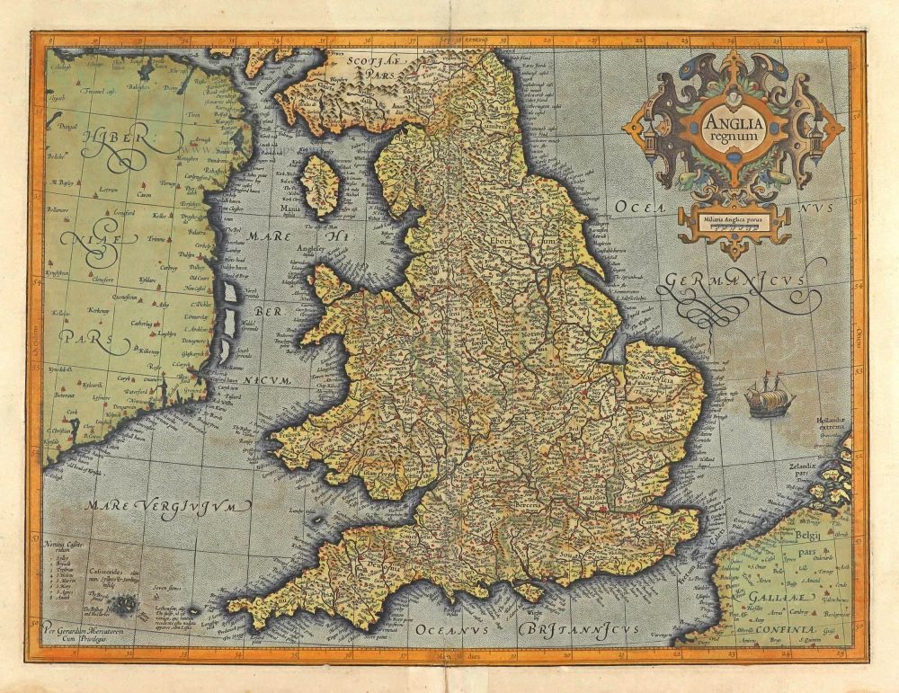
England, by Gerard Mercator. 1623
Anglia Regnum.
[Item number: 28132]
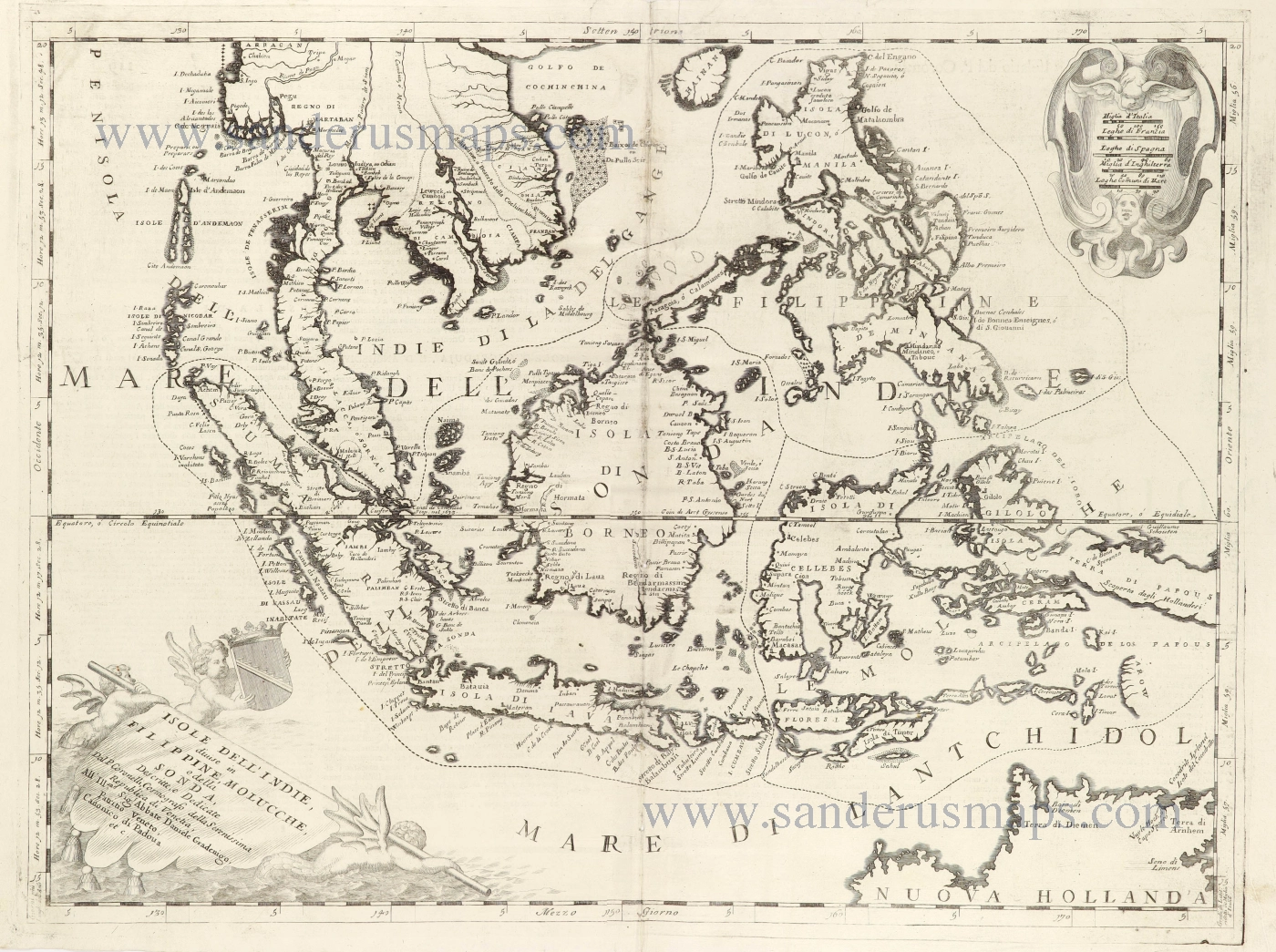
Southeast Asia and Northwest Australia by Vincenzo Coronelli. 1696
Isole dell'Indie, Divise in Filippine, Molucche, e della Sonda.
[Item number: 28670]
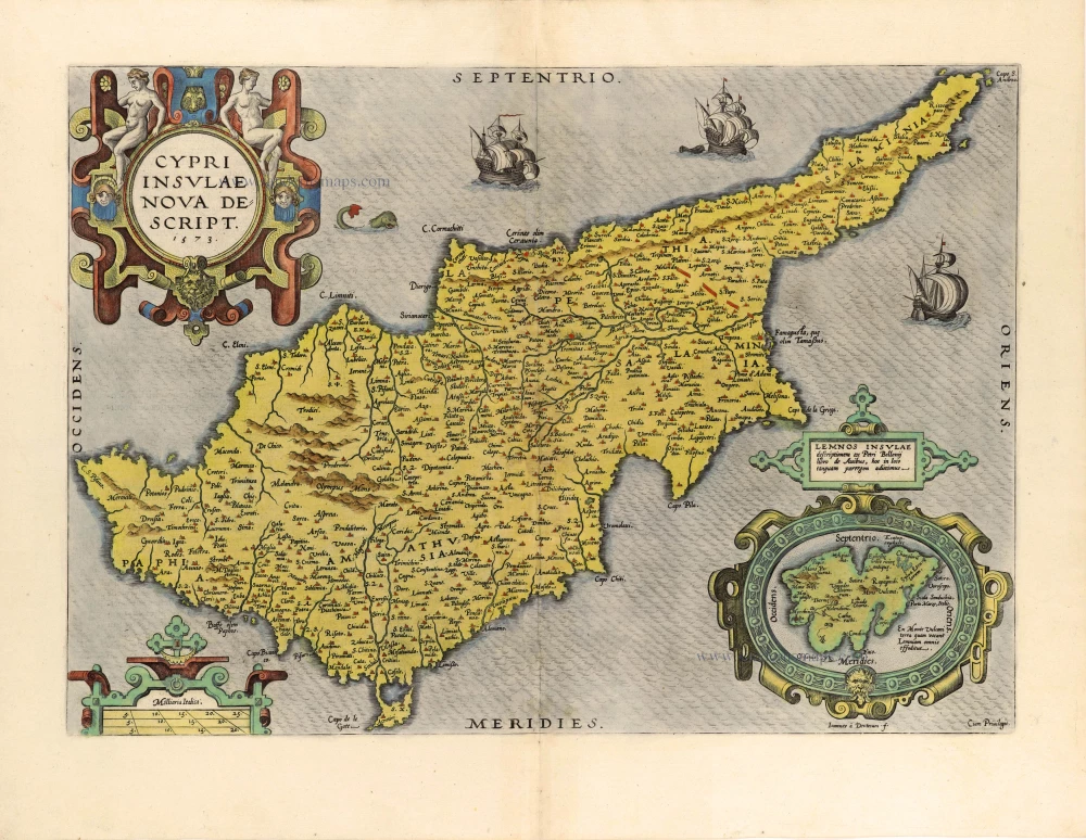
Cyprus by Abraham Ortelius. 1584
Cypri Insulae Nova Descript. 1573
[Item number: 29484]
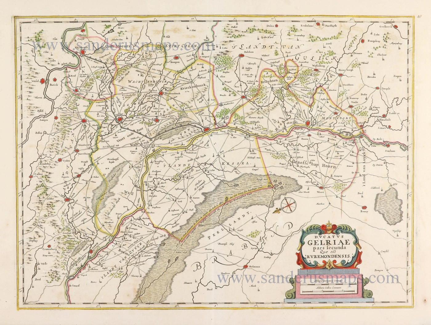
Gelderland - Roermond by Joannes Janssonius. 1677-80
Ducatus Gelriae pars secunda quae est Ruremondensis.
[Item number: 28585]

Welcome to Sanderus Antiquariaat
Antiquariaat Sanderus, named after the famous Flemish historian, Antonius Sanderus, is specialised in antiquarian books, medieval manuscripts, antique maps and prints from the 15th to the 18th centuries.
The company is a member of the Antiquarian Booksellers’ Association (ABA), the “The Belgian Royal Chamber of Antiques and Art Dealers” and the International Association of Antique Map Dealers (IAMA).