Antique maps catalogue
- All recent additions
-
Antique maps
- World and Polar
-
Europe
- Europe Continent
- Belgium
- Belgium - Cities
- The Low Countries
- The Netherlands
- The Netherlands - Cities
- Luxembourg
- France
- France - Cities
- Germany
- Germany - Cities
- Austria
- Italy
- Italy - Cities
- Spain and Portugal
- Greece & Greek Islands
- Switzerland
- British Isles
- British Isles - Cities
- Northern Europe
- Central Europe
- Eastern Europe
- Southeastern Europe
- America
- Asia
- Africa
- Mediterranean Sea
- Australia
- Oceans
- Celestial Maps
- Curiosities
- Books
- Medieval manuscripts
- Prints
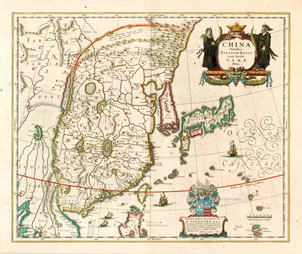
China - Japan - Korea, by Willem & Joan Blaeu. 1649-55
China Veteribus Sinarum Regio Nunc Incolis Tame Dicta.
[Item number: 27043]
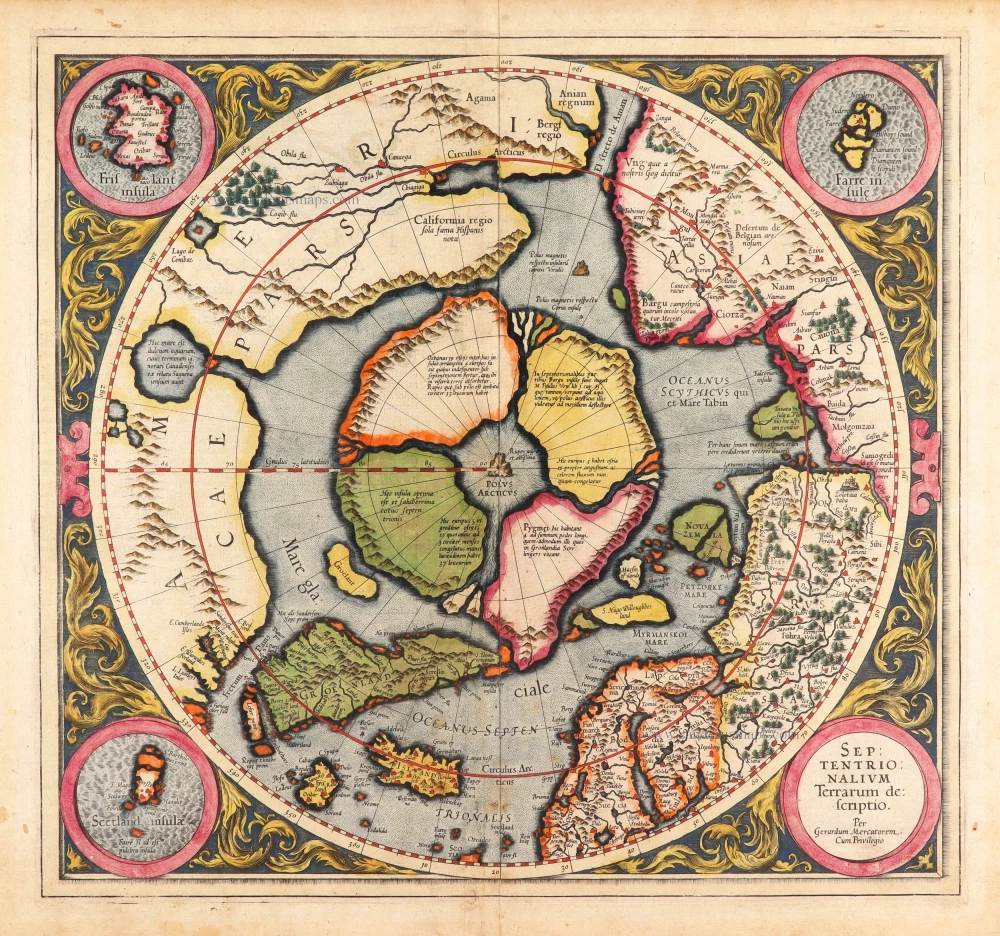
Arctic Region - North Pole by Gerard Mercator, first state published by Rumold Mercator. 1595
Septentrionalium Terrarum descriptio.
[Item number: 29799]
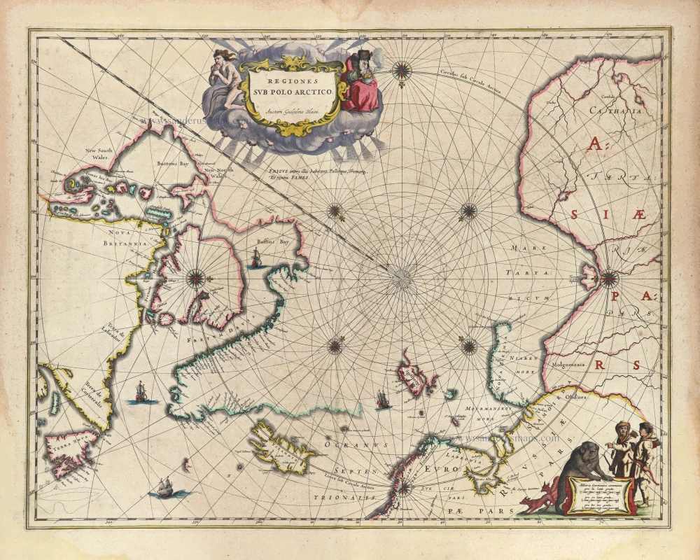
Arctic Region, by Joan Blaeu 1643
Regiones sub Polo Arctico.
[Item number: 29447]
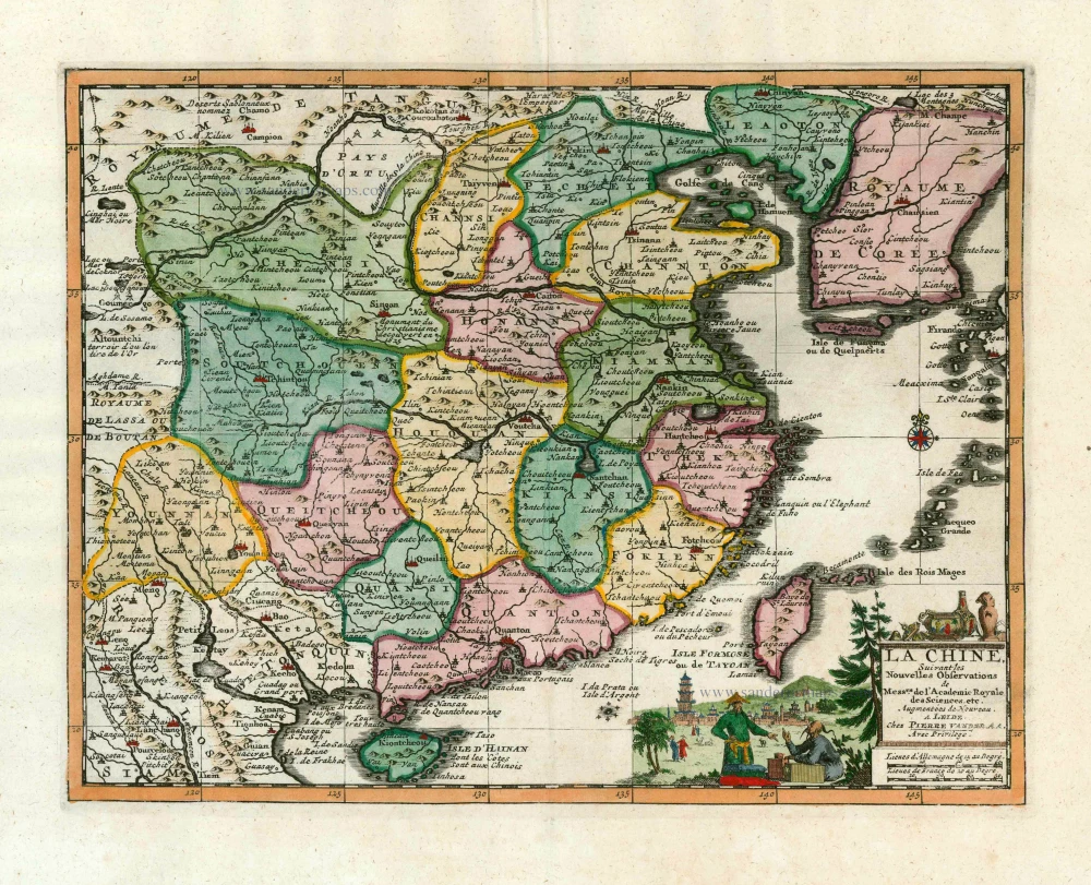
China, by Pieter van der Aa. 1713
La Chine, Suivant les Nouvelles Observations.
[Item number: 27095]
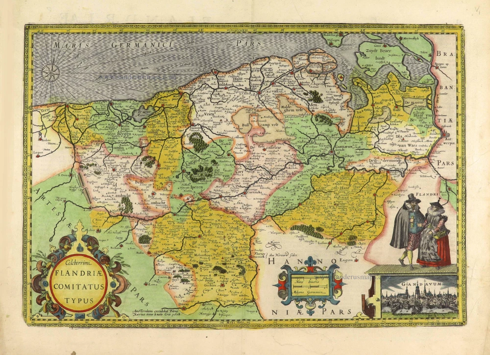
Flanders (Vlaanderen) by Petrus Kaerius (Pieter Van den Keere). 1617
Celeberrimi Flandriae Comitatus Typus.
[Item number: 28453]

Battle of the War of Succession between the four Mughal princes, sons of Shah Jahan (1658–1659), by Z. Châtelain. 1719
Représentation et Description du Soulèvement des IV. Princes du M ...
[Item number: 31434]
new
Welcome to Sanderus Antiquariaat
Antiquariaat Sanderus, named after the famous Flemish historian, Antonius Sanderus, is specialised in antiquarian books, medieval manuscripts, antique maps and prints from the 15th to the 18th centuries.
The company is a member of the Antiquarian Booksellers’ Association (ABA), the “The Belgian Royal Chamber of Antiques and Art Dealers” and the International Association of Antique Map Dealers (IAMA).