Antique maps catalogue
- All recent additions
-
Antique maps
- World and Polar
-
Europe
- Europe Continent
- Belgium
- Belgium - Cities
- The Low Countries
- The Netherlands
- The Netherlands - Cities
- Luxembourg
- France
- France - Cities
- Germany
- Germany - Cities
- Austria
- Italy
- Italy - Cities
- Spain and Portugal
- Greece & Greek Islands
- Switzerland
- British Isles
- British Isles - Cities
- Northern Europe
- Central Europe
- Eastern Europe
- Southeastern Europe
- America
- Asia
- Africa
- Mediterranean Sea
- Australia
- Oceans
- Celestial Maps
- Curiosities
- Books
- Medieval manuscripts
- Prints
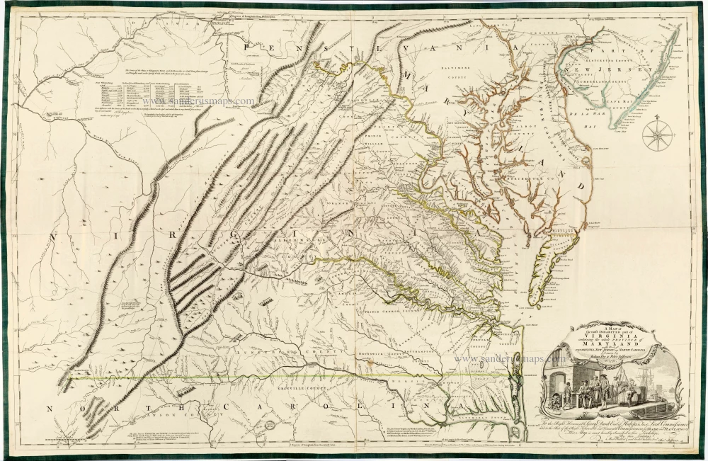
Joshua Fry & Peter Jefferson 1775
A Map of the Most Inhabited Part of Virginia Containing the ...
[Item number: 28119]
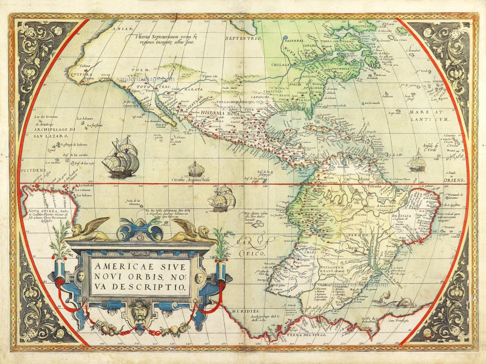
America by Abraham Ortelius. 1572
Americae Sive Novi Orbis, Nova Descriptio.
[Item number: 29237]
![Vincenzo Coronelli [No title]](https://sanderusmaps.com/assets/WEBP/m29448.webp)
North America by Coronelli Vincenzo 1696
Vincenzo Coronelli [No title]
[Item number: 29448]
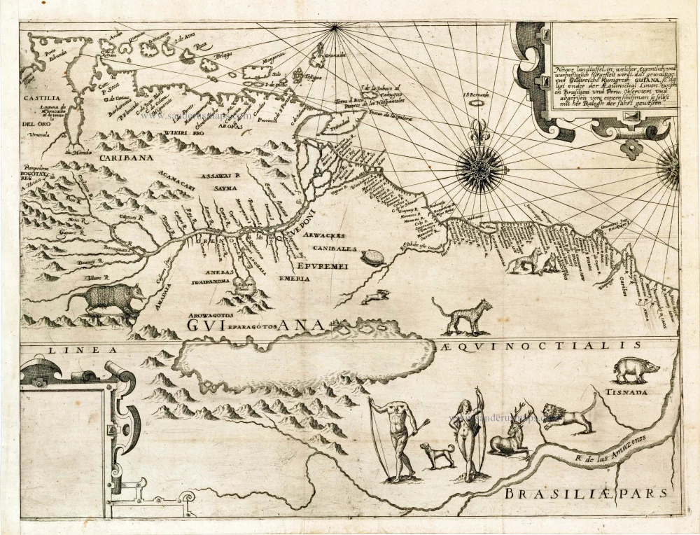
Guyana by Theodor de Bry. 1599
Neuwe Landtaffel, in welcher eigentlich, und warhafftiglich ...
[Item number: 27037]
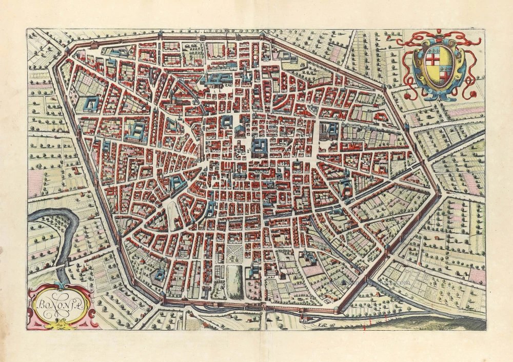
Bologna by J. Janssonius, after Braun and Hogenberg. 1657
Bononia.
[Item number: 31031]
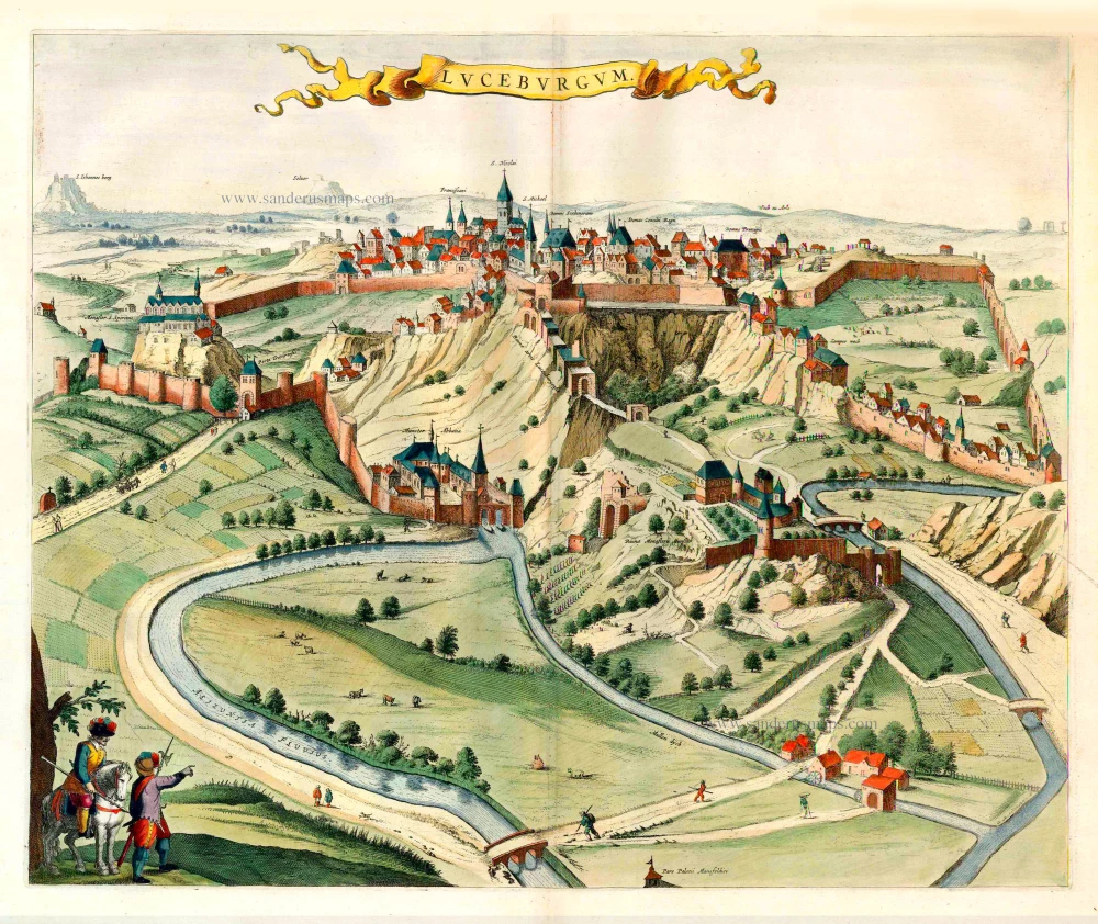
Luxembourg, by Joan Blaeu. 1652
Luceburgum.
[Item number: 25510]

Welcome to Sanderus Antiquariaat
Antiquariaat Sanderus, named after the famous Flemish historian, Antonius Sanderus, is specialised in antiquarian books, medieval manuscripts, antique maps and prints from the 15th to the 18th centuries.
The company is a member of the Antiquarian Booksellers’ Association (ABA), the “The Belgian Royal Chamber of Antiques and Art Dealers” and the International Association of Antique Map Dealers (IAMA).