Antique maps catalogue
- All recent additions
-
Antique maps
- Polar maps
- World
-
Europe
- Europe Continent
- Belgium
- Belgium - Cities
- The Low Countries
- The Netherlands
- The Netherlands - Cities
- Luxembourg
- France
- France - Cities
- Germany
- Germany - Cities
- Austria
- Italy
- Italy - Cities
- Spain and Portugal
- Greece & Greek Islands
- Switzerland
- British Isles
- British Isles - Cities
- Northern Europe
- Central Europe
- Eastern Europe
- Southeastern Europe
- America
- Asia
- Africa
- Mediterranean Sea
- Australia
- Oceans
- Celestial Maps
- Curiosities
- Title Pages
- Books
- Medieval manuscripts
- Prints

Bethune by Joan Blaeu. 1649
Bethune
[Item number: 22840]
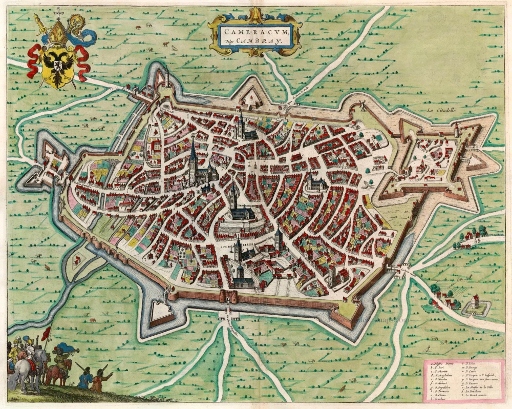
Cambrai, by Blaeu J. 1649
Cameracum, Vulgo Cambray
[Item number: 22841]

Arras, by Blaeu J. 1649
Atrebatum, Gallis Arras, Belgis Atrecht dicta.
[Item number: 22843]
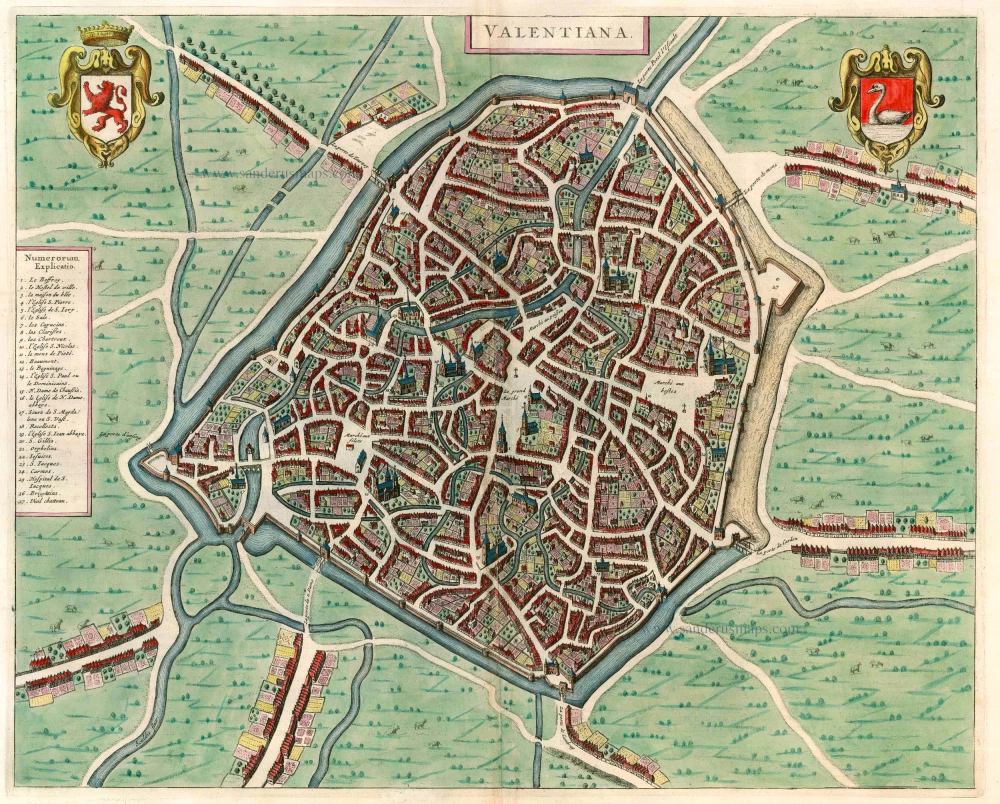
Valenciennes, by Blaeu J. 1649
Valentiana
[Item number: 22844]

Cassel by Joan Blaeu. 1649
Casletum vulgo Cassel Olim Castellum Morinorum.
[Item number: 13103]

Armentières, by Joan Blaeu. 1649
Armentieres
[Item number: 13106]

Bailleul, by Blaeu J. 1649
Balliolum vulgo Belle
[Item number: 13125]

Hesdin, by J. Blaeu. 1649
Plan du siege de Hesdin
[Item number: 13133]
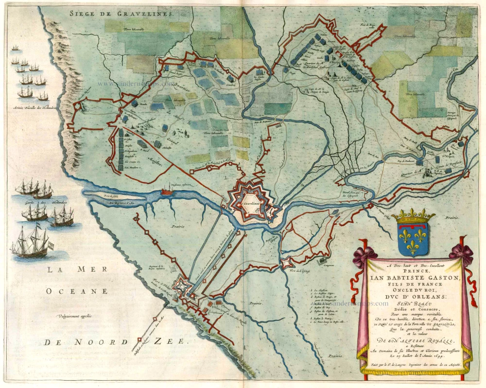
Gravelines, by Joan Blaeu. 1649
Siege de Gravelines
[Item number: 13136]

Steenvoorde, by Blaeu J. 1649
[Item number: 13137]

Gravelines, by Blaeu J. 1649
Gravelinga Gallis Gravelines dicta.
[Item number: 13138]

The siege of Dunkerque in1646, by Joan Blaeu. 1652
Plan de la ville de Dunkerque.
[Item number: 28731]
Rare
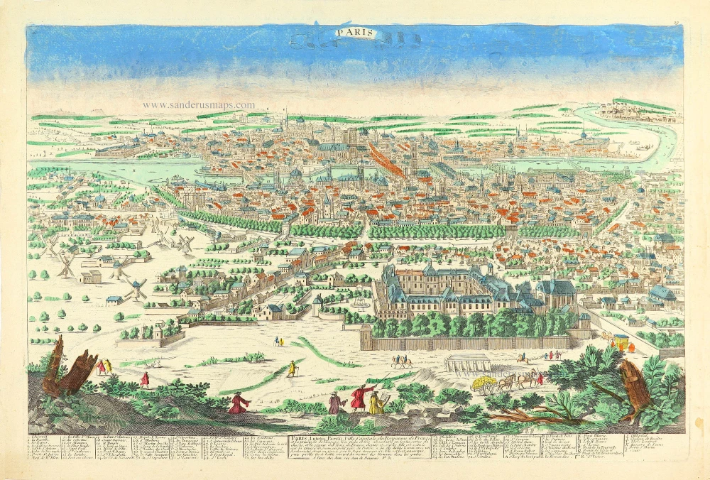
Paris by Pierre Aveline, published in Paris by Jean. c. 1780
Paris, Lutetia, Paritij, Ville Capitale du Royaume de France, et...
[Item number: 28753]

Bordeaux by Pierre Aveline, published in Paris by Jean. c. 1780
Bourdeaux ancienement Burdigala, Ville Capitale de la Guienne,...
[Item number: 28793]
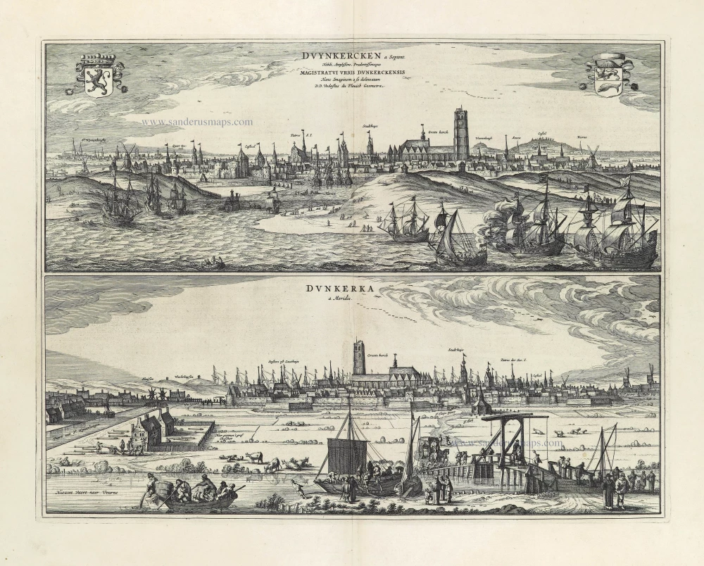
Dunkerque by Antonius Sanderus, published by Joan Blaeu. 1652
Duynkercken a Septent. - Dunkerka a Meridie.
[Item number: 28542]
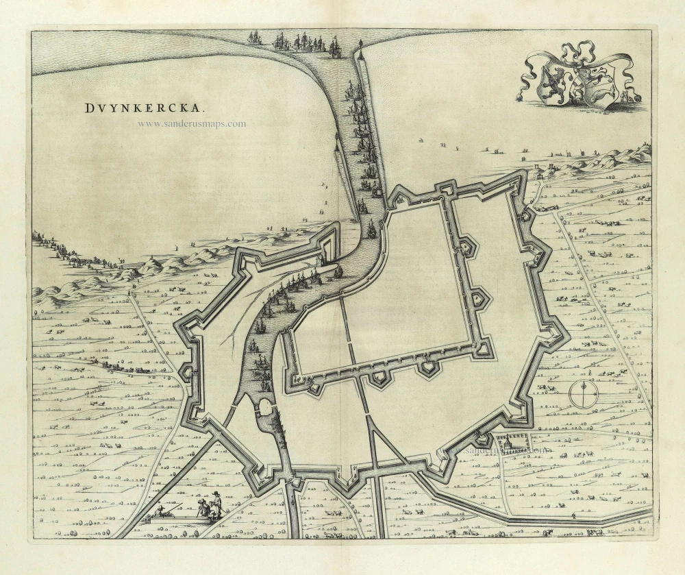
Fortification plan of Dunkerque by Antonius Sanderus, published by Joan Blaeu. 1652
Duynkercka.
[Item number: 28543]

Fortification plan of Dunkerque by Antonius Sanderus, published by Joan Blaeu. 1652
Duynkercka.
[Item number: 28885]

View of Paris, by Salathé after Schmidt. c. 1818
La Bourse.
[Item number: 32352]

Manuscript plan of Valenciennes, a fortified city of strategic military significance. 2nd half 17th century
Valansiene.
[Item number: 30125]

Manuscript plan of Sint Omer, a fortified city of strategic military significance. 2nd half 17th century
St. Omer.
[Item number: 30126]

Manuscript plan of Cambrai, a fortified city of strategic military significance. 2nd half 17th century
Cambray.
[Item number: 30127]
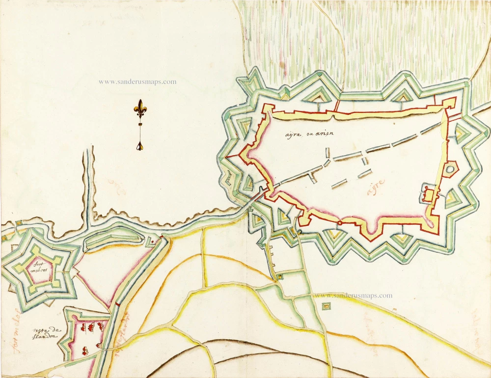
Manuscript plan of Aire-sur-la-Lys, a fortified city of strategic military significance. 2nd half 17th century
Ayre, ou Arien.
[Item number: 30128]

Manuscript plan of Gravelines, a fortified city of strategic military significance. 2nd half 17th century
Gravelines.
[Item number: 30129]

Manuscript plan of Saint-Amand-les-Eaux, a fortified place in northern France. 2nd half 17th century
Saint Amant.
[Item number: 30130]
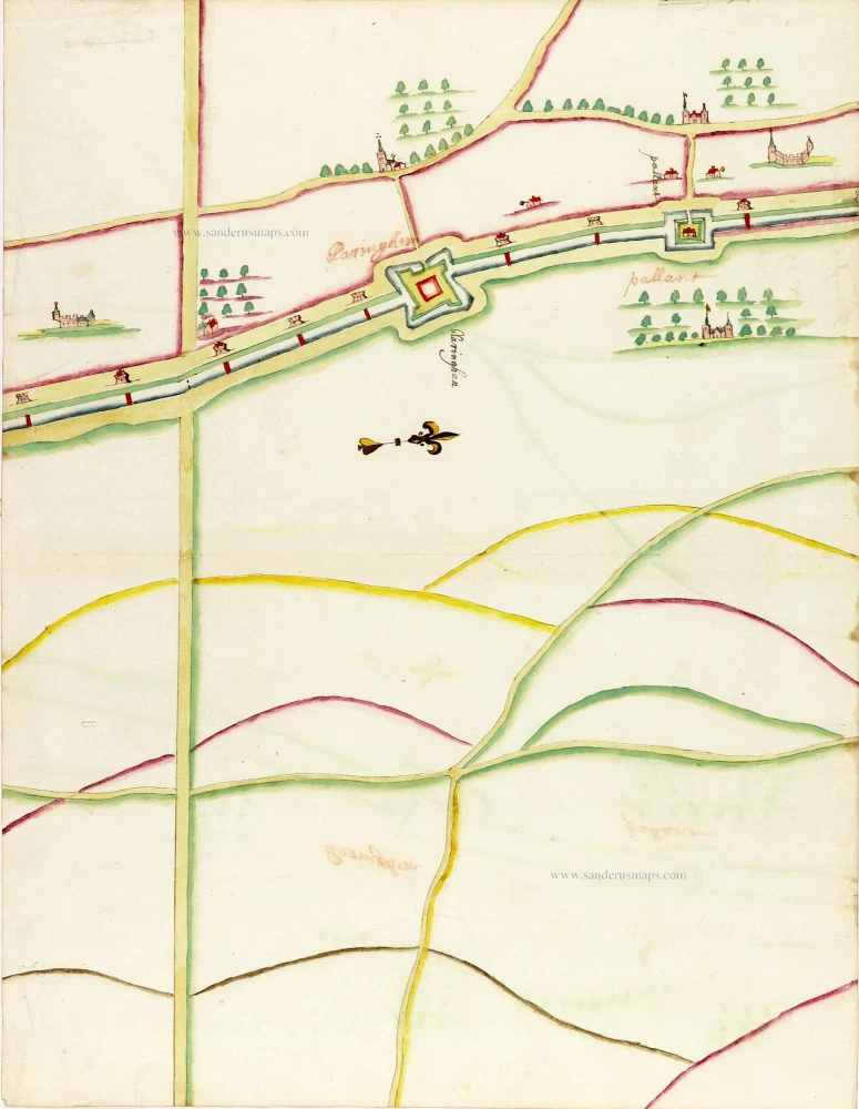
Manuscript plan of Blaringhem (near Hazebrouck, northern France) 2nd half 17th century
Blaringhem - Pallant
[Item number: 30131]

Extremely rare
Playing cards of the capitals of the world
Un Tour dans les Capitales du Monde. Jeu instructif.
[Item number: 30802]
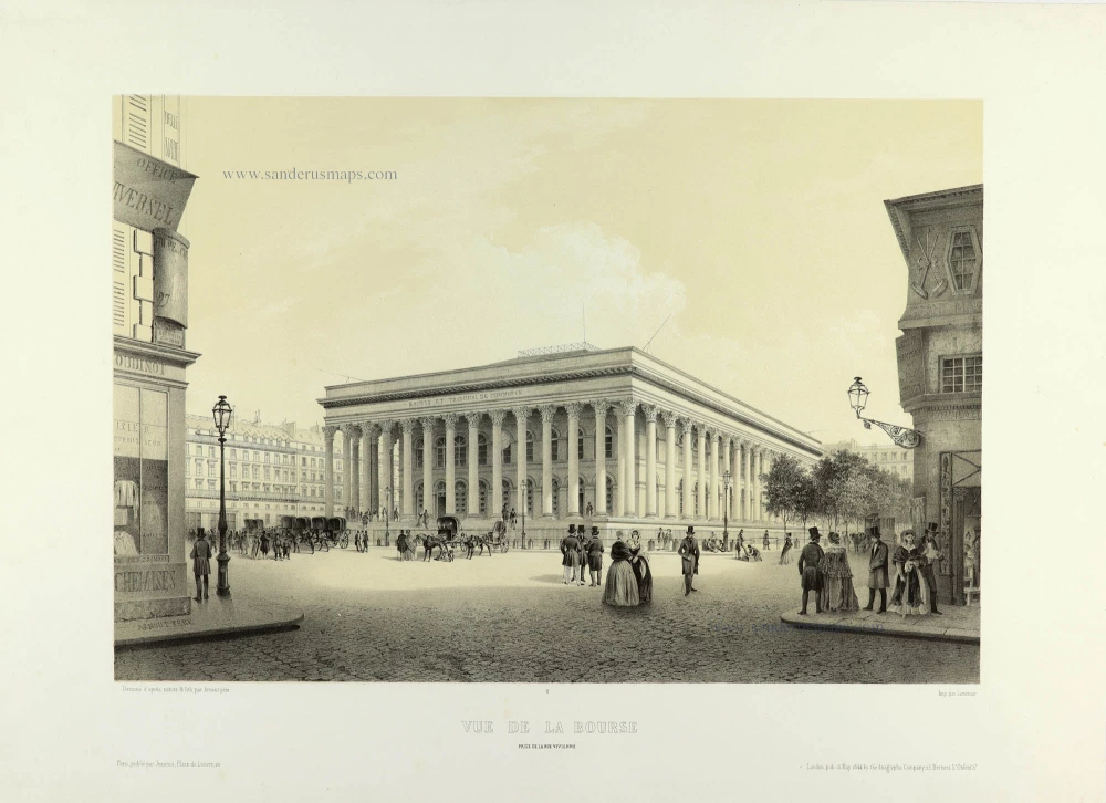
View of Paris, by Arnout Père. 1844
Vue de la Bourse prise de la Rue Vivienne.
[Item number: 32351]