Antique maps catalogue
- All recent additions
-
Antique maps
- World and Polar
-
Europe
- Europe Continent
- Belgium
- Belgium - Cities
- The Low Countries
- The Netherlands
- The Netherlands - Cities
- Luxembourg
- France
- France - Cities
- Germany
- Germany - Cities
- Austria
- Italy
- Italy - Cities
- Spain and Portugal
- Greece & Greek Islands
- Switzerland
- British Isles
- British Isles - Cities
- Northern Europe
- Central Europe
- Eastern Europe
- Southeastern Europe
- America
- Asia
- Africa
- Mediterranean Sea
- Australia
- Oceans
- Celestial Maps
- Curiosities
- Books
- Medieval manuscripts
- Prints
![[No title - Castel Novo, Citta di Ragusi, Citta di Cataro.]](https://sanderusmaps.com/assets/WEBP/m27548.webp)
(Croatia - Montenegro) Dubrovnik, Herceg Novi, Kotor (Cattaro) by Giovanni Francesco Camocio After 1575
[No title - Castel Novo, Citta di Ragusi, Citta di Cataro.]
[Item number: 27548]
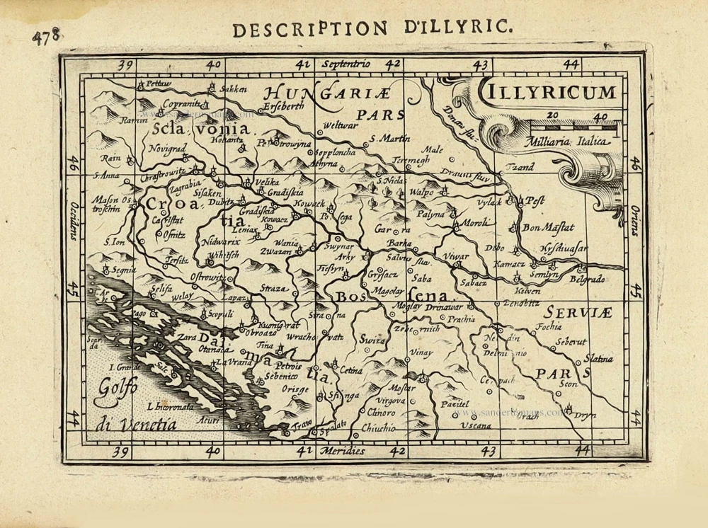
Balkan (West) by Petrus Bertius, published by Jodocus Hondius II. 1618
Illyricum.
[Item number: 31646]
Balkans (East), by Henricus Hondius. 1641
Walachia Servia, Bulgaria, Romania.
[Item number: 27512]

Balkans (West) by Mercator-Hondius 1619
Sclavonia, Croatia, Bosnia cum Dalmatiae Parte
[Item number: 12223]
![[No title] - [On verso:] Tabula .V. Europae.](https://sanderusmaps.com/assets/WEBP/m27959.webp)
Balkans - Dalmatia, by Lorenz Fries. 1525
[No title] - [On verso:] Tabula .V. Europae.
[Item number: 27959]

Very rare map of the siege of Belgrade in 1717.
Belgrade (Serbia) and three panoramic views by Joachim Ottens. 1717-1725
Nieuwe en Accurate Caart van de onderliggende Lande van Belgrado...
[Item number: 30237]
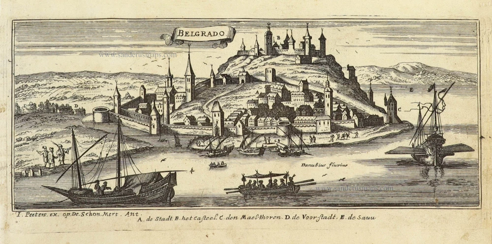
Beograd (Belgrade - Serbia) by J. Peeters. c. 1690
Belgrado.
[Item number: 31394]
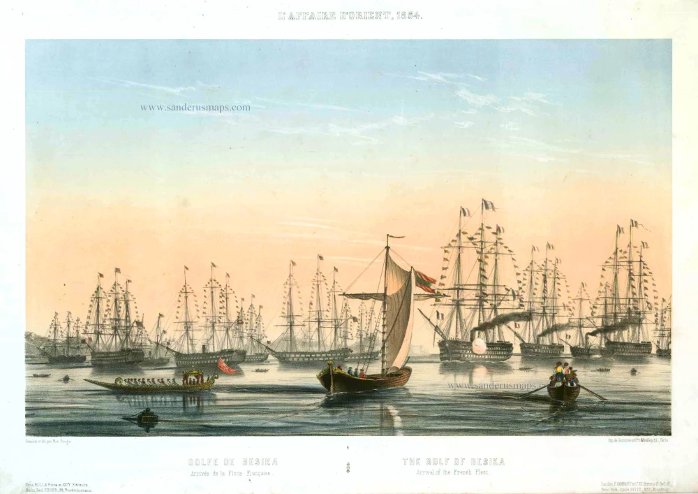
Bésika or Tenedos (Turkey), by Max Beeger. 1854
Golf de Besika. - Arrivée de la Flotte Française. / The Gulf of...
[Item number: 27439]
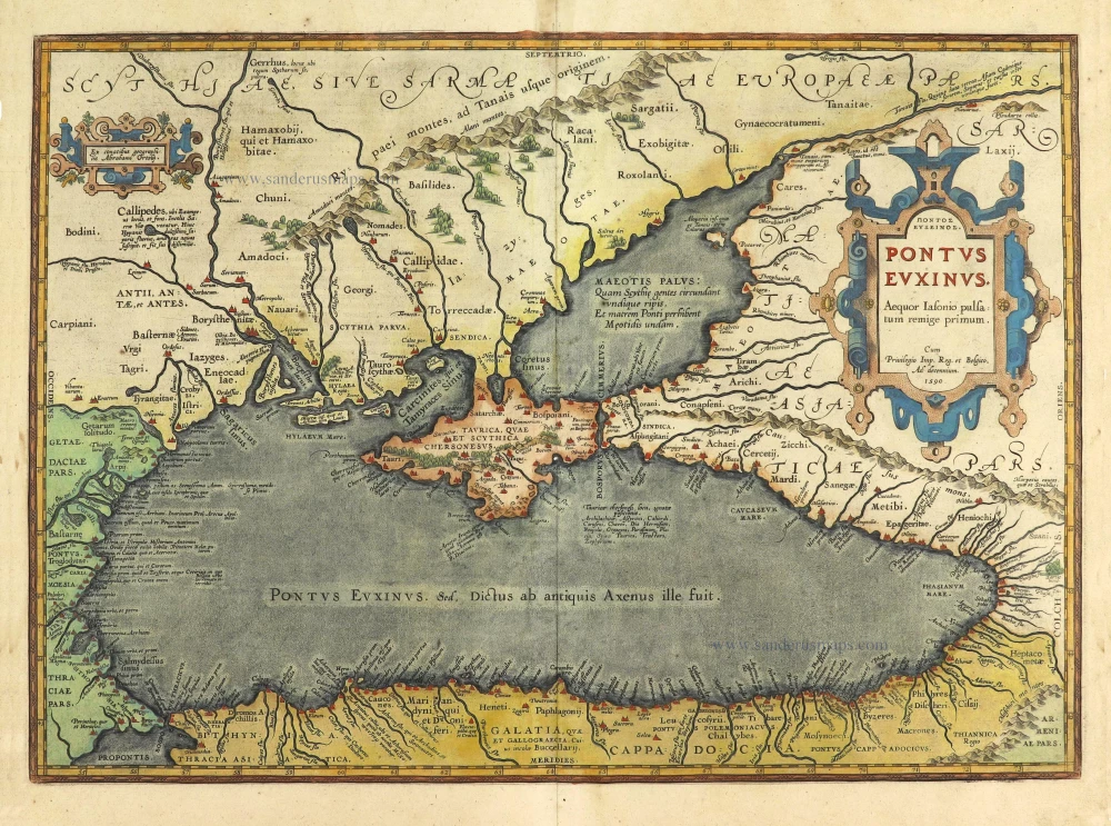
Black Sea by Abraham Ortelius. 1601
Pontus Euxinus.
[Item number: 28435]
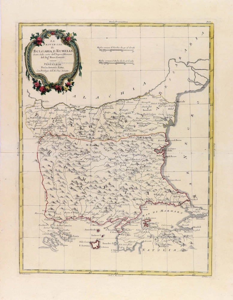
Bulgeria, by Antonio Zatta. 1779-1785
Le Provincie di Bulgaria, e Rumelia.
[Item number: 32306]
new
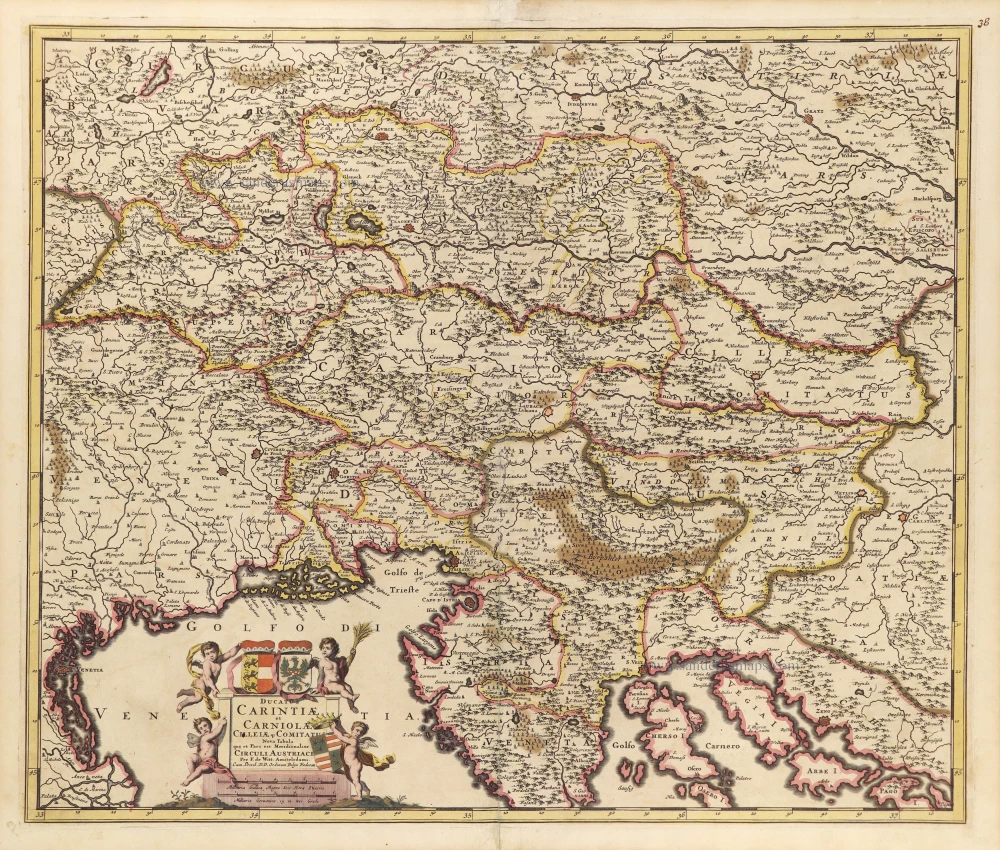
Carinthia (Kärnten), Carniola and Cilleia by Frederick de Wit. c. 1690
Ducatus Carintiae et Carniolae Cilleiae Comitatus Nova Tabula...
[Item number: 28740]
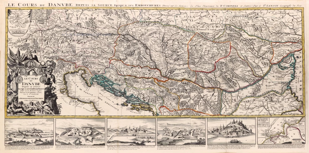
Spectacular map
Course of the Danube River by N. Sanson, so-called published by Hubert Jaillot. (Pirated edition by Pierre Mortier). 1692
Le Cours du Danube depuis sa Source jusqu'à ses Embouchures.
[Item number: 31196]
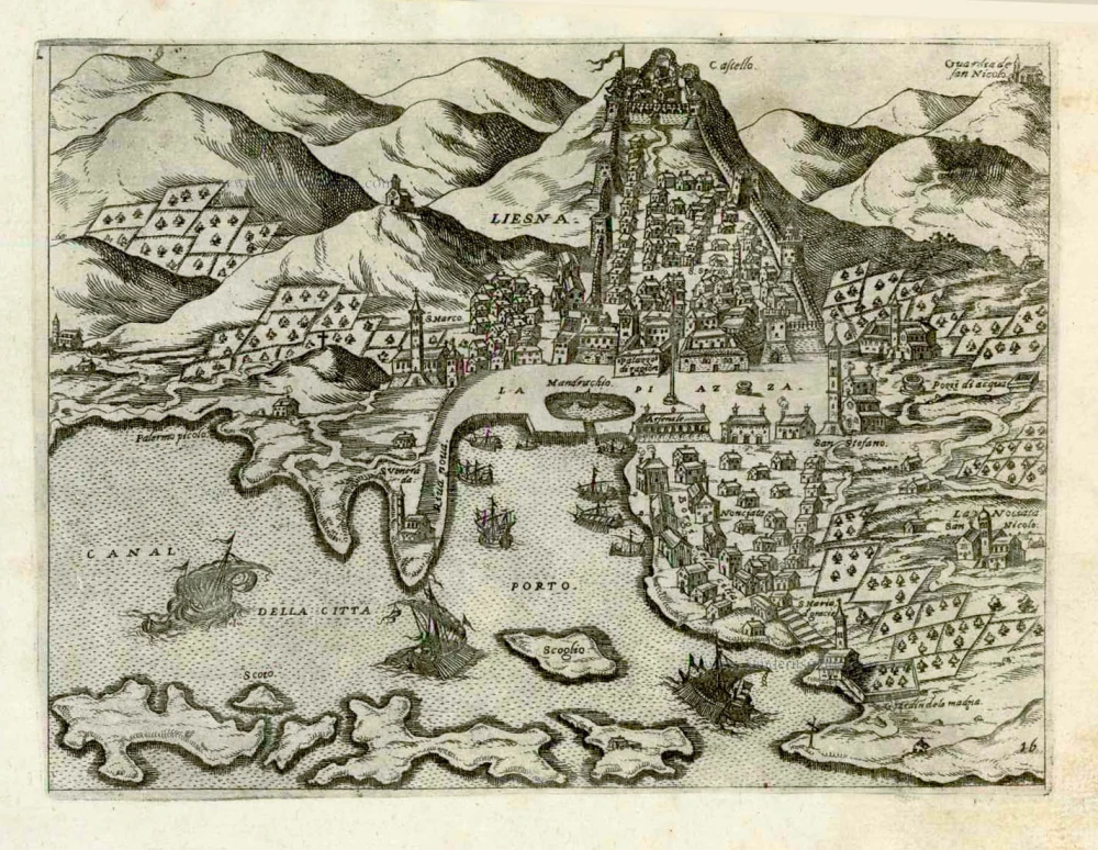
Croatia - Hkvar (Liesena) by Giovanni Francesco Camocio After 1575
Liesna.
[Item number: 27544]
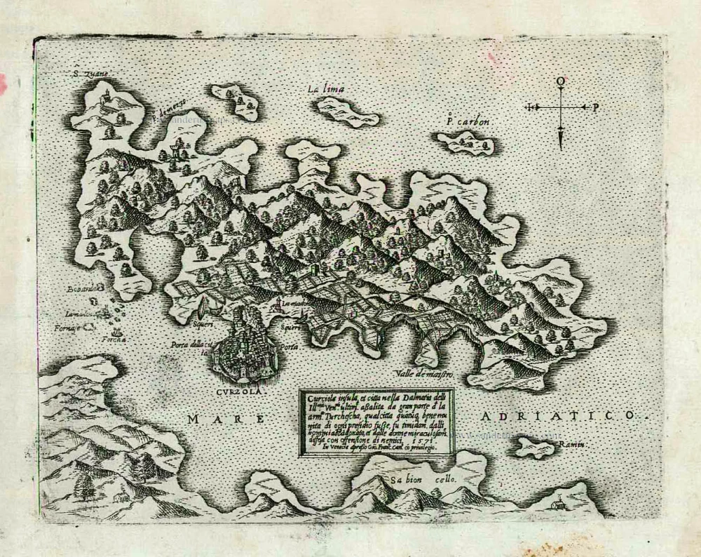
Croatia - Korcula by Giovanni Francesco Camocio c. 1575
Curciola insula et citta nella Dalmatia ...
[Item number: 27546]
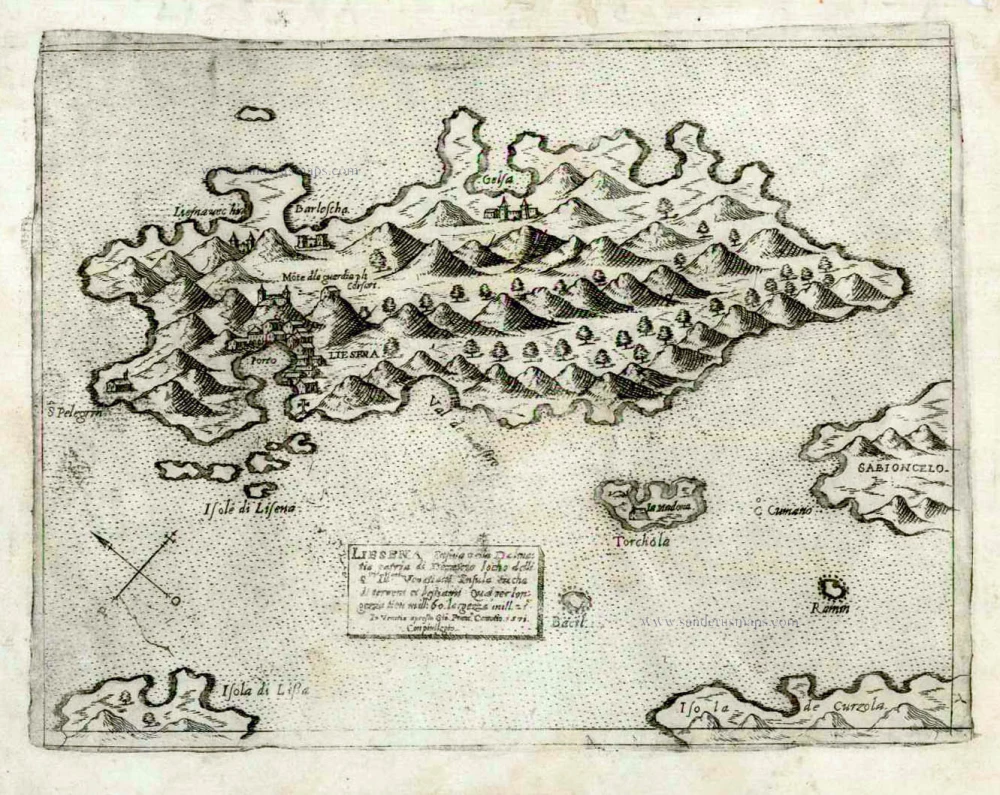
Croatia - Lesina by Giovanni Francesco Camocio After 1575
Liesena insula della Dalmatia patria di Demetrio loco delli...
[Item number: 27543]
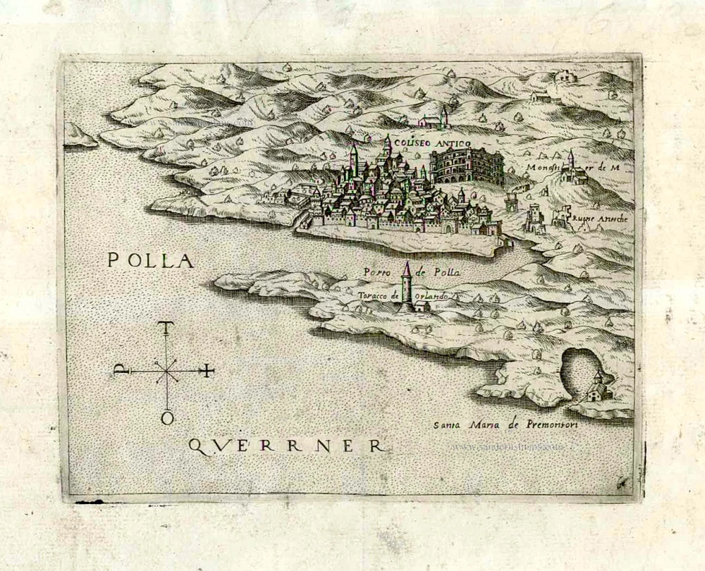
Croatia - Pulla by Giovanni Francesco Camocio After 1575
Polla.
[Item number: 27090]
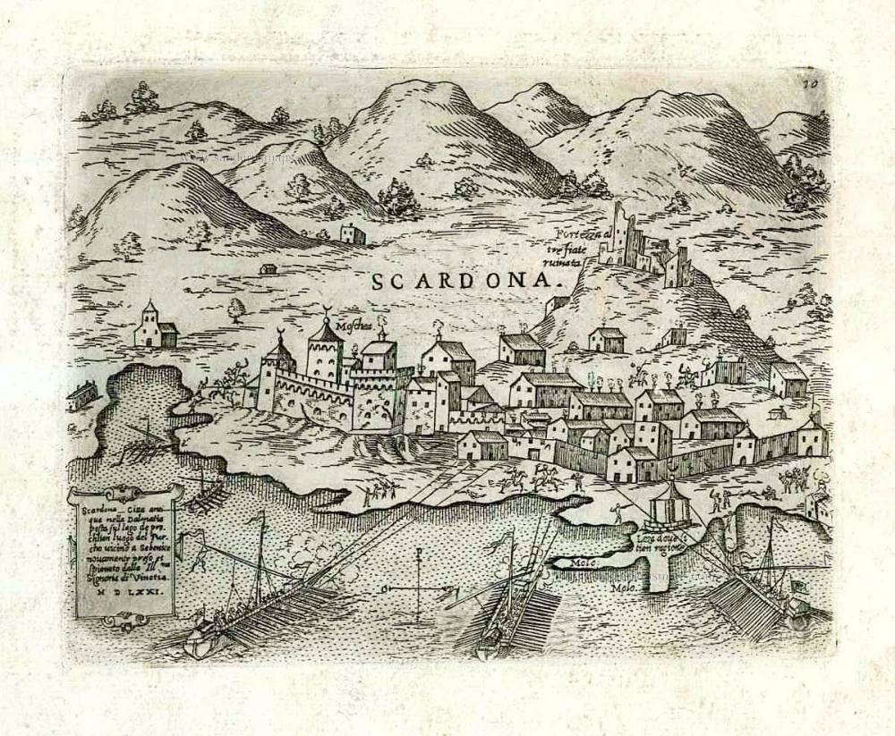
Croatia - Skradin (Scardona) by Giovanni Francesco Camocio After 1575
Scardona citta antiqua nella Dalmatia posta su lago de pruchlian...
[Item number: 27552]
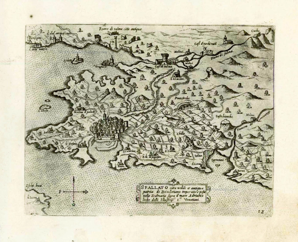
Croatia - Split by Giovanni Francesco Camocio After 1575
Spallato citta nobile et antiqua patria di Diocletino imperatore...
[Item number: 27542]
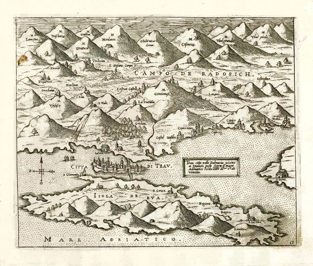
Croatia - Trogir (Traù) by Giovanni Francesco Camocio After 1575
Trau citta nella Dalmacia vicino a Spalato posto sopra il mare...
[Item number: 27554]

Dalmatia, by Antonio Zatta. 1779-1785
La Croazia, Bosnia, e Servia
[Item number: 32308]
new
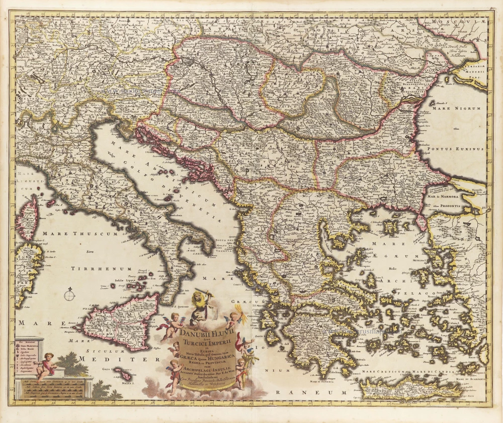
Danube and European Ottoman Empire, by Frederick de Wit. c. 1705
Danubii Fluvii Sive Turcici Imperii in Europa.
[Item number: 29279]
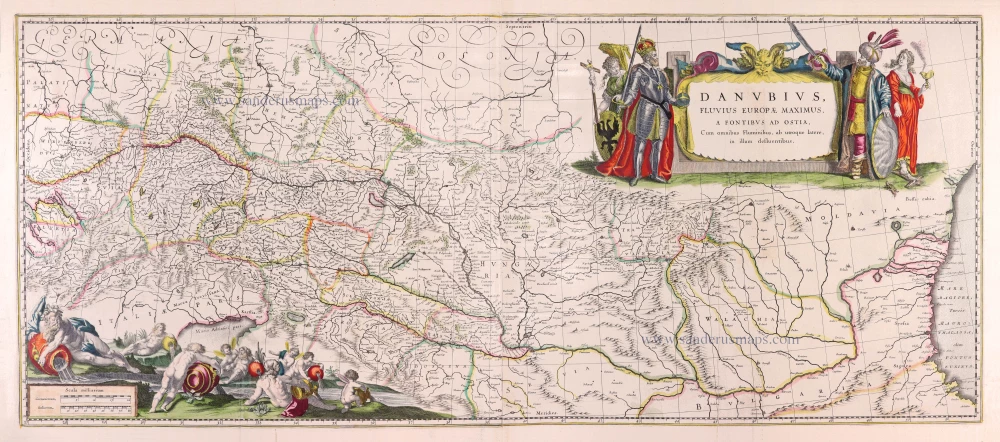
Danube River by Willem Blaeu. 1643
Danubius, Fluvius Europae Maximus, a Fontibus ad Ostia, Cum...
[Item number: 30307]
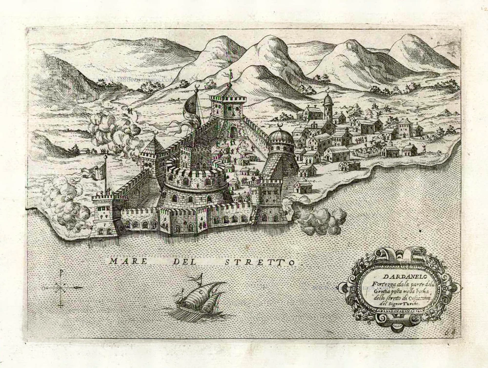
Dardanelles (Ottoman Fort) by Giovanni Francesco Camocio c. 1575
Dardanelo Fortezza dala parte dela Gretia posta nellabochadella...
[Item number: 27624]
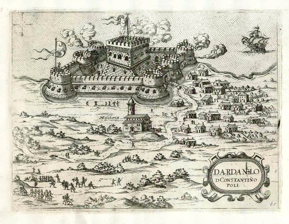
Dardanelles (Ottoman Fort) by Giovanni Francesco Camocio c. 1575
Dardanelo D Constantinopoli.
[Item number: 27625]

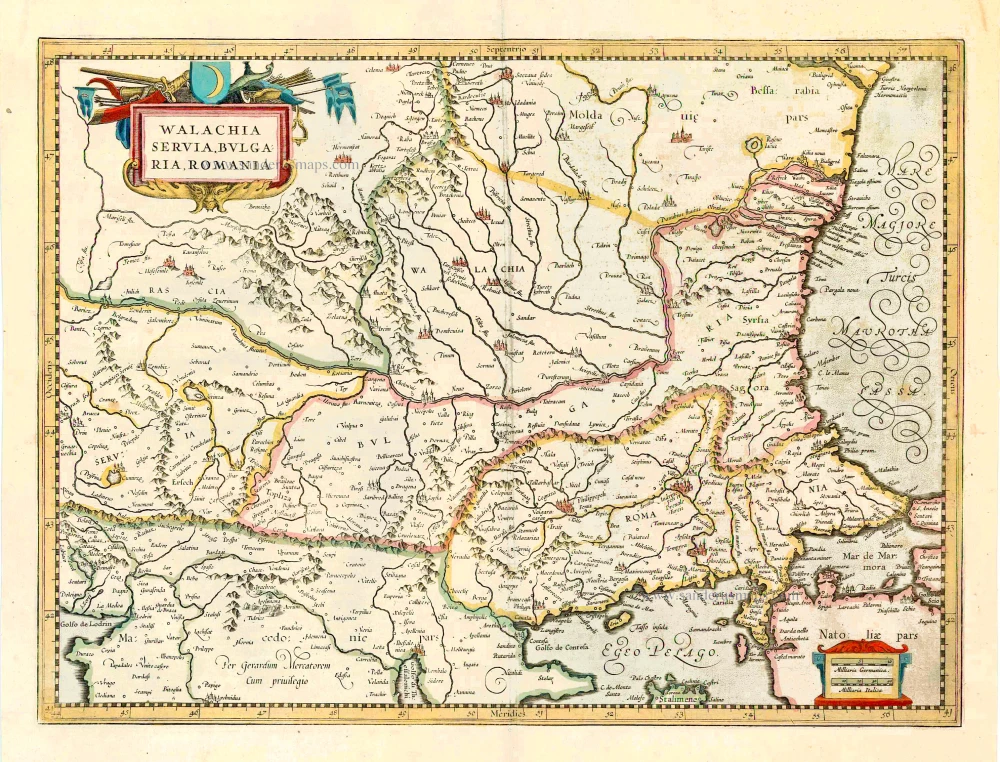
Eastern Balkan, by Willem Blaeu. 1644-45
Walachia, Servia, Bulgaria, Romania.
[Item number: 28594]

Eastern Illyricum (today's Bulgaria - Rumania), by Guillaume Sanson. 1665
Illyricum Orientis In quo Partes II. Moesia et Thracia.
[Item number: 30041]
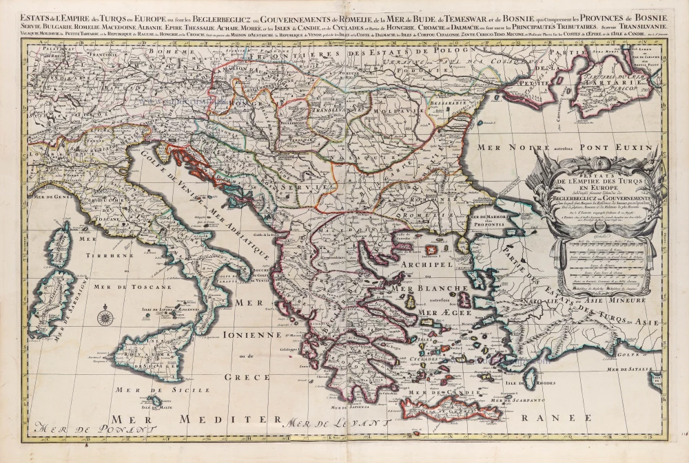
European Ottoman Empire by N. Sanson, so-called published by Hubert Jaillot. (Pirated edition by Pierre Mortier). 1692
Estats de l'Empire des Turqs en Europe.
[Item number: 31199]
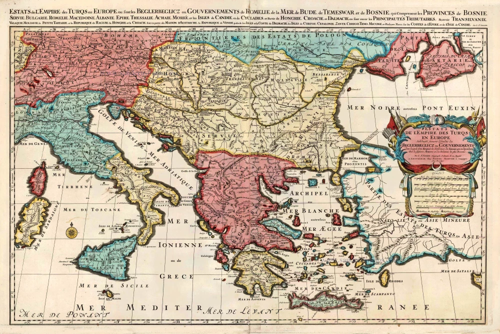
European Ottoman Empire by Nicolas Sanson, published by Pieter Mortier. c. 1705
Estats de l'Empire des Turqs en Europe.
[Item number: 27770]
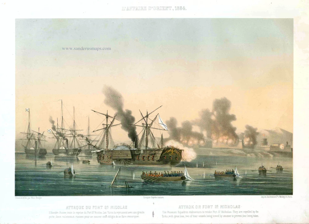
Fort St.-Nicholas (Batumi), by Max Beeger. 1854
Attaque du Fort St. Nicolas. / Attack on the Fort St. Nicholas.
[Item number: 27441]
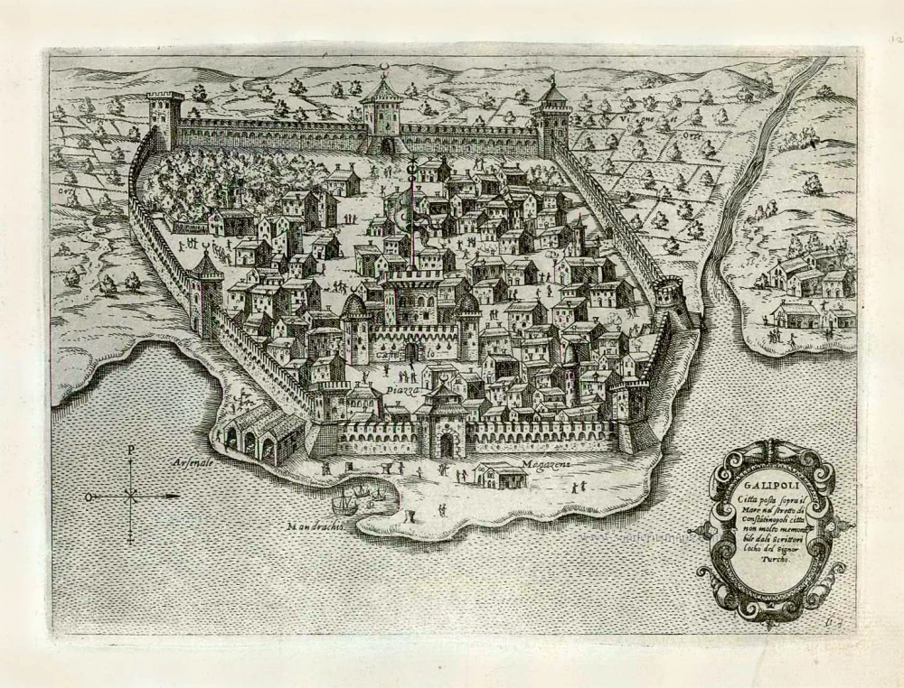
Gallipoli (Gelibolu) by Giovanni Francesco Camocio After 1575
Galipoli Citta posta sopra il Mare nel stretto di Constatinopoli...
[Item number: 27623]
![Ta Moder Bossinae, Serviae, Graeciae, et Sclavoniae. [From verso]](https://sanderusmaps.com/assets/WEBP/m28117.webp)
Greece (Balkan), by Lorenz Fries after Martin Waldseemüller. 1525
Ta Moder Bossinae, Serviae, Graeciae, et Sclavoniae. [From verso]
[Item number: 28117]
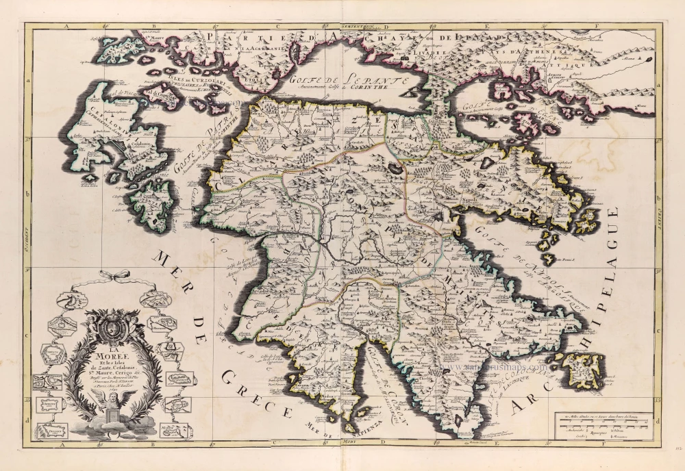
Greece - Peloponnese by N. Sanson, so-called published by Hubert Jaillot. (Pirated edition by Pierre Mortier). 1692
La Moree et les Isles de Zante, Cefalonie, Ste Maure, Cerigo &c.
[Item number: 31197]

In rare original colour
Gulf of Venice, by Zacharias Châtelain. 1708
Carte de Géographie des differents Etats de la République de...
[Item number: 31420]
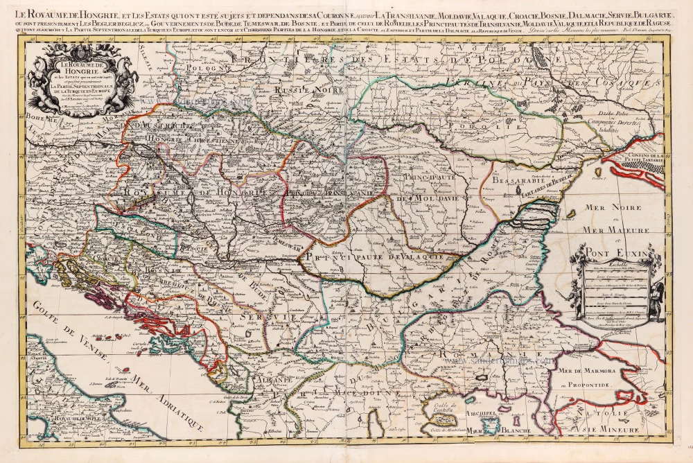
Hungary and Balkans by N. Sanson, so-called published by Hubert Jaillot. (Pirated edition by Pierre Mortier). 1692
Le Royaume de Hongrie et les Estats qui en ont este Sujets et...
[Item number: 31267]

Istria by Petrus Bertius, published by Jodocus Hondius II. 1618
Histria.
[Item number: 31651]
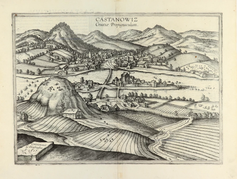
Kostajnica (Croatia) by Georg Braun & Frans Hogenberg. 1635
Castanowiz Croatiae Propugnaculum.
[Item number: 31766]