Antique maps catalogue
- All recent additions
-
Antique maps
- World and Polar
-
Europe
- Europe Continent
- Belgium
- Belgium - Cities
- The Low Countries
- The Netherlands
- The Netherlands - Cities
- Luxembourg
- France
- France - Cities
- Germany
- Germany - Cities
- Austria
- Italy
- Italy - Cities
- Spain and Portugal
- Greece & Greek Islands
- Switzerland
- British Isles
- British Isles - Cities
- Northern Europe
- Central Europe
- Eastern Europe
- Southeastern Europe
- America
- Asia
- Africa
- Mediterranean Sea
- Australia
- Oceans
- Celestial Maps
- Curiosities
- Title Pages
- Books
- Medieval manuscripts
- Prints
![Ta . Here . Helve. [From verso]](https://sanderusmaps.com/assets/WEBP/m28199.webp)
Switzerland by Lorenz Fries. 1525
Ta . Here . Helve. [From verso]
[Item number: 28199]
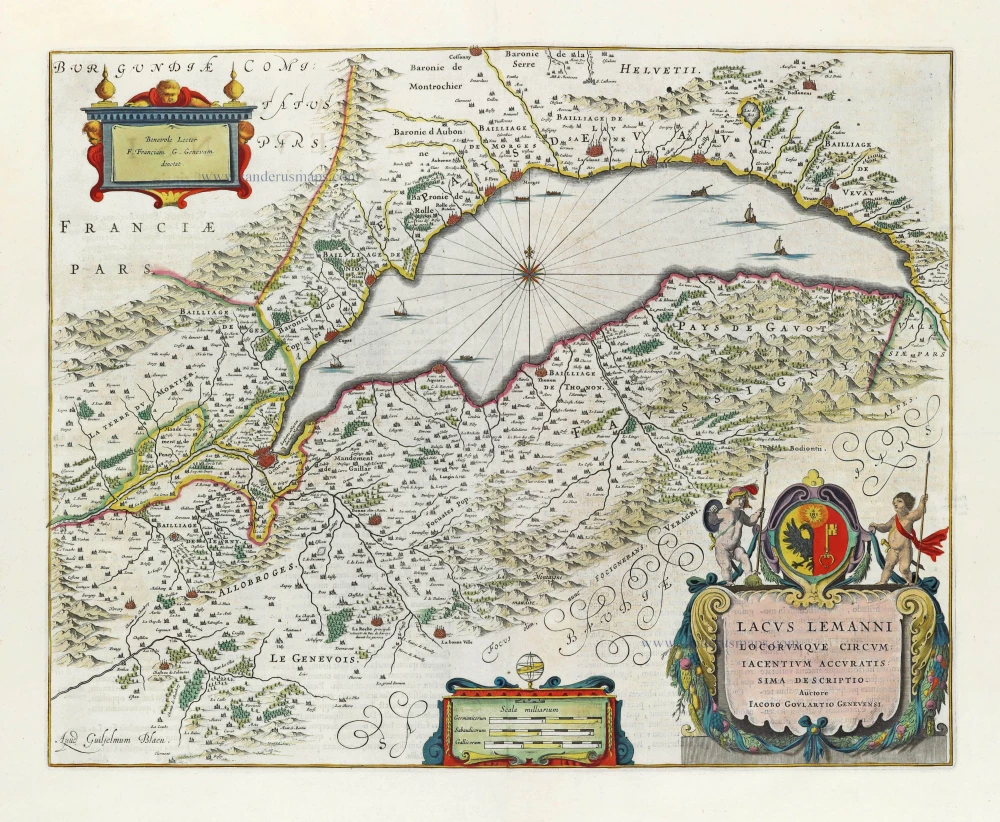
Lake of Geneva by Willem & Joan Blaeu. 1662
Lacus Lemanni Locorumquae Circumiacentium Accuratissima...
[Item number: 28236]
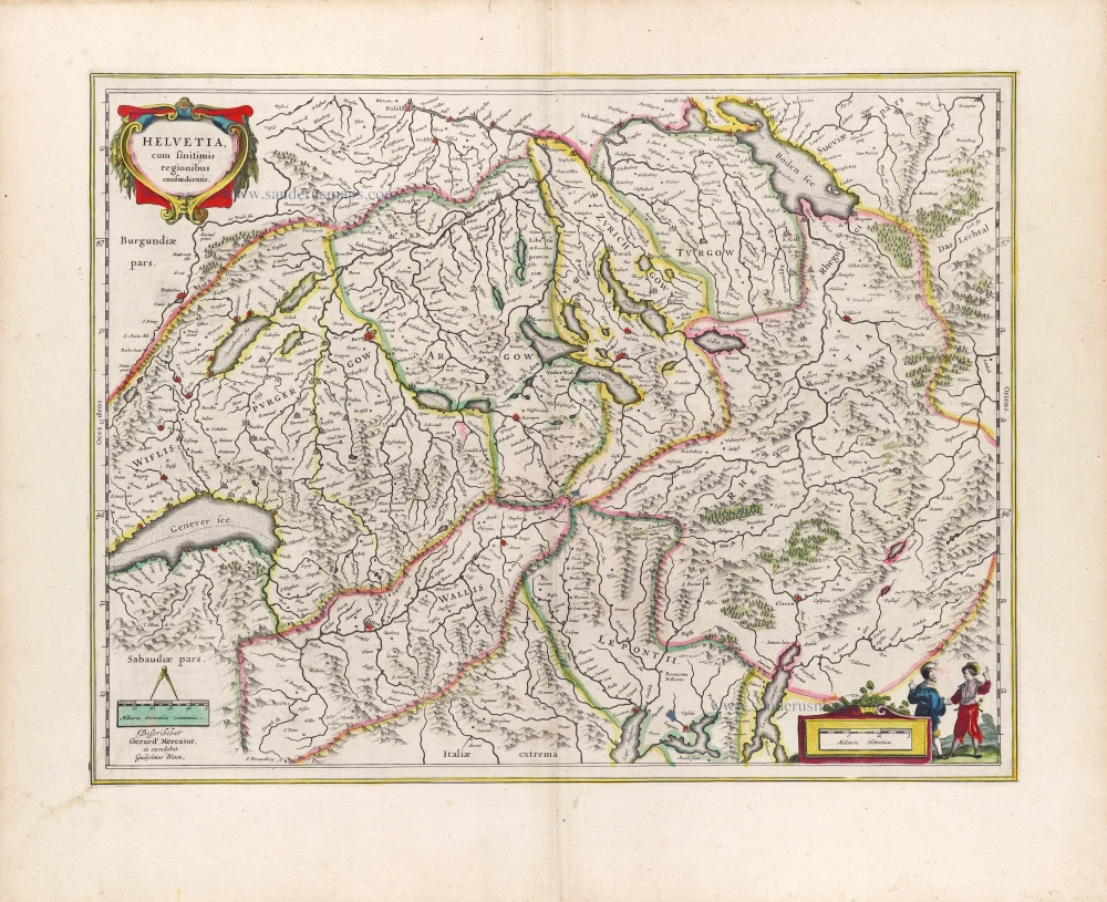
Switzerland by Willem Blaeu. 1643
Helvetia cum finitimis Regionibus confoederatis.
[Item number: 29928]
![Valesiae Provinciae Montanae [on sheet with] Basileae Inclytae Rauracorum Urbis ac eiusdem Circum Vicini Agri Situs Exactissima Delineatio Authore Sebastino Munstero](https://sanderusmaps.com/assets/WEBP/m05100.webp)
Valais - Basel, by Gerard de Jode. 1593
Valesiae Provinciae Montanae [on sheet with] Basileae Inclytae...
[Item number: 5100]
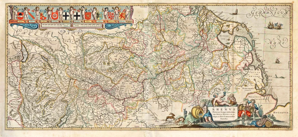
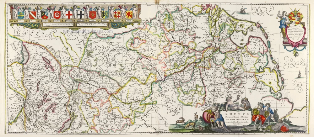
Rhine River, by H. Hondius & J. Janssonius. 1641
Rhenus Fluviorum Europae Celeberrimus, cum Mosa, Mosella, et...
[Item number: 26281]
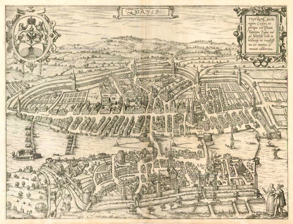
Zürich, by Braun & Hogenberg. 1588
Zurych - Tigurum, sive Turegum, Caesari, ut Plerique Existimant,...
[Item number: 25148]
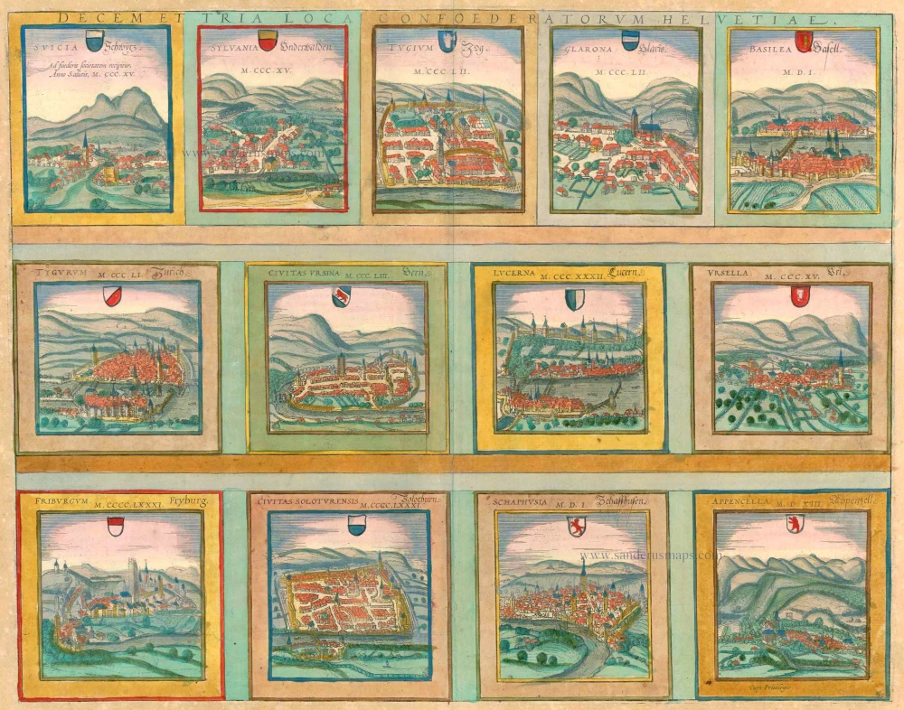
13 bird's-eye views of Swiss cities by Braun and Hogenberg: Schwyz, Unterwalden, Zug, Glarus, Basel, Zurich, Bern, Lucerne, Uri, Fribourg, Solothurn, Schaffhausen and Appenzell. 1572-1624
Decem et Tria Loca Confoederatorum Helvetiae.
[Item number: 23230]
Very rare.
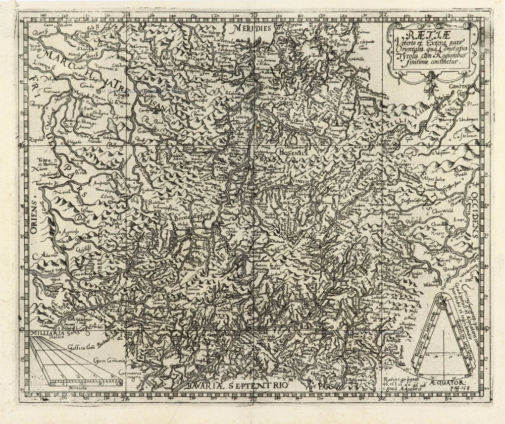
Switzerland - Eastern Rhaetia by Matthias Hirtzgarter. 1616
Raetiae veteris et exterae pars Orientalis, qua Comitatus...
[Item number: 31190]
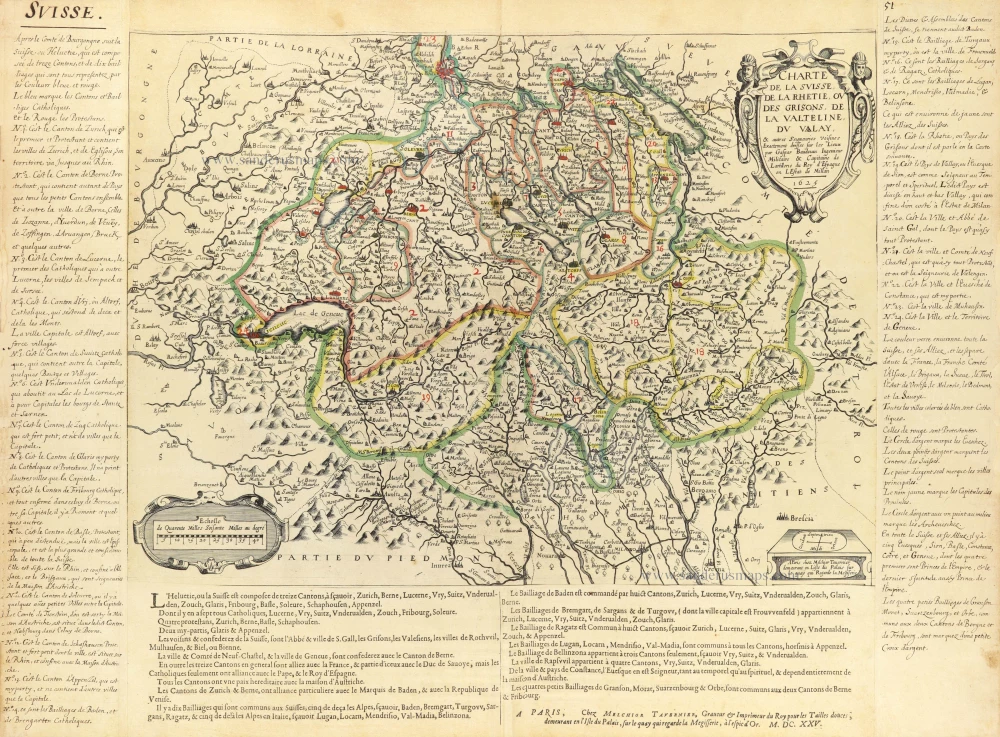
Early Tavernier with an exclusive text beneath. RARE!
Switzerland by Melchior Tavernier. c. 1630-1650
Charte de la Suisse, de la Rhetie, ou des Grisons, de la...
[Item number: 31212]
![Como Duorum Pliniorum patrio [on sheet with:] Chur.](https://sanderusmaps.com/assets/WEBP/m31028.webp)
Como and Chur by J. Janssonius. 1657
Como Duorum Pliniorum patrio [on sheet with:] Chur.
[Item number: 31028]
Big and decorative map.
Rhine River, by Willem Blaeu. 1643
Rhenus Fluviorum Europae Celeberrimus, cum Mosa, Mosella, et...
[Item number: 29927]
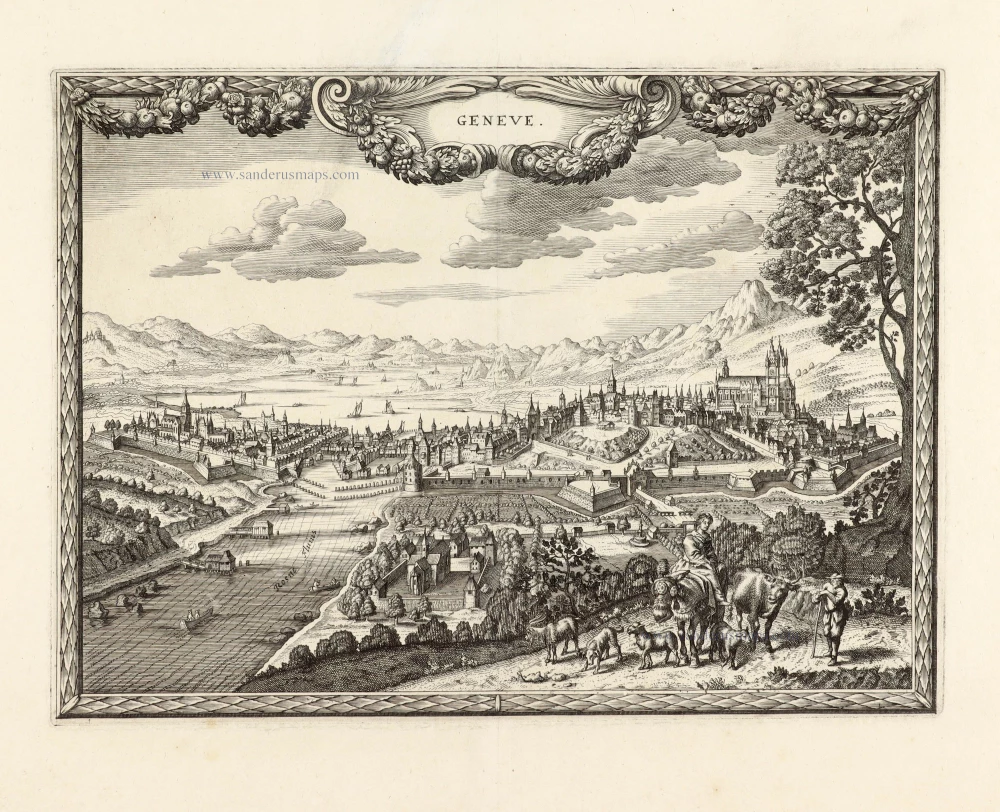
Unrecorded view of Genève (Genf) by Carel Allard
View of Genève (Genf) by Carel Allard. 1673
Geneve.
[Item number: 30567]
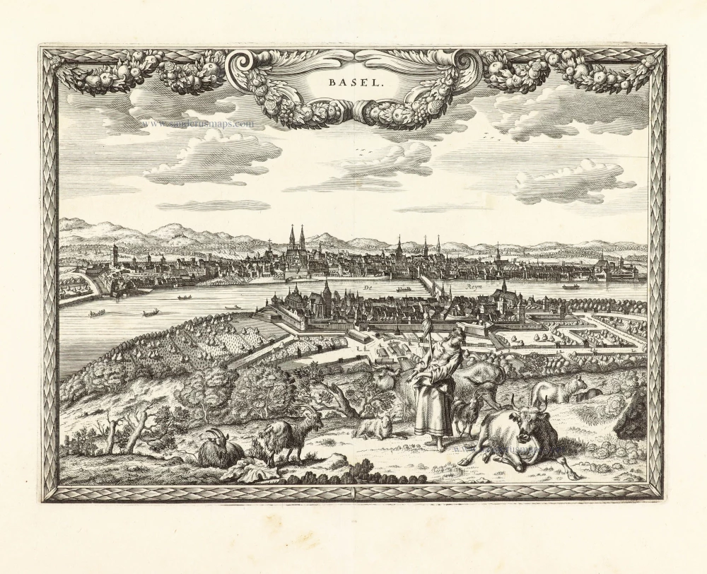
Unrecorded view of Basel by Carel Allard
View of Basel by Carel Allard. 1673
Basel.
[Item number: 30573]
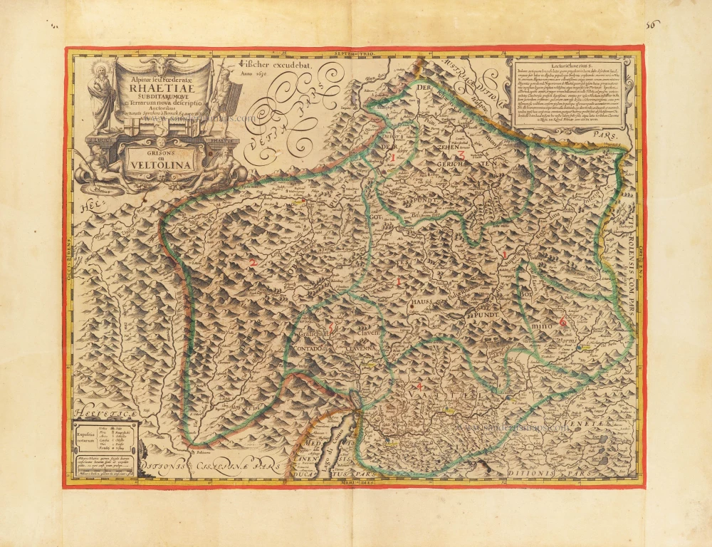
The first modern map of the Canton of Graubunden.
Italian and Swiss Alps by C.J. Visscher, after Philipp Cluverius. 1630
Alpinae seu foederatae Rhaetiae subdirarumque ei Terrarum nova...
[Item number: 30936]
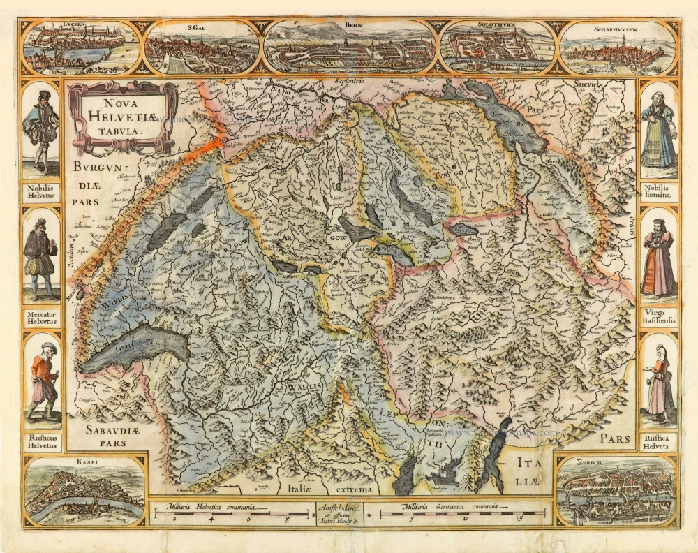
Switzerland, by Jodocus Hondius. c. 1634
Nova Helvetiae Tabula.
[Item number: 28003]

Zürich by Georg Braun & Frans Hogenberg. 1582
Zurych - Tigurum, sive Turegum, Caesari, ut Plerique Existimant,...
[Item number: 28827]
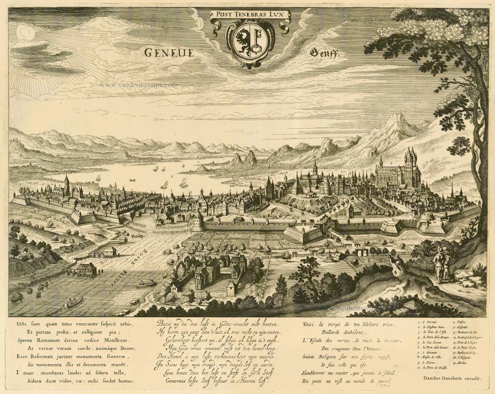
Geneve by Dancker Danckerts. c. 1660
Geneve - Genff.
[Item number: 6968]
Very rare
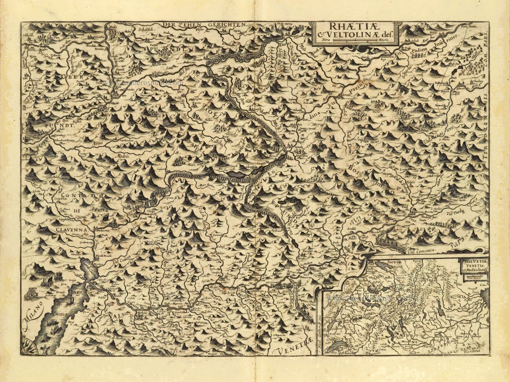
Italian and Swiss Alps by Nicolaas van Geelkercken. c. 1632
Rhaetiae & Veltolinae des.
[Item number: 28335]