Antique maps catalogue
- All recent additions
-
Antique maps
- World and Polar
-
Europe
- Europe Continent
- Belgium
- Belgium - Cities
- The Low Countries
- The Netherlands
- The Netherlands - Cities
- Luxembourg
- France
- France - Cities
- Germany
- Germany - Cities
- Austria
- Italy
- Italy - Cities
- Spain and Portugal
- Greece & Greek Islands
- Switzerland
- British Isles
- British Isles - Cities
- Northern Europe
- Central Europe
- Eastern Europe
- Southeastern Europe
- America
- Asia
- Africa
- Mediterranean Sea
- Australia
- Oceans
- Celestial Maps
- Curiosities
- Books
- Medieval manuscripts
- Prints
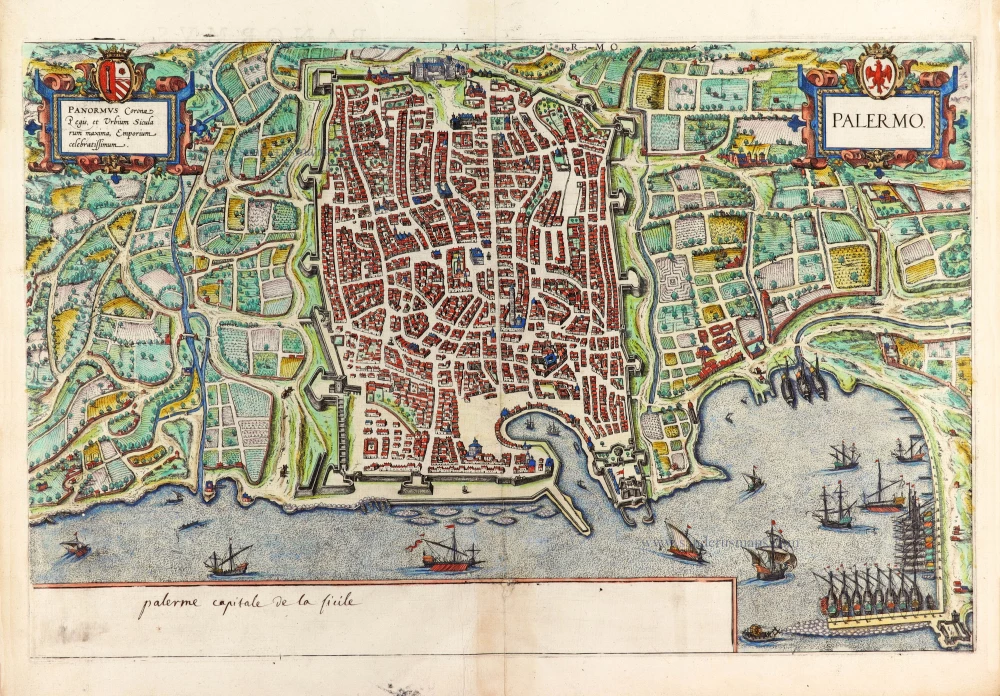
Palermo, by Georg Braun & Frans Hogenberg. 1588
Palermo.
[Item number: 30139]
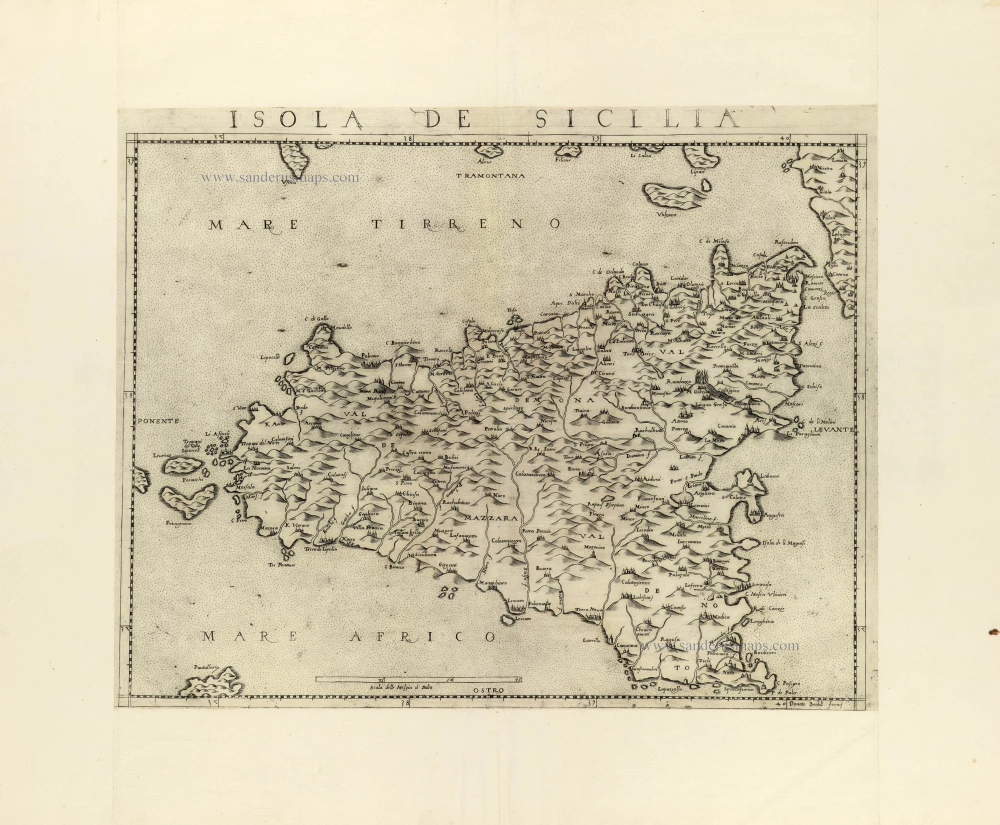
Sicily by Donato Bertelli. c. 1570-80
Isola de Sicilia.
[Item number: 31413]
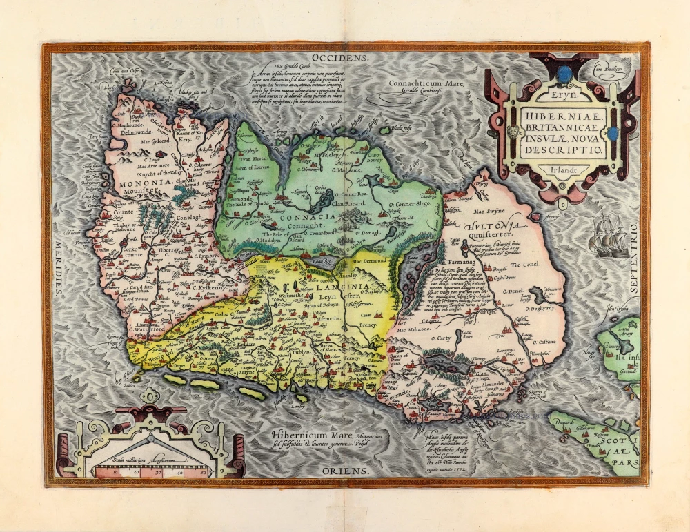
Ireland by Abraham Ortelius. 1595
Eryn. Hiberniae, Britannicae Insulae, Nova Descriptio. Irlandt.
[Item number: 30152]

Bird's-eye view plan of Cortona by Lauro Giacomo. 1639
Cortona Città Antichissima in Toscana Metropoli Già di Turrenia.
[Item number: 31416]

World by Willem Blaeu, in Mercator projection. 1643
Nova Totius Terrarum Orbis Geographica ac Hydrographica.
[Item number: 30271]
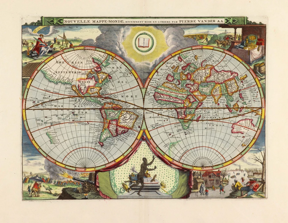
World by Pieter Van der Aa, double hemisphere. 1710
Nouvelle Mappe-Monde,
[Item number: 29136]

Welcome to Sanderus Antiquariaat
Antiquariaat Sanderus, named after the famous Flemish historian, Antonius Sanderus, is specialised in antiquarian books, medieval manuscripts, antique maps and prints from the 15th to the 18th centuries.
The company is a member of the Antiquarian Booksellers’ Association (ABA), the “The Belgian Royal Chamber of Antiques and Art Dealers” and the International Association of Antique Map Dealers (IAMA).