Antique maps catalogue
- All recent additions
-
Antique maps
- World and Polar
-
Europe
- Europe Continent
- Belgium
- Belgium - Cities
- The Low Countries
- The Netherlands
- The Netherlands - Cities
- Luxembourg
- France
- France - Cities
- Germany
- Germany - Cities
- Austria
- Italy
- Italy - Cities
- Spain and Portugal
- Greece & Greek Islands
- Switzerland
- British Isles
- British Isles - Cities
- Northern Europe
- Central Europe
- Eastern Europe
- Southeastern Europe
- America
- Asia
- Africa
- Mediterranean Sea
- Australia
- Oceans
- Celestial Maps
- Curiosities
- Books
- Medieval manuscripts
- Prints
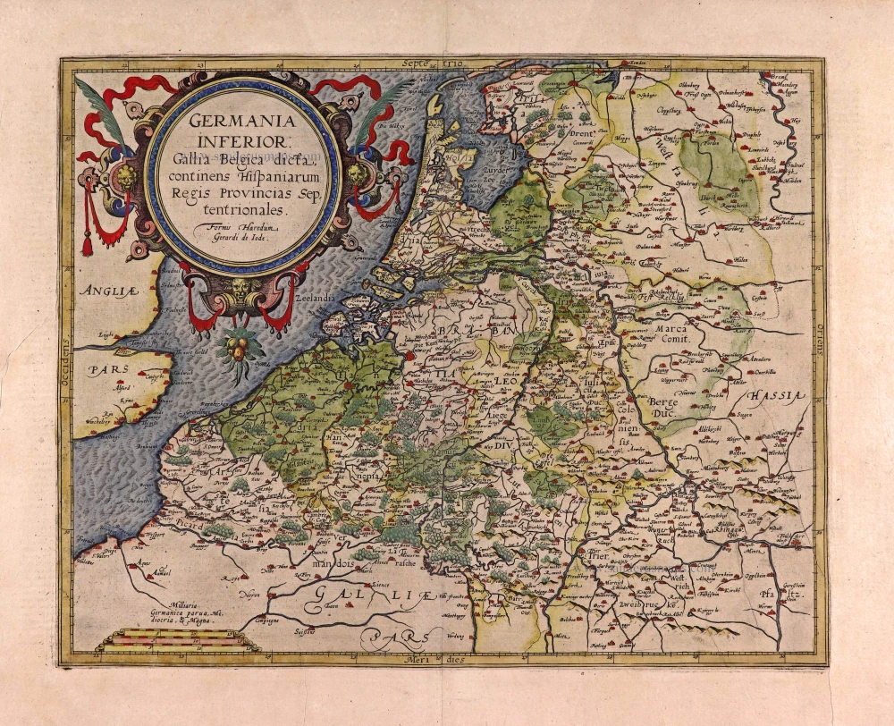
XVII Provinces, by Gerard de Jode. 1593
Germania Inferior. Gallia Belgica Dicta, continens Hispaniarum ...
[Item number: 27943]

North America by Hubert Jaillot. (Pirated edition by Pierre Mortier). 1694
Amerique Septentrionale, Divisee en ses Principales Parties.
[Item number: 31419]
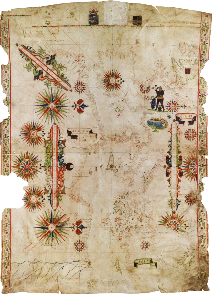
Portolan by Joan Oliva. 1615
Marseille, 1615.
[Item number: 31021]
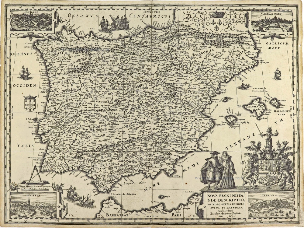
Spain by Willem Blaeu 1605
Nova Regni Hispaniae Descriptio, de novo multis in locis aucta ...
[Item number: 28367]
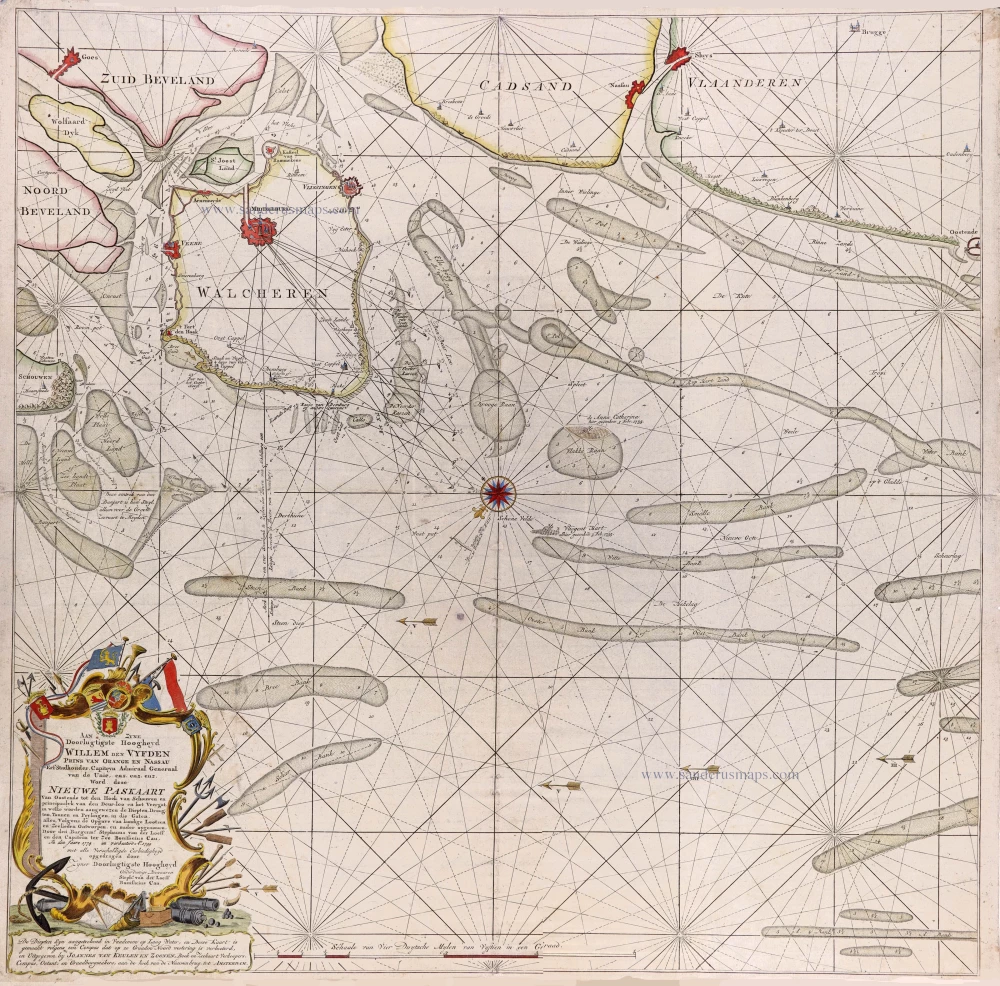
Seachart of Oostende—Knokke by Stephanus van der Loeff en Bonifacius Cau, published van Joannes Van Keulen. 1799
Nieuwe Paskaart Van Oostende tot den Hoek van Schouwen en ...
[Item number: 31168]
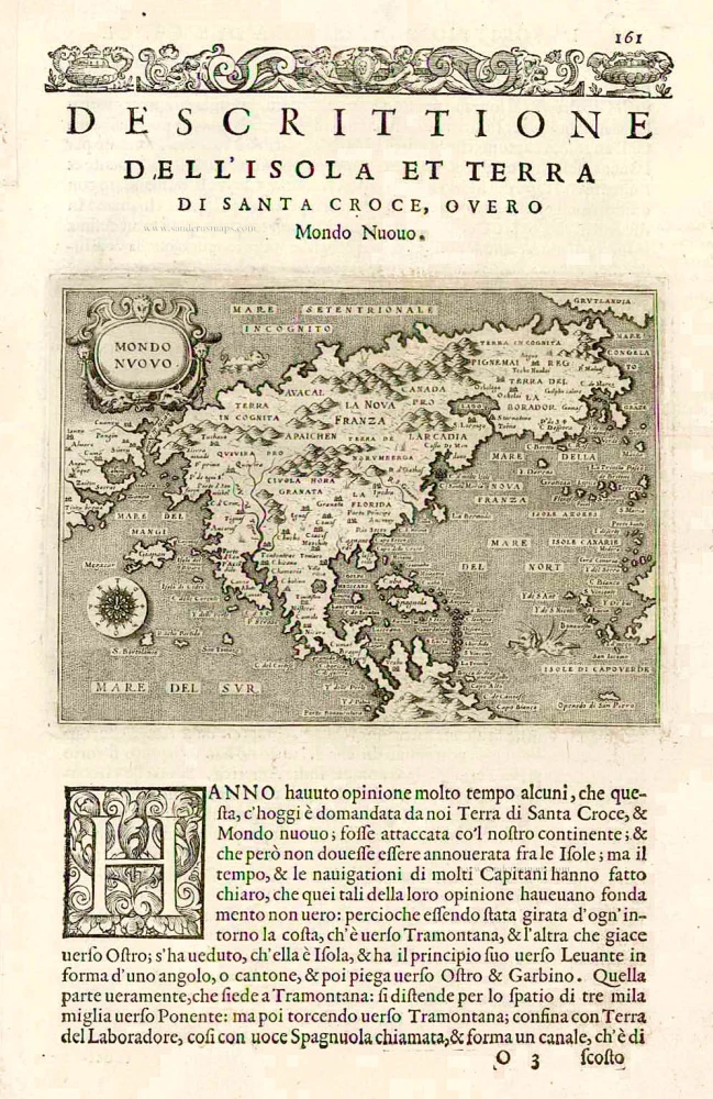
Tomaso Porcacchi., North America 1576
Mondo Nuovo - Descrittione del l'Isola et Terra di Sancta Croce, ...
[Item number: 27651]

Welcome to Sanderus Antiquariaat
Antiquariaat Sanderus, named after the famous Flemish historian, Antonius Sanderus, is specialised in antiquarian books, medieval manuscripts, antique maps and prints from the 15th to the 18th centuries.
The company is a member of the Antiquarian Booksellers’ Association (ABA), the “The Belgian Royal Chamber of Antiques and Art Dealers” and the International Association of Antique Map Dealers (IAMA).