Antique maps catalogue
- All recent additions
-
Antique maps
- World and Polar
-
Europe
- Europe Continent
- Belgium
- Belgium - Cities
- The Low Countries
- The Netherlands
- The Netherlands - Cities
- Luxembourg
- France
- France - Cities
- Germany
- Germany - Cities
- Austria
- Italy
- Italy - Cities
- Spain and Portugal
- Greece & Greek Islands
- Switzerland
- British Isles
- British Isles - Cities
- Northern Europe
- Central Europe
- Eastern Europe
- Southeastern Europe
- America
- Asia
- Africa
- Mediterranean Sea
- Australia
- Oceans
- Celestial Maps
- Curiosities
- Books
- Medieval manuscripts
- Prints
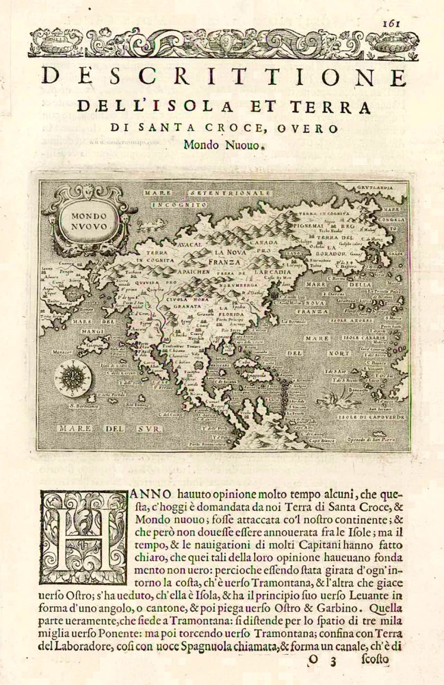
Tomaso Porcacchi., North America 1576
Mondo Nuovo - Descrittione del l'Isola et Terra di Sancta Croce, ...
[Item number: 27651]
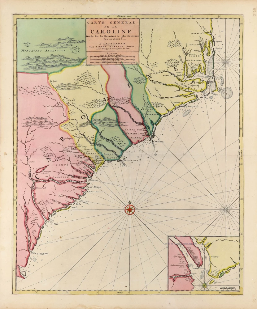
Carolina, by Pieter (Pierre) Mortier. c. 1696
Carte General de la Caroline.
[Item number: 31417]
new
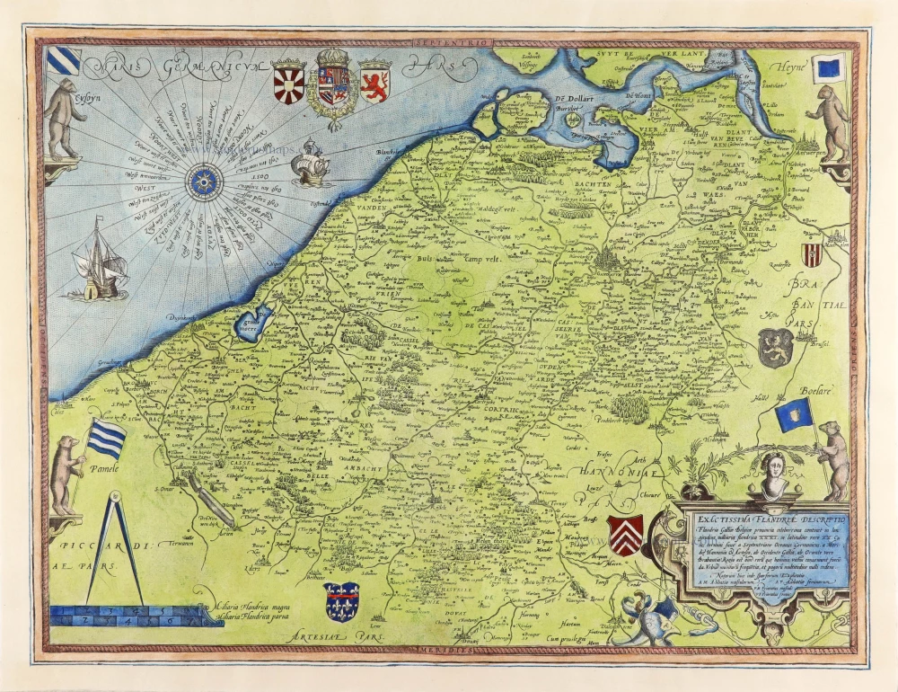
Flanders (Vlaanderen), by Gerard de Jode. 1593
Exactissima Flandriae Descriptio.
[Item number: 30309]
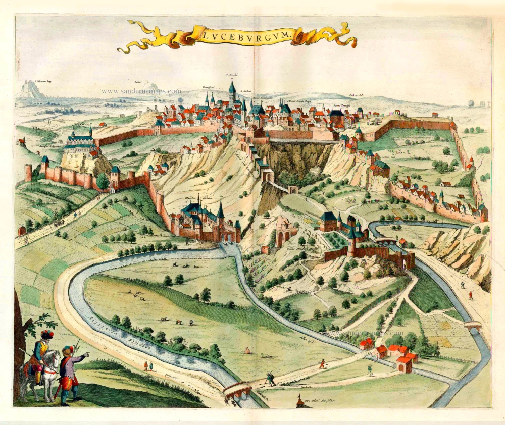
Luxembourg, by Joan Blaeu. 1652
Luceburgum.
[Item number: 25510]
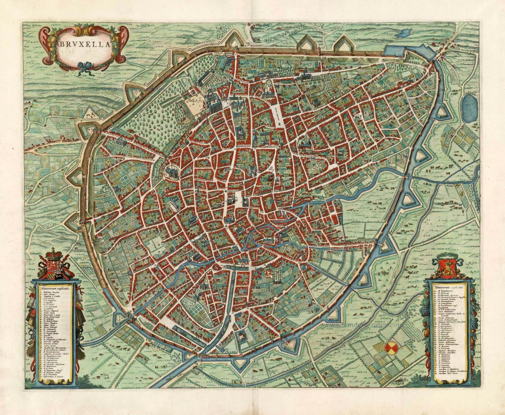
Brussels (Brussel, Bruxelles) by Joan Blaeu. 1652
Bruxella.
[Item number: 27499]
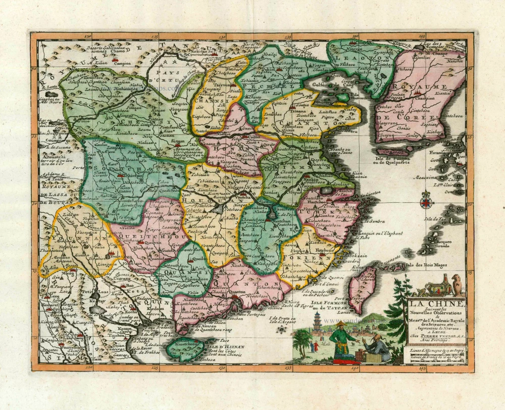
China, by Pieter van der Aa. 1713
La Chine, Suivant les Nouvelles Observations.
[Item number: 27095]
Recent additions
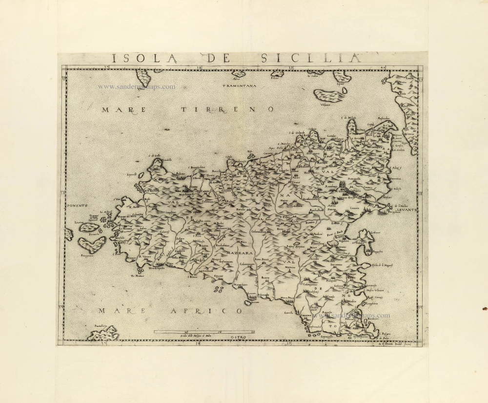
Scarce first state of this rare Lafreri-school Sicilia map
Sicily by Donato Bertelli. c. 1570-80
Isola de Sicilia.
[Item number: 31413]
new
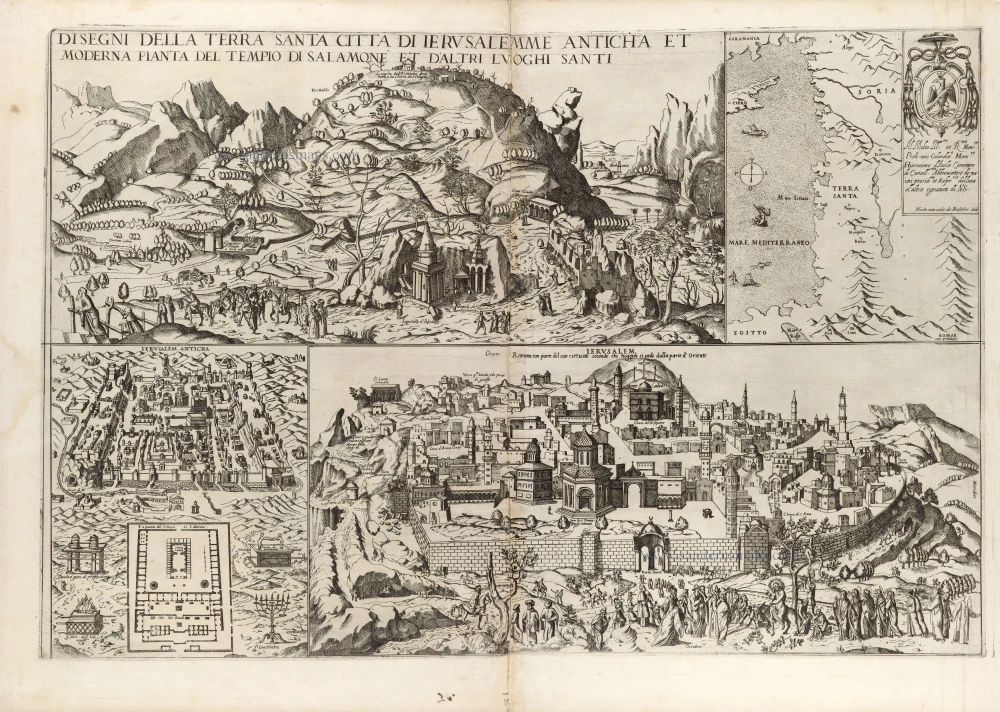
Extremely rare map, only one complete copy recorded
Map depicting Jerusalem and the Holy Land, by Nicolas van Aelst. 1590
Disegni della Terra Santa Citta di Ierusalemme Anticha et ...
[Item number: 31414]
new

Bird's-eye view plan of Cortona by Lauro Giacomo. 1639
Cortona Città Antichissima in Toscana Metropoli Già di Turrenia.
[Item number: 31416]
new

In rare original colour
Gulf of Venice, by Zacharias Châtelain. 1708
Carte de Géographie des differents Etats de la République de V ...
[Item number: 31420]
new
Welcome to Sanderus Antiquariaat
Antiquariaat Sanderus, named after the famous Flemish historian, Antonius Sanderus, is specialised in antiquarian books, medieval manuscripts, antique maps and prints from the 15th to the 18th centuries.
The company is a member of the Antiquarian Booksellers’ Association (ABA), the “The Belgian Royal Chamber of Antiques and Art Dealers” and the International Association of Antique Map Dealers (IAMA).