Antique maps catalogue
- All recent additions
-
Antique maps
- World and Polar
-
Europe
- Europe Continent
- Belgium
- Belgium - Cities
- The Low Countries
- The Netherlands
- The Netherlands - Cities
- Luxembourg
- France
- France - Cities
- Germany
- Germany - Cities
- Austria
- Italy
- Italy - Cities
- Spain and Portugal
- Greece & Greek Islands
- Switzerland
- British Isles
- British Isles - Cities
- Northern Europe
- Central Europe
- Eastern Europe
- Southeastern Europe
- America
- Asia
- Africa
- Mediterranean Sea
- Australia
- Oceans
- Celestial Maps
- Curiosities
- Books
- Medieval manuscripts
- Prints
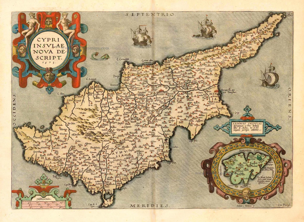
Cyprus, by Ortelius A. 1592
Cypri Insulae Nova Descript. 1573
[Item number: 22955]
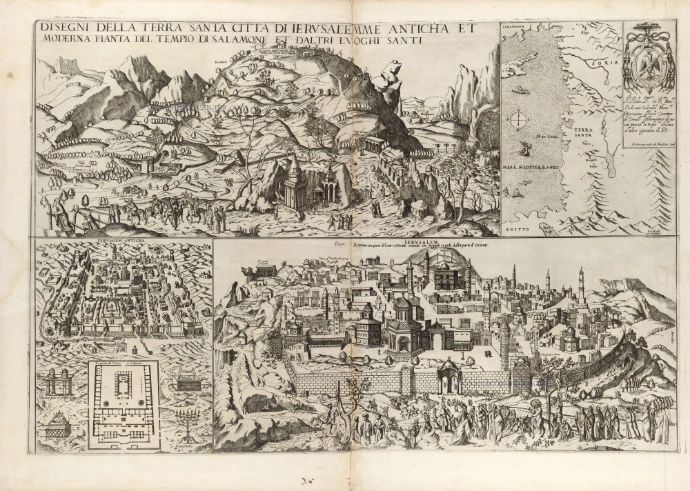
Map depicting Jerusalem and the Holy Land, by Nicolas van Aelst. 1590
Disegni della Terra Santa Citta di Ierusalemme Anticha et ...
[Item number: 31414]
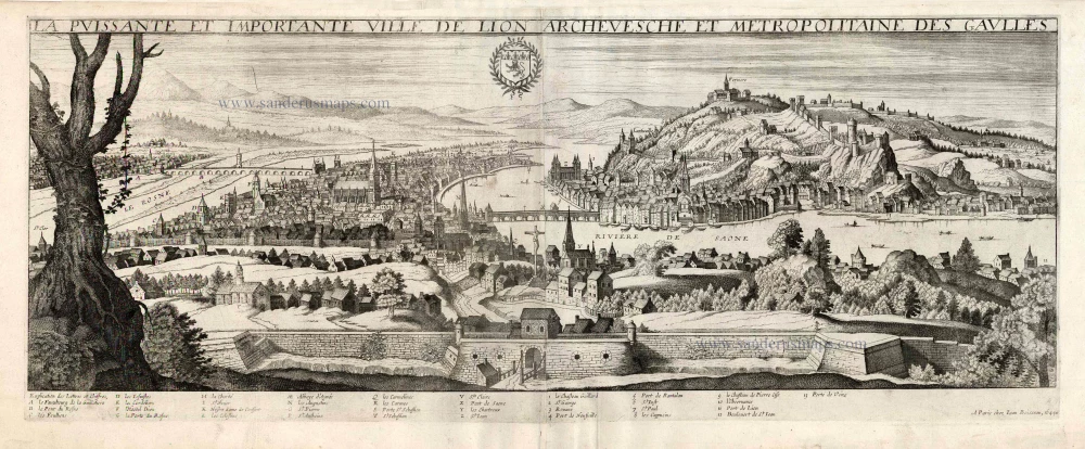
Lyon, by J. Boisseau. 1648
La Puissante et Importante Ville de Lion Archevesche et ...
[Item number: 25600]
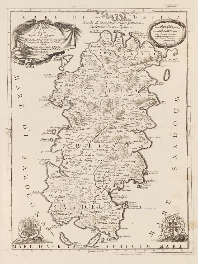
Sardinia (Sardegna) by Vincenzo Coronelli. 1696
Isola è Regno di Sardegna.
[Item number: 28715]
![[No title - on verso:] Tabula Moder. Indiae Orientalis.](https://sanderusmaps.com/assets/WEBP/m30658.webp)
Ptolemy map of Southeast Asia by Lorenz Fries, after Martin Waldseemüller. 1525
[No title - on verso:] Tabula Moder. Indiae Orientalis.
[Item number: 30658]
![Carte Generalle [sic] de France.](https://sanderusmaps.com/assets/WEBP/m30989.webp)
France, Christophe Tassin, with a panoramic view of Paris. 1634-37
Carte Generalle [sic] de France.
[Item number: 30989]

Welcome to Sanderus Antiquariaat
Antiquariaat Sanderus, named after the famous Flemish historian, Antonius Sanderus, is specialised in antiquarian books, medieval manuscripts, antique maps and prints from the 15th to the 18th centuries.
The company is a member of the Antiquarian Booksellers’ Association (ABA), the “The Belgian Royal Chamber of Antiques and Art Dealers” and the International Association of Antique Map Dealers (IAMA).