Antique maps catalogue
- All recent additions
-
Antique maps
- World and Polar
-
Europe
- Europe Continent
- Belgium
- Belgium - Cities
- The Low Countries
- The Netherlands
- The Netherlands - Cities
- Luxembourg
- France
- France - Cities
- Germany
- Germany - Cities
- Austria
- Italy
- Italy - Cities
- Spain and Portugal
- Greece & Greek Islands
- Switzerland
- British Isles
- British Isles - Cities
- Northern Europe
- Central Europe
- Eastern Europe
- Southeastern Europe
- America
- Asia
- Africa
- Mediterranean Sea
- Australia
- Oceans
- Celestial Maps
- Curiosities
- Books
- Medieval manuscripts
- Prints

Double-hemisphere world map, by Nicolaas Visscher I. c. 1678
Orbis Terrarum Nova et Accuratissima Tabula.
[Item number: 28934]
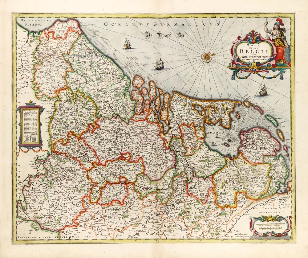
XVII Provinces (Low Countries) by Joannes Janssonius. 1666
Nova Totius Belgii Sive Germaniae Inferioris.
[Item number: 30079]
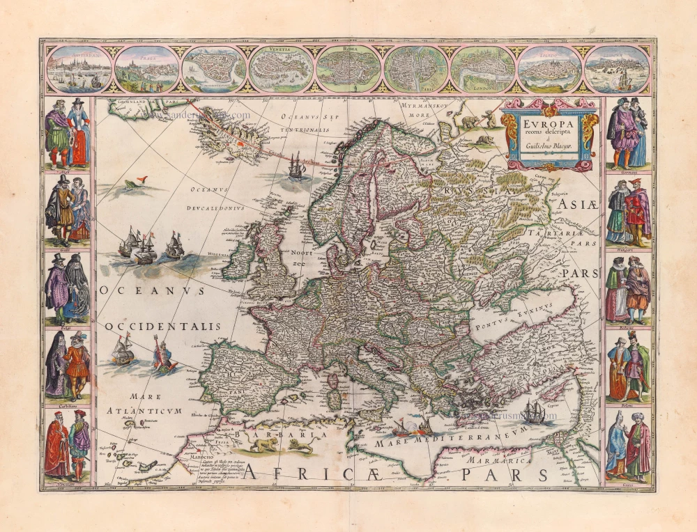
Europe by Blaeu Willem & Joan 1659
Europa Recens Descripta.
[Item number: 30206]
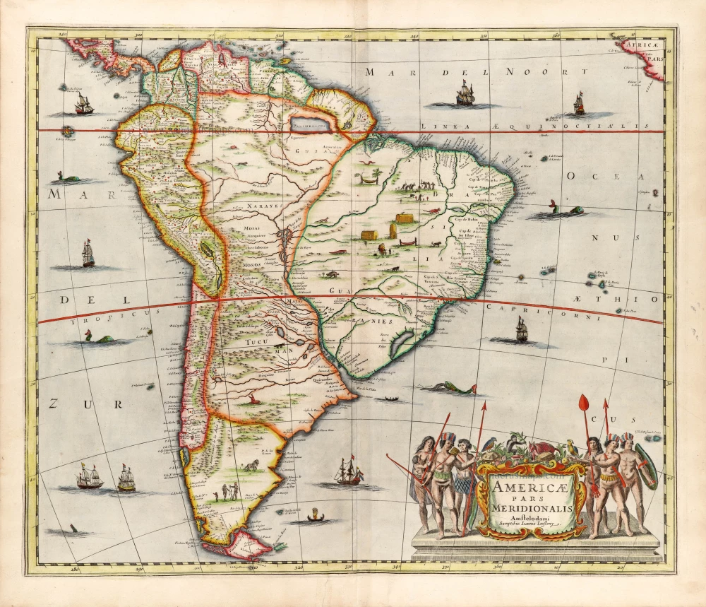
South America by Johannes Janssonius 1666
Americae Pars Meridionalis.
[Item number: 30078]
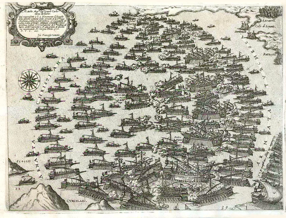
Battle of Lepanto (Greece), by Giovanni Francesco Camocio. c. 1575
Al Molto Mag.co Sig. Gentile Carbonana da Gubio. Qui rappresento ...
[Item number: 27633]

North America, by Nicolas Sanson, published by Pierre Mortier after A.H. Jaillot. 1694
Amerique Septentrionale, Divisee en ses Principales Parties.
[Item number: 29125]

Welcome to Sanderus Antiquariaat
Antiquariaat Sanderus, named after the famous Flemish historian, Antonius Sanderus, is specialised in antiquarian books, medieval manuscripts, antique maps and prints from the 15th to the 18th centuries.
The company is a member of the Antiquarian Booksellers’ Association (ABA), the “The Belgian Royal Chamber of Antiques and Art Dealers” and the International Association of Antique Map Dealers (IAMA).