Antique maps catalogue
- All recent additions
-
Antique maps
- World and Polar
-
Europe
- Europe Continent
- Belgium
- Belgium - Cities
- The Low Countries
- The Netherlands
- The Netherlands - Cities
- Luxembourg
- France
- France - Cities
- Germany
- Germany - Cities
- Austria
- Italy
- Italy - Cities
- Spain and Portugal
- Greece & Greek Islands
- Switzerland
- British Isles
- British Isles - Cities
- Northern Europe
- Central Europe
- Eastern Europe
- Southeastern Europe
- America
- Asia
- Africa
- Mediterranean Sea
- Australia
- Oceans
- Celestial Maps
- Curiosities
- Books
- Medieval manuscripts
- Prints
![Scarpanto - [Above map :] Descrittione del l'Isola di Scarpanto.](https://sanderusmaps.com/assets/WEBP/m29836.webp)
Scarpanto (Karpathos) by Thomasso Porcacchi. 1590
Scarpanto - [Above map :] Descrittione del l'Isola di Scarpanto.
[Item number: 29836]

Souda (Crete) by J. Peeters. c. 1690
Porta Suda Paleo in Candia.
[Item number: 31367]
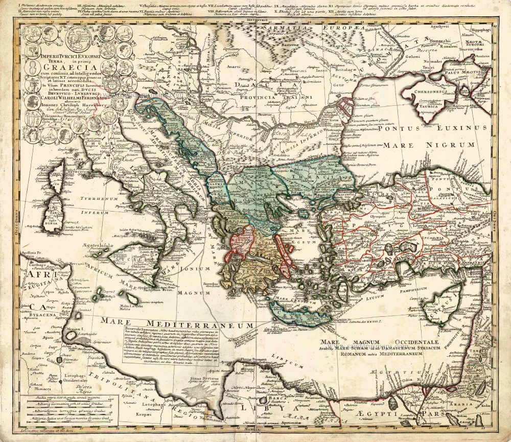
Southeastern Europe - Turkey by Homann Heirs 1752-1775
Imperii Turcici Europaei Terra in Primis Graecia.
[Item number: 26592]
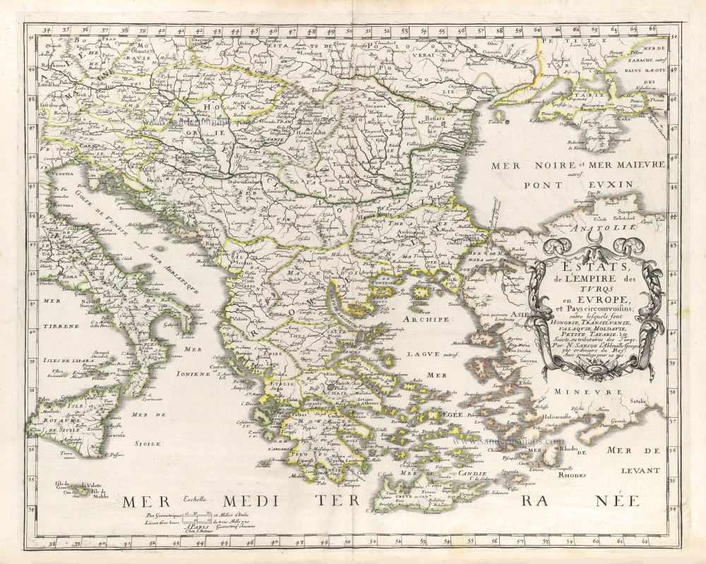
The Balkans by Nicolas Sanson. 1659
Estats, de l'Empire des Turqs en Europe; et Pays circomvoisins; ...
[Item number: 29686]
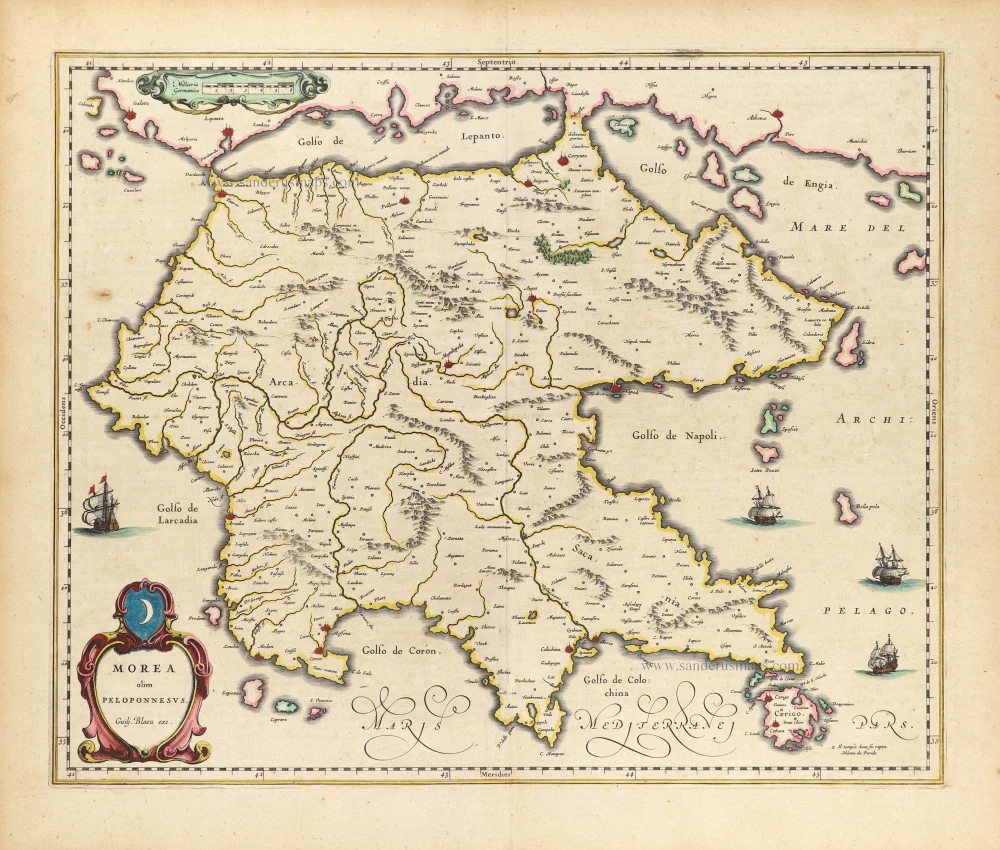
Peloponnisos by Willem Blaeu. 1640
Morea olim Peloponessus.
[Item number: 28881]
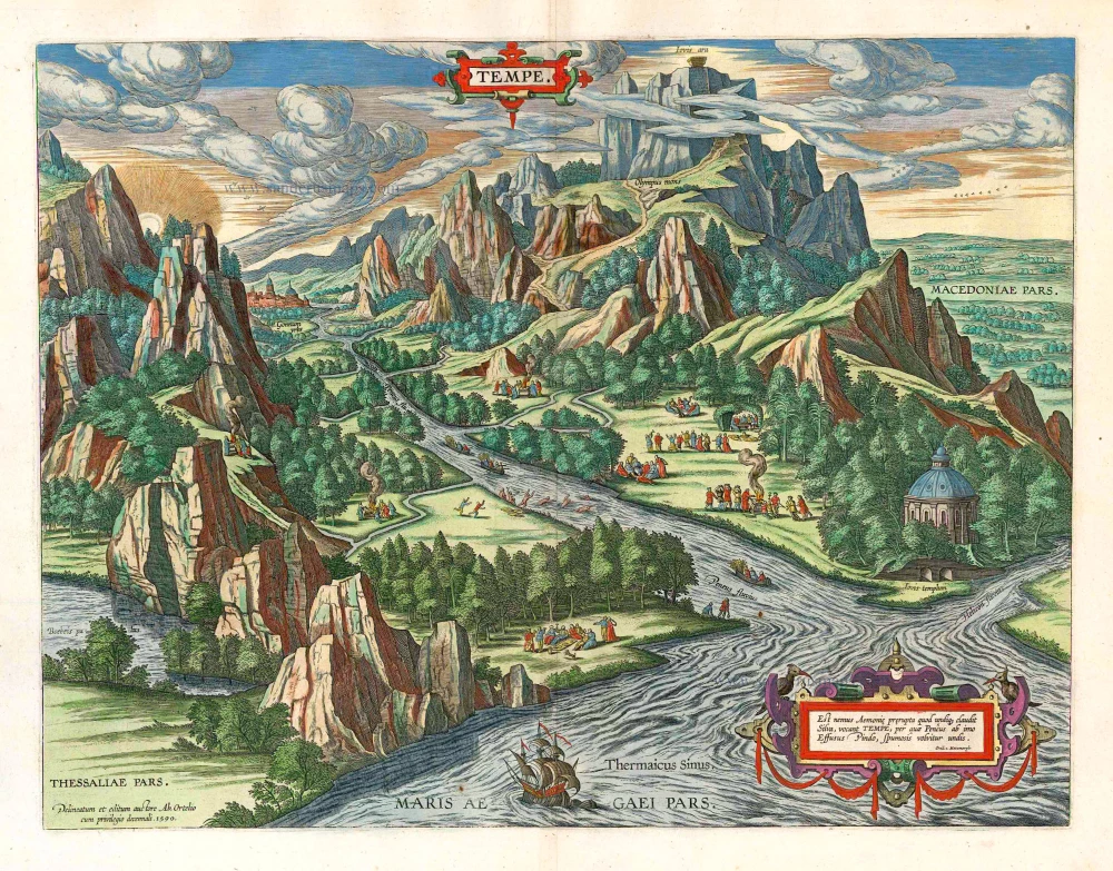
Parergon map
The valley of the river Peneus in Thessaly, by A. Ortelius. 1624
Tempe.
[Item number: 3153]

Zakynthos by Petrus Bertius, published by Jodocus Hondius II. 1618
Zante Insula.
[Item number: 31849]
![Zante. - [Above map :] Descrittione del l'Isola del Zante.](https://sanderusmaps.com/assets/WEBP/m29841.webp)
Zante (Zakynthos) by Thomasso Porcacchi. 1590
Zante. - [Above map :] Descrittione del l'Isola del Zante.
[Item number: 29841]