Antique maps catalogue
- All recent additions
-
Antique maps
- World and Polar
-
Europe
- Europe Continent
- Belgium
- Belgium - Cities
- The Low Countries
- The Netherlands
- The Netherlands - Cities
- Luxembourg
- France
- France - Cities
- Germany
- Germany - Cities
- Austria
- Italy
- Italy - Cities
- Spain and Portugal
- Greece & Greek Islands
- Switzerland
- British Isles
- British Isles - Cities
- Northern Europe
- Central Europe
- Eastern Europe
- Southeastern Europe
- America
- Asia
- Africa
- Mediterranean Sea
- Australia
- Oceans
- Celestial Maps
- Curiosities
- Books
- Medieval manuscripts
- Prints

Ptolemy map of Africa by Martin Waldseemüller 1513
Tabula Quarta Africae
[Item number: 31187]
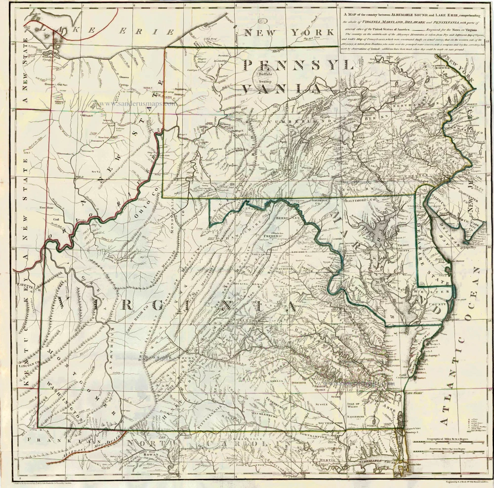
Virginia by Thomas Jefferson 1787
A Map of the country between Albemarle Sound, and Lake Erie, ...
[Item number: 27301]
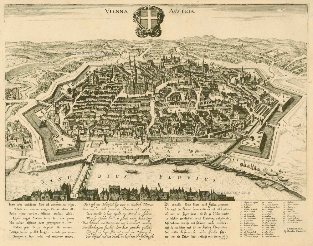
Wien, by D. Danckerts. c. 1660
Vienna Austria.
[Item number: 7049]
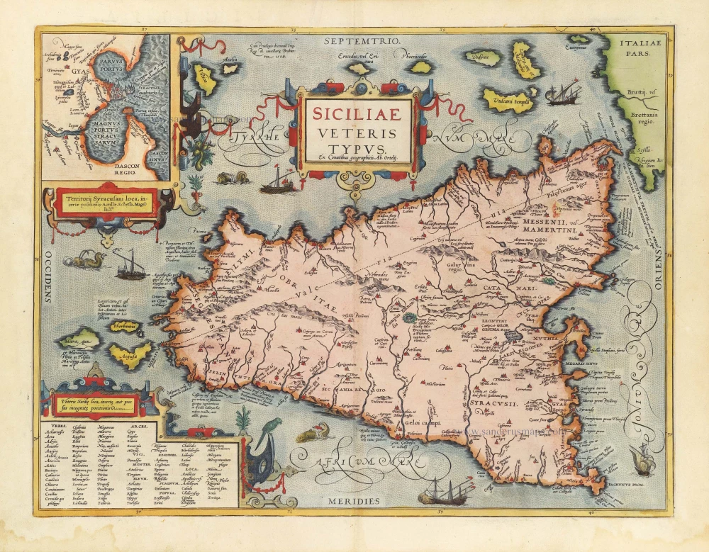
Ancient Sicily, by Abraham Ortelius. 1584
Siciliae Veteris Typus.
[Item number: 29146]
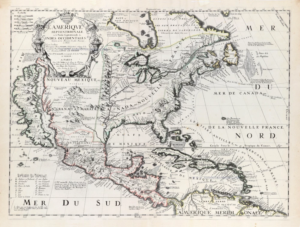
North and Central America by Vincenzo Coronelli, published by J.B. Nolin. 1689
L'Amerique Septentrionale, ou la Partie Septentrionale des Indes ...
[Item number: 31338]
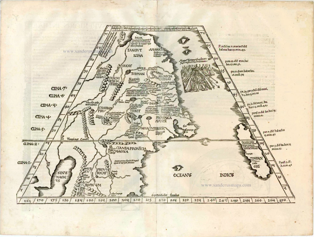
China - Japan, by Lorenz Fries after Martin Waldseemüller. 1525
Ta. Superioris Indiae et Tartariae Maioris.
[Item number: 27928]

Welcome to Sanderus Antiquariaat
Antiquariaat Sanderus, named after the famous Flemish historian, Antonius Sanderus, is specialised in antiquarian books, medieval manuscripts, antique maps and prints from the 15th to the 18th centuries.
The company is a member of the Antiquarian Booksellers’ Association (ABA), the “The Belgian Royal Chamber of Antiques and Art Dealers” and the International Association of Antique Map Dealers (IAMA).