Antique maps catalogue
- All recent additions
-
Antique maps
- World and Polar
-
Europe
- Europe Continent
- Belgium
- Belgium - Cities
- The Low Countries
- The Netherlands
- The Netherlands - Cities
- Luxembourg
- France
- France - Cities
- Germany
- Germany - Cities
- Austria
- Italy
- Italy - Cities
- Spain and Portugal
- Greece & Greek Islands
- Switzerland
- British Isles
- British Isles - Cities
- Northern Europe
- Central Europe
- Eastern Europe
- Southeastern Europe
- America
- Asia
- Africa
- Mediterranean Sea
- Australia
- Oceans
- Celestial Maps
- Curiosities
- Books
- Medieval manuscripts
- Prints
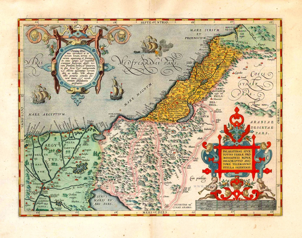
Holy Land, by Abraham Ortelius. 1624
Palaestinae sive totius Terrae Promissionis nova descriptio ...
[Item number: 1583]
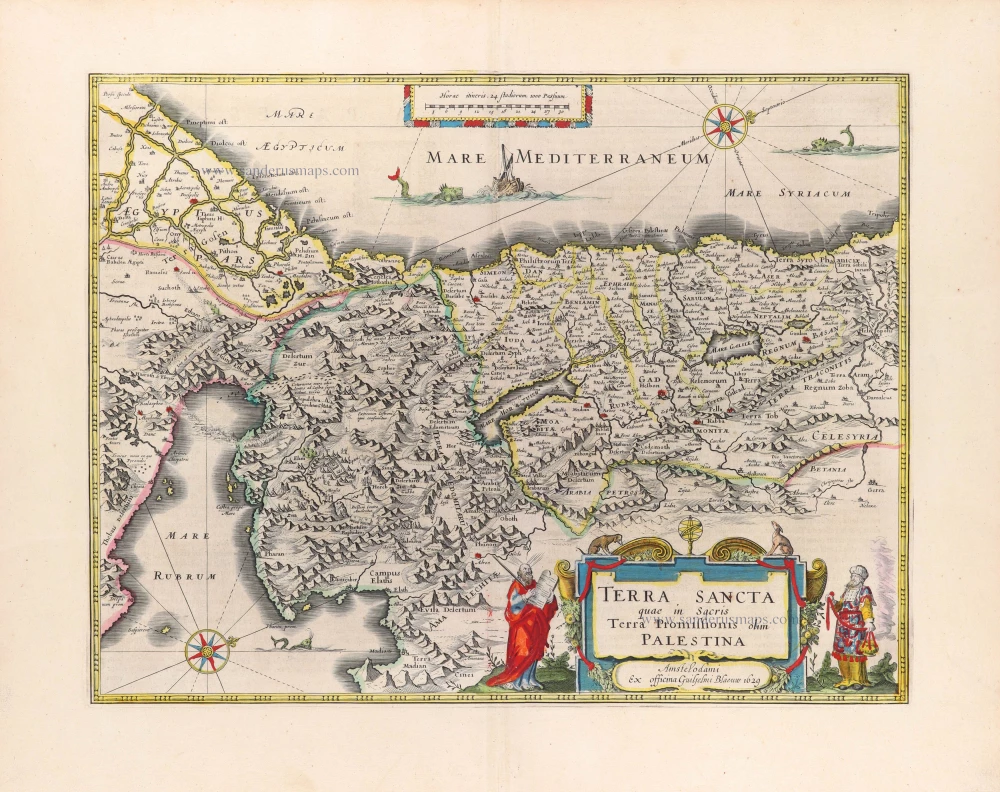
Holy Land, by Willem Blaeu. 1645
Terra Sancta quae in Sacris Terra Promissionis olim Palestina.
[Item number: 30914]
Superb old colouring, heightened with gold.
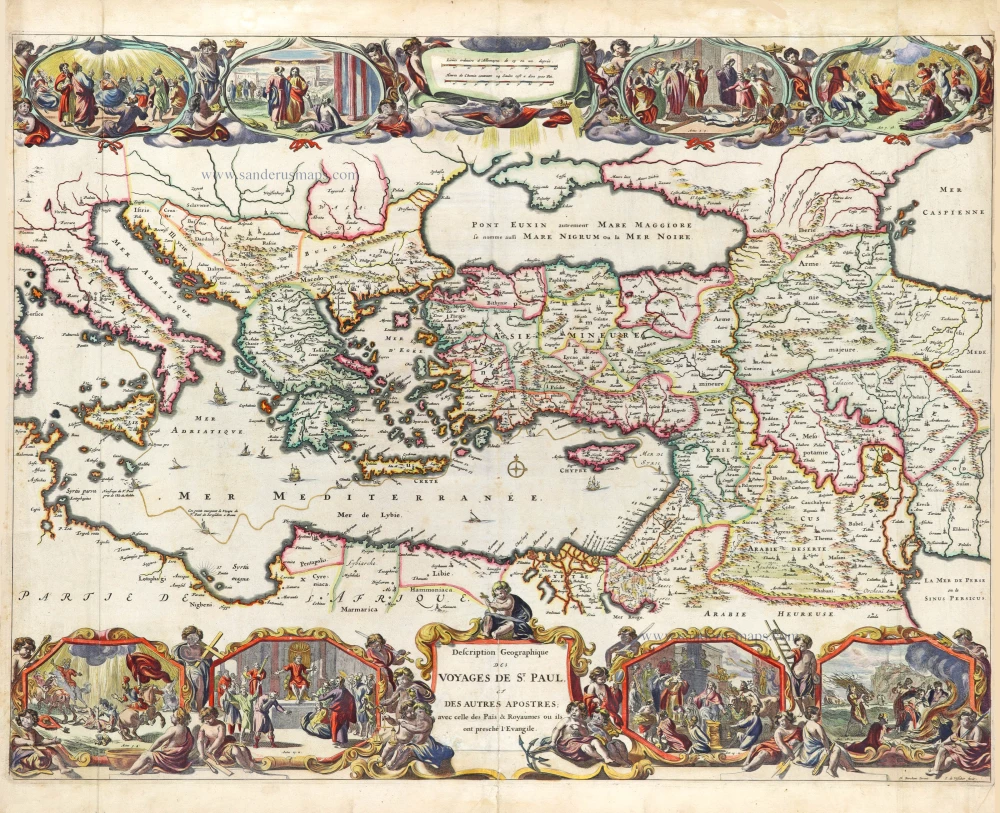
Eastern Mediterranean, by Nicolaes Visscher I. 1663
Description Geogaphique des voyages de St. Paul et des autres ...
[Item number: 31040]
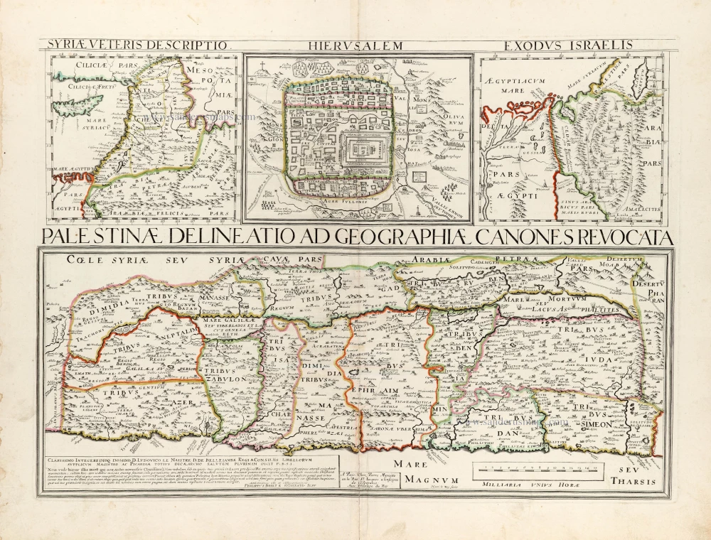
Holy Land - Jerusalem by Philippe Briet, published by Pierre Mariette. 1641
Palestinae Delineatio Ad Geographiae Canones Revocata.
[Item number: 30056]
Superb old colouring, heightened with gold.
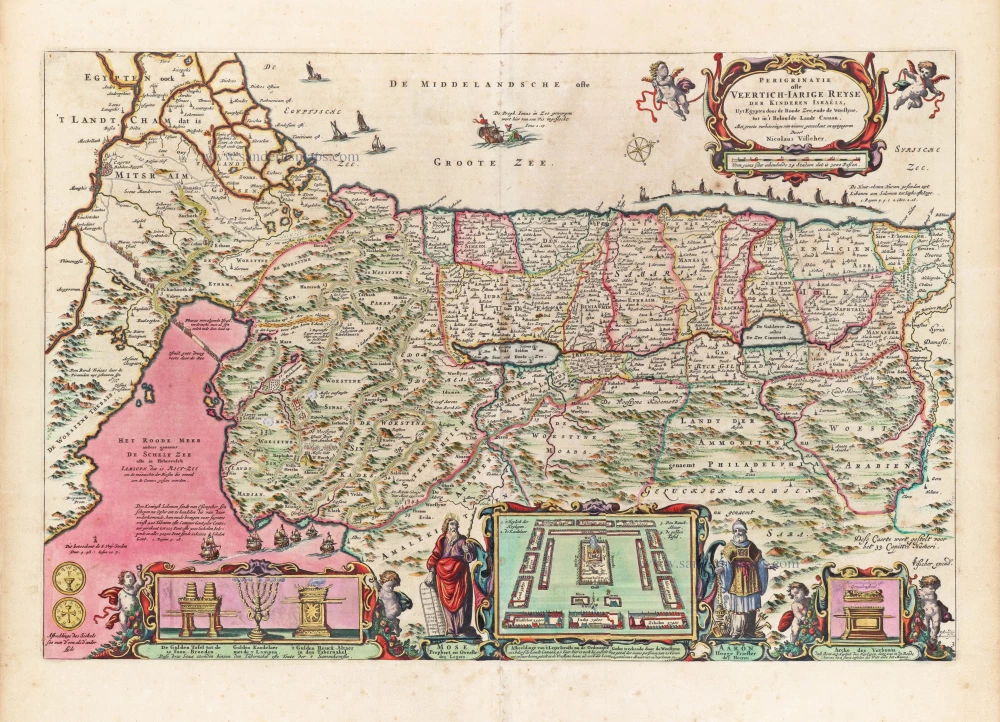
Holy Land, by Nicolaes Visscher I. 1663
Perigrinatie ofte Veertigh-Iarige Reyse der Kinderen Israëls.
[Item number: 30538]
Superb old colouring, heightened with gold.
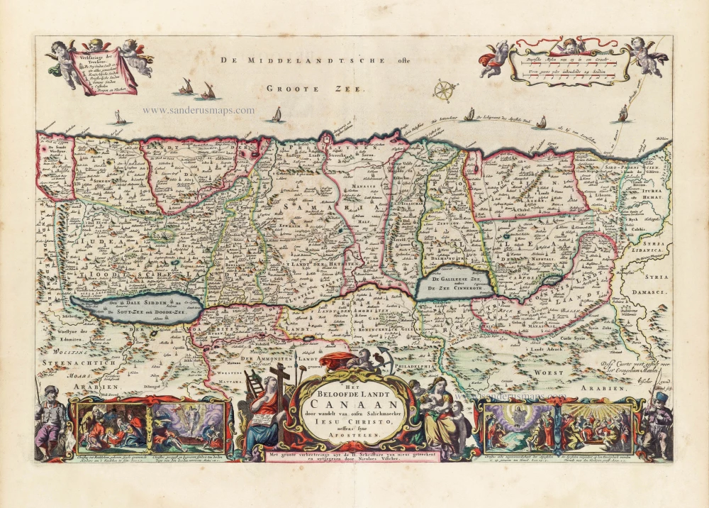
Holy Land by Nicolaas Visscher. 1663
Het Beloofde Landt Canaan door wandelt van onsen Salichmaeker ...
[Item number: 30535]

Holy Land, by Lorenz Fries. 1525
Tabula Terre Sanctae.
[Item number: 31846]
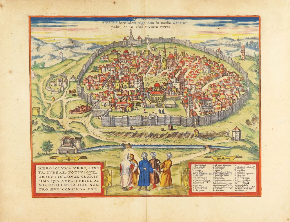
Jerusalem, by Georg Braun & Frans Hogenberg 1623
Hierosolyma Urbs Sancta, Iudeae, Totiusque Orientis Longe ...
[Item number: 29229]
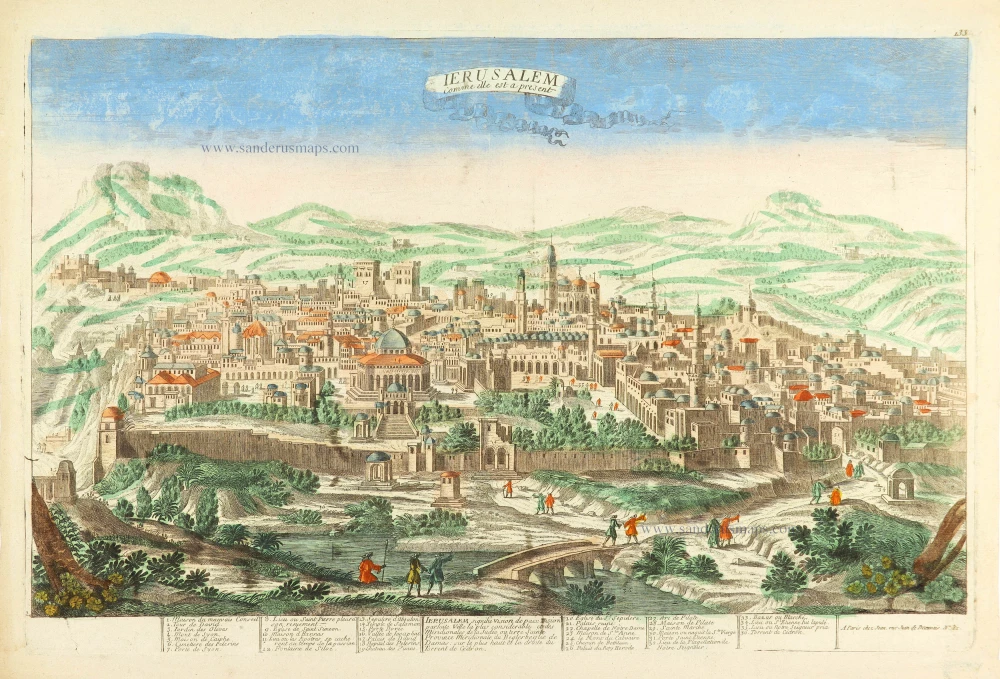
Jerusalem by Pierre Aveline. c. 1780
Ierusalem comme elle est a present.
[Item number: 28752]
Parergon map
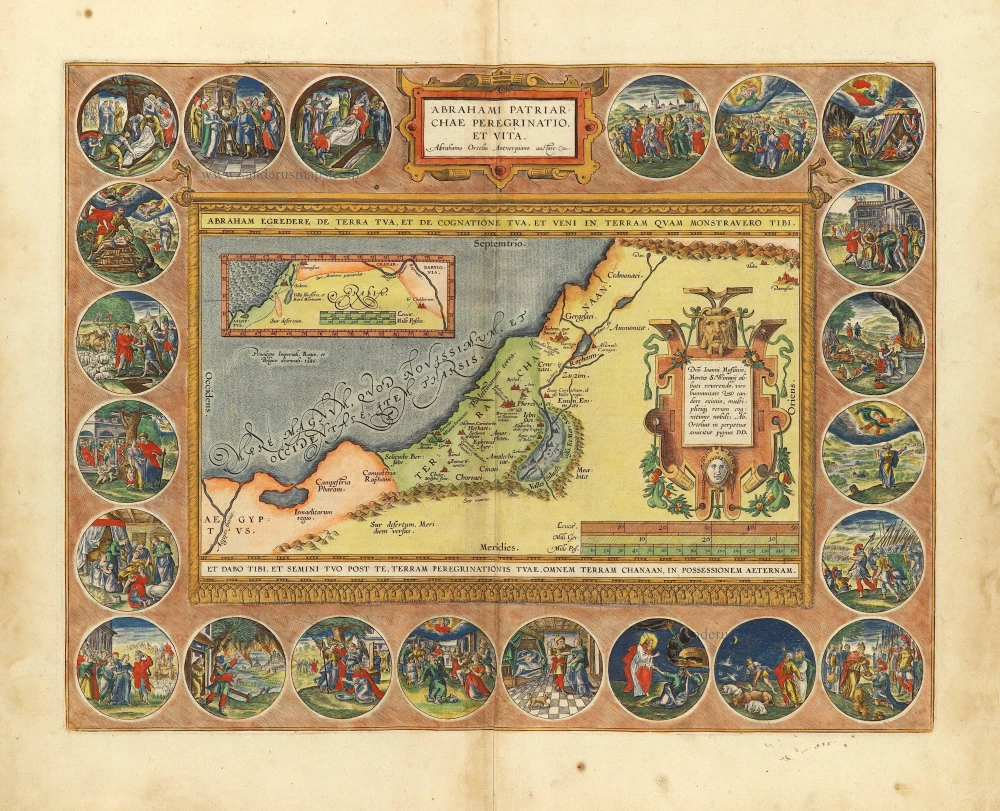
The Holy Land by Abraham Ortelius. 1612
Abrahami Patriarchae Peregrinatio, et Vita.
[Item number: 28921]
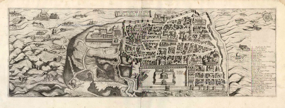
Jerusalem by J. Boisseau. 1648
Description de la Ville de Jerusalem avec les Noms des Saints ...
[Item number: 25598]
The most decorative map of the Holy Land to be included in a seventeenth century atlas
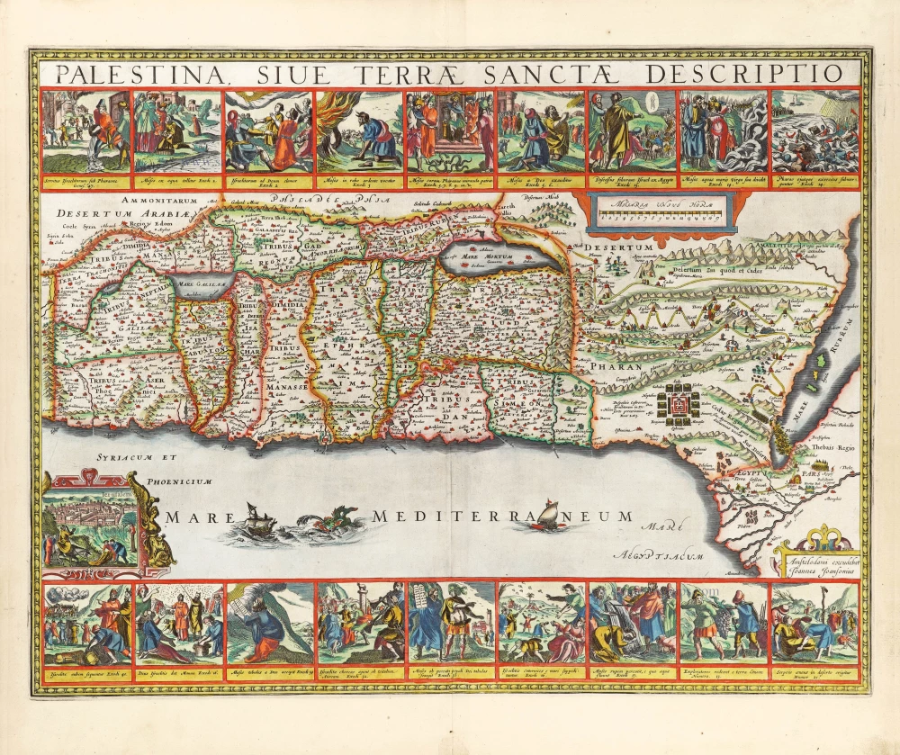
The Holy Land by Joannes Janssonius. 1666
Palestina, sive Terrae Sanctae Descriptio.
[Item number: 29972]
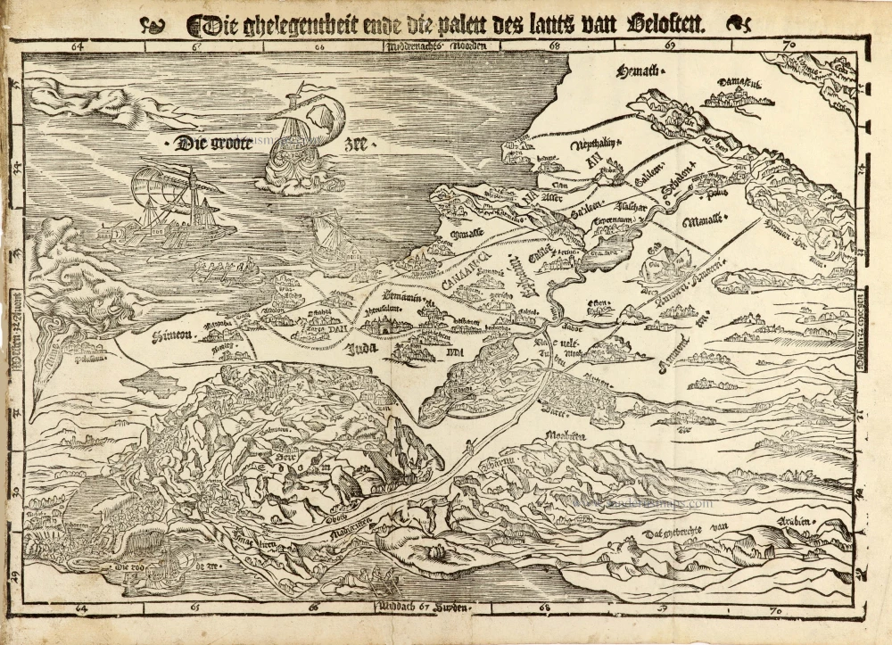
Holy Land map from the very rare van Liesveldt Bible
Holy Land by van Jacob van Liesveldt. 1532-1560
Die ghelegentheit ende die palen des lants van Beloften.
[Item number: 30549]
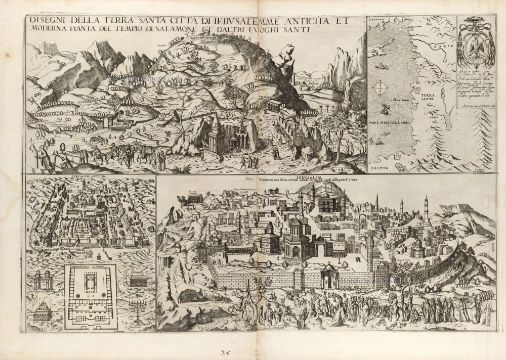
Extremely rare map, only one complete copy recorded
Map depicting Jerusalem and the Holy Land, by Nicolas van Aelst. 1590
Disegni della Terra Santa Citta di Ierusalemme Anticha et ...
[Item number: 31414]