www.sanderusmaps.com
Sanderus
Antique maps & books
  • Home
  • About us
  • Contact us
  • References
  • Our catalogue
  • 0

Advanced search

x
RESET

Search

Advanced search

Antique maps catalogue

Antique maps / Europe / Southeastern Europe
open categories
  • All recent additions
  • Antique maps
    • World and Polar
    • Europe
      • Europe Continent
      • Belgium
      • Belgium - Cities
      • The Low Countries
      • The Netherlands
      • The Netherlands - Cities
      • Luxembourg
      • France
      • France - Cities
      • Germany
      • Germany - Cities
      • Austria
      • Italy
      • Italy - Cities
      • Spain and Portugal
      • Greece & Greek Islands
      • Switzerland
      • British Isles
      • British Isles - Cities
      • Northern Europe
      • Central Europe
      • Eastern Europe
      • Southeastern Europe
    • America
      • The Americas
      • North America
      • Central America
      • West Indies
      • South America
    • Asia
      • Asia
      • Central Asia
      • China
      • Holy Land
      • India - Ceylon
      • Japan
      • Middle East
      • Southeast Asia
      • Turkey - Cyprus
    • Africa
    • Mediterranean Sea
    • Australia
    • Oceans
    • Celestial Maps
    • Curiosities
  • Books
    • Atlases
    • Bibles
    • Books with Maps
    • Botany
    • Classics - Antiquity
    • History
    • Incunabula
    • Medicine
    • Miscellany
    • Natural History
    • Scientific Books
    • Travel Books
  • Medieval manuscripts
    • Antiphonary Leaf
    • Miniature
    • Text Leaf
  • Prints
    • Birds Barraband
    • Birds Nozeman
    • Fish Bloch
    • Flowers Sweert/De Bry
    • Flowers Weinman
    • Fruits
    • Natural History
    • Hartmann Schedel - Liber Chronicarum
    • Master Prints
    • David Teniers
    • Naval Views - Ships
    • Vernet, C.&H. - Equestrian aquatints
    • Pluvinel - Equestrian Art
    • Angelo, D. M. T. - Fencing

Antique maps / Europe / Southeastern Europe
Showing 73 - 79 of 79 products
  • SORT BY
  • Title
  • Mapmaker
  • Price ↑ ↓
  • RESET
  • ‹ Previous
  • 1
  • 2
  • 3
  • › Next
Bombardement du Port Impérial d'Odessa.

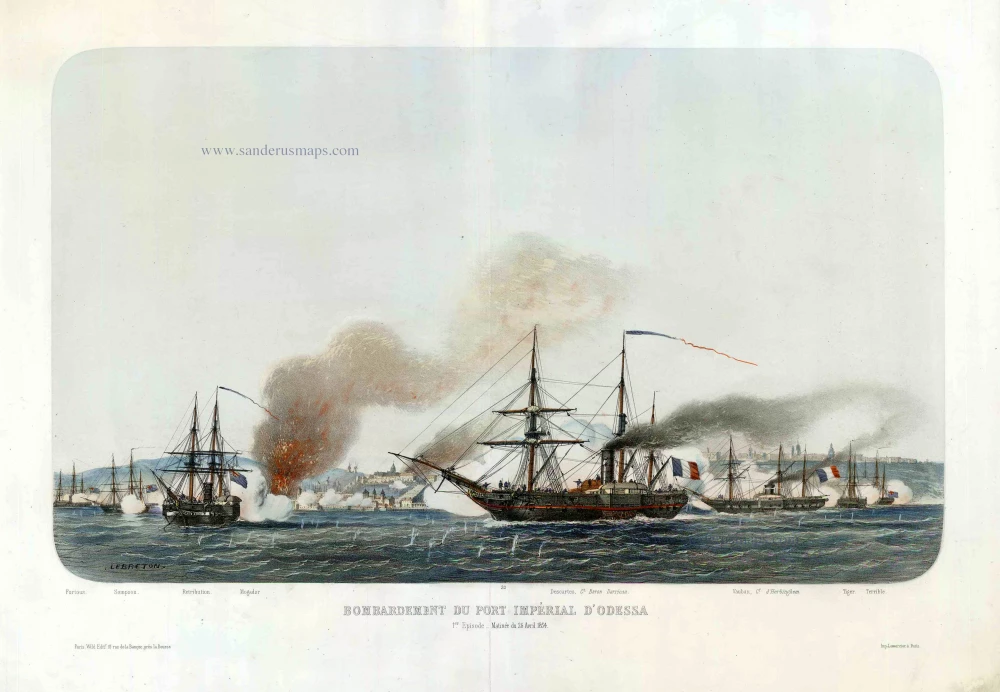
Odessa (Ukraine), by Louis Le Breton. c.1854
Bombardement du Port Impérial d'Odessa.
[Item number: 27443]

€900  ($1044 / £765)
Carte de la Partie Septentrionale de l'Empire Otoman Contenant la Crimée, la Moldavie, la Valakie, la Bulgarie, avec la Nouvelle Russie, les Gouvernement d'Astracan, et de Voronez, les Tatares Cosaques &.

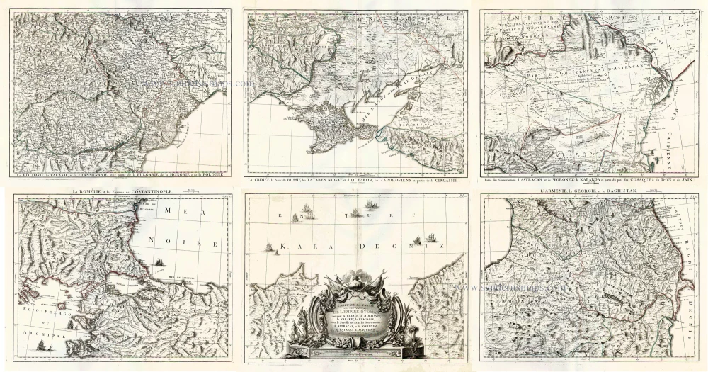
Black Sea and surroundings, by Francesco Santini. 1776-79
Carte de la Partie Septentrionale de l'Empire Otoman Contenant ...
[Item number: 26973]

€1400  ($1624 / £1190)
Danubius, Fluvius Europae Maximus, a Fontibus ad Ostia, Cum omnibus Fluminibus, ab utroque latere, in illum defluentibus.

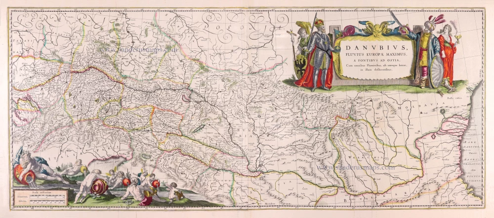
Danube River by Willem Blaeu. 1643
Danubius, Fluvius Europae Maximus, a Fontibus ad Ostia, Cum ...
[Item number: 30307]

€1400  ($1624 / £1190)
Nieuwe en Accurate Caart van de onderliggende Lande van Belgrado als mededes zelfs Belegeringh, ende Marse der Keyselyke Armée. A° 1717.

Very rare map of the siege of Belgrade in 1717.
Belgrade (Serbia) and three panoramic views by Joachim Ottens. 1717-1725
Nieuwe en Accurate Caart van de onderliggende Lande van Belgrado ...
[Item number: 30237]

€1600  ($1856 / £1360)
La Flotte Anglo-Française, entrant dans la Mer Noire 1854.

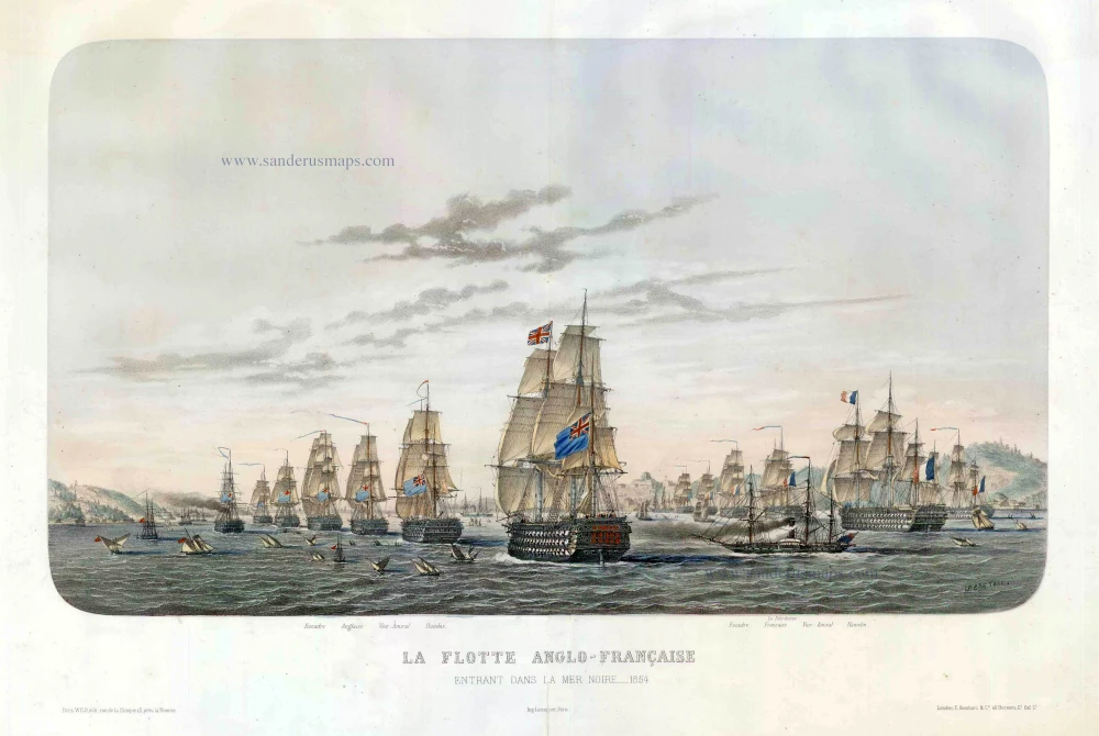
The Anglo-French Fleet entering the Black Sea, by Louis Le Breton. c.1854
La Flotte Anglo-Française, entrant dans la Mer Noire 1854.
[Item number: 27444]

€1700  ($1972 / £1445)
Byzantium nunc Constantinopolis.

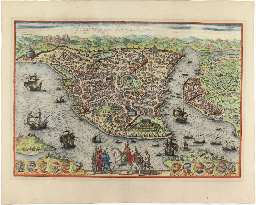
Istanbul (Constantinople), by Georg Braun and Frans Hogenberg. 1593
Byzantium nunc Constantinopolis.
[Item number: 30958]
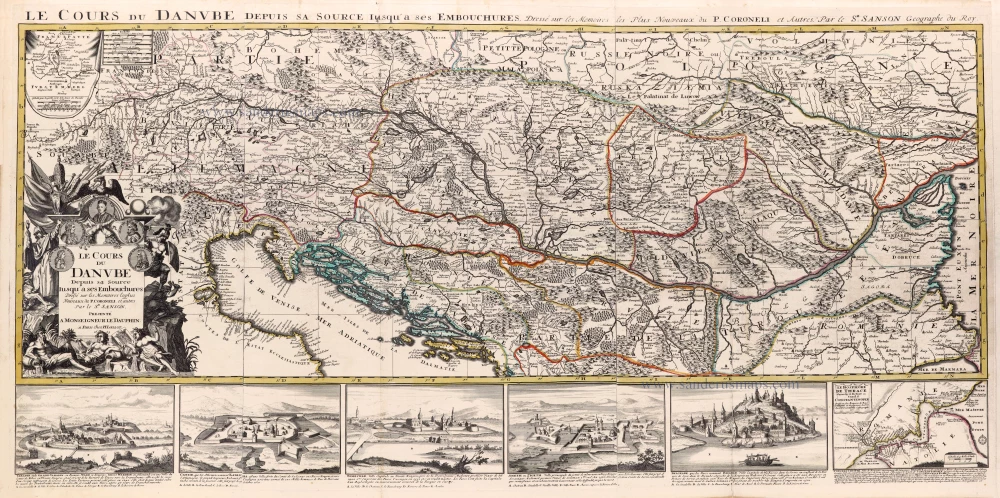
€2300  ($2668 / £1955)
Le Cours du Danube depuis sa Source jusqu'à ses Embouchures.

Spectacular map
Course of the Danube River by N. Sanson, so-called published by Hubert Jaillot. (Pirated edition by Pierre Mortier). 1692
Le Cours du Danube depuis sa Source jusqu'à ses Embouchures.
[Item number: 31196]

€2500  ($2900 / £2125)
  • ‹ Previous
  • 1
  • 2
  • 3
  • › Next

Contact us

Sanderusmaps
Nederkouter 32 - 9000 Ghent - Belgium
 +32 9 223 35 90
sanderus@sanderusmaps.com

Antique maps catalogue

  • All recent additions
  • Antique maps
  • Books
  • Medieval manuscripts
  • Prints

copyright © Sanderus 2025    About us -  Terms & conditions -  Privacy policy  -  Edit Cookie Settings

launched by Major Tom
www.sanderusmaps.com