Antique maps catalogue
- All recent additions
-
Antique maps
- World and Polar
-
Europe
- Europe Continent
- Belgium
- Belgium - Cities
- The Low Countries
- The Netherlands
- The Netherlands - Cities
- Luxembourg
- France
- France - Cities
- Germany
- Germany - Cities
- Austria
- Italy
- Italy - Cities
- Spain and Portugal
- Greece & Greek Islands
- Switzerland
- British Isles
- British Isles - Cities
- Northern Europe
- Central Europe
- Eastern Europe
- Southeastern Europe
- America
- Asia
- Africa
- Mediterranean Sea
- Australia
- Oceans
- Celestial Maps
- Curiosities
- Books
- Medieval manuscripts
- Prints

Mauritius, by J. Van Keulen II. 1753
Paskaart van 't Eyland MAURITIUS, geleegen in de Oostindische ...
[Item number: 30986]
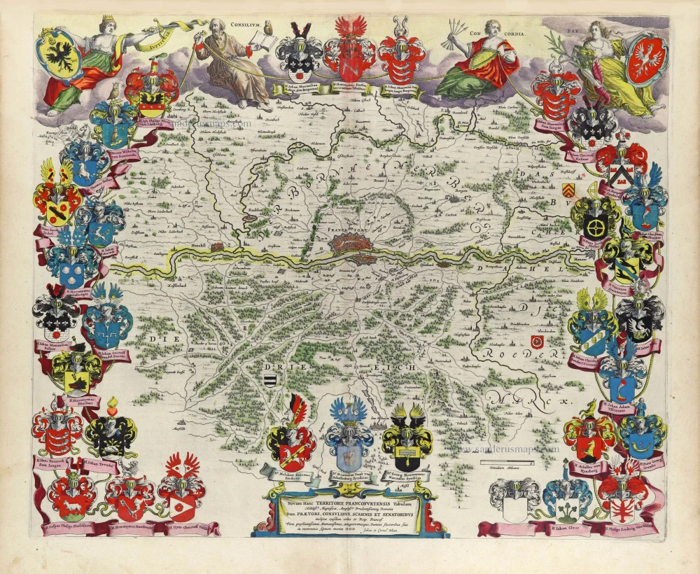
The Territory of Frankfurt am Main by J. Blaeu 1643
Novam Hanc Territorii Francofurtensis Tabulam ...
[Item number: 29904]
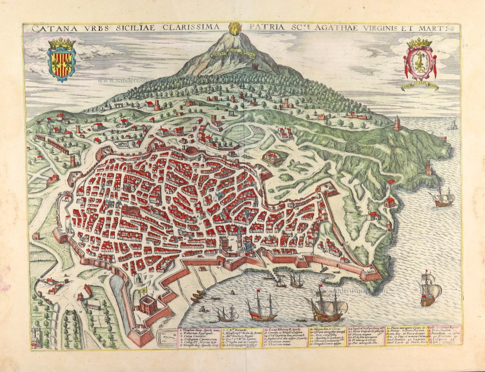
Catania with view of the Mount Etna by Georg Braun & Frans Hogenberg, published by J. Janssonius. 1657
Catana Urbs Siciliae Clarissima Patriae Scte Agathae Virginis et ...
[Item number: 31003]

North America, by Nicolas Sanson, published by Pierre Mortier after A.H. Jaillot. 1694
Amerique Septentrionale, Divisee en ses Principales Parties.
[Item number: 29125]
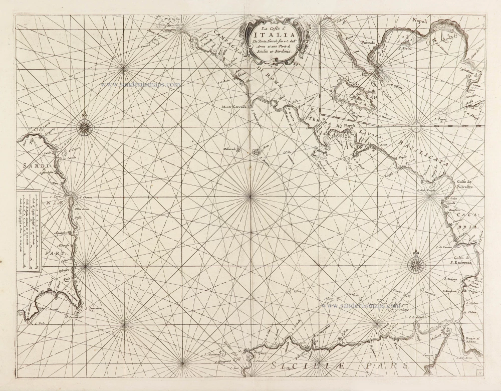
Chart of the Tyrrhenian Sea (Il Mar Tirenno) - between Italy, Sicily, and Sardinia, by Vincenzo Coronelli. 1696
La Costa d'Italia Da Porto Hercole fino a C. dell' Arme et una ...
[Item number: 28726]
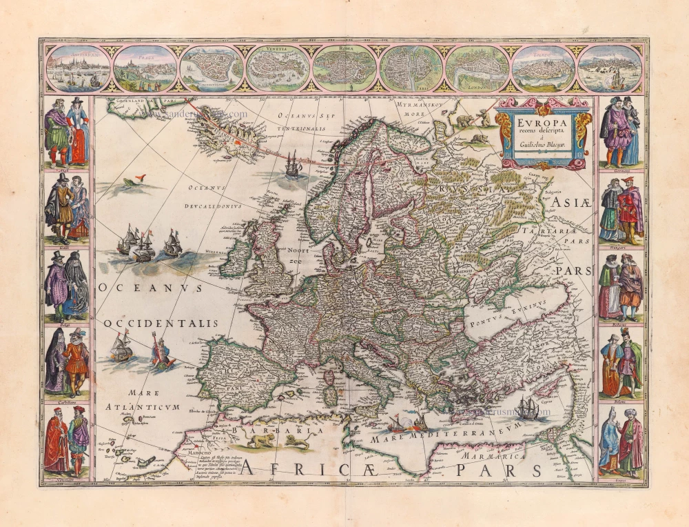
Europe by Blaeu Willem & Joan 1659
Europa Recens Descripta.
[Item number: 30206]

Welcome to Sanderus Antiquariaat
Antiquariaat Sanderus, named after the famous Flemish historian, Antonius Sanderus, is specialised in antiquarian books, medieval manuscripts, antique maps and prints from the 15th to the 18th centuries.
The company is a member of the Antiquarian Booksellers’ Association (ABA), the “The Belgian Royal Chamber of Antiques and Art Dealers” and the International Association of Antique Map Dealers (IAMA).