Antique maps catalogue
- All recent additions
-
Antique maps
- Polar maps
- World
-
Europe
- Europe Continent
- Belgium
- Belgium - Cities
- The Low Countries
- The Netherlands
- The Netherlands - Cities
- Luxembourg
- France
- France - Cities
- Germany
- Germany - Cities
- Austria
- Italy
- Italy - Cities
- Spain and Portugal
- Greece & Greek Islands
- Switzerland
- British Isles
- British Isles - Cities
- Northern Europe
- Central Europe
- Eastern Europe
- Southeastern Europe
- America
- Asia
- Africa
- Mediterranean Sea
- Australia
- Oceans
- Celestial Maps
- Curiosities
- Title Pages
- Books
- Medieval manuscripts
- Prints
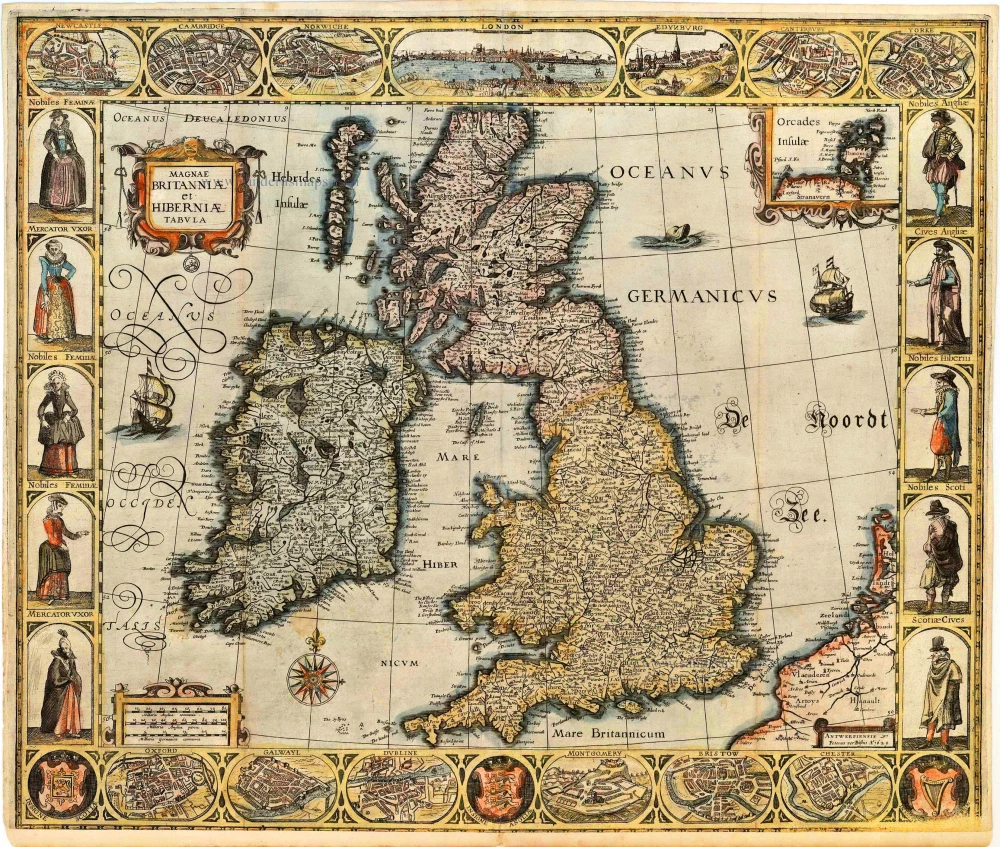
British Isles by Pieter Verbiest 1629
Magnae Britanniae et Hiberniae Tabula.
[Item number: 27737]
Rare
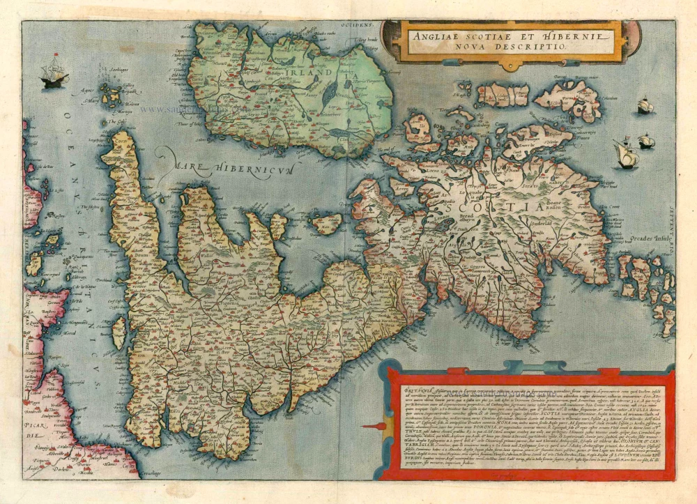
British Isles, by de G. Jode. 1593
Angliae Scotiae et Hibernie Nova Descriptio
[Item number: 11236]

'One of the finest maps published anywhere in the seventeenth century'
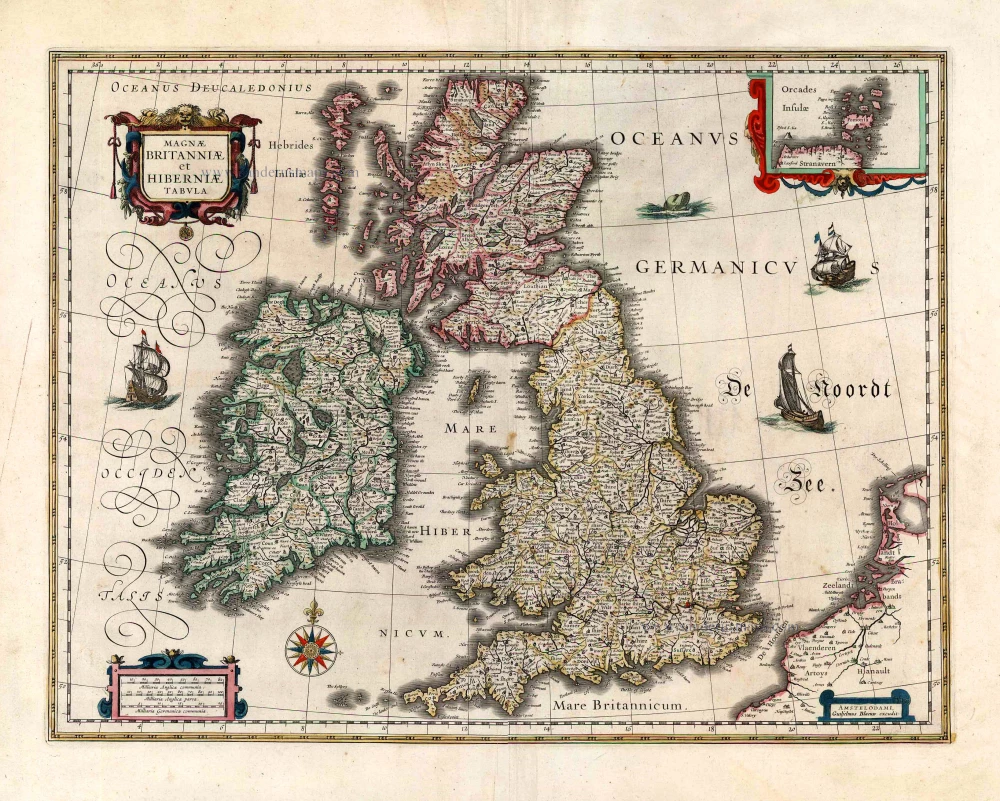
Great Brittain by Joan Blaeu 1645
Britannia prout divisa fuit temporibus Anglo-Saxonum, praesertim...
[Item number: 32188]
![[No title - On verso:] Principium Europae.](https://sanderusmaps.com/assets/WEBP/m30646.webp)
Rare 1525 edition in nice old colour.
Ptolemy map of the British Isles by Lorenz Fries, after Martin Waldseemüller 1525
[No title - On verso:] Principium Europae.
[Item number: 30646]

Rare and important sea chart
Ireland by Joannes Van Loon. 1666
Pas-caerte van Yrland, met Alle Zee-custen, Havenen,...
[Item number: 32978]
new
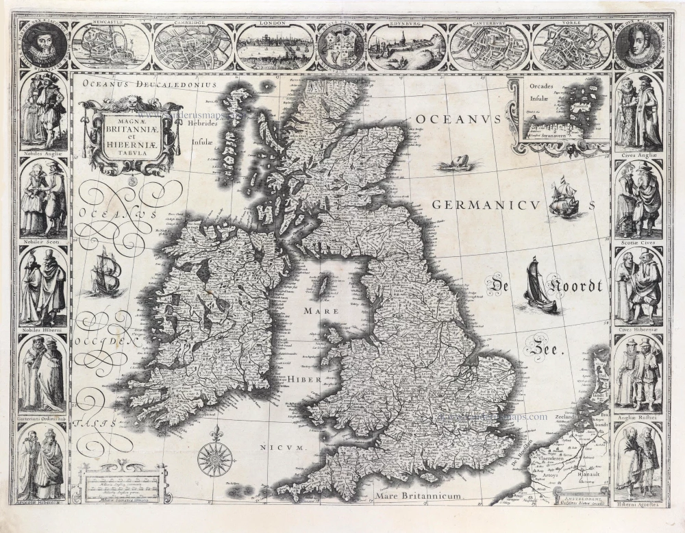
British Isles by Blaeu, with three decorative borders 1631
Magnae Britanniae et Hiberniae Tabula.
[Item number: 29586]
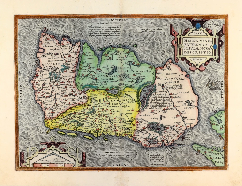
Ireland by Abraham Ortelius. 1595
Eryn. Hiberniae, Britannicae Insulae, Nova Descriptio. Irlandt.
[Item number: 30152]
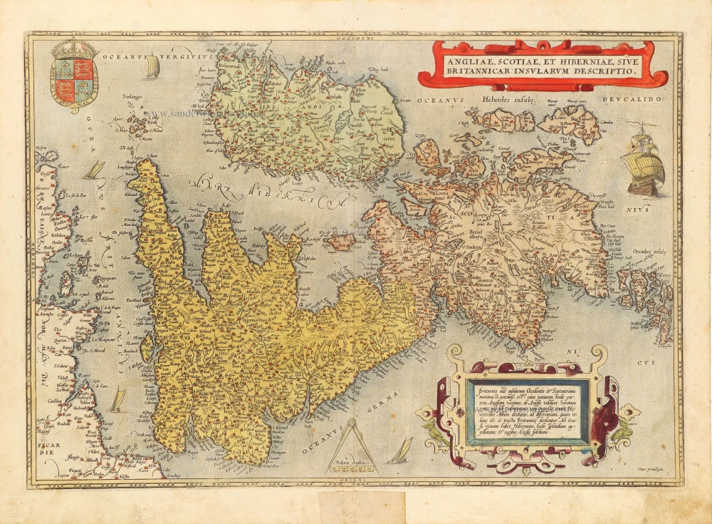
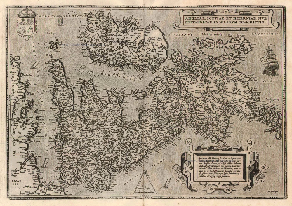
BRITISH ISLES by Abraham Ortelius 1572
Angliae, Scotiae, et Hiberniae, sive Britannicae Insularum...
[Item number: 15693]

Chart of the Southern North Sea, by Joannes Van Keulen 1680-1694
Pas Caerte van Texel, tot aende Hoofden; Begrypende in sich de...
[Item number: 32628]
The British Isles, by Joan and Willem Blaeu 1645
Magnae Britanniae et Hiberniae Tabula.
[Item number: 26715]
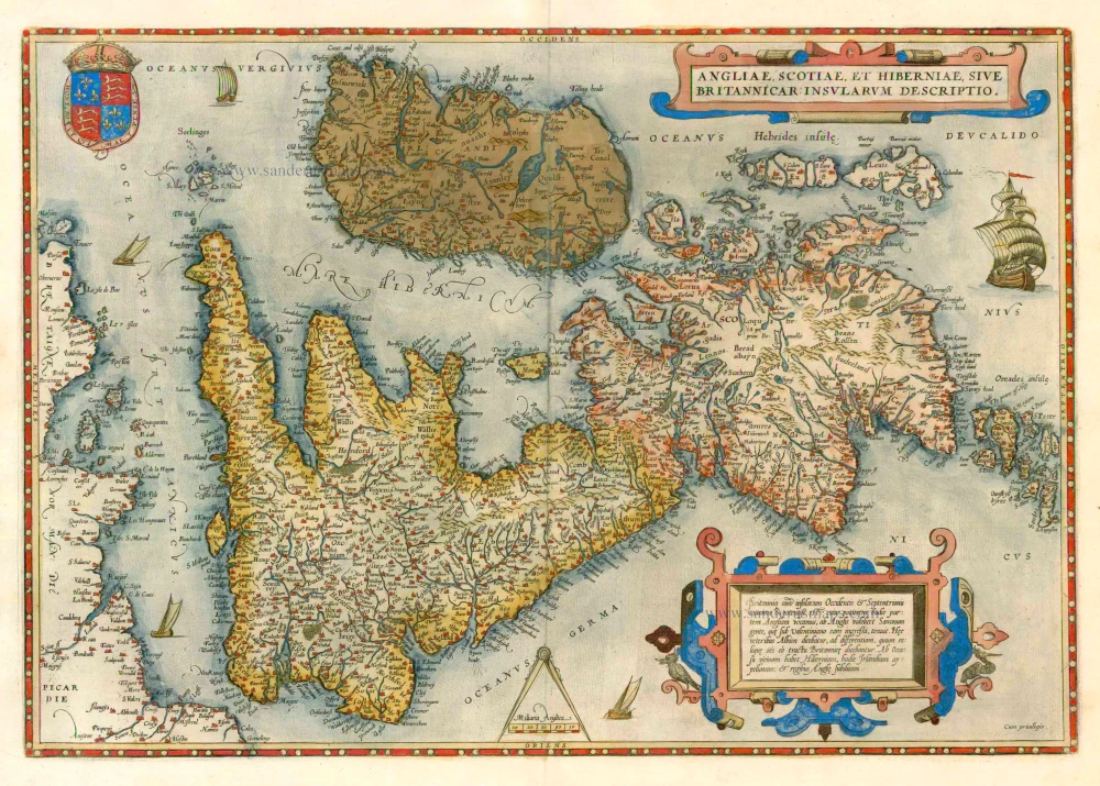
The British Isles by Abraham Ortelius. 1579
Angliae, Scotiae, et Hiberniae, sive Britannicae Insularum...
[Item number: 17897]
Rare first edition
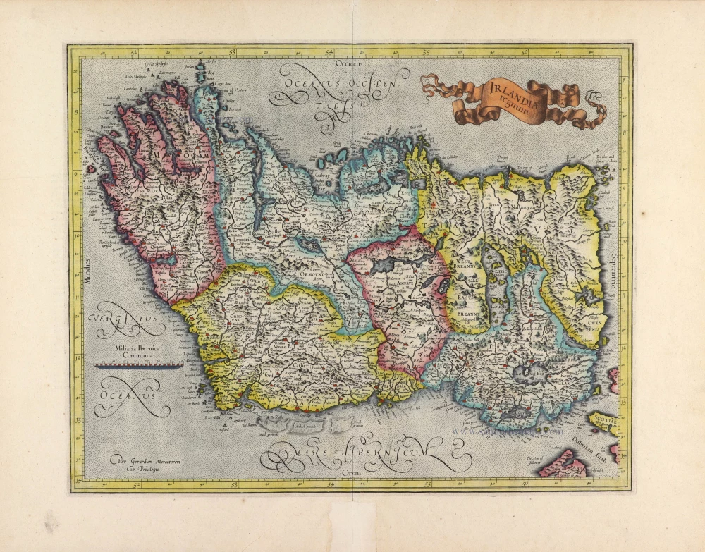
Ireland, by Gerard Mercator. 1595
Irlandiae Regnum.
[Item number: 31428]
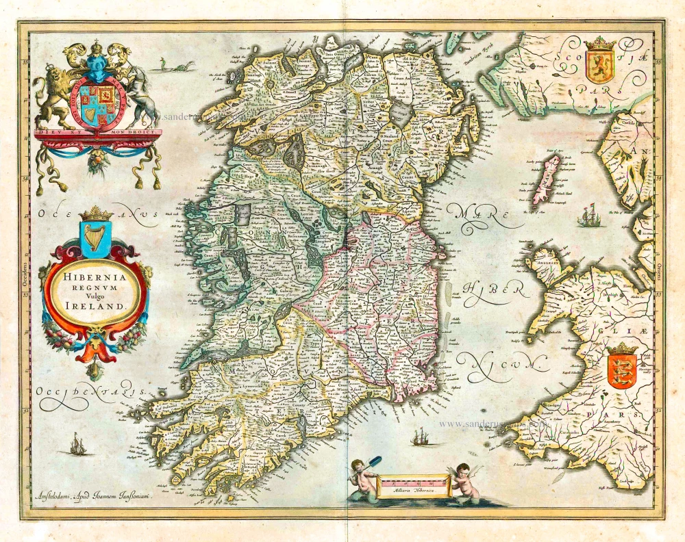
Ireland by Joannes Janssonius 1641
Hibernia Regnum Vulgo Ireland.
[Item number: 26258]
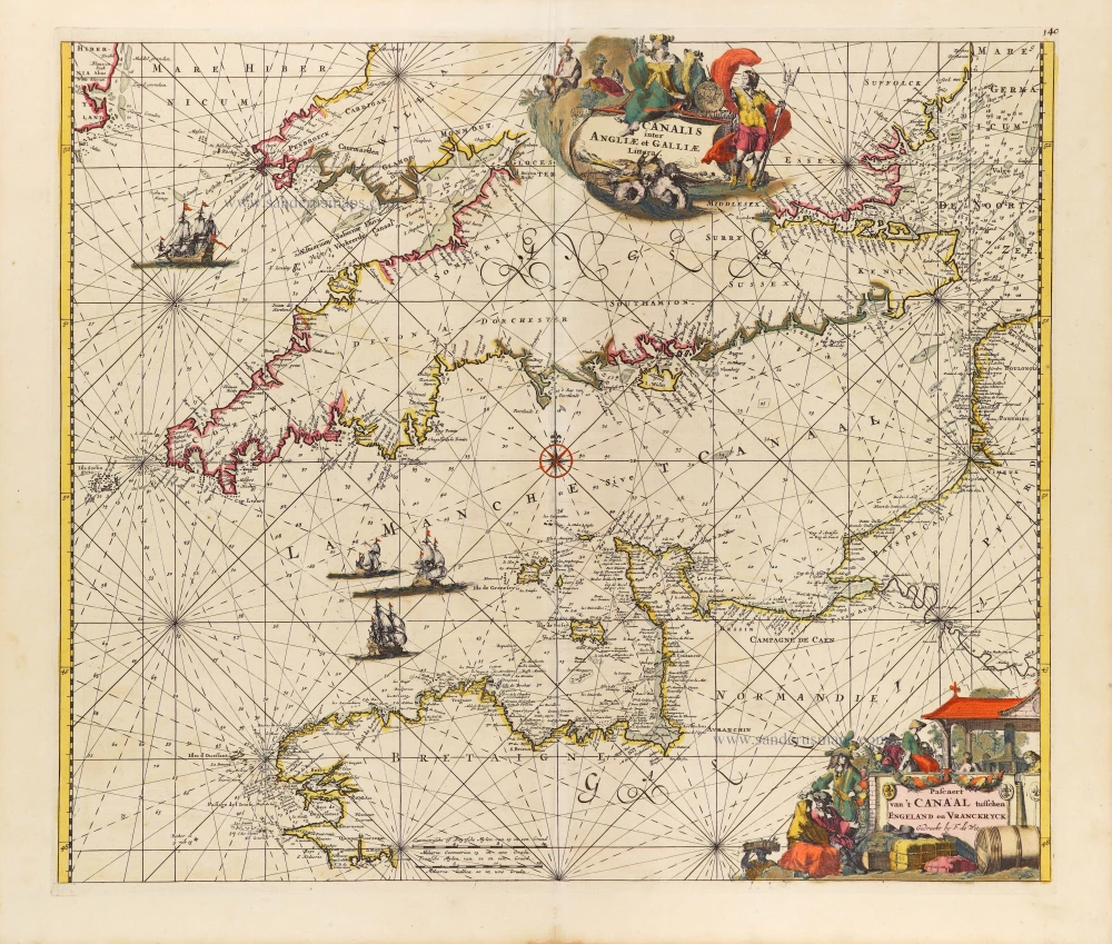
The English Channel, by Frederick de Wit. c. 1680
Canalis inter Angliae et Galliae Littera. - Pascaert van 't...
[Item number: 29171]
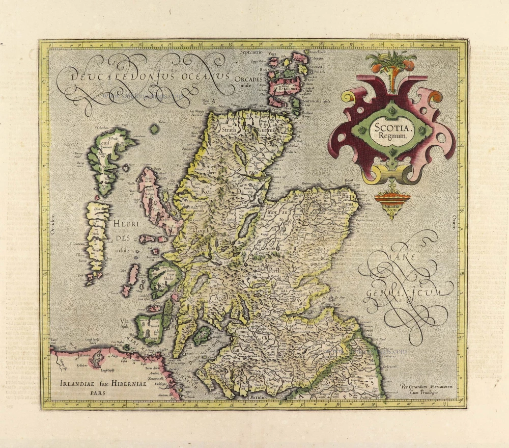
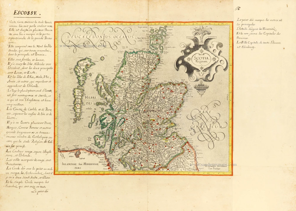
Scotland, by Gerard Mercator. 1633
Scotia Regnum.
[Item number: 32180]
The British Isles, by Ortelius A. 1601
Angliae, Scotiae, et Hiberniae, sive Britannicae Insularum...
[Item number: 22869]
Scotland, by Gerard Mercator. c. 1610-1650
Scotia Regnum.
[Item number: 31015]
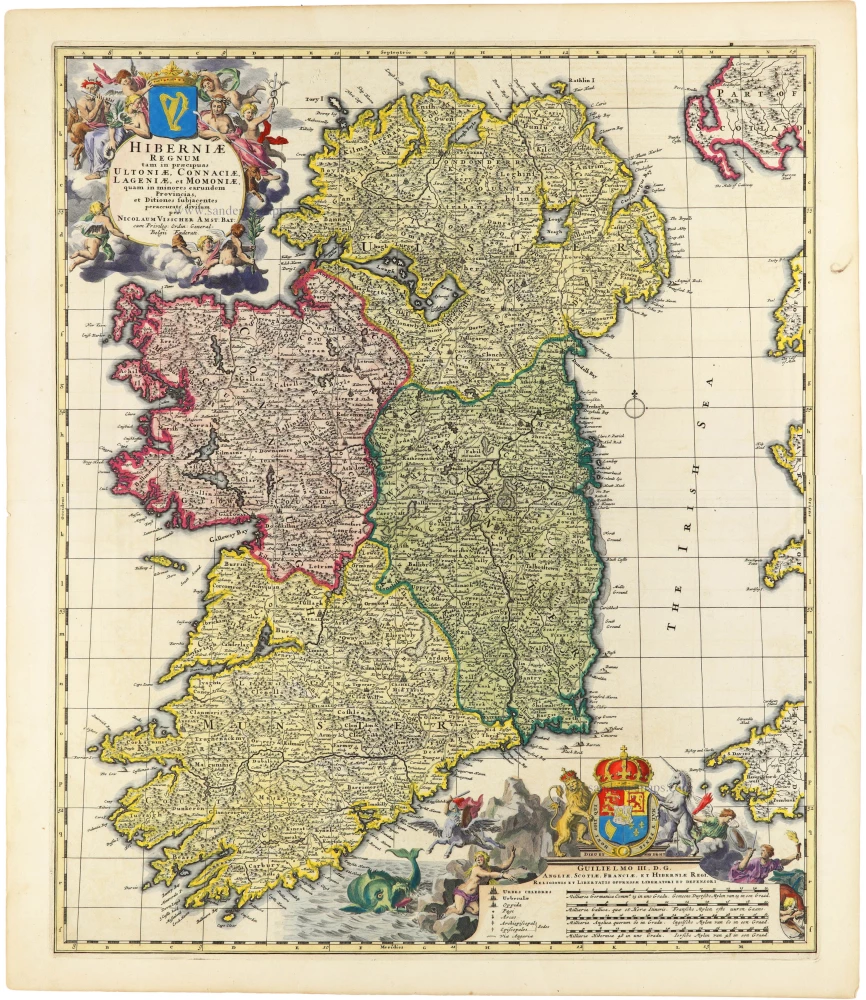
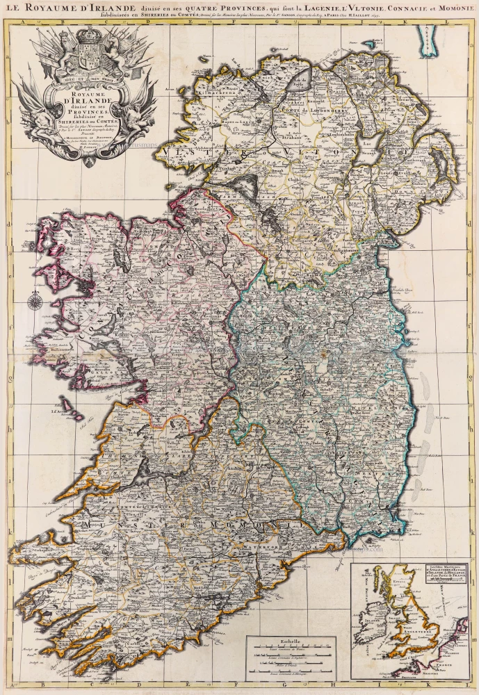
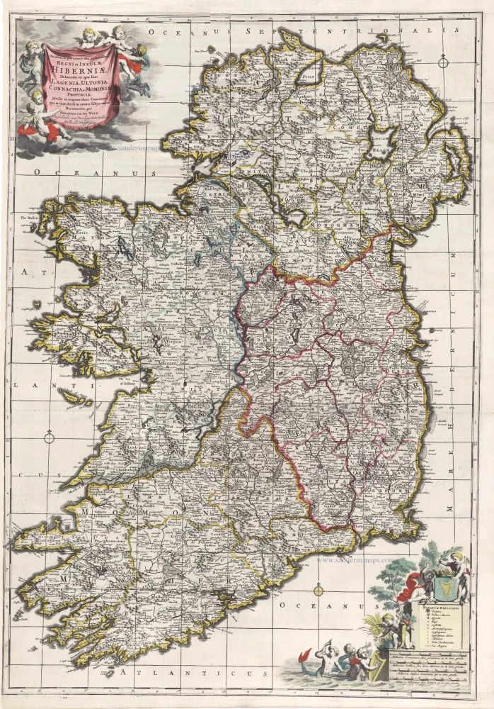
Ireland by Nicolas Visscher II c. 1705
Hiberniae Regnum tam in Praecipuas Ultoniae, Connaciae,...
[Item number: 32700]
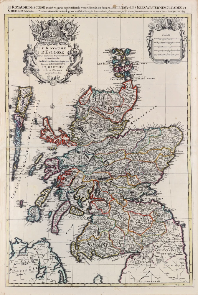
Scotland by N. Sanson, so-called published by Hubert Jaillot. (Pirated edition by Pierre Mortier). 1692
Le Royaume d'Escosse Divisé en Parties Septentrionale &...
[Item number: 31173]
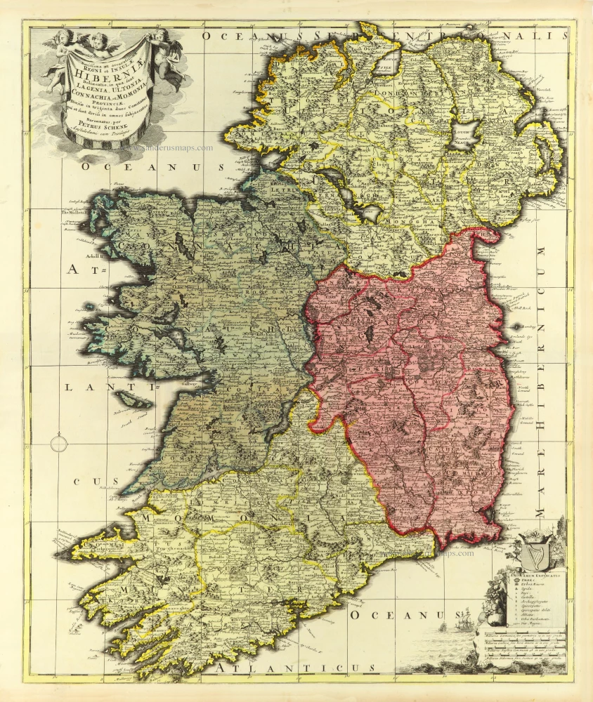
Ireland by Petrus Schenk. c. 1700
Novissima et accuratissima Regni et Insulae Hiberniae Delineatio...
[Item number: 32496]
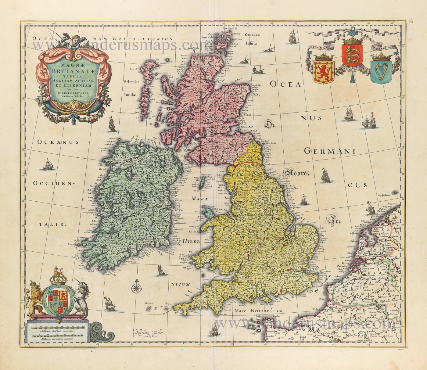
British Isles by Nicolaes Visscher I. 1677-80
Magnae Britanniae Tabula, Angliam, Scotiam, et Hiberniam...
[Item number: 28586]
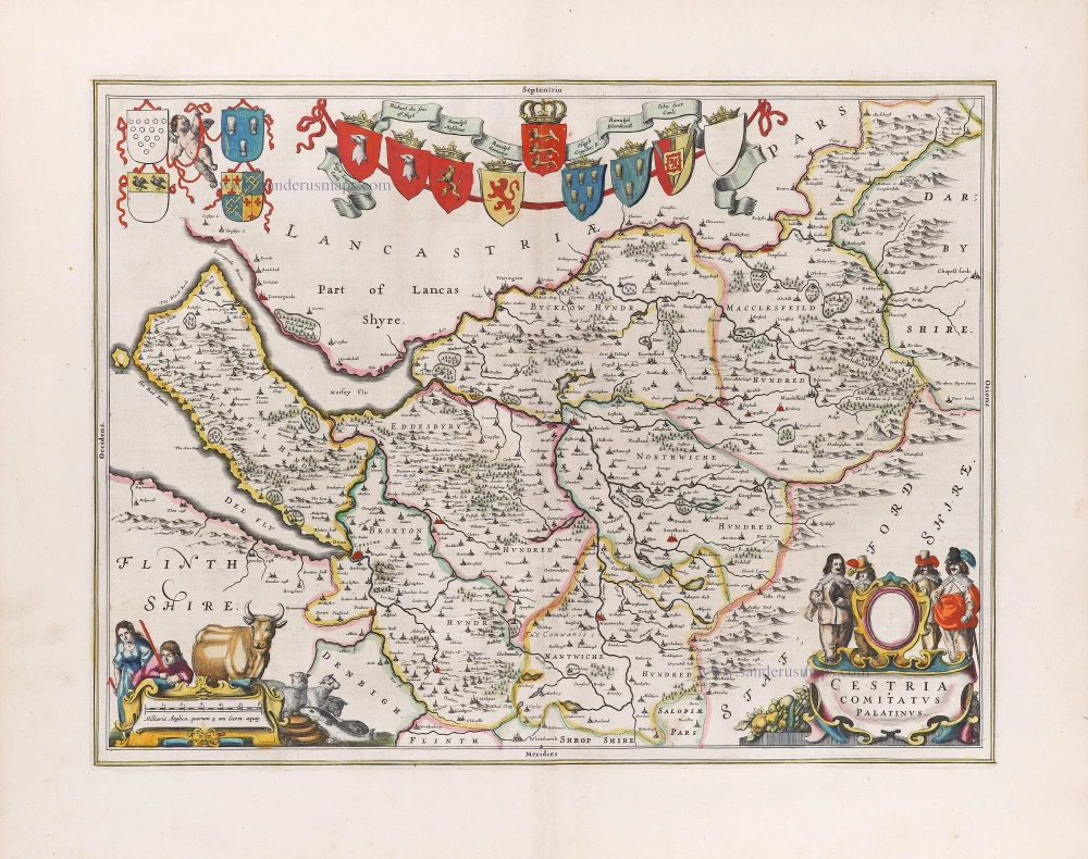
Cheshire by Joan Blaeu. 1645
Cestria Comitatus Palatinus.
[Item number: 29777]
Ireland by N. Sanson, so-called published by Hubert Jaillot. (Pirated edition by Pierre Mortier). 1692
Le Royaume d'Irlande Divisé en ses Provinces. Subdivisé en...
[Item number: 31171]
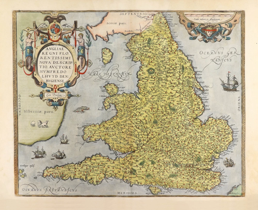
England by A. Ortelius. 1584
Angliae Regni Florentissimi nova descriptio.
[Item number: 30145]
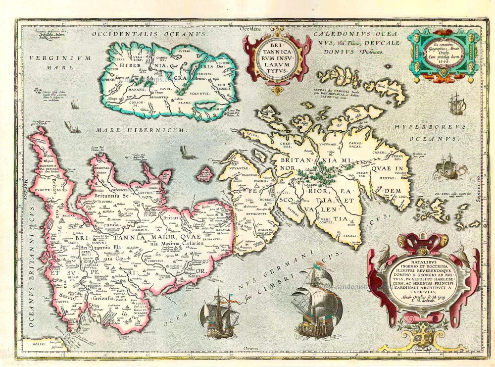
The British Isles, by Abraham Ortelius. 1624
Britannicarum Insularum Typus.
[Item number: 27469]
![Scotia - Parte Settentrionale. [in set with:] Parte Meridionale.](https://sanderusmaps.com/assets/WEBP/m28661.webp)
Scotland by Vincenzo Coronelli. 1696
Scotia - Parte Settentrionale. [in set with:] Parte Meridionale.
[Item number: 28661]
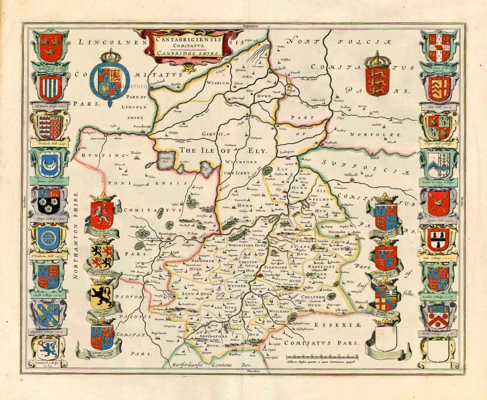
Cambridgeshire, by Joan Blaeu. 1645
Cantabrigiensis Comitatus; Cambridge Shire.
[Item number: 27571]
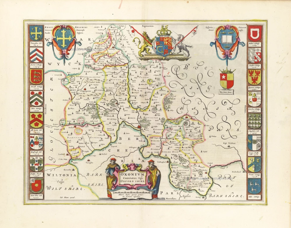
Oxfordshire by J. Blaeu 1645
Oxonium Comitatus, vulgo Oxford Shire.
[Item number: 29773]
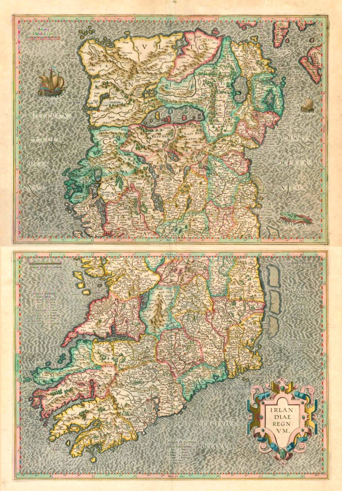
Ireland (North + South) (2 maps), by G. Mercator. 1623
Irlandiae Regnum .
[Item number: 2684]
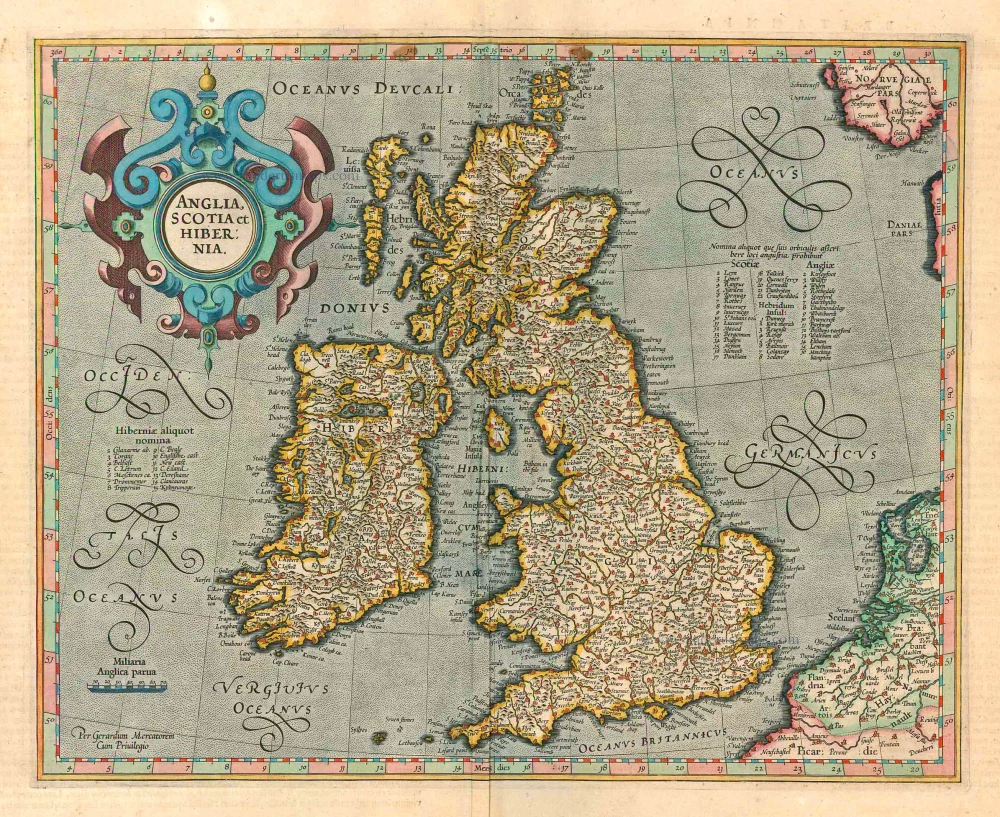
British Isles, by Gerard Mercator. 1623
Anglia, Scotia et Hibernia.
[Item number: 24894]
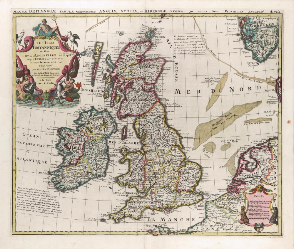
The British Isles by G. Delisle, published by Pierre Husson. c. 1709
Les Isles Britanniques ou sont le Rme d'Angleterre tiré de Sped...
[Item number: 29562]
Ireland by Frederik de Wit. c. 1691-97
Novissima ac Prae Caeteris Aliis Accuratissima Regni et Insulae...
[Item number: 29565]
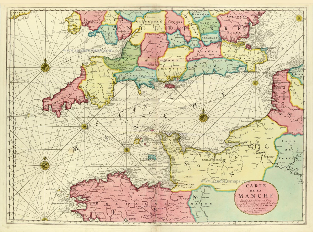
Channel, by Pierre Mortier. c. 1705
Carte de la Manche.
[Item number: 28001]

British Isles, by H. Jaillot c. 1705
Les Isles Britanniques; qui Contiennent les Royaumes...
[Item number: 27772]
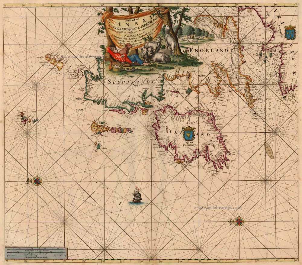
British Isles, by Van Keulen Johannes. 1697-1709
Paskaart van 't Canaal Engelandt Schotlandt en Yrland
[Item number: 5817]
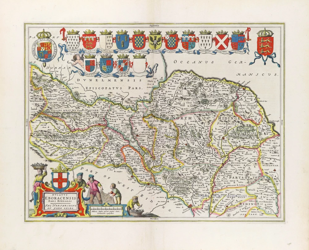
North Yorkshire, by Joan Blaeu. 1645
Ducatus Eboracensis Pars Borealis; The Northriding of Yorke...
[Item number: 29780]