Antique maps catalogue
- All recent additions
-
Antique maps
- Polar maps
- World
-
Europe
- Europe Continent
- Belgium
- Belgium - Cities
- The Low Countries
- The Netherlands
- The Netherlands - Cities
- Luxembourg
- France
- France - Cities
- Germany
- Germany - Cities
- Austria
- Italy
- Italy - Cities
- Spain and Portugal
- Greece & Greek Islands
- Switzerland
- British Isles
- British Isles - Cities
- Northern Europe
- Central Europe
- Eastern Europe
- Southeastern Europe
- America
- Asia
- Africa
- Mediterranean Sea
- Australia
- Oceans
- Celestial Maps
- Curiosities
- Title Pages
- Books
- Medieval manuscripts
- Prints
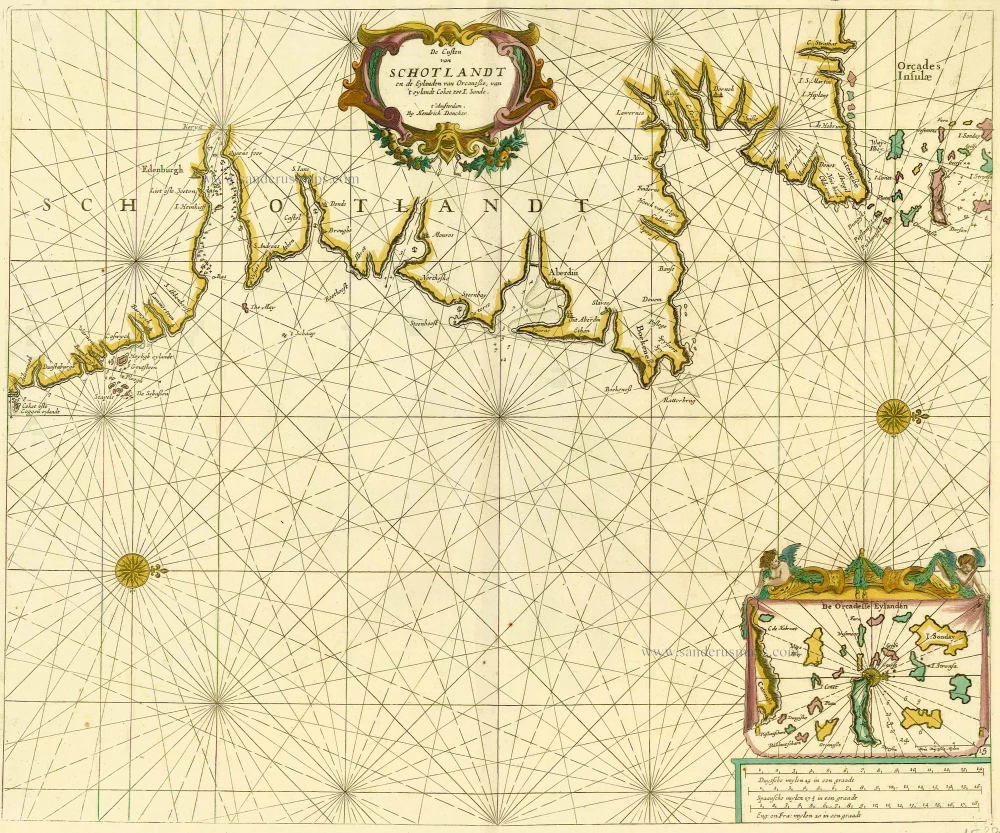
Scotland and Orkney Islands, by Doncker H. 1686
De Custen van Schotlandt en de Eylanden van Orcanese, van 't...
[Item number: 15386]
Heightened in gold
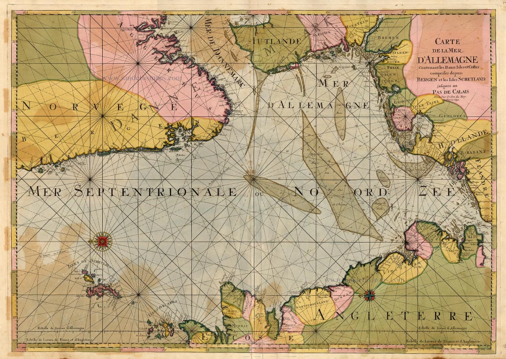
The North Sea by P. Mortier. 1693
Carte de la Mer d'Allemagne ...
[Item number: 15485]
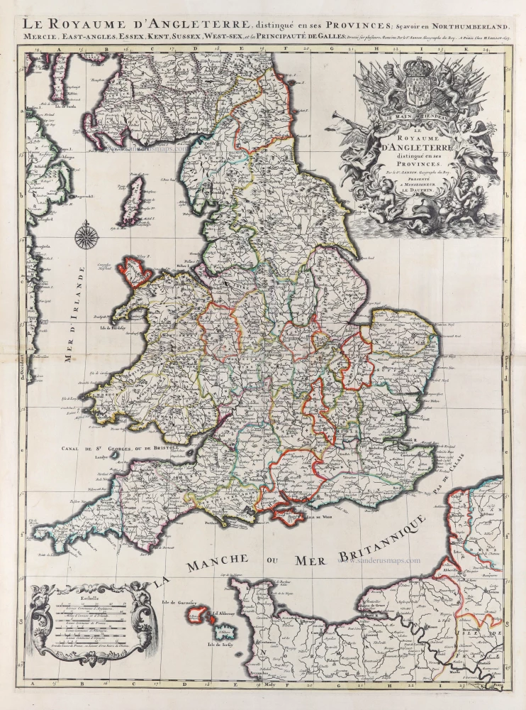
England and Wales by N. Sanson, so-called published by Hubert Jaillot. (Pirated edition by Pierre Mortier). 1692
Le Royaume d'Angleterre distingué en ses Provinces.
[Item number: 31409]
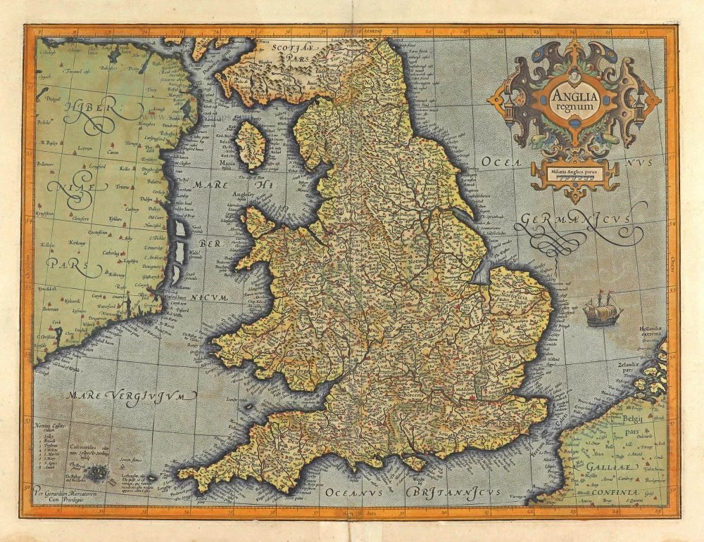
England, by Gerard Mercator. 1623
Anglia Regnum.
[Item number: 28132]

British Isles by N. Sanson, so-called published by Hubert Jaillot. (Pirated edition by Pierre Mortier). 1692 (Plate 2)
Les Isles Britanniques; qui Contiennent les Royaumes...
[Item number: 31175]
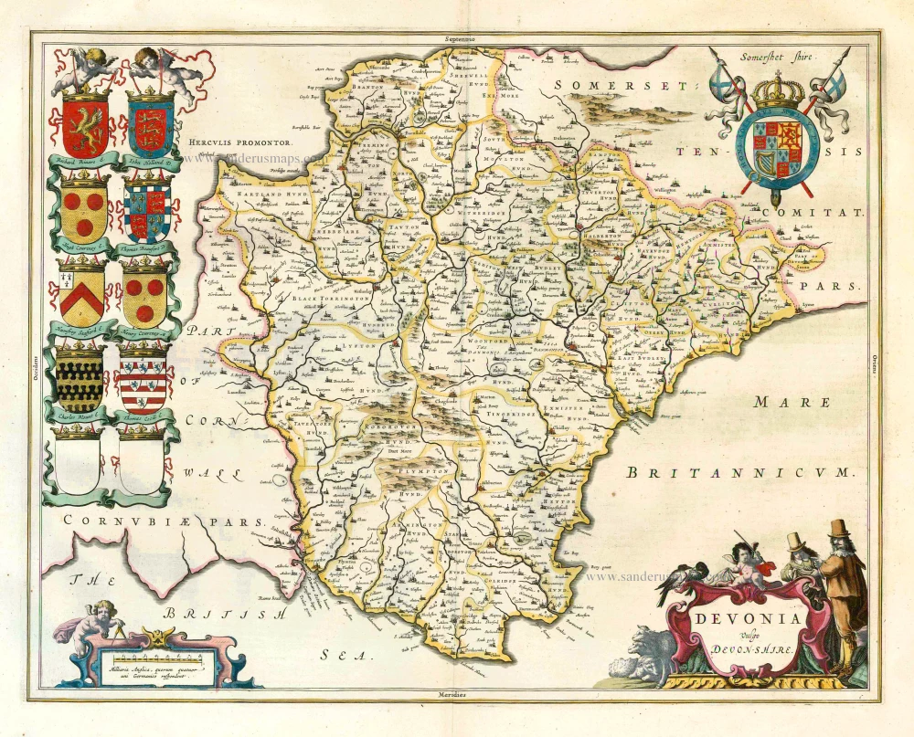
Devon, by J. Blaeu. 1645
Devonia vulgo Devon-Shire.
[Item number: 25749]
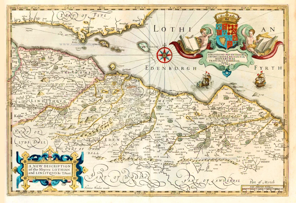
Lothian, by Henricus Hondius. 1641
A new description of the Shyres Lothian and Linlitquo. be T....
[Item number: 26241]
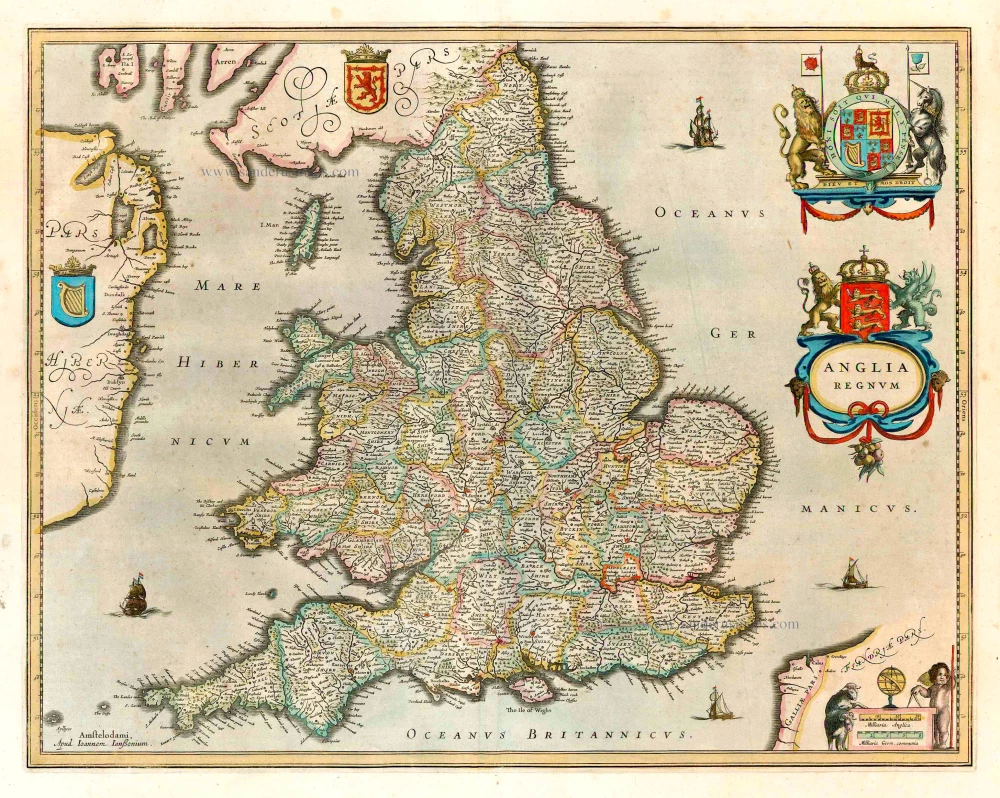
England, by Henricus Hondius. 1641
Anglia Regnum.
[Item number: 26242]
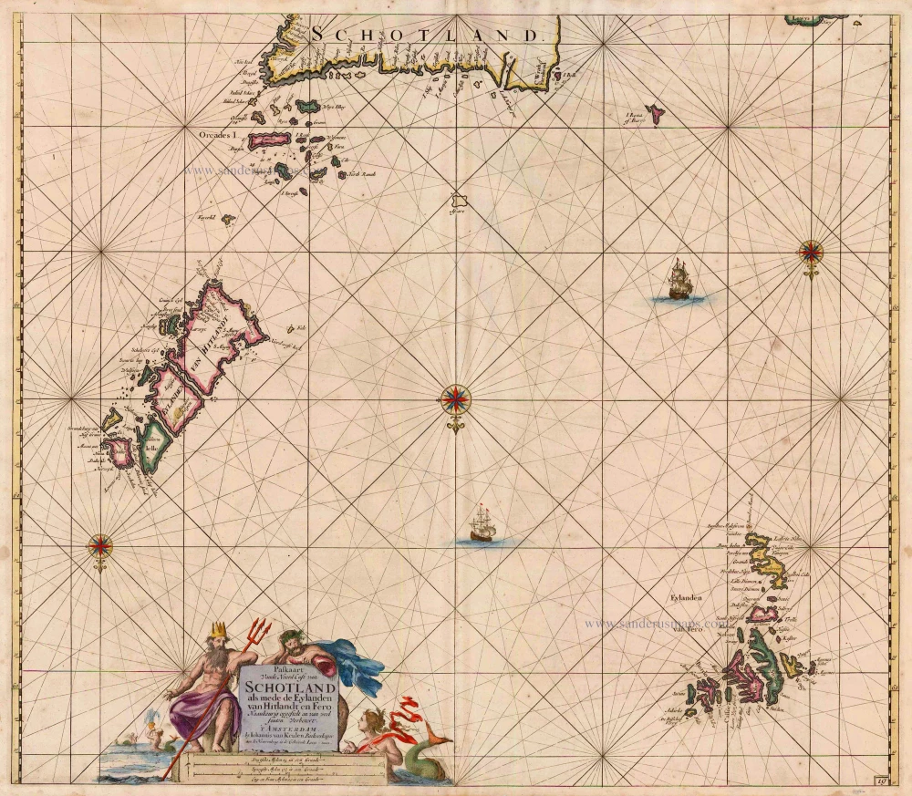
Northern Scotland, by Van Keulen Johannes. 1697-1709
Paskaart vande Noord Cust van Schotland als mede de Eylanden van...
[Item number: 5399]
![Bedfordiensis Comitatus, Anglis Bedford Shire [on sheet with] Buckinghamiensis Comitatus, Anglis Buckingham Shire.](https://sanderusmaps.com/assets/WEBP/m25760.webp)
Bedford and Buckinghamshire, by J. Blaeu. 1645
Bedfordiensis Comitatus, Anglis Bedford Shire [on sheet with]...
[Item number: 25760]
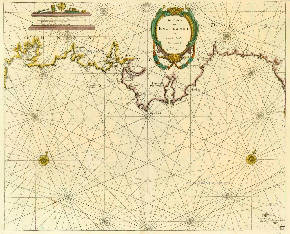
England, by Doncker H. 1686
De Custen van Engelandt van Poort landt tot Lezard.
[Item number: 16207]

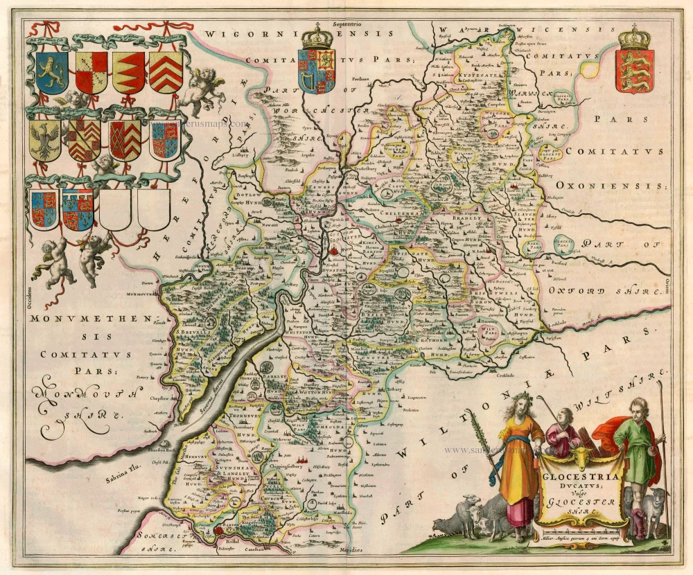
Worcester and Warwick, by J. Blaeu. 1645
Wigorniensis Comitatus et Comitatus Warwicensis; nec non...
[Item number: 32178]
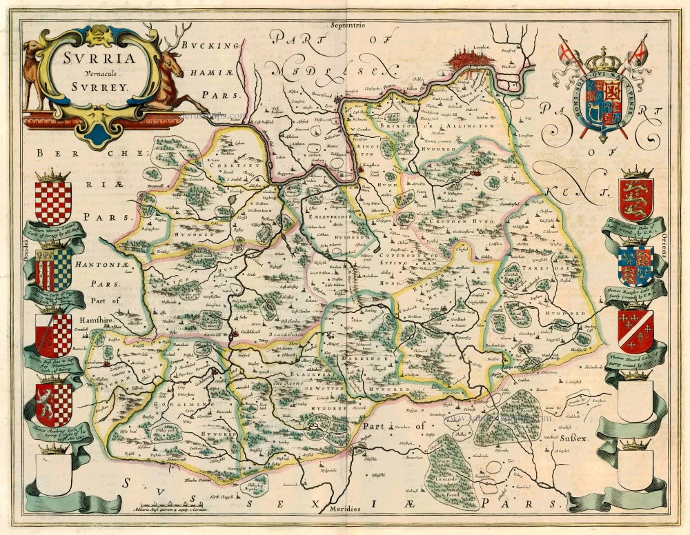
Surrey by Joan Blaeu. 1662
Surria vernacule Surrey
[Item number: 22812]
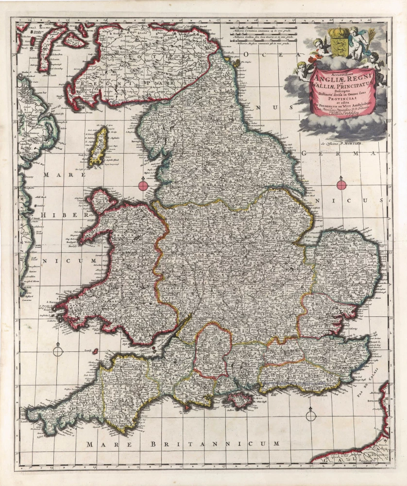
England & Wales by F. De Wit, published by Pierre Mortier. c. 1691-97
Accuratissima Angliae Regni et Walliae Principatus ...
[Item number: 29563]
Gloucester, by Joan Blaeu. 1662
Glocestria Ducatus; vulgo Glocester Shire
[Item number: 22813]
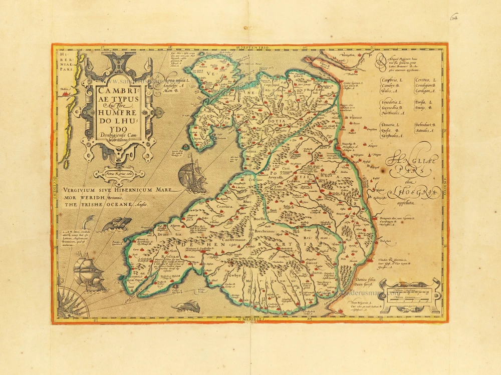
Wales, by Jodocus Hondius. c. 1610-1650
Cambriae Typus.
[Item number: 31014]
![Irlanda. - [Above map :] Descrittione dell'Isola d'Irlanda](https://sanderusmaps.com/assets/WEBP/m29734.webp)
Ireland, by Thomaso Porcacchi. 1590
Irlanda. - [Above map :] Descrittione dell'Isola d'Irlanda
[Item number: 29734]
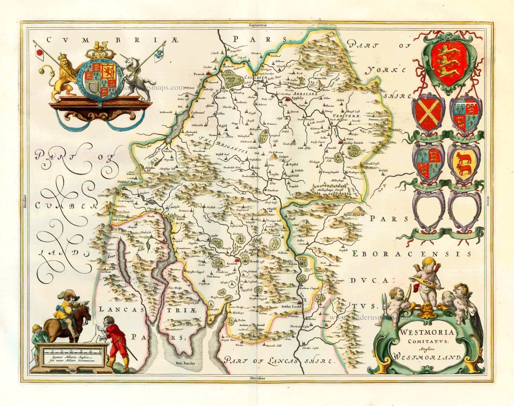
Westmoreland, by J. Blaeu. 1645
Westmoria Comitatus Anglice Westmorland.
[Item number: 25815]
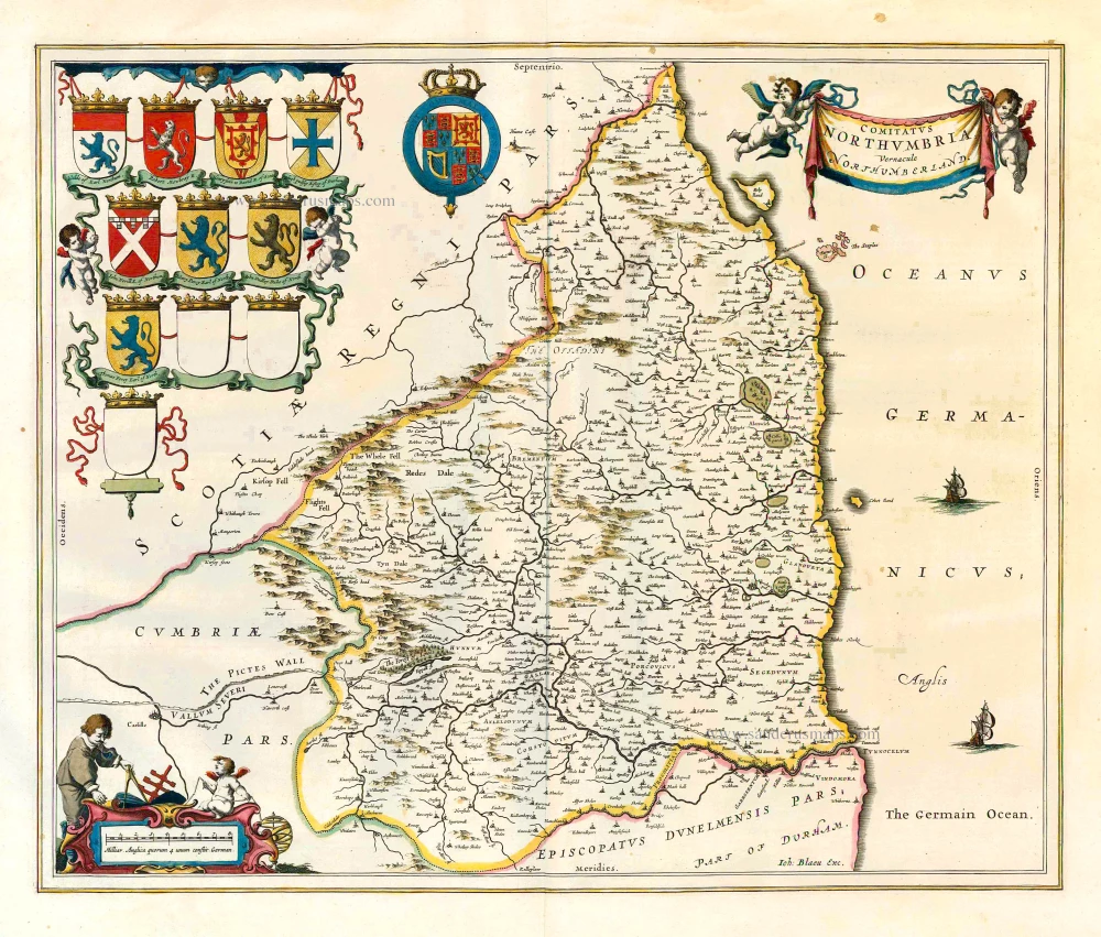
Northumberland, by J. Blaeu. 1645
Comitatus Northumbria; Vernacule Northumberland.
[Item number: 25804]
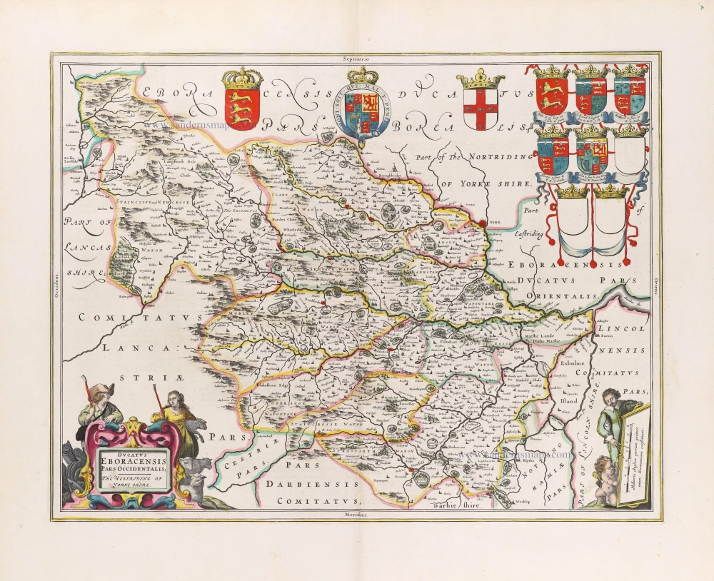
Yorkshire (West), by Blaeu J. 1645
Ducatus Eboracensis Pars Occidentalis; the Westriding of Yorke...
[Item number: 29779]
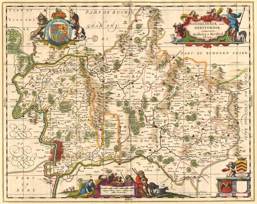
Hertfordshire & Middlesex, by Valk G. & Schenk P. c. 1700
Middelsexiae cum Hertfordiae Comita
[Item number: 1971]

Northampton, by Joan Blaeu. 1645
Comitatus Northantonensis Vernacule Northamtonshire.
[Item number: 26714]

First plate, first state of Homann's British Isles map.
British Isles by J.B. Homann. c. 1720
Magna Britannia complectens Angliae, Scotiae et Hiberniae Regna...
[Item number: 32162]
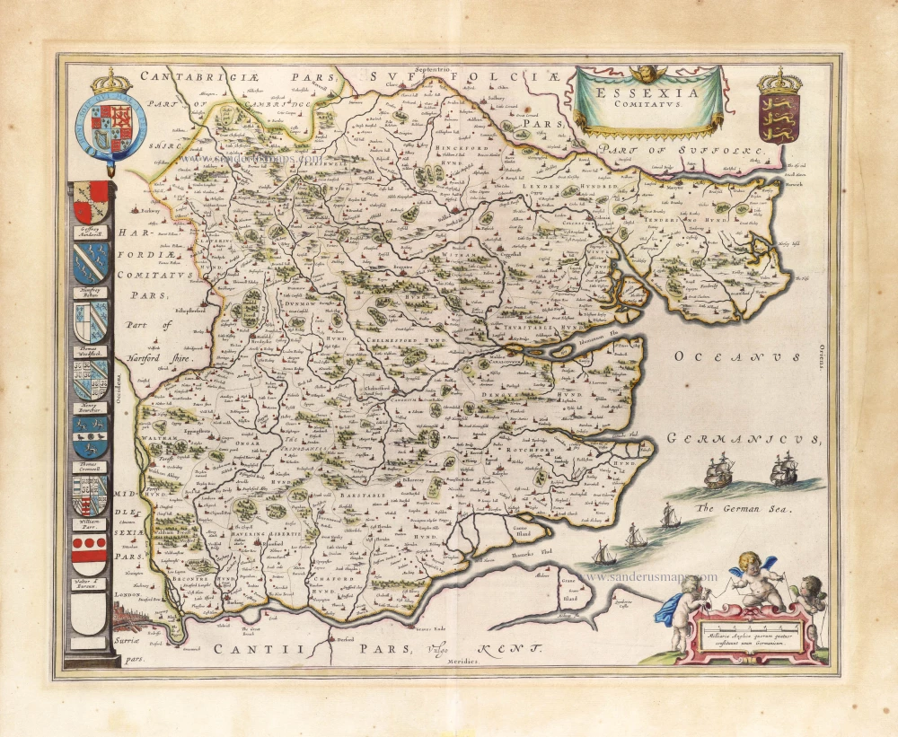
Essex, by J. Blaeu. 1646
Essexia Comitatus.
[Item number: 30234]

Scotland by Frederik de Wit, published by Covens & Mortier. After 1721
Scotia Regnum divisum in Partem Septentrionalem et Meridionalem.
[Item number: 28242]
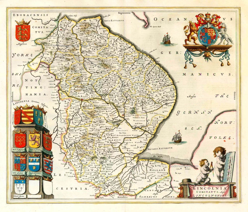
Lincolnshire, by J. Blaeu. 1645
Lincolnia Comitatus. Anglis Lincoln-shire.
[Item number: 25806]
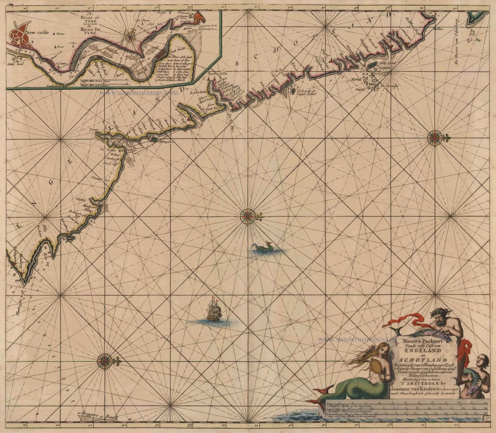
Sea chart of the East coast of England & Scotland, by Van Keulen Johannes 1697-1709
Nieuwe Paskaert vande Oost Cust van Engeland en Schotland...
[Item number: 8077]
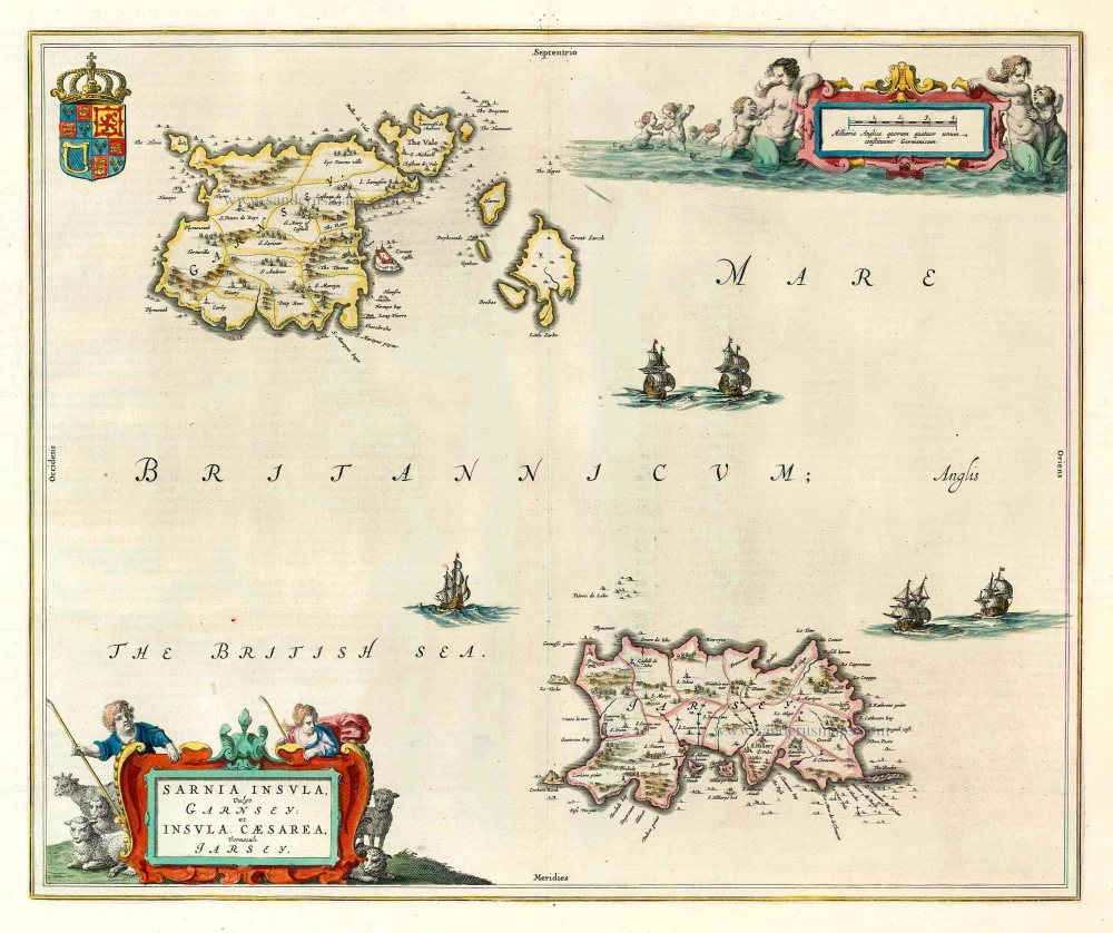
The Channel Islands, by J. Blaeu. 1645-48
Sarnia Insula, vulgo Garnsey: et Insula Caesarae, vernacule...
[Item number: 24640]

Northern England, by Frederick de Wit. ca. 1691-93
Tractus Regni Angliae Septentrion, in quo Ducatus Eboracensis,...
[Item number: 29031]
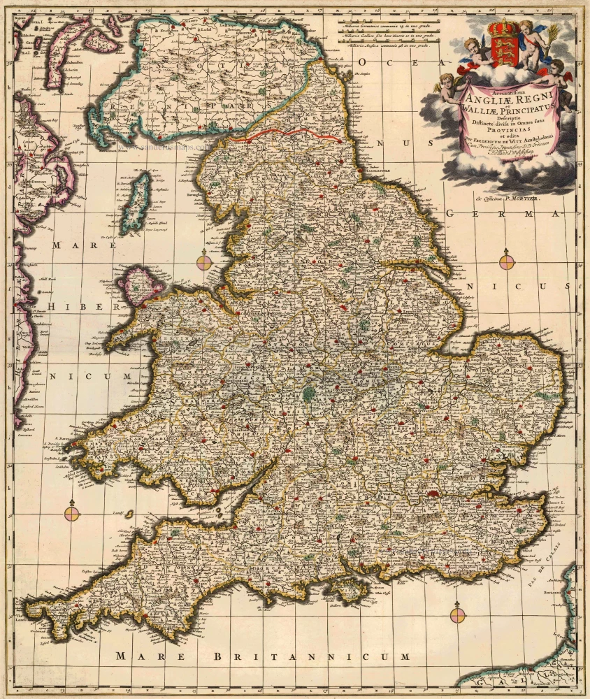
England & Wales, by F. De Wit, published by Pierre Mortier. c. 1715
Accuratissima Angliae Regni et Walliae Principatus ...
[Item number: 13684]
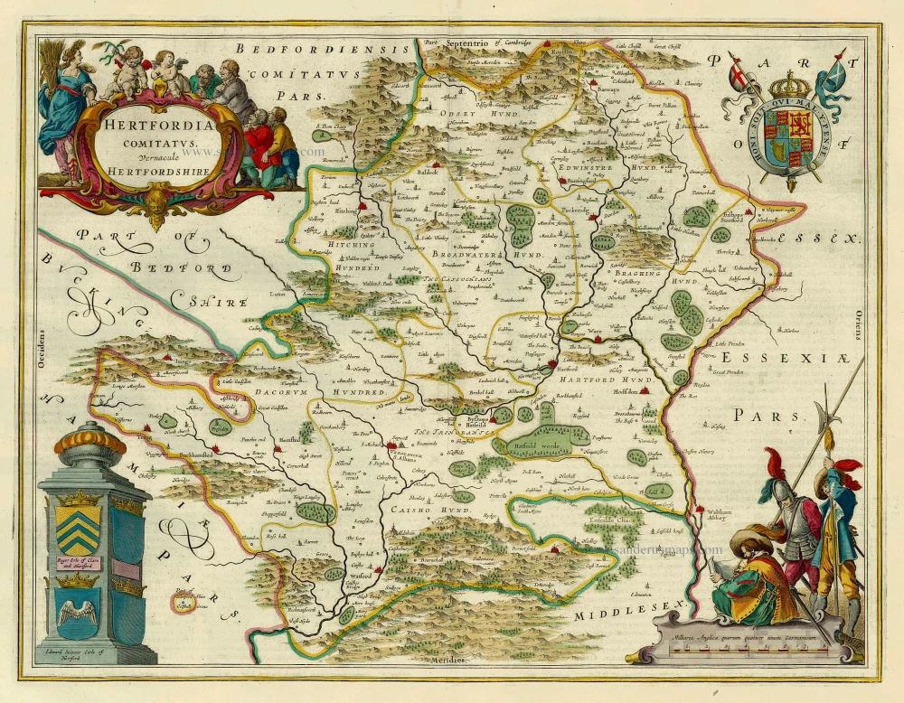
Hertford by J. Blaeu. 1654-1662
Hertfordia Comitatus. Vernacule Hertfordshire.
[Item number: 8107]
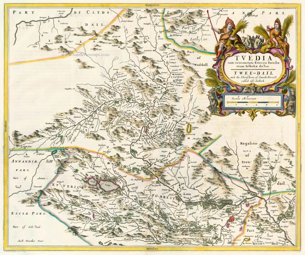
Scotland - Selkirk (Tweedail), by J. Blaeu. 1664-65
Tuedia cum Vicecomitatu Etterico Forestrae etiam Selkirkae...
[Item number: 13075]
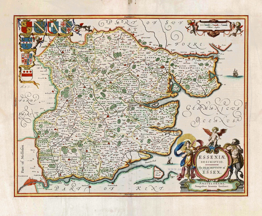
Essex, by Johannes Janssonius. 1666
Essexiae Descriptio. - The Description of Essex.
[Item number: 27303]
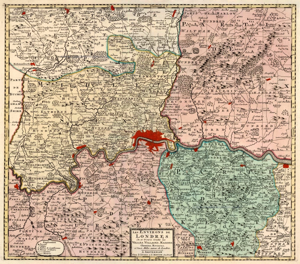
London, by Covens & Mortier. 1721-41
Les Environs de Londres Ou se trouve toutte les Villes,...
[Item number: 23728]
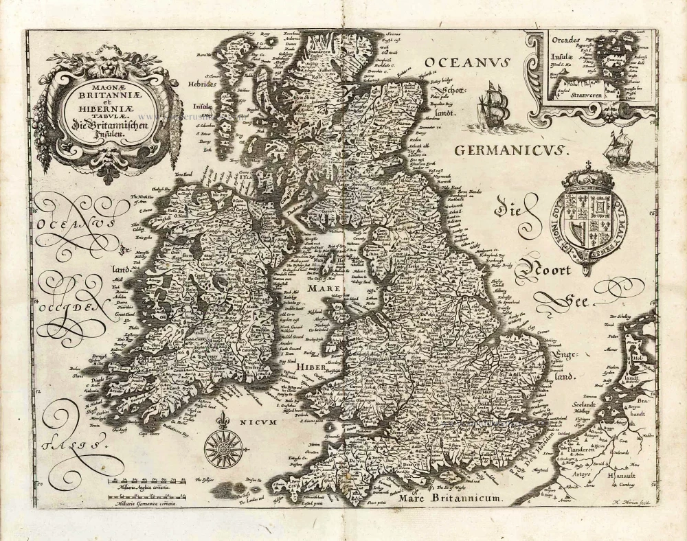
The British Isles, by M. Merian. 1638
Magnae Britanniae et Hiberniae Tabulae. - Die Britannischen...
[Item number: 25904]
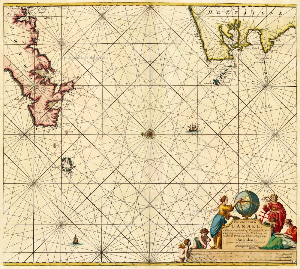
The Channel, by Van Keulen Johannes. 1697-1709
Pas-Caert van de Canael, tusschen Engelandt en Vranckryck, van...
[Item number: 14588]