Antique maps catalogue
- All recent additions
-
Antique maps
- World and Polar
-
Europe
- Europe Continent
- Belgium
- Belgium - Cities
- The Low Countries
- The Netherlands
- The Netherlands - Cities
- Luxembourg
- France
- France - Cities
- Germany
- Germany - Cities
- Austria
- Italy
- Italy - Cities
- Spain and Portugal
- Greece & Greek Islands
- Switzerland
- British Isles
- British Isles - Cities
- Northern Europe
- Central Europe
- Eastern Europe
- Southeastern Europe
- America
- Asia
- Africa
- Mediterranean Sea
- Australia
- Oceans
- Celestial Maps
- Curiosities
- Books
- Medieval manuscripts
- Prints
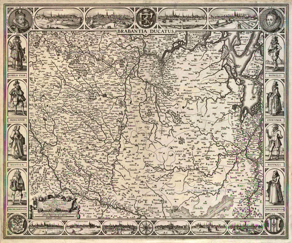
Brabant by C.J. Visscher. 1622
Brabantia Ducatus / Tabula Ducatus Brabantiae Continens ...
[Item number: 2640]
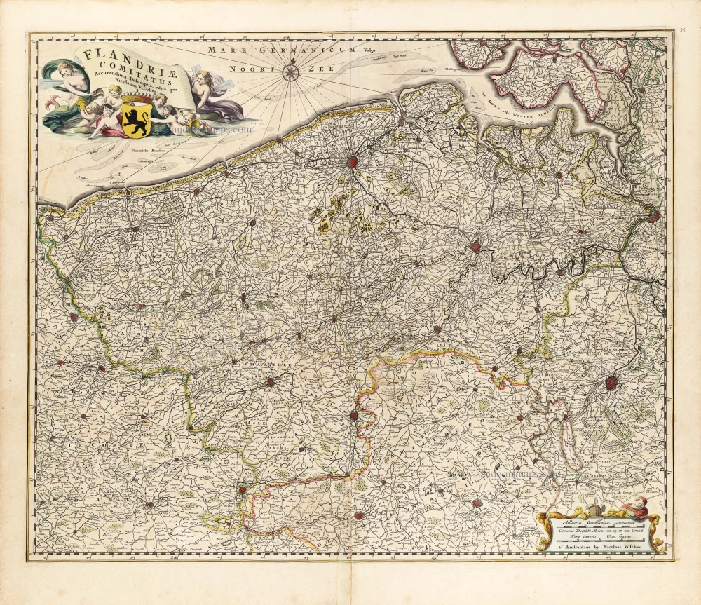
Flanders (Vlaanderen) by Nicolaas Visscher I. c. 1658
Flandriae Comitatus Accuratissima Descriptio.
[Item number: 29980]

Liège, by N. Visscher. 1683-1696
Leodiensis Episcopatus pars Media
[Item number: 13094]
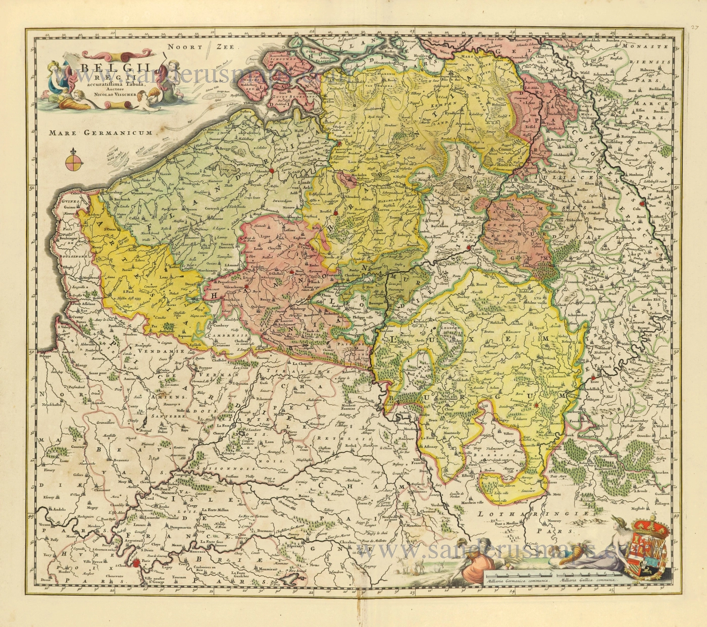
Southern Netherlands (Zuidelijke Nederlanden) by Nicolaes Visscher I. c. 1678
Belgii Regii accuratissima Tabula.
[Item number: 28518]
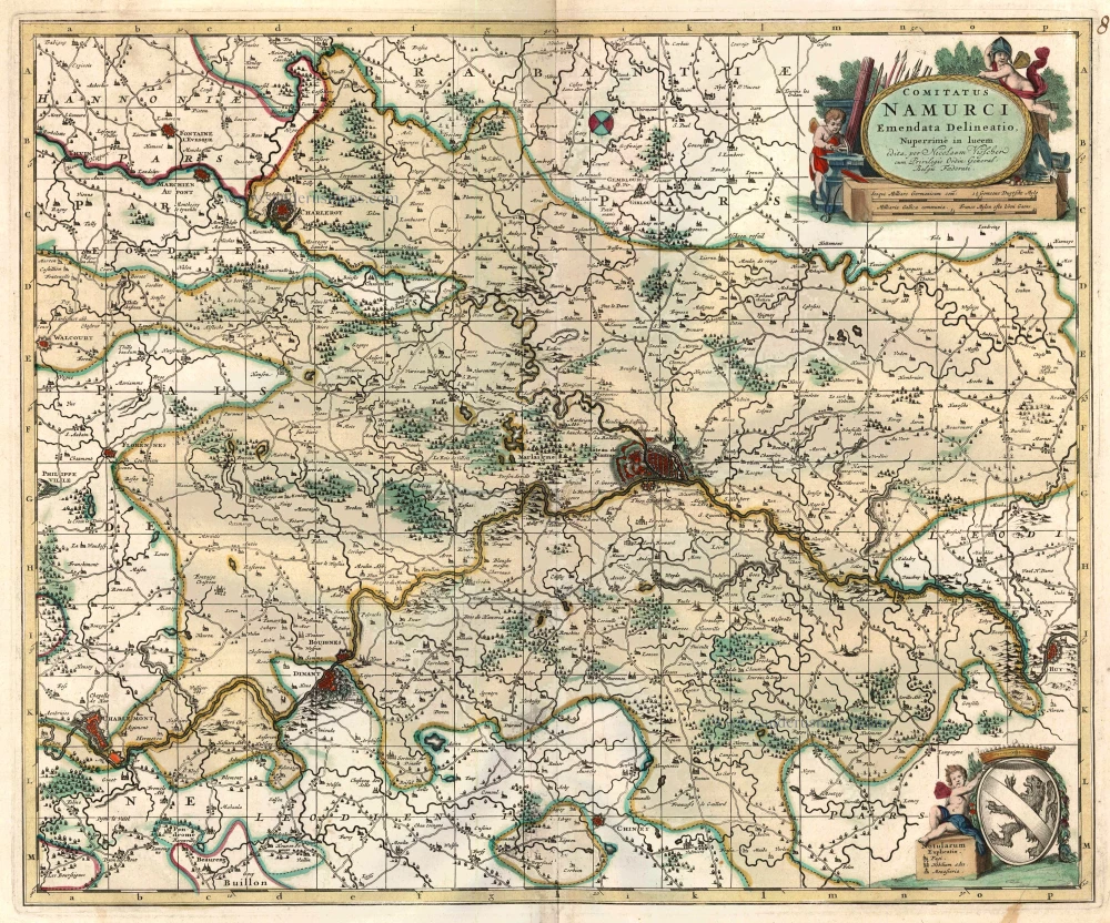
Namur, by N. Visscher 1683-1696
Comitatus Namurci
[Item number: 24453]
![Typus octo longaru[m] naviu[m]. Anno M.VI.c.II ab Hispaniae rege missaru[m] ad Oceanum Belgicum infestandu[m]. quarum naviu[m] quatuor Angloru[m] atq³ Hollandoru[m] virtute conquassatae sunt et submersae: ceterae naufragio periere.](https://sanderusmaps.com/assets/WEBP/m26804.webp)
Very important naval print.
Defeat of Spanish galleys by an Anglo-Dutch naval force off the coast of Flanders, 3-4 Oct. 1602. by Willem Blaeu c. 1602
Typus octo longaru[m] naviu[m]. Anno M.VI.c.II ab Hispaniae rege ...
[Item number: 26804]
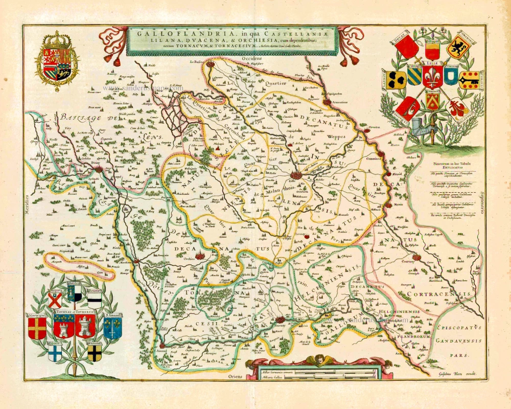
Gallo-Flandria, by Willem Blaeu. 1643
Galloflandria in qua Castellaniae Lilana, Duacena, &Orchiesa, ...
[Item number: 27125]

Flanders (Vlaanderen) and Zeeland, by Willem Blaeu. 1640-43
Flandria et Zeelandia Comitatus.
[Item number: 27409]
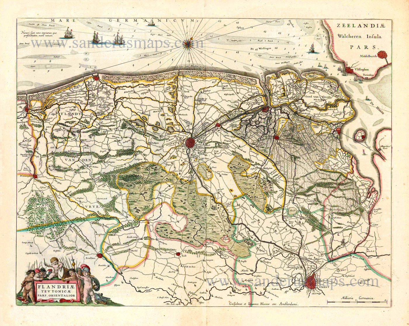
North West Flanders, by Willem & Joan Blaeu. 1643
Flandriae Teutonicae Pars Orientalior.
[Item number: 27403]
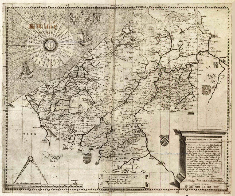
Flanders (Vlaanderen) by Domenico Zenoi. 1559
Exactissima Flandriae descriptio. Flandria, Caroli V. Aug. Imp. ...
[Item number: 25774]