Antique maps catalogue
- All recent additions
-
Antique maps
- World and Polar
-
Europe
- Europe Continent
- Belgium
- Belgium - Cities
- The Low Countries
- The Netherlands
- The Netherlands - Cities
- Luxembourg
- France
- France - Cities
- Germany
- Germany - Cities
- Austria
- Italy
- Italy - Cities
- Spain and Portugal
- Greece & Greek Islands
- Switzerland
- British Isles
- British Isles - Cities
- Northern Europe
- Central Europe
- Eastern Europe
- Southeastern Europe
- America
- Asia
- Africa
- Mediterranean Sea
- Australia
- Oceans
- Celestial Maps
- Curiosities
- Books
- Medieval manuscripts
- Prints
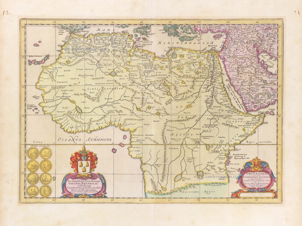
Africa, by Janssonius à Waesberghe. 1684
Africae Antiquae, et quarundam Europae, Asiaeque Adiacentium ...
[Item number: 10916]
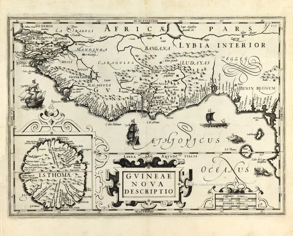
Guinea by Olfert Dapper. 1676
Guineae Nova Descriptio.
[Item number: 31122]
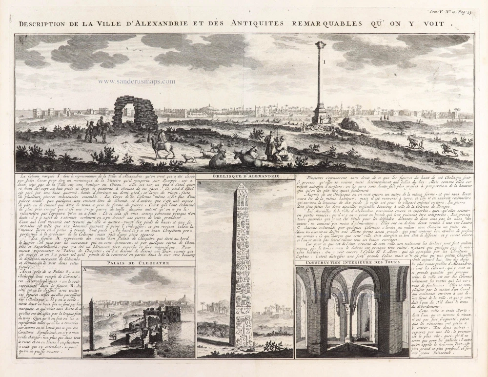
Alexandria (Egypt), by Z. Châtelain. 1719
Description de la Ville d'Alexandrie et des Antiquites ...
[Item number: 29382]

Algeria by Nicolas Sanson. 1658
Partie de la Barbarie, ou est le Royaume d'Alger dicisé en ses ...
[Item number: 28478]
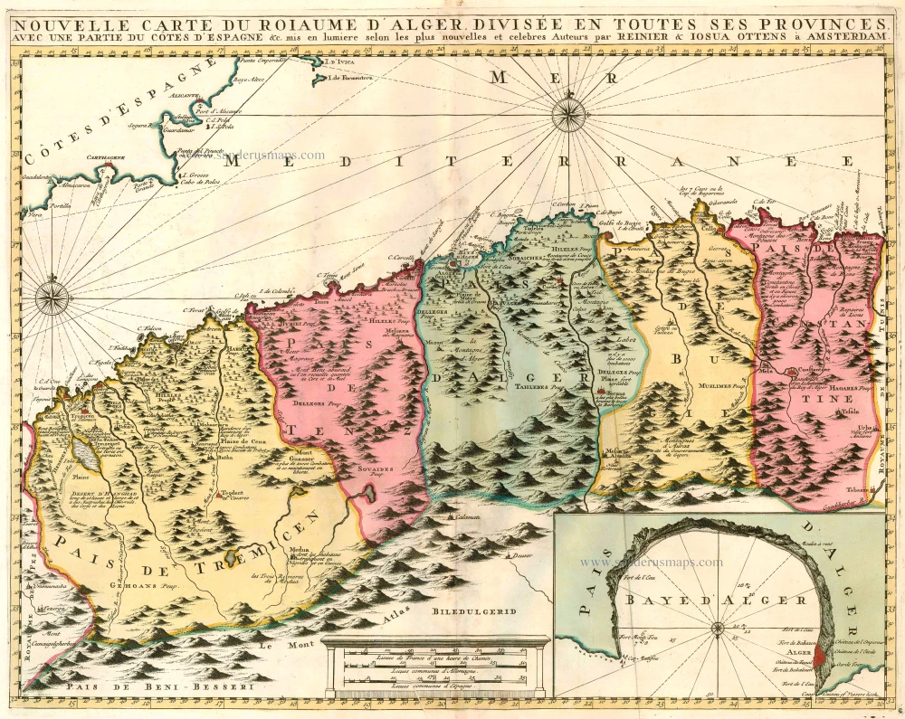
Northern Africa - Algeria (Algiers) by Ottens R. & J. 1756
Nouvelle Carte du Roiaume d'Alger, divisée en toutes ses ...
[Item number: 23495]
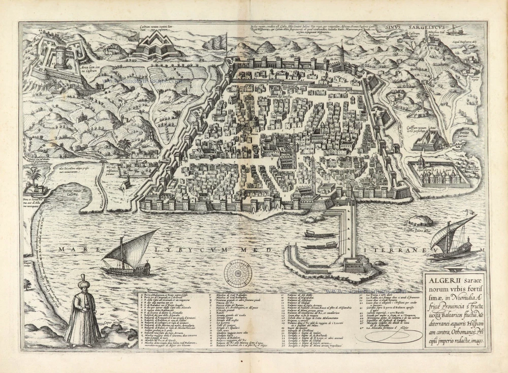
Algeria (Algiers), by Georg Braun & Frans Hogenberg. 1576
Algerii Saracenorum Urbis Fortissimae,
[Item number: 28052]
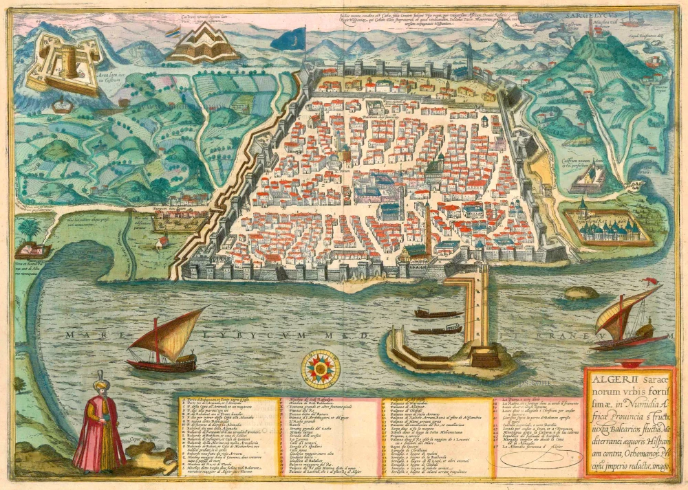
Algiers, by Georg Braun and Frans Hogenberg. 1575-1612
Algerii Saracenorum Urbis Fortissimae ...
[Item number: 23292]

Algiers (Algeria) by J. Peeters. c. 1690
Algiers
[Item number: 31365]
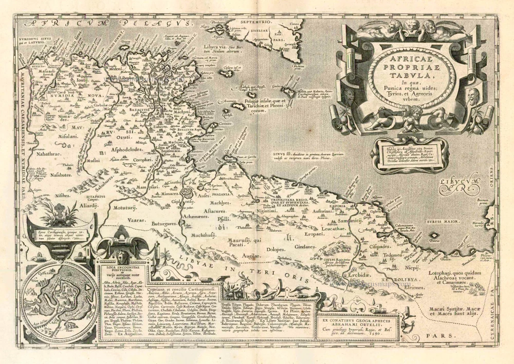
Ancient Northern Africa, by Ortelius A. 1624
Africae Propriae Tabula.
[Item number: 2053]
Parergon map
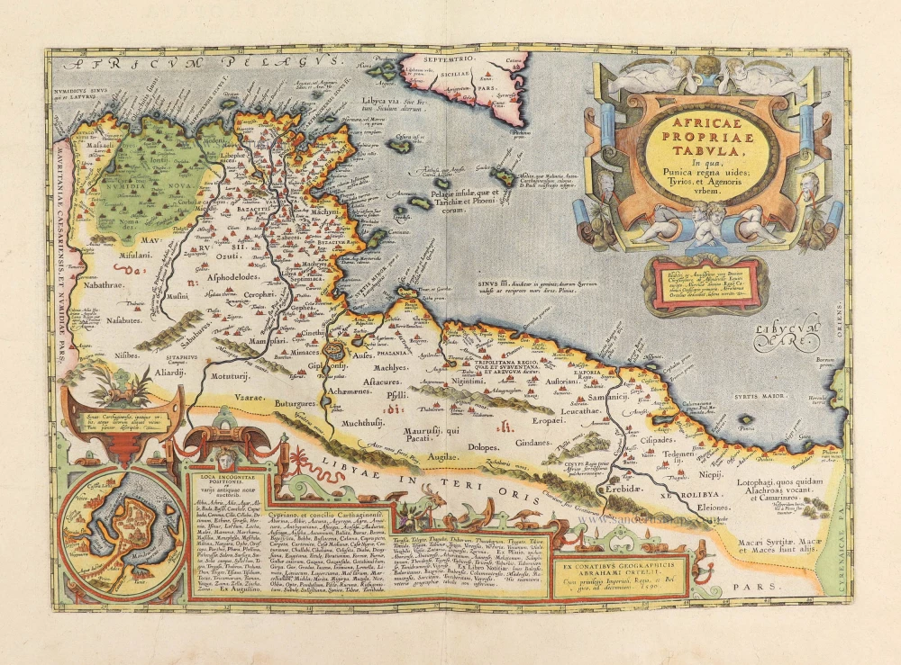
Abraham Ortelius, Ancient Northern Africa. 1609
Africae Propriae Tabula, In qua, Punica regna vides; Tyrios, et ...
[Item number: 29348]
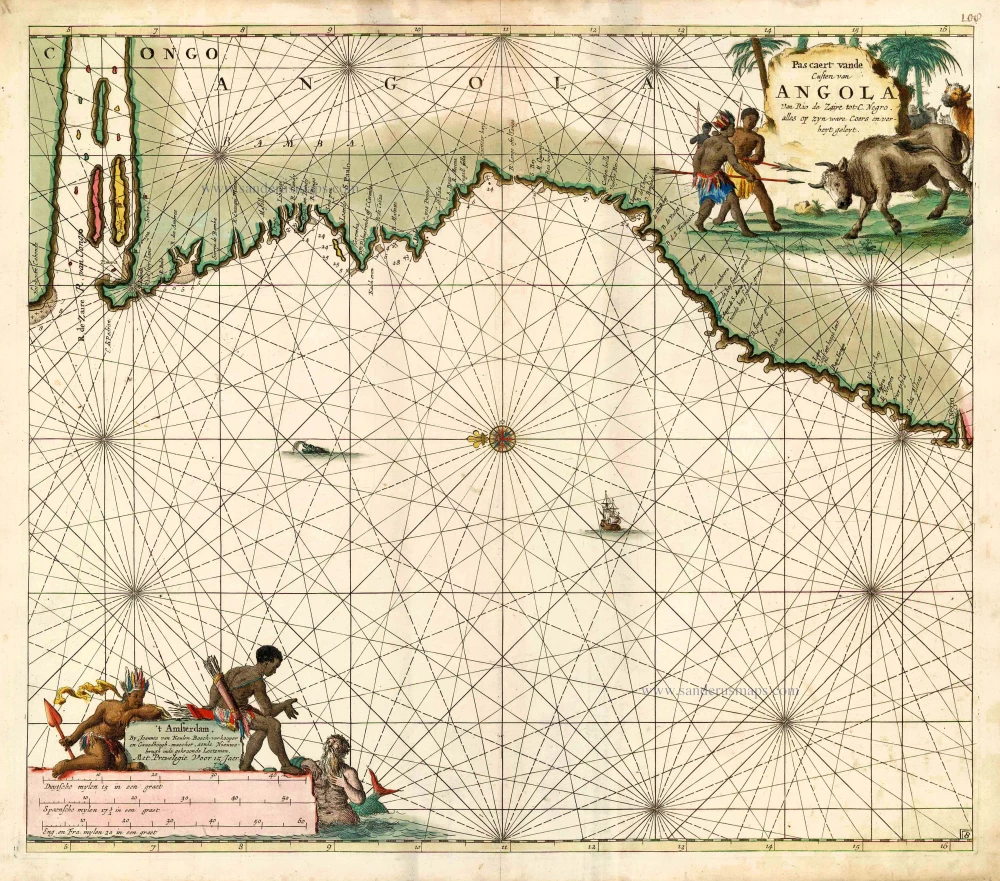
Sea chart of Angola, by J. Van Keulen. 1683
Pas Caert vande Custen van Angola van Rio de Zaire tot C. Negro.
[Item number: 16003]
SCARCE !
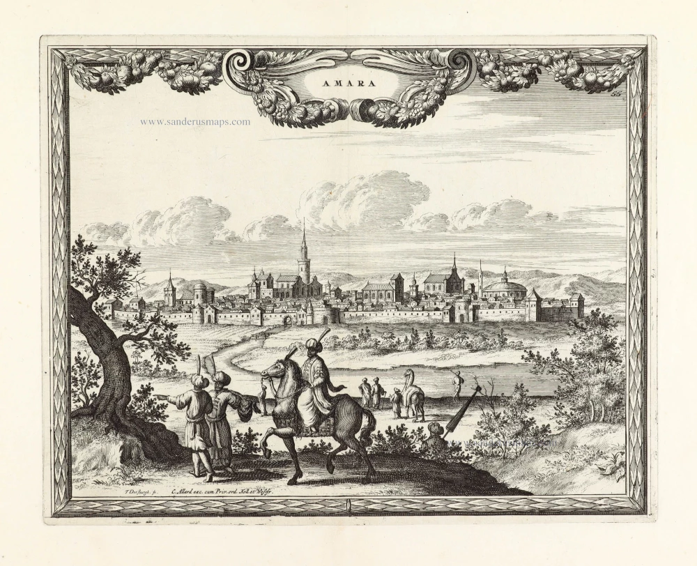
View of Asmara (Eritrea), by Carel Allard. 1685/90
Amara.
[Item number: 30579]
![[No title]](https://sanderusmaps.com/assets/WEBP/m27086.webp)
Rare.
Atlantic Ocean - Europe, Africa & Eastern Canada by Giovanni Francesco Camocio c. 1575
[No title]
[Item number: 27086]
![Cairus quae olim Babylon Aegypti Maxima Urbs. [Above the map :] Le grand Caire.](https://sanderusmaps.com/assets/WEBP/m27379.webp)
Cairo, by François de Belleforest. 1575
Cairus quae olim Babylon Aegypti Maxima Urbs. [Above the map :] ...
[Item number: 27379]

Cairo, by Georg Braun and Frans Hogenberg. 1599
Cairus, quae olim Babylon; Aegypti Maxima Urbs
[Item number: 23951]
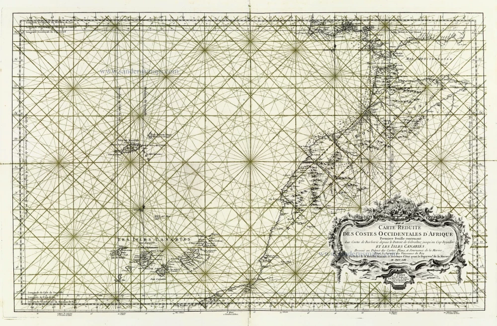
Canary Islands - Madeira , by J.N. Bellin. 1756-1770
Carte Reduite des Costes Occidentales d'Afrique ... et les Isles ...
[Item number: 28116]
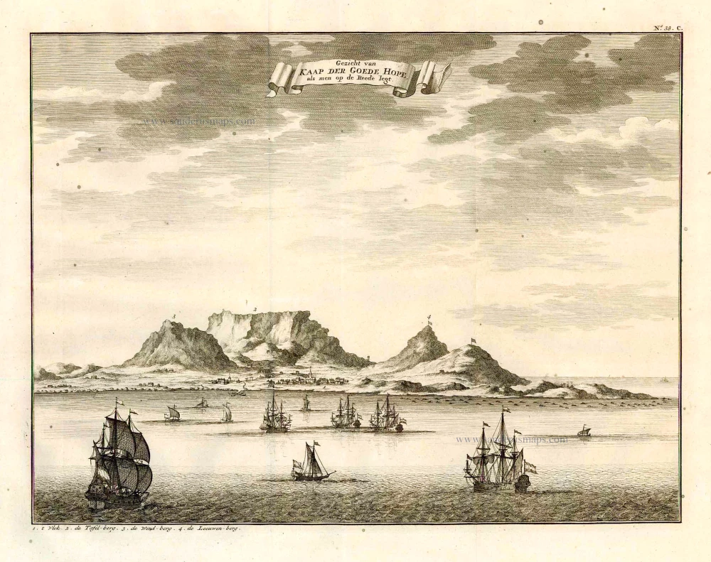
Cape of Good Hope by François Valentyn (Valentijn) 1724-26
Gezicht van Kaap der Goede Hope, als men op de Reede legt.
[Item number: 26879]

Cape Verde Islands, by Pieter van der Aa. 1713
Les Iles du Cap Verd, nommées par quelques Auteurs Iles de Sel.
[Item number: 26164]
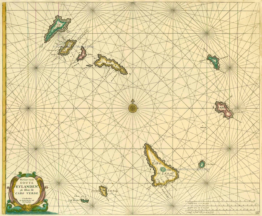
Cape Verde Islands, by Doncker H. 1686
Pas-Caart vande Soute Eylanden ofte Ilhas de Cabo Verde
[Item number: 13643]
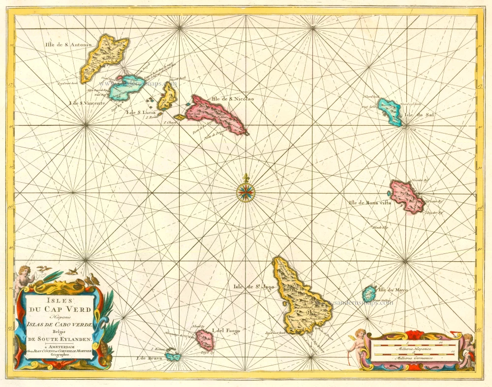
Cape Verde Islands, by Covens & Mortier. 1721-41
Isles du Cap Verd Hispanis Islas de Cabo Verde Belgis de Soute ...
[Item number: 23621]
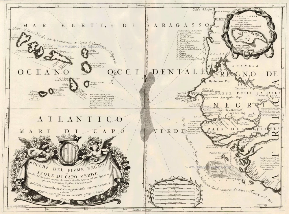
Cape Verde Islands, by Coronelli V.M. 1691
Bocche del Fiume Negro et Isole di Capo Verde
[Item number: 23167]
![Anfa, quibusdam Anaffa [on sheet with] Azaamurum [and] Diu [and] Goa](https://sanderusmaps.com/assets/WEBP/m23246.webp)
Casablanca (Anfa) - Azemmour (Azamor) - Diu - Old Goa (Velha Goa), by Georg Braun and Frans Hogenberg. 1599
Anfa, quibusdam Anaffa [on sheet with] Azaamurum [and] Diu [and] ...
[Item number: 23246]
![Anfa, quibusdam Anaffa [on sheet with] Azaamurum [and] Diu [and] Goa.](https://sanderusmaps.com/assets/WEBP/m25333.webp)
Casablanca (Anfa) - Azemmour (Azamor) - Diu - Old Goa (Velha Goa), by Braun & Hogenberg. 1582
Anfa, quibusdam Anaffa [on sheet with] Azaamurum [and] Diu [and] ...
[Item number: 25333]
![Anfa, quibusdam Anaffa [on sheet with] Azaamurum [and] Diu [and] Goa.](https://sanderusmaps.com/assets/WEBP/m28048.webp)
Casablanca - Azimur - Diu - Goa, by Georg Braun & Frans Hogenberg. 1574
Anfa, quibusdam Anaffa [on sheet with] Azaamurum [and] Diu [and] ...
[Item number: 28048]

Central Africa by Henricus Hondius 1641
Abissinorum Sive Pretiosi Ioannis Imperiu.
[Item number: 26451]
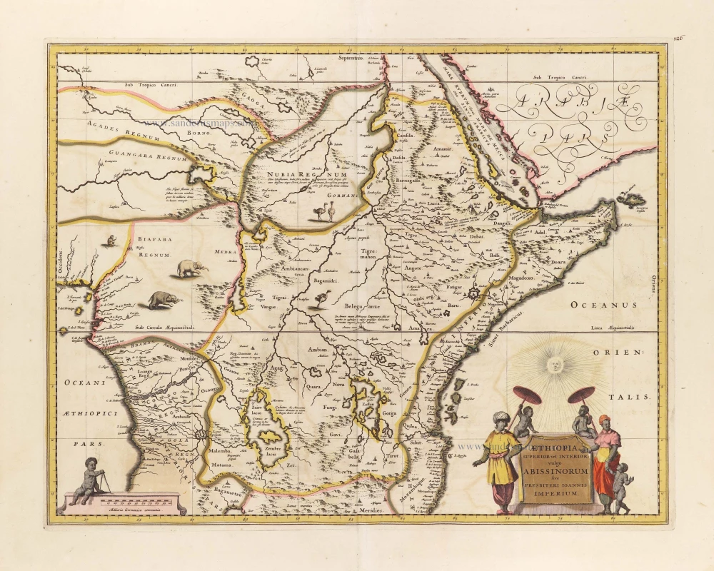
East and Central Africa, by Frederick de Wit. c. 1705
Aethiopia Superior vel Interior; vulgo Abissinorum sive ...
[Item number: 29162]
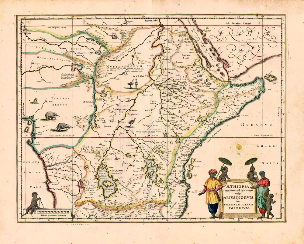
East and Central Africa, by Willem Blaeu. 1640
Aethiopia Superior vel Interior; vulgo Abissinorum sive ...
[Item number: 27693]
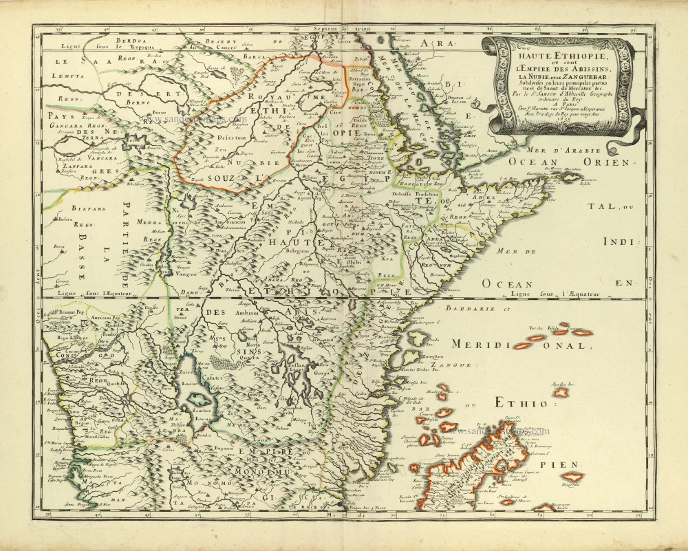
Central and eastern Africa by Nicolas Sanson 1658
Haute Ethiopie, ou sont l'Empire des Abissins, La Nubie, et le ...
[Item number: 28437]
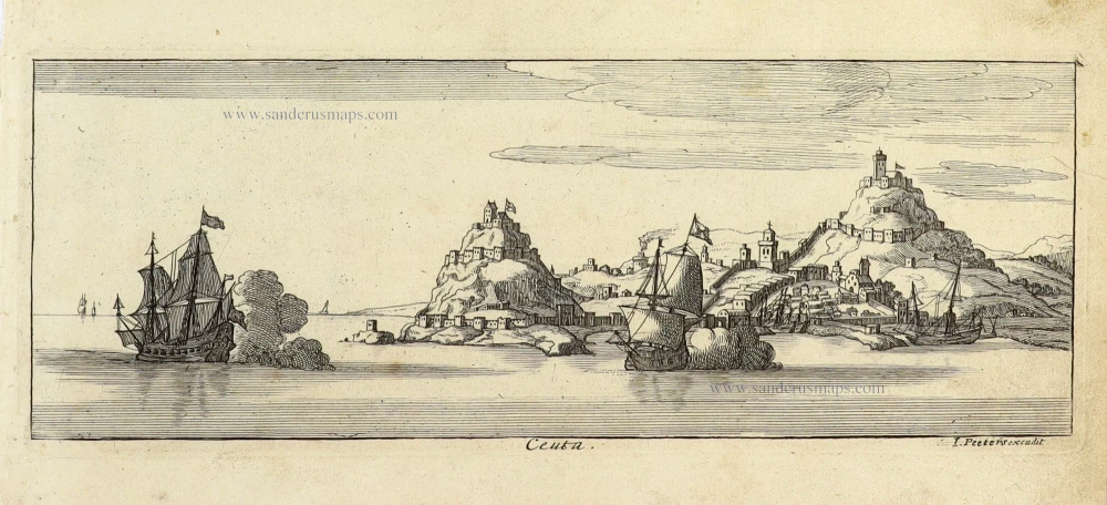
Ceuta (Spain) by J. Peeters. c. 1690
Ceuta.
[Item number: 31362]
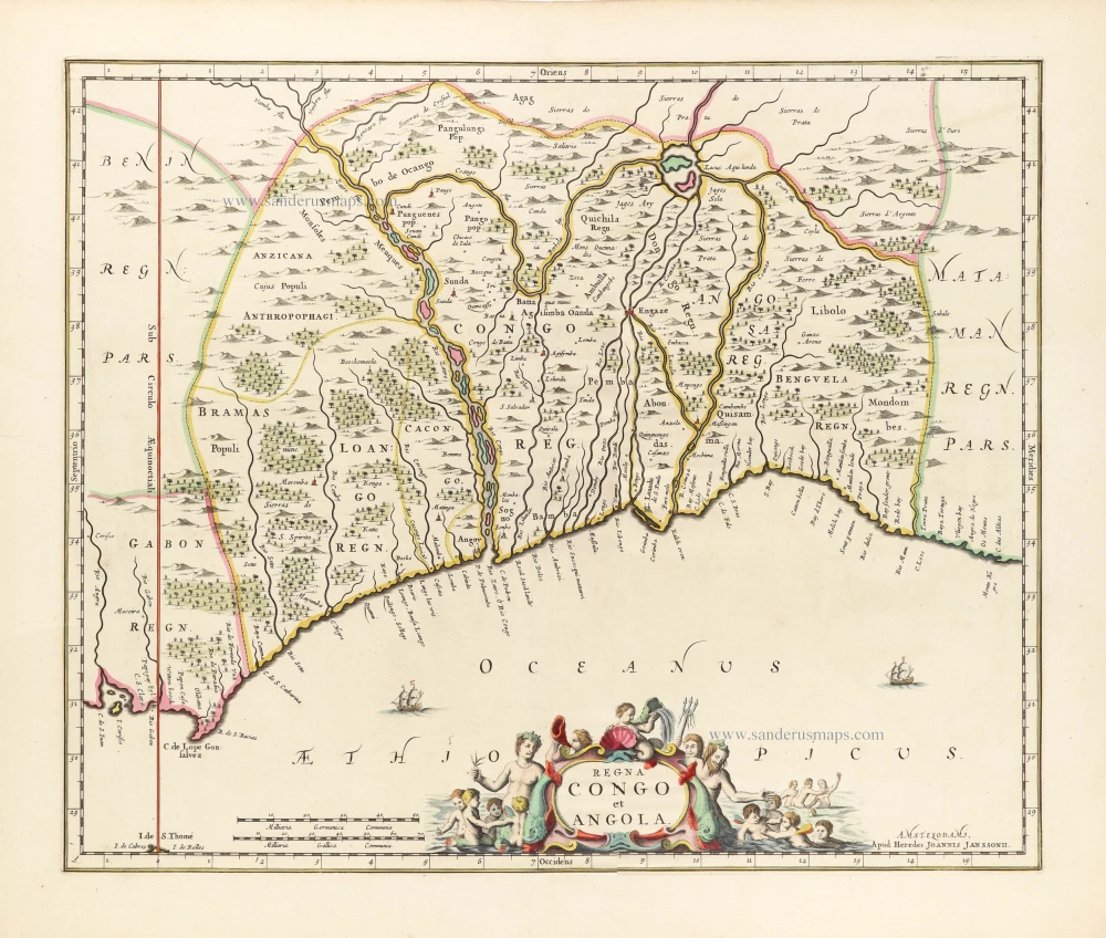
Central Africa showing the mouth of the Congo River, by the heirs of Johannes Janssonius. 1664
Regna Congo et Angola.
[Item number: 30786]
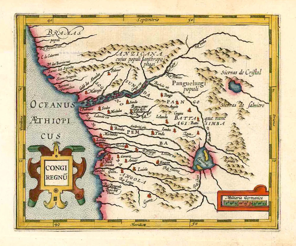
Congo, by G. Mercator - J. Hondius. 1607
Congi Regnu.
[Item number: 25292]
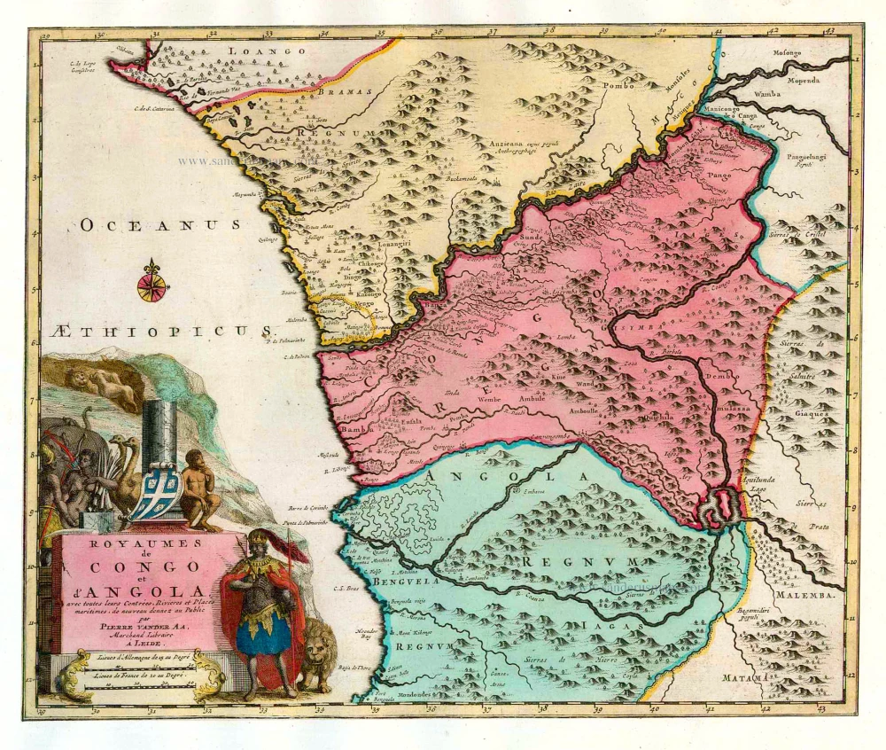
Congo & Angola, by Pieter van der Aa. 1713
Royaumes de Congo et d'Angola, avec toutes leurs Contrées, ...
[Item number: 26160]
![.II. Tabula Moderna Aphrice. [Title on verso:] Tabula .II. Aphricae.](https://sanderusmaps.com/assets/WEBP/m27978.webp)
Eastern Algeria - Tunisia - Western Libya, by Lorenz Fries. 1525
.II. Tabula Moderna Aphrice. [Title on verso:] Tabula .II. ...
[Item number: 27978]
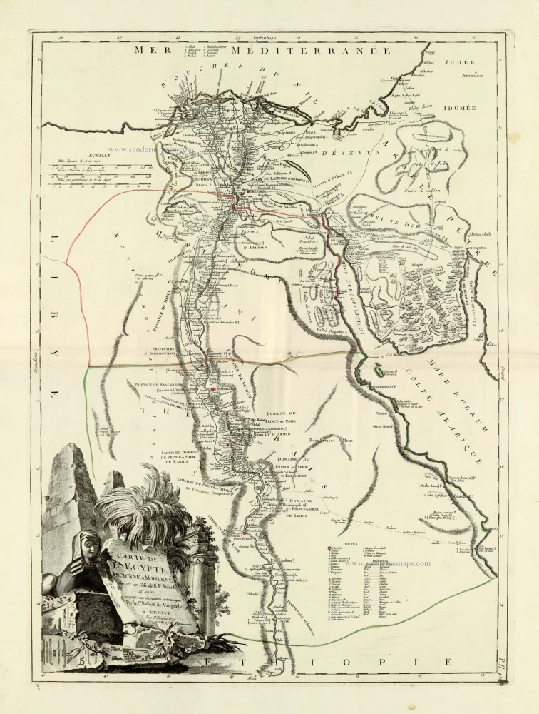
Egypt, by Francesco Santini. 1776-79
Carte de L'Egypte Ancienne et Moderne.
[Item number: 28099]
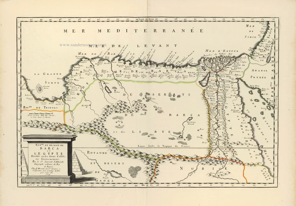
Egypt by Nicolas Sanson. 1658
Royme et Desert de Barca et L'Egypte Divisée en ses douze ...
[Item number: 28482]
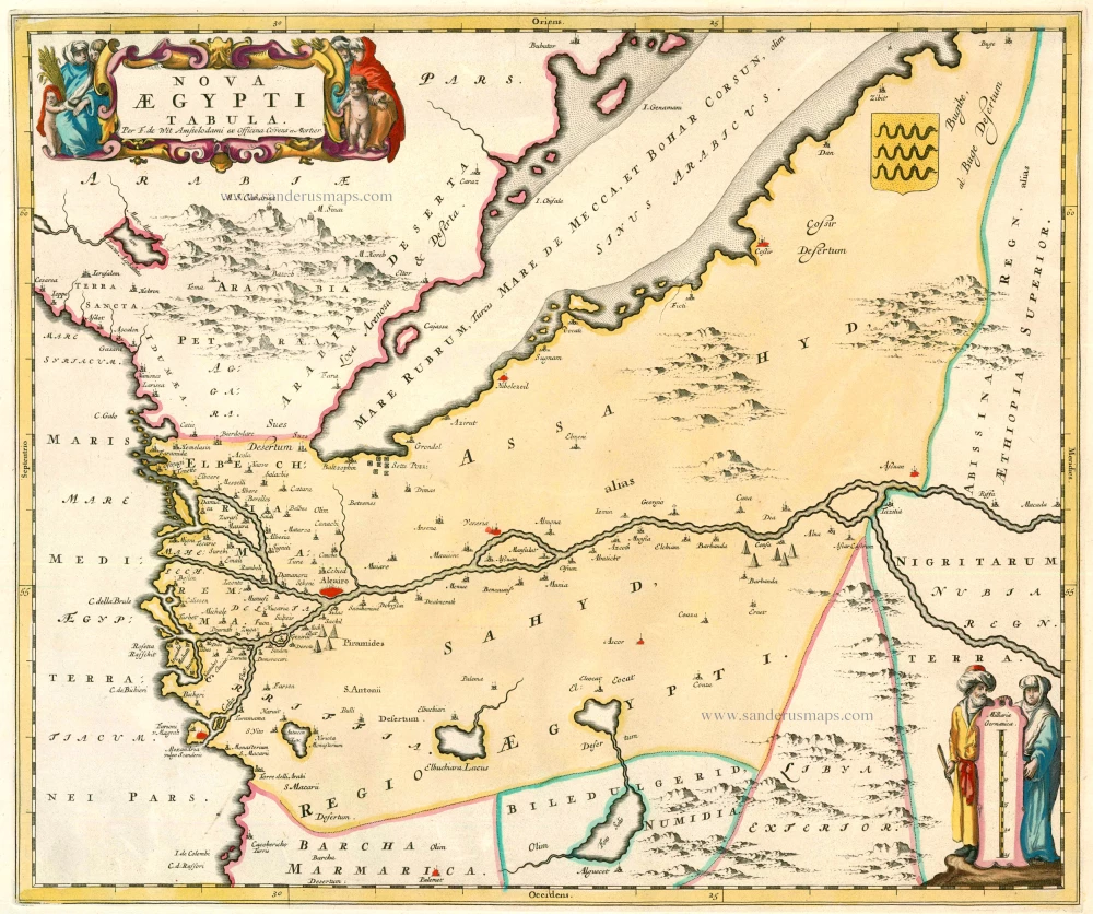
Egypt, by F. De Wit after Blaeu. 1721-41
Nova Aegypti Tabula
[Item number: 23616]