Antique maps catalogue
- All recent additions
-
Antique maps
- World and Polar
-
Europe
- Europe Continent
- Belgium
- Belgium - Cities
- The Low Countries
- The Netherlands
- The Netherlands - Cities
- Luxembourg
- France
- France - Cities
- Germany
- Germany - Cities
- Austria
- Italy
- Italy - Cities
- Spain and Portugal
- Greece & Greek Islands
- Switzerland
- British Isles
- British Isles - Cities
- Northern Europe
- Central Europe
- Eastern Europe
- Southeastern Europe
- America
- Asia
- Africa
- Mediterranean Sea
- Australia
- Oceans
- Celestial Maps
- Curiosities
- Books
- Medieval manuscripts
- Prints
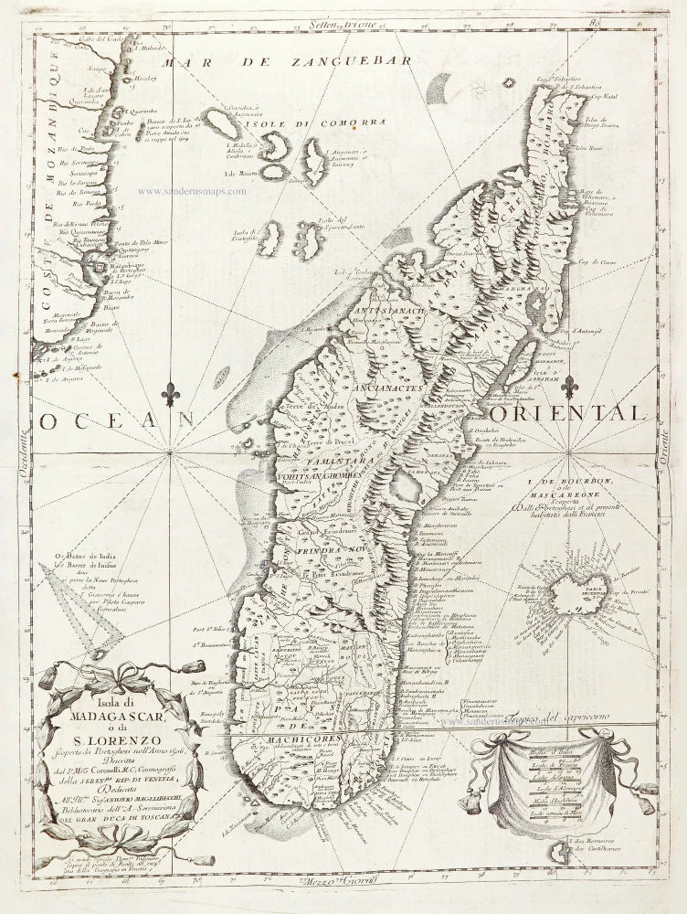
Madagascar, Réunion, and southwest Africa by Vincenzo Coronelli. 1696
Isola di Madagascar, ò di S. Lorenzo.
[Item number: 28680]
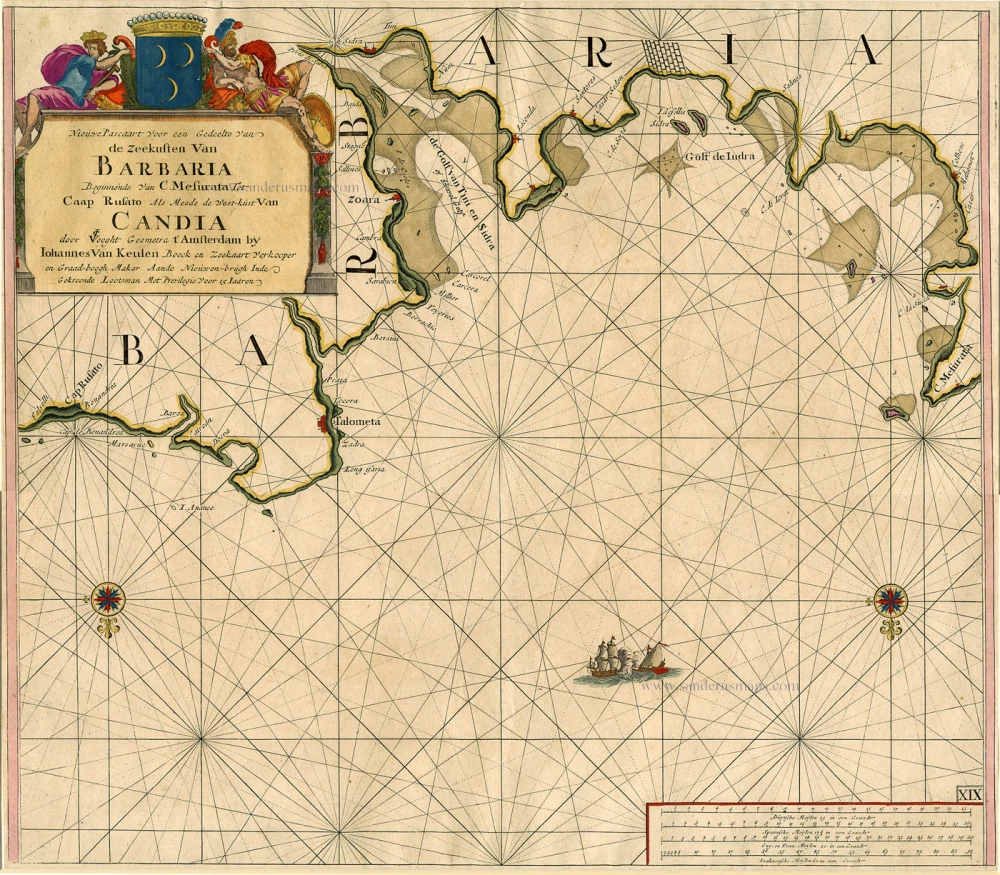
Sea chart of the coasts of Morocco, by Johannes Van Keulen. 1697-1709
Nieuwe Pascaart voor een Gedeelte van de Zeekusten van Barbaria...
[Item number: 6506]
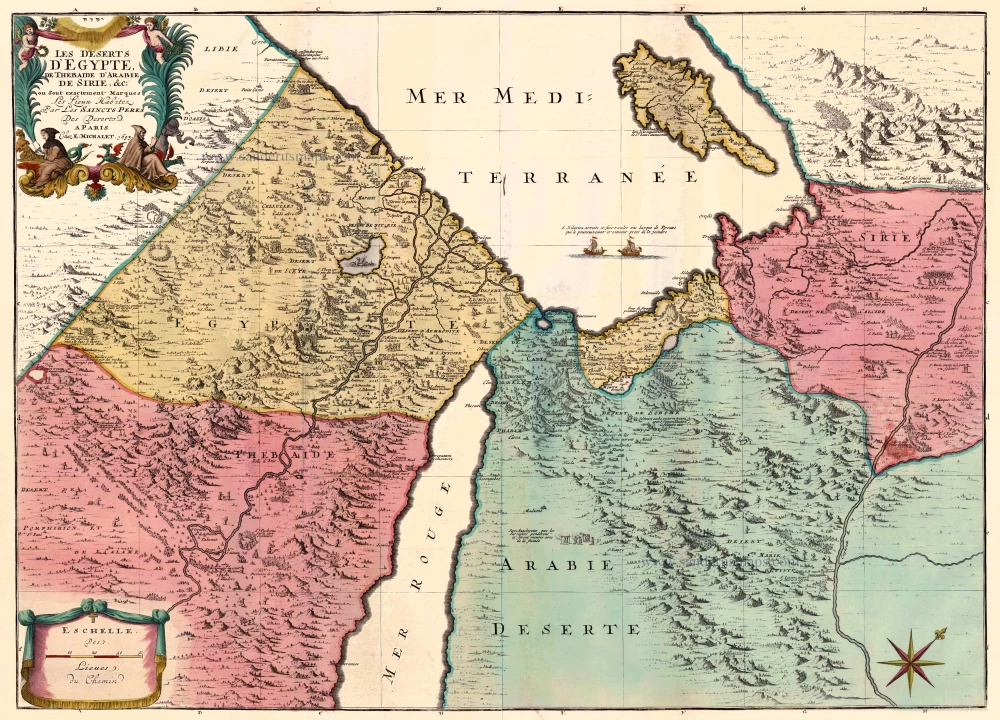
Egypt and the Middle East by Jaillot - Covens & Mortier. 1710
Les Deserts d'Egypte, de Thebaide d'Arabie, de Sirie, &c., ou...
[Item number: 23617]
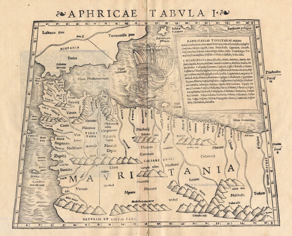
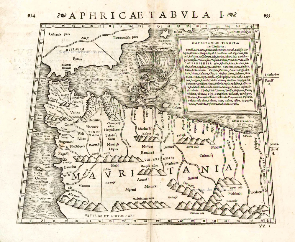
Morocco by Sebastian Münster 1542
Aphricae Tabula I
[Item number: 14709]

Morocco, by Matthäus Merian. 1638
Fezzae et Marocchi Regna Africae Celeberrima.
[Item number: 26671]
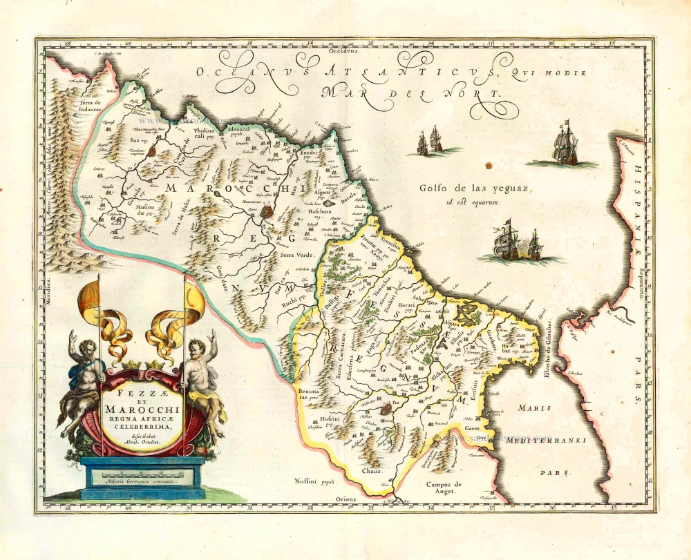
Morocco, by Willem Blaeu. 1640
Fezzae et Marocchi Regna Africae Celeberrima.
[Item number: 27146]
Morocco by Strabo - Sebastian Münster 1571
Aphricae Tabula I.
[Item number: 25642]
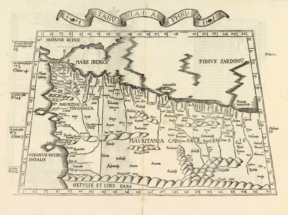
Morocco & Western Algeria, by Lorenz Fries. 1525
Tabula .I. Aphri
[Item number: 27979]
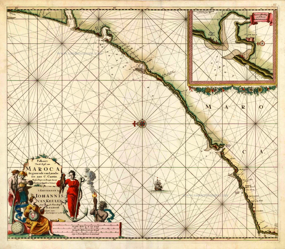
Sea chart of the west coast of Morocco, by Johannes Van Keulen. 1681
Paskaart van de Kust van Maroca Beginnende van Larache, tot aan...
[Item number: 16452]

Mozambique by Petrus Bertius, published by Jodocus Hondius II. 1618
Insula & Arx Mosambique
[Item number: 32065]
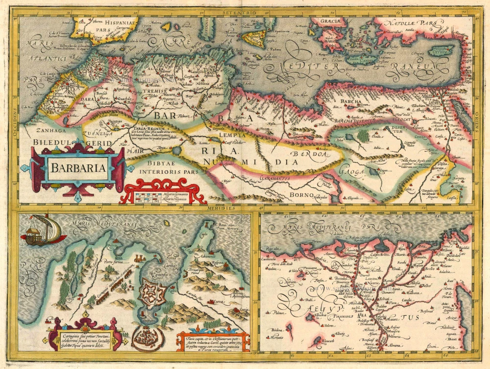
Northern Africa by J. Hondius 1613-16
Barbaria
[Item number: 13746]
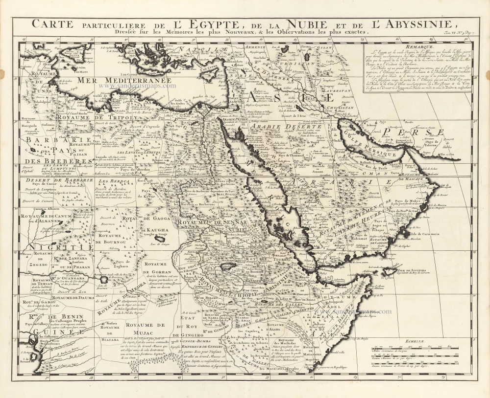
Northeast Africa & Arabia, by Z. Châtelain. 1719
Carte Particuliere de l'Egypte, de la Nubie et de l'Abyssinie.
[Item number: 29371]
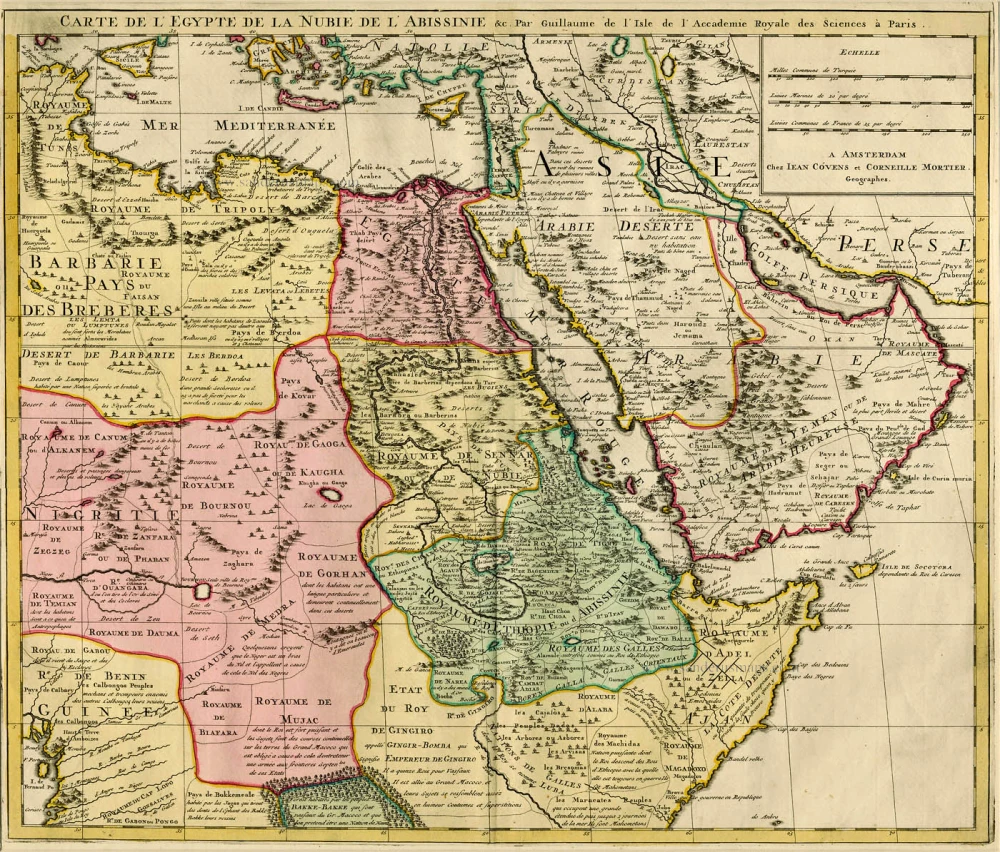
Northeast Africa & Arabia by Guillaume Delisle, published by Covens & Mortier ca. 1730.
Carte de l'Egypte de la Nubie de l'Abissinie &c.
[Item number: 12721]
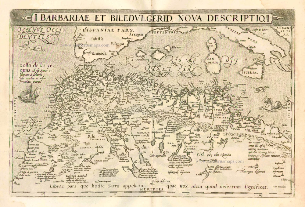
Northern Africa, by A. Ortelius. 1601
Barbariae et Biledulgerid, Nova Descriptio.
[Item number: 22524]
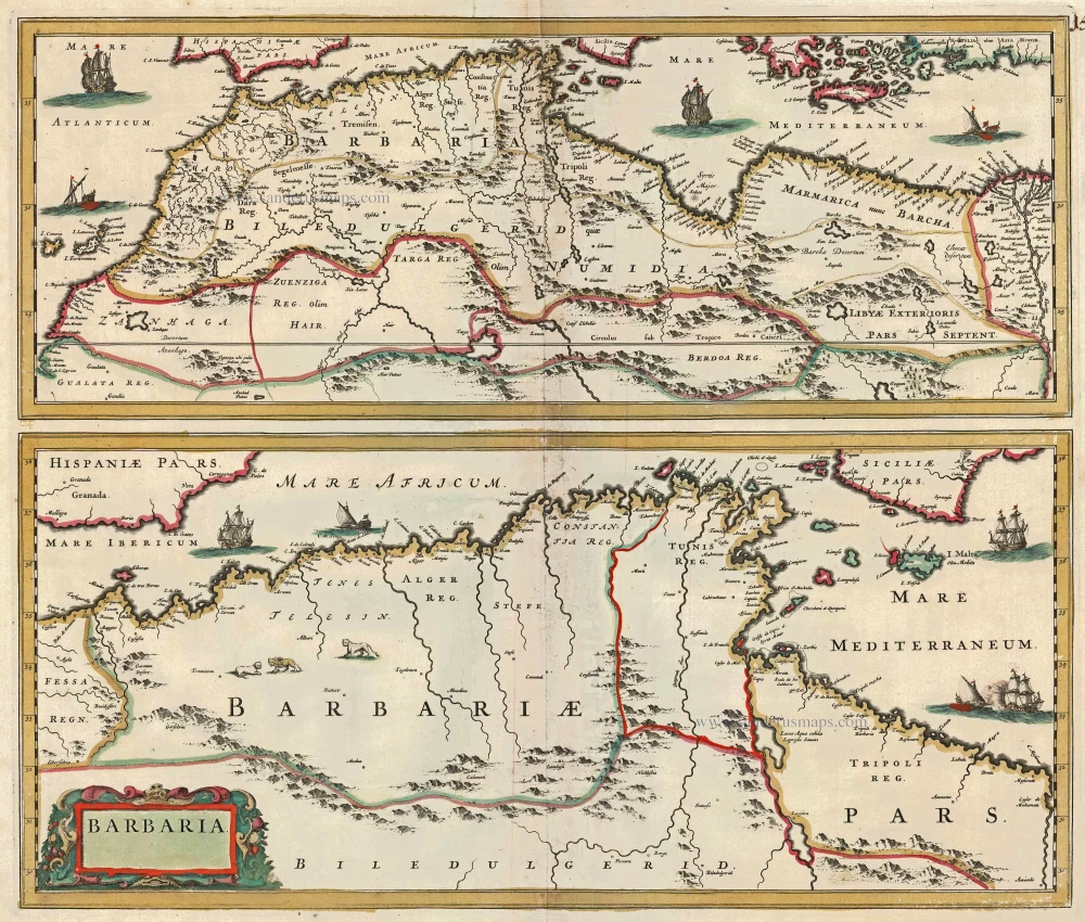
Northern Africa, by F. de Wit. c. 1680
Barbaria
[Item number: 24490]

Northern Africa by Petrus Bertius, published by Jodocus Hondius II. 1618
Barbaria.
[Item number: 32067]
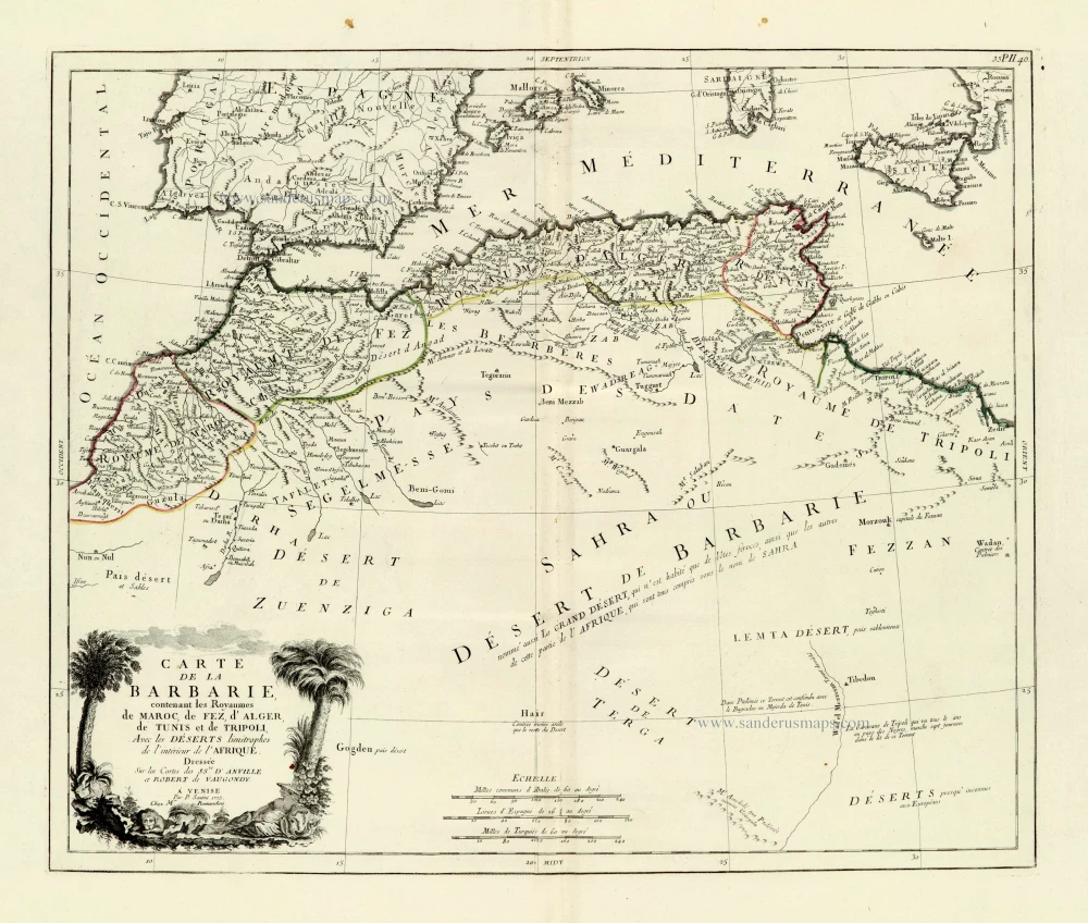
Northern Africa, by Francesco Santini. 1776-79
Carte de la Barbarie, contenant les Royaumes de Maroc, de Fez,...
[Item number: 28098]
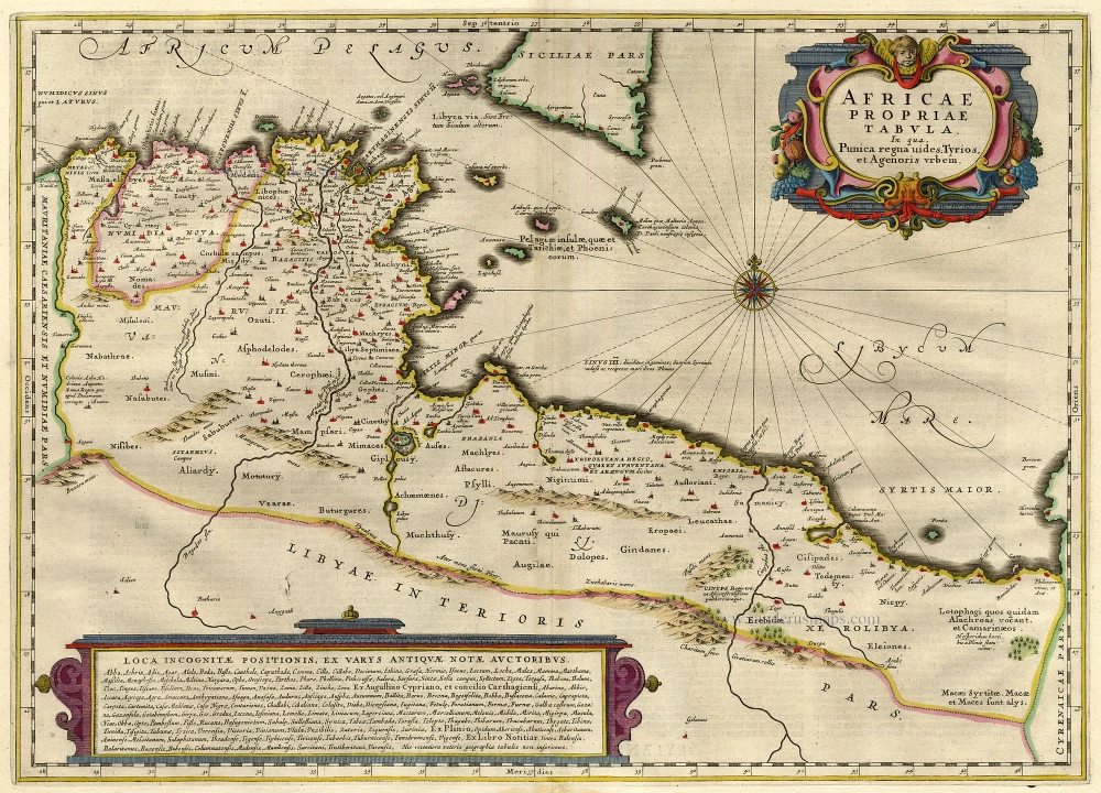
Northern Africa, by Janssonius J. 1645-58
Africae Propriae Tabula ..
[Item number: 19443]
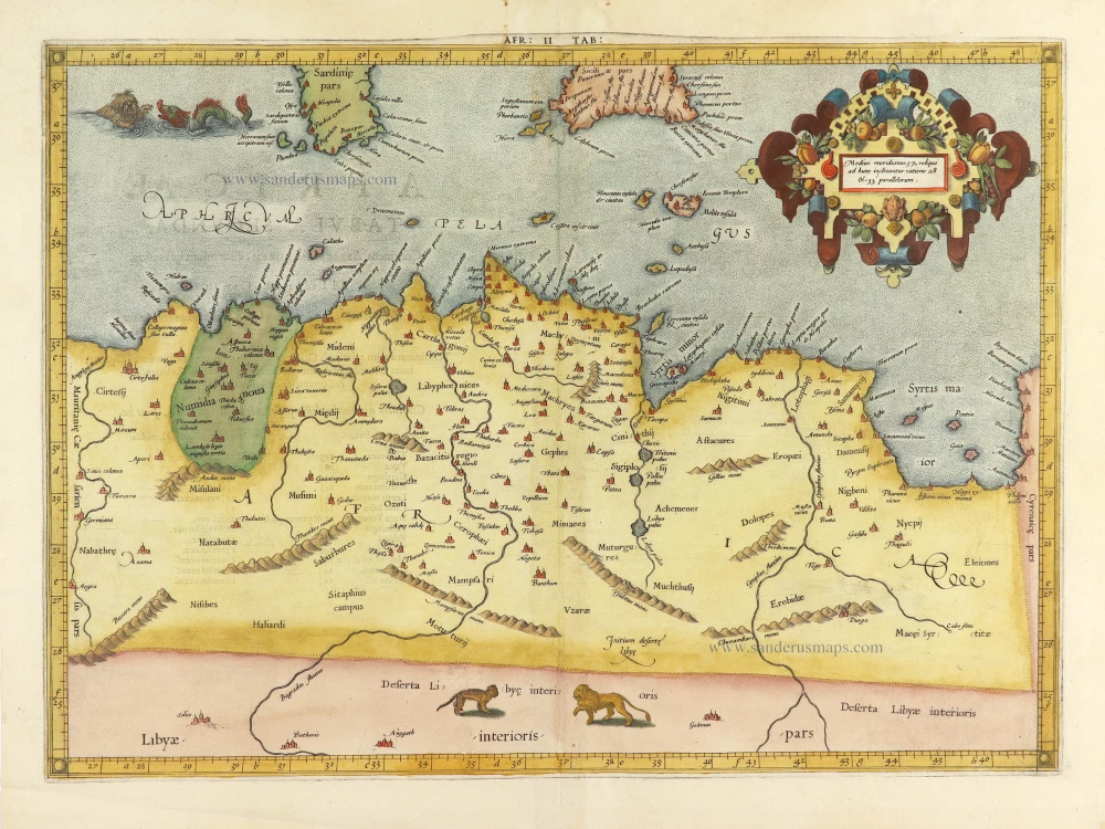
Northern Africa by Claudius Ptolemy, published by Jodocus Hondius. 1605
AFR. II. TAB.
[Item number: 28884]

Northern Africa by Joannes Janssonius. 1657
Nova Barbariae Descriptio.
[Item number: 28219]
![Libyae Interioris Pars. [Title on verso:] Tabula .III. Aphricae.](https://sanderusmaps.com/assets/WEBP/m27977.webp)
Northern Africa by Lorenz Fries.
Libya - Egypt, by Lorenz Fries. 1525
Libyae Interioris Pars. [Title on verso:] Tabula .III. Aphricae.
[Item number: 27977]

Northern Africa, by Blaeu J. 1662
Barbaria
[Item number: 22814]
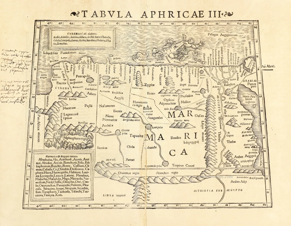
Northern Africa by Sebastian Münster. 1545
Tabula Aphricae III.
[Item number: 30293]
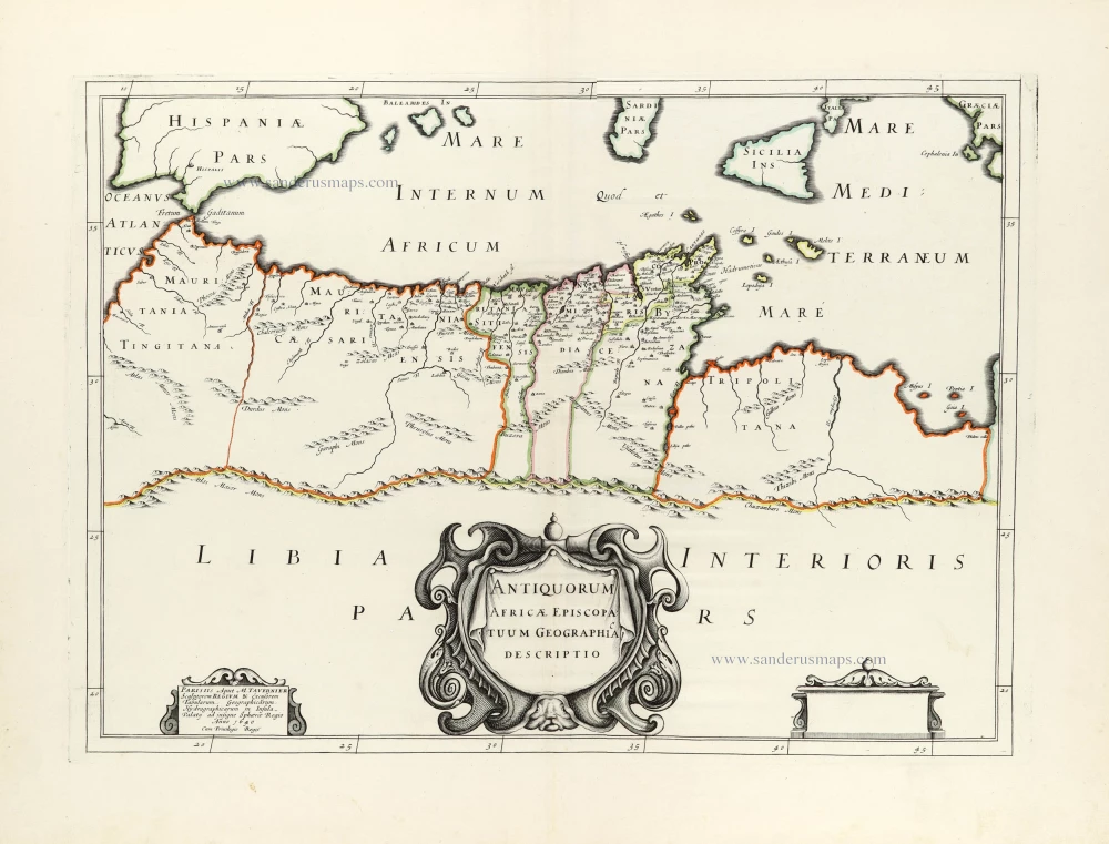
Northern Africa by Melchior Tavernier, published for Nicolas Sanson. 1640
Antiquorum Africae Episcopatuum Geographice Descriptio.
[Item number: 30001]
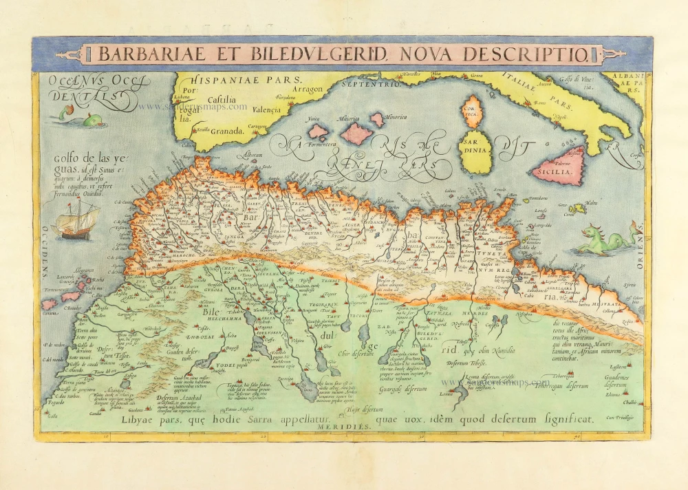
Northern Africa, by Abraham Ortelius. 1584
Barbariae et Biledulgerid, Nova Descriptio.
[Item number: 29356]
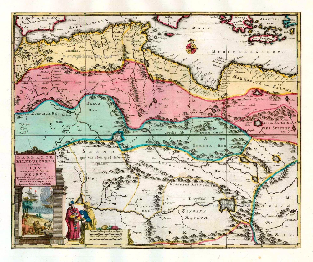
Northern Africa (Barbary), by Pieter van der Aa. 1713
Barbarie, Biledulgerid, (autrefois Libye) et une partie du Pays...
[Item number: 26154]
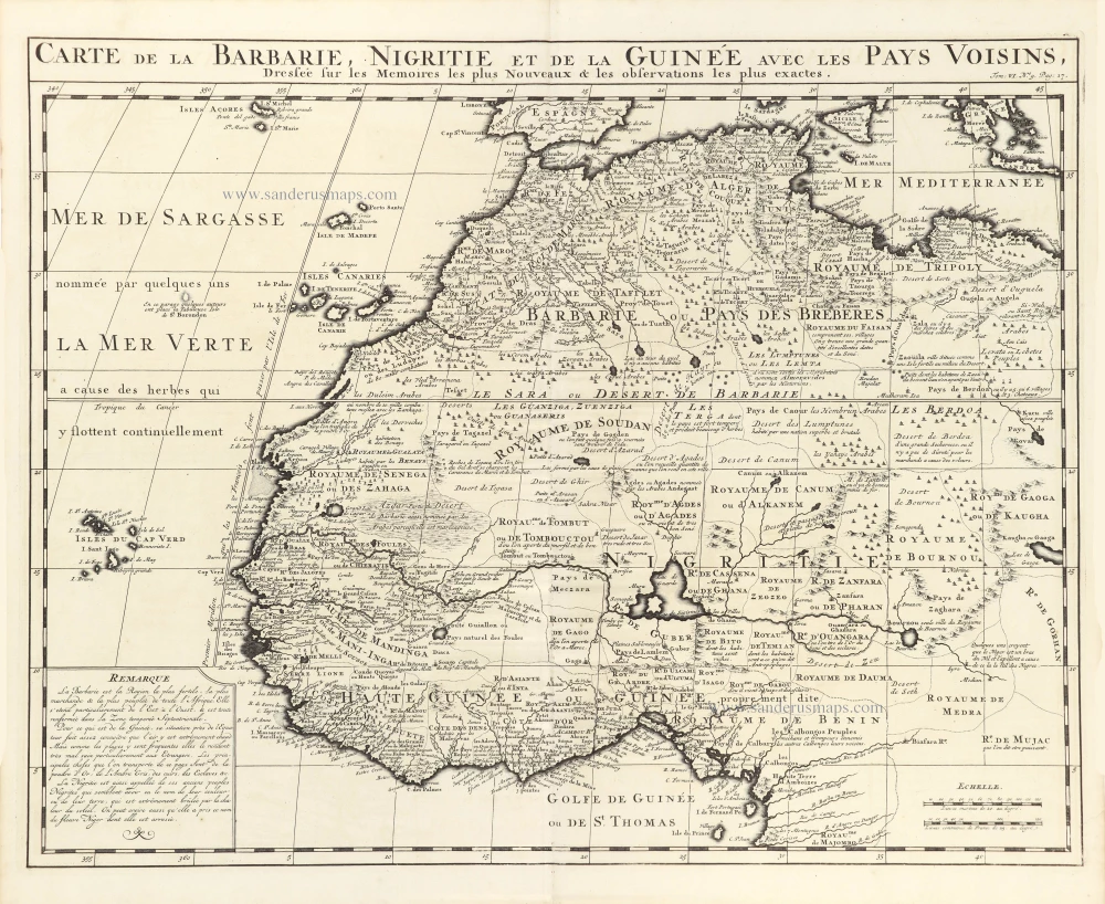
Northwest Africa, by Z. Châtelain. 1719
Carte de la Barbarie, Nigritie et de la Guinee avec les Pays...
[Item number: 29369]
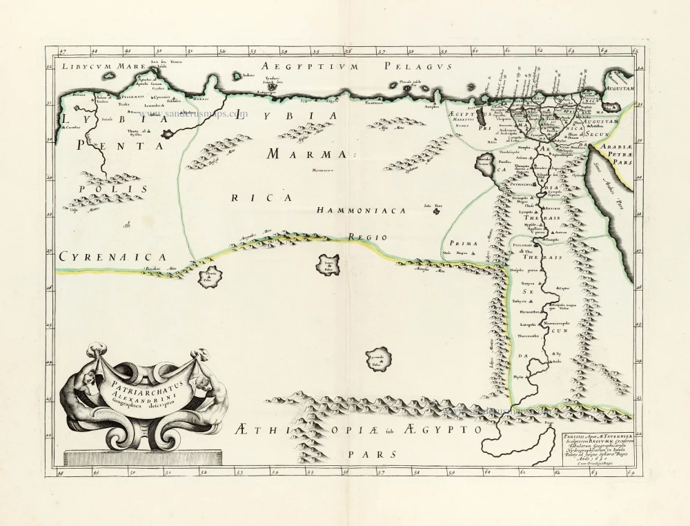
Egypt - Libya J.B. Tavernier. 1640
Patriarchatus Alexandrini Geographica descriptio.
[Item number: 30047]
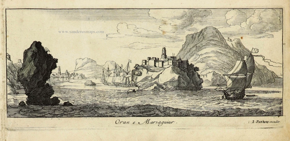
Oran (Algeria) by J. Peeters. c. 1690
Oran e Marsaguir
[Item number: 31358]
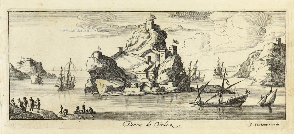
Peñón de Vélez de la Gomera (Spain) by J. Peeters. c. 1690
Penon de Velez
[Item number: 31386]

Red Sea by Petrus Bertius, published by Jodocus Hondius II. 1618
Mare Rubrum.
[Item number: 32062]
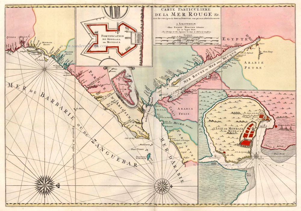
Red Sea by Covens & Mortier 1721-41
Carte Particuliere de la Mer Rouge &c. ...
[Item number: 23601]

Safi (Morocco) by J. Peeters. c. 1690
Safia.
[Item number: 31364]
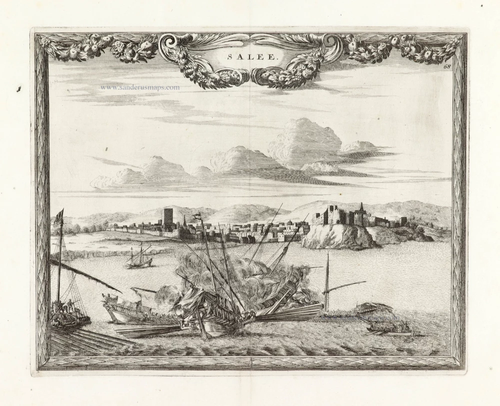
SCARCE !
View of Salé (Morocco), by Carel Allard. 1685/90
Salee;
[Item number: 30587]
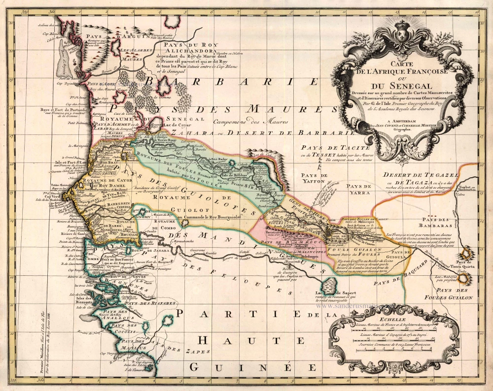
Senegal by Guillaume Delisle, published by Covens & Mortier. 1721-41
Carte de l'Afrique Françoise ou du Senegal ...
[Item number: 23614]
The South African Coast, by François Valentyn (Valentijn). 1724-26
No title
[Item number: 17825]